
Royal National Park Coast Track: A complete guide to Sydney’s best overnight hike
Last Updated on 22 April 2026
Within an hour of central Sydney and yet a world away from the city bustle, escape into nature and discover the dramatic beauty of Australia’s oldest national park on the Royal Coast Track, a stunning 30km bushwalk along secluded golden beaches, lush palm forests, and wind-sculpted cliffs. And if its proximity to the city and incredible natural scenery weren’t enough to convince you, the Coast Track also offers a fantastic opportunity to camp under the stars and in front of the waves at North Era Beach, one of Sydney’s absolute best campsites!
After walking this track in both directions and as both a single day hike and an overnighter, I’ve put together the ultimate guide to getting outside and exploring the Royal National Park Coast Track, including everything you need to know about getting to the trailhead, booking a campsite, what to expect along the trail, and what to pack for your walk. I guarantee this trail will leave you completely obsessed with the incomparable RNP!

Planning your hike
Hiking the Royal Coast Track in 1 or 2 days?
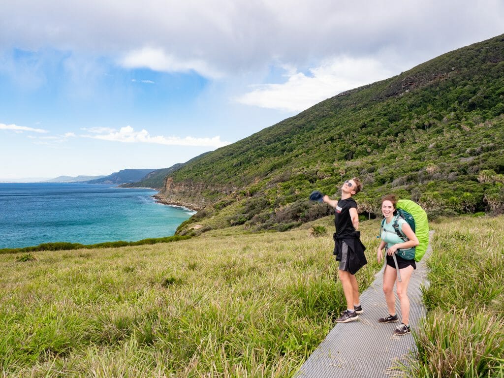
The most important thing you’ll need to decide before planning the finer details of your adventure is whether you’re going to be tackle the Coast Track as an ambitious day hike or an overnighter.
Even though the trail has a few steep hills, it’s totally possible to pound out the entire 30km in one long day, and this is actually how I first did the hike— even though it was an exhausting day, it was super fun and very doable for fit hikers!
The obvious benefit to doing the hike all in one go is that you’ll be able to carry a light day pack with only a few essentials rather than hauling your tent, sleeping bag, food, stove, and the whole camping works along the trail. Indeed, the lack of proper backpacking gear might make the decision for you! Or, and this is very likely, availability at the campground might also be the decider.
Having completed the hike both ways, I can see definite positives to either itinerary, so it will really come down to your schedule, your equipment, and how much time you want to spend splashing in the ocean (Figure 8 Pools, anyone?!). Either way, RNP will not disappoint.
Camping at North Era
>>> 2026 UPDATE: North Era Campground is closed until further notice. Check re-opening information on the NSW Parks website.
For those hoping to spend a night at impossibly beautiful North Era campground, you’ll need to reserve a spot in advance using the online booking system. Sites cost $12 for 1-3 people sharing, payable by credit card. You should receive an email within a few minutes that confirms receipt of booking and payment, but the final confirmation email with your spot details may come several hours later.
North Era is the one and only spot to camp along the Coast Track and is limited to just 36 spots, so expect every Saturday night and long weekend from here until the end of the year to be just about snatched up if you don’t plan well in advance.
If you can be flexible, it’s easy enough to find spots in the middle of the week or even on Fridays and Sundays during the low season (autumn/winter). And the campsite is stunning! North Era Beach is absolutely reason enough to spread the hike over 2 days, but the relaxed pace and freedom to spend more time swimming and exploring Royal National Park are also enticing bonuses of a longer walk.
Getting to and from the trailhead
In addition to being walkable as either a single day or overnight hike, it’s also possible to begin the hike at either end of the Royal National Park: Otford or Bundeena.
Since the trail undulates for pretty much the entire journey, the direction you walk won’t have great bearing on the difficulty of your hike, but it will impact how you get to and from the trailhead (don’t worry, there’s public transport at either end), in addition to whether you will walk a bigger first day or final day if camping at North Era (as the campsite isn’t perfectly placed in the middle of the trail).
Starting the walk from Bundeena
Logistically, there are a few different ways you can begin your walk from the north end of the National Park. Each option involves a train trip between Otford and Bundeena, a ferry ride to or from Cronulla, and some walking to the trailheads.
- Drive straight to the start of the trail at Bundeena. There is a fair bit of parking around, although it can get busy due to the day-trippers at this end of the park. At the end of the hike, walk to nearby Otford Station (2km) and take the train to Cronulla (1hr), where you’ll have to catch a ferry back to Bundeena (30min) to get your car. Keep in mind, the last ferry is at 6.30pm (5.30pm in winter), which can be tight if you’re doing the walk in a single day.
- Drive or take public transport to Cronulla and then catch the ferry across to Bundeena. It’s only a short walk (about 2km) to the trailhead from the wharf. At the end of the hike, walk to nearby Otford Station (another 2km) and catch a train (1hr) back to your car in Cronulla/wherever you came from.
- Drive to the end of the trail at Otford Station. There’s a small carpark at the station where you can safely park overnight. Take the train from Otford to Cronulla (1hr), catch the ferry across to Bundeena (30min), and then walk about 2km to the trailhead to begin your hike. As you finish, you’ll only have to walk 2km downhill to Otford Station to get your car.
Starting the walk from Otford
There are also several options for beginning your walk at the south end of the National Park.
The main benefit to walking this direction, other than it being more convenient for those living in Wollongong or the South Coast, is that it avoids a lot of the morning and afternoon crowds that tend to pile up on the last section of the trail between Wedding Cake Rock and Bundeena.
For overnighters, starting the walk in Otford also means that you’ll walk only 9km on your first day and save the remaining 21km for day 2, as North Era campground is fairly early in the trail.
- Drive or take public transport to Otford Station. There’s a small carpark at the station where you can safely park overnight. It’s a 2km walk to the trailhead from here and it is probably the steepest part of the entire hike. When you finish, walk 2km to the ferry wharf in Bundeena, take the ferry across to Cronulla (30min), and then take the train (1hr) back to your car in Otford/wherever you live.
- Drive to Cronulla and then catch the train back to Otford. Walk 2km uphill to the trailhead and then when you complete the hike, walk 2km to the ferry in Bundeena, sail across to Cronulla (30min), and retrieve your car.
- Drive straight to the start of the trail at Bundeena. Get on a ferry to Cronulla (30min) and then take the train back down to Otford. Walk 2km from the station to the trailhead and then finish the hike at your car in Bundeena.
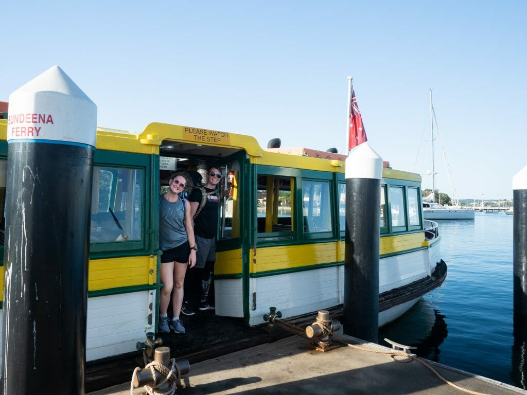
Cronulla Ferry information
- The ferry from Cronulla to Bundeena operates from 5.30am-6.30pm on weekdays, from 8.30am-6.30pm on weekends, and from 8.30am-5.30pm on winter weekends (June to August).
- The ferry from Bundeena to Cronulla operates from 6am-7pm on weekdays, from 9am-7pm on weekends, and from 9am-6pm on winter weekends (June to August).
- The journey takes about 30min in either direction.
- A ticket is $6.80 each way, cash only (no Opal cards and no EFTPOS) and you can purchase this directly onboard the ferry.
- The wharf is 2min from the train station in Cronulla and about 2km from the trail in Bundeena.
Sydney Trains information
- The train trip between Otford and Cronulla can be 50min or 1hr45m depending on whether an Express is running, and usually only departs once each hour. Be sure to check the timetable while planning your trip.
- Trains run well past dark, so that shouldn’t put any restrictions on completing your walk.
- Tickets range from $4-7 each way depending on time of day. Use your Opal card or any bank card with Paywave.

Royal Coast Track highlights
The Balconies
From the Bundeena ferry wharf, it’s about 2km of gentle uphill walking on residential streets to reach the trailhead (follow the blue signs for the Royal Coast Track after you disembark). After just 10min on a wide fire trail, you’ll pop out onto The Balconies, a spectacular and rugged section of cliffs overhanging the ocean, and continue onwards to Water Run, where enormous rectangles of rock have calved off from the coastline like oversized ice cubes.
This early section of the walk is in direct sun, as is about 80% of the trail, but it’s an undemanding and incredibly scenic introduction to the Coast Track. Just a small taste of what’s to come!
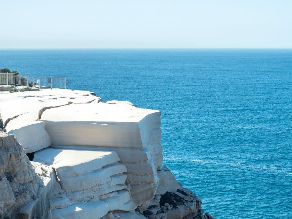
Wedding Cake Rock
Walking along the well-maintained trail for another few minutes (about 40min from the start of the track), you’ll reach the now insta-famous Wedding Cake Rock (and possibly wonder what all the fuss is about, after having just admired the impressive Balconies and Water Run).
With perfectly square edges and sharp sandstone layers, this blindingly white rock bears undeniable resemblance to its namesake, and is definitely one of the most unique rock formations I’ve ever seen, but its beauty is largely overshadowed by crowds (unless you’re there mid-week, like us) and a 2m fence that has been erected to keep people off of the unstable rock.
If you do want a photo of Wedding Cake Rock, I’d recommend walking a few metres further up the trail and then following a short side track off to the left— this spits you out above the rock, where you can get a photo without the fence or the crowds (and also without the $300 fine).
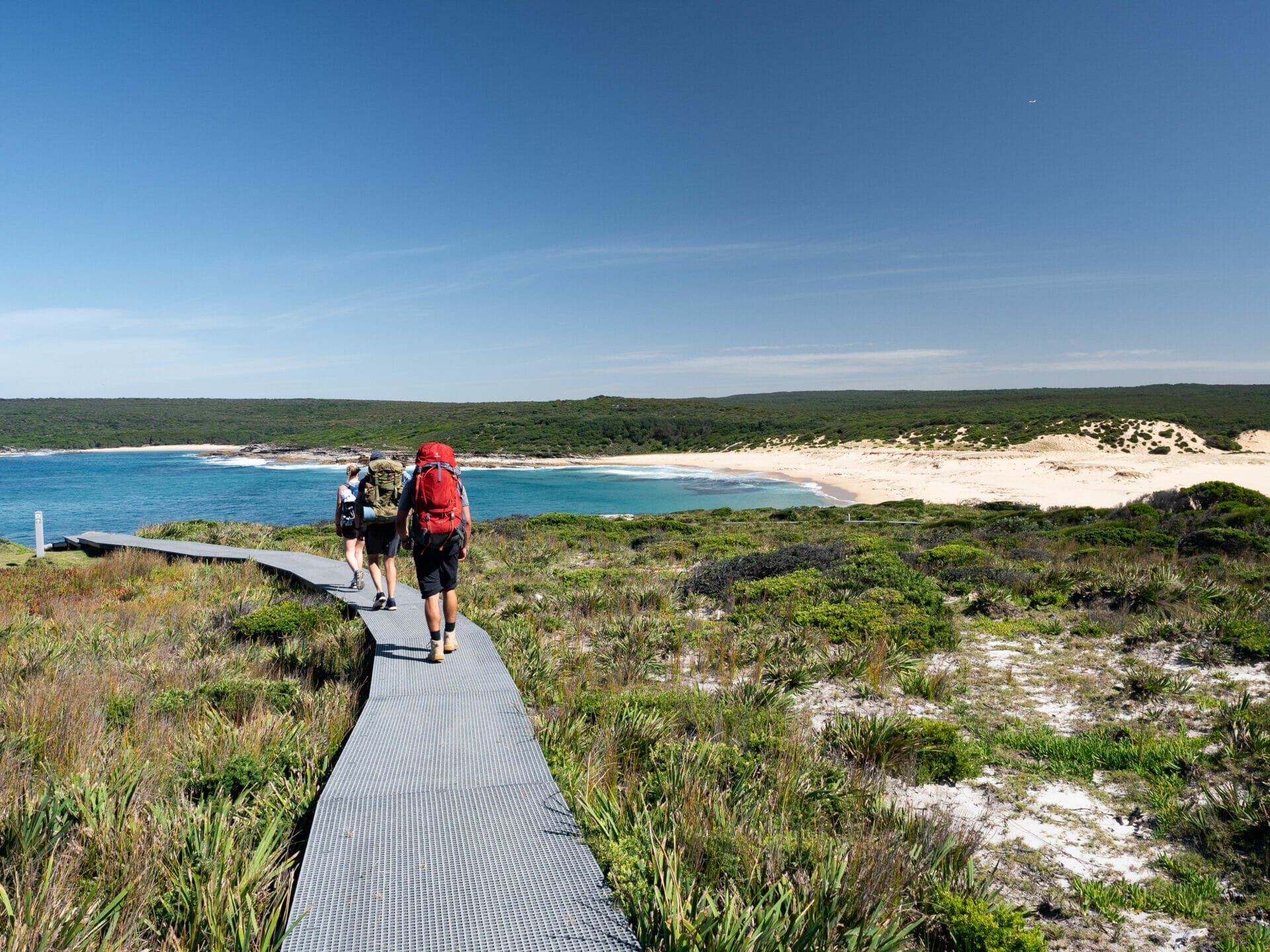
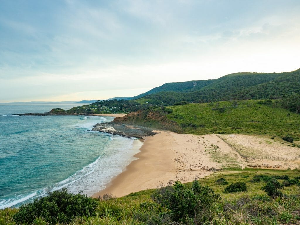
Marley Beaches
Not too far beyond Wedding Cake Rock, you’ll come up and over scenic Marley Head to reach Marley Beach and Little Marley Beach, the latter of which is a secluded stretch of sand perfect for your first swim of the day.
It’s not uncommon to enjoy this golden beach entirely to yourself, but the scenery on the approach may be just as beautiful as the beach, so take your time getting here. Fierce winds have carved wave-like patterns into the colourful rocks to create a truly unique coastal landscape, just one of the many reasons why this hike has become an intense favourite among locals and visitors alike.
Wattamolla
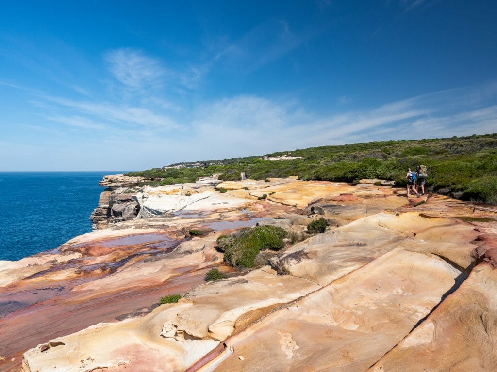
From Little Marley Beach, it’s about 4km to reach Wattamolla. There’s heaps going on here, including a large picnic area, a dam popular with swimmers (and those brave enough to leap off the jump rock), waterfalls galore, a sheltered beach, and some of the most spectacularly eroded cliffs you’ll find in NSW.
Enjoy lunch on one of the shaded picnic benches before heading down the stairs to Wattamolla for an afternoon swim (you can never have too many!).

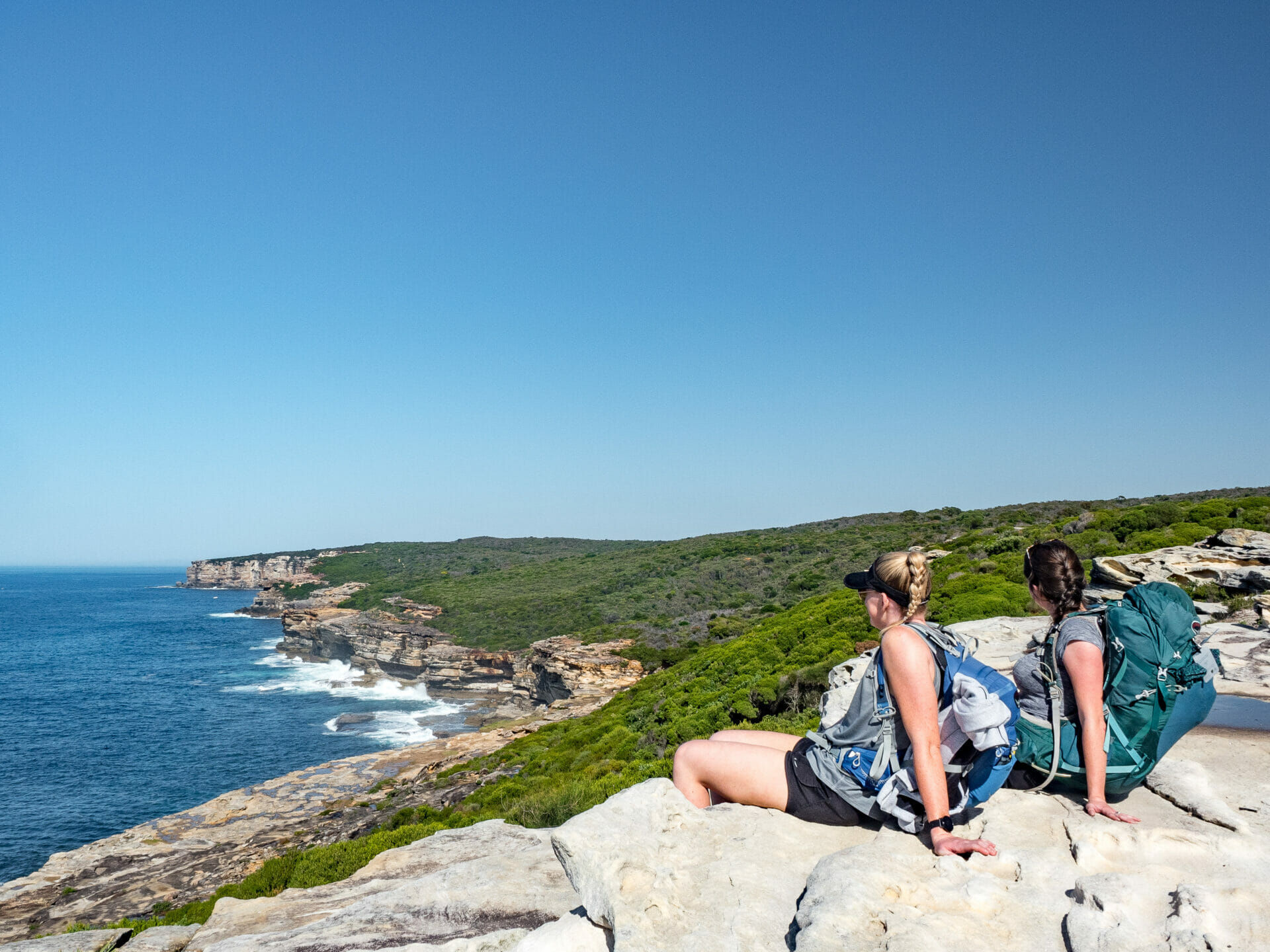
Eagle Rock
Continuing along the cliffs for a few kilometres, you’ll soon come to Curracurrang Cove and the striking Eagle Rock, which provides one of the most interesting photo opportunities along the whole trail.
And unlike Wedding Cake Rock, you are totally free to step right out onto this curiously avian rock for great photos!

Garie Beach
Another 3km along a slightly uphill trail and you’ll arrive at Garie Beach, one of the only places along the trail with vehicle access. This popular surf beach has some basic facilities, including a little snack kiosk.
Definitely take the opportunity to stock up on water from the bathroom taps, as this is the last place you’ll see any water until you return to civilisation (there’s no water to be had at the campsite, either!).
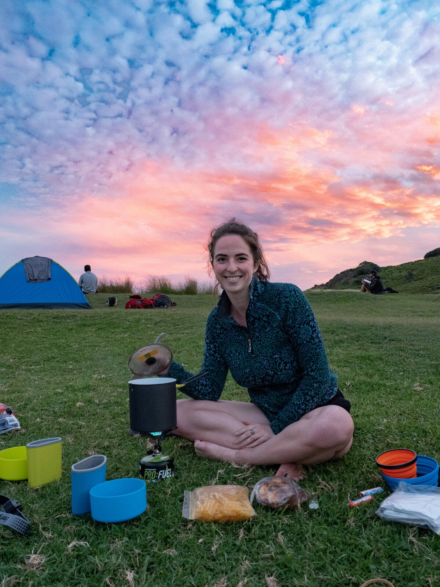
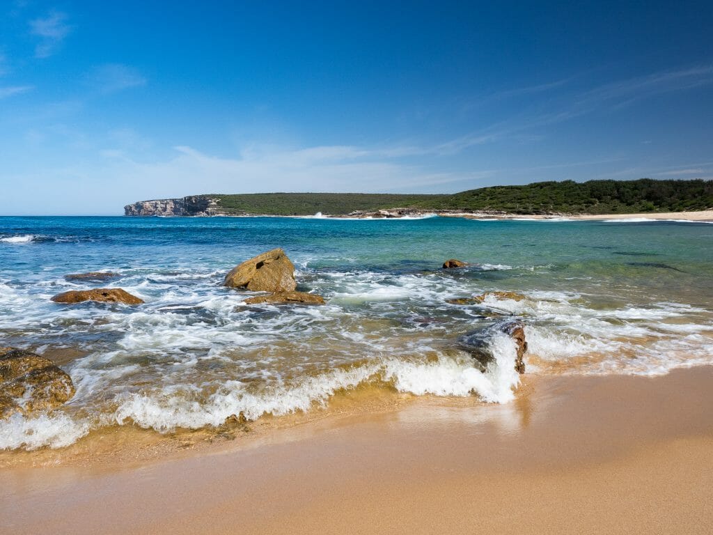
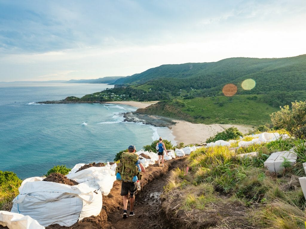
North Era Beach
From Garie Beach, camp is only about an hour away for those doing the hike as an overnighter! You’ll walk along the length of Garie and then up and over Thelma Head, which can feel a bit steep, particularly for those with a heavy backpack (we were absolutely puffing, but the view was worth it!).
Although very basic, North Era is one of the most beautiful spots along the entire 30km walk, and is an absolutely awesome place to camp. Tent sites must be booked in advance (see details above) for one of the limited spots; there is a drop toilet here, but not a whole lot else. Mingle with other hikers as the sun sets over the headlands and bask in the glory of your sore muscles.

Figure 8 Pools
Visiting Figure 8 Pools requires a detour off the main Coast Track (about 1hr total, not including swimming), which comes shortly after departing North Era Beach. A small sign on the left of the trail indicates the turn-off along a small trail, which brings you across a beach and a rock shelf before devolving into boulder scrambling.
The pools can be extremely dangerous in certain conditions, so you absolutely should NOT go unless you have checked the National Parks site for tides and weather warnings (you can re-check the warnings before turning off the main path, there is mobile reception here).
Mid-week during autumn and winter can be the perfect time to find some rare peace and seclusion if the weather and tides allow, which is how we got the pools all to ourselves on a Tuesday morning!
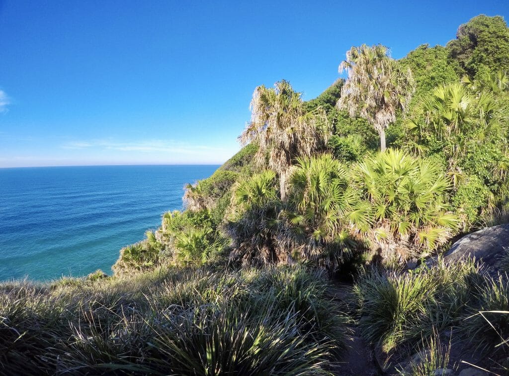
Burning Palms
After a magical swim at the Figure 8 Pools, the final stretch of the Royal Coast Track brings you through lush tropical forest with densely packed palms in every size and texture. This means you are in full shade for the end of the walk, which is an enormous relief, considering how steep the trail gets.
It doesn’t actually matter too much which direction you’re coming from— as I’ve written these trail notes, you’ll hike pretty much straight up to the top of the cliffs and then descend steeply back down to Otford, so even walking the opposite direction won’t save you the intense vertical climb. It’s moderately challenging, but you’re close to the end!
Otford
After tackling the seemingly endless uphill, you’ll journey back down to Otford along an incredibly steep track and eventually pop out on the side of the road. Sadly, the brutal descent is not over yet. From the end of the Royal National Park Coast Track, it’s approximately 2km to the station, almost entirely downhill.
Unlike the start of the track, this is not well signed— walk about 20m up the road (to your left) and turn down Fanshawe Road. At the end of this road, there will be a sign indicating the cut-through to get down to the train station, either to pick up your car or hop on a train. Collapse onto the bench seats and celebrate the end of an amazing hike!
What to expect on the Royal Coast Track
Terrain
The Coast Track is an interesting mix of very flat, sometimes even boardwalked trails and incredibly steep, poorly maintained tracks that are only a little drizzle away from a mudslide. Some of these trails are in the process of being developed into stairs, but the kind of impractical ones that look as if they were made for someone with 8ft long legs.
>>> Not sure what footwear to bring? Check out my guide to outdoor shoes, boots & mountaineering footwear
Water access
As mentioned previously, there is no water to be had at North Era campground and no official water along the trail. There was a little tap near the turn-off for the Figure 8 Pools, but it was completely dry during our visit, so you shouldn’t count on this.
Thankfully, you can still fill up water from the bathroom sinks or even buy water from the kiosk (when it’s open) at Garie Beach , which is only about 30min before camp if you’re walking towards Otford.
Camping at North Era
2026 UPDATE: North Era Campground is closed until further notice. Check re-opening information on the NSW Parks website.
North Era campground is remote-access only, meaning that most of the other campers (max 36) will either be doing the Coast Track with you or will have walked in from Garie Beach (about 1hr). There are very basic drop toilet facilities here and not much else— just relax and enjoy the scenery.
I wrote two super detailed guides to help you choose the best backcountry camping setup based on a decade of international, multi-day backpacking experience everywhere from Patagonia to the Peruvian Andes to the Great Ocean Walk on Australia’s southern coast!
>>> How to choose the best backpacking or alpine tent for your next adventure
>>> How to choose the best outdoor sleep system: sleeping bags, sleeping pads & camp pillows
Packing list for the Royal Coast Track
Have a look at my core packing lists for heaps of up-to-date recommendations on my favourite hiking layers, backpacking packs, trail boots, camp cookware, and more!
>>> If you’re complete the Royal Coast Track in a single day, use my day-hike packing list as a reference
>>> If you’re doing the Royal Coast Track as an overnighter, use my overnight backpacking packing list
Read about more multi-day hikes in Australia