• start here
  • about
  • group trips
  • brooke beyond

  • hiking guides
  • outdoor gear
    • hiking boots
    • hiking backpacks
    • cold-weather layers
    • backpacking tent
    • outdoor sleep system
    • backcountry food
    • day-hike packing list
    • hut-to-hut packing list
    • via ferrata packing list
    • backpacking packing list
    • mountaineering packing list

brooke beyond

Aus + NZ / Australia / New South Wales

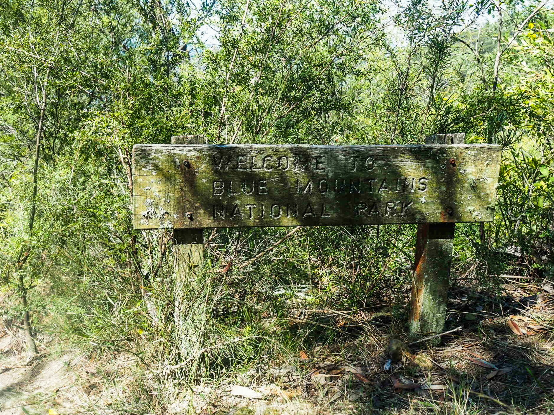
Best of the Blue Mountains: Prince Henry Cliff Walk

15 March 2018

Last Updated on 9 February 2021

A pleasant stroll along the cliffs that includes nearly all of the Blue Mountain’s major tourist spots—Scenic World, Katoomba Falls, Echo Point & the Three Sisters, Leura Cascades, and Bridal Veil Falls—the Prince Henry Cliff Walk is inarguably one of the best day hikes this region has to offer in every regard. Not only is it very accessible and riddled with detours, side-trips, and stop-overs, it’s also chocked full of panoramic mountain views, rich foliage, and sparkling waterfalls. For an early morning walk along this legendary trail, my friend Lucy and I took to the track this weekend, enjoying perfect weather and an incredibly memorable hike.

Allambie Lookout
Katoomba Cascades
The Three Sisters

All the details: Prince Henry Cliff Walk

Getting there

There is a large (free) carpark at the start of the walk, the red hop-on/hop-off tourist bus drives straight to Scenic World, and there may also be some other local/tourist buses servicing the nearby area. Unless you’re continuing back on foot, the best way to get to your car after the walk would be via taxi (call 131008 to book).

Starting point

Scenic World, the tourist epicentre of the Blue Mountains

Ending point

The walk officially ends just after Elysian Lookout (but track closures mean you may finish nearer to Bridal Veil Falls Lookout)

Total distance

~ 6.5km

Walking time

2.5hrs, depending on how often you stop for photos at the seemingly endless lookouts

Difficulty

A rather easy trail with only a few sections of stairs

Accessibility

Most lookouts along the way are only a short walk to the road, spotty mobile reception, plenty of facilities at the major stops, including Scenic World, Echo Point Visitors Centre, Leura Falls, etc.

Food & water

Food and drink available at Scenic World and Katoomba Falls Kiosk, plus a heap of restaurants/bars/cafes at Echo Point

Variations

It is a popular option to walk this track only between Scenic World and Echo Point, or only between Echo Point and Leura Cascades

My rating

7/10 for the amazing views and beautiful scenery, but rather poor signage during the second half of the trail and track closures that prevented us from walking the last kilometre

Scenic Skyway running across the Kedumba Valley

Scenic World

One of the biggest tourist draws in all of the Blue Mountains, possibly rivalled only by Echo Point and its view of the Three Sisters, Scenic World offers its own unique views of the area via a scenic cableway, forest floor walkway, railway down the cliff-side (the steepest in the world, actually), and “skyway” overlooking the valley. It’s been many years since I visited the park itself, but I do remember thoroughly enjoying myself, so I’d love to go back and re-explore on a future trip to the Blue Mountains.

From the entrance to Scenic World, there is a green sign pointing down a walkway for “Prince Henry Cliff Walk”. There is great signage along this first half of the trail, which guides you past a number of forks and towards Echo Point.

Skyway across the valley

Kedumba River Lookout & Katoomba Cascades

As you walk away from Scenic World, you peek out a number of times through the trees to catch glimpses of the skyway and cableway firing up for the morning. The first proper lookout just another couple hundred metres on is over the Kedumba River, and also affords a great view back onto Katoomba Falls just to the right of the railway. After just a few more minutes of strolling through the lush foliage, the path passes right by the Katoomba Cascades which, although more of a trickle than a true cascade due to the sunny weather, are still superb.

Lucy walking through the forest

Our first glimpse of the Three Sisters

Cliff View & Wollumai Lookouts

Continuing along the trail, Cliff View Lookout is a little platform off to the right, looking directly over Mount Solitary and much of the Kedumba Valley below. A few minutes more and another lookout, this time rather narrow and dominated by eucalyptus trees, splits off from the path offering more views over Mount Solitary and a rather impressive first glimpse of the Three Sisters in the distance. Better than these fenced lookouts, though, are a number of rocks to the side of the trail that also look out onto the mountains, offering a far less obstructed and chain-link-dominated view of the stunning scenery.

Cliff View Lookout

Unobstructed views of Mount Solitary
Three Sisters to the left & Mount Solitary to the right

Mount Solitary as seen from Lady Darley Lookout

Allambie & Lady Darley Lookouts

Continuing through a particularly heavily-forested section of trail and across some charming stone steps, you pop out once again right next to a rock that’s perfect for its expansive valley views. Climbing a long line of wooden steps, the path then reaches Lady Darley Lookout, one of my definite favourite points along the entire walk. The lookout is up a set of metal steps, but possibly the best view is from the rock on the other side of the fence before you even climb upwards—you can tell I’m not the first to have that idea, as the chain-link fence has a human-sized hole torn in it.

Lucy looking out over the mountains
Lucy stair-stepping up to Lady Darley Lookout

Echo Point, the Three Sisters & Honeymoon Bridge

After only a few more minutes, the path rounds a corner to Echo Point Lookout, the ever-crowded viewpoint over the Three Sisters. Indigenous legend has it that three sisters, members of the Katoomba tribe living in the valley, fell in love with three brothers from a neighbouring tribe. As with all good love stories, though, this was a forbidden love, because marriage was not permitted between tribes. The brothers stole the sisters away in the night, igniting a war between the tribes, and a witchdoctor turned the girls to stone as a means of protecting them from the bloodshed. If not for his own bad luck in the battle, the spell could have been reversed and the girls would have emerged unharmed from the fighting, but instead they will stand forever as stone and look over their home.

Looking out over the three rock formations and the Jamison Valley, it’s easy to see why this is such a popular viewpoint. Squinting a little closer at the Three Sisters, you can even see a little path winding from the cliffs to the first Sister, which can be reached by continuing past the visitor centre and following signs for Honeymoon Bridge and Giants Stairway. After descending quite a few stairs, it’s possible to wander along this bridge yourself and stare up at the imposing Sisters in all their glory.

Three Sisters from Echo Point

The first Sister
The descent to Honeymoon Bridge
The top of the first Sister

Lady Carrington Lookout & Fossil Rock

Walking back up several hundred steps (and pushing past what feels like several hundred people), a trail with even more steps leads back to the Cliff Walk and onwards towards Lady Carrington Lookout, a nameless lookout, and Fossil Rock.

Unlike the early sections of this hike that are meticulously signed at every fork, often including even distances and times, this latter portion is absolutely devoid of any helpful signage. In fact, there are a number of posts beside the trail that appear to have had the sign removed, so it can often be a little tricky to know that you’re on the right path. While I can’t confirm this for every single fork, it does appear that most of the paths converge eventually, though, so at least you’re never far from being on the right trail.

Lucy admiring the view from Fossil Rock

The Bridal Veil Lookouts & Leura Cascades

Continuing towards Leura Cascades, enjoy fleeting glimpses of Bridal Veil Falls, a stunning flow of water dropping quite a distance down one of the cliffs. Due to track closures, we have to divert up onto the road and back down via the Round Walk, which is how we end up missing the last kilometre of the Cliff Walk, but this trail does meander past the popular Leura Cascades, a small but crowded water feature nestled under the treetops, and make it all the way around to see Bridal Veil Falls from an entirely different angle, as well. From this lookout, seeing as it’s not possible to continue on the Cliff Walk, we hike back towards the Cascades and emerge from the trail onto the side of the road. It’s only a short walk down to the Leura Cascades carpark, from which it’s possible to call a taxi and cruise quickly back to the car (or bus) at Scenic World.

Leura Cascades
Lucy crossing the bridge to the Cascades

Bridal Veil Falls from above

Bridal Veil Falls

Overall impressions: Prince Henry Cliff Walk

There are hundreds of lookouts and dozens of falls in the sprawling Blue Mountains National Park, and it would likely take years to visit them all, but this comfortable and undemanding 6km walk takes in a fair few of the most spectacular and is probably one of the best hikes in the entire region in terms of scenery vs time/effort. In the more remote sections, you’ll find yourself the only one on the trail, but still try to tackle this walk in the morning to avoid the inevitable tourist pile-up around Scenic World, Echo Point, and Leura Cascades. All in all, I’d probably recommend this walk as the main activity for those short on time when visiting the Blue Mountains, as it really does offer a comprehensive exploration of this beautiful area.

Can’t get enough of the Blue Mountains? Check out these posts!

A COMPLETE GUIDE TO EXPLORING SYDNEY’S BLUE MOUNTAINS

THE BLUE MOUNTAINS’ GRAND CANYON LOOP WALKING TRACK

CHASING WATERFALLS ON THE VALLEY OF THE WATERS TRACK

12 INCREDIBLE LOOKOUTS IN THE BLUE MOUNTAINS

0 Comments
Share
brooke beyond

Hey, I'm Brooke and I'm obsessed with getting off the beaten path, exploring backcountry gems & travelling beyond the ordinary! I left Australia 5 years ago after finishing a PhD in Biomechanics & have been travelling the world full-time ever since (joined by my life/climbing partner, James). Whether it’s road-tripping through Mexico, climbing alpine peaks in the Andes, scuba diving in the Red Sea, or tackling epic via ferrata in the Dolomites, I hope this blog will inspire your future adventures & help you find wonder in every corner of the globe. xx bb

Leave a Comment Cancel Comment

You May Also Like

20 October 2018

Kangaroo Island road trip (day 2): Hanson Bay & Flinders Chase National Park

26 April 2019

Six Foot Track (day 3): Cox River to Explorers Tree

5 February 2020

The ultimate South Island NZ road trip: 3-4 week New Zealand travel itinerary

hi, I’m brooke!

I'm obsessed with getting off the beaten path, exploring backcountry gems & travelling beyond the ordinary! I left Australia 5 years ago after finishing a PhD in Biomechanics & have been travelling the world full-time ever since (now joined by my life/climbing partner, James). I hope this blog will inspire your future adventures & help you find wonder in every corner of the globe. xx bb

read my story
currently exploring

currently exploring

mexico

read our gear guides

🥾 hiking boots

🎒 hiking backpacks

🌨️ cold-weather layers

⛺️ backpacking & alpine tents

🛌 sleeping bag & pads

🍪 backcountry food

📸 travel camera gear

✈️ travel clothing

trail guides

summit guides

itineraries

outdoor gear

GPS maps

recent posts

  • Climbing Iztaccíhuatl volcano

    2-week Mexico volcanoes itinerary: climbing Pico de Orizaba, Izta, Malinche & Toluca

    3 June 2025
  • Mexico City: the perfect 5-day itinerary for CDMX

    31 May 2025
  • Climbing Iztaccíhuatl volcano

    Driving in Mexico: essential road trip guide for foreigners

    28 May 2025
  • 10-day Rwanda road trip itinerary: gorillas, volcanoes & Lake Kivu

    25 May 2025
  • 2-week Patagonia itinerary: best of Torres del Paine & Los Glaciares/El Chaltén

    22 May 2025

@brookebeyond_
brooke ✨travel & mountain gal

@brookebeyond_

  • magical moments in the swiss alps 🐄🇨🇭🧀🫐🌺
.
.
.
.
.
#swissalps #switzerland #matterhorn #zermatt #oeschinensee #lucerne #jungfraujoch #grindelwald #swisssummer
  • NEW CUSTOM GPS MAPS!!

✨ shop.brookebeyond.com ✨

Before every single backpacking trip, hut-to-hut & alpine expedition, I spend dozens of hours on @caltopo building a GPS track to help me navigate along the route confidently, especially when venturing off the standard trail (which I nearly always do) 🗺️

And after MANY requests to share my custom routes, I now have 8 super detailed JSON/GPX files that you can use to plan your own epic adventure off the beaten path— navigating right off your smartphone!!!

Available maps:
🇮🇹 Alta Via 2
🇮🇹 Alta Via 4
🇫🇷 Mont Blanc Summit
🇵🇪 Huayhuash Circuit
🇦🇷 Aconcagua Summit
🇺🇸 Teton Crest Trail
🇨🇱 O-Circuit
🇦🇷 Fitz Roy Loop
+ more coming soon!

These maps include detailed route beta with hundreds of waypoints, essential trail stats, alternatives & bailouts, side-trips & summits, all based on my adventurous modifications to these amazing routes! 

They’ve been heavily tested by friends & readers, and I’m confident you won’t find another resource like them 🗺️

✨ shop.brookebeyond.com ✨

ps. If you’ve bought one of my maps this summer (AV2 + AV4 have been SO popular!), I’d love to hear from you!!
  • We took our own engagement photos in the Swiss Alps this summer and here’s how it went 👉🏼

(#8 might just be my personal fave 😂)

ALSO this post is for anyone who’s gotten the (woefully mistaken) impression that I am “naturally photogenic”
  • absolutely one of the most amazing little hikes we did in Switzerlnad this summer (& the competition was stiff) 🤩🏔️🌞🌸

📍Saxer Lücke

GETTING THERE: catch the Frümsen gondola to Staubernkanzel

HIKE: 1hr (2.5km, 250m gain) to this amazing viewpoint

WHEN TO GO: the best lighting is in the afternoon, these photos were taken around 4pm and it just kept getting better!
.
.
.
.
.
#swissalps #switzerland #saxerlücke #swisssummer #alpstein
  • the BEST easy hike in Zermatt 🏔️🥾✨

For spectacular views of the Matterhorn, the enormous Monte Rosa massif, and the Gorner Glacier (as well as 29 peaks over 4,000m!), there’s no better EASY hike than Riffelberg to Gornergrat, accessible via the Gornergrat Railway in Zermatt. 

The hike only takes about 2hrs at a leisurely pace (I did it 7 weeks after knee surgery!), so it’s suitable for families and non-hikers with even a basic level of fitness 🏃🏻‍♀️

🇨🇭 START FROM ZERMATT
- purchase tickets (day-of is fine) from Gornergrat Railway, right across from Zermatt train station

🚞 GORNERGRAT RAILWAY
- tickets from Zermatt to Riffelberg cost 42CHF ($50USD)— there’s no discount for return, so keep it flexible by purchasing one-way
- the train takes the about 25min, sit on the right side for best views!
- when you finish the hike at Gornergrat, buy a one-way ticket back to Zermatt for 66CHF ($80USD)
- save 50% on tickets with the Swiss Half Fare Card— the pass costs 120CHF ($150USD) and lasts for a whole month, it’s almost always worth it!) 

🥾 HIKE DETAILS: RIFFELSEE TO GORNERGRAT
- the route is 5km with 560m elevation gain (entirely uphill)
- the best views of the Matterhorn are around Riffelsee, where several small lakes offer perfect reflections
- near Rotenboden (the train station in between Riffelberg & Gornergrat), there are excellent rocky viewpoints of both Matterhorn and Monta Rosa— it’s easy to find quiet views if you hike around a bit!
- as you get closer to Gornergrat, Monte Rosa and the Gorner Glacier are right in your face
- almost everyone does this hike in reverse (Gornergrat to Riffelberg), I just personally hate hiking downhill— but you can swap if you’d rather descend the entire way!
  • 2 months after knee surgery and barely a week after I stopped walking with a knee brace and cane, I was honestly so proud to be able to do this (objectively very easy) 5km hike with 250m gain— it may not seem like much, but for me, this was a HUGE step forward 🥹

📍 Saxer Lücke, Switzerland 

it’s been an extremely challenging recovery, both physically and mentally… but the milestone moments always fill me with hope that things are indeed getting better ❤️‍🩹

special shoutout to my fiancé/hiking partner/personal cheering squad @slatojc for slowing down with me on the trail and always offering a hand down slippery rocks before I even have to ask
  • it’s another “if it wasn’t so stupid beautiful, I’d never set foot in this country again because it’s bleeding me dry” kinda summer 🇨🇭🌸☀️🏔️🦋✨

(hands up if you feel personally victimised by Swiss prices but you can’t stay away because MOUNTAINS 😭😭)
  • magical summer sunsets in Switzerland ✨
.
.
.
.
#swissalps #stoosridge #swisssummer #sunset
  • BEST EASY HIKES IN SWITZERLAND 🇨🇭❤️‍🩹

just 2 months after knee surgery, I found myself travelling through Switzerland— in search of easy hikes that were actually accessible post-op 🩼 

luckily, there’s hardly a better place in the world for easy hiking than the Swiss Alps!!

so whether you’re recovering from an injury, hiking with older parents/young children, or just a non-hiker who loves an epic view, this short list of HIGH VALUE viewpoints & hikes offer the most spectacular mountain scenery with minimal challenge

💸 BUDGET TIP: buy the Swiss Half Fare Card to save 50% all these gondolas and trains, which can seriously add up!!

- Stoos Ridge: take the Stoosbahn to the little village of Stoos + walk about 15min to the chairlift that can take you all the way up to Fronalpstock— you can walk as little or as much as you want up here, the views are amazing right away
- Riffelsee: take the Gornergrat Railway from Zermatt to Riffelsee + hike 20min to the 2 beautiful alpine lakes (then either hike 1hr up to Gornergrat or catch the train)
- Saxer Lücke: catch a gondola + hike 1hr (2.5km, 250m gain) to this amazing viewpoint— hardest on this list and not suitable for those with extremely limited mobility 
- Kleine Scheidegg: take the train or the gondola from Grindelwald + hike about 20min uphill to the lake
- Jungfraujoch: from Kleine Scheidegg, take the gondola to Jungfraujoch + walk around the viewing platforms
- Trockener Steg: take the gondola from Zermatt + walk 10min from the top of the cable car to the lake for incredible Matterhorn views
- Oeschinensee: 20min walk from the top of the Kandersteg cable car to the lake (bus also available), then you can walk as little or as much as you want around the lake or on the famous Panorama Trail
.
.
.
.
.
#easyhikes #swissalps #matterhorn #jungfraujoch #oeschinensee #stoos #switzerland
follow @brookebeyond_

travel beyond the ordinary

Explore my travel guides, custom itineraries & blog posts with an interactive world map ✨

all destinations

  • magical moments in the swiss alps 🐄🇨🇭🧀🫐🌺
.
.
.
.
.
#swissalps #switzerland #matterhorn #zermatt #oeschinensee #lucerne #jungfraujoch #grindelwald #swisssummer
  • NEW CUSTOM GPS MAPS!!

✨ shop.brookebeyond.com ✨

Before every single backpacking trip, hut-to-hut & alpine expedition, I spend dozens of hours on @caltopo building a GPS track to help me navigate along the route confidently, especially when venturing off the standard trail (which I nearly always do) 🗺️

And after MANY requests to share my custom routes, I now have 8 super detailed JSON/GPX files that you can use to plan your own epic adventure off the beaten path— navigating right off your smartphone!!!

Available maps:
🇮🇹 Alta Via 2
🇮🇹 Alta Via 4
🇫🇷 Mont Blanc Summit
🇵🇪 Huayhuash Circuit
🇦🇷 Aconcagua Summit
🇺🇸 Teton Crest Trail
🇨🇱 O-Circuit
🇦🇷 Fitz Roy Loop
+ more coming soon!

These maps include detailed route beta with hundreds of waypoints, essential trail stats, alternatives & bailouts, side-trips & summits, all based on my adventurous modifications to these amazing routes! 

They’ve been heavily tested by friends & readers, and I’m confident you won’t find another resource like them 🗺️

✨ shop.brookebeyond.com ✨

ps. If you’ve bought one of my maps this summer (AV2 + AV4 have been SO popular!), I’d love to hear from you!!
  • We took our own engagement photos in the Swiss Alps this summer and here’s how it went 👉🏼

(#8 might just be my personal fave 😂)

ALSO this post is for anyone who’s gotten the (woefully mistaken) impression that I am “naturally photogenic”
  • absolutely one of the most amazing little hikes we did in Switzerlnad this summer (& the competition was stiff) 🤩🏔️🌞🌸

📍Saxer Lücke

GETTING THERE: catch the Frümsen gondola to Staubernkanzel

HIKE: 1hr (2.5km, 250m gain) to this amazing viewpoint

WHEN TO GO: the best lighting is in the afternoon, these photos were taken around 4pm and it just kept getting better!
.
.
.
.
.
#swissalps #switzerland #saxerlücke #swisssummer #alpstein
  • the BEST easy hike in Zermatt 🏔️🥾✨

For spectacular views of the Matterhorn, the enormous Monte Rosa massif, and the Gorner Glacier (as well as 29 peaks over 4,000m!), there’s no better EASY hike than Riffelberg to Gornergrat, accessible via the Gornergrat Railway in Zermatt. 

The hike only takes about 2hrs at a leisurely pace (I did it 7 weeks after knee surgery!), so it’s suitable for families and non-hikers with even a basic level of fitness 🏃🏻‍♀️

🇨🇭 START FROM ZERMATT
- purchase tickets (day-of is fine) from Gornergrat Railway, right across from Zermatt train station

🚞 GORNERGRAT RAILWAY
- tickets from Zermatt to Riffelberg cost 42CHF ($50USD)— there’s no discount for return, so keep it flexible by purchasing one-way
- the train takes the about 25min, sit on the right side for best views!
- when you finish the hike at Gornergrat, buy a one-way ticket back to Zermatt for 66CHF ($80USD)
- save 50% on tickets with the Swiss Half Fare Card— the pass costs 120CHF ($150USD) and lasts for a whole month, it’s almost always worth it!) 

🥾 HIKE DETAILS: RIFFELSEE TO GORNERGRAT
- the route is 5km with 560m elevation gain (entirely uphill)
- the best views of the Matterhorn are around Riffelsee, where several small lakes offer perfect reflections
- near Rotenboden (the train station in between Riffelberg & Gornergrat), there are excellent rocky viewpoints of both Matterhorn and Monta Rosa— it’s easy to find quiet views if you hike around a bit!
- as you get closer to Gornergrat, Monte Rosa and the Gorner Glacier are right in your face
- almost everyone does this hike in reverse (Gornergrat to Riffelberg), I just personally hate hiking downhill— but you can swap if you’d rather descend the entire way!
magical moments in the swiss alps 🐄🇨🇭🧀🫐🌺
.
.
.
.
.
#swissalps #switzerland #matterhorn #zermatt #oeschinensee #lucerne #jungfraujoch #grindelwald #swisssummer
magical moments in the swiss alps 🐄🇨🇭🧀🫐🌺
.
.
.
.
.
#swissalps #switzerland #matterhorn #zermatt #oeschinensee #lucerne #jungfraujoch #grindelwald #swisssummer
magical moments in the swiss alps 🐄🇨🇭🧀🫐🌺
.
.
.
.
.
#swissalps #switzerland #matterhorn #zermatt #oeschinensee #lucerne #jungfraujoch #grindelwald #swisssummer
magical moments in the swiss alps 🐄🇨🇭🧀🫐🌺
.
.
.
.
.
#swissalps #switzerland #matterhorn #zermatt #oeschinensee #lucerne #jungfraujoch #grindelwald #swisssummer
magical moments in the swiss alps 🐄🇨🇭🧀🫐🌺
.
.
.
.
.
#swissalps #switzerland #matterhorn #zermatt #oeschinensee #lucerne #jungfraujoch #grindelwald #swisssummer
magical moments in the swiss alps 🐄🇨🇭🧀🫐🌺
.
.
.
.
.
#swissalps #switzerland #matterhorn #zermatt #oeschinensee #lucerne #jungfraujoch #grindelwald #swisssummer
magical moments in the swiss alps 🐄🇨🇭🧀🫐🌺
.
.
.
.
.
#swissalps #switzerland #matterhorn #zermatt #oeschinensee #lucerne #jungfraujoch #grindelwald #swisssummer
magical moments in the swiss alps 🐄🇨🇭🧀🫐🌺
.
.
.
.
.
#swissalps #switzerland #matterhorn #zermatt #oeschinensee #lucerne #jungfraujoch #grindelwald #swisssummer
magical moments in the swiss alps 🐄🇨🇭🧀🫐🌺
.
.
.
.
.
#swissalps #switzerland #matterhorn #zermatt #oeschinensee #lucerne #jungfraujoch #grindelwald #swisssummer
magical moments in the swiss alps 🐄🇨🇭🧀🫐🌺
.
.
.
.
.
#swissalps #switzerland #matterhorn #zermatt #oeschinensee #lucerne #jungfraujoch #grindelwald #swisssummer
magical moments in the swiss alps 🐄🇨🇭🧀🫐🌺
.
.
.
.
.
#swissalps #switzerland #matterhorn #zermatt #oeschinensee #lucerne #jungfraujoch #grindelwald #swisssummer
magical moments in the swiss alps 🐄🇨🇭🧀🫐🌺
.
.
.
.
.
#swissalps #switzerland #matterhorn #zermatt #oeschinensee #lucerne #jungfraujoch #grindelwald #swisssummer
magical moments in the swiss alps 🐄🇨🇭🧀🫐🌺
.
.
.
.
.
#swissalps #switzerland #matterhorn #zermatt #oeschinensee #lucerne #jungfraujoch #grindelwald #swisssummer
@brookebeyond_
@brookebeyond_
•
Follow
magical moments in the swiss alps 🐄🇨🇭🧀🫐🌺 . . . . . #swissalps #switzerland #matterhorn #zermatt #oeschinensee #lucerne #jungfraujoch #grindelwald #swisssummer
2 days ago
View on Instagram |
1/5
NEW CUSTOM GPS MAPS!!

✨ shop.brookebeyond.com ✨

Before every single backpacking trip, hut-to-hut & alpine expedition, I spend dozens of hours on @caltopo building a GPS track to help me navigate along the route confidently, especially when venturing off the standard trail (which I nearly always do) 🗺️

And after MANY requests to share my custom routes, I now have 8 super detailed JSON/GPX files that you can use to plan your own epic adventure off the beaten path— navigating right off your smartphone!!!

Available maps:
🇮🇹 Alta Via 2
🇮🇹 Alta Via 4
🇫🇷 Mont Blanc Summit
🇵🇪 Huayhuash Circuit
🇦🇷 Aconcagua Summit
🇺🇸 Teton Crest Trail
🇨🇱 O-Circuit
🇦🇷 Fitz Roy Loop
+ more coming soon!

These maps include detailed route beta with hundreds of waypoints, essential trail stats, alternatives & bailouts, side-trips & summits, all based on my adventurous modifications to these amazing routes! 

They’ve been heavily tested by friends & readers, and I’m confident you won’t find another resource like them 🗺️

✨ shop.brookebeyond.com ✨

ps. If you’ve bought one of my maps this summer (AV2 + AV4 have been SO popular!), I’d love to hear from you!!
@brookebeyond_
@brookebeyond_
•
Follow
NEW CUSTOM GPS MAPS!! ✨ shop.brookebeyond.com ✨ Before every single backpacking trip, hut-to-hut & alpine expedition, I spend dozens of hours on @caltopo building a GPS track to help me navigate along the route confidently, especially when venturing off the standard trail (which I nearly always do) 🗺️ And after MANY requests to share my custom routes, I now have 8 super detailed JSON/GPX files that you can use to plan your own epic adventure off the beaten path— navigating right off your smartphone!!! Available maps: 🇮🇹 Alta Via 2 🇮🇹 Alta Via 4 🇫🇷 Mont Blanc Summit 🇵🇪 Huayhuash Circuit 🇦🇷 Aconcagua Summit 🇺🇸 Teton Crest Trail 🇨🇱 O-Circuit 🇦🇷 Fitz Roy Loop + more coming soon! These maps include detailed route beta with hundreds of waypoints, essential trail stats, alternatives & bailouts, side-trips & summits, all based on my adventurous modifications to these amazing routes! They’ve been heavily tested by friends & readers, and I’m confident you won’t find another resource like them 🗺️ ✨ shop.brookebeyond.com ✨ ps. If you’ve bought one of my maps this summer (AV2 + AV4 have been SO popular!), I’d love to hear from you!!
4 days ago
View on Instagram |
2/5
We took our own engagement photos in the Swiss Alps this summer and here’s how it went 👉🏼

(#8 might just be my personal fave 😂)

ALSO this post is for anyone who’s gotten the (woefully mistaken) impression that I am “naturally photogenic”
We took our own engagement photos in the Swiss Alps this summer and here’s how it went 👉🏼

(#8 might just be my personal fave 😂)

ALSO this post is for anyone who’s gotten the (woefully mistaken) impression that I am “naturally photogenic”
We took our own engagement photos in the Swiss Alps this summer and here’s how it went 👉🏼

(#8 might just be my personal fave 😂)

ALSO this post is for anyone who’s gotten the (woefully mistaken) impression that I am “naturally photogenic”
We took our own engagement photos in the Swiss Alps this summer and here’s how it went 👉🏼

(#8 might just be my personal fave 😂)

ALSO this post is for anyone who’s gotten the (woefully mistaken) impression that I am “naturally photogenic”
We took our own engagement photos in the Swiss Alps this summer and here’s how it went 👉🏼

(#8 might just be my personal fave 😂)

ALSO this post is for anyone who’s gotten the (woefully mistaken) impression that I am “naturally photogenic”
We took our own engagement photos in the Swiss Alps this summer and here’s how it went 👉🏼

(#8 might just be my personal fave 😂)

ALSO this post is for anyone who’s gotten the (woefully mistaken) impression that I am “naturally photogenic”
We took our own engagement photos in the Swiss Alps this summer and here’s how it went 👉🏼

(#8 might just be my personal fave 😂)

ALSO this post is for anyone who’s gotten the (woefully mistaken) impression that I am “naturally photogenic”
We took our own engagement photos in the Swiss Alps this summer and here’s how it went 👉🏼

(#8 might just be my personal fave 😂)

ALSO this post is for anyone who’s gotten the (woefully mistaken) impression that I am “naturally photogenic”
We took our own engagement photos in the Swiss Alps this summer and here’s how it went 👉🏼

(#8 might just be my personal fave 😂)

ALSO this post is for anyone who’s gotten the (woefully mistaken) impression that I am “naturally photogenic”
We took our own engagement photos in the Swiss Alps this summer and here’s how it went 👉🏼

(#8 might just be my personal fave 😂)

ALSO this post is for anyone who’s gotten the (woefully mistaken) impression that I am “naturally photogenic”
@brookebeyond_
@brookebeyond_
•
Follow
We took our own engagement photos in the Swiss Alps this summer and here’s how it went 👉🏼 (#8 might just be my personal fave 😂) ALSO this post is for anyone who’s gotten the (woefully mistaken) impression that I am “naturally photogenic”
7 days ago
View on Instagram |
3/5
@brookebeyond_
@brookebeyond_
•
Follow
absolutely one of the most amazing little hikes we did in Switzerlnad this summer (& the competition was stiff) 🤩🏔️🌞🌸 📍Saxer Lücke GETTING THERE: catch the Frümsen gondola to Staubernkanzel HIKE: 1hr (2.5km, 250m gain) to this amazing viewpoint WHEN TO GO: the best lighting is in the afternoon, these photos were taken around 4pm and it just kept getting better! . . . . . #swissalps #switzerland #saxerlücke #swisssummer #alpstein
1 week ago
View on Instagram |
4/5
the BEST easy hike in Zermatt 🏔️🥾✨

For spectacular views of the Matterhorn, the enormous Monte Rosa massif, and the Gorner Glacier (as well as 29 peaks over 4,000m!), there’s no better EASY hike than Riffelberg to Gornergrat, accessible via the Gornergrat Railway in Zermatt. 

The hike only takes about 2hrs at a leisurely pace (I did it 7 weeks after knee surgery!), so it’s suitable for families and non-hikers with even a basic level of fitness 🏃🏻‍♀️

🇨🇭 START FROM ZERMATT
- purchase tickets (day-of is fine) from Gornergrat Railway, right across from Zermatt train station

🚞 GORNERGRAT RAILWAY
- tickets from Zermatt to Riffelberg cost 42CHF ($50USD)— there’s no discount for return, so keep it flexible by purchasing one-way
- the train takes the about 25min, sit on the right side for best views!
- when you finish the hike at Gornergrat, buy a one-way ticket back to Zermatt for 66CHF ($80USD)
- save 50% on tickets with the Swiss Half Fare Card— the pass costs 120CHF ($150USD) and lasts for a whole month, it’s almost always worth it!) 

🥾 HIKE DETAILS: RIFFELSEE TO GORNERGRAT
- the route is 5km with 560m elevation gain (entirely uphill)
- the best views of the Matterhorn are around Riffelsee, where several small lakes offer perfect reflections
- near Rotenboden (the train station in between Riffelberg & Gornergrat), there are excellent rocky viewpoints of both Matterhorn and Monta Rosa— it’s easy to find quiet views if you hike around a bit!
- as you get closer to Gornergrat, Monte Rosa and the Gorner Glacier are right in your face
- almost everyone does this hike in reverse (Gornergrat to Riffelberg), I just personally hate hiking downhill— but you can swap if you’d rather descend the entire way!
@brookebeyond_
@brookebeyond_
•
Follow
the BEST easy hike in Zermatt 🏔️🥾✨ For spectacular views of the Matterhorn, the enormous Monte Rosa massif, and the Gorner Glacier (as well as 29 peaks over 4,000m!), there’s no better EASY hike than Riffelberg to Gornergrat, accessible via the Gornergrat Railway in Zermatt. The hike only takes about 2hrs at a leisurely pace (I did it 7 weeks after knee surgery!), so it’s suitable for families and non-hikers with even a basic level of fitness 🏃🏻‍♀️ 🇨🇭 START FROM ZERMATT - purchase tickets (day-of is fine) from Gornergrat Railway, right across from Zermatt train station 🚞 GORNERGRAT RAILWAY - tickets from Zermatt to Riffelberg cost 42CHF ($50USD)— there’s no discount for return, so keep it flexible by purchasing one-way - the train takes the about 25min, sit on the right side for best views! - when you finish the hike at Gornergrat, buy a one-way ticket back to Zermatt for 66CHF ($80USD) - save 50% on tickets with the Swiss Half Fare Card— the pass costs 120CHF ($150USD) and lasts for a whole month, it’s almost always worth it!) 🥾 HIKE DETAILS: RIFFELSEE TO GORNERGRAT - the route is 5km with 560m elevation gain (entirely uphill) - the best views of the Matterhorn are around Riffelsee, where several small lakes offer perfect reflections - near Rotenboden (the train station in between Riffelberg & Gornergrat), there are excellent rocky viewpoints of both Matterhorn and Monta Rosa— it’s easy to find quiet views if you hike around a bit! - as you get closer to Gornergrat, Monte Rosa and the Gorner Glacier are right in your face - almost everyone does this hike in reverse (Gornergrat to Riffelberg), I just personally hate hiking downhill— but you can swap if you’d rather descend the entire way!
2 weeks ago
View on Instagram |
5/5

  • start here
  • about
  • group trips
  • destinations
  • hiking guides
  • outdoor gear
  • custom GPS maps
  • privacy
  • contact

COPYRIGHT © 2025 BROOKE BEYOND. TRAVEL BEYOND THE ORDINARY. Site Powered by Pix & Hue.


Loading Comments...