• home
  • about
  • destinations
    • Africa
      • Botswana
      • Ethiopia
      • Morocco
      • Namibia
      • Rwanda
      • South Africa
      • Zimbabwe
    • Aus + NZ
    • Europe
      • France
      • Iceland
      • Italy
      • Montenegro
      • Norway
      • Slovenia
      • Switzerland
    • Latin America
      • Argentina
      • Bolivia
      • Chile
      • Colombia
      • Ecuador
      • Mexico
      • Peru
    • Middle East
      • Egypt
      • Jordan
      • Socotra
    • USA + Canada
  • brooke beyond
  • hiking guides
  • outdoor gear
    • hiking boots
    • hiking backpacks
    • cold-weather layers
    • backpacking tent
    • outdoor sleep system
    • backcountry food
    • day-hike packing list
    • hut-to-hut packing list
    • via ferrata packing list
    • backpacking packing list
    • mountaineering packing list
brooke beyond
Hiking the Laugavegur Trail
Europe / Iceland

Hiking the Laugavegur + Fimmvörðuháls: 5-day adventure itinerary & planning guide

15 July 2026

The Laugavegur Trail is Iceland’s best multi-day hike, traversing an astonishing range of landscapes through the southern Highlands: from the marbled rhyolite mountains of Landmannalaugar, through steaming geothermal valleys and black volcanic deserts, all the way to the glacial rivers and moss-covered canyons of Þórsmörk. It instantly became one of my all-time favourite trails, and that’s before I went back to hike the Fimmvörðuháls extension!

Based on my experience with these routes (and my love for always doing something a little extra), I combined the classic 55km Laugavegur Trail, 26km Fimmvörðuháls Trail, and a series of epic side trips into the ultimate 5-day adventure itinerary that delivers the very best of this region in one seamless hike.

This complete planning guide for the Laugavegur + Fimmvörðuháls contains a detailed 5-day itinerary packed with scenic side summits and recommended detours, plus essential information about transport logistics, hut and campsite bookings, river crossings, trail conditions, navigation, and everything you need to know for your own adventure! 

What's in this guide

Toggle
  • About the Laugavegur + Fimmvörðuháls hike
    • How hard is the Laugavegur Trail?
  • Essential planning info
    • When to hike the Laugavegur
    • Which direction to hike
    • Essential resources & maps
    • Huts on the Laugavegur
    • Campsites on the Laugavegur Trail
    • Booking huts & campsites
  • Getting to & from the trail
    • Getting to Landmannalaugar
    • Getting from Þórsmörk to Reykjavík
    • Getting from Skógar to Reykjavík
  • *Detailed Laugavegur + Fimmvörðuháls itinerary
    • Day 1: Landmannalaugar to Hrafntinnusker
    • Day 2: Hrafntinnusker to Álftavatn
    • Day 3: Álftavatn to Emstrur
    • Day 4: Emstrur to Þórsmörk
    • Day 5: Þórsmörk to Skógar (Fimmvörðuháls)
  • What to expect on the trail
    • Terrain & trail conditions
    • River crossings on the Laugavegur trail
    • Navigation on the Laugavegur trail
    • Safety in the Icelandic Highlands
    • Water access
  • Packing list for the Laugavegur Trail

About the Laugavegur + Fimmvörðuháls hike

  • Trailhead: Landmannalaugar
  • Time to complete: 5 days
  • Total distance: 88km
  • Elevation gain/loss: 3,100m gain / 3,670m loss

The classic Laugavegur Trail traverses 55km of wild scenery from the colourful mountains of Landmannalaugar to the lush glacial valleys of Þórsmörk, while my recommended 5-day itinerary adds the dramatic Fimmvörðuháls trail all the way out to Skógafoss AND incorporates adventurous side summits and scenic viewpoints throughout the route. 

Hiking the Laugavegur Trail
Landmannalaugar hot springs
Efstifoss on the descent towards Skógafoss

All of these side trips can be added or subtracted without changing the core structure of the route, but they definitely elevate the experience beyond the typical track! Note that the total stats increase by 4km and 400m if you include the very challenging summit of Stórasúla, which is only doable for those with significant off-trail experience.

With huts and campsites along the trail, the Laugavegur is also suitable for a wide range of hiking styles and budgets. The itinerary I’ve outlined in this guide follows the most popular overall itinerary (3 nights on the Laugavegur + 1 night in Þórsmörk before Fimmvörðuháls) and works equally well for hut-to-hut hikers and campers who are comfortable hiking an average of 5-7hrs per day.
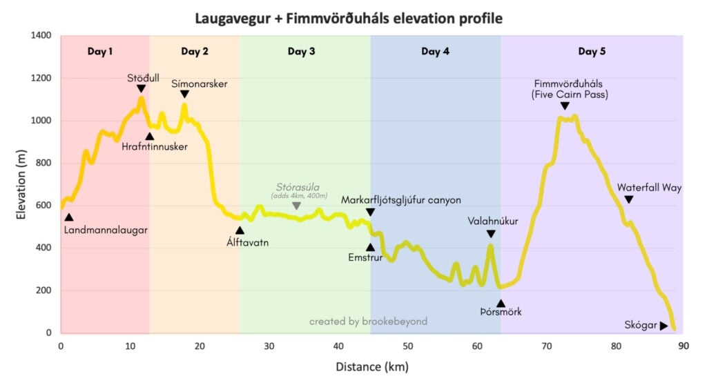
Laugavegur + Fimmvörðuháls elevation profile
Elevation profile of my 5-day Laugavegur + Fimmvörðuháls route

How hard is the Laugavegur Trail?

Despite the remote setting, the Laugavegur is actually a very approachable multi-day trek! The route is extremely well-marked, there are no technical sections on the standard trail, and daily distances (12-19km) are very manageable for hikers with reasonable fitness.

The final day on Fimmvörðuháls is objectively harder due to the increased distance (25km) and elevation gain (975m), but it’s still straightforward and non-technical. It’s possible to split this day nearly down the middle by adding a night at Baldvinsskáli or Fimmvörðuskáli, though most hikers should have no trouble completing it in a single day— for reference, we hiked this section in less than 7hrs.

>>> Read more about trail conditions & terrain along the Laugavegur below
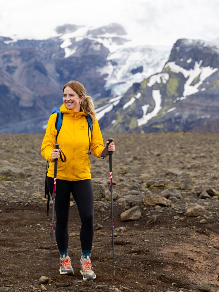
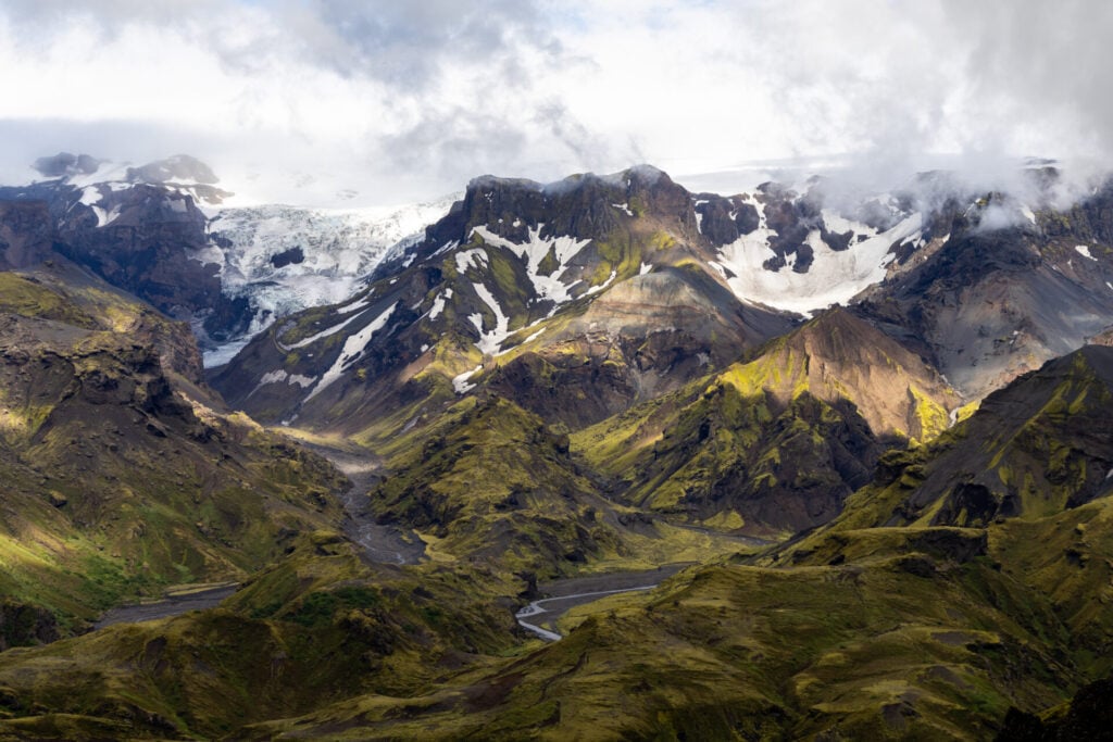
Mýrdalsjökull glacier
Views of Mýrdalsjökull glacier along Day 5

The biggest challenge on any Laugavegur hike is usually the weather, which can be WILDLY unpredictable and definitely necessitates dependable gear. Check the current weather conditions on vedur.is and read my detailed Laugavegur packing list to make sure you’re prepared to handle the Icelandic Highlands!
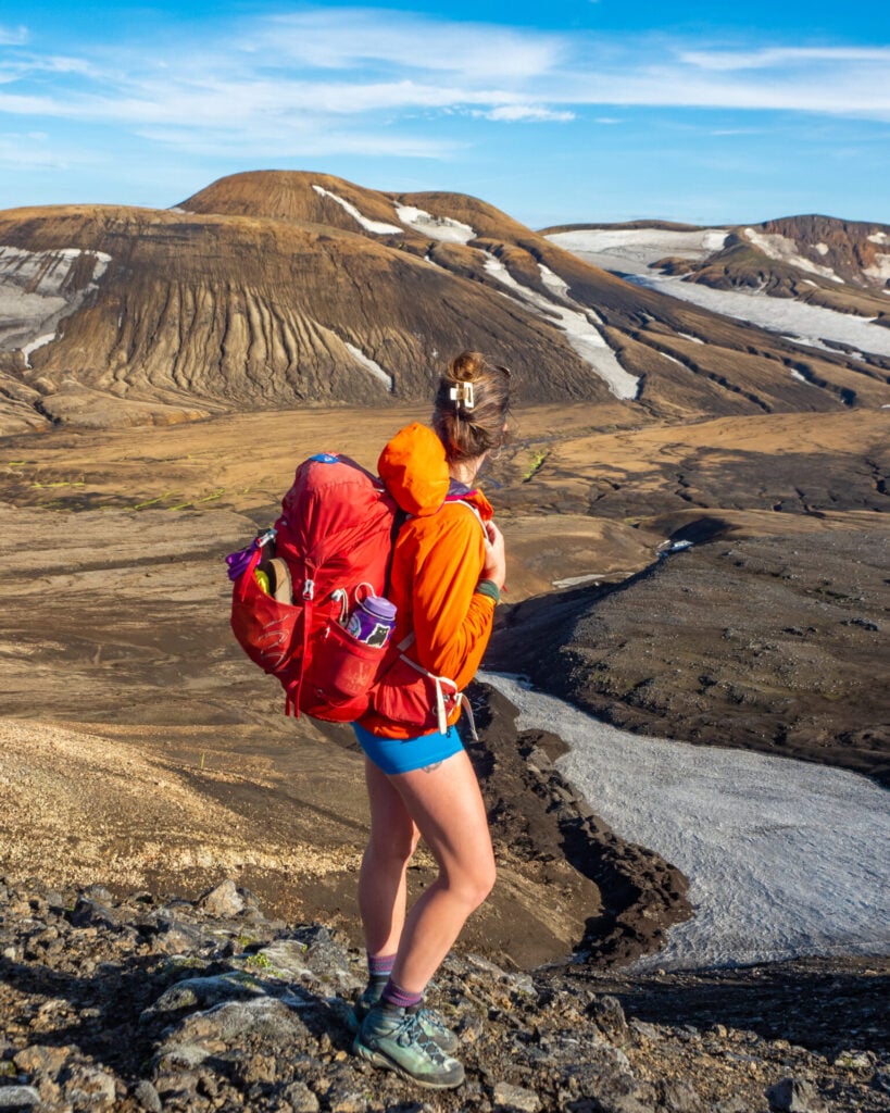
Hiking the Laugavegur Trail
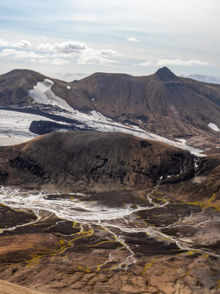
Looking out at Reykjafjöll from the trail above Hrafntinnusker on Day 1

A few of the side summits and off-trail viewpoints I’ve recommended do add an extra challenge— while most are suitable for any hiker, there are several that require confident navigation through unstable terrain. I’ll clearly call out the relative difficulty of every section throughout the detailed daily itinerary below so you always know exactly what to expect!

Note that the total route statistics quoted above (88km) include every recommended side trip EXCEPT Stórasúla, which adds 4km and 400m of elevation gain and is best reserved for hikers with significant off-trail experience.

🌿 A NOTE ABOUT OFF-TRAIL HIKING IN ICELAND

Some of the side trips I recommend in this itinerary venture completely off-trail into the wilderness of the Icelandic Highlands. Before including these in my own route, I specifically confirmed with a park ranger that off-trail travel was acceptable in these specific rocky and volcanic areas where there is little to no fragile vegetation. 

As a general rule in Iceland, NEVER walk on moss or delicate plantlife, which can take decades to recover from damage. Stick to rocky or barren volcanic terrain and, if in doubt, consult a hut warden or ranger before leaving the established trail!
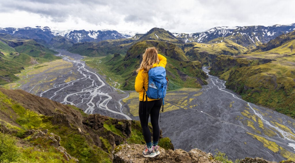
Valahnúkur hike
View over Þórsmörk from the top of Valahnúkur (side-trip on Day 4)

Essential planning info

When to hike the Laugavegur

The Laugavegur Trail is only accessible during a short summer hiking season, largely dependent on when the mountain roads to Landmannalaugar and Þórsmörk open. According to the Icelandic Touring Association (FÍ), the trail is usually open from 25 June to 15 September, though dates vary slightly every year.

Early in the hiking season, there are typically fewer hikers and less competition for bookings, but you’ll contend with snow across parts of the trail, colder temperatures, and higher river levels due to snow melt. Mid-July to mid-August is probably the most stable weather (I hiked in the first week of August), with the added benefit of nearly 24hrs of sunlight.
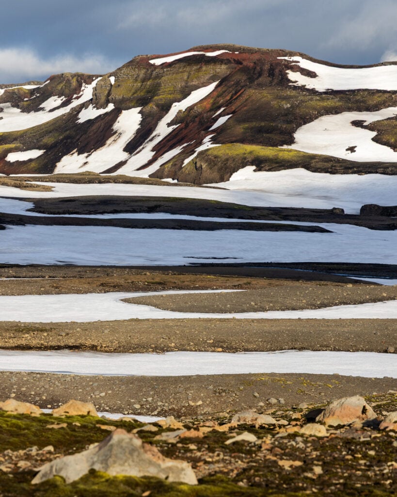
Snow on Fimmvörðuháls
Snow near Fimmvörðuháls on Day 5

Regardless of when you hike, weather in the Icelandic Highlands is famously unpredictable! Even in the middle of summer, you should be prepared for freezing rain, dense fog, sleet, strong wind, and rapidly changing mountain conditions.

Check forecasts on the Icelandic weather service vedur.is and consider modifying your itinerary if conditions are particularly poor (campers don’t need to book in advance, so this gives you more flexibility in case of bad weather).

>>> Read my detailed Laugavegur packing list for all the essential gear you should pack on this hike!
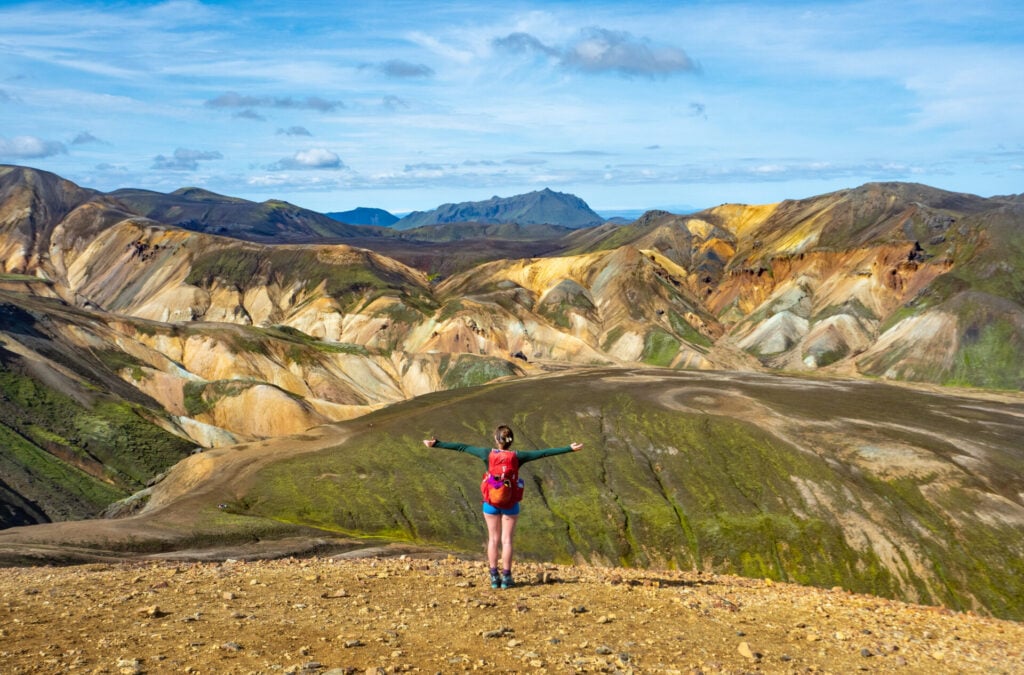
Brennisteinsalda summit in Landmannalaugar
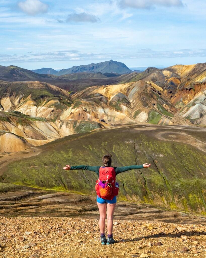
Incredible colours from the Brennisteinsalda summit on Day 1
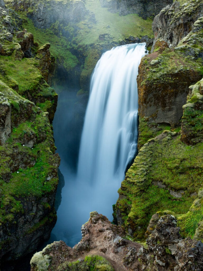
Waterfall Way hike to Skógar
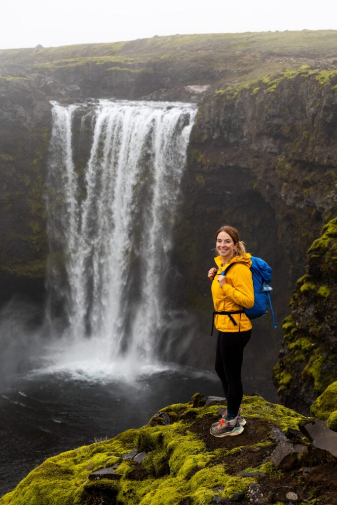
Skálabrekkufoss, one of several dozen waterfalls on the descent towards Skógafoss on Day 5

Which direction to hike

Although it’s possible to hike the Laugavegur in either direction, I’d recommend beginning at the farthest point (Landmannalaugar) and hiking back towards the Ring Road (Skógar) for the smoothest logistics. This is the direction that a vast majority of hikers travel, so most resources describe the southbound route— including this post! 

In terms of difficulty, the elevation gain (2,875m) and elevation loss (3,440m) are similar enough that it doesn’t make a huge difference, but hiking southbound involves slightly less uphill.
Essential resources & maps

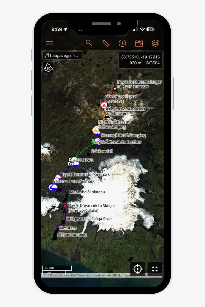
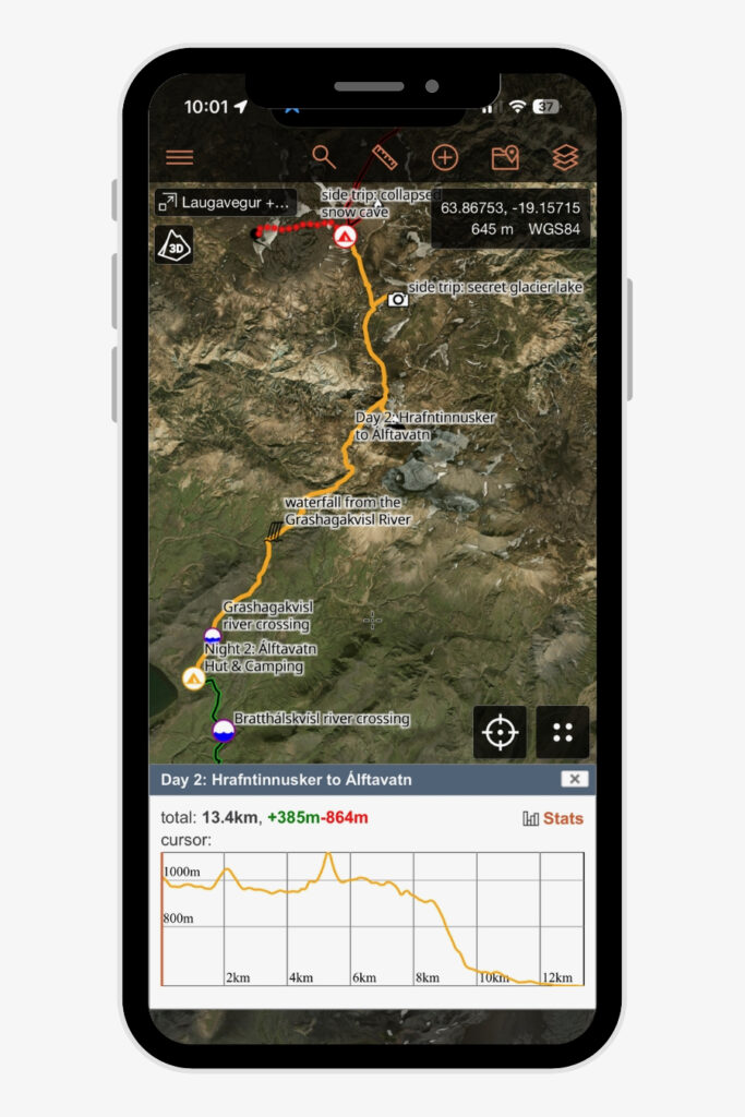
Especially for those following my Laugavegur + Fimmvörðuháls itinerary and recommended side trips, the absolute BEST navigational resource is my Laugavegur GPS map! Built after extensive research and refined through my own experience hiking the route (as well as real-world testing by several volunteers), it’s packed with detailed trail notes, custom waypoints, and carefully planned side trips to help you navigate confidently on and off the standard trail.

The map is available as a JSON & GPX download, and is compatible with all major GPS mapping devices/watches AND inexpensive GPS apps available on your smartphone, like CalTopo, Gaia GPS, and AllTrails.

My custom Laugavegur + Fimmvörðuháls map includes:

  • Complete daily tracks for the full Laugavegur route + Fimmvörðuháls extension, with trail stats, elevation profiles, and terrain insights
  • 10 campsites/huts along the route, with my recommendations + alternatives
  • All 8 major river crossings with precise locations and notes on expected water level
  • 9 scenic side summits & viewpoints off the main trail, each with a dedicated GPS track and notes
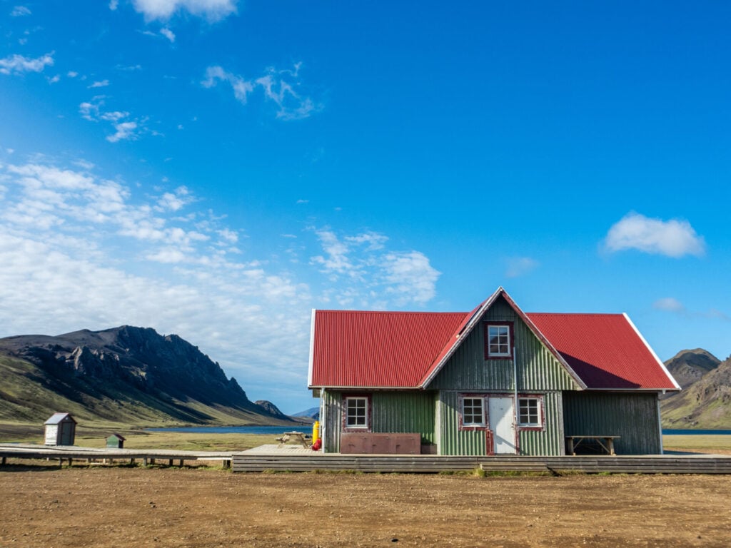
Álftavatn hut on the Laugavegur Trail
Álftavatn Hut on the Laugavegur Trail

Huts on the Laugavegur

Between Landmannalaugar and Skógar, there are seven huts operated by Ferðafélag Íslands (FÍ), the Iceland Touring Association. From north to south, these are: Landmannalaugar; Hrafntinnusker; Álftavatn; Hvanngil; Emstrur; Þórsmörk Langidalur; and Baldvinsskáli.

Every hut has a slightly different configuration (smaller bunkhouses vs mattresses spread across a sleeping loft vs 4-bed rooms shared by a mix of hikers), but all FÍ huts offer the same basic amenities:

  • Mattresses for sleeping (BYO sleeping bag and pillow)
  • Communal kitchen with gas stove and pots/pans
  • Bathrooms (some even have paid showers)
  • Access to clean drinking water
Hrafntinnusker hut on the Laugavegur Trail
Álftavatn hut on the Laugavegur Trail

Several huts also operate a small store selling limited dry goods and snack items (freeze-dried food, candy bars, beer), but stock is absolutely not guaranteed, so I’d recommend using this as a supplement to your packed food rather than relying on it for meals.

⛺️ OTHER HUTS ALONG THE LAUGAVEGUR

In addition to the seven FÍ huts described above, there are also two huts owned by Útivist (Básar in Þórsmörk & Fimmvörðuskáli on Fimmvörðuháls) and one owned by Volcano Huts in Þórsmörk/Húsadalur.

Útivist is another Icelandic hiking association, and their huts are comparable to the FÍ huts, offering simple mountain accommodation with communal facilities. They’re a good alternative if the corresponding FÍ huts are fully booked, but otherwise I’d recommend sticking with one booking system to keep the logistics simpler.

Uniquely, Volcano Huts in Húsadalur offers private rooms and glamping tents, plus hot meals, showers, a bar, and other facilities that feel much more like a hostel. If you’re after a more luxurious stay in Þórsmörk, you can definitely detour out here for Night 4 of the itinerary— staying here adds about 2.5km to the final day’s hike (I’ve personally hiked from here + the detour over Valahnúkur in a single day, and it’s very doable).

Camping on the Laugavegur Trail
Tents at the Emstrur Campsite

Campsites on the Laugavegur Trail

Located next to each of the huts on the Laugavegur, campsite amenities are a little more basic, but you can reasonably expect:

  • A cooking/dining shelter specifically for use by campers (BYO stove + cookware)
  • Bathrooms (sometimes shared with huts, sometimes separate)
  • Access to clean drinking water

You don’t need to pre-book campsites, so this can be a fantastic way to keep your itinerary flexible around weather, both in terms of exact starting date and how far you want to hike on any given day (with several options for shorter/longer days using interim campsites along the route).

Generally, I’d recommend camping for those who want to prioritise flexibility and a tighter budget (huts are more than 5x the cost of campsites), while huts are better for those who want guaranteed shelter from the elements and lighter pack weight.
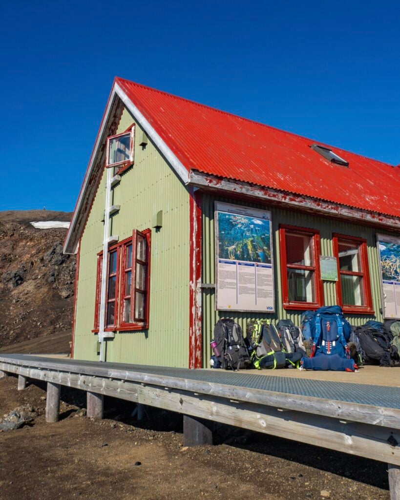
Álftavatn hut on the Laugavegur Trail
FÍ huts on the Laugavegur Trail

Booking huts & campsites

Hut spaces are very limited and typically need to be booked 3-6 months in advance, while campsites are more flexible— book online or simply arrive and pay at each site for maximum flexibility around weather.

Following the itinerary outlined in this guide, you should book the following huts/campsites:

  • Night 1: Hrafntinnusker
  • Night 2: Álftavatn
  • Night 3: Emstrur
  • Night 4: Þórsmörk Langidalur

FÍ now conveniently bundles hut accommodation into multi-night “packages” rather than requiring separate bookings for each hut. As of mid-2026, the 4-night hut package corresponding to this itinerary costs 68,000ISK ($560USD) per person. Note that Emstrur also offers pre-erected tents, so if all hut spaces are unavailable, you might still get a spot by exploring options under the “packages/combination” tab.
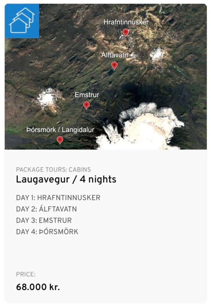
4-night Laugavegur hut package
The 4-night FÍ hut package corresponding to this itinerary

Each of the campsites along this route charge 3,400ISK per night, so the same 4-night itinerary costs just 13,600ISK ($110USD) for campers. You can book these in advance or simply arrive and pay without a reservation, maintaining more flexibility for inclement weather and daily energy levels. 

Payment at campsites can usually be made by credit card, but I’d still recommend carrying at least a small amount of Icelandic króna in case card machines are offline and you want to purchase snacks, drinks, or showers at the huts.
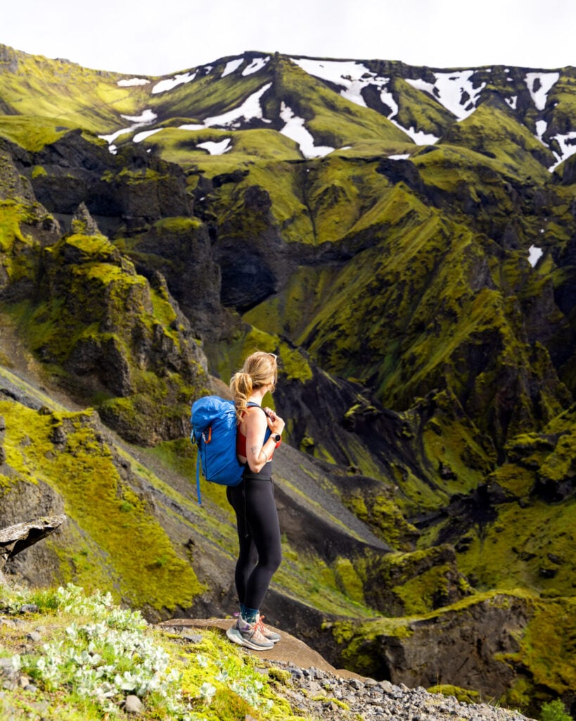
Strákagil canyon hiking
Ascending through Strákagil canyon on Day 5

Getting to & from the trail

Getting to Landmannalaugar

Reykjavík Excursions (owned by Icelandia) operates a reliable Highland Bus to Landmannalaugar from several locations, including a central hostel downtown and the main bus station (BSÍ).

For the 2026 hiking season:

  • Cost: 13,500ISK ($110USD) one-way
  • Departure: 7am from BSÍ bus station in Reykjavík
  • Arrival: 11.30am in Landmannalaugar

Up until ONE day before departure, you can modify or cancel your ticket entirely free of charge— this is great for flexible campers waiting for the best weather window to begin hiking! Simply email your confirmation number and requested date change to main@re.is.
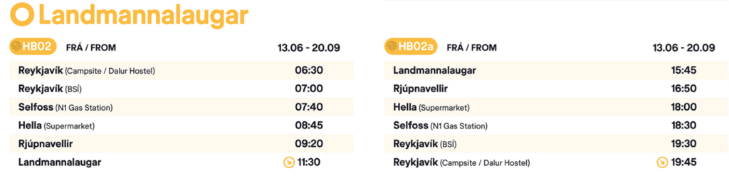
2026 Highland Bus schedule to Landmannalaugar

Getting from Þórsmörk to Reykjavík

For those hiking ONLY the classic Laugavegur route that ends in Þórsmörk, you can catch a Highland Bus back to Reykjavík through Reykjavík Excursions. There are two daily buses departing Þórsmörk throughout the peak summer season, but note that in early June OR September, this reduces to one mid-afternoon departure.

For the 2026 hiking season:

  • Cost: 13,000ISK ($106USD) one-way
  • Departures: 3.15pm or 8.15pm from Þórsmörk Langidalur
  • Arrivals: 7.45pm or 12am at BSÍ bus station in Reykjavík

In my experience, it’s possible to hop onto an earlier or later bus than the one you originally booked, but this is entirely dependent on availability and buses DO occasionally sell out during peak season.

As with the Landmannalaugar route, tickets can be changed or cancelled free of charge up to one day before departure by emailing main@re.is. This flexibility is particularly useful if you later decide to continue onwards to Skógar via the Fimmvörðuháls extension!
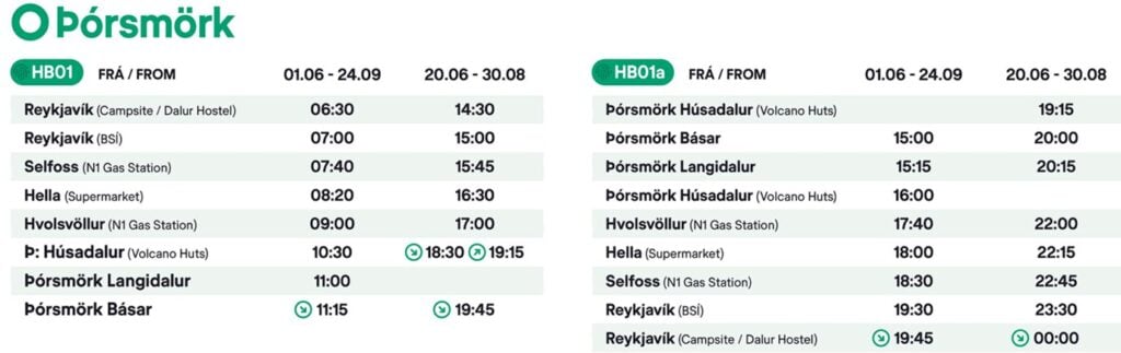
2026 Highland Bus schedule from Þórsmörk

Getting from Skógar to Reykjavík

For hikers completing the full itinerary recommended in this post (including the Fimmvörðuháls extension), there are a few different options for getting from Skógar back to Reykjavík:

  • Reykjavík Excursions Highland Bus: departs Skógar daily at 10.15am, so this option realistically requires spending a final night at Skógar campground and catching the bus the following morning. Tickets are 9,900ISK ($82USD).
  • Southcoast Adventure bus: departs Skógar at 10pm and only runs as far west as Hvolsvöllur (about 45min away), so I’d recommend staying overnight there (Midgard is our favourite hostel in Iceland!) and continuing onwards to Reykjavík on a combination of the #53 and #51 public buses the following morning. Tickets for the Southcoast Adventure bus cost 6,990ISK ($57USD) + the combo of public buses costs a total of 5,400ISK ($44USD). There are several departures throughout the day, but the connection is unavoidable.
  • Public bus (Strætó #52): a local bus also services this route, departing Skógar at 5.55pm and arriving around 8pm at Mjódd E, a major bus interchange roughly 6km outside downtown Reykjavík. From there, you can easily connect onto one of several frequent local buses into the city centre or the BSÍ terminal. Tickets for this route are 7,600ISK ($60USD) + an additional 690ISK ($6USD) for the intercity fare, payable by credit card on board. NOTE: the #52 bus does NOT operate on Mondays, Wednesdays, or Saturdays!
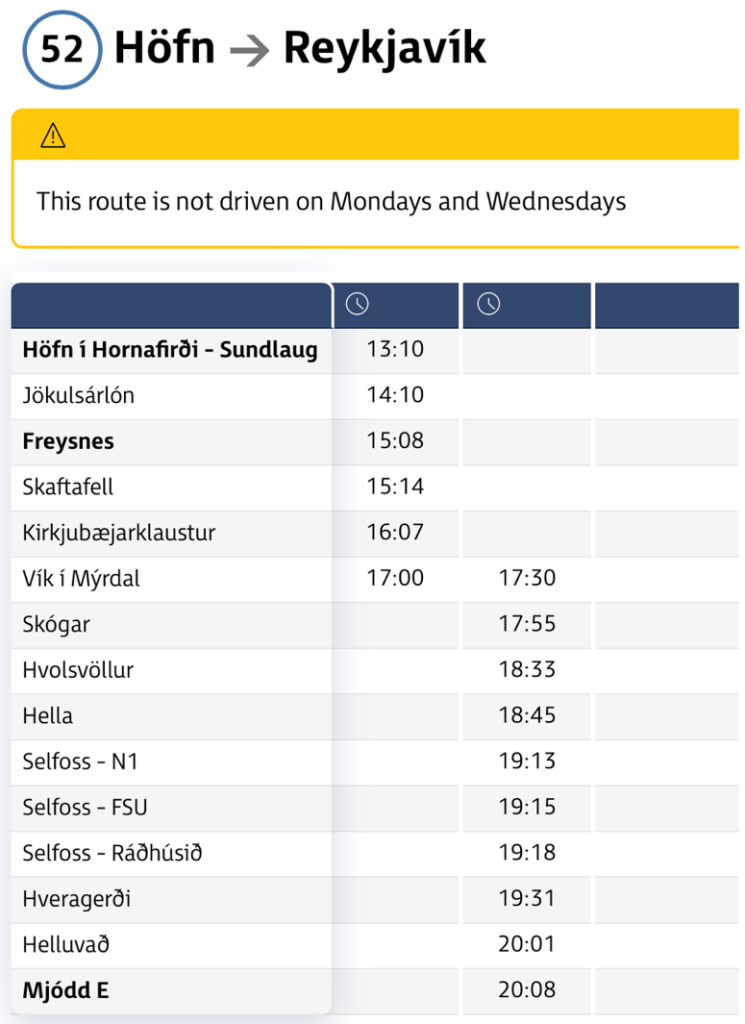
Strætó #52 public bus schedule

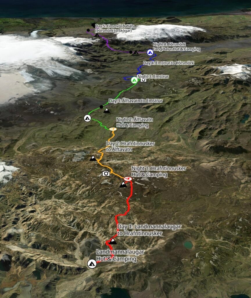
Map of Laugavegur + Fimmvörðuháls Trail
Map of my 5-day Laugavegur + Fimmvörðuháls itinerary [built in Caltopo]

*Detailed Laugavegur + Fimmvörðuháls itinerary

Described in detail below, my 5-day Laugavegur + Fimmvörðuháls itinerary incorporates interesting side summits and scenic viewpoints off the standard trail for the ultimate multi-day hike through the Icelandic Highlands!

  • Day 1: Landmannalaugar to Hrafntinnusker + Brennisteinsalda summit + Stöðull summit
    • 4.5hrs; 12km; 750m gain
  • Day 2: Hrafntinnusker to Álftavatn + secret glacier lagoon + Símonarsker summit
    • 5hrs; 13.5km; 385m gain)
  • Day 3: Álftavatn to Emstrur + Markarfljótsgljúfur canyon
    • 6hrs; 19km; 350m gain
    • CHALLENGING SIDE TRIP: Stórasúla summit adds 2hrs; 4km; 400m gain
  • Day 4: Emstrur to Þórsmörk + Valahnúkur summit
    • 6.5hrs; 18.5km; 640m gain
  • Day 5: Þórsmörk to Skógar (Fimmvörðuháls)
    • 7hrs; 25km; 975m gain
Brennisteinsalda summit in Landmannalaugar

Day 1: Landmannalaugar to Hrafntinnusker

  • Trail time: 4.5hrs
  • Distance: 12km
  • Elevation gain/loss: 750m gain / 320m loss
  • River crossings: none
  • Side trips (included in stats): Brennisteinsalda summit + Stöðull summit

The first day of the Laugavegur is the shortest of the entire 5-day itinerary and a spectacular introduction to the Icelandic Highlands. Although it features the steepest sustained climb (until Fimmvörðuháls on Day 5), the trail is never particularly difficult, gradually ascending through stark lava fields, colourful rhyolite mountains, and steaming geothermal valleys to reach Hrafntinnusker.

This is also the busiest section of the trail, overlapping with several popular day-hikes around Landmannalaugar for the first few kilometres— but it absolutely doesn’t detract from the outrageous landscapes!

Landmannalaugar Hot Springs
Bláhnjúkur summit in Landmannalaugar

LANDMANNALAUGAR SIDE QUESTS

The Highland Bus from Reykjavík typically arrives in Landmannalaugar shortly after 11am, and because today’s hiking route is relatively short, there’s no need to rush immediately onto the trail. For a relaxed start to the day, soak in the natural Landmannalaugar Hot Springs beside the campsite. Fed by small geothermal waterfalls, the steaming pools are free to use and easily one of the most scenic hot springs in Iceland!

Alternatively, if you’re feeling particularly energetic, you can begin the trip with a quick side hike to nearby Bláhnjúkur (“Blue Peak”), one of the most iconic viewpoints in the Highlands. The return hike takes about 2hrs and departs a few hundred metres left of the campsite, climbing steeply above the braided river valleys, black lava fields, and marbled rhyolite mountains you’ll soon be hiking directly through.
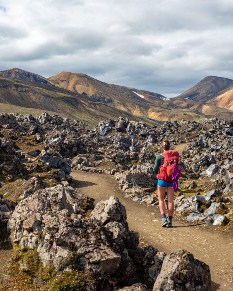
Hiking the Laugavegur Trail
The trek begins by crossing the Laugahraun lava field

The official Laugavegur trailhead begins immediately behind the bustling Landmannalaugar hut, crossing through the dramatic Laugahraun lava field. After 1.5km, continue left at a signed junction towards Hrafntinnusker, skirting the edge of the lava field through steaming valleys and colourful geothermal slopes streaked with sulphur deposits and bubbling vents.

Hiking the Laugavegur Trail
Hiking on Laugavegur Trail
Hiking the Laugavegur Trail
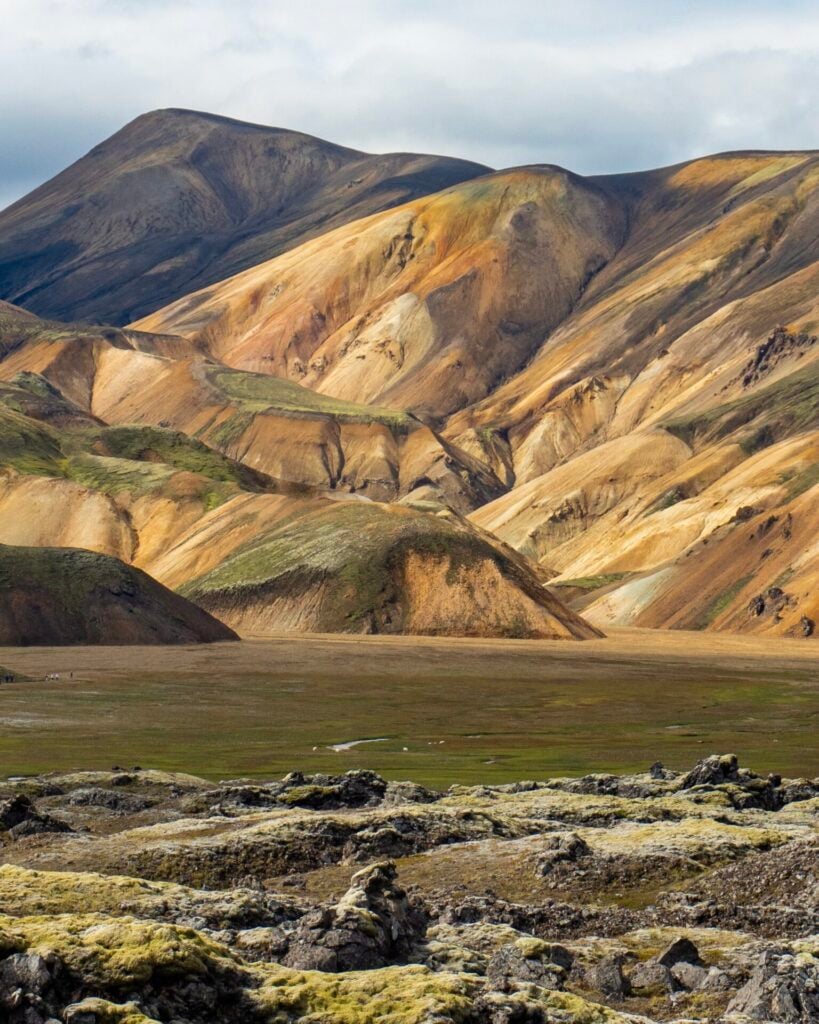
Rhyolite mountains of Landmannalaugar

A well-worn side trail climbs the golden hillside of Brennisteinsalda around the 3.5km-mark, and this is one of the best short side summits along the entire route! From the top of the “Sulphur Wave”, enjoy spectacular views across the marbled rhyolite mountains that make Landmannalaugar so unique.
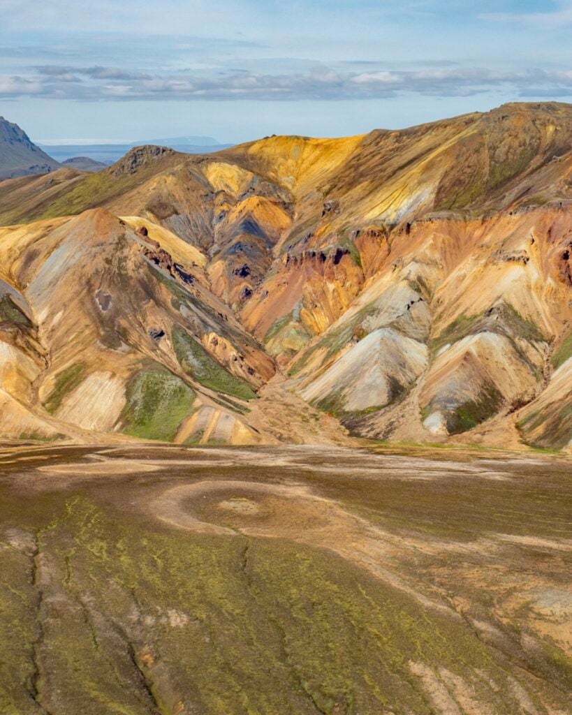
Brennisteinsalda summit in Landmannalaugar
View from the summit of Brennisteinsalda
Hiking the Laugavegur Trail
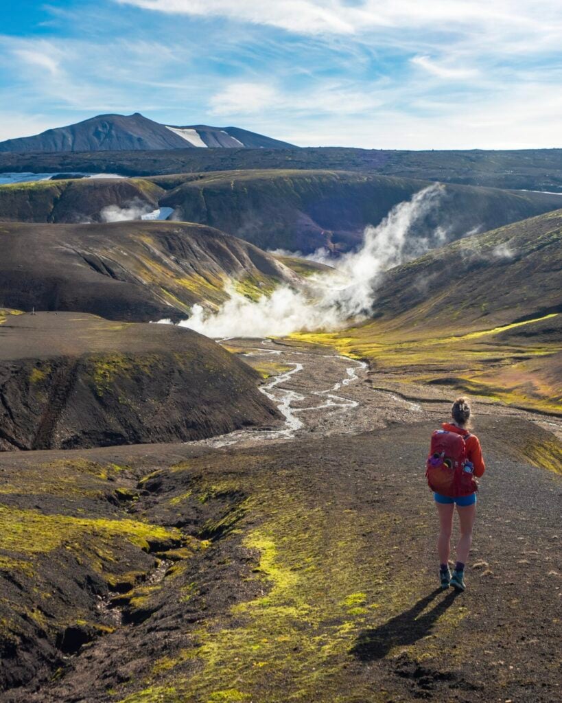
Geothermal valleys on the hike out of Landmannalaugar

Beyond Brennisteinsalda, the trail climbs gradually through more geothermal valleys before transitioning into volcanic wilderness of ash-black valleys and rolling mountains capped by lingering snowfields. As you gain elevation, the Highlands begin to feel increasingly remote and otherworldly.

Roughly 4.5hrs after leaving Landmannalaugar, the huts and campsite at Hrafntinnusker come into view. Either before the final descent to camp or returning up to this point after dinner, I highly recommend a short side trip up Stöðull, the hill just to your left.
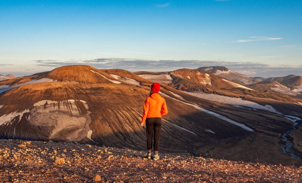
Hiking the Laugavegur Trail
Be sure to catch the sunset from Stöðull

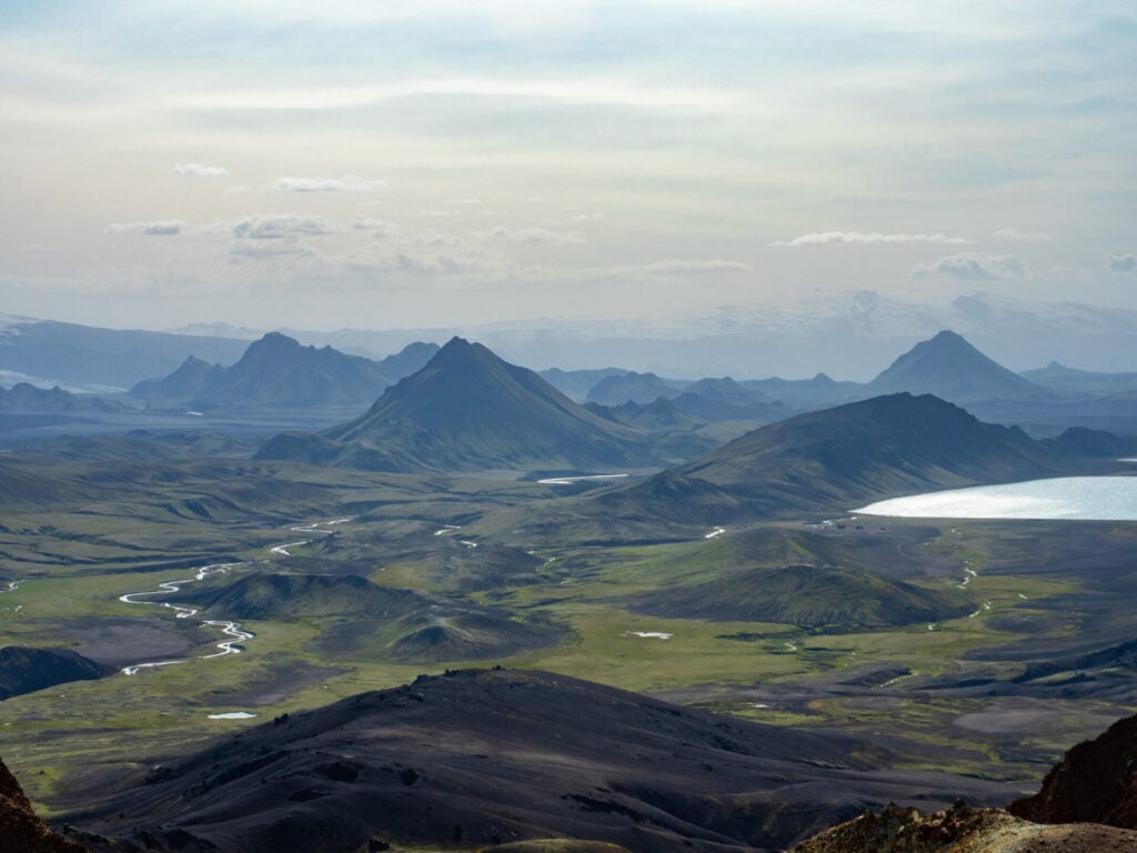
From this vantage point, enjoy expansive views over Reykjafjöll and the volcanic wilderness stretching towards Álftavatn. It’s particularly popular at sunset and takes about 20min from camp.
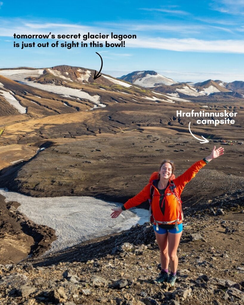
Hrafntinnusker campsite on the Laugavegur Trail
Overlooking the Hrafntinnusker campsite

Night 1: Hrafntinnusker

Perched at the highest point of the Laugavegur Trail (1,100m), Hrafntinnusker is by far the most exposed and weather-beaten campsite on the route. Wind here can be absolutely relentless, even in summer, and temperatures are often noticeably colder than elsewhere on the trail.

The hut accommodates 52 hikers and is arranged dormitory-style, with larger groups and early arrivals usually claiming the lower bunk beds while later arrivals often end up sleeping on mattresses spread across the floor upstairs.

For campers, several low rock walls provide nominal shelter from the wind, and there’s also a dedicated cooking shelter plus separate bathrooms for tent campers. Note that there’s no waste disposal here, so you’ll need to bag out all your own rubbish to Álftavatn (where there are bins available). 
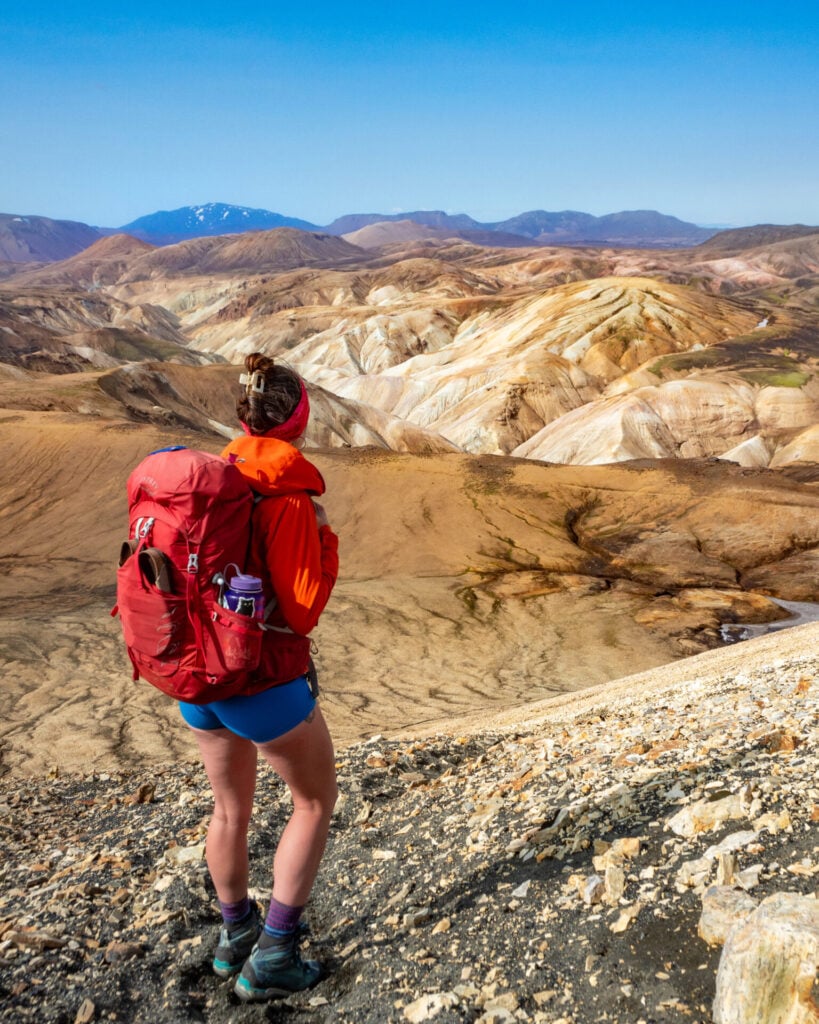
Hiking the Laugavegur Trail
View from the summit of Símonarsker

Day 2: Hrafntinnusker to Álftavatn

  • Trail time: 5hrs
  • Distance: 13.5km
  • Elevation gain/loss: 385m gain / 865m loss
  • River crossings: calf-deep river crossing just before hut
  • Side trips (included in stats): secret glacier lagoon + Símonarsker summit

The second day of the Laugavegur is one of the most relaxed of the itinerary, descending gradually from the high volcanic plateau around Hrafntinnusker into the glacial valleys surrounding Álftavatn. Do note, however, that conditions on this section vary dramatically. Early summer often involves extensive snow travel and more challenging navigation, and at any time, white-out conditions or strong winds can quickly complicate today’s route.

IF the weather cooperates, you’ll have plenty of time to explore a few off-route highlights, including a hidden glacier lagoon and the summit of Símonarsker! Both were recommended by a park ranger, who encouraged venturing off the main trail in this particular area because the landscape is almost entirely volcanic ash and bare rock rather than fragile moss or vegetation.
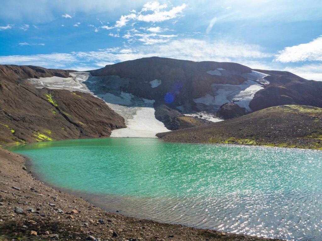
Hiking the Laugavegur Trail
Secret glacier lagoon on the Laugavegur

Departing Hrafntinnusker, the trail contours along the base of Reykjafjöll through a golden-brown landscape of volcanic slopes and lingering snowfields. Keep an eye on your GPS for a turn up into the hills that will bring you to a turquoise glacier lagoon, totally hidden from sight and perfectly secluded just 15min off the main trail. I enjoyed it entirely to myself and, had the weather been just a little warmer, it would have been amazing for a swim!

Hiking the Laugavegur Trail

The route continues through folded yellow rhyolite valleys, melting snow bridges, and steaming geothermal pockets before reaching another worthwhile side trip. A little over 4.5km from camp, head left off the trail and ascend the golden hillside of Símonarsker, climbing to the summit in under 30min for spectacular views over the Kaldaklofsfjöll glacier and the icy braided rivers carving through the volcanic valley below.
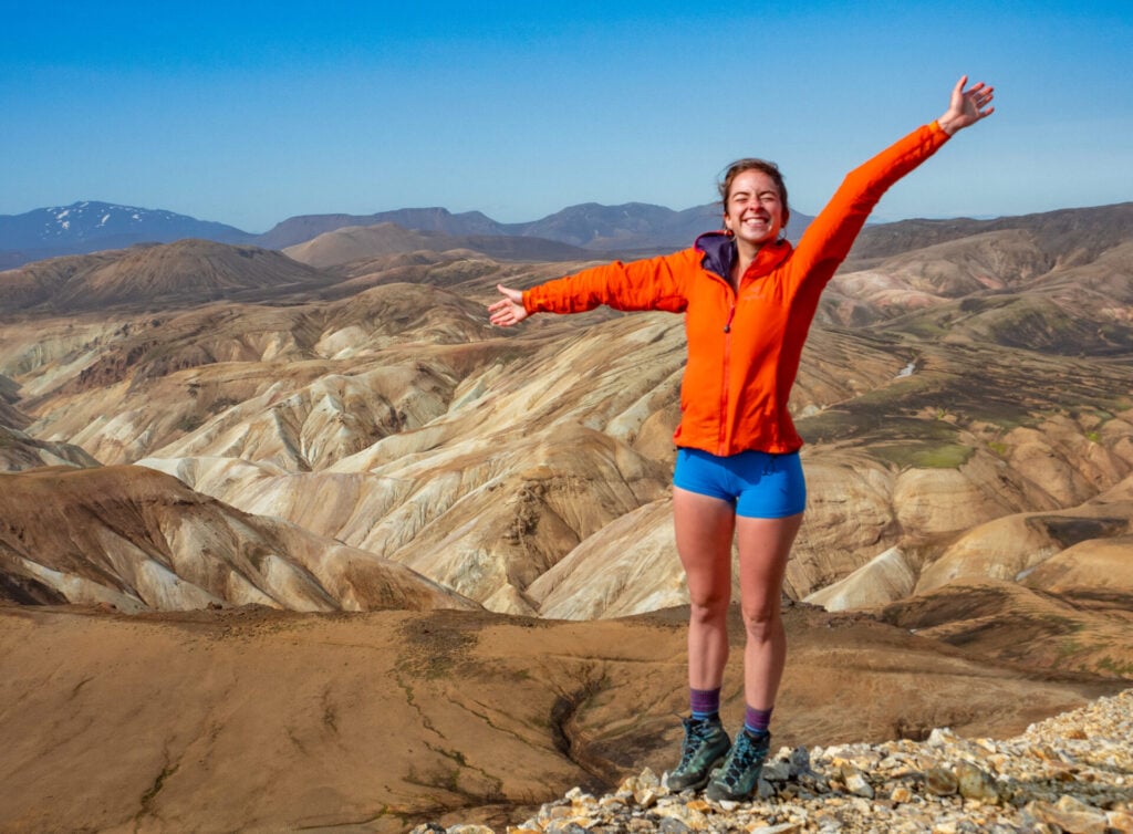
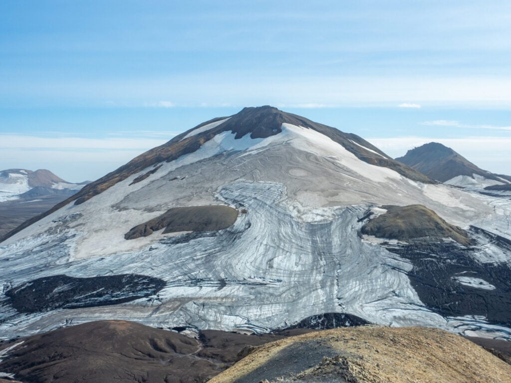
Hiking the Laugavegur Trail
On the summit of Símonarsker
Hiking the Laugavegur Trail
View of the Kaldaklofsfjöll glacier
Hiking the Laugavegur Trail
Incredible views from the summit of Símonarsker

Descending from Símonarsker, the main trail is relatively flat for several kilometres through Jökultungur, the “glacier tongue” valley that forms one of the most geothermally active sections of the Laugavegur. Steam vents hiss from the hillsides and colourful mineral deposits streak the surrounding slopes, while distant glaciers dominate the horizon.

Around the 8.5km mark, the route begins a steep descent from the golden plateau alongside a delicate waterfall fed by the Grashagakvísl River. As you lose elevation, the terrain gradually transitions to greener valleys and broad black plains surrounding Álftavatn.

Hiking the Laugavegur Trail
Views on the descent to Álftavatn

Just before reaching camp, you’ll cross the Grashagakvísl River. Water levels vary substantially depending on season and recent weather, but during my hike in August, this was a mellow calf-deep crossing. Earlier in the summer, it may even be possible to cross on lingering snow bridges, but these should definitely be approached cautiously.
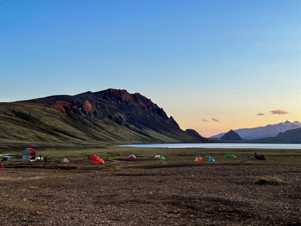
Álftavatn campsite on the Laugavegur Trail
Camping on the shores of Álftavatn lake

Night 2: Álftavatn

Located on the shores of a large, shallow lake surrounded by low mountains, Álftavatn is one of the most scenic and comfortable camps along the Laugavegur. There are two FÍ huts accommodating a total of 72 hikers in smaller rooms (usually 2-6 people per room), connected via a well-appointed communal kitchen and dining area.

The campground sits directly beside the huts with shared bathroom facilities for all guests. It’s generally more sheltered and therefore much warmer than the previous night’s stay. You can also throw away rubbish in Álftavatn, so take the chance to offload anything you’ve been carrying since Landmannalaugar!
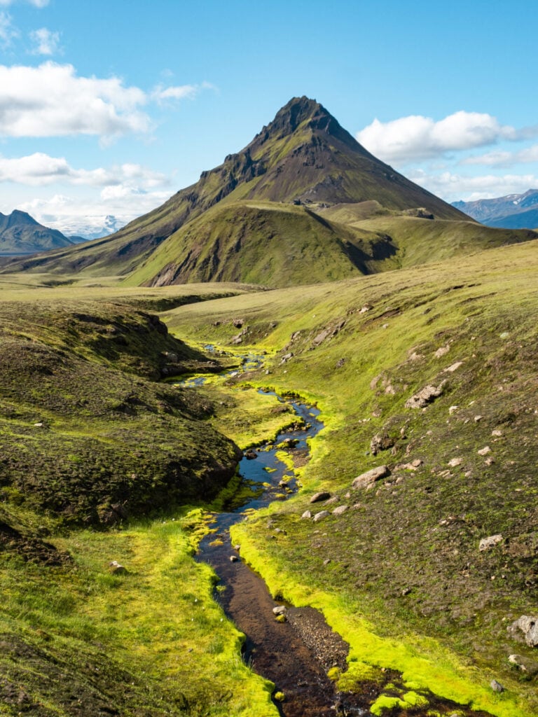
Hiking the Laugavegur Trail
The incredible Stórasúla peak

Day 3: Álftavatn to Emstrur

  • Trail time: 6hrs + 2hrs for Stórasúla side summit
  • Distance: 19km
  • Elevation gain/loss: 350m gain / 420m loss
  • River crossings: 2 river crossings early in the day (1 calf-level, 1 up to hip-level)
  • Side trips: Stórasúla summit* adds 4km + 400m + Markarfljótsgljúfur canyon

As the longest day of the standard Laugavegur Trail, the route covers a huge variety of landscapes as the lush mossy valleys and glacial rivers near Álftavatn transition to a stark volcanic moonscape and eventually to the colourful canyonlands of Emstrur.

Today also features the most difficult side summit I’ve recommended anywhere in this itinerary. Suitable ONLY for hikers with prior experience navigating rough, unstable off-trail terrain, the Stórasúla summit provides an absolutely mind-blowing vantage point over the black sand deserts of Mælifellssandur and surrounding peaks! With two deep river crossings on the standard route, this is an eventful day from start to finish.
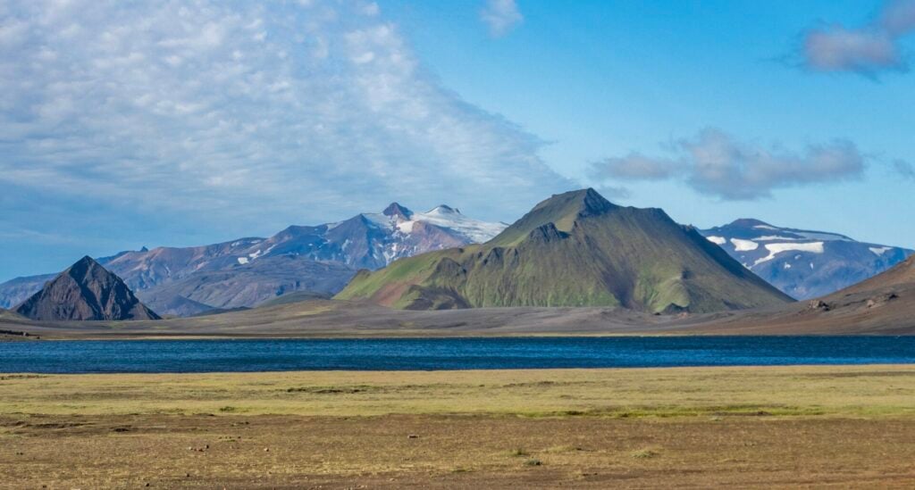
Hiking the Laugavegur Trail
Incredible scenery along the lake

Shortly after leaving Álftavatn, the trail crosses several small, bridged streams before reaching the first meaningful river crossing of the day: Bratthálskvísl, located about 1.5km from camp. Depending on the season and recent weather, this crossing can range from ankle to calf-deep.

The remaining 2.5km from the river crossing to the campsite at Hvanngil ascends very gradually through broad green valleys framed by distant volcanic peaks. It’s possible to stay at Hvanngil instead of Álftavatn on Night 2, but the setting isn’t nearly as nice, so consider it more of a back-up plan.
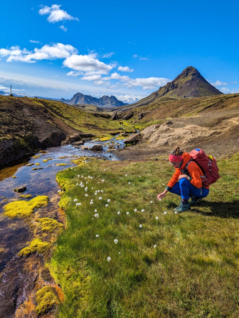
Hiking the Laugavegur Trail
Picking dandelions in front of Stórasúla

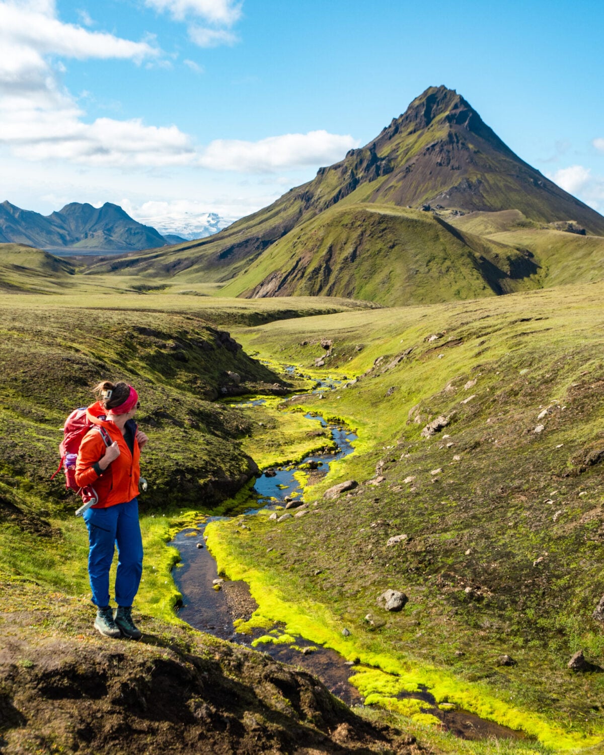
Continuing past Hvannagil, the trail passes through a fairytale landscape of moss-lined rivers and dandelion fields in the foreground of pyramidal Stórasúla. Less than 1km from the hut, there’s a large footbridge across the Kaldaklofskvísl River, followed closely by an unbridged crossing of the Bláfjallakvísl River, the deepest river crossing on the entire route.

At the time of my hike in August, the river was up to hip level— water levels vary considerably depending on recent rain and glacial melt, but regardless of conditions, it’s important to scout a safe line, unbuckle your pack, and ideally link arms or cross alongside other hikers for added stability. To save your pants from getting soaked on the crossing, most people also change into shorts for the ford!

The landscape at this point transforms dramatically from lush green scenery around Hvanngil to the vast black desert of Mælifellssandur. About 2km from the second river crossing, you’ll come to the turn-off point for a side summit of Stórasúla, the pyramidal peak that dominated this morning’s view. Note there’s no trail, this is just an approximate point I’ve marked on the GPS!

Stórasúla is a challenging but amazing side summit!

🗻 HOW HARD IS THE STÓRASÚLA SIDE SUMMIT?

Stórasúla is by far the most challenging side trip I’ve recommended within this itinerary and should ONLY be attempted by hikers with significant previous experience navigating steep scree and unmarked off-trail terrain. My GPS track is very general, and you’ll need to use your own judgement to find the best line up to the summit ridge, generally making a few tight switchbacks and then traversing the hillside on a broad, sweeping traverse. It’s incredibly steep and there is NO marked trail or signed route!

For those with adequate backcountry experience, it takes about 1hr to reach the summit of Stórasúla, gaining just under 400m up the rocky eastern slopes of the mountain. The views over the black expanse of Mælifellssandur, Stórkonufell (the U-shaped mountain in the distance), and the enormous Mýrdalsjökull glacier are truly insane, and you can guarantee VERY few people have ever experienced it from this point!
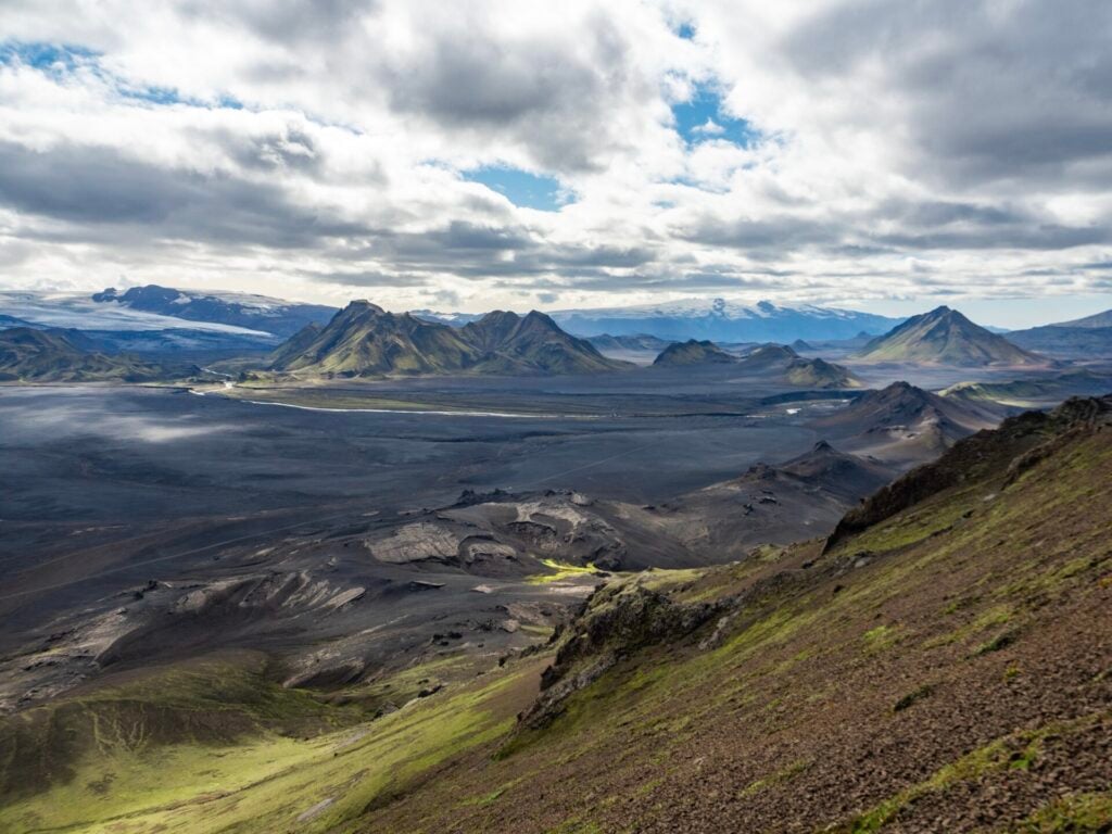
Stórasúla mountain
Enormous views on the Stórasúla ascent
Hiking the Laugavegur Trail
Back on the trail towards Emstrur

Back on the main trail below Stórasúla, the remaining 11km to Emstrur pass quickly on a gentle, mostly flat trail through the volcanic desert.

Just before reaching camp, a short spur trail branches right towards the rim of Markarfljótsgljúfur, a large canyon carved by powerful glacial meltwater that makes an excellent scenic detour (accessible to everyone). 
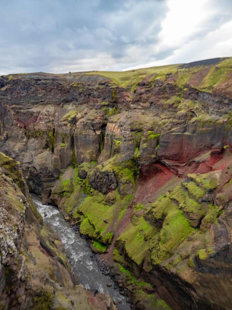
Markarfljótsgljúfur canyon on the Laugavegur Trail
beautiful colours of Markarfljótsgljúfur Canyon
Markarfljótsgljúfur canyon on the Laugavegur Trail

Layers of black basalt, rust-red volcanic rock, and vivid green moss paint the canyon walls in bright colours, while narrow fissures and towering cliffs give the entire landscape a wild, primordial feel. It’s possible to either visit directly off the trail or return after dinner without your pack, as it’s quite close to Emstrur.
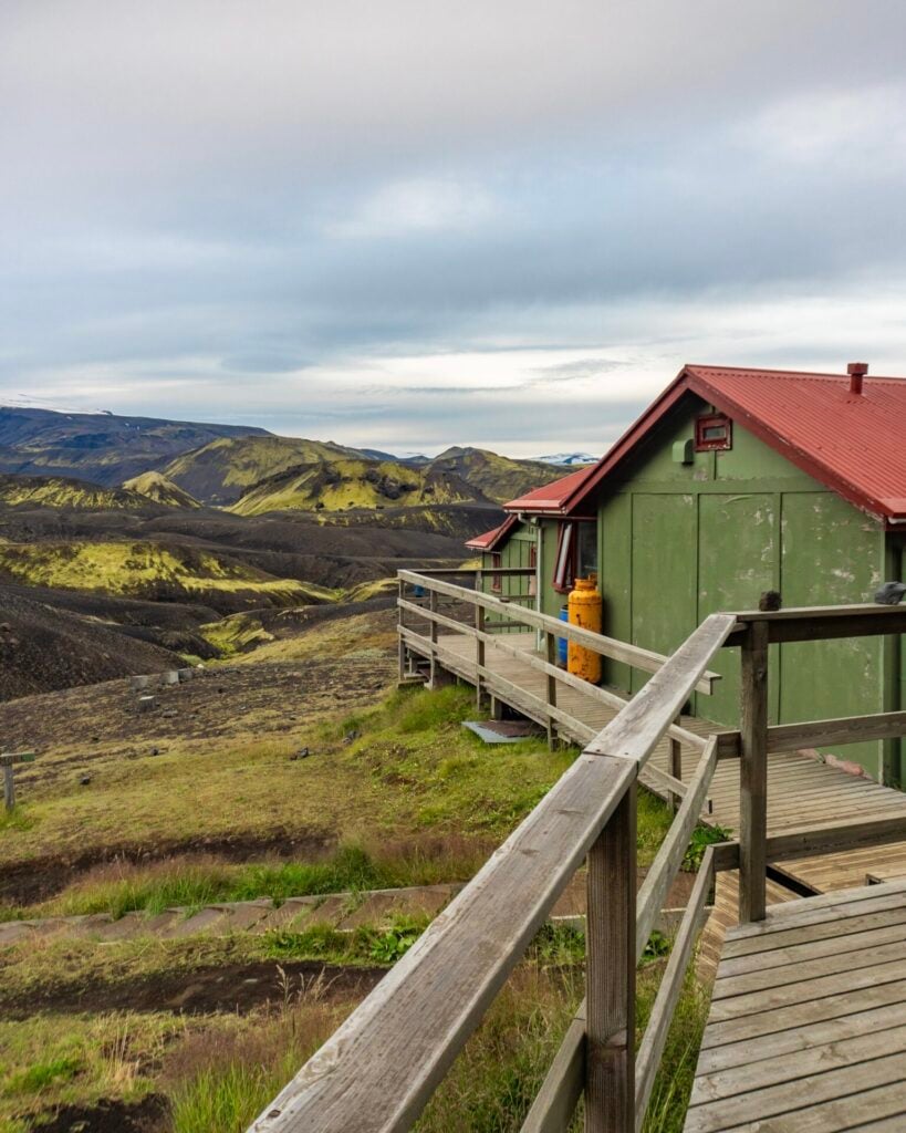
Emstrur Hut on the Laugavegur Trail
on the patio of Emstrur Hut

Night 3: Emstrur

Perched near the rim of Markarfljótsgljúfur canyon, Emstrur consist of three separate huts that each accommodate around 20 hikers in a bunk-style sleeping room that also has a shared kitchen and dining space (no privacy between sleeping and cooking). 

The campground is slightly below the huts along a small river and includes a communal cooking shelter for campers. Bathrooms (with showers!) are shared between campers and hut guests.
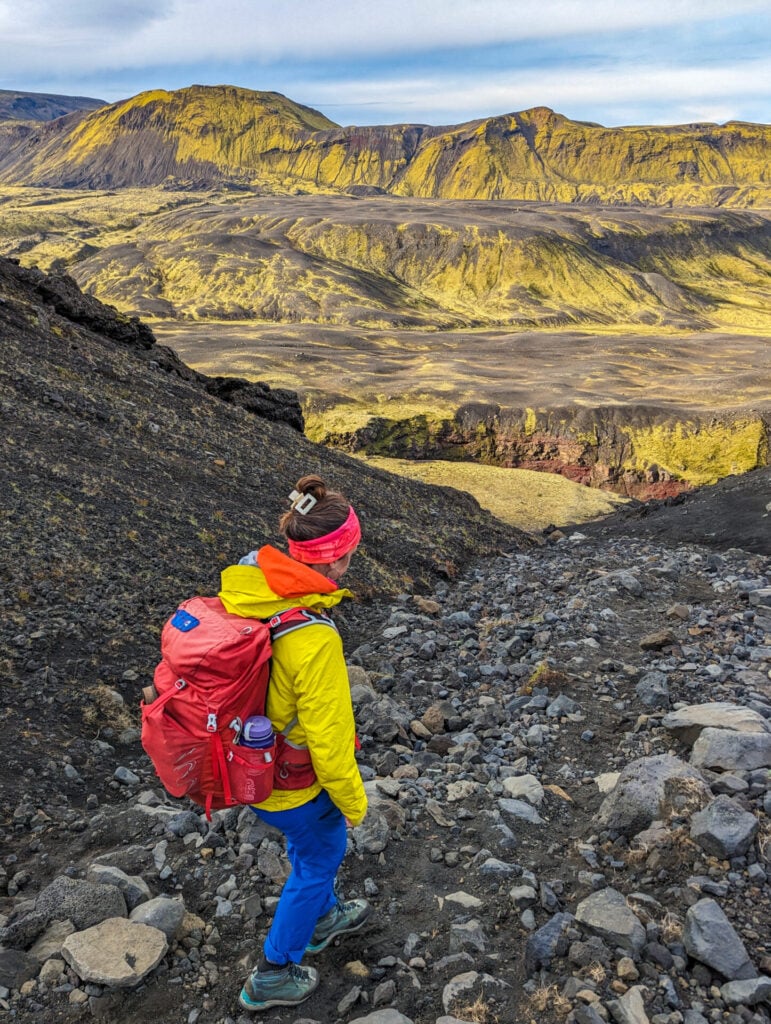
Markarfljótsgljúfur canyon on the Laugavegur Trail
Descending towards Þórsmörk

Day 4: Emstrur to Þórsmörk

  • Trail time: 6.5hrs
  • Distance: 18.5km
  • Elevation gain/loss: 640m gain / 890m loss
  • River crossings: knee-deep river crossing just before the hut
  • Side trips (included in stats): Markarfljót River viewpoint + Valahnúkur summit

The final day of the classic Laugavegur Trail follows a relaxed descent into Þórsmörk (“Thor’s Valley”), one of the most lush and mystical landscapes in the Icelandic Highlands. Characterised by deep canyons, moss-covered hillsides, braided glacial rivers, and dense birch forest, this feels like an entirely different world!

From the hut at Langidalur, a short side-trip takes you up to the summit of Valahnúkur on a steep but well-defined trail for panoramic views over the braided Krossá River, surrounding glacier-capped peaks, and the lush valleys that make Þórsmörk so impressive. This is a dramatic ending for some hikers, but for those continuing on Fimmvörðuháls, it’s an incredible introduction to one of Iceland’s most beloved wilderness areas.
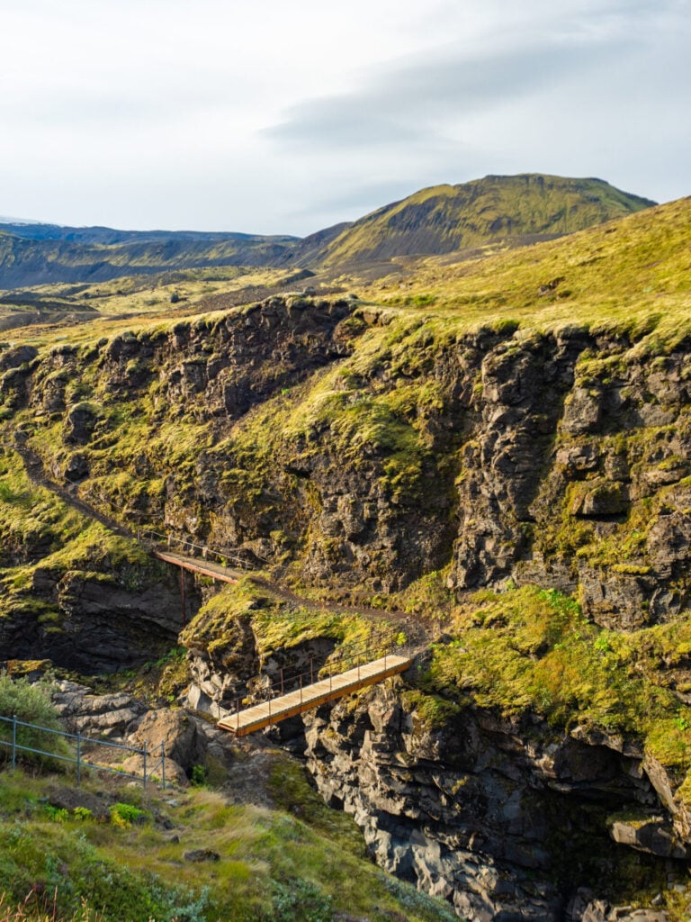
Hiking the Laugavegur Trail
Crossing the Fremri-Emstruá River

Departing Emstrur, the trail remains fairly level for the first 2km before descending steeply towards the Fremri-Emstruá River on one of the most dramatic sections of the route. Crossing the river via a narrow footbridge suspended above the canyon, the trail ascends the opposite hillside with incredible views over the gaping landscape.

Roughly 2km farther along, another short spur trail branches right towards an outstanding viewpoint where the Fremri-Emstruá joins the much larger Markarfljót River deep within the canyon below. From the cliff edge, you can look directly down at the glacial rivers carving through the painted volcanic walls of Markarfljótsgljúfur, streaked in black basalt, rust-red rock, and vivid green moss.
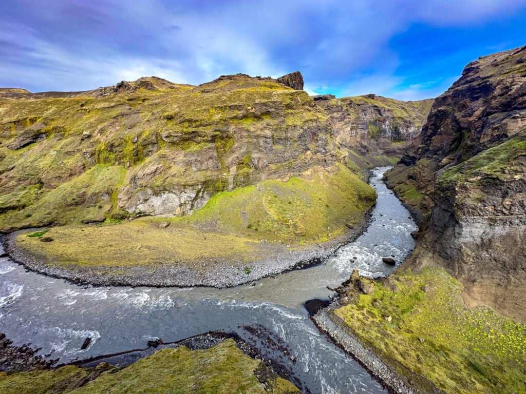
Markarfljótsgljúfur canyon on the Laugavegur Trail
Viewpoint of Markarfljót River just off the main trail

The trail continues gradually downhill alongside the eastern rim of Markarfljótsgljúfur before eventually veering left towards Þórsmörk. Other than two short climbs and one final river crossing near the end of the day, the terrain is gentle and straightforward, making for a fairly relaxed final stage of the classic route.
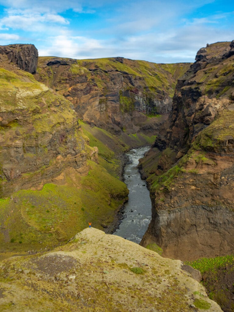
Markarfljótsgljúfur canyon on the Laugavegur Trail
Overlooking Markarfljótsgljúfur Canyon

Before the first of the small ascents, cross the Ljósá river on a footbridge, and then immediately after the second ascent, cross the Þröngá River. This is the last of the unbridged crossings on the route, and it can be tricky due to the uneven terrain— it was also knee-deep during my hike in August, so exercise extra caution here. 

Beyond Þröngá, the landscape transforms once again as the trail enters the dense birch forests of Hamraskógar. After several days trekking through volcanic deserts and exposed highlands, the sudden greenery of Þórsmörk feels like a huge shift!

Hiking the Laugavegur Trail

The classic Laugavegur officially ends at Langidalur, an FÍ hut right on the northern bank of the raging Krossá River — one of Iceland’s most dangerous glacial rivers, crossed tomorrow via footbridge. I’d highly recommend dropping your pack here and tacking on a quick evening hike to the summit of Valahnúkur, just over 1km (230m elevation gain) from the FÍ hut!
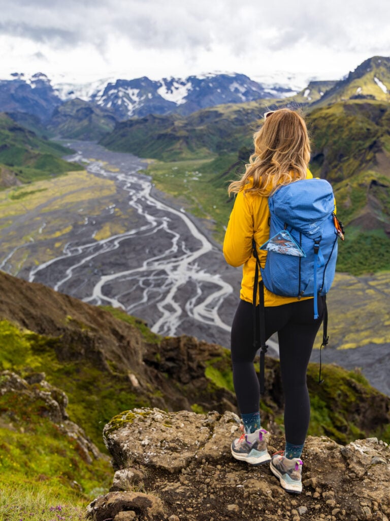
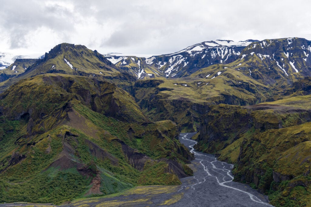
View from the top of Valahnúkur
Valahnúkur hike
Best views over Þórsmörk from Valahnúkur

Widely considered the best short hike in Þórsmörk, Valahnúkur delivers phenomenal panoramic views over the braided glacial rivers, dramatic green canyons, and surrounding glacier-capped mountains that make Thor’s Valley such a magical place.

This is a phenomenal ending to the classic Laugavegur trail, but some of the best scenery in Þórsmörk is still to come on Fimmvörðuháls tomorrow!
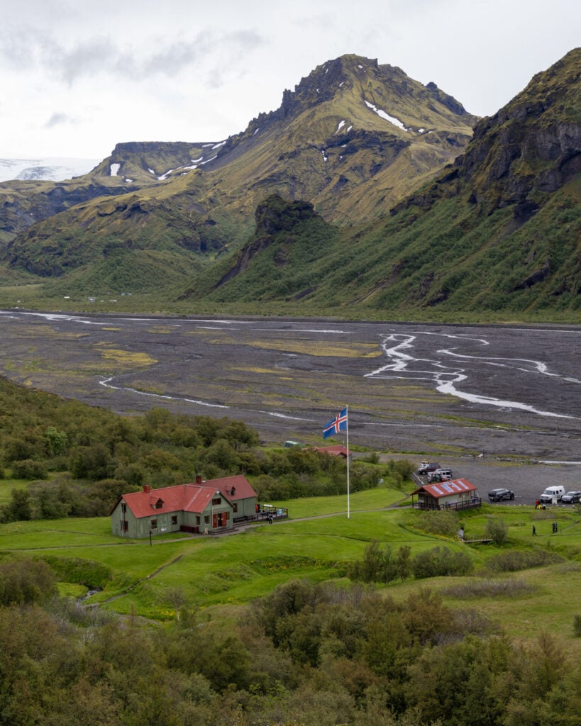
Þórsmörk Langidalur hut & camping

Night 4: Þórsmörk

Arriving into Þórsmörk at the end of the Laugavegur trail, there are several accommodation options for the night, each with slightly different trade-offs depending on comfort preferences and whether you’re continuing onto Fimmvörðuháls the following morning:

  • FÍ Þórsmörk/Langidalur Hut – the official end to the Laugavegur, this is is the easiest in terms of booking logistics, since you can package it together with all of your other camping/huts reserved directly on the FÍ website
  • Volcano Huts (Húsadalur) – the most comfortable of all huts in Þórsmörk, Volcano Huts offers hot meals, showers, glamping tents, private rooms, and a generally more developed atmosphere; however, it’s located 1.5km off the main trail before Langidalur, so staying here ADDS 2km to the Fimmvörðuháls on Day 5 (we’ve personally started from Húsadalur, added the Valahnúkur side trip, and still reached Skógar in under 9hrs, so this extension is not unrealistic for strong hikers!)
  • Básar Hut – on the south side of the Krossá, this is the most rustic of the three options, but still provides comfortable camping; in exchange for walking an extra 30min at the end of Day 4, Básar SAVES 2km off the Fimmvörðuháls on Day 5
Efstifoss on the descent towards Skógafoss

Day 5: Þórsmörk to Skógar (Fimmvörðuháls)

  • Trail time: 7hrs
  • Distance: 25km
  • Elevation gain/loss: 975m gain / 1175m loss
  • River crossings: Krossá (several bridged crossings)

The Fimmvörðuháls extension adds yet another world of landscapes to the already diverse Laugavegur Trail. Climbing steeply out of the lush forests of Þórsmörk and into a harsh volcanic alpine landscape, the route passes directly between the Eyjafjallajökull and Mýrdalsjökull glaciers (this high point is known as Fimmvörðuháls, or “Five Cairn Pass”) before descending dramatically alongside dozens of waterfalls all the way to Skógafoss on Iceland’s south coast.

Compared to any single day on the classic Laugavegur trail, Fimmvörðuháls is considerably longer and more challenging, but we found it vastly easier than online resources suggest. Under good conditions, the trail is straightforward and very well marked, with some of the most impressive scenery of the entire 5-day hike!
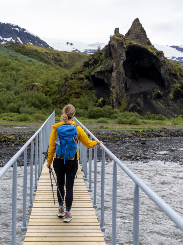
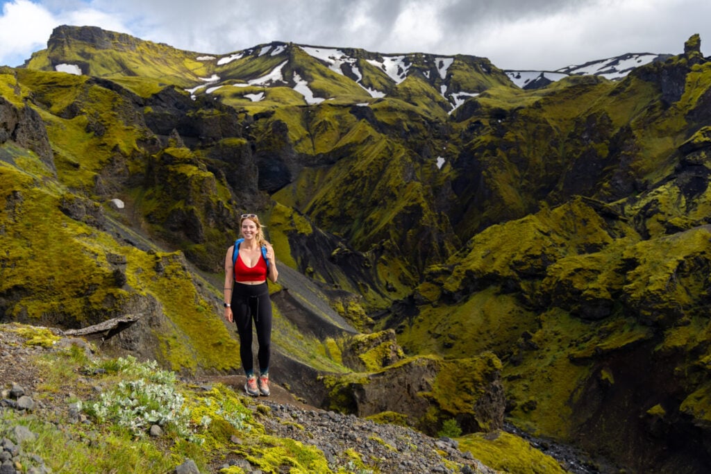
Footbridge over the Króssa River on Fimmvörðuháls
Ascending gradually through Strákagil canyon

Departing the FÍ hut in Þórsmörk Langidalur, the route crosses the infamous Krossá River on a series of small wooden planks and a large footbridge, eventually heading left along the far side of the river to reach Básar hut in about 30min.

From Básar, the trail ascends initially through the vibrant volcanic landscapes of Strákagil canyon and up the narrow Kattarhryggir (“Cat’s Spine”), gaining elevation gradually. As you cross onto the rocky Morinsheiði plateau around 550m above Þórsmörk, views open dramatically onto the Mýrdalsjökull glacier.
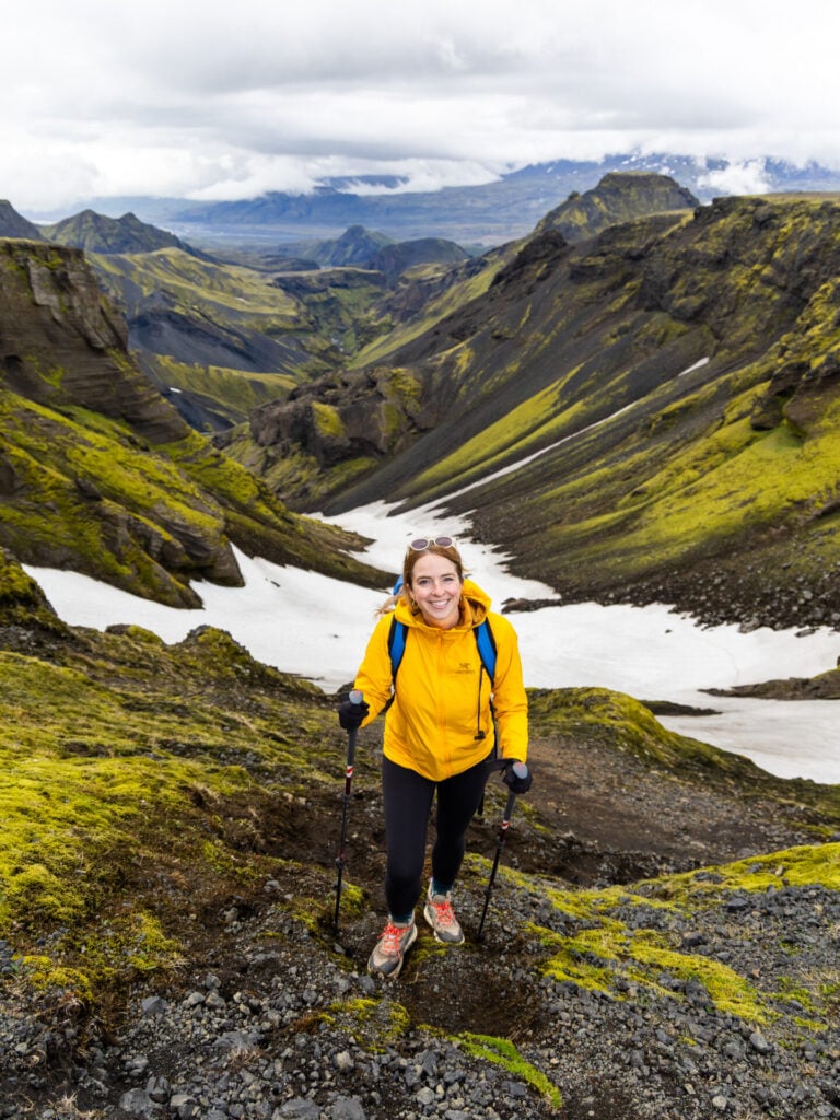
Morinsheiði plateau
Spectacular views from the Morinsheiði plateau
Climbing above Hvannágil canyon
The chain section at Heljarkambur ridge

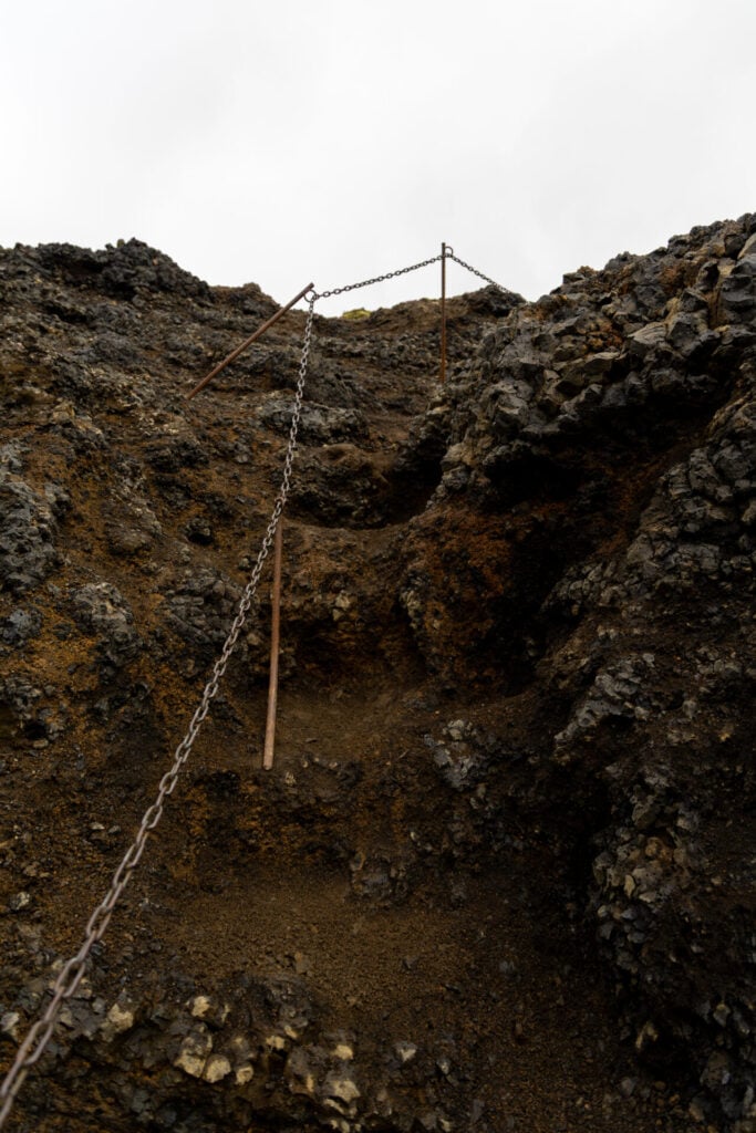
At the far end of the Morinsheiði plateau, the route ascends again along Heljarkambur, a narrow ridge above the yawning expanse of Hvannágil canyon— this is a steep, rocky trail with some exposure secured with a chain (but it’s unlikely you’ll need to use the chain if you have trekking poles). 

The final 200m push brings you up the steep, snowy slopes of Brattafönn, through the Goðahraun lava field (formed during the 2010 eruption), and finally to Fimmvörðuháls, the expansive mountain pass between Eyjafjallajökull and Mýrdalsjökull glaciers that gives the trail its name.
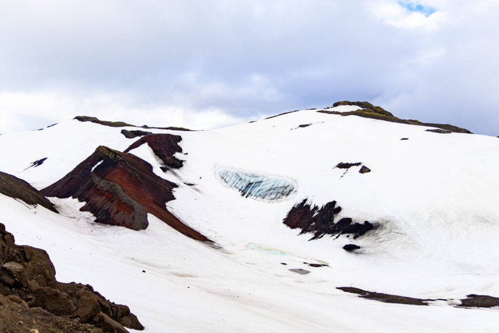
Snow on Fimmvörðuháls
Considerable snow-cover on Fimmvörðuháls

Near the highest point of the route, the trail passes the Magni and Móði craters, formed during the 2010 eruption of Eyjafjallajökull. The volcanic terrain here feels stark and freshly sculpted, with black ash slopes, lava formations, and broad glacier views extending in every direction. You can run up the craters for expansive views, but this is only worthwhile in clear weather!

Fimmvörðuskáli remains snow-covered throughout most of the year, and conditions at the pass can be notoriously challenging, so keep a close watch on trail markers for the safest and most expedient route forward. It took us a total of 3.5hrs to ascend from Básar to Baldvinsskáli hut at a comfortable pace.
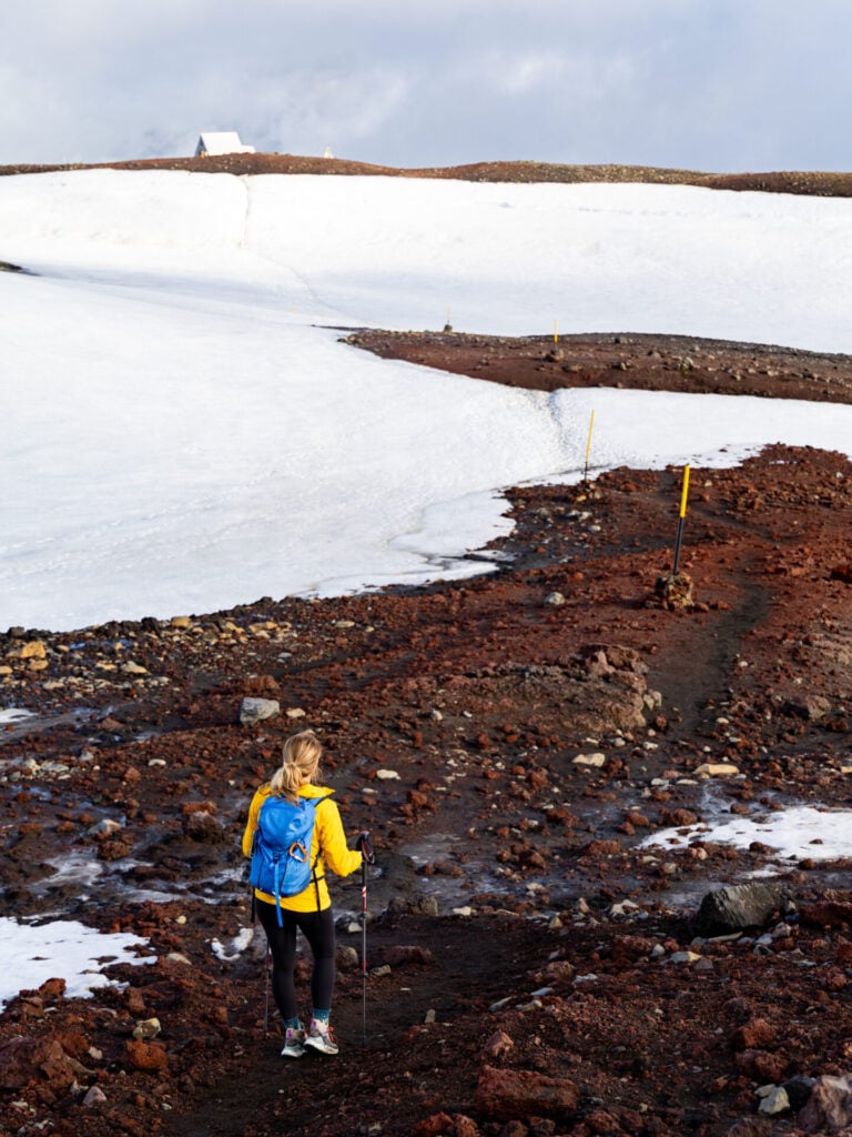
Baldvinsskáli hut
Approaching the Baldvinsskáli hut through snow

After enjoying a break near Baldvinsskáli hut, connect to a wide, rocky road that descends 4.5km to reach a wooden bridge across the Skógá River.

From here, the trail overlaps with the popular Waterfall Way route for the remaining 8km into Skógar, passing no fewer than 20 spectacular waterfalls! The large falls closest to the bridge (Efstifoss) and the drop waterfall a few minutes below (Miðfoss & Neðstifoss) are some of the most impressive.
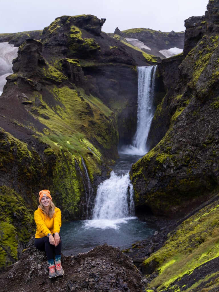
Miðfoss & Neðstifoss
The double waterfall of Miðfoss & Neðstifoss
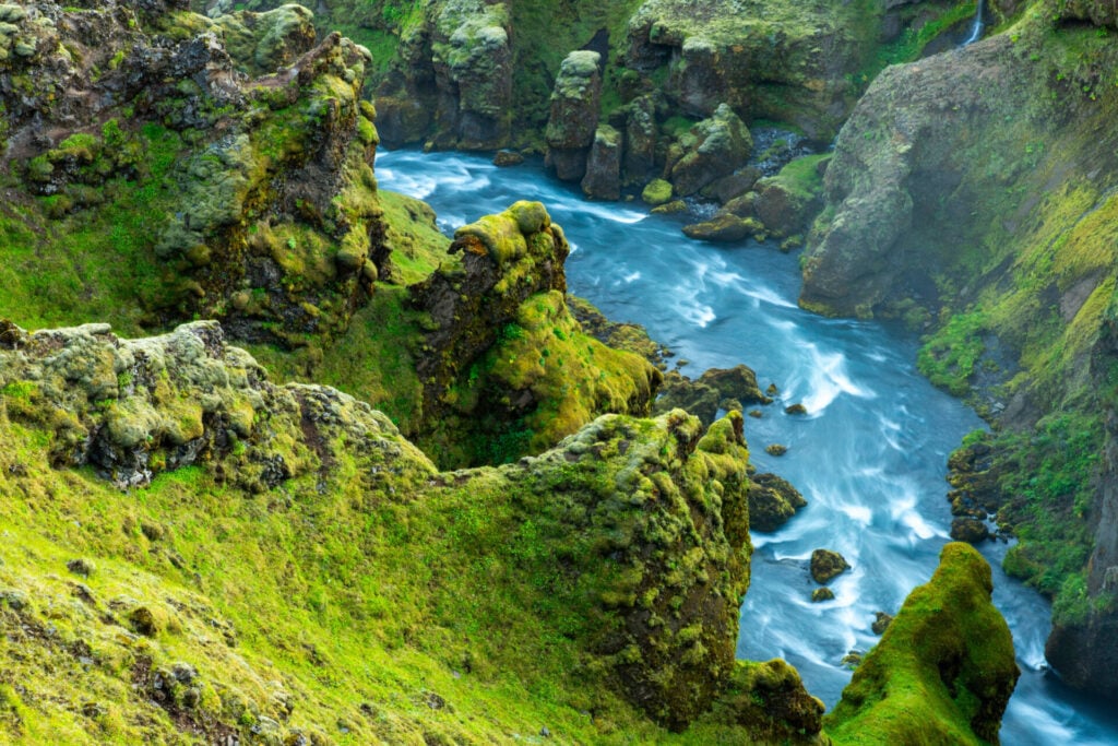
Moss-covered Skógá gorge on Waterfall Way
Moss-covered Skógá gorge

Beyond this, there’s a period of about 45min that’s rather unremarkable, but then you’ll join a long parade of waterfalls all the way to the top of Skógafoss and down the stairs immediately left. Allow about 3hrs for the descent from Baldvinsskáli hut to the carpark at Skógafoss.
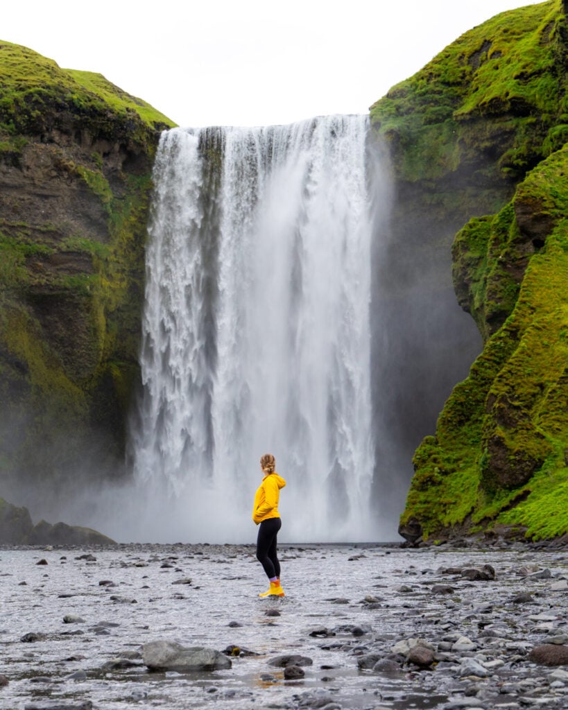
Skógafoss
The grand finale, Skógafoss!

What to expect on the trail

Terrain & trail conditions

While the surrounding landscapes change dramatically from lava fields and steaming geothermal valleys to black volcanic deserts and high glaciated passes, the Laugavegur Trail + Fimmvörðuháls extension are generally very straightforward and well-established. A majority of the route follows clear paths through the dirt or volcanic ash, and there are no technical sections anywhere on the standard trail. 
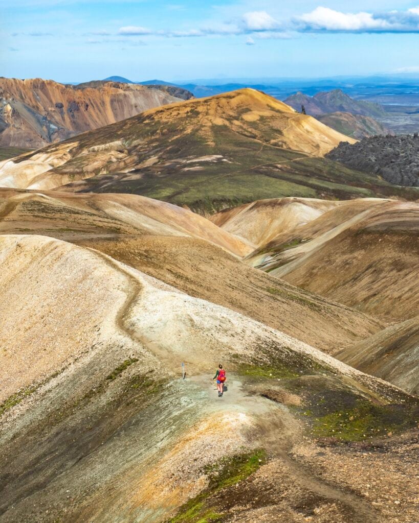
Hiking the Laugavegur Trail
Trail conditions are generally great on the Laugavegur

Depending on the season, you may encounter lingering snowfields, particularly around Hrafntinnusker and Fimmvörðuháls, but these aren’t steep enough to require traction devices in normal summer conditions. There are also occasional rocky or muddy sections, but overall, I’d consider the terrain fairly undemanding for hikers with previous backpacking experience.

Hiking the Laugavegur Trail
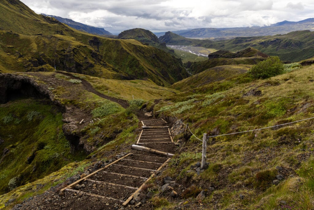
Trail out of Þórsmörk
Well-defined trail ascending out of Þórsmörk
Hiking the Laugavegur Trail
Scree on the side summit Símonarsker

Conversely, my recommended side summits are unmarked off-trail routes over unstable volcanic terrain that require confident navigation and careful footwork. In particular, the ascent of Stórasúla is extremely steep and should only be attempted by experienced hikers comfortable travelling through challenging, loose scree with absolutely no defined trail!
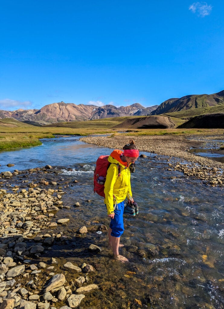
River crossing on the Laugavegur Trail
Tiny river crossing on the Laugavegur

River crossings on the Laugavegur trail

One of the more challenging elements of the classic Laugavegur route is the series of unbridged river crossings you’ll encounter. There are four major river crossings in total, and depending on recent rainfall and glacial melt, water levels can be up to hip-level.

I’ve specifically called out all major crossings throughout this guide (and marked them with exact coordinates in my custom GPS map), but for reference, the deepest crossing on the standard route is usually Bláfjallakvísl on Day 3 and all major river crossings on Fimmvörðuháls are bridged. 

Tips for a safe river crossing:

  • Visually scout the river and identify the safest, shallowest line across
  • Remove your boots and cross in water shoes or sandals (Tevas work well)
  • Unclip your backpack hip belt so you can quickly detach from your pack if needed
  • Use trekking poles for extra stability on rocky riverbeds
  • On deeper crossings, link arms with other hikers and cross together as a group for additional support and balance
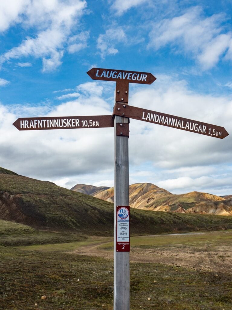
Trail sign on the Laugavegur Trail
Trail signs on the Laugavegur Trail

Navigation on the Laugavegur trail

Start to finish, the Laugavegur is beautifully marked with a combination of stakes and official trail signs, and otherwise obvious and well-worn from steady foot traffic.

In good weather, it would be quite difficult to get lost on the standard route, BUT when low fog or heavy rain settles into the area between Hrafntinnusker and Álftavatn or up at Fimmvörðuháls pass, the landscape can transform quickly into a featureless white-out. 
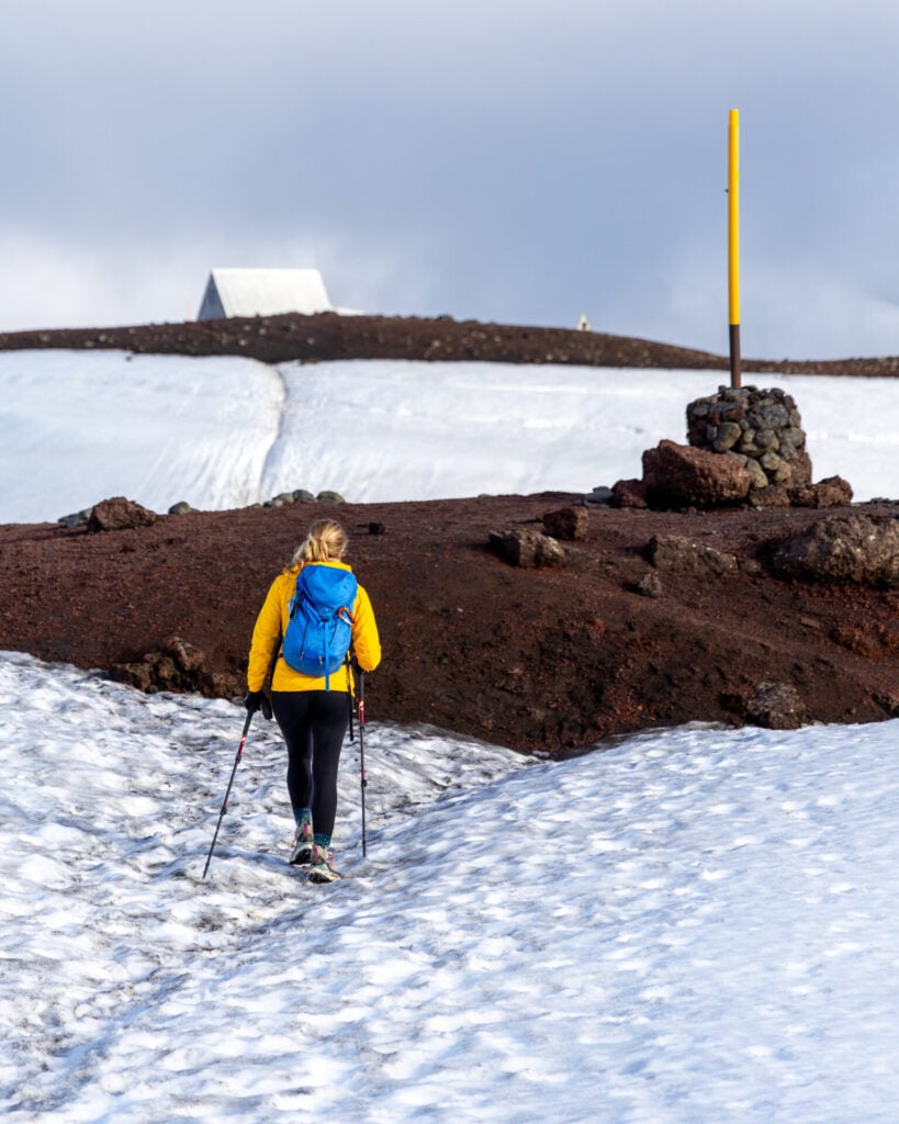
snow on Fimmvörðuháls
Following yellow trail markers across the snow on Fimmvörðuháls

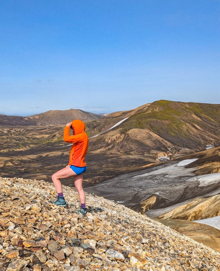
I was fortunate to enjoy almost perfect conditions on every day of my own hike, but after comparing stories with other hikers, it’s clear that this is absolutely not the norm— so don’t be lulled into a false sense of security by the fact I’m wearing shorts in some of these photos! When setting out on the Laugavegur, you need to be prepared for strong wind, freezing rain, dense fog, sleet, and rapidly changing mountain weather even in the middle of summer.

For this reason (and especially with the side trips I’ve included throughout this itinerary), I’d strongly recommend carrying a GPS with offline mapping capability. I built and rigorously tested a custom GPS map for the exact Laugavegur + Fimmvörðuháls itinerary described in this guide, including all side summits, river crossings, campsites, and important junctions— this is an excellent resource to ensure you always know exactly where you are! 
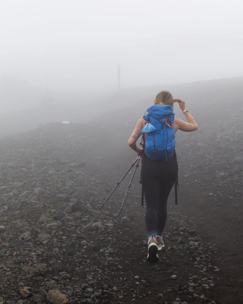
White-out conditions on the Fimmvörðuháls

Safety in the Icelandic Highlands

There’s little danger posed by the specific terrain or everyday navigational demands of the Laugavegur, so the real safety concern along this route is the weather.

The Icelandic Highlands famously suffer from unpredictable weather and, particularly at higher elevation or on exposed sections of the route, the Laugavegur and Fimmvörðuháls are very susceptible to fog, rain, snow, and low-hanging storm systems that can blow through the region with little warning, even in the middle of summer. 

Under poor conditions, the route becomes exponentially more difficult, and the risks of hypothermia, disorientation, and exhaustion increase dramatically. The single best way to mitigate these safety concerns is by packing appropriate waterproof hiking layers and gear capable of handling genuinely harsh weather. I’d also strongly recommend carrying an emergency satellite communicator for additional peace of mind, especially if you plan to explore some of my recommended side summits and/or hike alone.

>>> Read my detailed packing list for essential hiking layers and safety gear required on the Laugavegur Trail
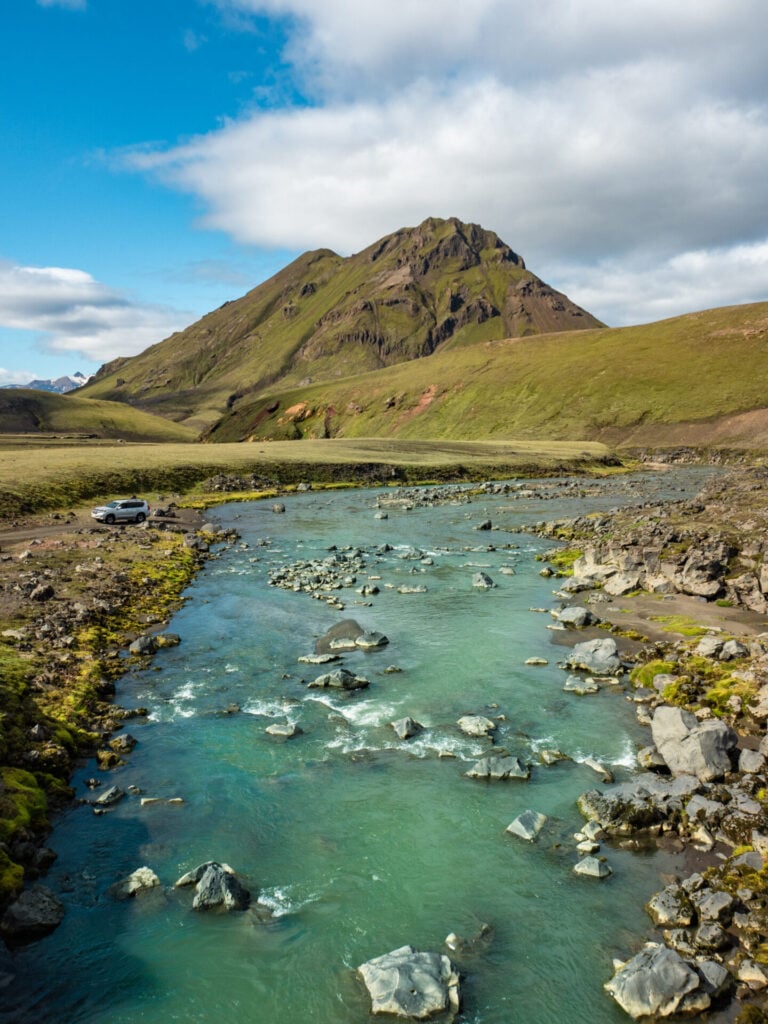
River crossing on the Laugavegur Trail
Kaldaklofskvísl River

Water access

Thankfully, water is abundant along the Laugavegur! Clean drinking water is available at every hut/campsite along the route, so you can comfortably refill bottles each morning before hiking. 

Throughout the day, there are countless rivers and streams where you can top up water as needed— it’s often safe to drink, but consider packing a lightweight hiking filter just to be cautious.
Packing for the Laugavegur + Fimmvörðuháls
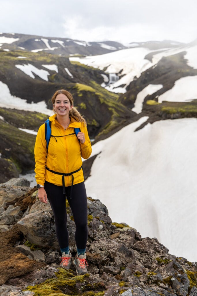
Layers are absolutely essential on the Laugavegur + Fimmvörðuháls

Packing list for the Laugavegur Trail

The weather in the Icelandic Highlands is notoriously unpredictable, so packing appropriately is a matter of safety on the Laugavegur! For all the clothing, safety gear, and camping essentials I’d specifically recommend for this trail, check out my detailed packing list:

>>> Complete Laugavegur packing list: what to pack for Iceland’s best multi-day trek

Strákagil canyon
Hiking the Laugavegur Trail
Efstifoss waterfall

Read all of my Iceland itineraries & travel guides

  • Best hikes in Iceland
  • 10-day Iceland 4WD campervan itinerary: best of the Highlands & F-roads
  • Ultimate Iceland Ring Road itinerary
  • East Fjords travel guide: best hikes, waterfalls & hot springs around Egilsstaðir
  • 1-week Northern Iceland road trip itinerary from Akureyri
  • Westfjords road trip itinerary
  • Laugavegur + Fimmvörðuháls hiking guide
  • Laugavegur packing list
TAGS:hiking guides
0 Comments
Share
brooke beyond

Hey, I'm Brooke and I'm obsessed with exploring unique destinations, remote landscapes, and high-elevation summits around the world! I left Australia 6 years ago after finishing a PhD in Biomechanics & have been travelling the world full-time ever since, now joined by my husband/climbing partner, James. Whether it’s road-tripping through Mexico, climbing alpine peaks in the Andes, scuba diving in the Red Sea, or tackling epic via ferrata in the Dolomites, I hope this blog will inspire your future adventures & help you find wonder in every corner of the globe. xx bb

Leave a Comment Cancel Comment

You May Also Like

4 November 2016

Exploring underground Paris: Les Catacombs

6 July 2026

Complete Peaks of the Balkans packing list

27 April 2025

Complete Mt Triglav via ferrata packing list

hi, I’m brooke!

I’m a full-time traveller obsessed with exploring unique destinations, remote landscapes, and high-elevation summits around the world. As a former research scientist with a PhD in Biomechanics, I now put my academic background to use writing thesis-level travel itineraries & hiking guides designed to help you explore better, more deeply, and always beyond the ordinary! xx bb

about brooke beyond
currently exploring

currently exploring

finland

read our gear guides

🥾 hiking boots

🎒 hiking backpacks

🌨️ cold-weather layers

⛺️ backpacking & alpine tents

🛌 sleeping bag & pads

🍪 backcountry food

📸 travel camera gear

trail guides

summit guides

itineraries

outdoor gear

GPS maps

recent posts

  • Hiking the Laugavegur Trail

    Hiking the Laugavegur + Fimmvörðuháls: 5-day adventure itinerary & planning guide

    15 July 2026
  • Buni Jezercës (Great Valley of Lakes)

    Peaks of the Balkans: the ultimate 12-day hiking route & complete planning guide

    10 July 2026
  • Valbona Valley guesthouses

    Peaks of the Balkans guesthouses: what to expect (+ best 2026 guesthouses)

    8 July 2026
  • Hiking to the Ropojana Valley

    Complete Peaks of the Balkans packing list

    6 July 2026
  • Descending from Valbona Pass into Valbona

    Peaks of the Balkans (Day 12): Theth to Valbona

    2 July 2026

@brookebeyond_
brooke ✨travel & mountain gal

@brookebeyond_

  • And finally, some photos from the Montenegro section of our Peaks of the Balkans route! 

We totally fell in love with the hiking in this country on our road trip last year (there are SO many amazing mountains here!!!), and the most recent adventure just cemented what we already knew: Montenegro is one of Europe’s most underrated hiking destinations.

🔗 check out our road-trip itinerary: brookebeyond.com/montenegro-itinerary (ALSO IN BIO)

—
#peaksofthebalkans #montenegro #prokletije #accursedmountains #prokletijenationalpark
  • The second-youngest country in the world and still flying under the radar for most travellers, Kosovo completely surprised us! 

We spent 5 days hiking through Bjeshkët e Nemuna National Park as part of our Peaks of the Balkans loop, and the limestone peaks, alpine lakes, newly-minted via ferrata routes, and warm Balkan hospitality were a genuine highlight. I have a feeling you’ll be seeing more of little Kosovo soon!

—
#peaksofthebalkans #kosovo #hiking #gjeravica #viaferrata
  • Just a few of my favourite photos from the Albania section of our 12-day Peaks of the Balkans hike! These days contained some of the biggest alpine scenery anywhere on the trail, and we were pretty star-struck as we hiked through Valbona, Theth, Prosllopit Pass, the Great Valley of Lakes, and up to the summit of Maja Bojës! 

—
#peaksofthebalkans #albania #theth #valbona #hiking
  • We just wrapped up an incredible 12-day Peaks of the Balkans circuit that brought us through 220km of the Accursed Mountains in Albania, Montenegro, and Kosovo, plus 7 additional summits off the standard route. And it was AMAZING!! 🍾🥂

This is the first multi-day hike I’ve done since my knee surgery last year, and there’s still a loongggggg road ahead to get back to where I was athletically… but this feels like a significant milestone on that journey.

And aside from the physical one, this year has taken me on a rather unexpected emotional journey, too. The peril of tying too much of your self-worth to any one activity is the inevitable sense of loss that results from *suddenly not being able to do that activity*. And I spent a lot of this past year asking myself “without the mountains and without the next harder summit, who even are you?”

Forced to experience life at a slower pace, to do things I would have previously dismissed as “too easy” and to find personal satisfaction in them anyway, a lot of unintended growth happened. I found a way to still be me on the easy route, or even on no route at all. Particularly as I navigate the realities of chronic injury and illness where the next surgery may be lurking just around the corner, this has brought me some peace. 

But DANG, it feels really good to be here RIGHT NOW, doing what I love in this fragile but mobile body 🏔️🖤

—
#peaksofthebalkans #albania #montenegro #kosovo #balkans
  • a collection of some of my favourite photos after 5 trips to Egypt— this has really become one of my favourite destinations, and no doubt we will be back!

— 
#egypt #pyramids #travelegypt #valleyofthekings #karnaktemple
  • The magic of being completely alone in Petra ✨ 

… alongside the sadness of knowing what this emptiness means for the locals who depend on a steady flow of tourism in order to feed their families. 

Preparing to run our most recent group trip, there was a lot of apprehension from our guests about travelling to Jordan with the ongoing war in Iran. Not dissimilar to the trips we ran last year or the year before, both in the midst of the Gaza war next-door. 

Foreign media loves to paint the Middle East as one homogeneous (and incredibly dangerous) region, but the reality is that Jordan has remained stable & safe through decades of neighbouring conflict. And this has been no exception!

I’m unbelievably grateful that every single one of our participants trusted us with this trip, that they fell in love with Jordan just like we knew they would— and most of all, that they’ll be able to take home stories of warmth, welcome, and wonder that might start to shift the narrative. 

The truth is that Jordan feels as safe as ever, and there’s possibly no better time to visit than right now: when you’ll enjoy it all to yourself AND when it truly means so much 🖤🇯🇴

—
#jordan #petra #jordantravel #traveljordan @experiencejordanadventures
  • Long before the Nile was crowded with large-scale cruise ships, it beckoned aristocrats, archaeologists, artists & adventurers who explored Egypt aboard elegant wooden sailing boats known as dahabiya. 

Popular throughout the 19th century, these graceful boats eventually fell out of fashion as motorised cruise ships became the new standard, but about 20 years ago, @nourelnil set out to revive the golden age of Nile travel with a small fleet of traditional wooden dahabiya.

We’ve been on 3 Nile cruises in the last 3 years and loved every experience, but actually *sailing* the Nile was indescribably special. 

While most Nile Cruises spend surprisingly little time actually cruising (and a lot of time docked in Luxor or Aswan, effectively operating like a floating hotel), we spent six leisurely days sailing from Esna to Aswan beneath striped canvas sails— the longest sailing time of any boat operating on the river.

Surrendering to the rhythm of the Nile, an entirely new side of Egypt unfurls before you: empty temples, lush islands, village markets, and remote stretches of the river that feel almost undiscovered. 

Nour El Nil is a celebration of the destinations that emerge when you slow to appreciate the journey ✨

—
#nilecruise #egypt #dahabiya #nileriver #egypttravel
  • Just wrapped up my 5th group trip and our FIRST EVER luxury “classics” tour through Jordan & Egypt— and we’re just feeling so incredibly grateful that this gets to be our job 🥹🥰

We travelled through Jordan & Egypt a total of SEVEN times in the last few years to build this latest itinerary, personally trying every restaurant, hotel, attraction, and countless alternatives in order to craft my perfect version of this journey.

There’s so much work that goes on behind the scenes, but building & running custom trips around the world is truly a labour of love for me— and I feel so strongly that our VALUE is in creating something unique, always underpinned by personal experience, never copied or corporate or mass-produced.

In the excited lead-up to the trip, I told James that this must be how a painter or a musician feels, pouring all of their time and passion into creating something meant to evoke a powerful emotion, where the reward is in watching people connect with that creation. The true joy of this job is in taking people on a curated journey through these places that I love so much— and then watching them fall in love themselves. 

I obsess over the order, the pacing, the inclusions and the cuts, because this journey is my love-letter to Jordan or Egypt or (later this year) Ethiopia. 

And then to hear guests call it ✨the trip of a lifetime✨

it’s everything.

I’m unbelievably grateful for everyone who trusted us with this trip & that our entire group was able to experience the magic of these 2 incredible countries for themselves, even amidst a lot of regional uncertainty. Thank you for embarking on my love letter ❤️
  • I always thought I was a summer gal… but we spent 3 months in Scandinavia this winter and it was, without question, one of the BEST trips I’ve done in nearly 6 years of full-time travel.

Turns out, winter is MAGICAL!!! 

We hiked popular summits without a single other person, saw Northern Lights on more than 30 different nights, made friends with local reindeer (then ate their friends & family for dinner, very sorry), witnessed midday sunsets and complete polar night, and spent literally hundreds of hours in the sauna. 

It’s hard to even describe how amazing this trip was, but we’re already booked to go back to Norway & Sweden for 3 months next winter to do it all over again 😅

—
#norway #lofoten #sweden #winterinnorway
follow @brookebeyond_

travel beyond the ordinary

Explore my travel guides, custom itineraries & blog posts with an interactive world map ✨

all destinations

  • And finally, some photos from the Montenegro section of our Peaks of the Balkans route! 

We totally fell in love with the hiking in this country on our road trip last year (there are SO many amazing mountains here!!!), and the most recent adventure just cemented what we already knew: Montenegro is one of Europe’s most underrated hiking destinations.

🔗 check out our road-trip itinerary: brookebeyond.com/montenegro-itinerary (ALSO IN BIO)

—
#peaksofthebalkans #montenegro #prokletije #accursedmountains #prokletijenationalpark
  • The second-youngest country in the world and still flying under the radar for most travellers, Kosovo completely surprised us! 

We spent 5 days hiking through Bjeshkët e Nemuna National Park as part of our Peaks of the Balkans loop, and the limestone peaks, alpine lakes, newly-minted via ferrata routes, and warm Balkan hospitality were a genuine highlight. I have a feeling you’ll be seeing more of little Kosovo soon!

—
#peaksofthebalkans #kosovo #hiking #gjeravica #viaferrata
  • Just a few of my favourite photos from the Albania section of our 12-day Peaks of the Balkans hike! These days contained some of the biggest alpine scenery anywhere on the trail, and we were pretty star-struck as we hiked through Valbona, Theth, Prosllopit Pass, the Great Valley of Lakes, and up to the summit of Maja Bojës! 

—
#peaksofthebalkans #albania #theth #valbona #hiking
  • We just wrapped up an incredible 12-day Peaks of the Balkans circuit that brought us through 220km of the Accursed Mountains in Albania, Montenegro, and Kosovo, plus 7 additional summits off the standard route. And it was AMAZING!! 🍾🥂

This is the first multi-day hike I’ve done since my knee surgery last year, and there’s still a loongggggg road ahead to get back to where I was athletically… but this feels like a significant milestone on that journey.

And aside from the physical one, this year has taken me on a rather unexpected emotional journey, too. The peril of tying too much of your self-worth to any one activity is the inevitable sense of loss that results from *suddenly not being able to do that activity*. And I spent a lot of this past year asking myself “without the mountains and without the next harder summit, who even are you?”

Forced to experience life at a slower pace, to do things I would have previously dismissed as “too easy” and to find personal satisfaction in them anyway, a lot of unintended growth happened. I found a way to still be me on the easy route, or even on no route at all. Particularly as I navigate the realities of chronic injury and illness where the next surgery may be lurking just around the corner, this has brought me some peace. 

But DANG, it feels really good to be here RIGHT NOW, doing what I love in this fragile but mobile body 🏔️🖤

—
#peaksofthebalkans #albania #montenegro #kosovo #balkans
  • a collection of some of my favourite photos after 5 trips to Egypt— this has really become one of my favourite destinations, and no doubt we will be back!

— 
#egypt #pyramids #travelegypt #valleyofthekings #karnaktemple
  • The magic of being completely alone in Petra ✨ 

… alongside the sadness of knowing what this emptiness means for the locals who depend on a steady flow of tourism in order to feed their families. 

Preparing to run our most recent group trip, there was a lot of apprehension from our guests about travelling to Jordan with the ongoing war in Iran. Not dissimilar to the trips we ran last year or the year before, both in the midst of the Gaza war next-door. 

Foreign media loves to paint the Middle East as one homogeneous (and incredibly dangerous) region, but the reality is that Jordan has remained stable & safe through decades of neighbouring conflict. And this has been no exception!

I’m unbelievably grateful that every single one of our participants trusted us with this trip, that they fell in love with Jordan just like we knew they would— and most of all, that they’ll be able to take home stories of warmth, welcome, and wonder that might start to shift the narrative. 

The truth is that Jordan feels as safe as ever, and there’s possibly no better time to visit than right now: when you’ll enjoy it all to yourself AND when it truly means so much 🖤🇯🇴

—
#jordan #petra #jordantravel #traveljordan @experiencejordanadventures
And finally, some photos from the Montenegro section of our Peaks of the Balkans route! 

We totally fell in love with the hiking in this country on our road trip last year (there are SO many amazing mountains here!!!), and the most recent adventure just cemented what we already knew: Montenegro is one of Europe’s most underrated hiking destinations.

🔗 check out our road-trip itinerary: brookebeyond.com/montenegro-itinerary (ALSO IN BIO)

—
#peaksofthebalkans #montenegro #prokletije #accursedmountains #prokletijenationalpark
And finally, some photos from the Montenegro section of our Peaks of the Balkans route! 

We totally fell in love with the hiking in this country on our road trip last year (there are SO many amazing mountains here!!!), and the most recent adventure just cemented what we already knew: Montenegro is one of Europe’s most underrated hiking destinations.

🔗 check out our road-trip itinerary: brookebeyond.com/montenegro-itinerary (ALSO IN BIO)

—
#peaksofthebalkans #montenegro #prokletije #accursedmountains #prokletijenationalpark
And finally, some photos from the Montenegro section of our Peaks of the Balkans route! 

We totally fell in love with the hiking in this country on our road trip last year (there are SO many amazing mountains here!!!), and the most recent adventure just cemented what we already knew: Montenegro is one of Europe’s most underrated hiking destinations.

🔗 check out our road-trip itinerary: brookebeyond.com/montenegro-itinerary (ALSO IN BIO)

—
#peaksofthebalkans #montenegro #prokletije #accursedmountains #prokletijenationalpark
And finally, some photos from the Montenegro section of our Peaks of the Balkans route! 

We totally fell in love with the hiking in this country on our road trip last year (there are SO many amazing mountains here!!!), and the most recent adventure just cemented what we already knew: Montenegro is one of Europe’s most underrated hiking destinations.

🔗 check out our road-trip itinerary: brookebeyond.com/montenegro-itinerary (ALSO IN BIO)

—
#peaksofthebalkans #montenegro #prokletije #accursedmountains #prokletijenationalpark
And finally, some photos from the Montenegro section of our Peaks of the Balkans route! 

We totally fell in love with the hiking in this country on our road trip last year (there are SO many amazing mountains here!!!), and the most recent adventure just cemented what we already knew: Montenegro is one of Europe’s most underrated hiking destinations.

🔗 check out our road-trip itinerary: brookebeyond.com/montenegro-itinerary (ALSO IN BIO)

—
#peaksofthebalkans #montenegro #prokletije #accursedmountains #prokletijenationalpark
And finally, some photos from the Montenegro section of our Peaks of the Balkans route! 

We totally fell in love with the hiking in this country on our road trip last year (there are SO many amazing mountains here!!!), and the most recent adventure just cemented what we already knew: Montenegro is one of Europe’s most underrated hiking destinations.

🔗 check out our road-trip itinerary: brookebeyond.com/montenegro-itinerary (ALSO IN BIO)

—
#peaksofthebalkans #montenegro #prokletije #accursedmountains #prokletijenationalpark
And finally, some photos from the Montenegro section of our Peaks of the Balkans route! 

We totally fell in love with the hiking in this country on our road trip last year (there are SO many amazing mountains here!!!), and the most recent adventure just cemented what we already knew: Montenegro is one of Europe’s most underrated hiking destinations.

🔗 check out our road-trip itinerary: brookebeyond.com/montenegro-itinerary (ALSO IN BIO)

—
#peaksofthebalkans #montenegro #prokletije #accursedmountains #prokletijenationalpark
And finally, some photos from the Montenegro section of our Peaks of the Balkans route! 

We totally fell in love with the hiking in this country on our road trip last year (there are SO many amazing mountains here!!!), and the most recent adventure just cemented what we already knew: Montenegro is one of Europe’s most underrated hiking destinations.

🔗 check out our road-trip itinerary: brookebeyond.com/montenegro-itinerary (ALSO IN BIO)

—
#peaksofthebalkans #montenegro #prokletije #accursedmountains #prokletijenationalpark
And finally, some photos from the Montenegro section of our Peaks of the Balkans route! 

We totally fell in love with the hiking in this country on our road trip last year (there are SO many amazing mountains here!!!), and the most recent adventure just cemented what we already knew: Montenegro is one of Europe’s most underrated hiking destinations.

🔗 check out our road-trip itinerary: brookebeyond.com/montenegro-itinerary (ALSO IN BIO)

—
#peaksofthebalkans #montenegro #prokletije #accursedmountains #prokletijenationalpark
And finally, some photos from the Montenegro section of our Peaks of the Balkans route! 

We totally fell in love with the hiking in this country on our road trip last year (there are SO many amazing mountains here!!!), and the most recent adventure just cemented what we already knew: Montenegro is one of Europe’s most underrated hiking destinations.

🔗 check out our road-trip itinerary: brookebeyond.com/montenegro-itinerary (ALSO IN BIO)

—
#peaksofthebalkans #montenegro #prokletije #accursedmountains #prokletijenationalpark
And finally, some photos from the Montenegro section of our Peaks of the Balkans route! 

We totally fell in love with the hiking in this country on our road trip last year (there are SO many amazing mountains here!!!), and the most recent adventure just cemented what we already knew: Montenegro is one of Europe’s most underrated hiking destinations.

🔗 check out our road-trip itinerary: brookebeyond.com/montenegro-itinerary (ALSO IN BIO)

—
#peaksofthebalkans #montenegro #prokletije #accursedmountains #prokletijenationalpark
And finally, some photos from the Montenegro section of our Peaks of the Balkans route! 

We totally fell in love with the hiking in this country on our road trip last year (there are SO many amazing mountains here!!!), and the most recent adventure just cemented what we already knew: Montenegro is one of Europe’s most underrated hiking destinations.

🔗 check out our road-trip itinerary: brookebeyond.com/montenegro-itinerary (ALSO IN BIO)

—
#peaksofthebalkans #montenegro #prokletije #accursedmountains #prokletijenationalpark
And finally, some photos from the Montenegro section of our Peaks of the Balkans route! 

We totally fell in love with the hiking in this country on our road trip last year (there are SO many amazing mountains here!!!), and the most recent adventure just cemented what we already knew: Montenegro is one of Europe’s most underrated hiking destinations.

🔗 check out our road-trip itinerary: brookebeyond.com/montenegro-itinerary (ALSO IN BIO)

—
#peaksofthebalkans #montenegro #prokletije #accursedmountains #prokletijenationalpark
And finally, some photos from the Montenegro section of our Peaks of the Balkans route! 

We totally fell in love with the hiking in this country on our road trip last year (there are SO many amazing mountains here!!!), and the most recent adventure just cemented what we already knew: Montenegro is one of Europe’s most underrated hiking destinations.

🔗 check out our road-trip itinerary: brookebeyond.com/montenegro-itinerary (ALSO IN BIO)

—
#peaksofthebalkans #montenegro #prokletije #accursedmountains #prokletijenationalpark
@brookebeyond_
@brookebeyond_
•
Follow
And finally, some photos from the Montenegro section of our Peaks of the Balkans route! We totally fell in love with the hiking in this country on our road trip last year (there are SO many amazing mountains here!!!), and the most recent adventure just cemented what we already knew: Montenegro is one of Europe’s most underrated hiking destinations. 🔗 check out our road-trip itinerary: brookebeyond.com/montenegro-itinerary (ALSO IN BIO) — #peaksofthebalkans #montenegro #prokletije #accursedmountains #prokletijenationalpark
3 days ago
View on Instagram |
1/6
The second-youngest country in the world and still flying under the radar for most travellers, Kosovo completely surprised us! 

We spent 5 days hiking through Bjeshkët e Nemuna National Park as part of our Peaks of the Balkans loop, and the limestone peaks, alpine lakes, newly-minted via ferrata routes, and warm Balkan hospitality were a genuine highlight. I have a feeling you’ll be seeing more of little Kosovo soon!

—
#peaksofthebalkans #kosovo #hiking #gjeravica #viaferrata
The second-youngest country in the world and still flying under the radar for most travellers, Kosovo completely surprised us! 

We spent 5 days hiking through Bjeshkët e Nemuna National Park as part of our Peaks of the Balkans loop, and the limestone peaks, alpine lakes, newly-minted via ferrata routes, and warm Balkan hospitality were a genuine highlight. I have a feeling you’ll be seeing more of little Kosovo soon!

—
#peaksofthebalkans #kosovo #hiking #gjeravica #viaferrata
The second-youngest country in the world and still flying under the radar for most travellers, Kosovo completely surprised us! 

We spent 5 days hiking through Bjeshkët e Nemuna National Park as part of our Peaks of the Balkans loop, and the limestone peaks, alpine lakes, newly-minted via ferrata routes, and warm Balkan hospitality were a genuine highlight. I have a feeling you’ll be seeing more of little Kosovo soon!

—
#peaksofthebalkans #kosovo #hiking #gjeravica #viaferrata
The second-youngest country in the world and still flying under the radar for most travellers, Kosovo completely surprised us! 

We spent 5 days hiking through Bjeshkët e Nemuna National Park as part of our Peaks of the Balkans loop, and the limestone peaks, alpine lakes, newly-minted via ferrata routes, and warm Balkan hospitality were a genuine highlight. I have a feeling you’ll be seeing more of little Kosovo soon!

—
#peaksofthebalkans #kosovo #hiking #gjeravica #viaferrata
The second-youngest country in the world and still flying under the radar for most travellers, Kosovo completely surprised us! 

We spent 5 days hiking through Bjeshkët e Nemuna National Park as part of our Peaks of the Balkans loop, and the limestone peaks, alpine lakes, newly-minted via ferrata routes, and warm Balkan hospitality were a genuine highlight. I have a feeling you’ll be seeing more of little Kosovo soon!

—
#peaksofthebalkans #kosovo #hiking #gjeravica #viaferrata
The second-youngest country in the world and still flying under the radar for most travellers, Kosovo completely surprised us! 

We spent 5 days hiking through Bjeshkët e Nemuna National Park as part of our Peaks of the Balkans loop, and the limestone peaks, alpine lakes, newly-minted via ferrata routes, and warm Balkan hospitality were a genuine highlight. I have a feeling you’ll be seeing more of little Kosovo soon!

—
#peaksofthebalkans #kosovo #hiking #gjeravica #viaferrata
The second-youngest country in the world and still flying under the radar for most travellers, Kosovo completely surprised us! 

We spent 5 days hiking through Bjeshkët e Nemuna National Park as part of our Peaks of the Balkans loop, and the limestone peaks, alpine lakes, newly-minted via ferrata routes, and warm Balkan hospitality were a genuine highlight. I have a feeling you’ll be seeing more of little Kosovo soon!

—
#peaksofthebalkans #kosovo #hiking #gjeravica #viaferrata
The second-youngest country in the world and still flying under the radar for most travellers, Kosovo completely surprised us! 

We spent 5 days hiking through Bjeshkët e Nemuna National Park as part of our Peaks of the Balkans loop, and the limestone peaks, alpine lakes, newly-minted via ferrata routes, and warm Balkan hospitality were a genuine highlight. I have a feeling you’ll be seeing more of little Kosovo soon!

—
#peaksofthebalkans #kosovo #hiking #gjeravica #viaferrata
The second-youngest country in the world and still flying under the radar for most travellers, Kosovo completely surprised us! 

We spent 5 days hiking through Bjeshkët e Nemuna National Park as part of our Peaks of the Balkans loop, and the limestone peaks, alpine lakes, newly-minted via ferrata routes, and warm Balkan hospitality were a genuine highlight. I have a feeling you’ll be seeing more of little Kosovo soon!

—
#peaksofthebalkans #kosovo #hiking #gjeravica #viaferrata
The second-youngest country in the world and still flying under the radar for most travellers, Kosovo completely surprised us! 

We spent 5 days hiking through Bjeshkët e Nemuna National Park as part of our Peaks of the Balkans loop, and the limestone peaks, alpine lakes, newly-minted via ferrata routes, and warm Balkan hospitality were a genuine highlight. I have a feeling you’ll be seeing more of little Kosovo soon!

—
#peaksofthebalkans #kosovo #hiking #gjeravica #viaferrata
The second-youngest country in the world and still flying under the radar for most travellers, Kosovo completely surprised us! 

We spent 5 days hiking through Bjeshkët e Nemuna National Park as part of our Peaks of the Balkans loop, and the limestone peaks, alpine lakes, newly-minted via ferrata routes, and warm Balkan hospitality were a genuine highlight. I have a feeling you’ll be seeing more of little Kosovo soon!

—
#peaksofthebalkans #kosovo #hiking #gjeravica #viaferrata
The second-youngest country in the world and still flying under the radar for most travellers, Kosovo completely surprised us! 

We spent 5 days hiking through Bjeshkët e Nemuna National Park as part of our Peaks of the Balkans loop, and the limestone peaks, alpine lakes, newly-minted via ferrata routes, and warm Balkan hospitality were a genuine highlight. I have a feeling you’ll be seeing more of little Kosovo soon!

—
#peaksofthebalkans #kosovo #hiking #gjeravica #viaferrata
The second-youngest country in the world and still flying under the radar for most travellers, Kosovo completely surprised us! 

We spent 5 days hiking through Bjeshkët e Nemuna National Park as part of our Peaks of the Balkans loop, and the limestone peaks, alpine lakes, newly-minted via ferrata routes, and warm Balkan hospitality were a genuine highlight. I have a feeling you’ll be seeing more of little Kosovo soon!

—
#peaksofthebalkans #kosovo #hiking #gjeravica #viaferrata
The second-youngest country in the world and still flying under the radar for most travellers, Kosovo completely surprised us! 

We spent 5 days hiking through Bjeshkët e Nemuna National Park as part of our Peaks of the Balkans loop, and the limestone peaks, alpine lakes, newly-minted via ferrata routes, and warm Balkan hospitality were a genuine highlight. I have a feeling you’ll be seeing more of little Kosovo soon!

—
#peaksofthebalkans #kosovo #hiking #gjeravica #viaferrata
The second-youngest country in the world and still flying under the radar for most travellers, Kosovo completely surprised us! 

We spent 5 days hiking through Bjeshkët e Nemuna National Park as part of our Peaks of the Balkans loop, and the limestone peaks, alpine lakes, newly-minted via ferrata routes, and warm Balkan hospitality were a genuine highlight. I have a feeling you’ll be seeing more of little Kosovo soon!

—
#peaksofthebalkans #kosovo #hiking #gjeravica #viaferrata
@brookebeyond_
@brookebeyond_
•
Follow
The second-youngest country in the world and still flying under the radar for most travellers, Kosovo completely surprised us! We spent 5 days hiking through Bjeshkët e Nemuna National Park as part of our Peaks of the Balkans loop, and the limestone peaks, alpine lakes, newly-minted via ferrata routes, and warm Balkan hospitality were a genuine highlight. I have a feeling you’ll be seeing more of little Kosovo soon! — #peaksofthebalkans #kosovo #hiking #gjeravica #viaferrata
5 days ago
View on Instagram |
2/6
Just a few of my favourite photos from the Albania section of our 12-day Peaks of the Balkans hike! These days contained some of the biggest alpine scenery anywhere on the trail, and we were pretty star-struck as we hiked through Valbona, Theth, Prosllopit Pass, the Great Valley of Lakes, and up to the summit of Maja Bojës! 

—
#peaksofthebalkans #albania #theth #valbona #hiking
Just a few of my favourite photos from the Albania section of our 12-day Peaks of the Balkans hike! These days contained some of the biggest alpine scenery anywhere on the trail, and we were pretty star-struck as we hiked through Valbona, Theth, Prosllopit Pass, the Great Valley of Lakes, and up to the summit of Maja Bojës! 

—
#peaksofthebalkans #albania #theth #valbona #hiking
Just a few of my favourite photos from the Albania section of our 12-day Peaks of the Balkans hike! These days contained some of the biggest alpine scenery anywhere on the trail, and we were pretty star-struck as we hiked through Valbona, Theth, Prosllopit Pass, the Great Valley of Lakes, and up to the summit of Maja Bojës! 

—
#peaksofthebalkans #albania #theth #valbona #hiking
Just a few of my favourite photos from the Albania section of our 12-day Peaks of the Balkans hike! These days contained some of the biggest alpine scenery anywhere on the trail, and we were pretty star-struck as we hiked through Valbona, Theth, Prosllopit Pass, the Great Valley of Lakes, and up to the summit of Maja Bojës! 

—
#peaksofthebalkans #albania #theth #valbona #hiking
Just a few of my favourite photos from the Albania section of our 12-day Peaks of the Balkans hike! These days contained some of the biggest alpine scenery anywhere on the trail, and we were pretty star-struck as we hiked through Valbona, Theth, Prosllopit Pass, the Great Valley of Lakes, and up to the summit of Maja Bojës! 

—
#peaksofthebalkans #albania #theth #valbona #hiking
Just a few of my favourite photos from the Albania section of our 12-day Peaks of the Balkans hike! These days contained some of the biggest alpine scenery anywhere on the trail, and we were pretty star-struck as we hiked through Valbona, Theth, Prosllopit Pass, the Great Valley of Lakes, and up to the summit of Maja Bojës! 

—
#peaksofthebalkans #albania #theth #valbona #hiking
Just a few of my favourite photos from the Albania section of our 12-day Peaks of the Balkans hike! These days contained some of the biggest alpine scenery anywhere on the trail, and we were pretty star-struck as we hiked through Valbona, Theth, Prosllopit Pass, the Great Valley of Lakes, and up to the summit of Maja Bojës! 

—
#peaksofthebalkans #albania #theth #valbona #hiking
Just a few of my favourite photos from the Albania section of our 12-day Peaks of the Balkans hike! These days contained some of the biggest alpine scenery anywhere on the trail, and we were pretty star-struck as we hiked through Valbona, Theth, Prosllopit Pass, the Great Valley of Lakes, and up to the summit of Maja Bojës! 

—
#peaksofthebalkans #albania #theth #valbona #hiking
Just a few of my favourite photos from the Albania section of our 12-day Peaks of the Balkans hike! These days contained some of the biggest alpine scenery anywhere on the trail, and we were pretty star-struck as we hiked through Valbona, Theth, Prosllopit Pass, the Great Valley of Lakes, and up to the summit of Maja Bojës! 

—
#peaksofthebalkans #albania #theth #valbona #hiking
Just a few of my favourite photos from the Albania section of our 12-day Peaks of the Balkans hike! These days contained some of the biggest alpine scenery anywhere on the trail, and we were pretty star-struck as we hiked through Valbona, Theth, Prosllopit Pass, the Great Valley of Lakes, and up to the summit of Maja Bojës! 

—
#peaksofthebalkans #albania #theth #valbona #hiking
Just a few of my favourite photos from the Albania section of our 12-day Peaks of the Balkans hike! These days contained some of the biggest alpine scenery anywhere on the trail, and we were pretty star-struck as we hiked through Valbona, Theth, Prosllopit Pass, the Great Valley of Lakes, and up to the summit of Maja Bojës! 

—
#peaksofthebalkans #albania #theth #valbona #hiking
Just a few of my favourite photos from the Albania section of our 12-day Peaks of the Balkans hike! These days contained some of the biggest alpine scenery anywhere on the trail, and we were pretty star-struck as we hiked through Valbona, Theth, Prosllopit Pass, the Great Valley of Lakes, and up to the summit of Maja Bojës! 

—
#peaksofthebalkans #albania #theth #valbona #hiking
Just a few of my favourite photos from the Albania section of our 12-day Peaks of the Balkans hike! These days contained some of the biggest alpine scenery anywhere on the trail, and we were pretty star-struck as we hiked through Valbona, Theth, Prosllopit Pass, the Great Valley of Lakes, and up to the summit of Maja Bojës! 

—
#peaksofthebalkans #albania #theth #valbona #hiking
@brookebeyond_
@brookebeyond_
•
Follow
Just a few of my favourite photos from the Albania section of our 12-day Peaks of the Balkans hike! These days contained some of the biggest alpine scenery anywhere on the trail, and we were pretty star-struck as we hiked through Valbona, Theth, Prosllopit Pass, the Great Valley of Lakes, and up to the summit of Maja Bojës! — #peaksofthebalkans #albania #theth #valbona #hiking
6 days ago
View on Instagram |
3/6
We just wrapped up an incredible 12-day Peaks of the Balkans circuit that brought us through 220km of the Accursed Mountains in Albania, Montenegro, and Kosovo, plus 7 additional summits off the standard route. And it was AMAZING!! 🍾🥂

This is the first multi-day hike I’ve done since my knee surgery last year, and there’s still a loongggggg road ahead to get back to where I was athletically… but this feels like a significant milestone on that journey.

And aside from the physical one, this year has taken me on a rather unexpected emotional journey, too. The peril of tying too much of your self-worth to any one activity is the inevitable sense of loss that results from *suddenly not being able to do that activity*. And I spent a lot of this past year asking myself “without the mountains and without the next harder summit, who even are you?”

Forced to experience life at a slower pace, to do things I would have previously dismissed as “too easy” and to find personal satisfaction in them anyway, a lot of unintended growth happened. I found a way to still be me on the easy route, or even on no route at all. Particularly as I navigate the realities of chronic injury and illness where the next surgery may be lurking just around the corner, this has brought me some peace. 

But DANG, it feels really good to be here RIGHT NOW, doing what I love in this fragile but mobile body 🏔️🖤

—
#peaksofthebalkans #albania #montenegro #kosovo #balkans
We just wrapped up an incredible 12-day Peaks of the Balkans circuit that brought us through 220km of the Accursed Mountains in Albania, Montenegro, and Kosovo, plus 7 additional summits off the standard route. And it was AMAZING!! 🍾🥂

This is the first multi-day hike I’ve done since my knee surgery last year, and there’s still a loongggggg road ahead to get back to where I was athletically… but this feels like a significant milestone on that journey.

And aside from the physical one, this year has taken me on a rather unexpected emotional journey, too. The peril of tying too much of your self-worth to any one activity is the inevitable sense of loss that results from *suddenly not being able to do that activity*. And I spent a lot of this past year asking myself “without the mountains and without the next harder summit, who even are you?”

Forced to experience life at a slower pace, to do things I would have previously dismissed as “too easy” and to find personal satisfaction in them anyway, a lot of unintended growth happened. I found a way to still be me on the easy route, or even on no route at all. Particularly as I navigate the realities of chronic injury and illness where the next surgery may be lurking just around the corner, this has brought me some peace. 

But DANG, it feels really good to be here RIGHT NOW, doing what I love in this fragile but mobile body 🏔️🖤

—
#peaksofthebalkans #albania #montenegro #kosovo #balkans
@brookebeyond_
@brookebeyond_
•
Follow
We just wrapped up an incredible 12-day Peaks of the Balkans circuit that brought us through 220km of the Accursed Mountains in Albania, Montenegro, and Kosovo, plus 7 additional summits off the standard route. And it was AMAZING!! 🍾🥂 This is the first multi-day hike I’ve done since my knee surgery last year, and there’s still a loongggggg road ahead to get back to where I was athletically… but this feels like a significant milestone on that journey. And aside from the physical one, this year has taken me on a rather unexpected emotional journey, too. The peril of tying too much of your self-worth to any one activity is the inevitable sense of loss that results from *suddenly not being able to do that activity*. And I spent a lot of this past year asking myself “without the mountains and without the next harder summit, who even are you?” Forced to experience life at a slower pace, to do things I would have previously dismissed as “too easy” and to find personal satisfaction in them anyway, a lot of unintended growth happened. I found a way to still be me on the easy route, or even on no route at all. Particularly as I navigate the realities of chronic injury and illness where the next surgery may be lurking just around the corner, this has brought me some peace. But DANG, it feels really good to be here RIGHT NOW, doing what I love in this fragile but mobile body 🏔️🖤 — #peaksofthebalkans #albania #montenegro #kosovo #balkans
1 week ago
View on Instagram |
4/6
a collection of some of my favourite photos after 5 trips to Egypt— this has really become one of my favourite destinations, and no doubt we will be back!

— 
#egypt #pyramids #travelegypt #valleyofthekings #karnaktemple
a collection of some of my favourite photos after 5 trips to Egypt— this has really become one of my favourite destinations, and no doubt we will be back!

— 
#egypt #pyramids #travelegypt #valleyofthekings #karnaktemple
a collection of some of my favourite photos after 5 trips to Egypt— this has really become one of my favourite destinations, and no doubt we will be back!

— 
#egypt #pyramids #travelegypt #valleyofthekings #karnaktemple
a collection of some of my favourite photos after 5 trips to Egypt— this has really become one of my favourite destinations, and no doubt we will be back!

— 
#egypt #pyramids #travelegypt #valleyofthekings #karnaktemple
a collection of some of my favourite photos after 5 trips to Egypt— this has really become one of my favourite destinations, and no doubt we will be back!

— 
#egypt #pyramids #travelegypt #valleyofthekings #karnaktemple
a collection of some of my favourite photos after 5 trips to Egypt— this has really become one of my favourite destinations, and no doubt we will be back!

— 
#egypt #pyramids #travelegypt #valleyofthekings #karnaktemple
a collection of some of my favourite photos after 5 trips to Egypt— this has really become one of my favourite destinations, and no doubt we will be back!

— 
#egypt #pyramids #travelegypt #valleyofthekings #karnaktemple
a collection of some of my favourite photos after 5 trips to Egypt— this has really become one of my favourite destinations, and no doubt we will be back!

— 
#egypt #pyramids #travelegypt #valleyofthekings #karnaktemple
a collection of some of my favourite photos after 5 trips to Egypt— this has really become one of my favourite destinations, and no doubt we will be back!

— 
#egypt #pyramids #travelegypt #valleyofthekings #karnaktemple
a collection of some of my favourite photos after 5 trips to Egypt— this has really become one of my favourite destinations, and no doubt we will be back!

— 
#egypt #pyramids #travelegypt #valleyofthekings #karnaktemple
a collection of some of my favourite photos after 5 trips to Egypt— this has really become one of my favourite destinations, and no doubt we will be back!

— 
#egypt #pyramids #travelegypt #valleyofthekings #karnaktemple
a collection of some of my favourite photos after 5 trips to Egypt— this has really become one of my favourite destinations, and no doubt we will be back!

— 
#egypt #pyramids #travelegypt #valleyofthekings #karnaktemple
a collection of some of my favourite photos after 5 trips to Egypt— this has really become one of my favourite destinations, and no doubt we will be back!

— 
#egypt #pyramids #travelegypt #valleyofthekings #karnaktemple
a collection of some of my favourite photos after 5 trips to Egypt— this has really become one of my favourite destinations, and no doubt we will be back!

— 
#egypt #pyramids #travelegypt #valleyofthekings #karnaktemple
a collection of some of my favourite photos after 5 trips to Egypt— this has really become one of my favourite destinations, and no doubt we will be back!

— 
#egypt #pyramids #travelegypt #valleyofthekings #karnaktemple
a collection of some of my favourite photos after 5 trips to Egypt— this has really become one of my favourite destinations, and no doubt we will be back!

— 
#egypt #pyramids #travelegypt #valleyofthekings #karnaktemple
a collection of some of my favourite photos after 5 trips to Egypt— this has really become one of my favourite destinations, and no doubt we will be back!

— 
#egypt #pyramids #travelegypt #valleyofthekings #karnaktemple
a collection of some of my favourite photos after 5 trips to Egypt— this has really become one of my favourite destinations, and no doubt we will be back!

— 
#egypt #pyramids #travelegypt #valleyofthekings #karnaktemple
@brookebeyond_
@brookebeyond_
•
Follow
a collection of some of my favourite photos after 5 trips to Egypt— this has really become one of my favourite destinations, and no doubt we will be back! — #egypt #pyramids #travelegypt #valleyofthekings #karnaktemple
2 weeks ago
View on Instagram |
5/6
The magic of being completely alone in Petra ✨ 

… alongside the sadness of knowing what this emptiness means for the locals who depend on a steady flow of tourism in order to feed their families. 

Preparing to run our most recent group trip, there was a lot of apprehension from our guests about travelling to Jordan with the ongoing war in Iran. Not dissimilar to the trips we ran last year or the year before, both in the midst of the Gaza war next-door. 

Foreign media loves to paint the Middle East as one homogeneous (and incredibly dangerous) region, but the reality is that Jordan has remained stable & safe through decades of neighbouring conflict. And this has been no exception!

I’m unbelievably grateful that every single one of our participants trusted us with this trip, that they fell in love with Jordan just like we knew they would— and most of all, that they’ll be able to take home stories of warmth, welcome, and wonder that might start to shift the narrative. 

The truth is that Jordan feels as safe as ever, and there’s possibly no better time to visit than right now: when you’ll enjoy it all to yourself AND when it truly means so much 🖤🇯🇴

—
#jordan #petra #jordantravel #traveljordan @experiencejordanadventures
The magic of being completely alone in Petra ✨ 

… alongside the sadness of knowing what this emptiness means for the locals who depend on a steady flow of tourism in order to feed their families. 

Preparing to run our most recent group trip, there was a lot of apprehension from our guests about travelling to Jordan with the ongoing war in Iran. Not dissimilar to the trips we ran last year or the year before, both in the midst of the Gaza war next-door. 

Foreign media loves to paint the Middle East as one homogeneous (and incredibly dangerous) region, but the reality is that Jordan has remained stable & safe through decades of neighbouring conflict. And this has been no exception!

I’m unbelievably grateful that every single one of our participants trusted us with this trip, that they fell in love with Jordan just like we knew they would— and most of all, that they’ll be able to take home stories of warmth, welcome, and wonder that might start to shift the narrative. 

The truth is that Jordan feels as safe as ever, and there’s possibly no better time to visit than right now: when you’ll enjoy it all to yourself AND when it truly means so much 🖤🇯🇴

—
#jordan #petra #jordantravel #traveljordan @experiencejordanadventures
The magic of being completely alone in Petra ✨ 

… alongside the sadness of knowing what this emptiness means for the locals who depend on a steady flow of tourism in order to feed their families. 

Preparing to run our most recent group trip, there was a lot of apprehension from our guests about travelling to Jordan with the ongoing war in Iran. Not dissimilar to the trips we ran last year or the year before, both in the midst of the Gaza war next-door. 

Foreign media loves to paint the Middle East as one homogeneous (and incredibly dangerous) region, but the reality is that Jordan has remained stable & safe through decades of neighbouring conflict. And this has been no exception!

I’m unbelievably grateful that every single one of our participants trusted us with this trip, that they fell in love with Jordan just like we knew they would— and most of all, that they’ll be able to take home stories of warmth, welcome, and wonder that might start to shift the narrative. 

The truth is that Jordan feels as safe as ever, and there’s possibly no better time to visit than right now: when you’ll enjoy it all to yourself AND when it truly means so much 🖤🇯🇴

—
#jordan #petra #jordantravel #traveljordan @experiencejordanadventures
@brookebeyond_
@brookebeyond_
•
Follow
The magic of being completely alone in Petra ✨ … alongside the sadness of knowing what this emptiness means for the locals who depend on a steady flow of tourism in order to feed their families. Preparing to run our most recent group trip, there was a lot of apprehension from our guests about travelling to Jordan with the ongoing war in Iran. Not dissimilar to the trips we ran last year or the year before, both in the midst of the Gaza war next-door. Foreign media loves to paint the Middle East as one homogeneous (and incredibly dangerous) region, but the reality is that Jordan has remained stable & safe through decades of neighbouring conflict. And this has been no exception! I’m unbelievably grateful that every single one of our participants trusted us with this trip, that they fell in love with Jordan just like we knew they would— and most of all, that they’ll be able to take home stories of warmth, welcome, and wonder that might start to shift the narrative. The truth is that Jordan feels as safe as ever, and there’s possibly no better time to visit than right now: when you’ll enjoy it all to yourself AND when it truly means so much 🖤🇯🇴 — #jordan #petra #jordantravel #traveljordan @experiencejordanadventures
1 month ago
View on Instagram |
6/6

  • home
  • about
  • itineraries
  • hiking guides
  • outdoor gear
  • custom GPS maps
  • group trips
  • contact

COPYRIGHT © 2025 BROOKE BEYOND. TRAVEL BEYOND THE ORDINARY. Site Powered by Pix & Hue.

Loading Comments...