
Hiking the Six Foot Track in Sydney’s Blue Mountains
Last Updated on 22 April 2026
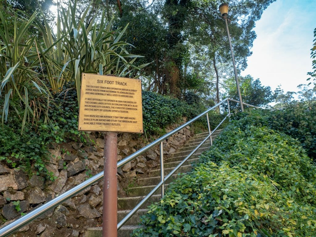
Spanning 45km of the Blue Mountains National Park from Jenolan Caves to Katoomba, the Six Foot Track was constructed in 1884 as a horse route between the two cities. Exactly 100 years later, the track was opened to hikers and is now one of Sydney’s most popular overnight hikes!
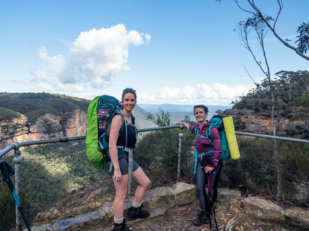
Setting out for 2-3 days, visit underground palaces of crystalline stalactites, explore lush and vibrant Megalong Valley, look up at towering sandstone cliffs, and camp out at pristine rivers, all within a 90min drive of the city. This guide contains everything you need to know about walking the Six Foot Track yourself, including how to get to the trailhead, details of the route, and information about campsites and facilities along the way— basically, everything I wish I’d known before walking the track!
About the Six Foot Track
The Six Foot Track is a classic 45km trail through the Blue Mountains of New South Wales, running from Jenolan Caves to the Explorers Tree just outside Katoomba. Typically completed over 2–3 days, the route traverses a diverse landscape of eucalyptus forest, open farmland, river crossings, and deep valleys, offering a scenic and accessible multi-day hike within a few hours of Sydney.
Originally constructed in 1884 as a horse track between Katoomba and Jenolan, the trail was built to be six feet wide— just enough for two horses to pass! Today, that generous width makes for a comfortable walking track, with long stretches of well-formed trail that are ideal for steady hiking and easy conversation, even on the climbs.


Getting to the Six Foot Track
Getting to Explorers Tree (Katoomba)
From central Sydney, it’s a 90min drive to the Six Foot Track trailhead at Explorers Tree in Katoomba. There’s a carpark here, but it can get really busy on the weekends or over the holidays, so you might have to park in town (if you’re catching a shuttle with TCP tours, Nyla will pick you up from wherever you park the car— more info below).
Turns out, it might be advantageous to park in town anyway— apparently some unsavoury types have cracked onto the fact that cars are being left unattended here for 3 days at a times, which means break-ins are becoming a concern. There’s a heap of free street parking on Bathurst Road where you can safely park for several days.
Alternatively, trains run directly from Central Station to Katoomba Station. The journey takes 2hrs and from the station, it’s about 3km to the trailhead at Explorers Tree, mostly downhill.
Transport between Jenolan Caves and Katoomba
It’s possible to begin the Six Foot Track from Explorers Tree in Katoomba or from Jenolan Caves, and although there’s little reason to choose one direction over the other in terms of track difficulty or campsite locations, I think starting at Jenolan Caves ultimately makes the most logistical sense.
Travelling this direction, you can shuttle to the start of the track in Jenolan and then finish back in Katoomba right at your car (or the train station). Without a specific shuttle time hanging over your head, your final day on the trail is far more flexible and enjoyable!
Shuttle options from Katoomba to Jenolan Caves
- TCP Day Tours: Usually, the shuttle picks up from Katoomba Station at 9.45am (catch the 7.23am train from Central) or from Explorers Tree at 10.15am (where you can park your car at the end of the trail) for $50 cash per person. If you’re the first one booking for a given date, though, the lovely woman who operates the shuttle will let you set any pick-up time and meet you right at your car (convenient if you’ve parked in town rather than at the trailhead). Call Nyla on 0424 188 779 to book. UPDATE: It seems this option may no longer be available!
- Trolley Tours: Another option is Trolley Tours, which operates a shuttle departing central Katoomba at 10.35am for $50 per person.
- Katoomba Taxis: At the time of writing, I was quoted $215 for a private taxi from Katoomba to Jenolan Caves (up to 4 people). Call 02 4782 1311 to book.

*Six Foot Track itinerary
Day 1: Jenolan Caves to Black Range Camp
- Distance: 8.5km
- Trail hours: 3hrs
- Campsite: Black Range Campground
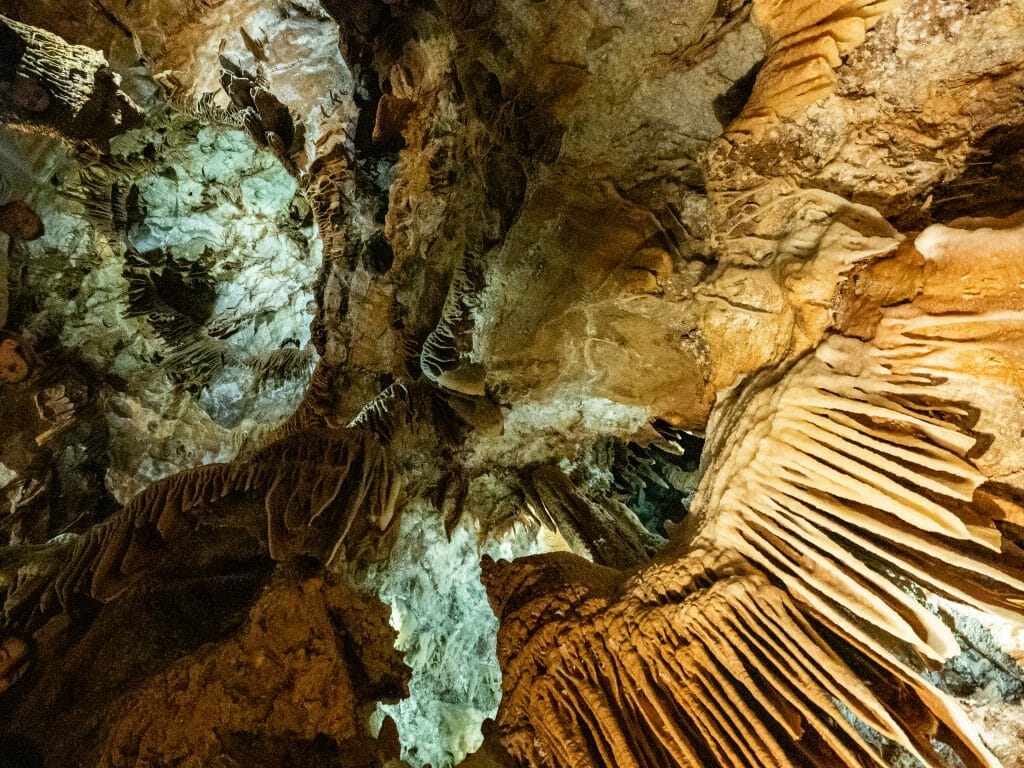
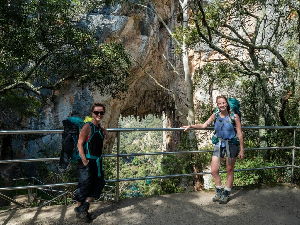
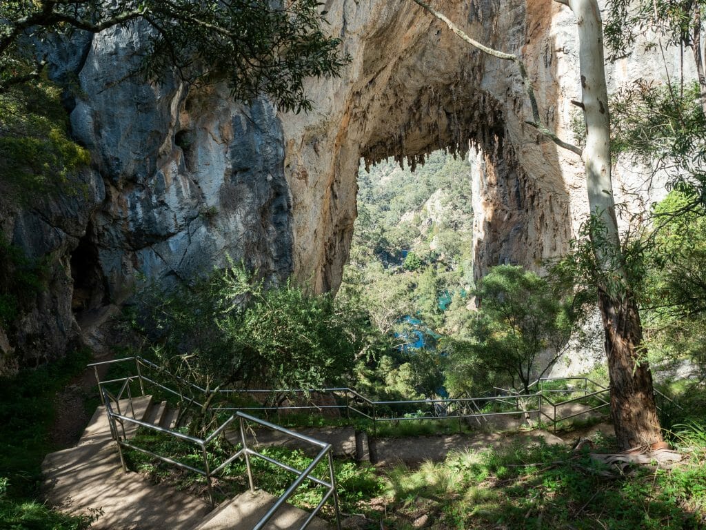
The Six Foot Track begins at Jenolan Caves, and before setting off, it’s well worth exploring one of the famous show caves! There are nearly a dozen caves open to the public, each showcasing incredible limestone formations, but Orient Cave is widely considered the standout.
Known for its sparkling crystal formations and long, curtain-like stalactites, it can easily be visited on a guided 90min tour before you start hiking.


In addition to the caves themselves, there are several impressive landmarks to admire around Jenolan this morning. Spend a few minutes at the vivid Blue Lake, home to a few native platypus, though they are notoriously difficult to spot!
The lake was formed by a nearby dam, but the vibrant blue hue is surprisingly natural, the result of light reflecting off limestone particles suspended throughout the water. Combined with the bright green palms lining its banks and the lush foliage beyond, it’s a striking and memorable start to the hike.


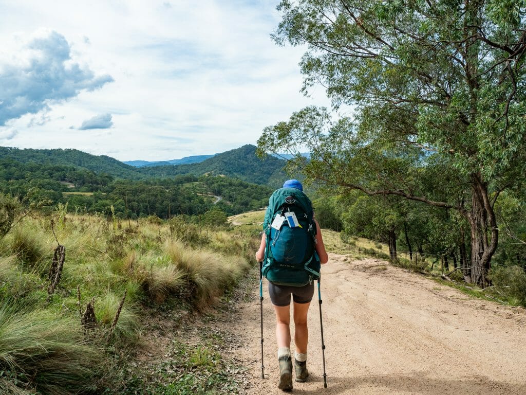
Once on the trail, the first hour is the most challenging section of the day, climbing steadily on the six-foot-wide track that gives the route its name, with an elevated view over Carlotta Arch along the way.
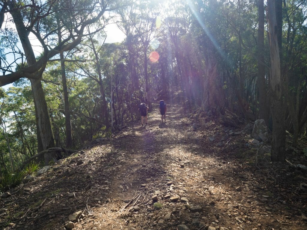
After this initial ascent, the trail settles into a more relaxed rhythm, following a broad, well-defined path through open eucalyptus forest with gentle undulations rather than sustained climbs. The remainder of the day continues through quiet, uncrowded bushland to Black Range Campground, marking the end of an easy and accessible first day on the track.
Day 2: Black Range to Cox’s Creek
- Distance: 21km
- Trail time: 4.5hrs
- Campsite: Cox River Campground
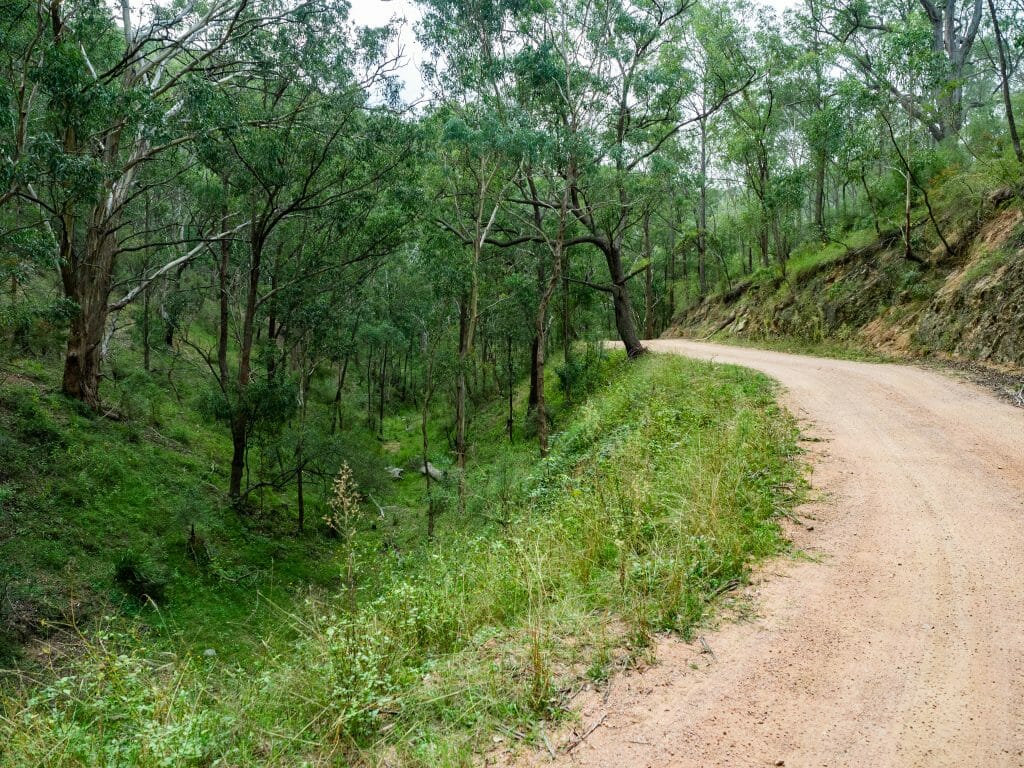
Day 2 is the longest day on the Six Foot Track, but the predominantly downhill profile makes it far less physically demanding than the distance might suggest. Leaving Black Range, the trail follows wide fire trails and vehicle tracks through eucalyptus forest, with a steady descent into the surrounding valleys.
As you approach Alum Creek (a logical lunch stop roughly 14.5km into the day), the gradient steepens considerably, and the track can feel relentless on the knees. The trade-off is a welcome change in scenery, with the trail opening up to expansive views across blue gum valleys as you descend.
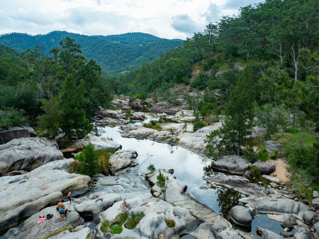
The route continues downhill on a rough vehicle track, where you may encounter occasional 4WD traffic— one of the less appealing aspects of this section. From Alum Creek, it’s around 90min to Cox River Campground, where the landscape shifts again to a wide, grassy riverside clearing.

Day 3: Cox’s Creek to Explorers Tree
- Distance: 15.5km
- Trail time: 4hrs
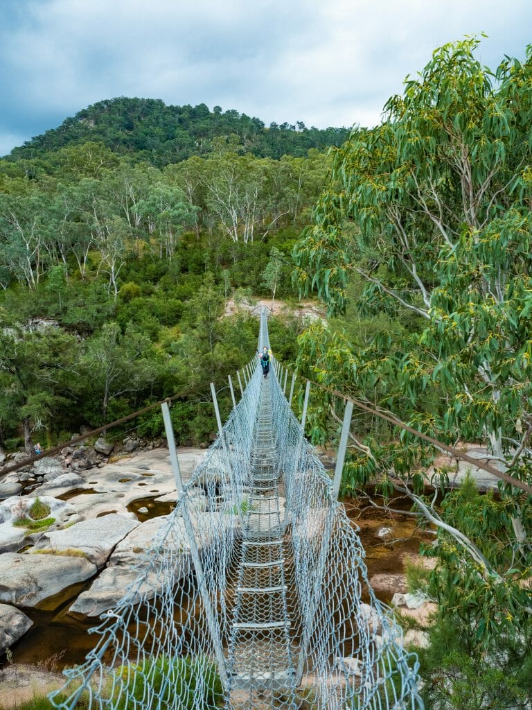
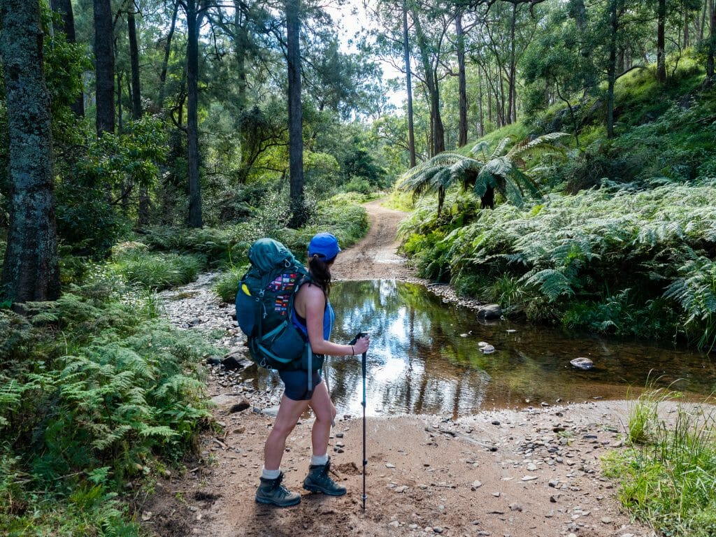
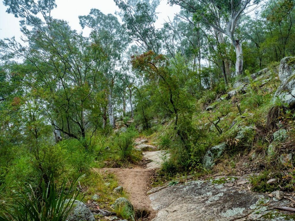
Day 3 begins with one of the highlights of the entire track: crossing the Bowtells Swing Bridge, which spans the full width of the Cox River. From the bridge, take the right-hand fork to continue along the Six Foot Track, beginning a gently undulating section on narrower trail as you follow the river out of the valley.
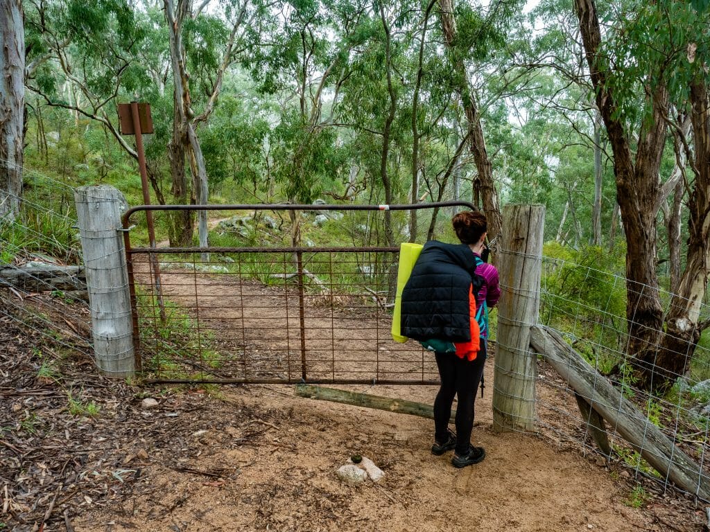
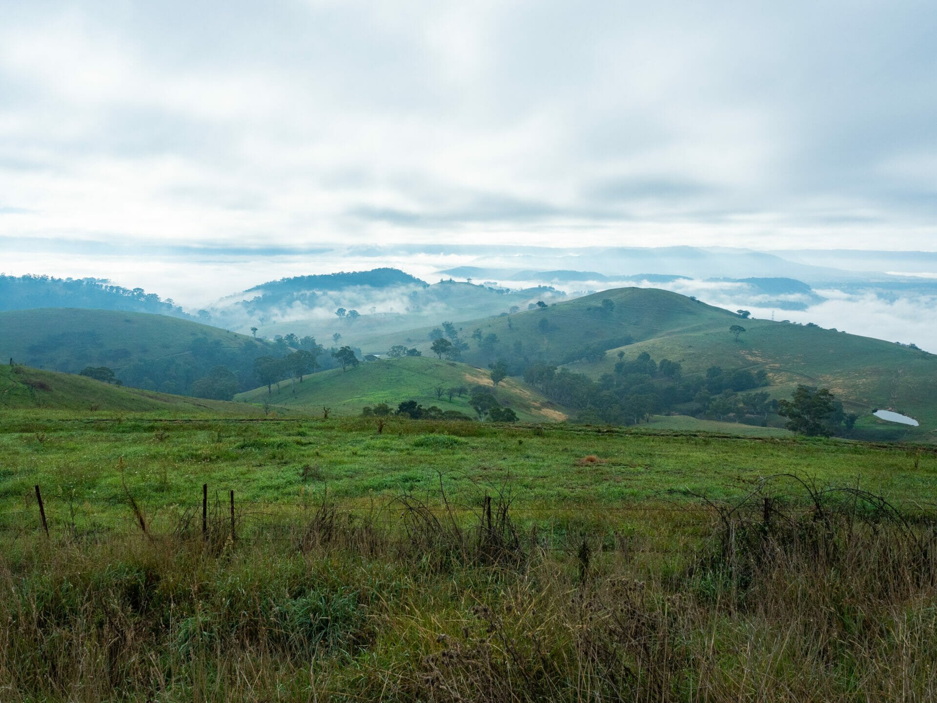
The route then transitions into the pastoral landscape of Megalong Valley, with the trail passing through private farmland and open paddocks. Expect to open and close gates or climb over fence stiles regularly as you make your way through this section, which can feel quite different from the bushland of the previous days. In the early morning, mist often lingers over the valley, creating a peaceful and atmospheric stretch of trail.
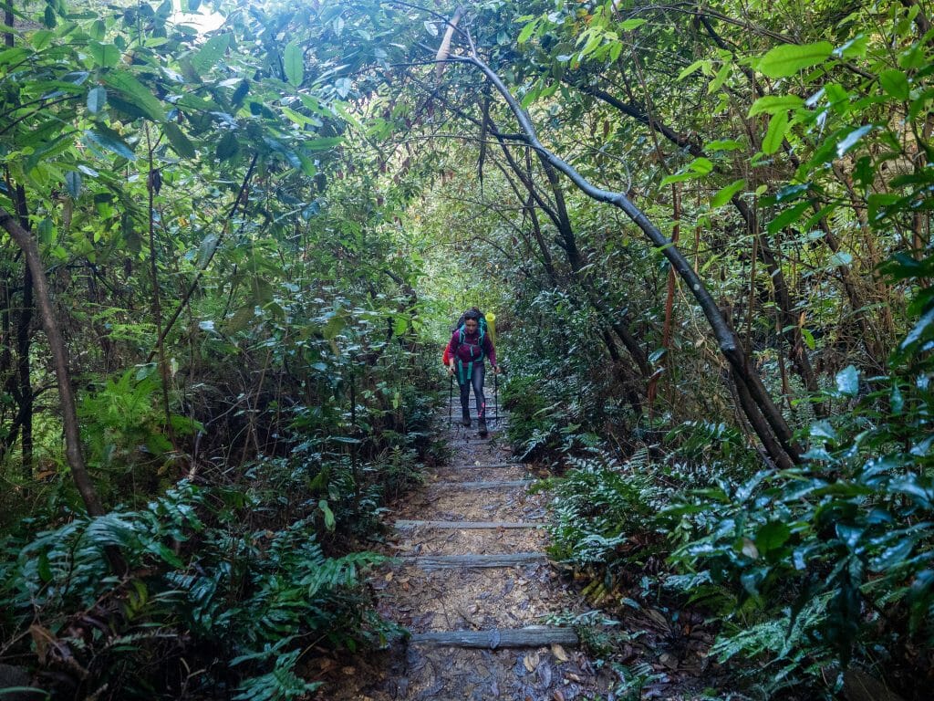
After several kilometres of mostly flat walking, the final challenge awaits: a steady climb up to Explorers Tree. The ascent follows a series of large stone steps through lush green forest, with small waterfalls and dense vegetation providing a scenic backdrop as you gain elevation.
Near the end of the track (about 1km from the finish line), a short detour leads to a cliffside lookout— a worthwhile final stop before completing the 50km Six Foot Track!

What to expect on the trail
Terrain
There’s a fair bit of up and down on the Six Foot Track as you descend into the Megalong Valley and ascend back up onto the cliffs but, for the most part, the terrain is easy to handle. Much of the trail is actually wide horse trails or even dirt roads, so it would be possible to do the entire hike in sturdy runners if you were so inclined.
Weather
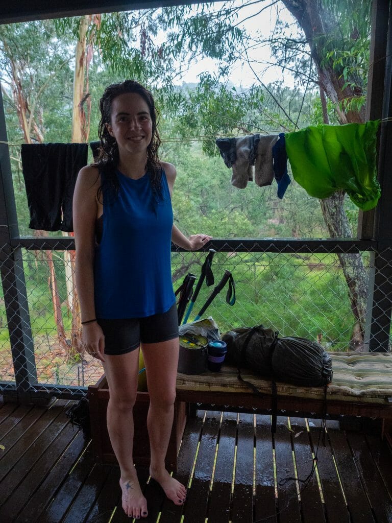
The Blue Mountains region tends to be considerably hotter than Sydney in the summer and considerably colder in the winter, so the best time to do this walk, both in terms of weather and crowds, is during spring or autumn. It’s also very possible that you’ll be caught in a torrential downpour (as we were), so I recommend watching the weather and aiming for a dry several days to at least minimise the chance of flooding on the trail.
Even when the weather is warm in the day during spring or autumn, be warned that the temperatures can dip dramatically at night. We were sweating on the trail and shivering at camp most nights. Bring plenty of layers and a warm sleeping bag!
>>> Not sure how to stay warm and comfy at camp? This sleep system guide breaks down everything from sleeping bags to pads to the perfect backcountry pillow.
Water access
All of the campsites have large rainwater tanks for you to fill up at— NSW Parks recommends filtering this water, but I didn’t have any issue drinking it straight from the tap. If it hasn’t rained in a long time, these tanks might be low or even empty, though, so it’s always smart to pack a lightweight hiking filter in case you need to fill up from one of the many rivers or creeks instead.
Camping & facilities
There are 3 campsites immediately along the track (Black Range, Alum Creek, Cox River) and 2 situated just slightly off the track (Jenolan Caves, Megalong Cemetery). I can only speak for the 3 main campgrounds, but these all have large grassy fields to set up your tent, a map of the track, drop toilets (BYO toilet paper and hand sanitiser), and rainwater tanks.
All of the sites are accessible by vehicle, which makes it easy to tackle the walk in sections if you don’t have a tent or want to carry a full pack. There is also a total fire ban, so you need to bring a camp stove to prepare your dinner.
Within 500m of Cox River campground, there is the Six Foot Track Eco Lodge where you can get a comfy dorm bed for $45 or even just pop in for a wine or beer ($5-7). We ended up staying here due to torrential rains on the second night of our walk, so I can highly recommend the lovely facilities and the amazing home cooking (we had kangaroo goulash and several glasses of shiraz).
Safety
Although this track at times feels to be a secluded walk, every single campsite along the trail has vehicle access, so you are never far from civilisation should you need help. There is pretty limited mobile reception along the track, but given the reasonable number of hikers passing through each day, I didn’t feel like we needed to carry any GPS or PLB for safety. Pack appropriate clothing for the weather, bring reliable hiking gear, and you should be totally fine.
>>> I put together a complete layering system guide with all my favourite gear picks for staying warm, dry & comfortable in every condition
Packing list for the Six Foot Track
Have a look at my core packing lists for heaps of up-to-date recommendations on my favourite hiking layers, backpacking packs, trail boots, camp cookware, and more!
>>> The ultimate overnight backpacking packing list

Read about more multi-day hikes in Australia
The Comments
oprol evorter
I think this site contains some very wonderful info for everyone : D.