Wineglass Bay: Hiking the Hazards Circuit in Freycinet National Park
Last Updated on 9 February 2021
Hundreds of people walk up to Wineglass Bay Lookout every day to see Tasmania’s most beautiful beach from above, but surprisingly few people continue onwards to actually set foot on its perfectly white sand or swim in the crystal-clear water. Explore more of Freycinet National Park with this easy walk to Wineglass Bay Beach and neighbouring Hazards Beach, both of which are every bit as stunning up close as they look from a distance.
All the details: Hazards Circuit
Getting there
Freycinet National Park is a 2.5hr drive from Hobart or a 3.5hr drive from Launceston
Starting point
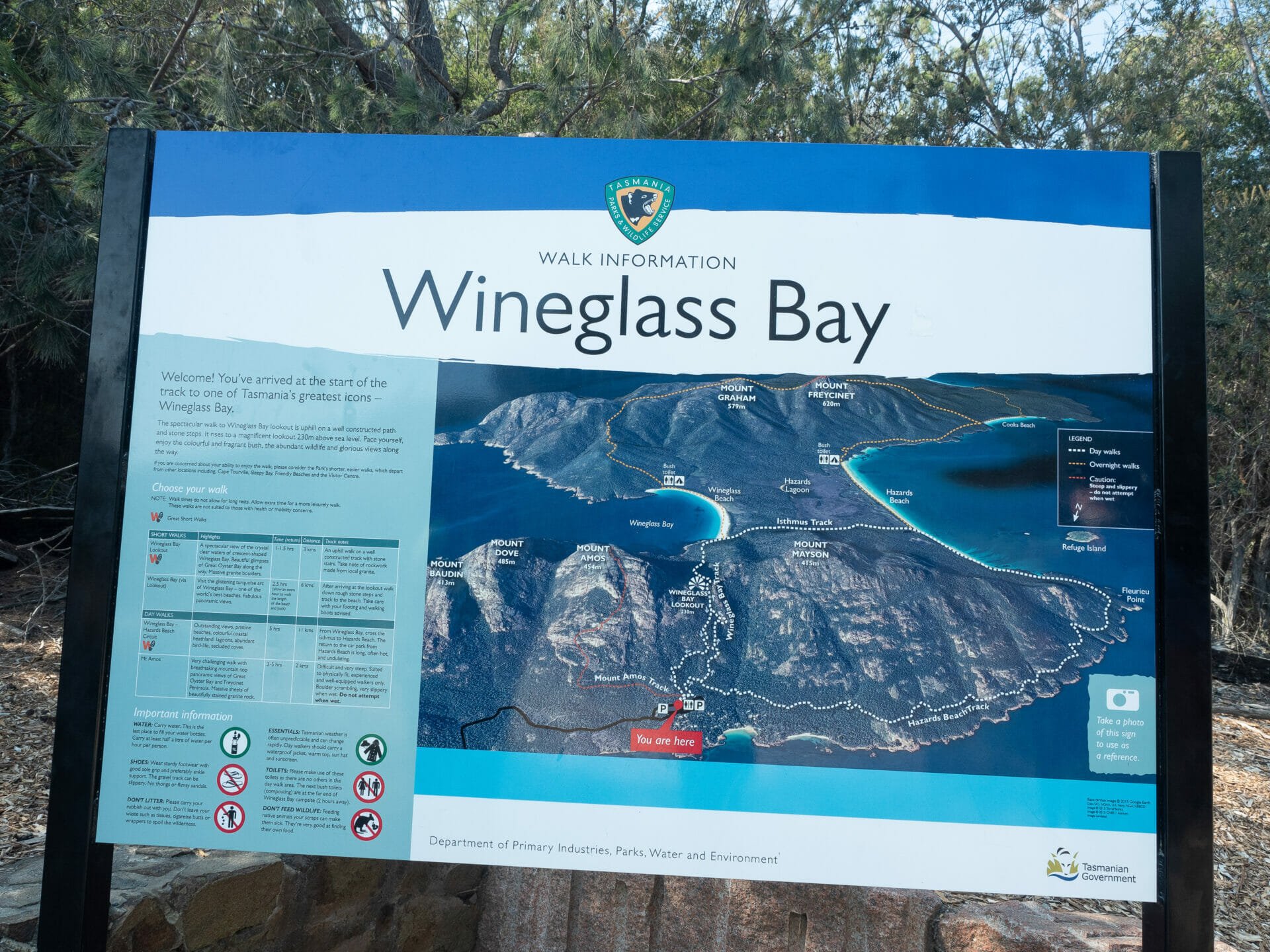
Wineglass Bay Walk carpark (just inside Freycinet National Park— you will need a Parks Pass, which can be purchased from onsite ticket machines)
Total distance
17km loop
Walking time
4.5hrs, including frequent photo stops along the way
Difficulty
Easy; the first half-hour of the trail to Wineglass Bay Lookout is moderately steep, followed by a steep decline to the beach, but the rest of the track is almost entirely flat, with only minor undulations from Hazards Beach to the carpark
Safety
Trekking poles can be useful on the ascent to Wineglass Bay Lookout; we saw 3 Tiger Snakes in a single day on the trail, so be cautious and prepared in case of emergency
Amenities
There are nice toilets at the trailhead, as well as access to drinking water
My rating
3 STARS for beautiful Wineglass Beach, although much of the subsequent walk is not particularly scenic or thrilling
Wineglass Bay Lookout
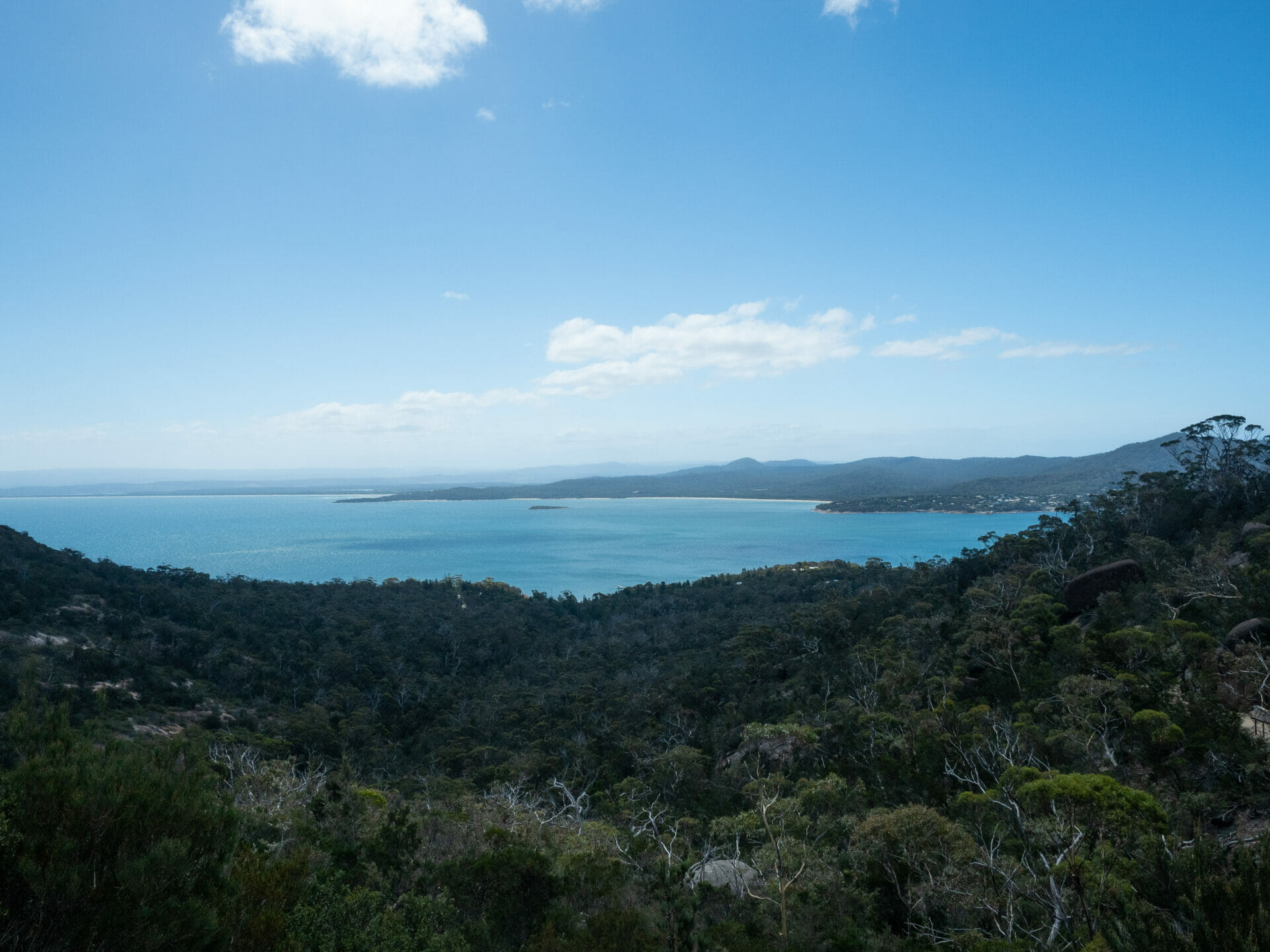
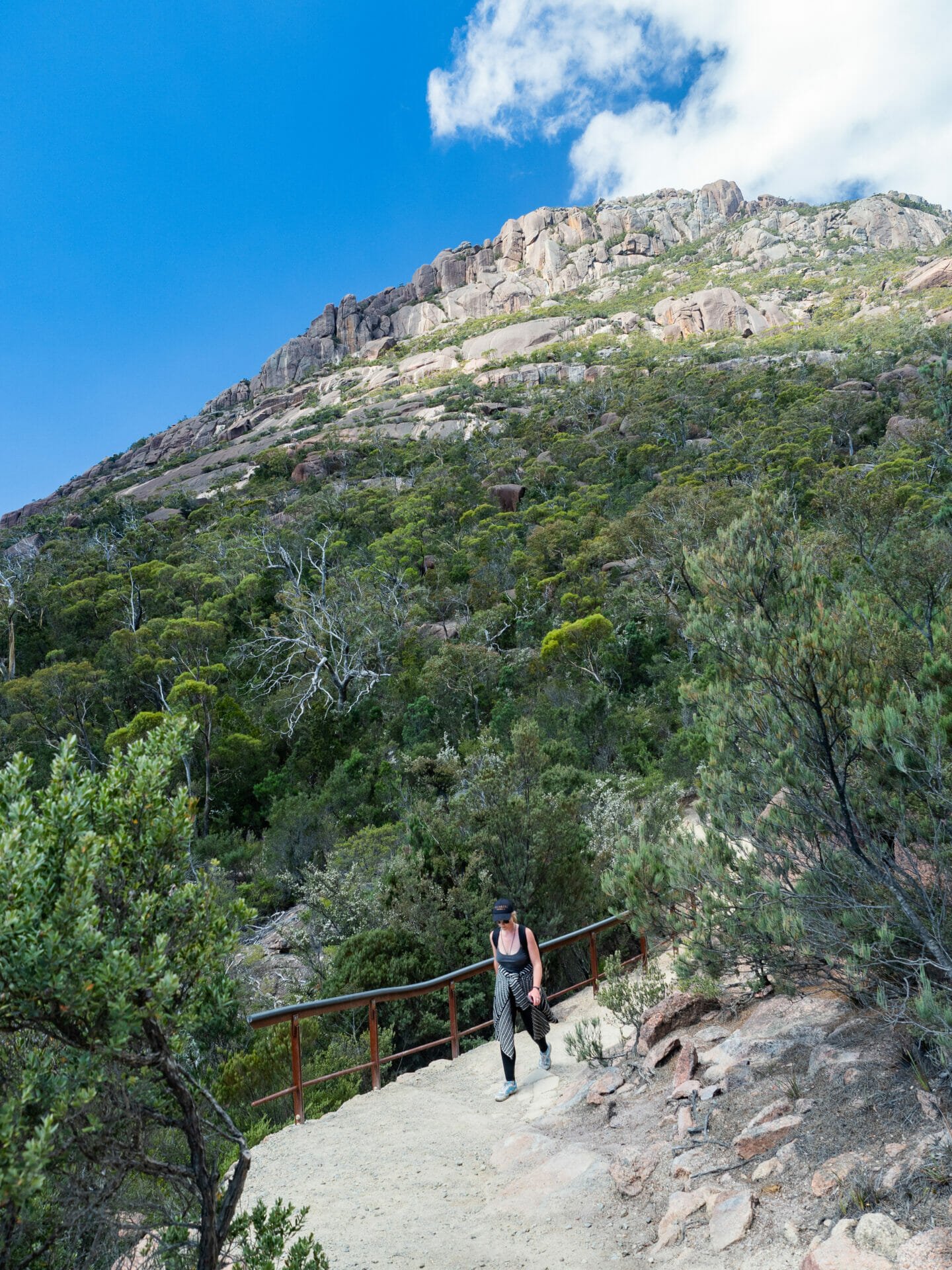
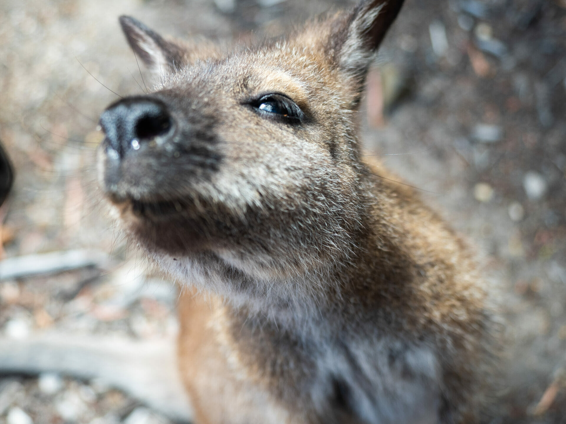
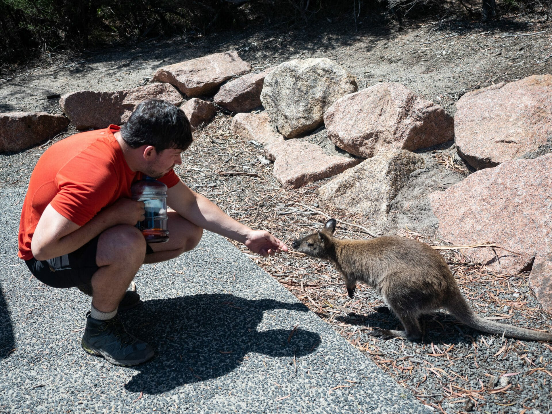
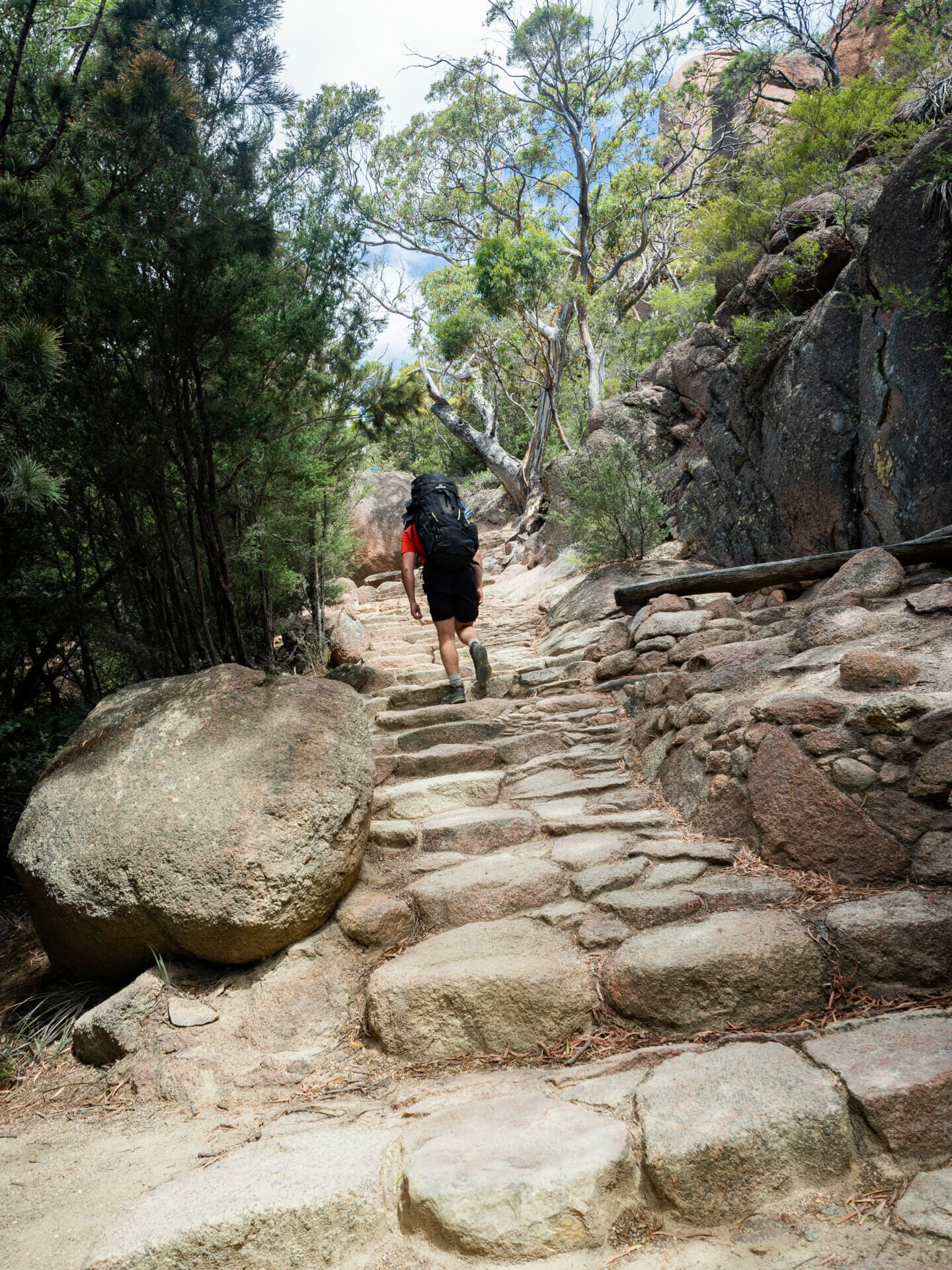
After a quick ascent of Mt Amos (our second in two days) and some kisses from a friendly local wallaby in the carpark, Cal and I set off on the 5km walk towards Tassie’s iconic Wineglass Bay. Although nowhere near as steep or challenging as Mt Amos, we are now weighed down by full packs, so the 30 minute uphill climb is still a sweaty affair. As we near the high point of the trail on a combination of stone steps and gravel, we enjoy unobstructed views of Coles Bay behind us and ever-improving weather conditions above.
The vast majority of people on the trail, and there is certainly no shortage this afternoon, are here to visit Wineglass Bay Lookout, a platform situated in the saddle between Mt Mayson and Mt Amos. This spot offers a less impressive vantage point over Wineglass Bay than Mt Amos, but at a much lower energy expenditure (and death risk) than the latter, so I can definitely see the appeal for some of the wedge-sandalled women we pass— who, it should be acknowledged, are still under-prepared for this easier walk, especially considering the large tiger snake that we spot slithering around about halfway to the top.
-

- Walking to Wineglass Bay Lookout
-

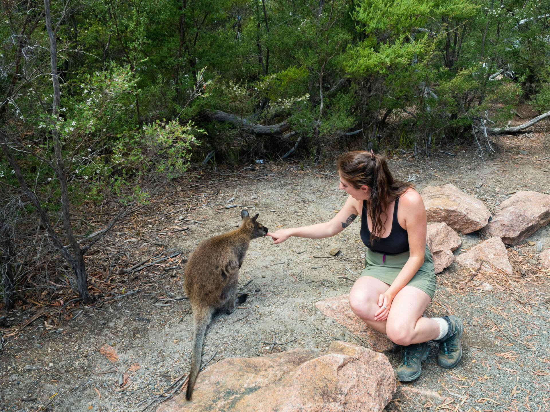
- Adorable local wallaby
-
- Trailhead
-
- Callum getting kisses from a wallaby
-
- The climb to Wineglass Bay lookout
-
- Sweet little wallaby kisses before our hike
-
- Bennetts wallaby

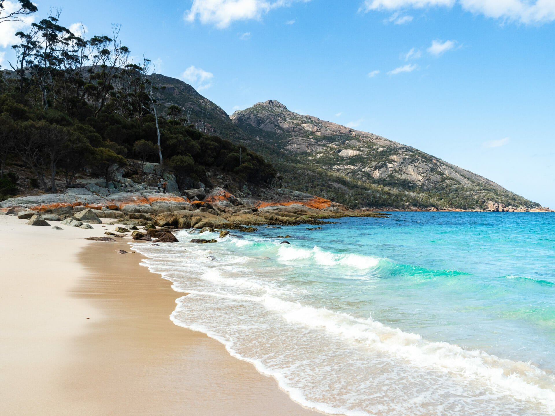
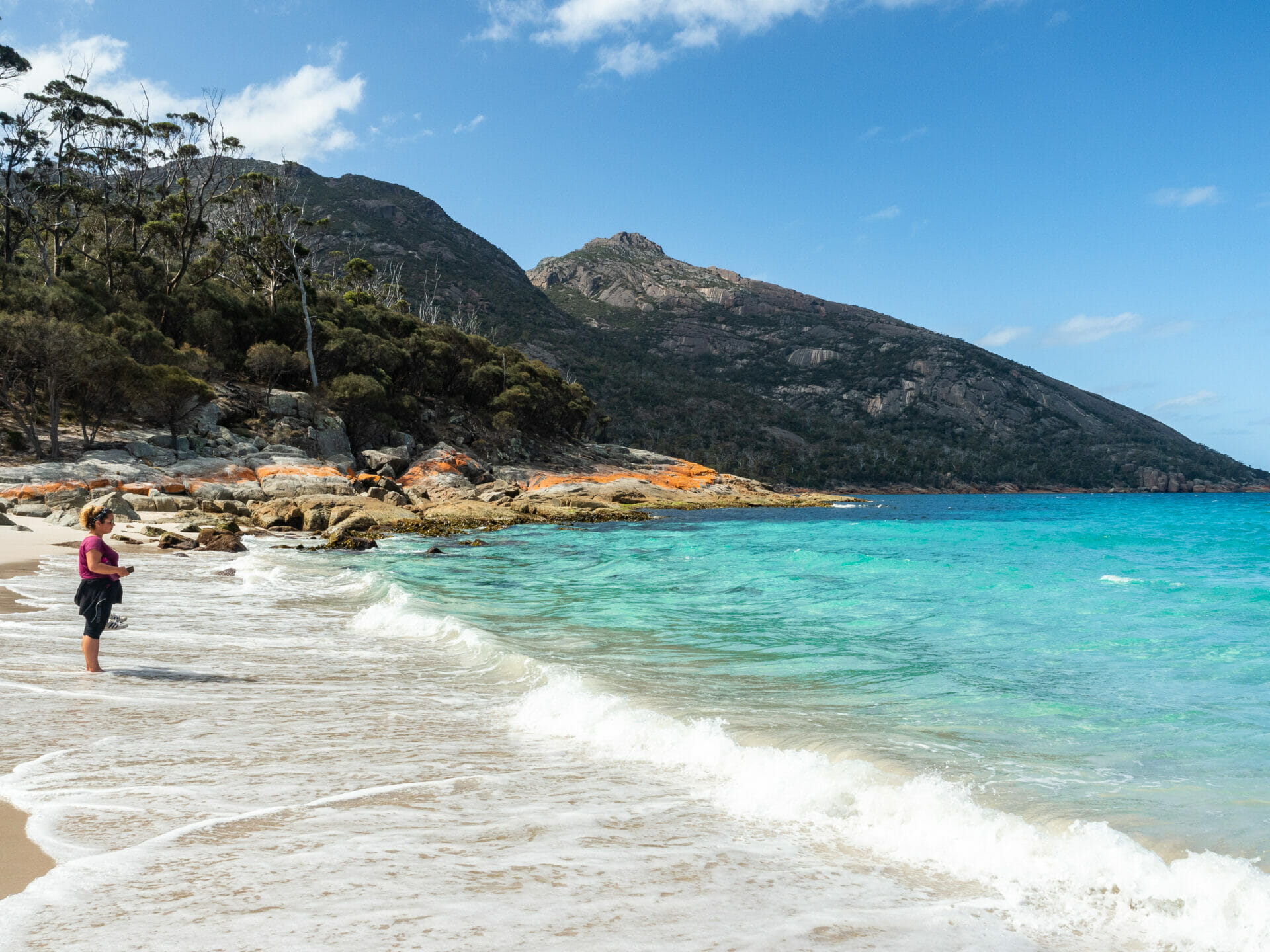
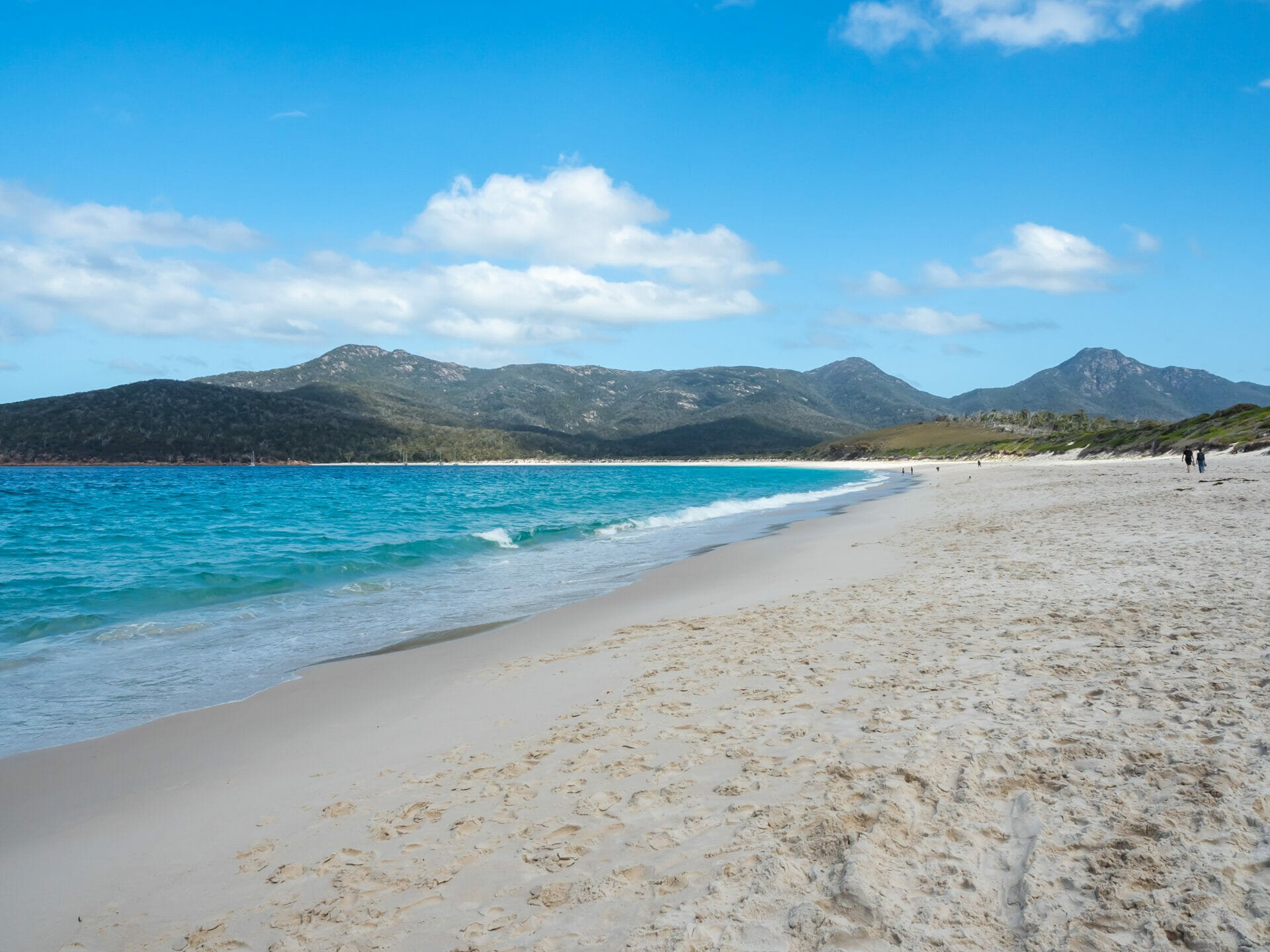
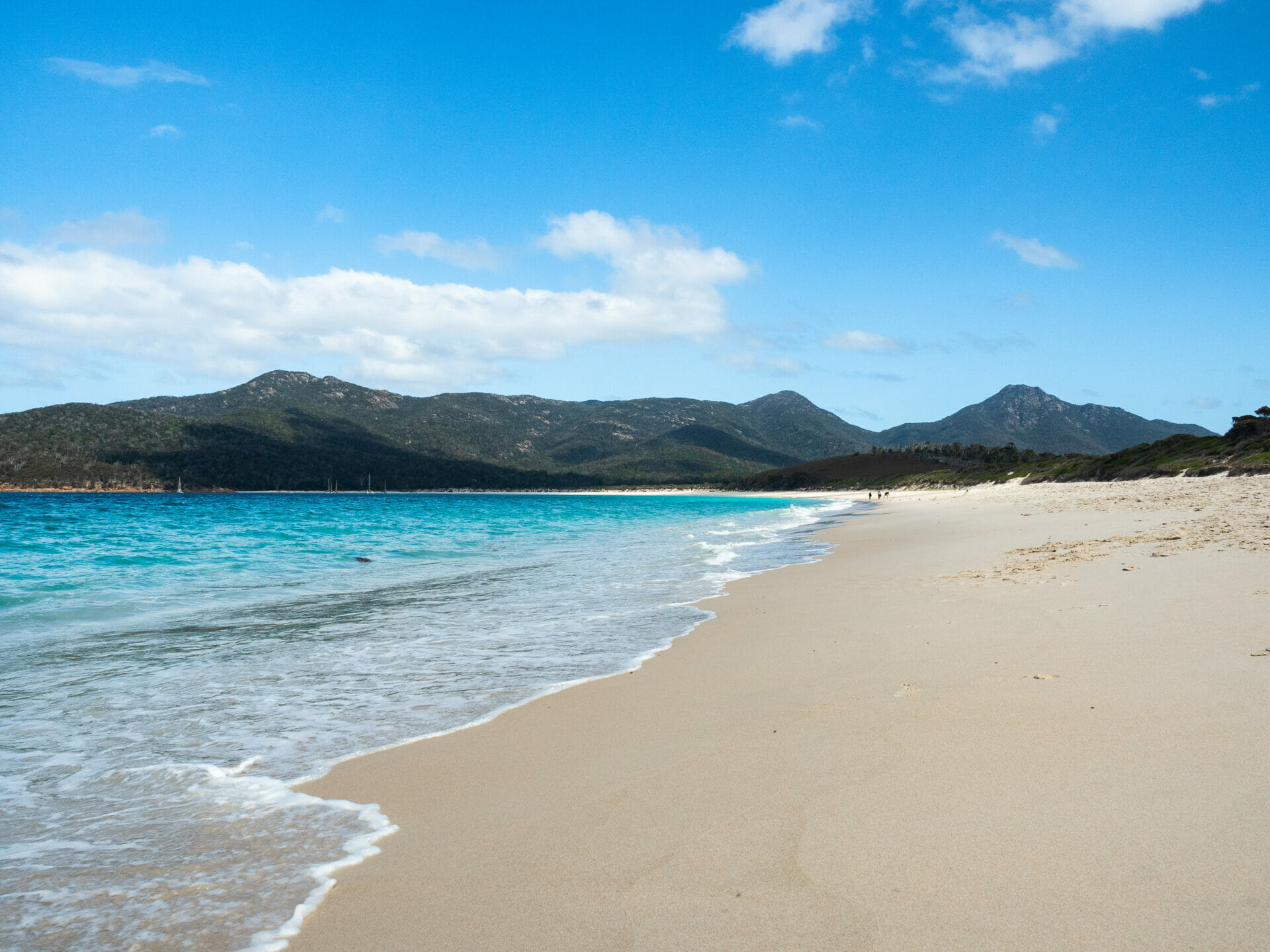
Wineglass Beach
Wineglass Beach
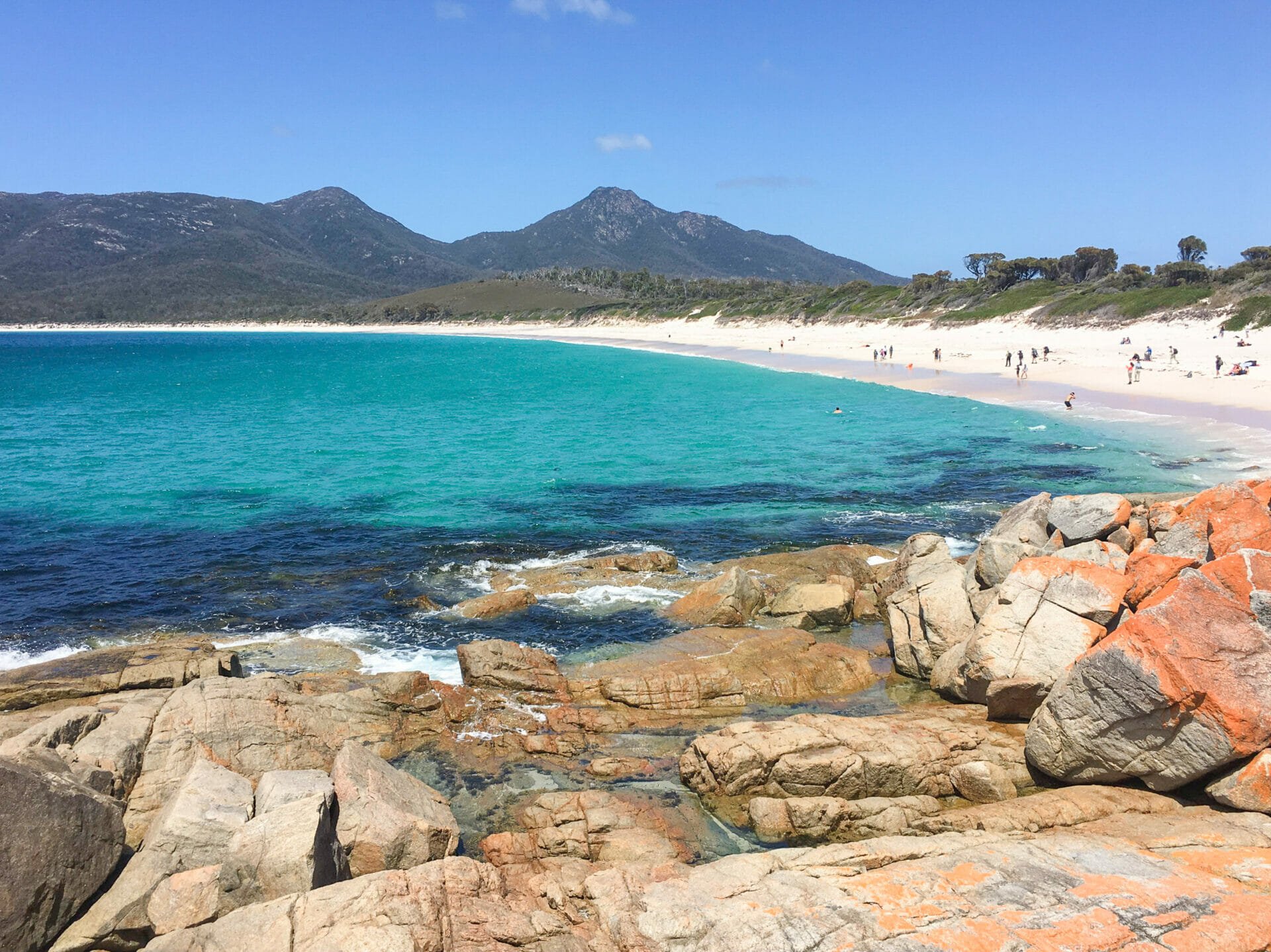
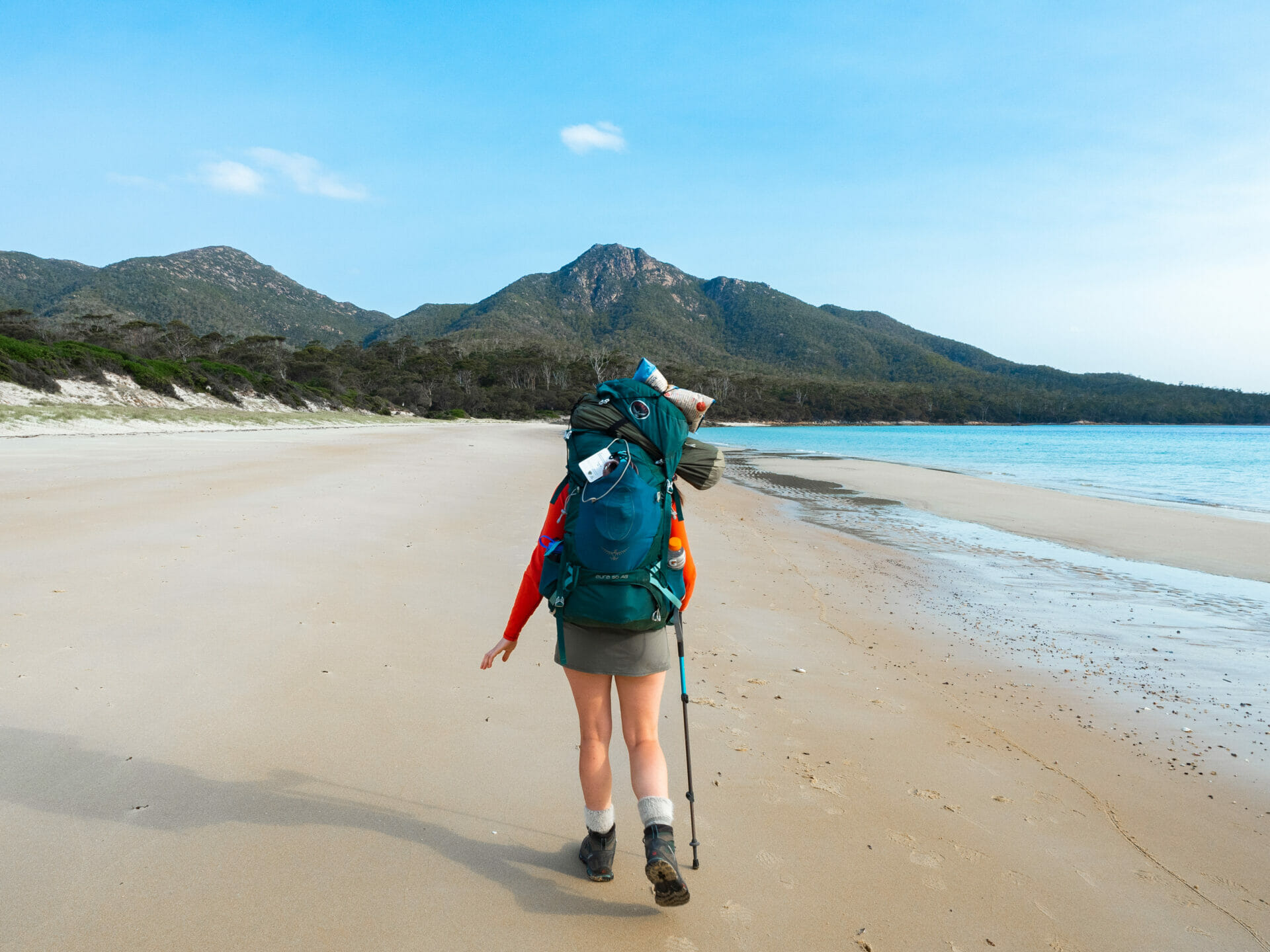
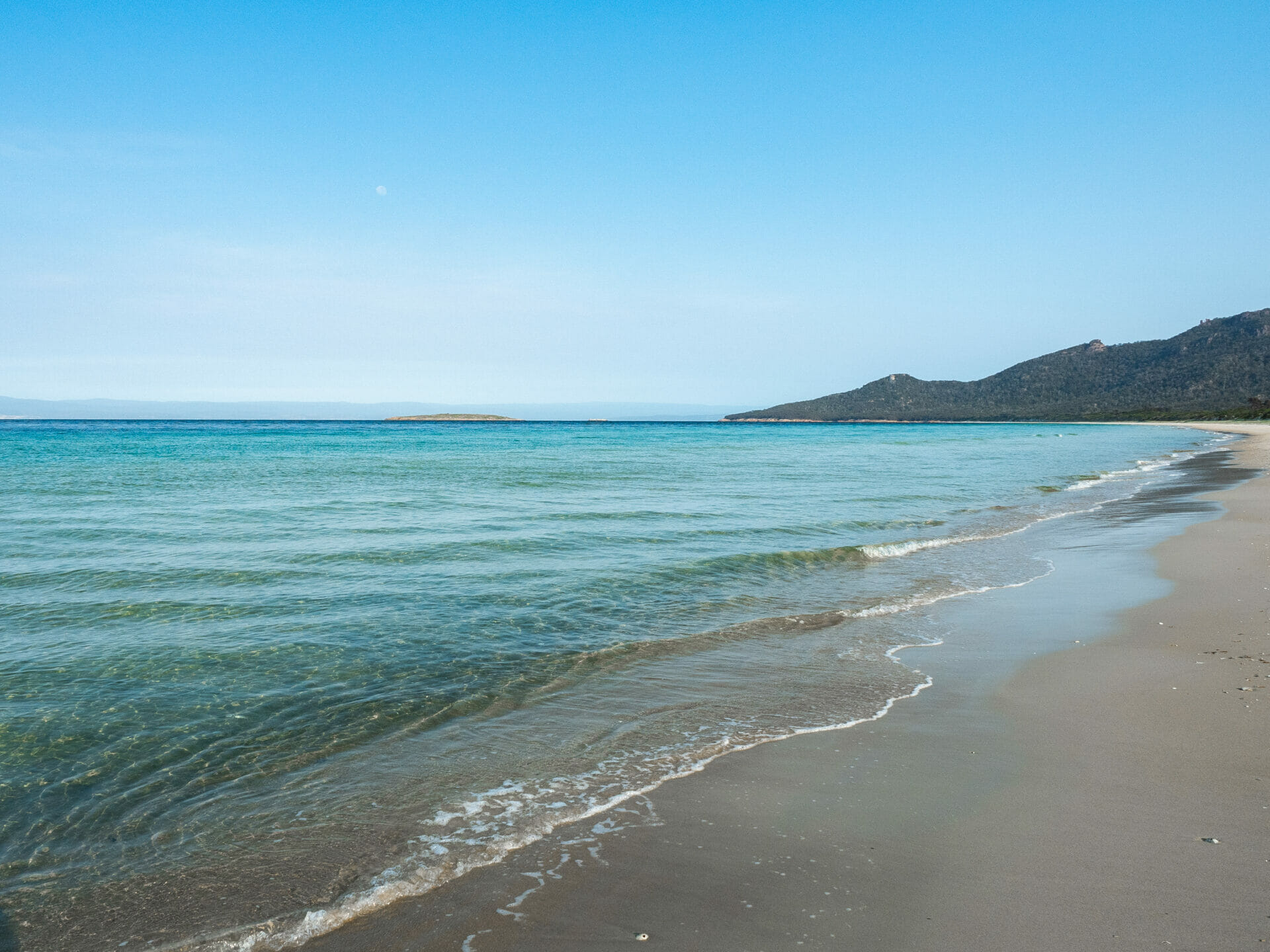
Just before we reach Wineglass Bay Lookout, Cal and I deviate from the masses and take a path leading steeply downhill towards the beach. This section is infinitely more troublesome for my still-recovering sprained ankle than the any of the uphill, but thankfully it levels out within about 15 minutes and becomes a gentle, sandy trail all the way to the beach— which is every bit as stunning as it looked from above. The whole walk takes about an hour, but we are still excited to throw off our packs and boots and run into the water for a dip on arrival.
While we were busy re-climbing Mt Amos this morning, dad and Eileen made their way straight to Wineglass Bay and have been relaxing here ever since, waiting to meet up with us before continuing on to camp at Hazards Beach across the Isthmus Track. It had been our original plan to set up camp at the south end of Wineglass Bay, which would have involved a further 45 minutes across the sand, but apparently several locals passed on advice that the camp can get pretty stinky in the summer months, which was enough to put dad and Eileen off and warrant a modification to the itinerary. I’m fairly disappointed not to be camping at the main attraction, but I am hopeful that the other side of the peninsula will be just as beautiful.
-

- A beautiful afternoon at Wineglass Bay
-
- Wineglass Beach
-
- Splashing around at Wineglass Bay
-
- Amazing Wineglass Bay
Hazards Beach
Isthmus Track to Hazards Beach
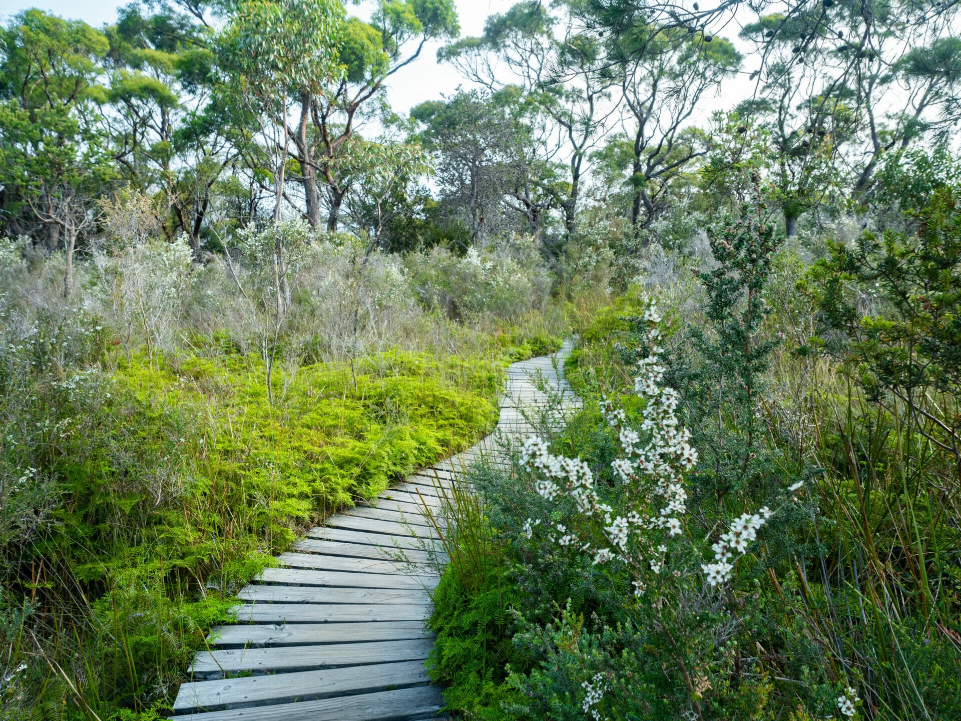
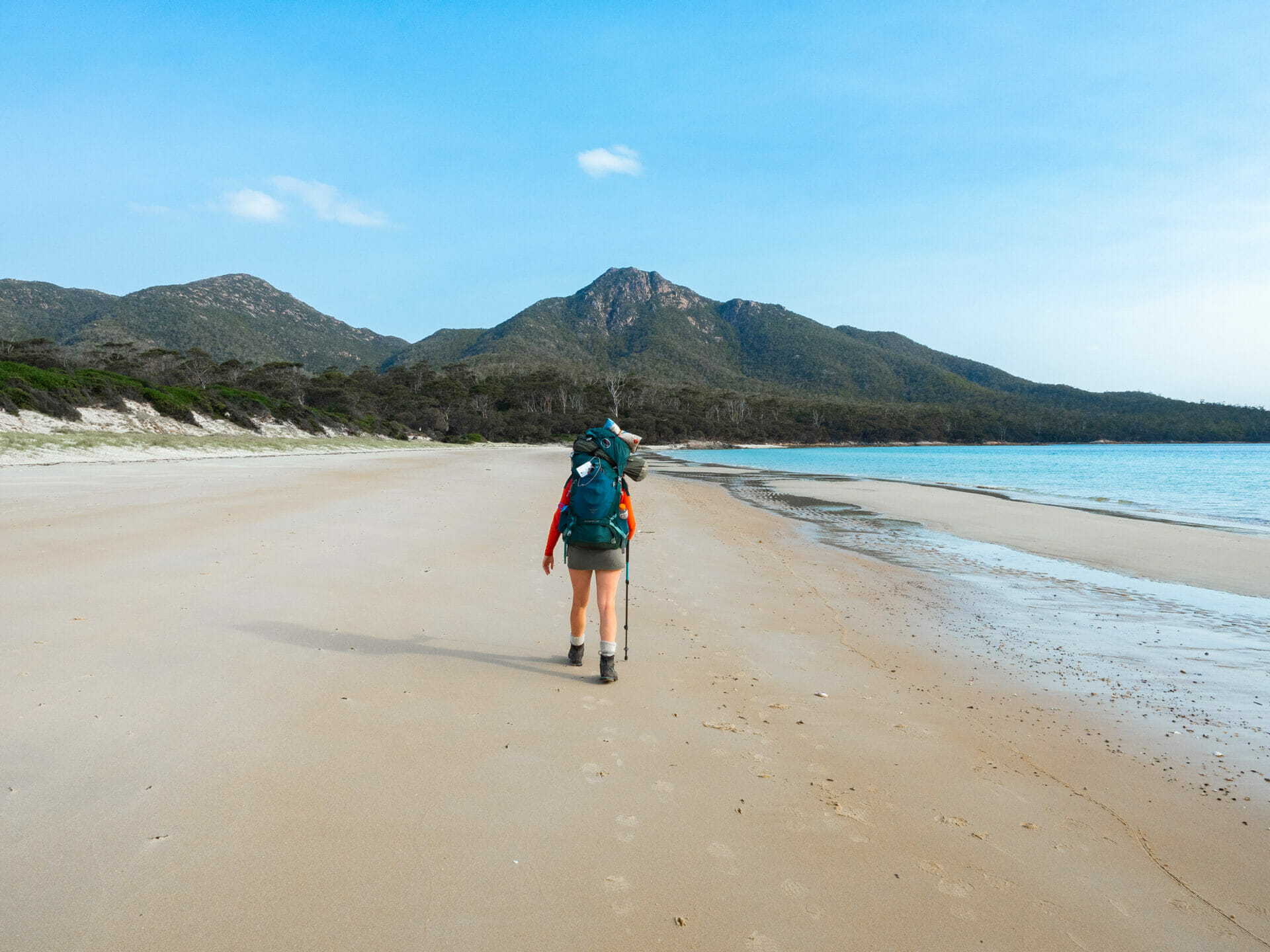
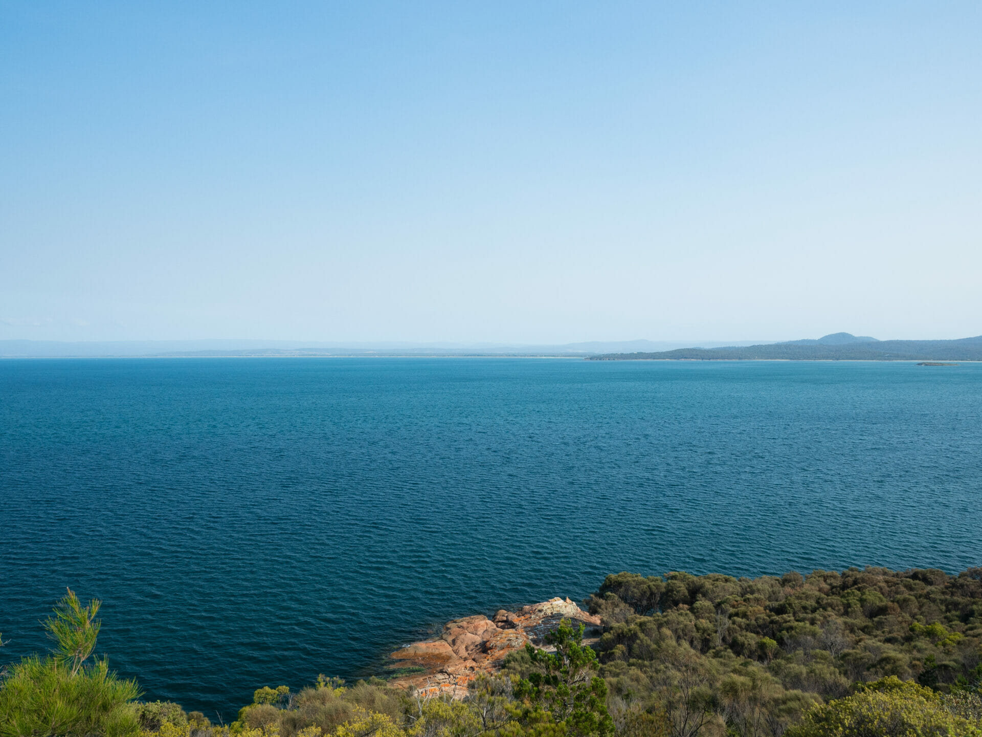
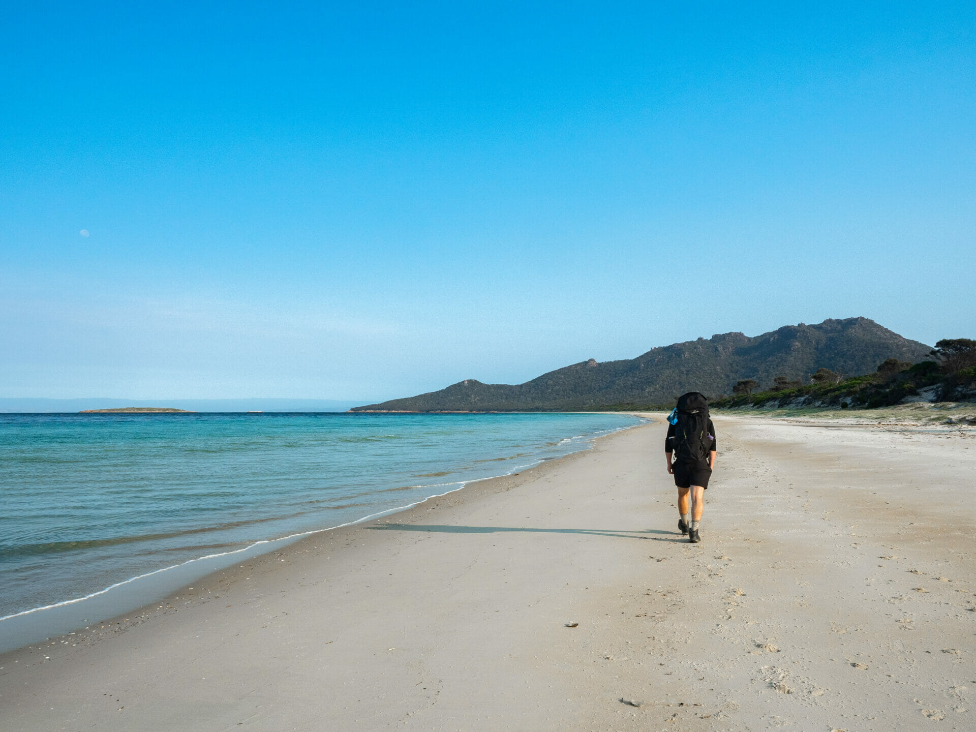
Cal and I hang around in the powder-fine sand at Wineglass Bay another hour before we pack up and set out along the perfectly flat, intermittently boardwalk’d Isthmus Track, coming out at the north end of Hazards Beach in well under an hour (despite a second snake sighting). Unfortunately, we still have to stomp along the entire length of the beach to reach camp at the south end, but the scenery is lovely and there isn’t another soul around. It also helps that the sand is well-packed and much firmer than Wineglass Bay’s, making for a fairly easy beach walk.
-
- Golden hour in the forest
-
- Family dinner at Hazards Beach
-
- The flat and gentle walk to Hazards Beach
-
- Sunset over Hazards Beach
-
- Walking across Hazards Beach to camp
-
- Hazards Beach campsite
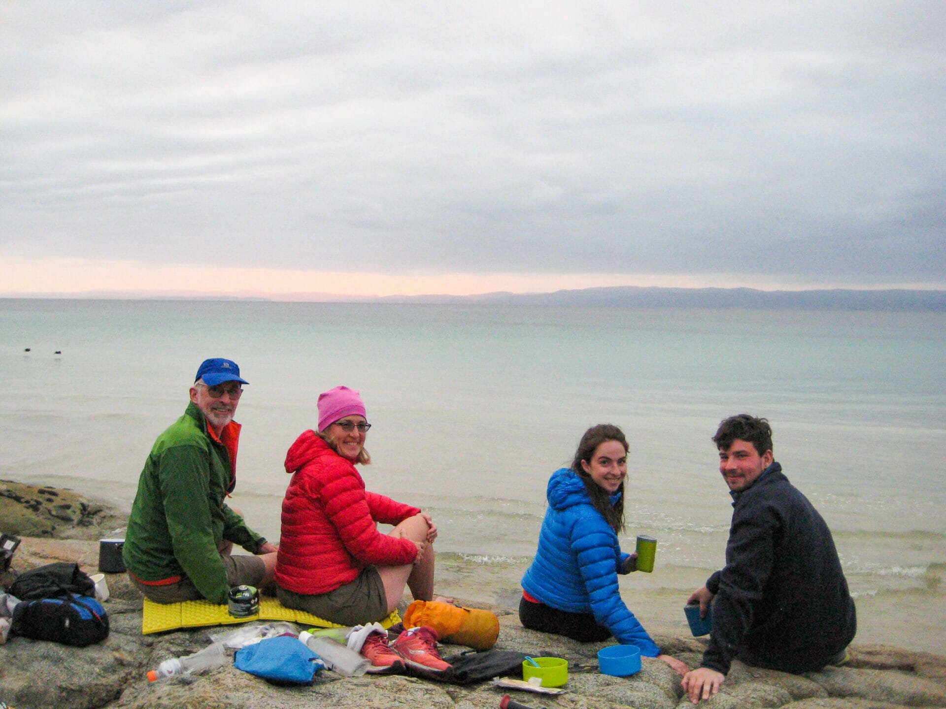
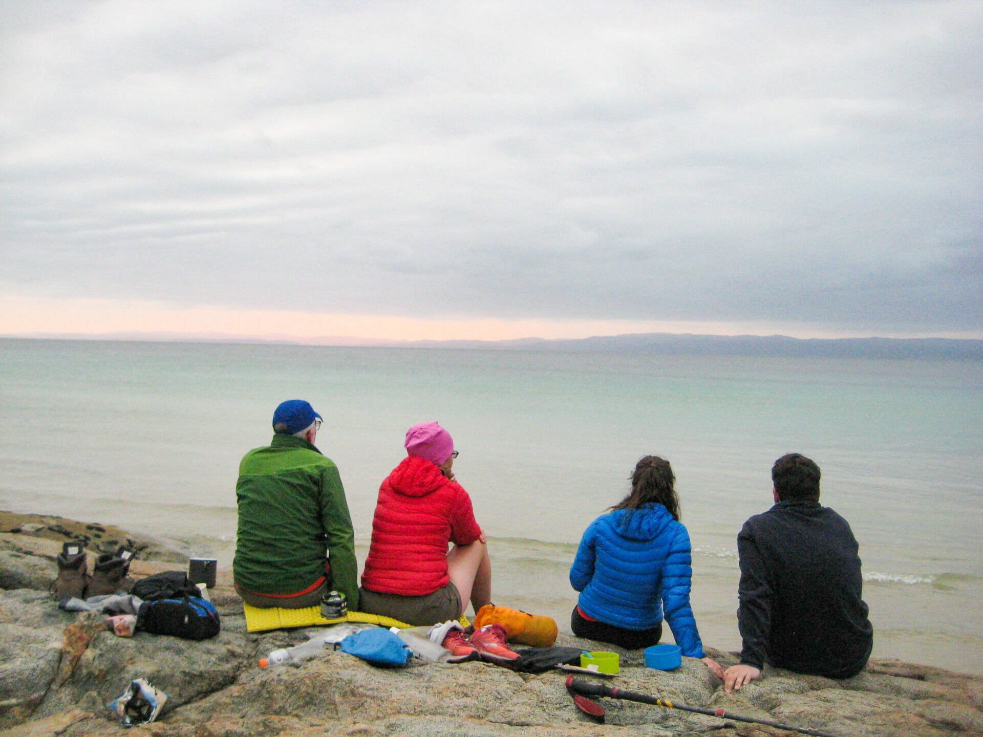
Our tent up and camp nicely organised by 6pm (even after a third tiger snake encounter), we situate ourselves on a flat, beachfront rock and boil water for a Mexican feast, complete with mountain margaritas (as all good hiking meals require). Before long, we are joined on the rock by a pair of friends from Melbourne and NZ. They’ve just come from Bay of Fires, where we are heading next, and are about to embark on the Overland Track, which we did last week, so there are plenty of tips and stories to swap as the sun slowly descends over the water.
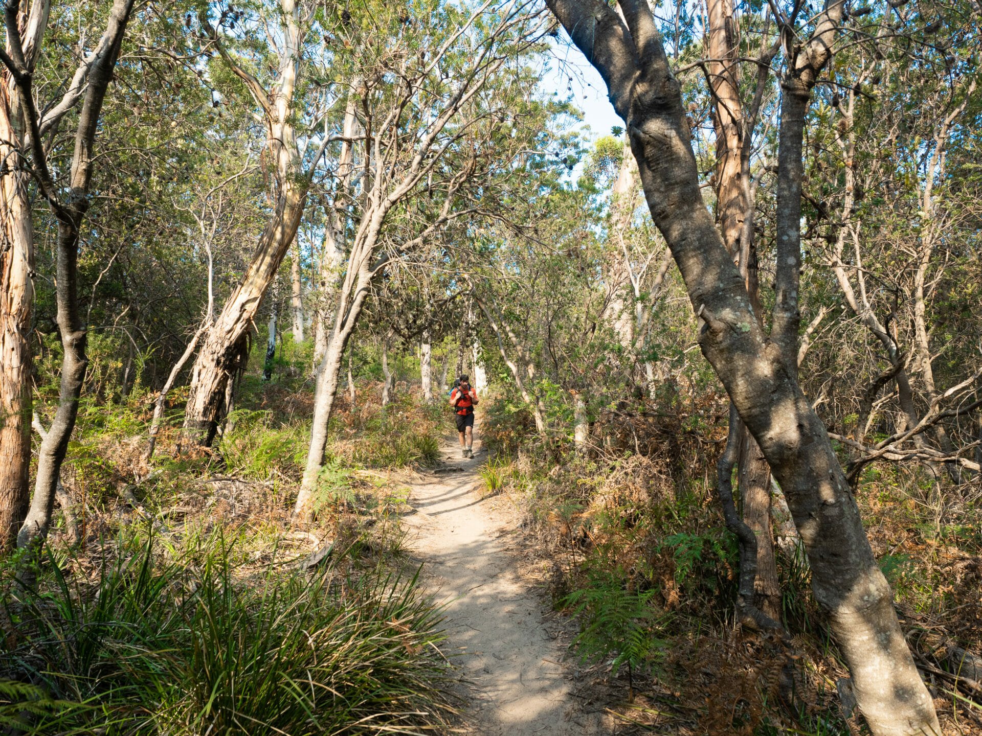
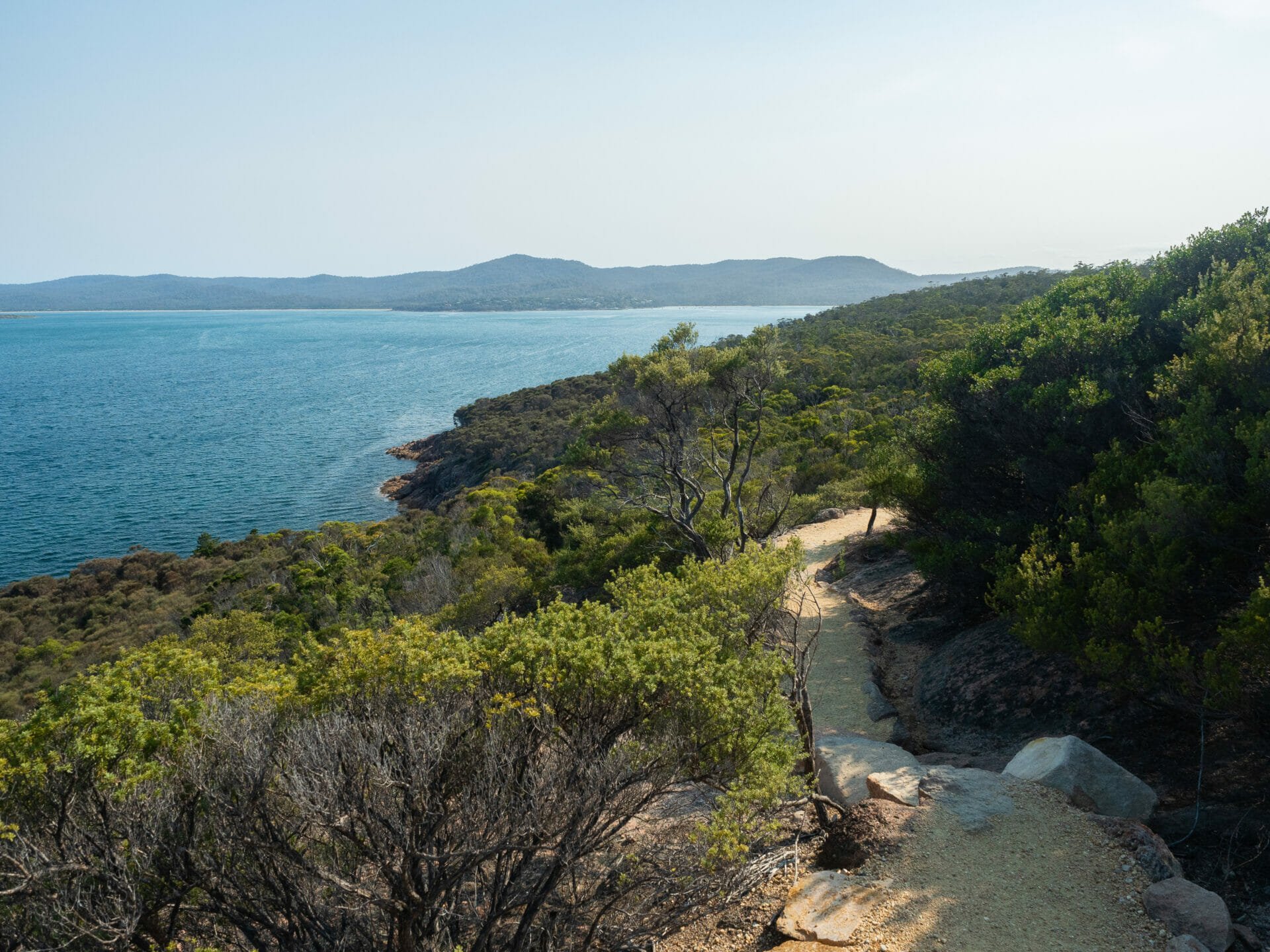
By the next morning, we are up and out of camp before 8am, motoring back along the sandy beach and continuing along the coast via the Hazards Circuit. Despite the expectation of a flat trail like yesterday’s walk between Wineglass Bay and Hazards Beach, we have an undulating natural path the entire way back to the carpark. On the bright side, the walk is predominately shaded and we manage to cover the entire 8km in 2 hours, reaching the car a full hour sooner than anticipated— and not a moment too soon, in Cal’s opinion. As much as we have loved exploring Wineglass Bay, we are all looking forward to relaxing in Bay of Fires for the next few days and giving our hiking boots a bit of a rest.
-
- Walking back to the carpark
-
- Morning ocean views
-
- Hazards Beach
Hazards Beach
Overall impressions: Hazards Circuit
The ascent to Wineglass Lookout can be a little steep, but the incline is short-lived and the reward of swimming in sheltered Wineglass Bay afterwards is enough to encourage even the most reluctant of hikers to push through. With camping at either Wineglass Beach or Hazards Beach, this is one of the best overnight walks in Freycinet National Park, which also happens to be one of Tasmania’s most scenic regions. For the ultimate experience, combine this 2-day adventure with a quick ascent of Mt Amos, departing from the same trailhead.
Read more about our adventures in Tasmania
THE OVERLAND TRACK: A COMPREHENSIVE DIY GUIDE TO TASMANIA’S MOST ICONIC MULTI-DAY HIKE
SUMMITING MT AMOS FOR THE ABSOLUTE BEST VIEW OF WINEGLASS BAY
TOP 5 MOST BEAUTIFUL SPOTS TO EXPLORE IN TASMANIA’S BAY OF FIRES
WHAT TO DO ON BRUNY ISLAND: THE PERFECT DAY-TRIP ITINERARY
WHAT TO DO IN TASMANIA: 30 AMAZING ADVENTURES ON AUSTRALIA’S ISLAND STATE