Driving the Road to Hana: recommendations for your Maui road trip
Last Updated on 17 April 2026
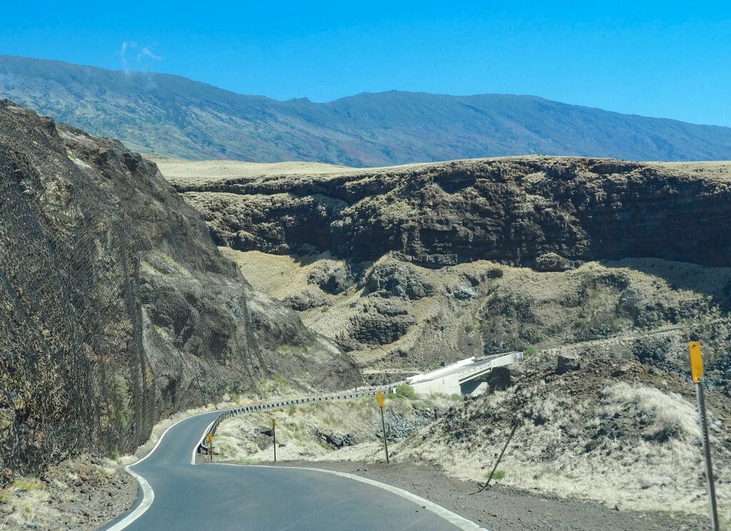
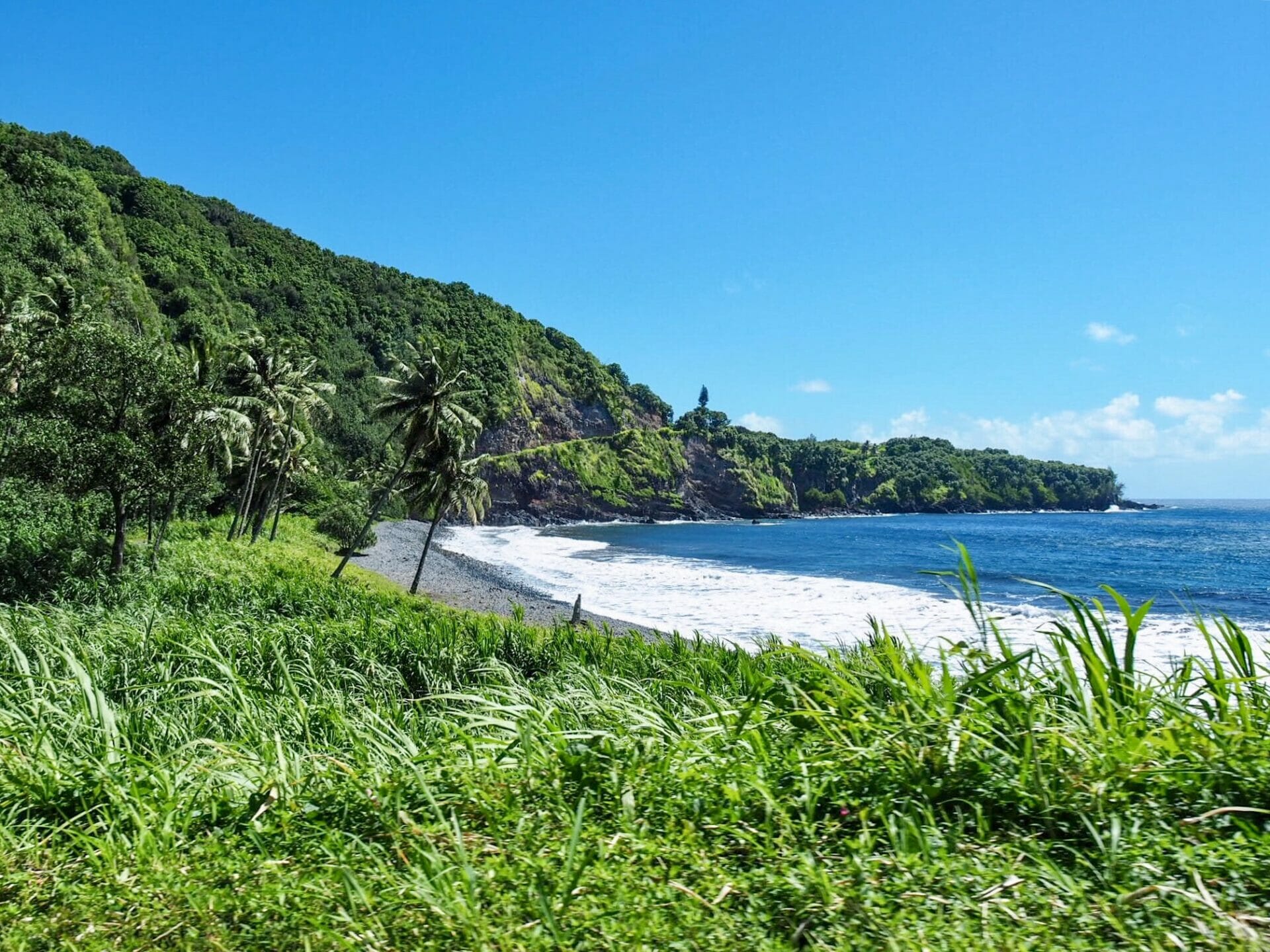
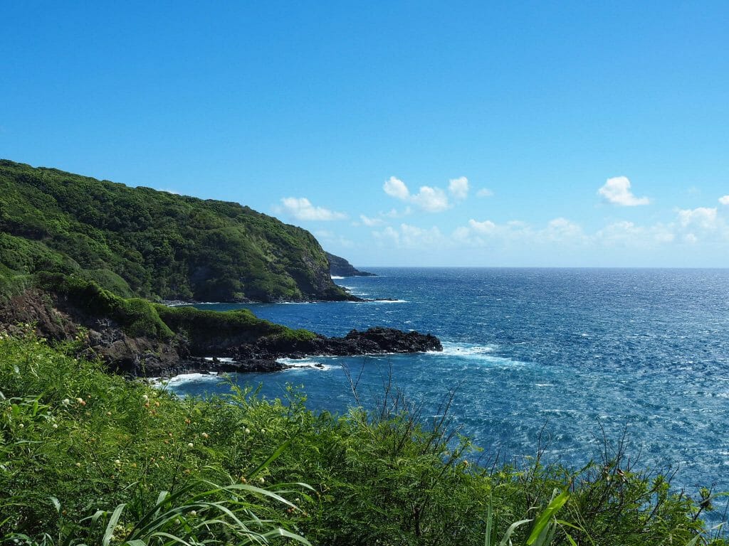
Inarguably Hawaii’s most iconic driving route, no trip to Maui is complete without braving the Road to Hana. Winding for more than 100km through the beautiful and often untamed Maui jungle towards a town of the same name, the Hana Highway is a shockingly narrow road whose hair-pin turns and zig-zagging will be enough to unsteady even the strongest of stomachs. It’s lucky, then, that there are dozens of incredible waterfalls, beaches, and hikes to enjoy along the route, as frequent stopping is essential.
This is not a drive for the faint of heart, but ultimately, it’s an adventure and a beautiful one at that! Here’s everything you need to know about driving the Road to Hana, including my recommendations for planning your road trip and the best stops along the way.
Driving the Road to Hana
As amazing as the Road to Hana can be, a full day in the car enduring hundreds of abrupt turns and impossibly narrow two-lane roads is not everyone’s idea of a good time.
After our experience on the Road to Hana, there were certainly some mixed feelings (and perhaps some less-than-mixed feelings, as carsickness claimed a few victims). I’d definitely still recommend the drive, but with some modifications to make sure it’s more enjoyable.
Tip 1 | Avoid Hana Highway
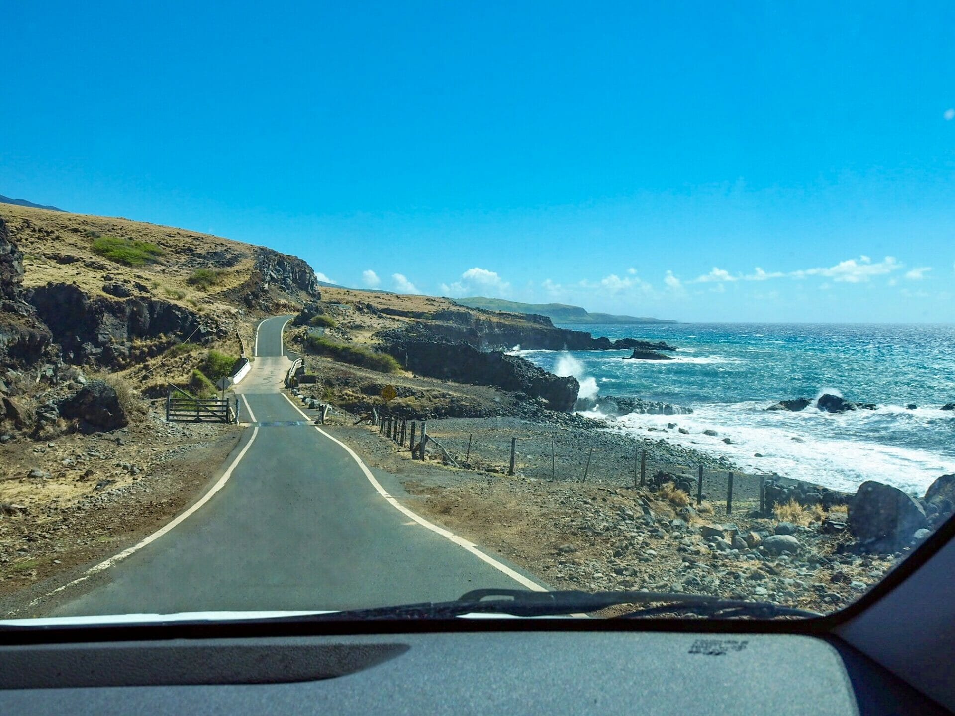
Yes, I know Hana Highway is the Road to Hana, but you can enjoy so many of the wonderful stops without having to endure hours on this torturous road. We drove along the south coast from Lahaina to Hana, on the recommendation of our waiter the previous night, and this proved a far less crowded and winding alternative to the Hana Highway we took on our way back. I can only imagine the state we would have been in if we drove the Hana Highway both ways, but one way was still more than enough for some roadside vomiting to occur…
If you’re going to tackle to whole drive in a single day, I strongly recommend taking the southern route on the way to Hana and taking the Hana Highway on the way home. Better yet, though, plan to stay in Hana for the night and drive the Hana Highway fresh the next day!
Tip 2 | Allow more time
That’s probably the best idea: give yourself two days. We missed out on a lot of great stops because we were all feeling too ill to enjoy ourselves and just wanted to get home. The first half of the drive was where all the fun happened, so perhaps the experience would have been better if we broke it into 2 days and stayed the night in Hana.
Not only does it give you the opportunity to recover after a stressful day of driving before you embark on the other half of the journey, it also gives you more time to explore the hikes, waterfalls, and beaches that make the Road to Hana so worthwhile in the first place.
Tip 3 | Combat carsickness
Perhaps this was a problem unique to us— as we were pulled over for another vomit on the side of the road, an American couple could be heard shouting from their bright blue Jeep “this is such a fun road to drive!”— but if you find yourself at all prone to carsickness, then do yourself a favour and be prepared to combat the inevitable nausea.
Whether that means bringing Dramamine, getting an open-air car, or just splitting the drive into 2 days, having realistic expectations of the drive and preparing accordingly will save a lot of pain and really maximise the fun.
Tip 4 | Do your research
Amazingly, the Road to Hana is so poorly signed that it’s near-impossible to find the beautiful waterfalls and viewpoints you’ve been dreaming of if you don’t know where to look.
I’d strongly recommend plotting your favourite stops on Google Maps or even using the Road to Hana app to navigate. And the second I stopped keeping track of where we were, assuming we could just “wing it” (and also succumbing to some intense nausea from looking at my phone), we missed an enormous stretch of stops that I had wanted to see. Do your research to find out where you’d most like to stop and then stay alert if you want to make the turn.

Now, if I haven’t totally frightened everyone away from their own Road to Hana trip, let me just say that it’s one of the most beautiful places you’ll ever explore, simply overflowing with natural wonders, and a well-planned trip will undoubtedly leave you dying to come back.
Best stops on the Road to Hana
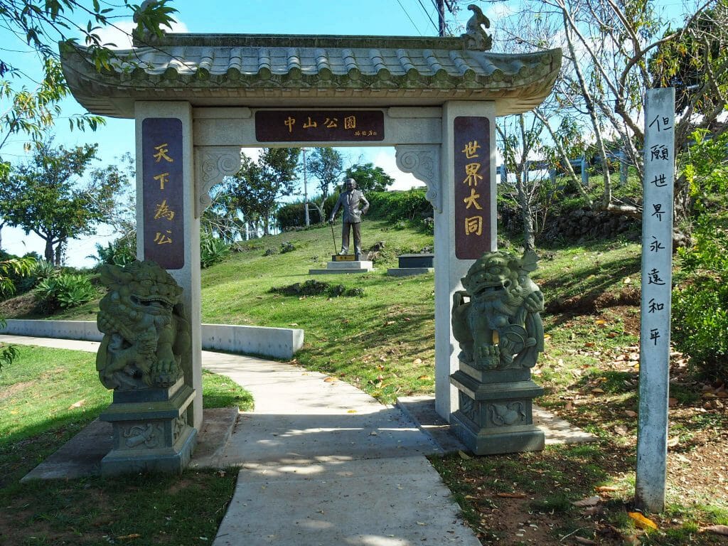
Sun Yat Sen Park
One of our first stops of the morning was this Asian-inspired garden overlooking the volcano and the west side of the island. Both approaching and driving away from this park, there are a number of (somewhat sketchy) road widenings where you could pull over for even better views, if you’re prepared to stop quickly.


Pipiwai Trail & Bamboo Forest
The one thing I had read about on the Road to Hana that I simply had to do was the hike along Pipiwai Trail to Waimoku Falls. Entry into the park was $20, payable by credit card, and then the walk departs from a little visitor’s centre. The trail is fairly moderate and not more than a few kilometres, but the heat can often make it feel more challenging than it is. The reward for all the sweat, though, is a collection of beautiful little waterfalls, a walk through the amazing (and well-shaded!!) Bamboo Forest, and a view up to the towering Waimoku Falls. If you only do one thing, make sure it’s this hike!


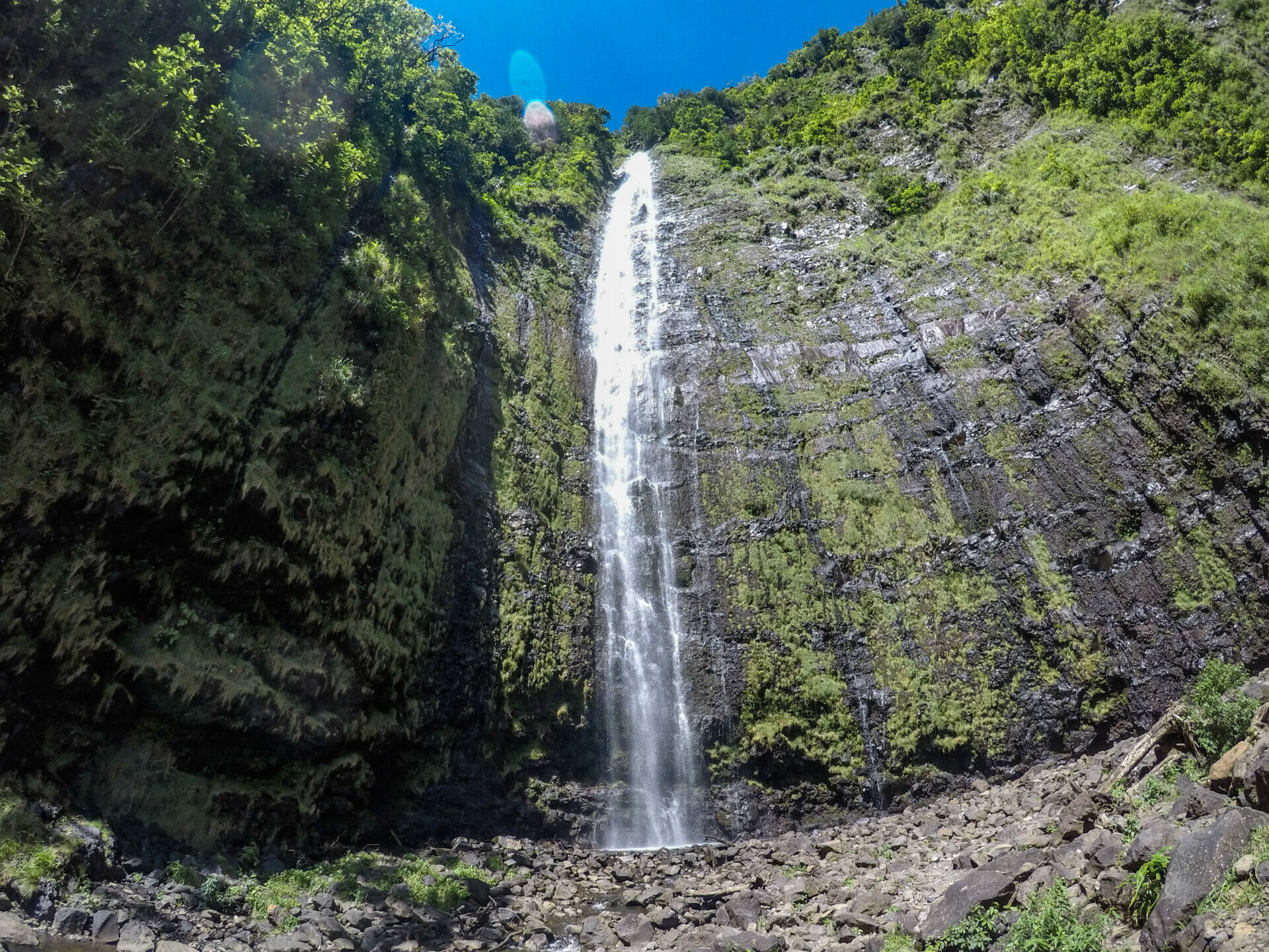
Waimoku Falls
Once at the end of the Pipiwai Trail, you reach Waimoku Falls, an incredibly tall waterfall cascading over a black cliff that is all-too-tempting to just throw yourself under. To get closer to the falls, you walk directly behind the sign that says “don’t pass this point”, which I felt a bit bad about, but Callum had already disappeared beyond it and I was trying to catch up to get some of his Gatorade, so.


Waianapanapa State Park
Rated one of the best beaches in the world, this stunning black sand beach is flanked by palm trees, tropical flowers, and lush green vegetation, but looks slightly other-worldly just because of the pitch black sand. We didn’t hop out of the car for a swim here as we would have liked, but even driving by and snapping a few photos was beautiful.


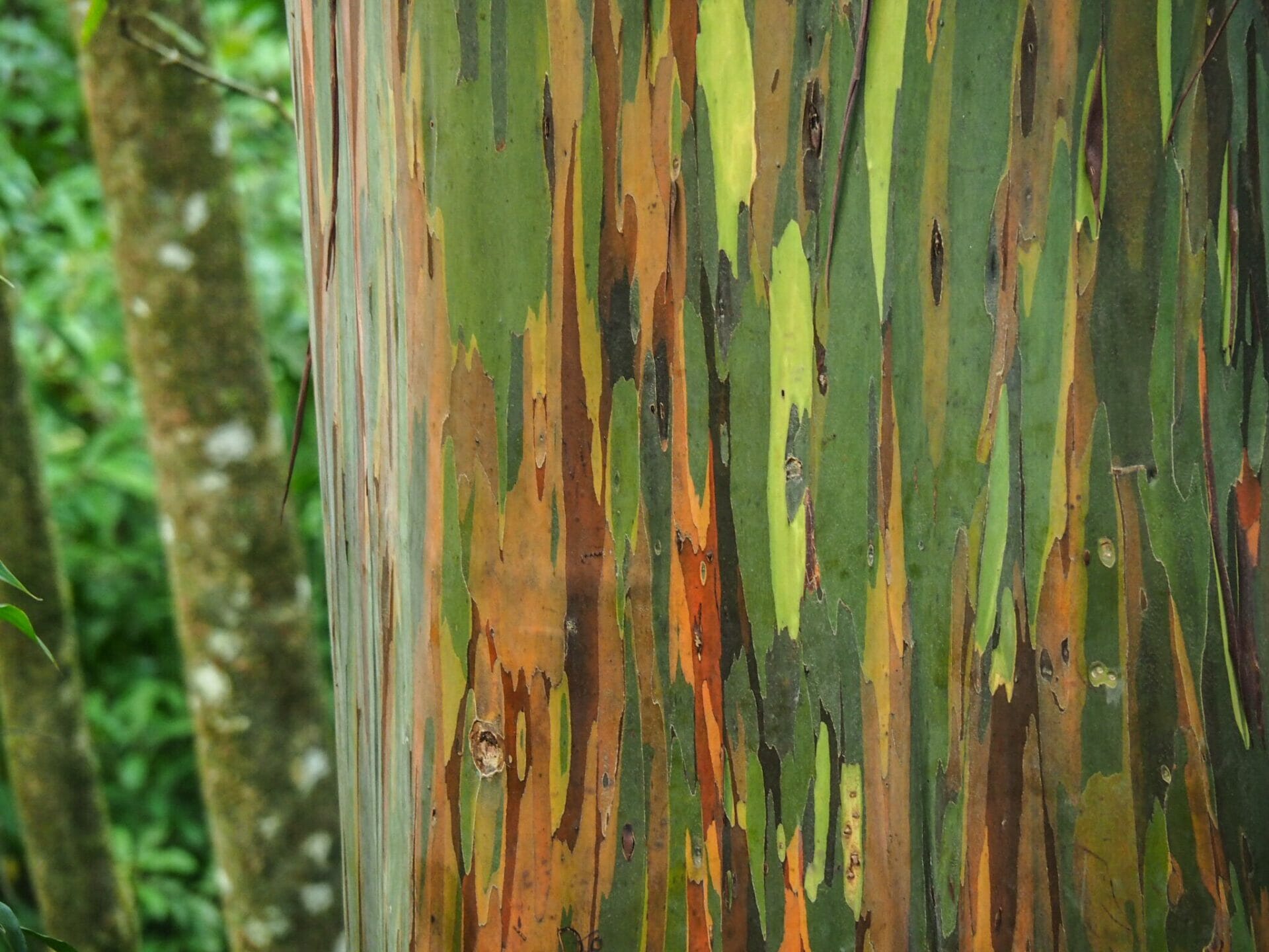
Hana & the Rainbow Eucalyptus trees
By the time we finally reached Hana, we were more than a little wilted by the driving and the heat, so we just settled for some nibbles at a little café. Only minutes after being back in the car, though, we had to pull over for more fresh air— coincidentally, pulling over right next to the famous Rainbow Eucalyptus trees that line a small section of the Hana Highway. It was pure luck that we even got to see these incredibly colourful trees, but I’m so glad we did!


Read more about Hawaii
THE VALLEY ISLE: TOP 10 WAYS TO ENJOY MAUI
THE BEST SPOTS TO SNORKEL WITH TURTLES ON MAUI
CATCHING SUNRISE, MOUNTAIN BIKING & ZIPLINING IN HALEAKALĀ NATIONAL PARK