
The ultimate East Fjords travel guide: best things to do in East Iceland
Aside from a handful of popular attractions close to the Ring Road, East Iceland (Austurland) remains blissfully off the main tourist route. With dramatic mountain ranges, charming fjord towns, hundreds of uncrowded hiking trails, and some of the most distinctive landscapes in the entire country, we’re convinced that the wild and wonderful East Fjords are the most underrated region in Iceland!
We’ve road-tripped through East Iceland on three separate trips over different seasons, but on our most recent adventure, we spent 2 full weeks based in Egilsstaðir, exploring countless hidden gems, local hiking trails, scenic drives, and remote hot springs that rarely feature on the typical Iceland itinerary.
This guide breaks down the absolute best things to do within distinct sub-regions of East Iceland so that you can understand where things are located, which activities make sense to combine into a single day, and ultimately how to build the BEST East Fjords itinerary!
Best things to do in East Iceland at a glance
>>> Best hikes: Þerribjörg Cliffs, Waterfall Circle, Mt Bjólfur, Hengifoss (upper viewpoint)
>>> Best waterfalls: Klifbrekkufossar, Rjúkandifoss, Strútsfoss, Hengifoss, Gufufoss
>>> Best scenic drives: Mjóafjarðarvegur (953), Öxi Pass (939), Hellisheiði Eystri (917)
>>> Best wildlife experience: Hafnarhólmi puffin colony
>>> Best hot springs: Laugarfell, Vök Baths (Egilsstaðir), Musterið Spa (Borgarfjörður Eystri)
>>> Best local towns: Seyðisfjörður, Bakkagerði
>>> Best craft breweries: KHB Brugghús (Borgarfjörður Eystri); Askur Taproom/Austri Brugghús (Egilsstaðir)
>>> Popular spots: Stuðlagil Canyon, Hengifoss, Seyðisfjörður
>>> True hidden gems: Þerribjörg Cliffs, Waterfall Circle, Mjóifjörður, Strútsfoss


About this East Fjords travel guide
Egilsstaðir is the largest town in East Iceland, and roads radiate like spokes from this central hub towards the surrounding fjords, mountain valleys, and Highlands. Since you’ll almost certainly have to pass through Egilsstaðir to get anywhere in the region, this is by far the most logical base for exploring the East Fjords!
Rather than provide you with an overwhelming list of hikes, waterfalls, scenic drives, and hot springs to visit across East Iceland, I’ve organised all our recommendations into 7 distinct sub-regions, each designed as a standalone day-trip from Egilsstaðir. My hope is that this format will allow you to visualise the geography of the East Fjords, understand which activities easily combine, and choose the most interesting regions to add to your own itinerary!
*To enjoy all the activities recommended within this guide, you’d need a full week in the East Fjords + a few extra days to allow for the inevitability of poor weather!
Map of the East Fjords
All of these 7 sub-regions (and my recommended activities in each) are depicted on the map below:
- Egilsstaðir & Fljótsdalur Valley
- Laugarfell & the Eastern Highlands (S of Egilsstaðir)
- Borgarfjörður Eystri (NE of Egilsstaðir)
- Seyðisfjörður (E of Egilsstaðir)
- Mjóifjörður (SE of Egilsstaðir)
- Vopnafjörður & Hellisheiði Eystri (NW of Egilsstaðir)
- Stuðlagil (W of Egilsstaðir)
>>> See more information about getting to East Iceland (including driving from other parts of Iceland vs flying domestically and renting a car directly in Egilsstaðir), plus our recommendations for the best hotels, hostels, and campgrounds in East Iceland below!
*Best things to do in the East Fjords
1 | Egilsstaðir & Fljótsdalur Valley
- From Egilsstaðir: 0-50min (in the immediate area + S into the valley)
- Recommended time: full day
One of the easiest (and therefore most popular) sub-regions to explore in East Iceland is the area immediately south of Egilsstaðir, following the shores of Lagarfljót, the long, glacier-fed lake that leads into the beautiful Fljótsdalur Valley.
The star attraction is Hengifoss, one of Iceland’s most distinctive waterfalls, but farther into the valley, you’ll find another spectacular red-striped waterfall that receives only a fraction of the visitors, Strútsfoss. Visit one or both falls on short hikes, enjoying the scenic drive alongside Lagarfljót as you make your way back towards Egilsstaðir for craft beer and wood-fired pizza at Askur Taproom. Finish the day with a soak in the fantastic Vök Baths, one of our favourite geothermal lagoons in Iceland!
Litlanesfoss & Hengifoss hike
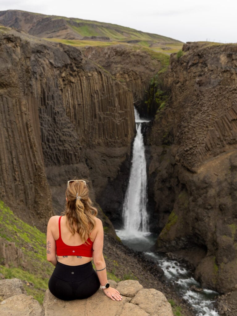
Trailhead: Hengifoss | Time: 2-3hrs | Stats: 7km (450m gain) | Difficulty: moderate
Plunging 128m down a basalt cliff streaked with horizontal bands of brilliant red clay, Hengifoss is certainly the most famous waterfall in East Iceland. There’s a busy highway of a trail leading steadily up the canyon past the hexagonal basalt columns of Litlanesfoss to reach the base of Hengifoss, but few visitors know that there’s actually a trail leading to the top of the falls for a far better view.
For all the hundreds of tourists on the lower path, we didn’t see a single hiker on the more rugged upper trail!

Although the upper trail isn’t marked on any of the official maps at the trailhead, it’s fairly well-defined and even marked by cairns. Unlike several other areas around Hengifoss where rope barriers and “do not cross” signs explicitly restrict access, we saw no signs or barriers here, so it appears that the trail is just a well-kept local secret!
To find the upper trail, walk just shy of 2km up the main path and, VERY soon after passing the junction with the descent route leading back to the car park, make a sharp left turn up the hillside.
Be careful to stick to the existing trodden trail to minimise environmental impact! Within about 10min, you’ll reach the top of the cliffs alongside Hengifoss, where the view across the canyon to the enormous red-striped waterfall is immediately spectacular.
Strútsfoss hike
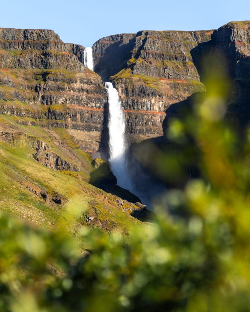
Trailhead: Strútsfoss carpark | Time: 2hrs | Stats: 7km (350m) | Difficulty: easy
Heading deeper into Fljótsdalur Valley, Strútsfoss is a much more off-the-radar waterfall that has the same distinctive red banding as Hengifoss, but without the crowds! Both waterfalls are absolutely worth seeing, but if you’re short on time: choose Hengifoss if you’re willing to hike to the upper viewpoint for a closer view; otherwise, choose Strútsfoss for a quieter experience right on the main trail (but know that the falls are farther away).
The hike to Strútsfoss begins from a small car park in the valley, following the river on a somewhat circuitous route to avoid crossing private property before connecting to a wider, more obvious path up to the falls.
Aim to arrive within a few hours of midday or visit during cloudy conditions if you want to photograph Strútsfoss with even lighting— too early or late in the day and the falls will be partially shaded by the canyon walls.
Viewpoints along Lagarfljót
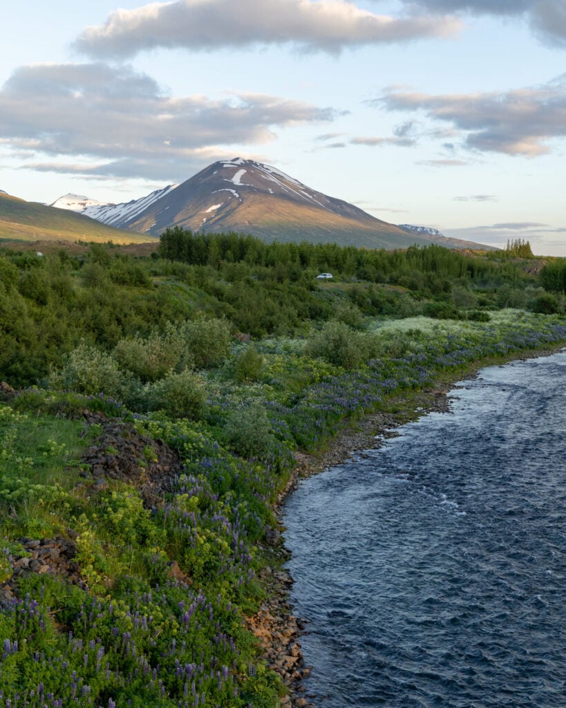
Driving back towards Egilsstaðir, there are quite a few informal viewpoints overlooking Lagarfljót, the narrow glacial lake stretching through the valley towards town. It’s a beautiful drive, but the chilly waters are also home to one of Iceland’s oldest surviving legends!
As far back as 1345, Icelanders have reported sightings of the Lagarfljót Wyrm, a giant serpentine creature believed to live within the depths of the lake. The wyrm gained a lot of media attention several years ago when a local farmer posted a video that, I’ll admit, does look alarming like a giant lake-dwelling monster… so keep an eye out, you never know!
Austri Brugghús/Askur Taproom
Back in Egilsstaðir, sample some local craft beer from Austri Brugghús at their Askur Taproom, which also serves excellent wood-fired pizza. We usually advocate for cooking your own meals in Iceland since eating out is so exorbitantly expensive, but this was a very satisfying splurge after a day of hiking!
Vök Baths
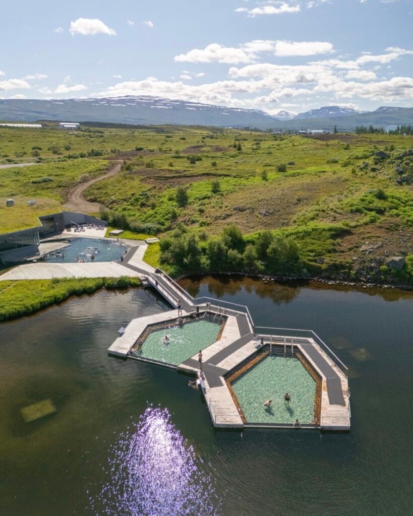
With geothermal infinity pools that float directly on Urriðavatn, a small lake just northwest of Egilsstaðir, Vök Baths are one of the most unique lagoons in Iceland. Beyond the hot pools, there’s also a sauna, mist tunnel, cold plunge, swim-up bar, and of course easy access to the chilly lake for swimming!
Like most of Iceland’s high-end lagoons, entry is a little steep at 7,690 ISK ($55USD), but it’s totally worth it to relax on the lake after a full day of exploring. There’s no need to reserve in advance, and typically the evening is a bit quieter as the families peel off to bed.
2 | Laugarfell & the Eastern Highlands
- From Egilsstaðir: 1hr S
- Recommended time: full day
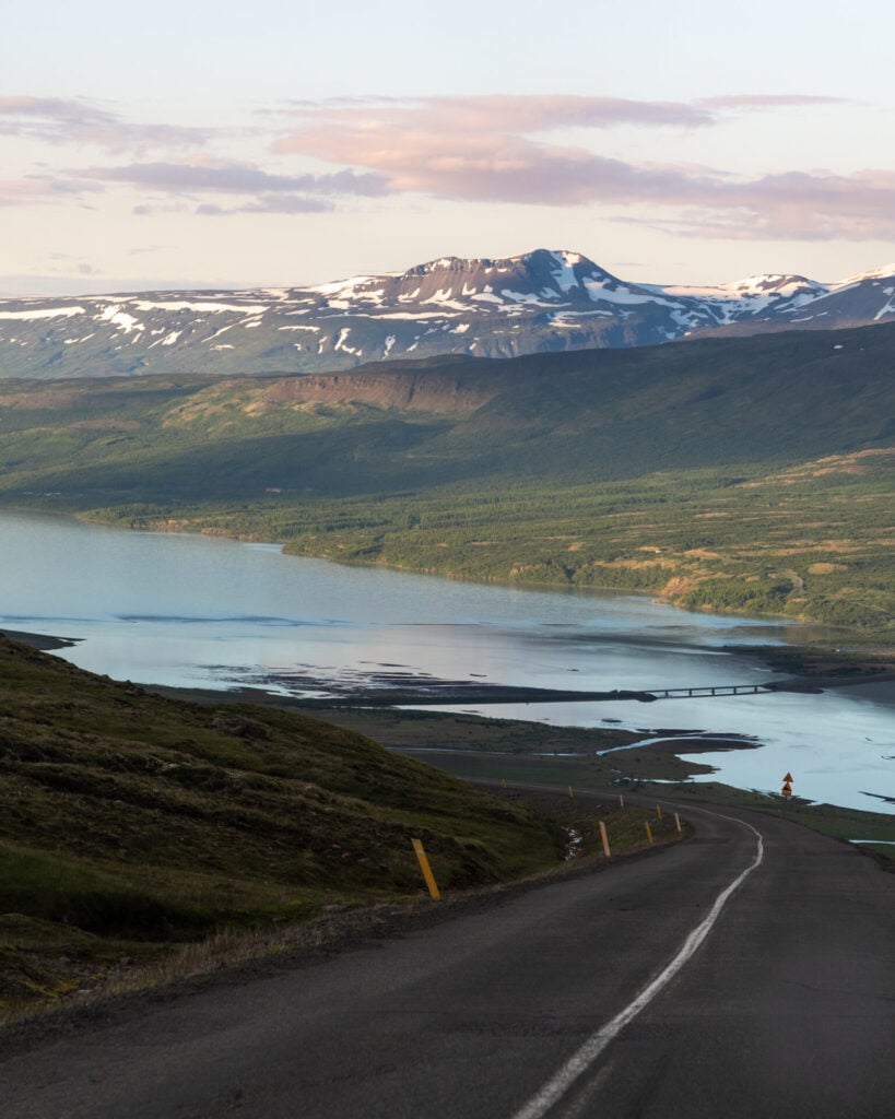
The beautiful and more remote region of Laugarfell sits above Fljótsdalur Valley in the Eastern Highlands, just 30min beyond Hengifoss— but a world away from the tourist crowds. You could theoretically combine these first two regions, but only if you’re prepared to skip some of the recommended activities!
If time allows, I’d highly recommend dedicating an entire day to this part of the Eastern Highlands. The drive is incredibly scenic and you can occupy a good chunk of the afternoon on the Waterfall Circle hike, a fairly unknown trail that visits 5 different waterfalls, before relaxing in the beautiful Laugarfell geothermal springs right at the trailhead.
Scenic drive to Laugarfell (Road 910)
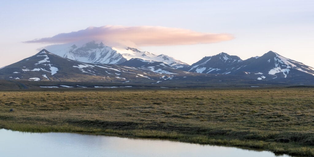
From the southern end of Lagarfljót, Road 910 climbs out of Fljótsdalur Valley and into the remote Eastern Highlands, with the landscape becoming increasingly wild as you drive towards Laugarfell. On a clear day, the enormous snow-capped peak of Mt Snæfell dominates the horizon and we pulled over no fewer than 5 times on this drive to take photos!

Waterfall Circle hike
Trailhead: Laugarfell | Time: 3-4hrs | Stats: 8km (250m gain) | Difficulty: easy
Not to be confused with the popular Skógafoss Waterfall Way hike on the South Coast, the fabulous and wildly underrated Waterfall Circle trail is tucked into this remote corner of East Iceland that sees exceptionally little foot traffic despite the amazing scenery.
Beginning at the Laugarfell accommodation and campsite, you can follow this short, straightforward loop in either direction, but we recommend hiking clockwise towards Stuðlafoss, a near-lookalike to Svartifoss with the same dramatic basalt columns but none of the crowds.
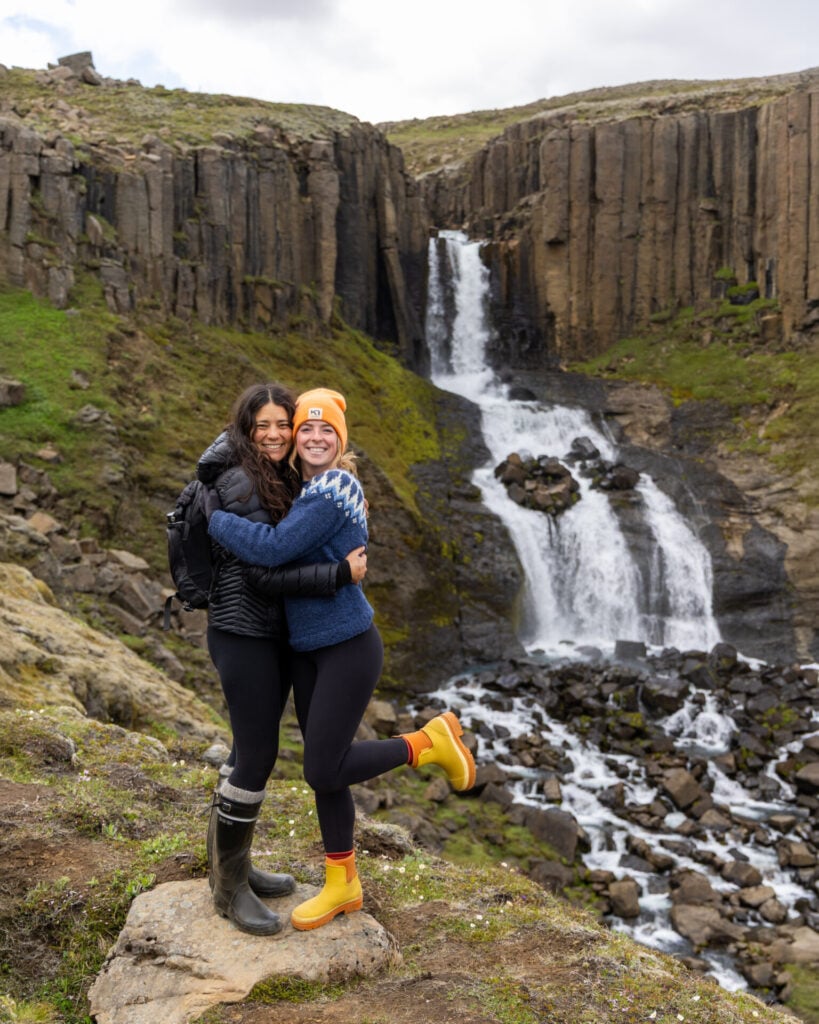
The trail is relatively flat and easy to follow, with boardwalks across some of the wetter sections, making this an excellent option for hikers of truly any experience level.
The route takes in a total of five waterfalls, descending towards a river junction before gradually climbing alongside the gorge carved by the Jökulsá í Fljótsdal river to reach Kirkjufoss. With the snowy peak of Mt Snæfell rising dramatically in the background, this final waterfall is my absolute favourite, but the entire route is excellent— and we didn’t see more than 3 people all day!

Laugarfell hot pools
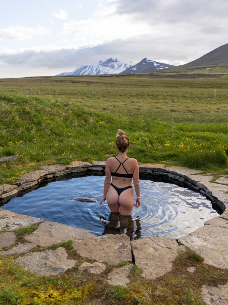
Once back at Laugarfell after the hike, we highly recommend a dip in the two natural hot pools that give the area its name. Built from local stone and fed by natural springs of different temperatures, the pools look out across the untouched landscape towards Mt Snæfell.
Entry is just 2700ISK ($22USD) per person, and the hotel also serves a small menu of delicious Icelandic soups if you fancy a quick bite.
3 | Borgarfjörður Eystri
- From Egilsstaðir: 1hr NE
- Recommended time: full day
Tucked beneath colourful mountains in the northeastern-most fjords, tiny Borgarfjörður Eystri is one of our absolute favourite corners of East Iceland. Combine spectacular hiking to remote Brúnavík Beach with great local food and beer at KHB Brugghús, a relaxing afternoon at Musterið Spa, and a golden-hour visit to the little islet of Hafnarhólmi, where you can get closer to puffins than anywhere else in Iceland, for a fantastic full-day adventure.
All these activities centre around the tiny village of Bakkagerði (so you can theoretically mix and match), but the itinerary I’ve suggested here takes into account opening hours for the spa, brewery, and restaurant, as well as the best time of day for puffin activity. I’d recommend approaching the day in this order!
Scenic drive to Borgarfjörður Eystri (Road 94)
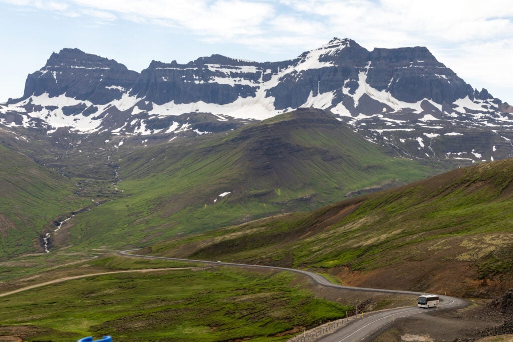
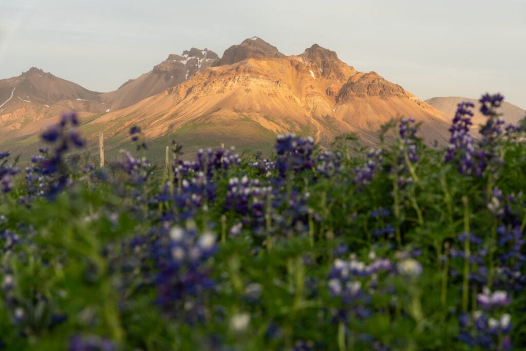
Like nearly every route in the East Fjords, the drive to Borgarfjörður Eystri on Road 94 is absolutely stunning. The road climbs over a mountain pass before descending dramatically towards the coast, with colourful peaks surrounding the tiny village of Bakkagerði below. Expect to make several photo stops before you even arrive!

Brúnavík hike
Trailhead: near Hafnarhólmi | Time: 3-4hrs | Stats: 14km (700m gain) | Difficulty: easy
The hike to Brúnavík beach begins from a small roadside car park just 500m shy of the puffin colony at Hafnarhólmi, taking in the spectacular mountains of Borgarfjörður Eystri along an undemanding trail that leads to a remote, pebbled seafront.
A well-defined trail ascends steadily out of the fjord to a high point between the mountains before descending steeply towards the isolated bay of Brúnavík. Here, a sweeping beach of dark volcanic sand meets the North Atlantic beneath colourful mountains, and you’re almost guaranteed to have it all to yourself!

There are two options for the return journey from Brúnavík: retrace your steps along the same trail (8km, 700m elevation gain) or complete a longer loop beneath the impressive summits of Hofstrandarskarð and Svartfell (14km, 700m elevation gain). We recommend the latter for a more varied day out, although it does involve nearly 2km of road walking at the very end.
Musterið Spa
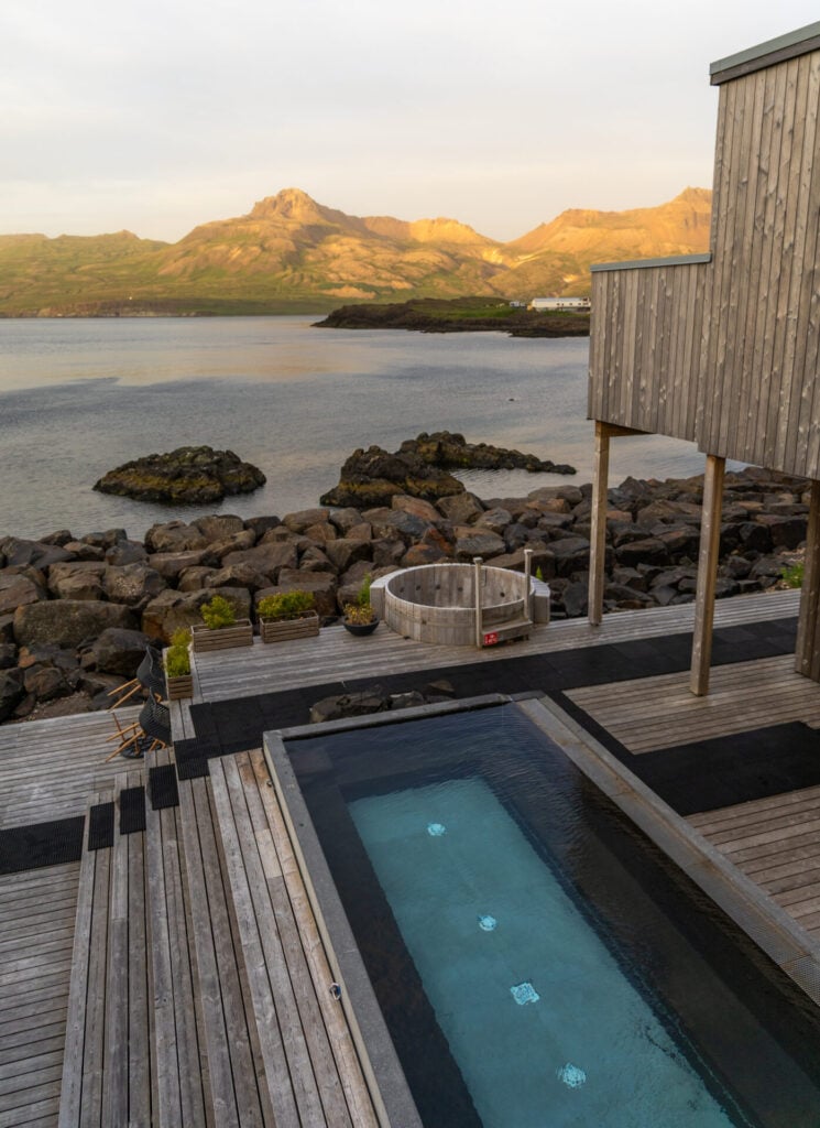
Back in Bakkagerði, Musterið Spa features two geothermal hot pools overlooking the fjord, a cold plunge, sauna facilities, and a full-service bar pouring local KHB beers alongside a rotating cocktail menu.
The spa is attached to the upscale Blábjörg Resort and can only accommodate about 20 people, though it’s usually far quieter than that— particularly after 5pm, when the spa becomes child-free. Entry is 5400ISK ($44USD) for non-guests and we found it to be the perfect post-hike activity!


KHB Brugghús & Frystiklefinn Restaurant
The puffins are the true main event in Borgarfjörður Eystri, but the colony is most active after 9/10pm, so we’d highly recommend grabbing dinner and drinks in town to run the clock down a bit.
KHB Brugghús is a fantastic local brewery and distillery, producing craft beer, gin, and even Landi (traditional Icelandic moonshine) inspired by the local folklore of Borgarfjörður Eystri. We’ve sampled craft beer all over the country, but KHB is my absolute favourite brewery in Iceland— I’d highly recommend their fruited sour (super light, a total crowd-pleaser), but everything is excellent!
Right next door, Frystiklefinn occupies the village’s former freezing house and serves an extensive and incredibly delicious menu of Icelandic-inspired dishes, wood-fired pizza, and inventive Landi cocktails. This is another one of those rare instances where the splurge on eating dinner out is totally worthwhile!
Hafnarhólmi puffin colony
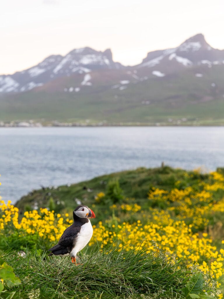
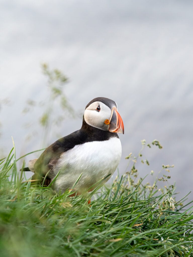
Driving a few kilometres past town (only about 1min beyond parking for the Brúnavík beach hike), Hafnarhólmi is the absolute best place in Iceland to see puffins up close. This small rocky islet is home to a small but thriving puffin colony, and a network of viewing platforms allows you to observe the birds from mere metres away!


Against the backdrop of Borgarfjörður Eystri’s jagged mountains, we captured some of our absolute favourite photos here without even needing to use a telephoto lens!
>>> Read more: Where to see puffins in Iceland: popular spots + hidden gems!
4 | Seyðisfjörður
- From Egilsstaðir: 30min E
- Recommended time: full day (or half day without Mt Bjólfur summit)
Wedged between steep mountains at the end of a long fjord, Seyðisfjörður is the creative heart of East Iceland and one of the most charming small towns in the country. Although the fjord is well established on the tourist track, there are still some fabulous ways to get up and away from the cruise ship crowds if you know where to look!
Among the many things to do in Seyðisfjörður, I’d specifically recommend one of two hiking options high above the fjord: Mt Bjólfur is a longer, rather challenging ascent, while Baugur Bjólfs viewpoint is either an easy 1hr hike OR a 5min walk (if you have 4WD). Continuing downhill, check out popular Gufufoss and the dozens of waterfalls that surround it, and finally the colourful town of Seyðisfjörður itself for a great full day of exploration.
>>> Check the cruise schedule in Seyðisfjörður to avoid the busiest days!
Seyðisfjarðarvegur scenic drive (Road 93)
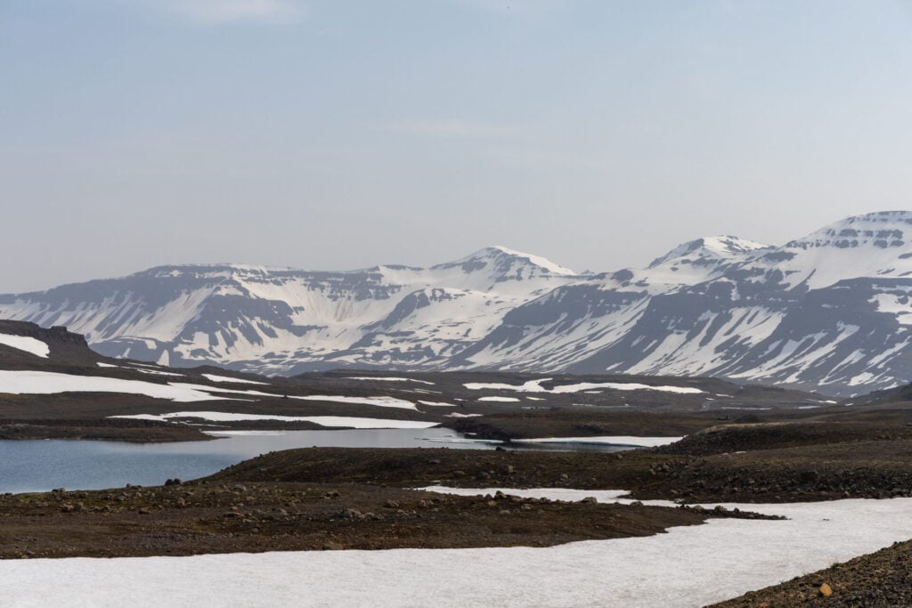
Despite being a relatively short drive from Egilsstaðir, our jaws truly hit the floor as we dropped into the fjord along Road 93 (Seyðisfjarðarvegur). Before driving to Mjóifjörður, we might have described this as the most stunning arrival into any fjord in Iceland— but even so, it’s a close second!

Mt Bjólfur summit hike
Trailhead: Stafdalur Ski Station | Time: 4-6hrs | Stats: 16km (750m gain) | Difficulty: challenging
Presiding over the picturesque town of Seyðisfjörður, the summit of snow-covered Mt Bjólfur offers unparalleled views of the surrounding fjord for those willing and able to tackle the demanding route.
The trail begins at the Stafdalur Ski Station (approximately halfway between Egilsstaðir and Seyðisfjörður), following an intermittently marked trail deep into the valley before connecting with the ridgeline at its lowest point. The most challenging part of the route ascends unmarked and occasionally very steep snowfields to top out at 1,085m, looking dramatically down into the fjord.


We went one step further and turned the standard out-and-back summit excursion into a challenging loop, descending dramatically (and rather perilously) straight off the face of Mt Bjólfur towards the newly minted Baugur Bjólfs viewpoint above Seyðisfjörður.
Our variation is ONLY recommended for very experienced hikers who are confident scrambling on poor-quality rock, descending huge slopes of loose scree, and navigating completely off-trail without cairns or route markers!
Even without our challenging variation, however, this is still a tricky hike. Mt Bjólfur remains snow-covered well into July, requiring confidence traversing steep snow slopes and navigating towards the summit where no obvious trail exists. The reward is an unmatched vantage point of the surrounding mountains and a true adventure!

Baugur Bjólfs viewpoint
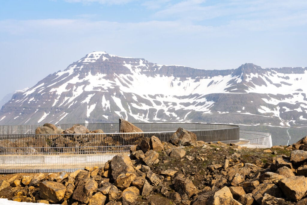
For those not eager to tackle the challenging summit hike described above, you can still enjoy commanding views over Seyðisfjörður from the newly-constructed Baugur Bjólfs viewpoint that hangs over the side of Mt Bjólfur.
Drive just a few minutes past the ski station before turning left onto a dirt road. Those with a 4WD can park just 10min from the viewpoint here, while those with a 2WD will need to park and walk for about 1hr up the 4WD access road.
Views aren’t quite as spectacular as those from the summit, but the time commitment and physical demands are significantly less, so this might be a good alternative depending on your preferences!
Gufufoss
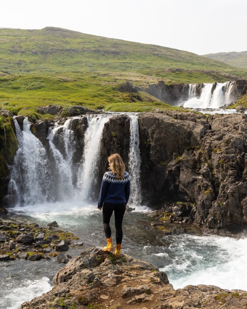
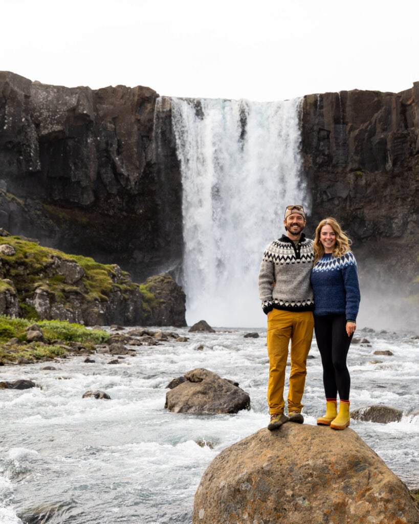
A few minutes farther down Road 93, Gufufoss tumbles over a broad cliff beside the road. There are waterfalls literally everywhere along the descent into Seyðisfjörður, but this is by far the most impressive, and an easy path leads from the car park right to the base of the falls!
Seyðisfjörður
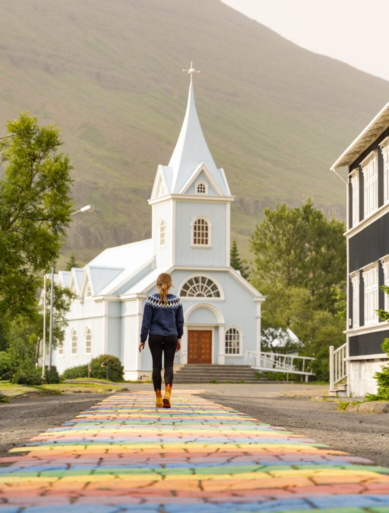
Once you finally reach Seyðisfjörður, spend a little time exploring one of the most vibrant small towns in Iceland. Walk along the famous Rainbow Street leading directly towards the pastel-blue Seyðisfjarðarkirkja, pop into a few small galleries and local cafés, then stroll along the waterfront before driving back over the pass to Egilsstaðir.
5 | Mjóifjörður
- From Egilsstaðir: 30min SE
- Recommended time: half day
Among the most spectacular of our off-the-beaten-path discoveries in East Iceland is Mjóifjörður. Appropriately named “Narrow Fjord”, this 18km-long inlet is one of the most remote inhabited corners of East Iceland, home to a single tiny village, Brekkuþorp, with just 14 residents. When road access closes for 8 months of the year, access is by boat only!
The real reason to visit Mjóifjörður is the wildly scenic drive over the mountains and the spectacular tiered Klifbrekkufossar waterfall, which makes a good turn-around point. You only need half a day for these activities, so it’s easy to combine with another region (ex. Seyðisfjörður, if you aren’t hiking to the summit of Mt Bjólfur), just don’t underestimate how many times you’ll want to stop for photos!
Mjóafjarðarvegur scenic drive (Road 953)
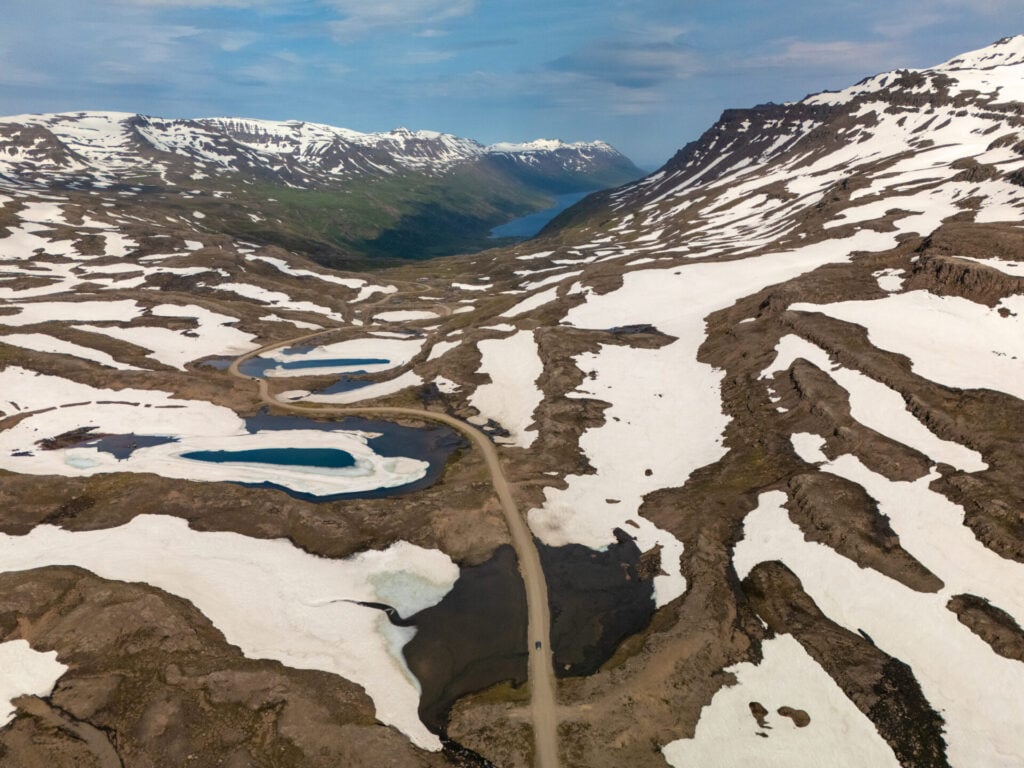
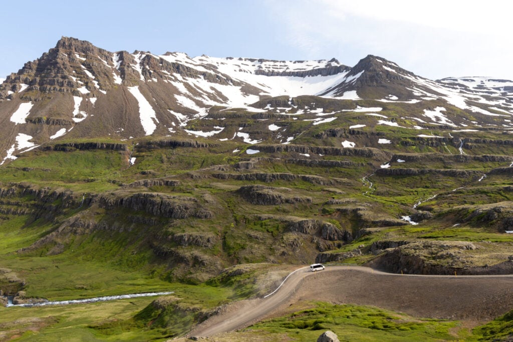
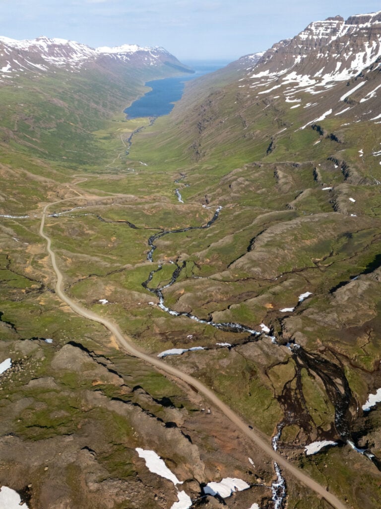
It takes only about 30min to drive straight through from Egilsstaðir to Klifbrekkufossar, but Mjóafjarðarvegur is easily one of the most spectacular drives in East Iceland, and we spent HOURS pulling over to take photos, fly our drone, and scamper out of the car into the incredible landscape!


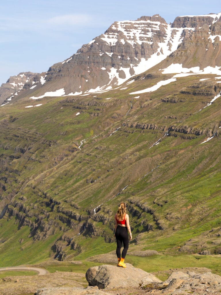
The narrow road climbs into a stark mountain landscape of snow-streaked peaks, tumbling streams, and small alpine lakes, surrounded by the distinctive geometric basalt mountains of the East Fjords, where millions of years of erosion have exposed layered, stair-stepped lava flows.
Klifbrekkufossar
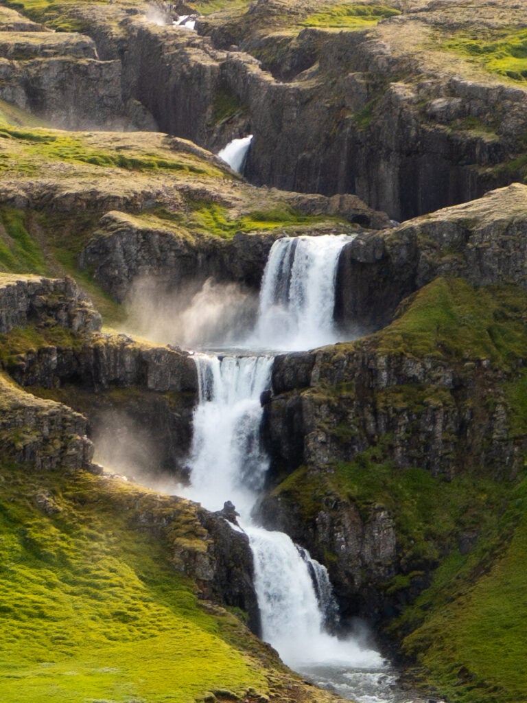
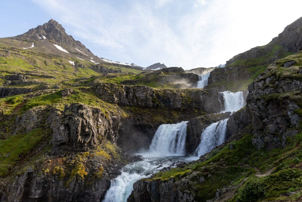
Cascading down the mountainside in a seemingly endless series of tiers, the Klifbrekkufossar waterfalls are the star attraction of Mjóifjörður. You can get an excellent view of the entire waterfall just a short walk from the road, but for a little more adventure, follow a rough trail climbing alongside the right-hand side of the falls.
We scrambled up to the third tier, where you can stand almost eye-level with one of the cascades and look back across the valley. The view isn’t necessarily better from a photography standpoint, but it’s a fun little adventure nonetheless!
6 | Vopnafjörður & Hellisheiði Eystri
- From Egilsstaðir: 1hr NW
- Recommended time: full day
Perhaps even farther off the radar than Mjóifjörður, Hellisheiði Eystri and the wild coastline surrounding Vopnafjörður are truly unlike anywhere else in Iceland.
A spectacular mountain road climbs high above an enormous black-sand coastline, with several quick viewpoints along the way before reaching the trailhead for Þerribjörg Cliffs, a truly wild and unknown hike to distance orange sea cliffs and a perfect pebbled beach. This is a full day of recommendations I can guarantee you won’t find on ANY other Iceland itinerary, and it’s one of our absolute favourites!
Scenic drive over Hellisheiði Eystri (Road 917)
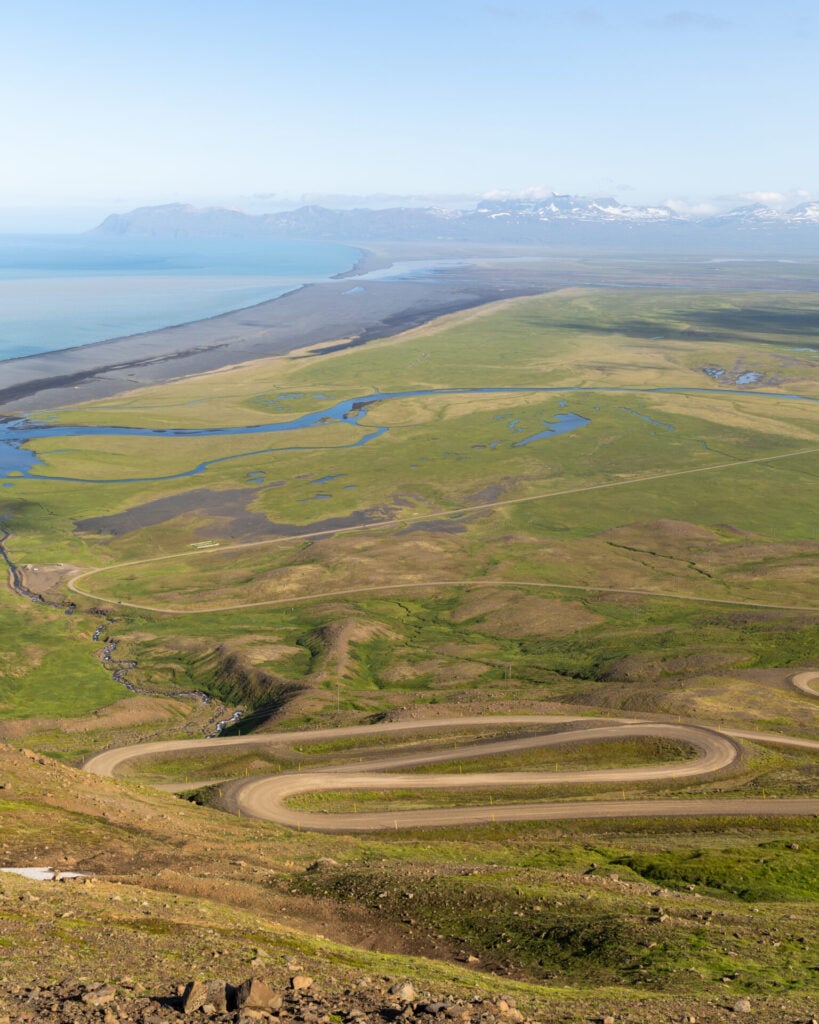
Linking the remote fjord community of Vopnafjörður with Egilsstaðir, Road 917 climbs steeply over the dramatic 665m Hellisheiði Eystri pass, one of the highest mountain roads in Iceland. From the eastern side, the road rises above the vast black sands of Héraðssandur on a series of dramatic hair-pin turns, with mountains as far as Borgarfjörður Eystri visible in the distance.
The road is steep and narrow, but accessible to 2WD vehicles during the summer months. We highly recommend continuing over the pass towards Vopnafjörður after the Þerribjörg hike, extending the adventure for even more epic scenery (more info below).
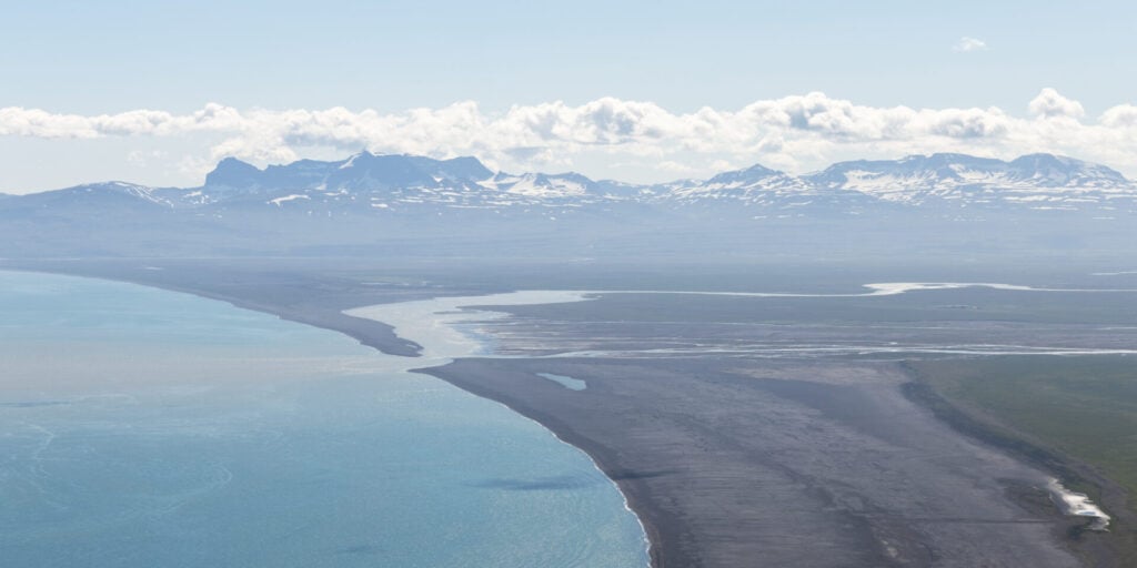
Héraðssandur Útsýnisstaður (black sand beach)
Shortly before reaching the turn-off for Þerribjörg Cliffs, stop at this roadside viewpoint for a spectacular look back over the switchbacks of Road 917 twisting down the mountainside towards the black sand beach, Héraðssandur. It’s only a quick photo stop, but one of the best perspectives on this dramatic road!
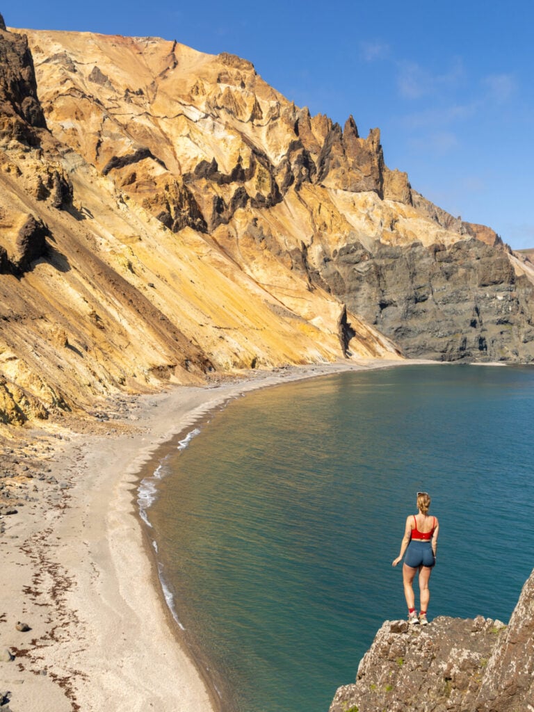
Þerribjörg Cliffs hike
Trailhead: Útsýnisstaður (2WD) or closer here (4WD) | Time: 4-5hrs | Stats: 8km (800m gain) | Difficulty: challenging
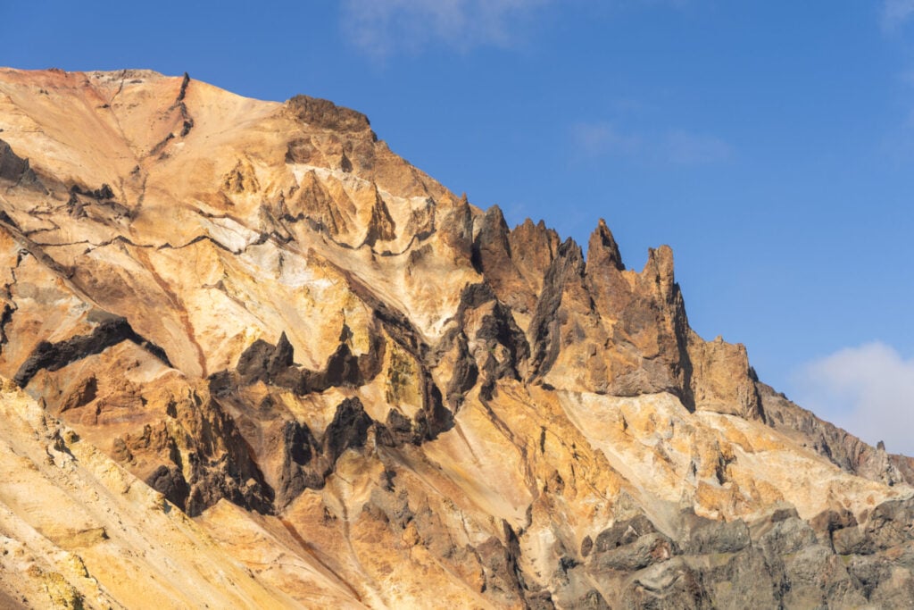
The vibrant orange Þerribjörg Cliffs (sometimes called Ker Cliffs) are a spectacular hidden gem of East Iceland and easily one of the most unique places we’ve seen anywhere in the country!
While a short walk from the Landsendi trailhead provides a distant glimpse of these vibrant sea cliffs, the real adventure lies in hiking all the way down to the secluded beach at their base. We discovered this route thanks to a very short description on the local tourism website and can confidently say that extremely few non-locals have EVER ventured this far!


Those with a 4WD can park several kilometres closer to the trail along a rough, rocky road, but even with a 2WD you can still park just off Road 917 and make your way towards the cliffs (allows 1-2hrs extra).
From the 4WD trailhead, the route is steep, rugged, and occasionally loose underfoot, requiring confidence on difficult terrain and some basic navigation. Fixed ropes have been installed on the steepest sections, and these are super helpful for pseudo-abseiling with your hands and then hauling yourself back up on the return.
All said, it’s a fairly challenging hike, but the reward is complete solitude in a spectacular coastal landscape truly unlike anywhere else in Iceland. Passing through a series of almost Mediterranean coves before emerging onto the pristine pebble beach below Þerribjörg, allow plenty of time for a picnic lunch and a swim in the chilly North Atlantic before tackling the steep uphill return.
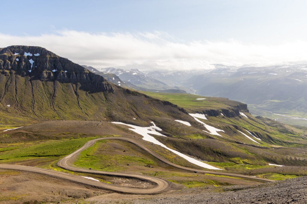
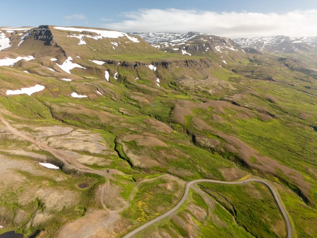
Scenic drive towards Vopnafjörður (Road 917)
After a spectacular hike out to Þerribjörg Cliffs, continue driving Road 917 over Hellisheiði Eystri towards Vopnafjörður. This detour doubles the return time to Egilsstaðir (from 1hr to a little over 2hrs), but it’s absolutely worth it to experience the other side of the pass, where the road plunges dramatically through the mountains towards the coast and Vopnafjörður below.


Alternatively, plan this excursion for your final day in East Iceland and continue north towards Mývatn or Akureyri afterwards, rather than doubling back to Egilsstaðir. This makes Road 917 a spectacularly scenic alternative to simply heading north on the Ring Road (and it’s exactly what we did on our last day in the East)!
7 | Jökuldalur
- From Egilsstaðir: 1hr W
- Recommend time: half day (best added to arrival or departure day)
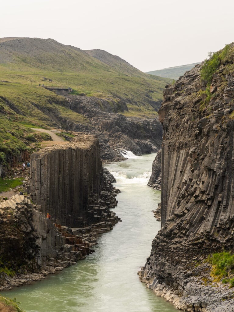
The final region covered in this East Iceland guide is the somewhat distant (but very well-known) Jökuldalur Valley, home to the spectacular Stuðlagil Canyon about an hour west of Egilsstaðir. Combining this iconic basalt canyon with the dramatic drop of Rjúkandi waterfall makes for an easy half-day excursion, but you might also consider visiting on your way to/from North Iceland for maximum efficiency.
Rjúkandifoss
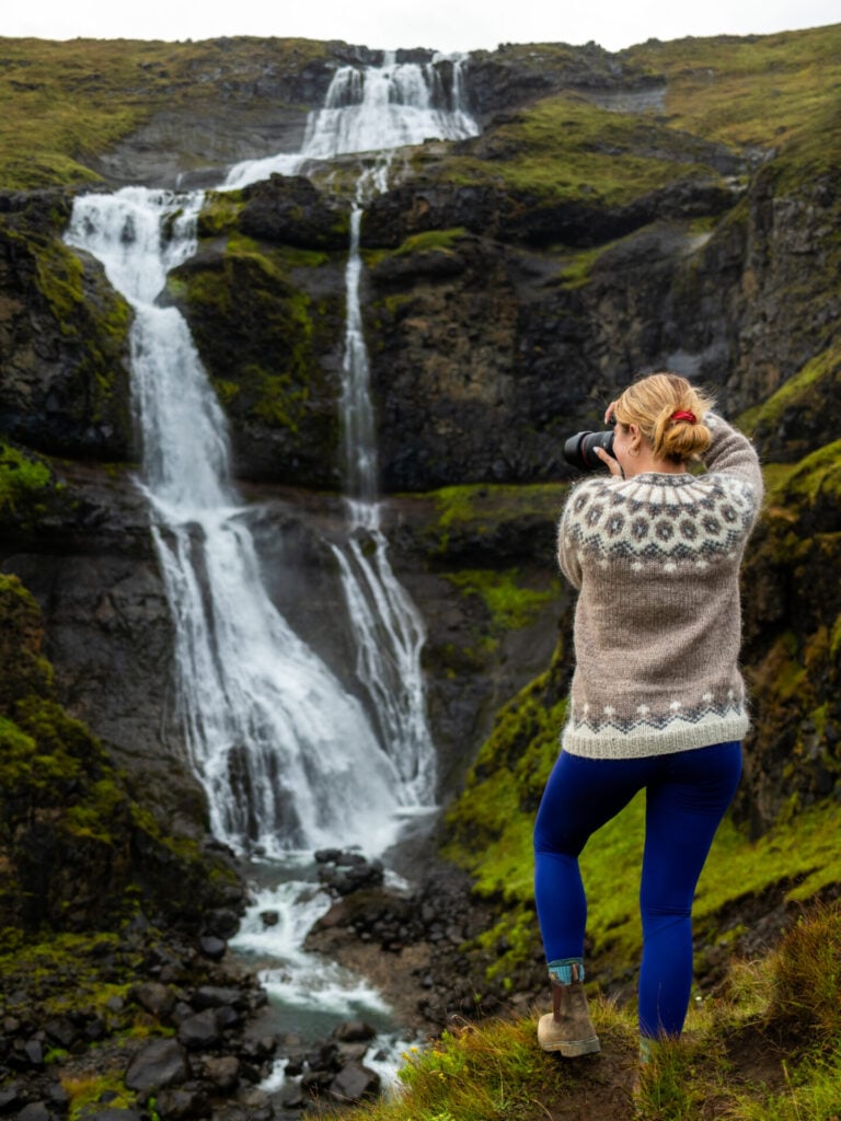
Immediately before turning off towards Stuðlagil Canyon, Rjúkandifoss is visible tumbling down the mountainside almost all the way to the Ring Road. From the small roadside car park, a short path climbs to an excellent viewpoint of the multi-tiered waterfall, while a steeper trail continues farther up the right-hand side for another perspective.
Visit before or after the canyon, depending on lighting (Stuðlagil is best in the hours surrounding midday, when sunlight reaches deeper into the narrow gorge).
Stuðlagil Canyon
Trailhead: Stuðlagil East car park | Time: 2-3hrs | Stats: 6km (100m gain) | Difficulty: easy
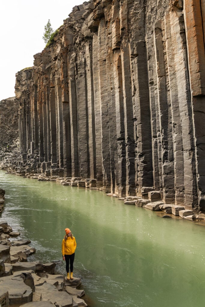
Possibly the most famous landmark in East Iceland, Stuðlagil Canyon is a narrow gorge lined with dramatically warped basalt columns, cut by the vibrant turquoise waters of the glacial Jökulsá á Dal river (trending towards milky green/brown after heavy rainfall or the dam’s seasonal opening in early autumn).
Stuðlagil was only “discovered” in 2009 when the construction of a nearby hydroelectric plant lowered the river level enough to reveal enormous basalt formations along the canyon walls, but it’s absolutely surged in popularity the last few years, so expect to find large crowds!
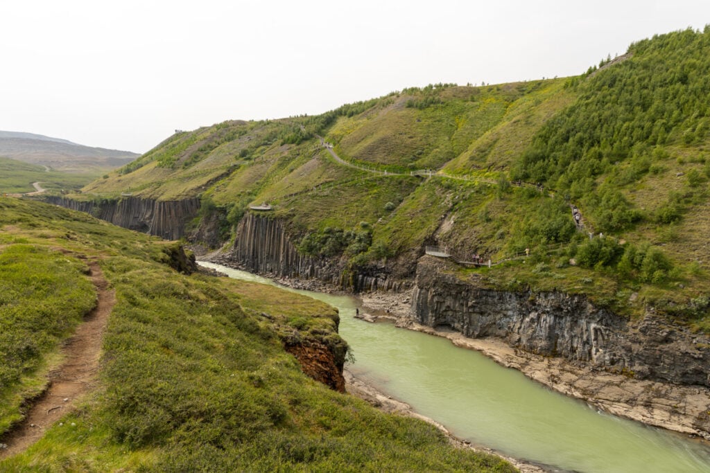
In years past, the east and west side of the canyon offered vastly different experiences, but with recent improvements to infrastructure, both sides now offer access directly inside the canyon and are suitable for 2WD vehicles.
The perspective is obviously a little different from each side, so it’s worth visiting both if you have time, but our favourite experience is still from the East, where you can scramble onto the basalt columns themselves!


Drive to the eastern parking area near Stuðlafoss (newly 2WD-accessible, despite what older sources suggest), then follow the wide, easy trail for approximately 2-2.5km towards Stuðlagil.
You’ll begin getting views into the gorge after about 10min, but continue to the main canyon, where you can descend carefully amongst the basalt columns for the iconic water-level perspective. Allow about 2-3hrs to visit the east side of the canyon and 4-5hrs total to fully explore both sides, with the best lighting on either side of midday!
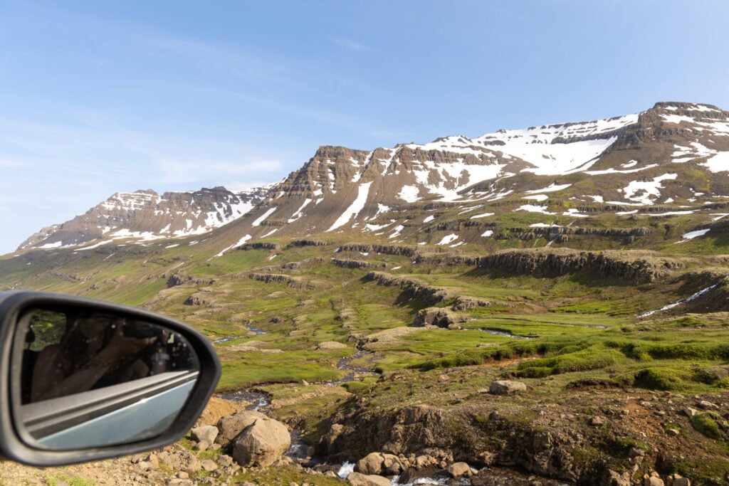
East Iceland trip logistics
Here’s a quick overview of getting to Egilsstaðir from other parts of Iceland, renting a car locally vs elsewhere, and our recommended hotels, hostels, and campgrounds for exploring the East Fjords:
Getting to East Iceland
Driving to Egilsstaðir
If you’re visiting East Iceland as part of a larger Iceland road trip, Egilsstaðir is approximately:
- 3hrs from Höfn (Southeast Iceland)— I highly recommend the scenic route over Öxi Pass (Road 939); more info below!
- 3hrs from Akureyri (North Iceland)
- 2hrs from Mývatn (North Iceland)
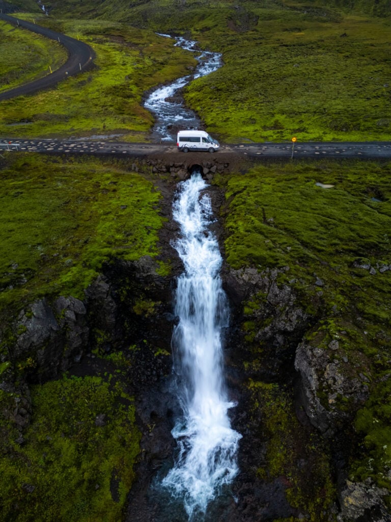
Scenic drive: Öxi Pass (Road 939)
Whether you’re travelling north into Egilsstaðir at the start of your trip or heading south at the end, the detour off the Ring Road over Öxi Pass (Road 939) is one of the most jaw-dropping scenic routes in all of Iceland. We’ve driven this route in both directions and it’s spectacular either way, but for those driving south, the views truly unfurl in front of you all the way down to Berufjörður.


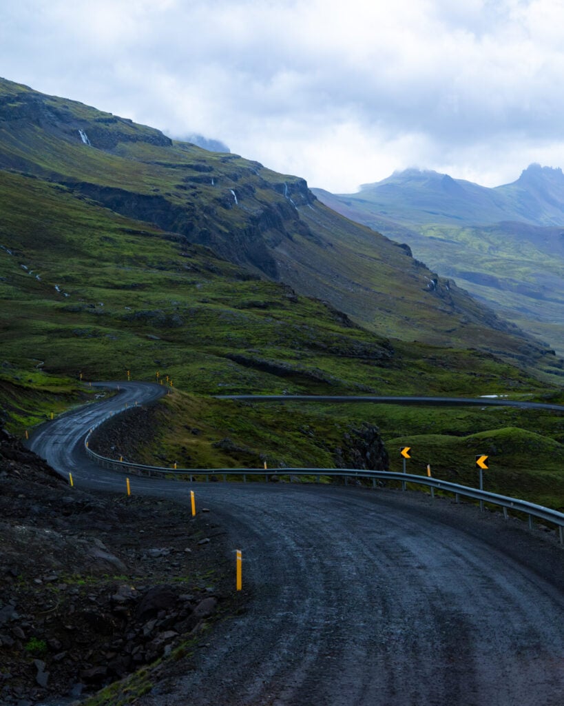
The road is rough, heavily potholed in sections, and best tackled with a 4WD (though technically not a requirement), but the scenery is simply extraordinary: narrow gravel roads twisting through vivid green mountains, waterfalls pouring down nearly every cliff face, and glacial rivers carving deep canyons through black volcanic rock. It honestly feels like a journey through some ancient, mystical land.
Although the drive itself only takes about an hour without stops, allow at least 2hrs to properly enjoy the route. There are seemingly hundreds of waterfalls, many unnamed and completely hidden from the usual tourist trail, so it’s worth going slow and stopping often!
Flying to Egilsstaðir
For a shorter Iceland trip or one specifically focused on the East Fjords, you can also take a short flight from Reykjavík Domestic Airport to Egilsstaðir and rent a car directly from the airport.
Several major rental companies operate from Egilsstaðir Airport, including Hertz, Avis, and Budget, making it incredibly easy to plan an East Iceland trip without the long drive from Keflavík.
>>> Check the best car rental prices from Egilsstaðir Airport using DiscoverCars!
Flying to Akureyri
Depending on flight and car-rental prices, it may occasionally make more sense to fly from Reykjavík Domestic Airport to Akureyri, rent your car there, and then drive the incredibly easy 3hrs to Egilsstaðir entirely on the Ring Road.
Where to stay in East Iceland
For the itinerary outlined in this guide, we highly recommend staying in or near Egilsstaðir. As the largest town in East Iceland and the central hub from which all roads radiate towards the surrounding fjords, it’s by far the most convenient base for exploring everything the region has to offer.
We’ve stayed at several guesthouses, hostels, and campgrounds around Egilsstaðir, so these are our top recommendations:
Eyjólfsstadir Guesthouse
Eyjólfsstadir Guesthouse is the best place we’ve stayed near Egilsstaðir, a charming and incredibly quiet local guesthouse offering comfortable private rooms with clean shared bathrooms and a lovely communal kitchen/dining area for preparing your own meals.
It strikes the perfect balance between the affordability of a hostel and the cozy atmosphere of a local guesthouse. Rooms start around $150/night for 2 people, breakfast is included, and the property is tucked into a peaceful rural setting just 10min south of Egilsstaðir proper. We found it to be an incredibly comfortable base for an extended stay in the East Fjords and would return in a heartbeat!
Eiðar Hostel
Eiðar Hostel wouldn’t ordinarily make the cut for our recommended accommodation, BUT it has a huge number of rooms, so if you’re booking anything last-minute around Egilsstaðir, it can be a decent fallback when seemingly everything else is sold out or exorbitantly expensive. This is exactly how we found ourselves staying there on a last-minute trip extension.
Private rooms (~$200/night) are smaller and more basic than Eyjólfsstaðir, also with shared bathrooms and a fully equipped communal kitchen. We found it considerably noisier thanks to the large tour groups passing through, but it works perfectly well in a pinch and the property is only about 10min north of Egilsstaðir.
Campgrounds near Egilsstaðir
If you’re travelling by campervan or tent, there are also several conveniently located campgrounds throughout the region:
- Atlavík: beautifully situated amongst the trees of Hallormsstaðaskógur on the shores of Lagarfljót, the facilities are relatively basic, but this is the most beautiful camping location that we’ve found in the region
- Mjóanes: not the most scenic campground on this list, but more centrally located than the lakeside campsite at Atlavík
- Camp Egilsstaðir: the least exciting but most practical camping option is located right in the centre of Egilsstaðir within walking distance of supermarkets and restaurants
- Laugarfell: a spectacularly remote option in the Eastern Highlands, right at the trailhead for the Waterfall Circle and beside the natural hot pools (see itinerary #2 above)
- Álfaborg (Borgarfjörður Eystri): conveniently located right in Bakkagerði, just 5min from the puffin colony at Hafnarhólmi
- Seyðisfjörður: centrally located in Seyðisfjörður within easy walking distance of restaurants, cafés, and the waterfront
- Stuðlagil Canyon Camping: located just 200m from Stuðlagil, we’d planned to stay here for an early morning visit to the canyon but ended up elsewhere due to weather; I can’t comment on the facilities, but it’s a super convenient location for seeing the canyon before crowds arrive!
**Note that nearly all campsites in Iceland operate seasonally, so don’t be alarmed if Google shows “closed”— they’ll be open come summertime!


Read all of my Iceland itineraries & travel guides
- 20 best hikes in Iceland (after MANY months of exploration!)
- Where to see puffins in Iceland: popular spots + hidden gems
- 10-day Iceland 4WD campervan itinerary: best of the Highlands & F-roads
- Ultimate Iceland Ring Road itinerary
- The ultimate East Fjords travel guide: best things to do in East Iceland
- 5-day Westfjords + Snæfellsnes road trip itinerary
- Laugavegur + Fimmvörðuháls hiking guide: Iceland’s best 5-day hike
- Laugavegur hike packing list
