
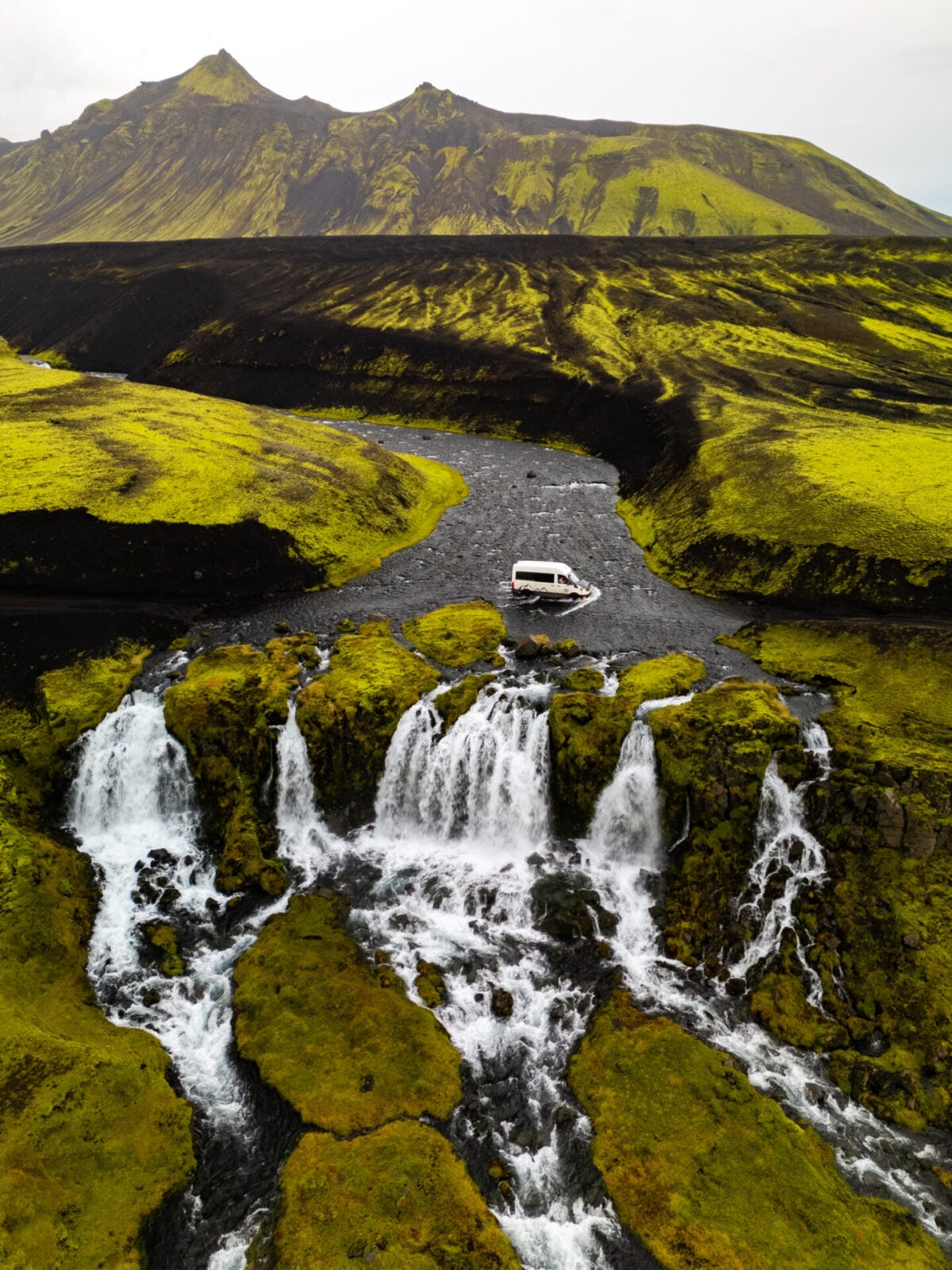
12-day Iceland 4WD campervan itinerary: best of the Highlands & F-roads
Most travellers focus on the classic Ring Road, but so many of Iceland’s most spectacular destinations are hidden beyond the main highway: deep in the colourful rhyolite mountains and volcanic deserts of the Highlands, tucked into remote fjords, and scattered along empty hiking trails that see almost no visitors. With a 4WD, it’s possible to experience a totally different side of this bucket-list destination!
We’ve spent MONTHS exploring Iceland across half a dozen trips, including extensive road trips through its wildest and most remote corners, in order to build a series of itineraries and travel guides packed with unique recommendations you won’t find on other travel blogs.
This 10-day Iceland 4WD itinerary links together dramatic Highland landscapes, epic hiking trails, scenic campsites, geothermal areas, hidden waterfalls, and the most spectacular F-roads in the entire country. Alongside a detailed day-by-day route, this guide also covers essential logistics like F-road conditions, river crossing tips, vehicle recommendations, and campsites to help you plan the ultimate 4WD road trip across Iceland!
>>> Read all of our detailed Iceland road trip itineraries & travel guides!


About this Iceland road trip
Even since my first visit in 2016, Iceland has totally blown up on the international tourism scene, with millions of annual visitors crowding popular sites along the South Coast and the Golden Circle to the point that they almost feel “ruined”. But venture deep into Iceland’s remote interior and the experience is vastly different: solitude in truly jaw-dropping landscapes that remain largely insulated from over-tourism thanks to their relative inaccessibility.
This itinerary leaves the Ring Road behind to maximise time in exactly these kinds of wild, untouched places. Explore the remote Icelandic Highlands, tackle rugged F-roads, hike through otherworldly landscapes, and venture to untouched corners of a country that still has a few secrets tucked away for those willing to get off the beaten path.
Beginning and ending at Keflavík International Airport, cover more than 3,000km over 10 full days (plus arrival and departure days), with an average of 3-5hrs of daily driving. Although adventurous, this is still a relatively approachable 4WD itinerary by Icelandic standards (suitable for confident drivers keen to tackle their first river crossing), and it’s one of the best road trips we’ve EVER done!
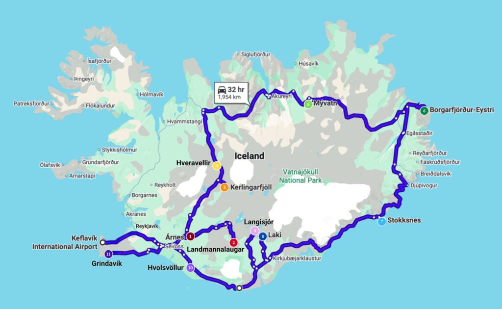
Highlights of the route include:
- Otherworldly scenery in Landmannalaugar & Fjallabak Nature Reserve
- Vibrant geothermal Kerlingarfjöll & Hveravellir in the Central Highlands
- Hidden waterfalls & hot springs of Northern Iceland
- Off-the-beaten-path hikes & adorable puffins in the remote East Fjords
- Stokksnes, Fjallsárlón & carefully selected highlights of the South Coast
- Langisjór, Laki & an epic waterfall crossing in the remote Southern Highlands
- Hidden gems on the Reykjanes Peninsula
>>> Skip the logistics and take me straight to the itinerary!
Iceland road trip logistics
When to drive this Iceland 4WD itinerary
This itinerary is specifically designed for Iceland’s short Highland season, when the country’s interior mountain roads (F-roads) are open and river crossings are manageable. Generally, the best time to tackle this route is from mid-July through late August, when conditions are the most stable and daylight hours are still extremely long.
We’ve personally driven this full itinerary in early-September and repeated several sections from late-June to early-July on different trips, so each period has different pros and cons:
- Late June: fewer crowds and lingering snow in the Highlands, but some F-roads may still be closed and rivers can run high with snowmelt
- July & August: the most reliable weather and road access, but also the most popular tourist season (so you’ll have more campsite competition and possibly less seclusion)
- Early September: fewest tourists and possible northern lights (we’ve seen them several times in September!), but colder weather, stronger storms, and less predictable river conditions
Suitable 4WD vehicles for this itinerary
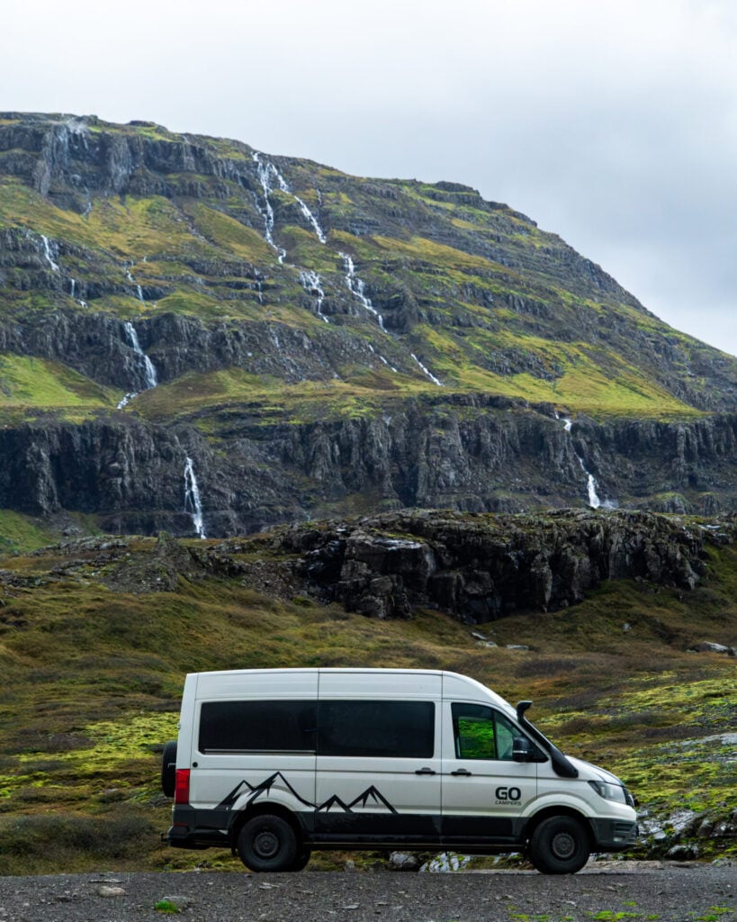
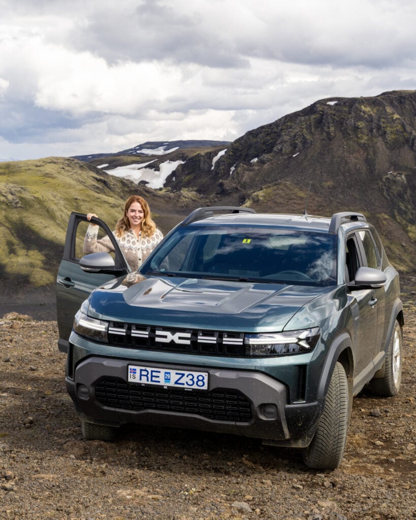
In most conditions, this itinerary will be manageable in 4WD vehicles like the Dacia Duster (the most popular rental vehicle in the country), Toyota Land Cruiser, and high-clearance 4WD campervans.
>>> Explore the best car rental prices in Iceland on DiscoverCars!
Renting a 4WD campervan
Although it’s possible to complete this itinerary in most 4WD vehicles (+ a tent), we highly recommend renting a 4WD campervan with a bed, indoor cooking space, and comfortable seating. Even in the milder summer months when Iceland’s F-roads are passable, the weather is highly unpredictable, and we were ONLY able to move through this entire itinerary without significant weather disruption thanks to our campervan!
Whenever it started to rain, we’d retreat inside, cook lunch, and then drive to the next destination to wait out the storm. This kind of flexibility is what MADE our road trip, and thankfully, renting a campervan in Iceland can be quite reasonable— basic options start at just $80/day, which is equivalent to the cost of hiring an SUV!
Rental insurance in Iceland
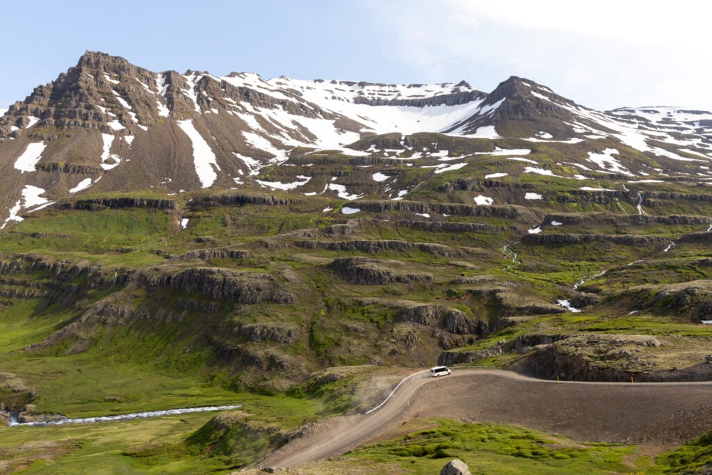
Iceland is one of the FEW places where we’d strongly recommend paying for comprehensive rental insurance! Between flying gravel, violent wind gusts, ash/sand storms, rough F-roads, and river crossings, conditions here can be especially hard on vehicles— and repair costs are absolutely brutal.
At a minimum, we’d recommend:
- gravel protection
- sand & ash protection
- wind/door damage coverage
- tyre protection
Most importantly: river crossings are usually NOT covered by rental insurance, even with the highest-tier package. If you flood the engine during a crossing, you may be fully liable for the damage, so we strongly recommend a high-clearance 4WD with a snorkel!
Our experience with Go Campers
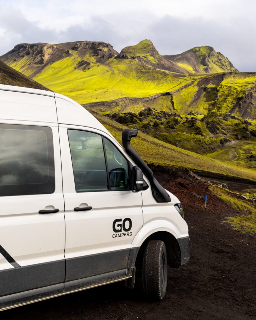
To tackle higher river levels in early September (and provide more living space in case we ran into poor weather), we opted for a van with extra-high clearance and a snorkel, plus a spacious and well-organised interior. Built on a VW Crafter 4WD, our Go 4×4 LUX Camper was an absolute beast that handled every F-road and river crossing we threw at it!
With the platinum insurance policy and roadside assistance, we paid a whopping $500/day for our camper— but honestly, it was entirely worth it for peace of mind, and we’d do it all over again. This is not sponsored, we just loved that van!
Camping in Iceland
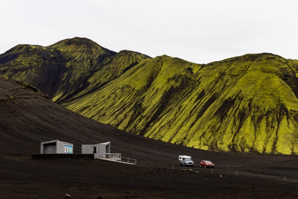
Even in a fully self-contained campervan, wild camping is not permitted in Iceland, so you’ll need to overnight in designated campsites. Luckily, Iceland has hundreds of campsites spread across the country, including some wonderfully remote locations in the Highlands!
Campsite facilities
Amenities vary widely, but all campsites have toilets, most have showers, and some offer communal kitchens, laundry, WiFi, or indoor seating areas. If you’re travelling in an SUV or small camper that doesn’t have a kitchen, it’s worth checking facilities in advance and planning your overnight stops around campsites with cooking areas.
If you’re travelling in a self-contained campervan, facilities barely matter! We’ve stayed at (and recommended throughout this itinerary) some very basic but truly AMAZING campsites where the spectacular location more than makes up for limited amenities. A comfortable camper gives you far more freedom to prioritise these remote locations, which are a huge part of the experience!
Booking campsites in Iceland
Some campsites can be booked through Parka or directly online, while others operate on a turn-up-and-pay system. In peak summer, it might be worth booking the more popular or limited-capacity sites in advance, but we made absolutely no bookings when we drove this route in September and never had any issues. One of the great things about a campervan road trip is the ability to be flexible around weather!
>>> We regularly referenced this map of Icelandic campsites provided on the Go Campers website to make changes to our planned itinerary.
Fuel, groceries & supplies
Once you leave the Ring Road, services become extremely limited. Fuel stations can be separated by several hundred kilometres in the Highlands, and some areas have absolutely no food, fuel, or services whatsoever. I’ve done my best to call out last-chance fuel stops within this itinerary, but as a general rule:
- refill your fuel tank whenever you can (especially before heading into the Highlands)
- stock up on groceries in larger towns like Selfoss, Akureyri, Egilsstaðir, and Höfn
- carry extra snacks, water, and emergency supplies
Driving in Iceland
Types of Icelandic roads
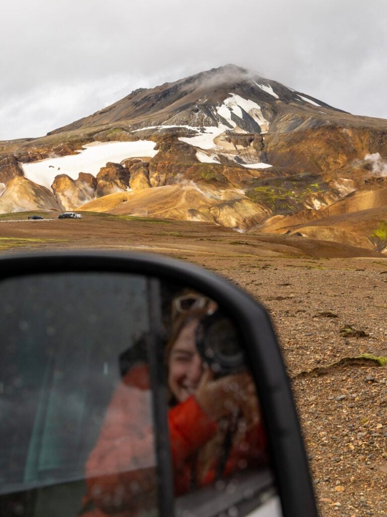
Road quality in Iceland varies enormously, and understanding the country’s road system will help you quickly assess what kind of driving conditions to expect. As a general rule, the larger the road number, the rougher the driving is likely to be!
Here’s a useful cheat code for understanding Icelandic roads:
- Road 1 / Ring Road: the main highway circling Iceland; almost entirely paved and generally in excellent condition for all vehicles
- Double-digit roads (ex. 26): larger regional roads connecting the Ring Road to smaller towns or nearby regions; often paved or easy driving on gravel
- Triple-digit roads (ex. 208): smaller access roads that are usually dirt/gravel, rougher, narrower, and slower to drive; a 4WD with decent clearance is very useful, especially since these often turn into F-roads
- F-roads (ex. F208): rough mountain roads through the Highlands that legally require a 4WD vehicle; these are only open in summer and frequently involve rocky terrain, steep sections, and unbridged river crossings
About Iceland’s F-roads
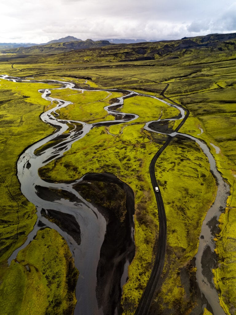
A network of rough, unpaved roads provide access to Iceland’s remote interior, and the most rugged among these are specifically classified as “F-roads”. Although the quality of these roads can vary, they are minimally maintained, often include unbridged river crossings, and are ONLY accessible to 4WD vehicles by law!
Depending on river levels and current weather conditions, F-roads are only open during a narrow window from late June through early September. This is the ONLY time you can drive this full itinerary!
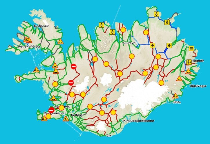
>>> Even during this season, you should regularly check the status of Iceland’s F-roads, seasonal closures, and relevant safety information on road.is!
How challenging is this 4WD itinerary?
This itinerary focuses primarily on sites that are only accessible with a 4WD and features several dozen river crossings ranging from small to medium— but it’s still a “beginner-friendly” 4WD itinerary by Icelandic standards!
With adequate research (including careful reading of this guide), frequent assessment of current road conditions on road.is, and general familiarisation with river crossing techniques, most confident drivers will find this itinerary well within their wheelhouse!
Tips for crossing a river in Iceland
River crossings are one of the most challenging (and anxiety-inducing) elements of a 4WD road trip in Iceland, and it’s certainly the one that gave us the most pause. Prior to our first 4WD campervan road trip, James had never done a single river crossing, but after watching countless videos, chatting to locals, and exercising his usual brand of extreme caution, he’s now successfully crossed even medium/large rivers like a pro!
How to approach a river crossing in Iceland:
- Research the route in advance so you know whether it’s realistic in your vehicle (not all 4WD vehicles have the same clearance), how challenging it is (some rivers are NOT beginner-friendly in any vehicle), and alternate routes if you’re not able to pass safely.
- When you arrive to the river crossing, get out of your vehicle and take time to visually inspect the crossing! Identify the best entry and exit points, as well as obstacles to avoid in the river.
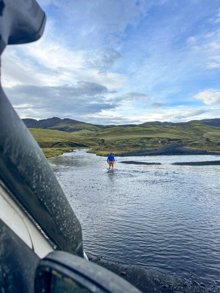
- In some instances, it might even be worth rolling up your pants and fording across river to assess the best line— just be careful not to wade into a deep, fast-moving river and put yourself into a dangerous situation. As a general rule of thumb, the water level should be less than half the height of your wheel for a safe crossing, and you can measure this against your leg.
- If you’re still unsure about the crossing, consider waiting for another vehicle to arrive. It can sometimes be helpful to follow an experienced driver across the river, particularly one who knows the safest line and may be able to assist if you get into trouble.
- But ultimately, be prepared to turn around and drive away! There will be some river crossings that simply aren’t safe in your vehicle and/or with your current level of experience, and sometimes it’s not possible to make that call until you’re looking at the river yourself. Try to schedule any questionable river crossings earlier in the day so you have plenty of time to back-track, if needed.
**Under NO circumstances should you attempt driving through the Krossá river without a super jeep and significant prior experience— we steer well clear of it on this itinerary for a reason! If you want to explore Þórsmörk, it’s so much easier just to take the Highland Bus and save yourself the stress and danger of attempting Iceland’s most notorious river crossing.
*Detailed 10-day Iceland 4WD road trip
Day 1: Keflavík Airport to Árnes (+ arrival logistics)
- Drive time: 2hrs
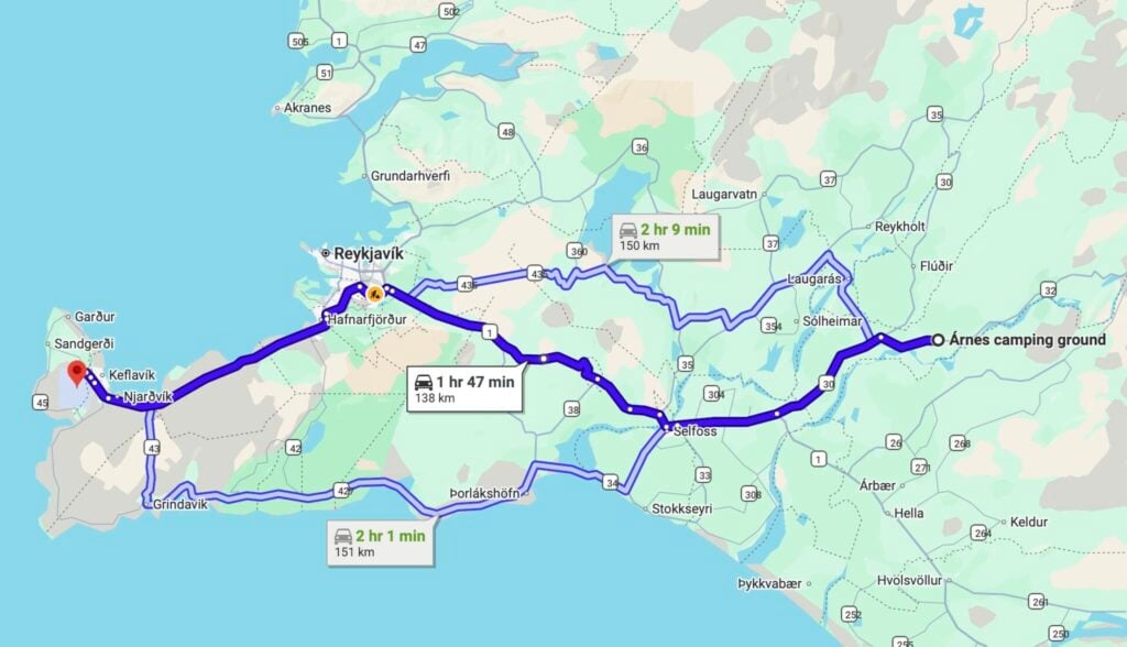
- Roads: 41 > 1 > 30 > 32
- Campsite: Árnes
The first day of this Iceland 4WD itinerary is mostly about logistics and setting yourself up for an epic full day in the Highlands tomorrow!
After landing at Keflavík International Airport and picking up your campervan, we’d recommend doing a major grocery shop at Krónan. This is our favourite supermarket chain in Iceland for both prices and selection, and the location in Keflavík is massive and typically uncrowded. Next door, the BYKO also sells coolers/eskies if your vehicle doesn’t have a fridge.
Once fully stocked, drive a little less than 2hrs to reach Árnes Campground, a quiet and convenient base for tomorrow’s drive into the Highlands. Depending on your arrival time, this is a good opportunity to organise your campervan, cook dinner, and get an early night before the real adventure begins!
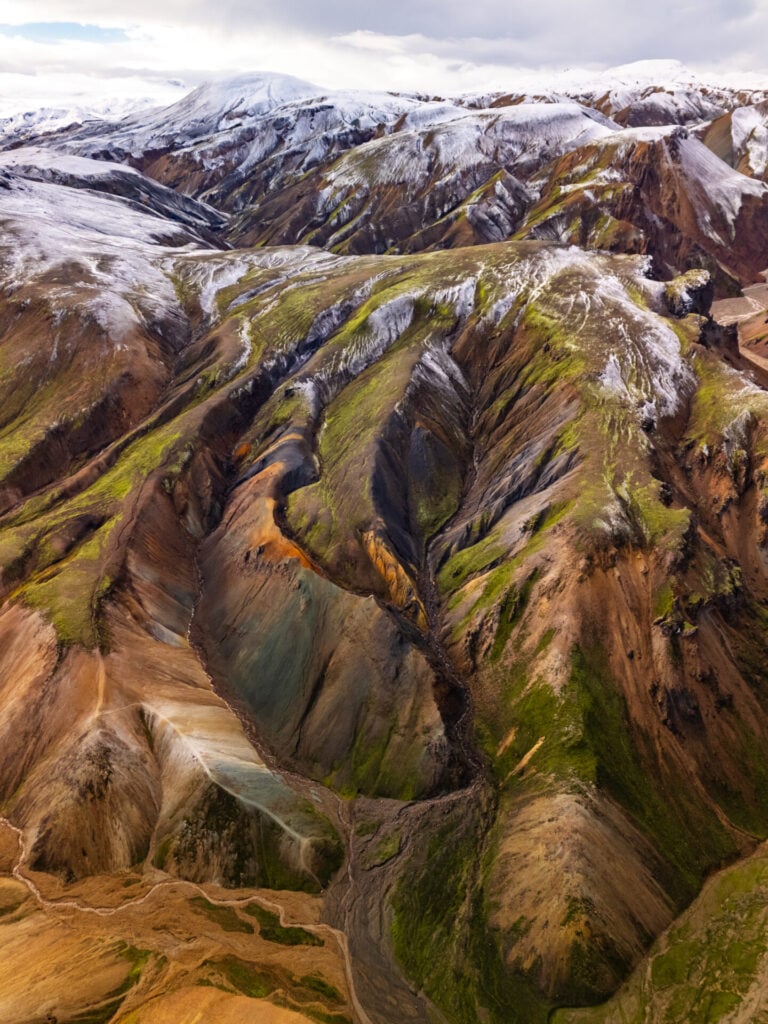
Day 2: Scenic route to Landmannalaugar (Southern Highlands)
- Drive time: 3.5hrs
- Roads: 32 > (327) > (332) > 26 > 208 > F224
- Highlights: Háifoss, the largest waterfall in the Highlands; dozens of waterfalls in the Valley of Tears (Sigöldugljúfur); Bláhylur & Ljótipollur Crater Lakes; hike to the summit of Bláhnjúkur; Landmannalaugar Hot Springs
- Campsite: Landmannalaugar
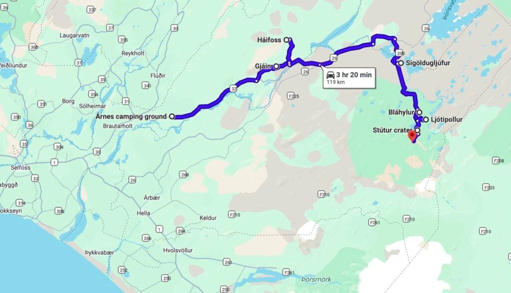
Spend your first full day in Iceland descending into the Fjallabak Nature Reserve on the impossibly scenic drive to Landmannalaugar, the heart of the Highlands and one of the most spectacular places in the entire country! There are several access points, but we recommend following Road 26/208— this route features so many interesting stops and short walks that you’ll barely spend any time in the car.
I’ve listed all the worthwhile stops between Árnes and Landmannalaugar below, but depending on timing, you might consider saving a few for the return drive tomorrow (where you’ll backtrack along these same roads). Aim to arrive in Landmannalaugar at least 3hrs before sunset so you have time to hike up to the summit of Bláhnjúkur and soak in the spectacular Landmannalaugar Hot Springs!
Gjáin Valley & Gjárfoss
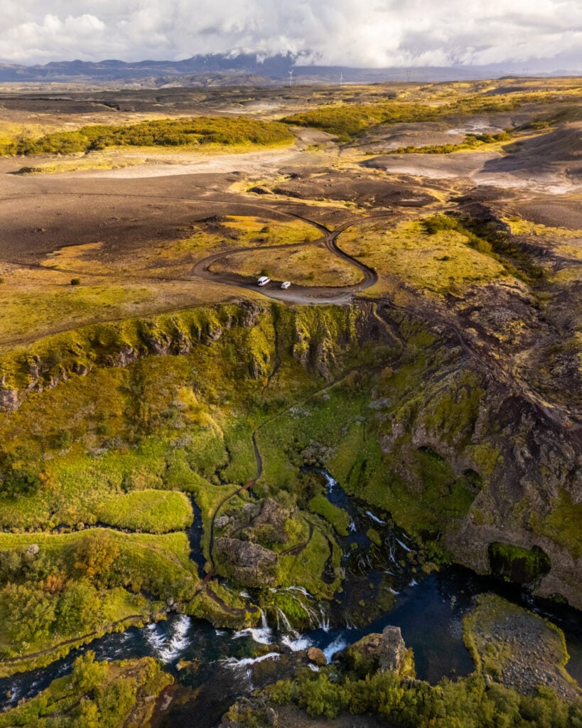
About 30min from Árnes, make your first short detour of the day onto Road 327 to visit Gjáin. The first 10min to the lower parking area are pretty mellow, but the final 5min to the upper parking area definitely require a 4WD.


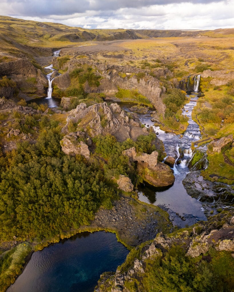
Hidden within a lush volcanic valley, Gjáin feels completely unlike the barren highlands surrounding it— a surreal pocket of greenery filled with waterfalls, basalt formations, caves, and winding streams. Apparently parts of Game of Thrones were filmed here, but thanks to its position even a short distance off the Ring Road, we had this stop entirely to ourselves!
A short network of trails leads around the valley and past the beautiful Gjárfoss waterfall. It’s also possible to hike all the way from Gjáin to Háifoss on a well-marked trail, but for the purposes of this itinerary, we’d recommend returning to Road 32 and continuing onwards to Háifoss by car.
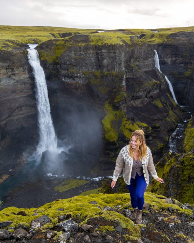
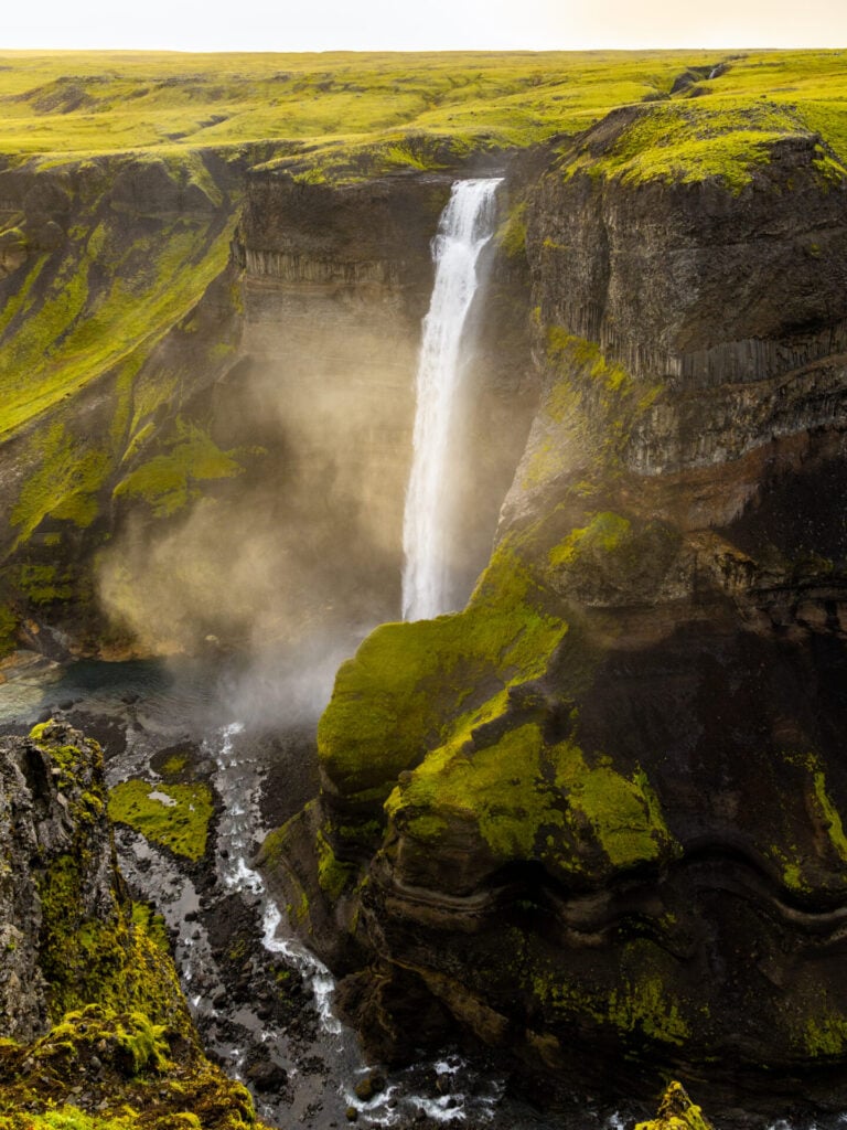
Háifoss: the largest waterfall in the highlands
Backtracking from Gjáin, continue east on Road 32 for only a short distance before turning left onto the rough Road 332— although not technically an F-road, 332 is positively littered with potholes and you’ll need a 4WD with good clearance to navigate it, even at low speeds. About 45min after leaving Gjáin (including 30min on Road 332), arrive at the Háifoss parking area and walk just a few minutes to the canyon rim.


Plunging 122m into a dramatic volcanic gorge, Háifoss is the tallest waterfall in the Icelandic Highlands and easily one of our favourites in the entire country!
Most visitors turn around at the main viewpoint, but there’s actually a small network of trails leading along the canyon rim and down towards the river below. Allow 1.5–2hrs if you want to properly explore the area, or simply wander 5–10min away from the main lookout for quieter views of both Háifoss and neighbouring Granni waterfall.
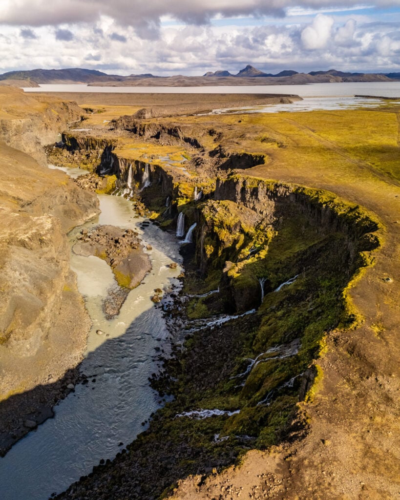
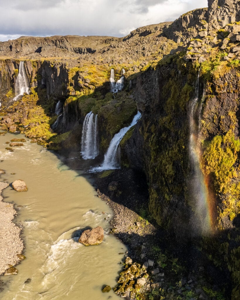
Valley of Tears: Sigöldugljúfur Canyon
Returning along the violently potholed Road 332, you’ll hop back on Road 32 to connect with Road 26, following this paved road east to The Highland Centre Hrauneyjar—the last opportunity to get fuel as you approach Landmannalaugar (about 40km/70min from the campsite). We highly recommend driving into the Highlands with a full tank, since there are NO opportunities to refuel out here!
About 10min past the Highland Centre, turn right onto Road 208, which begins paved, but quickly deteriorates into washboard gravel for the remaining 26km (1hr) to Landmannalaugar.
The first major stop along 208 is Sigöldugljúfur, better known as the “Valley of Tears”, where dozens of tiny waterfalls spill into a vibrant blue canyon below. You can drive almost right to the canyon rim (HERE) to enjoy sweeping views across one of the most photogenic landscapes in the Highlands.
Bláhylur Crater Lake
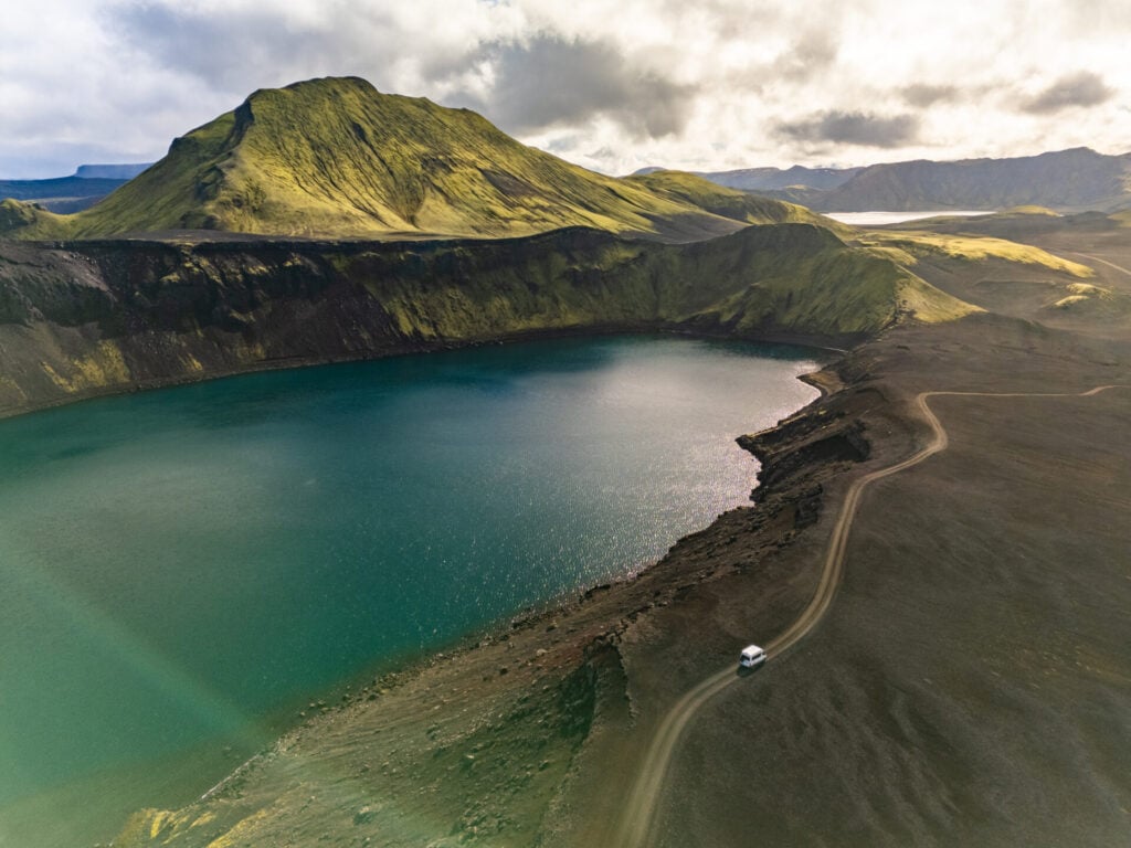
Roughly 40min farther along Road 208, make a quick detour to Bláhylur (sometimes called Hnausapollur), a striking crater lake framed by vivid green volcanic slopes.
With a 4WD, you can drive all the way up to the rim and then hike a further 20min to reach a high vantage point overlooking the deep blue water and surrounding highlands.
Ljótipollur Crater Lake
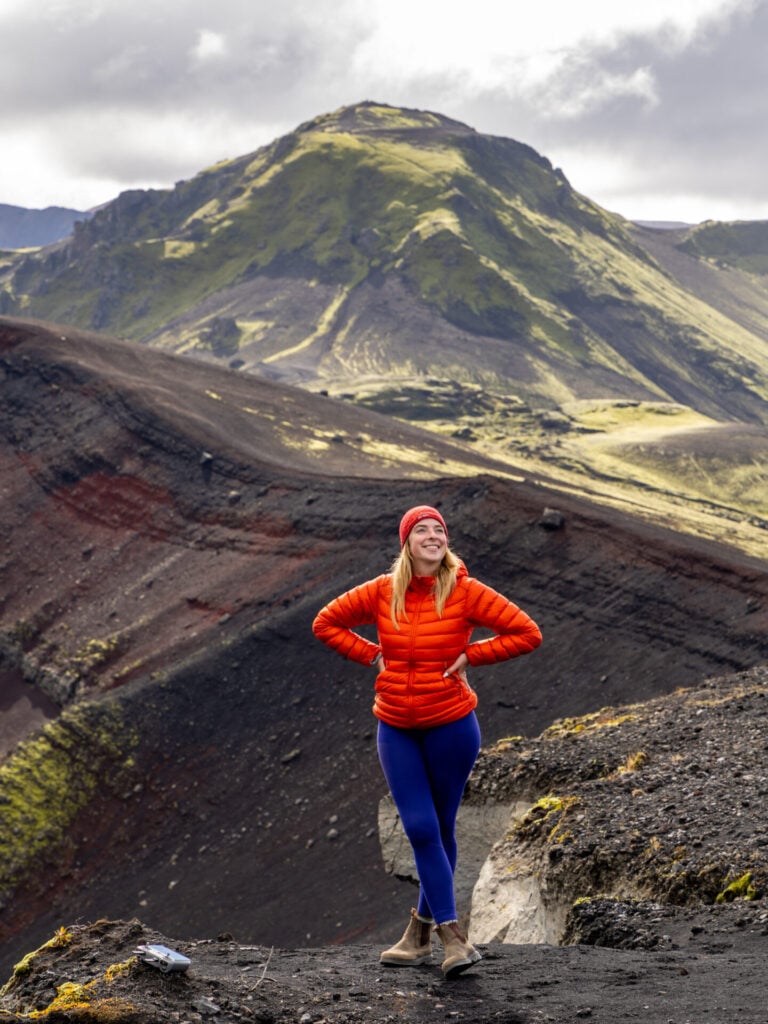
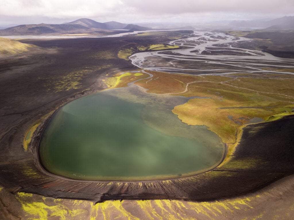
Only a few minutes away, another left-handed turn off the 208 brings you to a small carpark where you can hike about 5-10min uphill to the rim of another crater lake, Ljótipollur!
Where Bláhylur is all about the intense colour of the lake (and beautiful green mountain situated just behind), Ljótipollur opens onto sweeping views of braided rivers and black volcanic plains extending deep into the Highlands.
Stútur Crater & Frostastaðavatn Lake
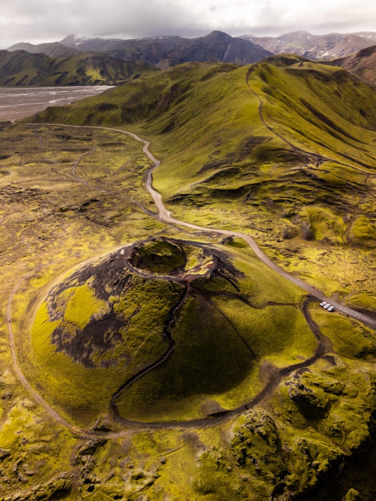
Less than 10min from Landmannalaugar, two final roadside stops showcase some of the most spectacular scenery along Road 208.
A short trail leads to the rim of Stútur crater, a vibrant green mound with a perfect ice-cream scoop out of the top, while nearby viewpoints overlook the patterned shoreline of Frostastaðavatn lake.
River crossing at Landmannalaugar
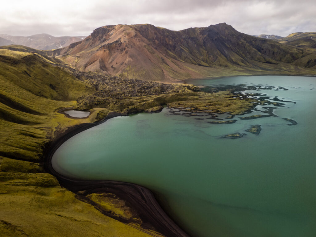
Approaching Landmannalaugar, turn onto F224 for the final 2km to camp. There’s an occasionally intimidating river crossing RIGHT before the campsite— depending on water levels, it might be passable in a compact SUV or it might require high clearance.
Luckily, there are plenty of other people around, so you can watch a few successful crossings and take notes, or even ask someone directly for help (and if it comes to it, you can sleep in your camper in the day lot; not technically allowed, but widely done and you’ll just have to walk across the bridge to use camp bathrooms).

Bláhnjúkur hike
Trailhead: Landmannalaugar campsite | Time: 2-3hrs | Stats: 4.5km (350m gain) | Difficulty: easy
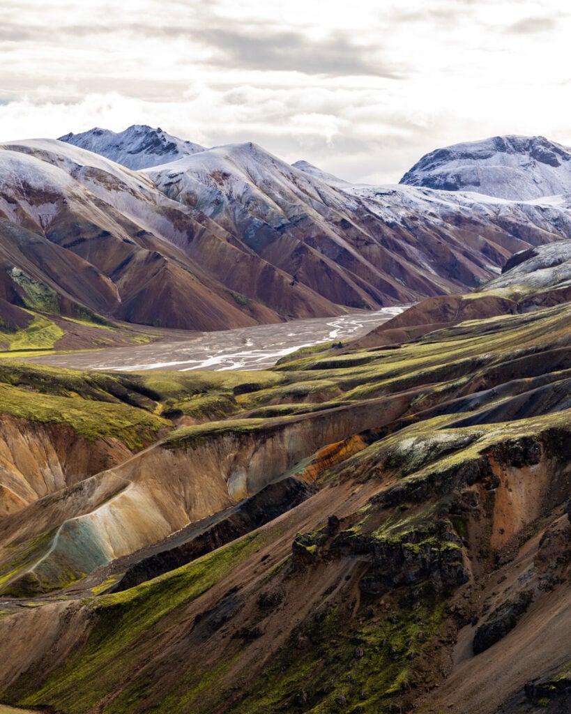
With a few hours of remaining daylight, set out on the spectacular Bláhnjúkur hike. Rising above the colourful rhyolite mountains of Landmannalaugar, the “Blue Peak” is one of the BEST short hikes in Iceland and a perfect introduction to the Highlands!
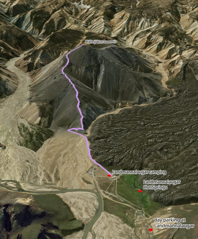


Pass the campsite and follow a relatively flat traverse left along the base of the mountains towards Bláhnjúkur, connecting with the signed trail at the foot of a large grey hillside.
The route climbs steeply up this hill before continuing on a series of switchbacks towards the summit, gaining elevation quickly and delivering increasingly spectacular views over colourful rhyolite mountains, braided river valleys, black lava fields, and the surrounding Highlands.
>>> Read my post on the 20 best hikes in Iceland

Landmannalaugar Hot Springs
Finish the day with a soak in the free geothermal hot springs beside the campground, one of the absolute highlights of staying overnight in Landmannalaugar.
Unlike Iceland’s more developed lagoons, these natural hot springs feel wonderfully wild and rugged— steaming turquoise water winding through black lava rock and moss-covered hills beneath the colourful rhyolite mountains of Fjallabak. There are even a few small waterfalls delivering piping hot water into the main pool!


Day 3: Landmannalaugar to Kerlingarfjöll (Southern Highlands)
- Drive time: 4.5hrs
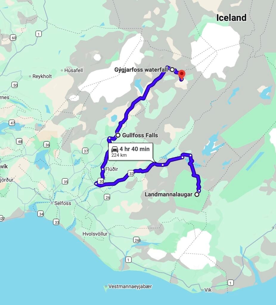
- Roads: F224 > 208 > 26 > 32 > 30 > 35 > F347
- Highlights: hike to Brennisteinsalda and Hrafntinnusker along the Laugavegur trail; Gulfoss; Gýgjarfoss, one of the Highland’s hidden gems; Highland Baths
- Campsite: Highland Base at Kerlingarfjöll (pre-book on Parka)
Waking up in breathtaking Landmannalaugar, there are many excellent ways to spend your second day in the Highlands, but I’d highly recommend the spectacular return hike to Hrafntinnusker (or a shorter variation to Brennisteinsalda). Both routes explore the multi-coloured rhyolite mountains of the Fjallabak Nature Reserve and follow the opening section of the famous Laugavegur Trail, widely considered Iceland’s best multi-day hike.
Aim to get back on the road with 5hrs of remaining daylight, since you’ll have a sizeable drive to reach tonight’s campsite in the Central Highlands. Fortunately, there are a couple worthwhile waterfall stops along the way and another beautiful hot spring waiting at the end of the drive into Kerlingarfjöll!
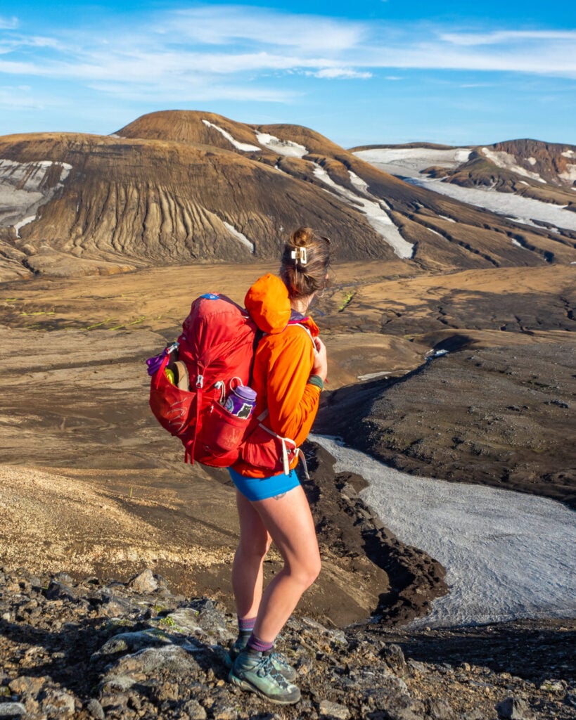
Hrafntinnusker hike
Trailhead: Landmannalaugar campsite | Time: 4-5hrs | Stats: 22km (800m gain) | Difficulty: moderate
Deep into the colourful rhyolite hills of Fjallabak, Hrafntinnusker is surrounded by steaming geothermal vents, glossy obsidian formations, and improbable year-round snowfields. This hike follows the first 11km of the Laugavegur Trail, making this an excellent way to experience one of Iceland’s most spectacular trekking routes without committing to the full 5-day hike (although you absolutely should at some point!).
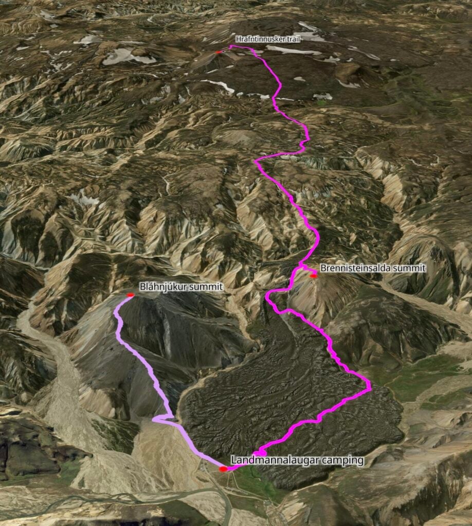


Begin by crossing the dramatic Laugahraun lava field, detouring briefly to enjoy amazing views from the summit of Brennisteinsalda, before climbing steadily into a surreal landscape of steaming hillsides and volcanic valleys.
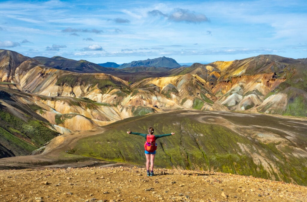
As the route nears Hrafntinnusker, colourful rhyolite hills gradually give way to a barren volcanic wilderness of ash-black valleys and rolling mountains capped by lingering snowfields. As the campground comes into view, head left up the hill to Stöðull for the best vantage point of the surrounding landscape!
The outbound hike generally takes 4-5hrs, while the return is almost entirely downhill and much quicker, particularly without all the photo spots. Allow 6-8hrs total— if you plan on making my recommended stops in the afternoon, you’ll need to get an early start!
Alternative: Brennisteinsalda hike
Trailhead: Landmannalaugar campsite | Time: 2hrs | Stats: 7km (300m gain) | Difficulty: easy
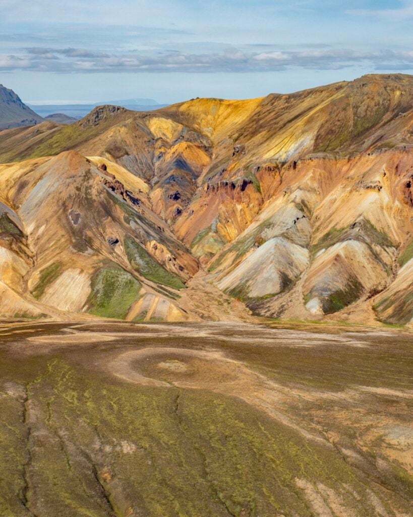
If you’re not keen on a 6-8hr hike, you can follow the same route along the Laugavegur Trail as described previously and simply turn around at the colourful summit ridge of Brennisteinsalda, known as the “Sulphur Wave”.
Whichever hiking route you choose, we’d recommend getting back on the road with at least 5hrs of daylight remaining so you can comfortably reach Kerlingarfjöll before dark (and ideally fit in two quick waterfalls stops right along the route).
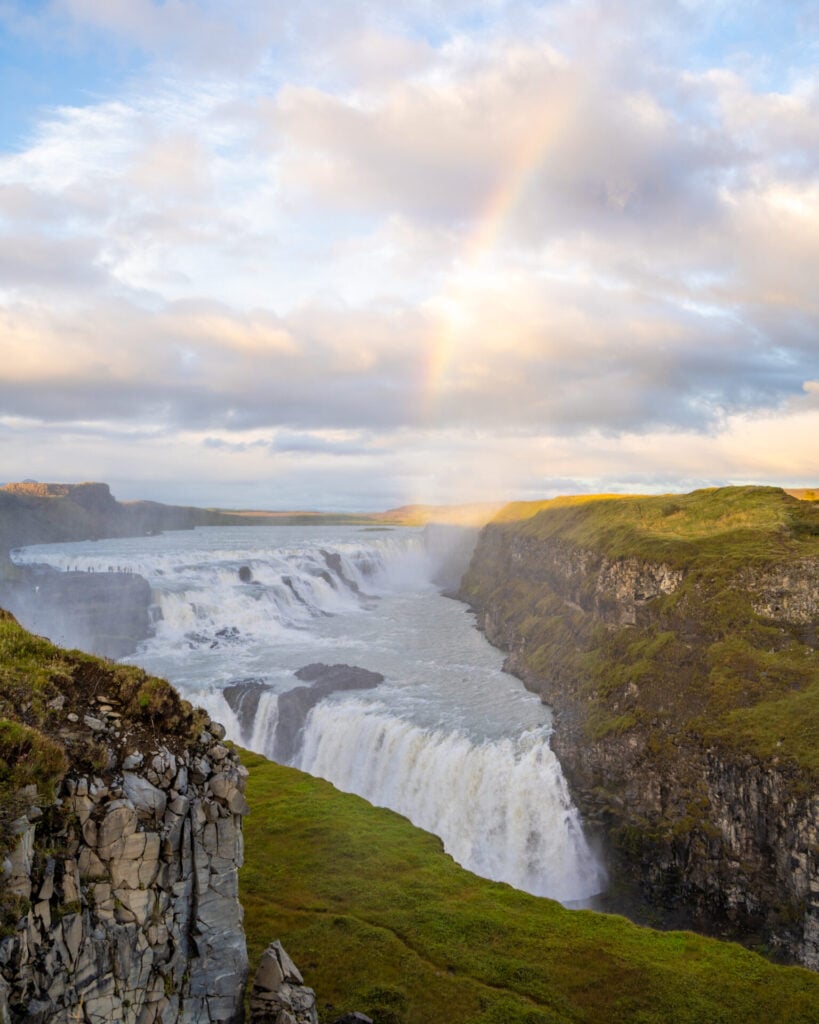
Gullfoss: Golden Circle waterfall
Without stops, the drive from Landmannalaugar to Kerlingarfjöll takes roughly 4.5hrs, but you can break the journey up with a few waterfalls along the way! Gullfoss is about 2.5hrs into the drive—shortly after getting all the way back out to Árnes (campsite from Night 1), turn right onto Road 30, and after 30min, right again onto Road 35.


Gullfoss is one of Iceland’s most famous waterfalls and one of the few major Golden Circle attractions that still feels worth visiting (with free parking). Fed by glacial water from Langjökull, Gullfoss plunges dramatically into a narrow canyon in two distinct tiers, sending enormous clouds of spray into the air.
A network of paths and boardwalks leads to several viewpoints overlooking the falls, so allow 10–30min depending on how much you want to explore.
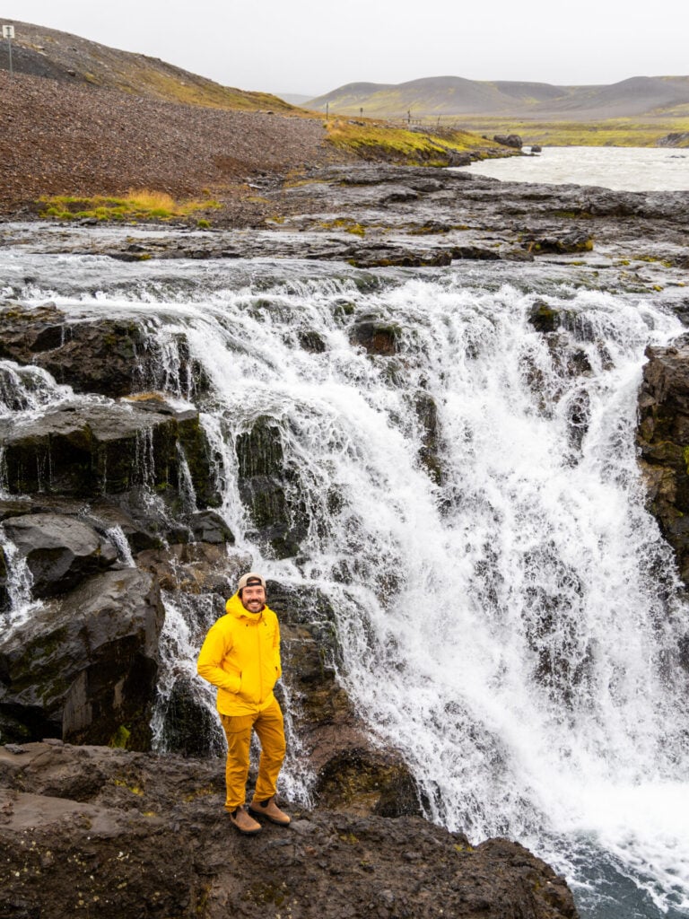
Gýgjarfoss
From Gulfoss, continue north on Road 35 for another 1.5hrs. The first 15km of this section is paved, but the next 40km are on rough gravel, so it’s somewhat slow-going. Shortly after turning onto the F347, you’ll drive right by Gýgjarfoss, a beautiful waterfall spilling beneath a small bridge deep in the Highlands. Compared to the crowds at Gullfoss, this stop feels wonderfully quiet and remote!
From here, continue the final 15km up F347 to Highland Base at Kerlingarfjöll, where the campground is located just below the main hotel complex.
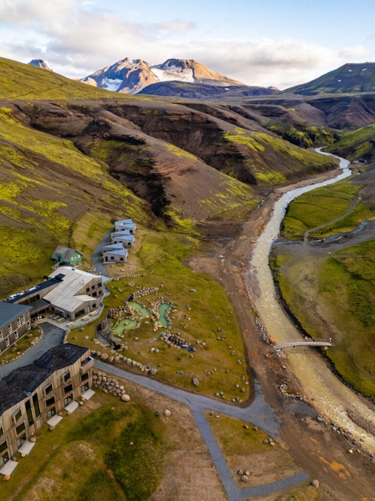
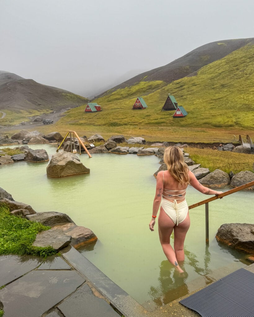
Highland Baths
Highland Base at Kerlingarfjöll also has a compact but beautiful hot spring lagoon, which includes several interconnected pools, a steam room, cold plunge, and a bar. Entry is free for hotel guests, and campers receive a sizeable discount— it was just $23USD per person when we visited. The baths are open until 11pm, so you can soak as soon as you arrive or wait until after dinner!

Day 4: Kerlingarfjöll to Hveravellir Geothermal Area (Central Highlands)
- Drive time: 1.5hrs
- Roads: F347 > 35 > 735 > F735
- Highlights: hike through Hveradalir to the summit of Mænir; vibrant hot pools in Hveravellir Geothermal Area; natural hot spring right beside camp
- Campsite: Hveravellir
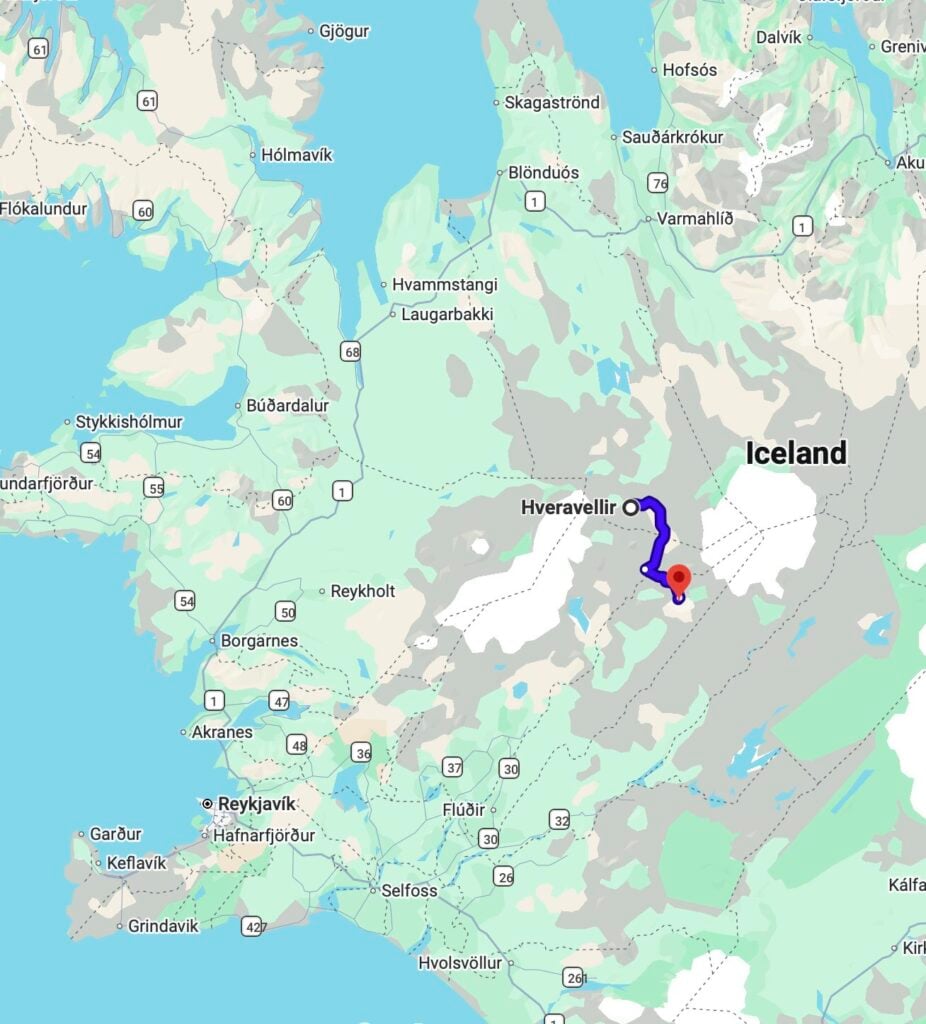
Today is all about the extraordinary geothermal landscapes of Iceland’s central Highlands, and first up is Kerlingarfjöll, a volcanic mountain range tucked between the Hofsjökull and Langjökull glaciers that still feels like a hidden gem. Spend the morning hiking through Hveradalir (the most active geothermal area in Kerlingarfjöll) and up to the summit of Mænir for views of the valley below. Vibrant orange rhyolite mountains, deep red volcanic soil, steaming vents, lingering snowfields, and glaciers combine into one of the most surreal landscapes we’ve ever seen!
Later in the afternoon, continue just 1.5hrs north to Hveravellir, another geothermal area with bubbling hot springs, steaming fumaroles, and a beautiful natural hot pool right beside the campsite.
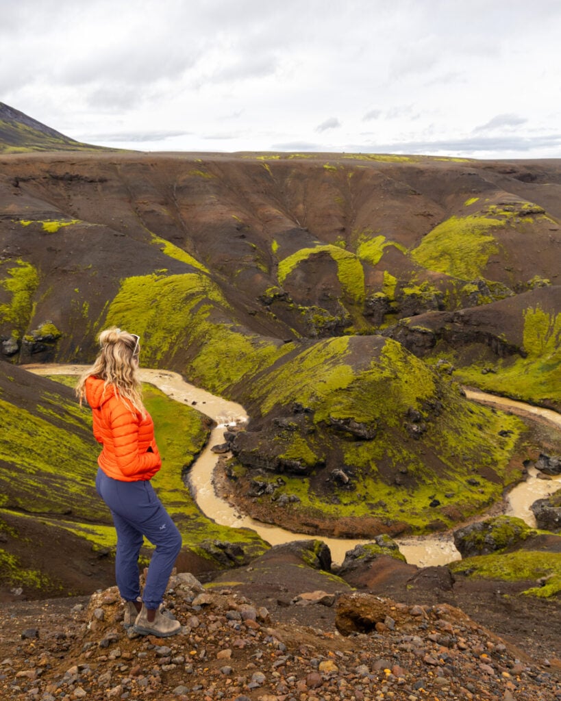
Horseshoe Bend
On the quick 10min drive up F347 from Highland Basecamp to the Hveradalir Parking Area, you’ll pass a scenic Horseshoe Bend in the Ásgarðsá River (right around here) and it’s worth stopping for a quick photo!
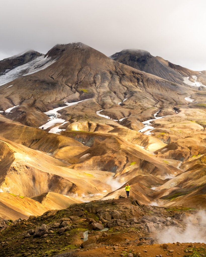
Hveradalir Circuit + Mænir Summit hike
Trailhead: Hveradalir car park | Time: 5-6hrs | Stats: 9km (850m gain) | Difficulty: moderate
The absolute best way to experience Kerlingarfjöll is by hiking through Hveradalir, where a 4km circuit winds around glowing orange mountains as the landscape disappears and reappears behind thick curtains of steam.
For those simply unsatisfied by the bare minimum, my recommended hiking route combines the Hveradalir Circuit with the summit of Mænir mountain, and I promise it’s worth a little extra effort!
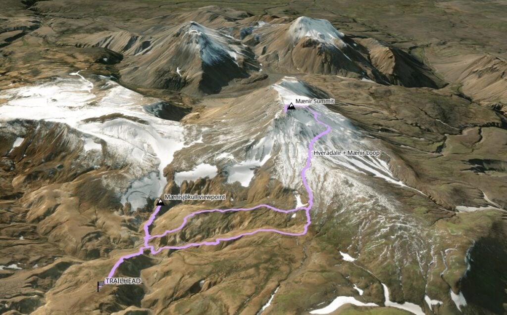
From the parking area, descend the wooden staircase into the alien planet of Hveradalir and follow orange trail markers anti-clockwise through the valley. Roughly halfway around the circuit, branch right onto the grey-marked trail climbing towards the summit of Mænir. The ascent takes about 40min and rewards you with spectacular panoramic views over the geothermal valley below.

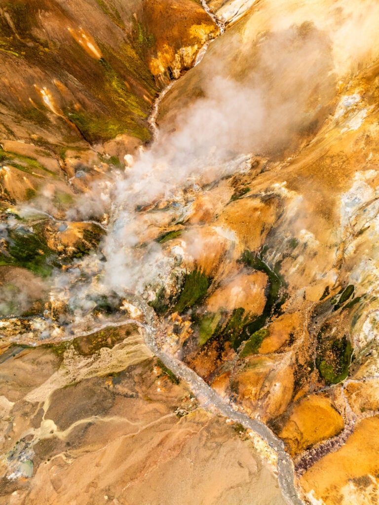


Back on the main trail, several wooden staircases lead into the surrounding hills for additional viewpoints. We’d especially recommend climbing towards the base of Mænisjökull glacier, where the contrast between glowing geothermal terrain and streaks of snow and ice is absolutely jaw-dropping.
We spent nearly 6hrs doing this 9km loop, which should give you an idea of just how often we stopped to take photos and explore interesting spur trails! My best advice is don’t rush your time here— this is one of the coolest areas of the itinerary and you don’t have far to go for the next and final stop of the day!
>>> Read my post on the 20 best hikes in Iceland
Hveravellir Geothermal Area
After a thorough exploration of Hveradalir, get back on the road, backtracking along F347 and then heading north on Road 35 for about 1.5hrs to reach Hveravellir, another geothermal area with a confusingly similar name (but an entirely different atmosphere).
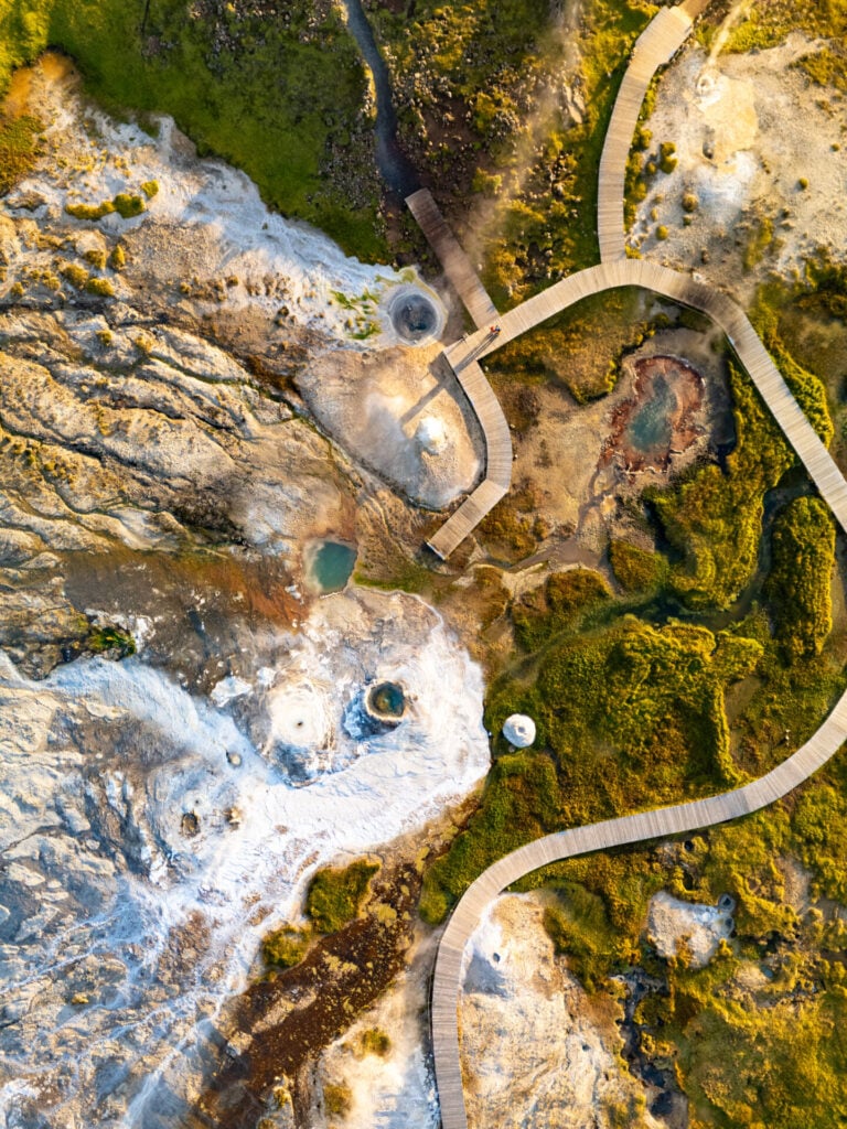
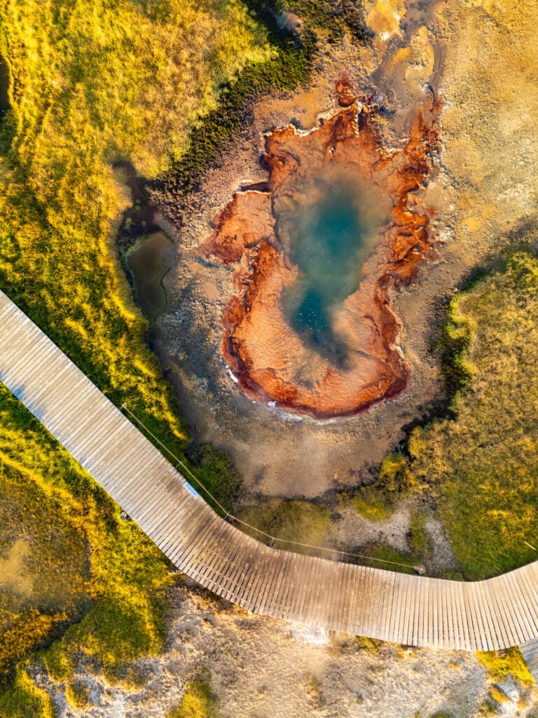
A short boardwalk loops through bubbling turquoise pools, steaming fumaroles, colourful mineral deposits, and violently boiling hot springs (that would melt your skin off, not safe for soaking). You only need about 20min to see explore the area before heading back to the camping area beside Hveravellir Lodge.


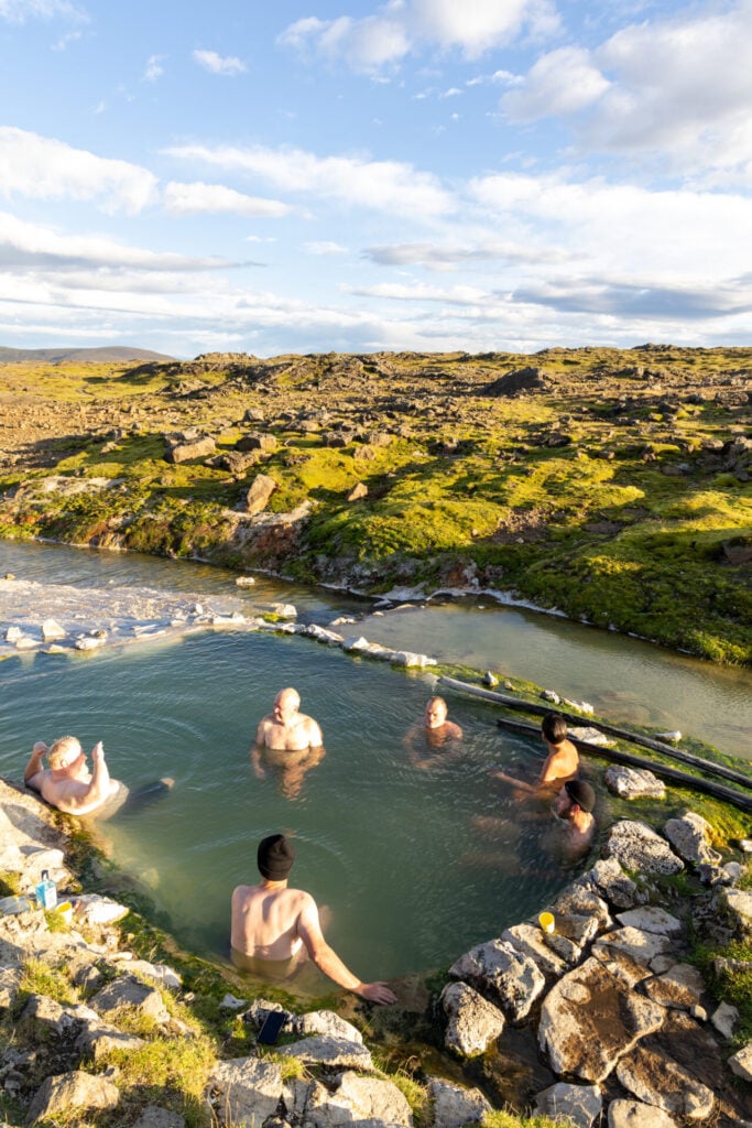
Camping at Hveravellir comes with access to a wonderful natural hot pool fed by geothermal runoff from the surrounding hot springs. It’s one of Iceland’s best wild soaking opportunities, with rarely more than a few other guests!
Day 5: Hveravellir Geothermal Area to Mývatn (North Iceland)
- Drive time: 6hrs
- Roads: F735 > 735 > 35 > 1 > (752) > 83 > 84 > 1 > (842 > F26)
- Highlights: riverside Fosslaug Hot Springs or upscale Forest Lagoon; Aldeyjarfoss and Hrafnabjargafoss, 4WD-only waterfalls in the north; volcanic craters and geothermal landscapes around Lake Mývatn
- Campsite: Vogar or Hlíð Ferðaþjónusta (both on the shores of Lake Mývatn)
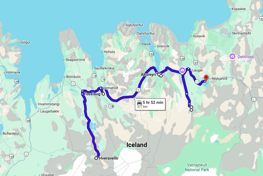
Leaving the central Highlands behind, today’s route transitions north towards Akureyri and Lake Mývatn, combining remote waterfalls like Aldeyjarfoss and Hrafnabjargafoss with hidden hot springs and wild volcanic landscapes.
Without stops, the drive from Hveravellir to Mývatn takes 4-5hrs, but rough road conditions along Road 35 usually slow things down—and since the route ALSO includes many worthwhile detours, we’d recommend getting a reasonably early start!


Fosslaug Hot Springs + Reykjafoss
Departing Hveravellir, the morning begins with a fairly unpleasant stretch of washboard gravel on Road 35 before reconnecting with the Ring Road, Iceland’s main paved highway.
If you fancy a morning soak, detour about 10min off the Ring Road to Fosslaug, a beautiful hot spring pool tucked along a river. You’ll need to pay 1500isk to park, then walk about 10min to the hot pot along the river, passing a fabulous viewpoint of Reykjafoss along the way. We had this entirely to ourselves for nearly an hour, so there are definitely perks of visiting in the morning!
⚠️ UPDATE: due to increasing tourist numbers and disagreements over management of the private land on which Fosslaug sits, access to the hot springs and waterfall has been restricted and it’s unclear when/if the site will be re-opened to visitors. Check the current status online before driving out here!
Akureyri & Forest Lagoon
Back on the Ring Road, it’s a little over an hour to Akureyri, where we’d recommend stopping at Krónan to restock groceries before heading back into more remote areas.
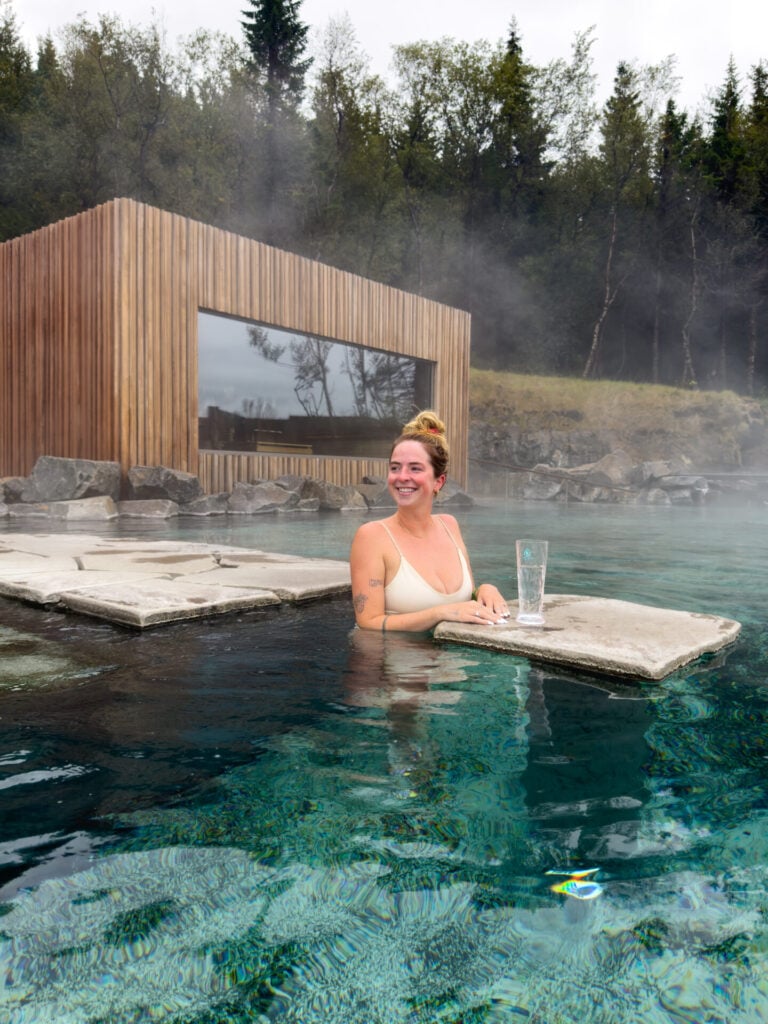
If you’re still after a soak, stop at Forest Lagoon on your way out of Akureyri! This beautifully designed geothermal spa is tucked into birch forest overlooking Eyjafjörður, featuring warm infinity pools, swim-up bars, a sauna, and cold plunge that can easily occupy several hours of your afternoon.
ICELAND’S ONLY TOLL ROAD
Driving out of Akureyri, note that the Vaðlaheiðargöng tunnel along the Ring Road is a paid TOLL road. It only saves about 10min of driving, but costs a whopping 2216ISK ($18USD), so there’s almost no reason to take this— make sure to route your GPS up and around the bridge via Road 83 and 84.
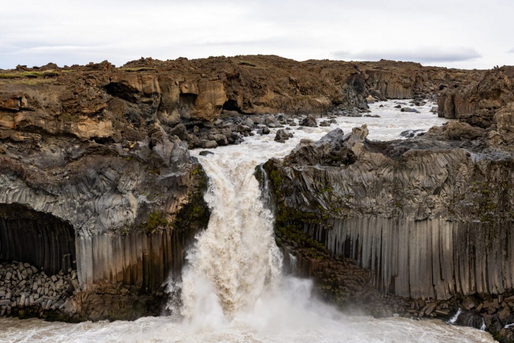
Aldeyjarfoss
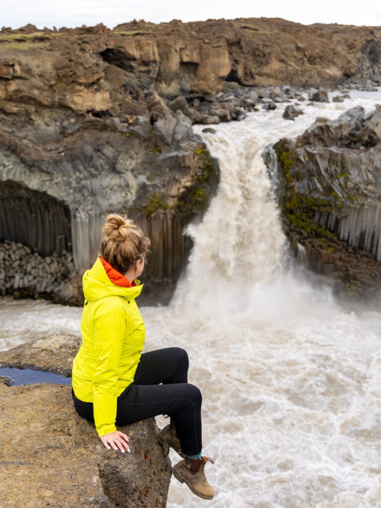
Roughly 10min beyond the toll road detour, turn onto Road 842 just before Goðafoss. The drive to Aldeyjarfoss follows a flat dirt road south along the Skjálfandafljót River for about 45min, turning into the more rugged F26 for the final 6km to the falls. You’ll have to get out to open and close multiple sheep gates, but otherwise the route is very straightforward.


From the parking area, a short trail descends for 5-10min to Aldeyjarfoss, erupting dramatically from a wall of towering basalt columns. The contrast between warped black basalt, where ancient lava cooled and contracted into remarkable geometric formations, and the white water of the falls is incredible. Likewise: the extreme solitude!
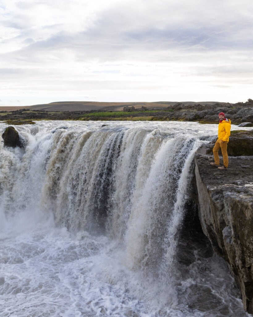
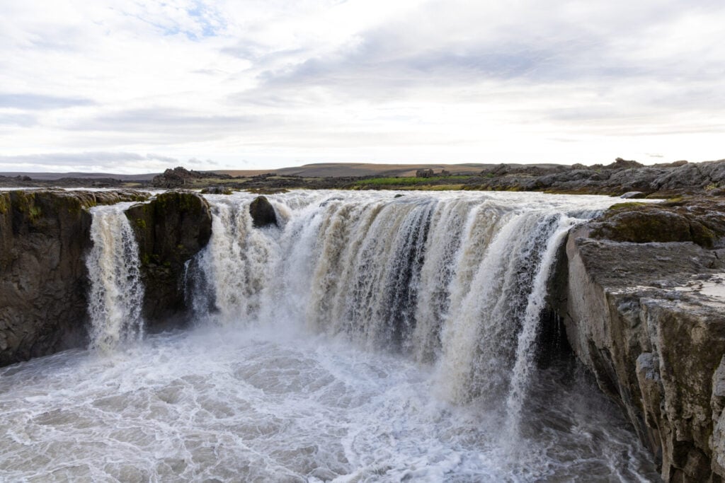
Hrafnabjargafoss
Less than 10min farther along F26 lies Hrafnabjargafoss, a broad panoramic waterfall framed by rugged volcanic terrain and braided glacial water. It’s almost like a smaller scale Goðafoss (which you can see next), minus the throngs of people!


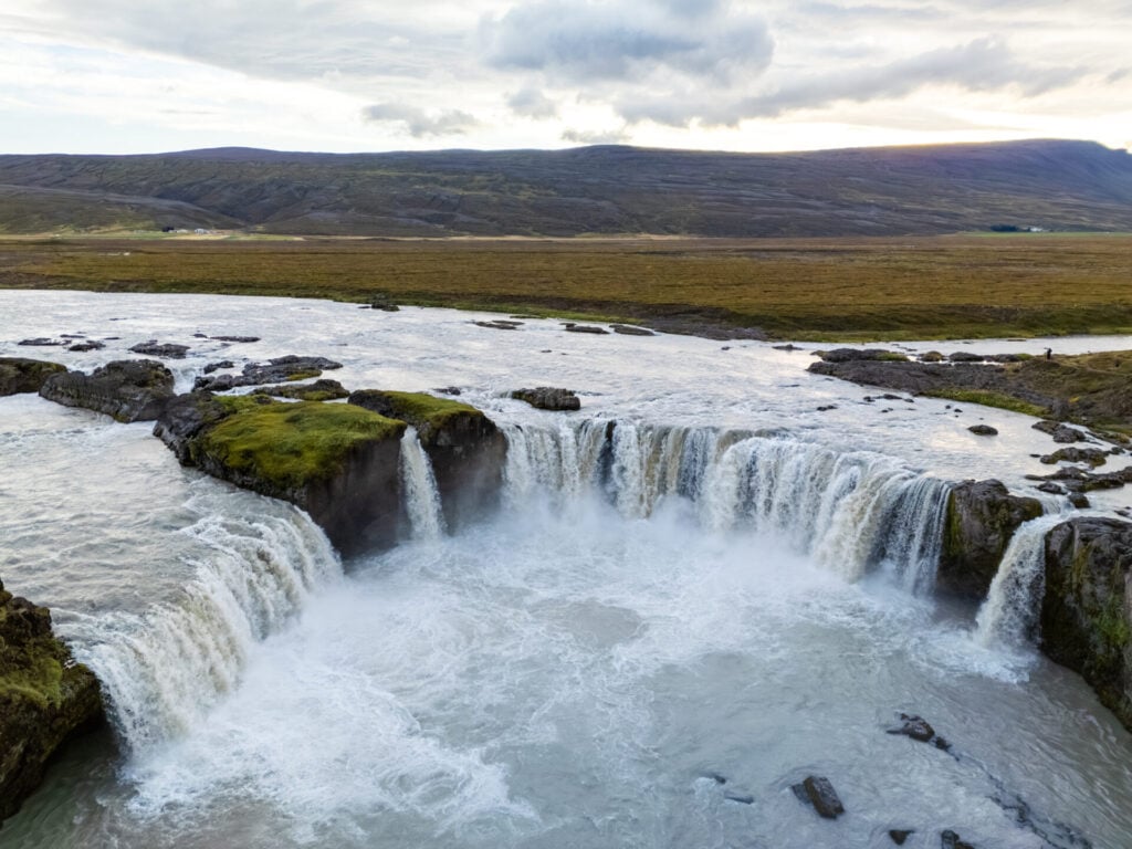
Goðafoss
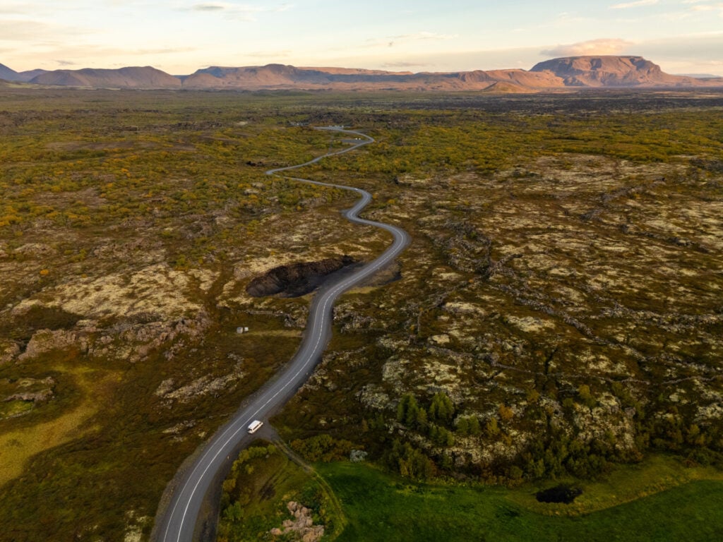
It takes about an hour to return to the Ring Road from Hrafnabjargafoss, and right at this junction, you can stop to visit the most famous waterfall in North Iceland, Goðafoss.
Compared to the quiet isolation of the waterfalls you just visited, this place can feel like an absolute zoo— but the waterfall itself is undeniably beautiful, thundering across a 30m-wide semi-circular lava shelf and easily accessed by viewing platforms on both sides of the river.
Lake Mývatn Craters
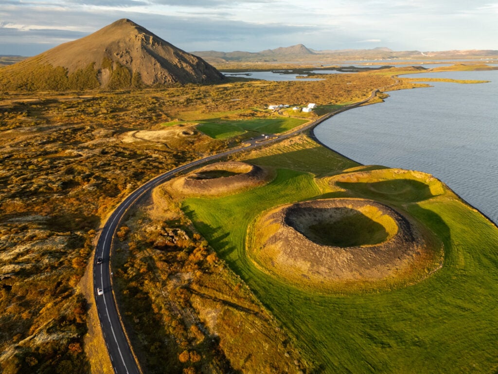
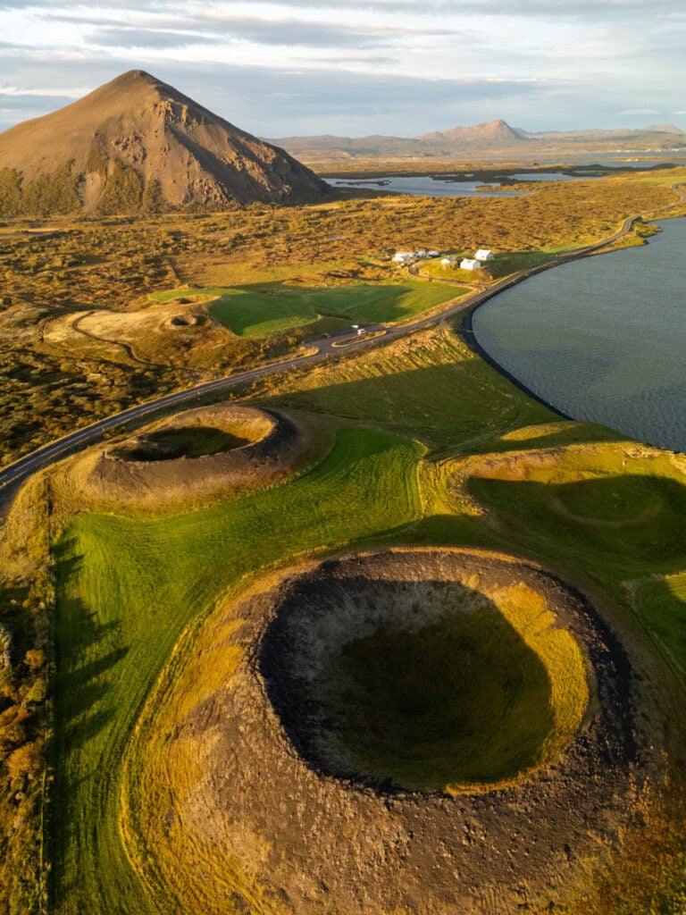
Roughly 30min farther east along the Ring Road, arrive at Lake Mývatn, one of Iceland’s most geologically fascinating regions. There are countless things to see around the lake, but one of our favourites is the cluster of craters along the shoreline that you’ll drive right by.
These strange moss-covered hills formed when lava flowed across wetlands, instantly boiling trapped groundwater into steam and causing small explosions in the landscape. The result is a bizarre crater landscape that feels completely unlike anywhere else in Iceland!
Other points of interest in Mývatn
Depending on when you roll into Mývatn (and whether you want to squeeze in a few quick stops tomorrow morning), here are several other worthwhile sights around the lake:
- Krafla: a volcanic caldera and lava field formed during a series of dramatic eruptions in the late 20th century, with several short walks and viewpoints
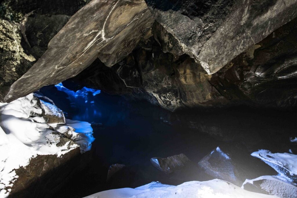
- Grjótagjá Lava Cave: a small lava cave with a vivid blue geothermal spring, famous as a filming location in Game of Thrones (no longer open for swimming)
- Dimmuborgir: a lava field filled with towering volcanic rock formations, caves, and arches, including the famous Kirkjan, or “Lava Church”
- Hverir Geothermal Area: bubbling mud pots, steaming fumaroles, and sulphur-stained earth (they’ve started charging for parking here, so it’s not a top choice since you’ve just seen the more impressive Hveravellir)
- Earth Lagoon: the “Blue Lagoon of the North” (formerly Mývatn Nature Baths), this upscale lagoon features milky-blue geothermal pools overlooking the volcanic landscapes surrounding Lake Mývatn
Day 6: Mývatn to Borgarfjörður Eystri (East Iceland)
- Drive time: 4.5hrs
- Roads: 1 > 85 > 917 > 925 > 944 > 94
- Highlights: hike to Þerribjörg sea cliffs and swim on a hidden beach; scenic drive on Road 917; hot pools at Musterið Spa; local craft beer at KHB Brugghús; Hafnarhólmi puffin colony in Borgarfjörður Eystri
- Campsite: Álfaborg (Borgarfjörður Eystri)
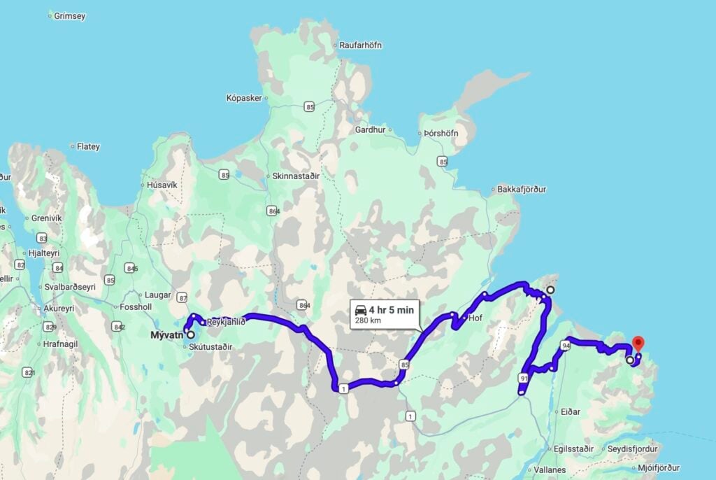
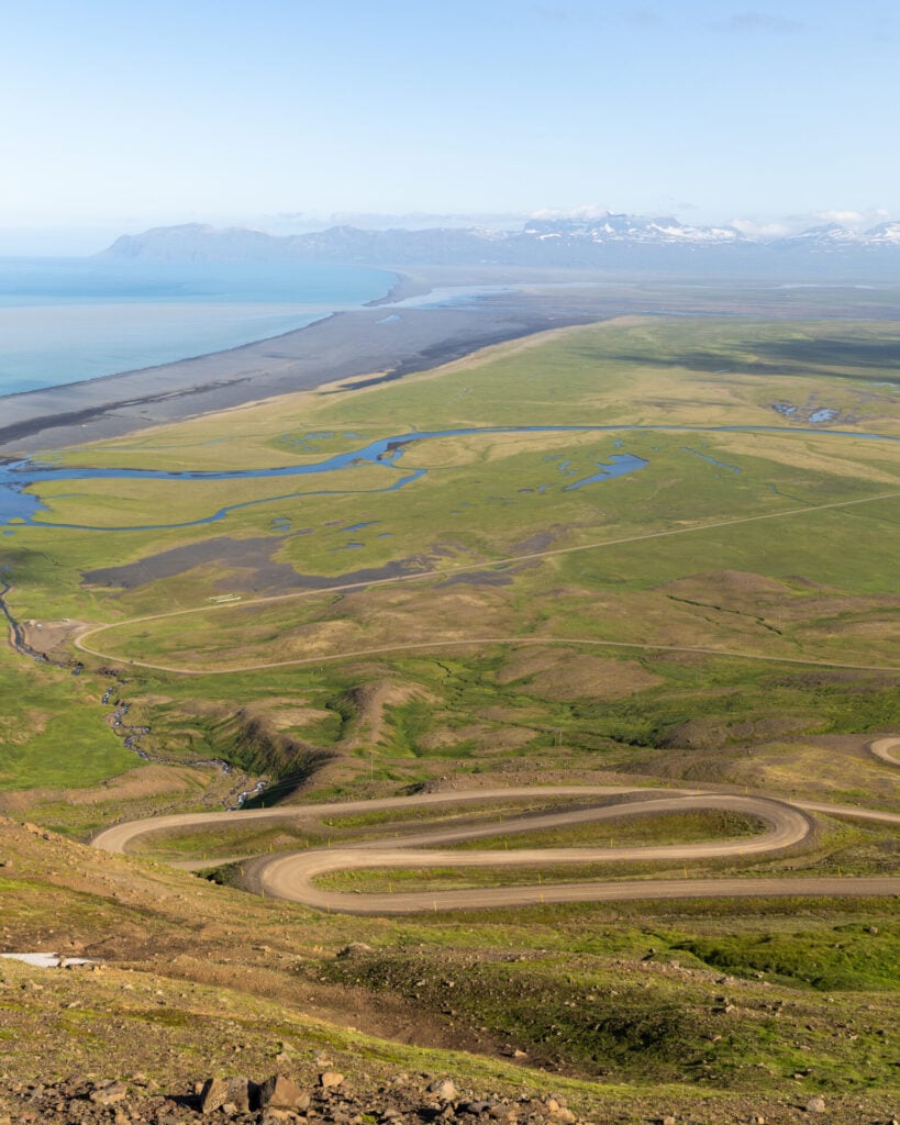
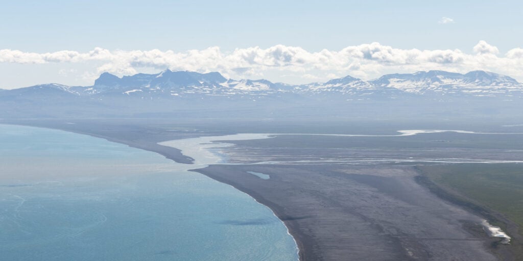
Today’s itinerary explores two remote and truly spectacular corners of East Iceland, first tackling a challenging but epic hike out to the vibrant orange Þerribjörg Cliffs. Just getting here feels like an adventure, with dramatic hairpin roads winding over isolated mountain passes and a long black sand beach.
After a refreshing swim in the ocean, continue farther east to discover the enchanting Borgarfjörður Eystri region, one of the country’s best areas for hiking, puffin viewing, and dramatic coastal scenery. Compared to the more heavily visited South Coast, this part of Iceland still feels extremely wild and remote, with winding fjord roads, isolated mountains, black sand coves, and tiny fishing villages tucked between towering cliffs!
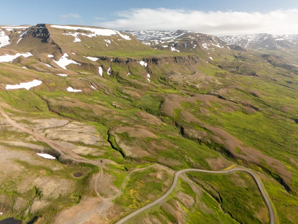
Scenic drive on Road 917
The drive from Mývatn to Þerribjörg takes around 2.5hrs. The first half simply follows the Ring Road east before turning north onto Road 85 and eventually climbing over Hellisheiði Eystri pass on Road 917, one of my favourite scenic drives in the East Fjords!
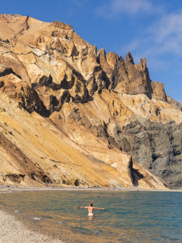

Þerribjörg Cliffs hike
Trailhead: near Vopnafjörður here (4WD only) | Time: 4-5hrs | Stats: 8km (800m gain) | Difficulty: challenging
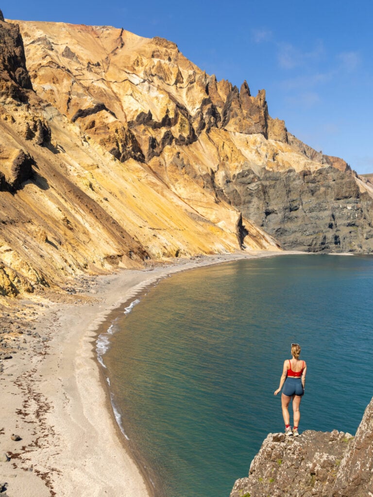
The main activity today is the somewhat strenuous hike out to the Þerribjörg Cliffs, a spectacular area of bright orange sea cliffs rising directly from the ocean— and a total hidden gem. With a 4WD, you can park several kilometres closer to the trail and you’re unlikely to see another soul all morning!
The trail is steep, rugged, and occasionally loose underfoot, requiring some basic route-finding and confidence on difficult terrain. Fixed ropes have been installed on the steepest sections, and these are super helpful for pseudo-abseiling with your hands and then hauling yourself back up on the return.
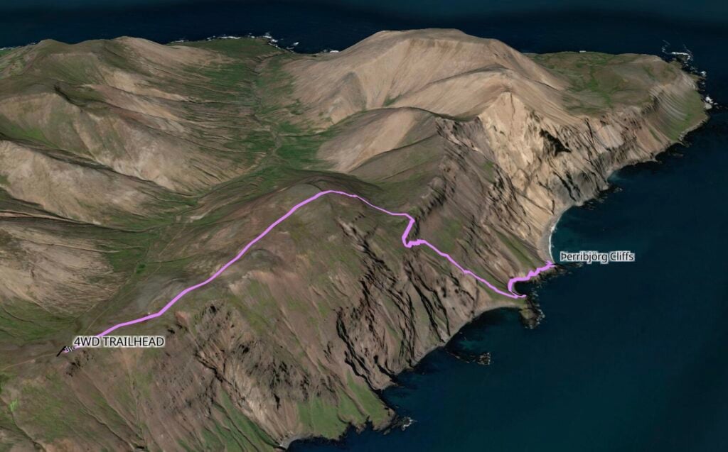


It takes about 2hrs to reach the pebbled beach, but most of the elevation gain is on the return route, so brace yourself for a steep climb off the coast and about 4-5hrs of total hiking.
Bakkagerði
From the Þerribjörg trailhead, descend dramatic switchbacks down the eastern side of Road 917 before following a series of quiet rural roads (925 > 944 > 94) to reach the small town of Bakkagerði in Borgarfjörður Eystri.
This is one of the most spectacular corners of Iceland’s remote East Fjords, and with a half-day to explore, you can see a few of the highlights before retiring to the scenic Álfaborg campsite right in town!
Musterið Spa
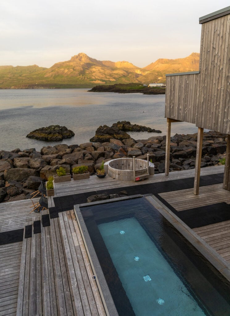
Attached to the upscale Blábjörg Resort right in Bakkagerði, Musterið Spa features two geothermal hot pools overlooking the fjord, a cold plunge, sauna facilities, and a full-service bar pouring local KHB beers alongside a rotating cocktail menu.
The spa can only accommodate about 20 people, though it’s usually far quieter than that— particularly after 5pm, when the spa becomes child-free. Entry is 5400ISK ($44USD) for non-guests and we found it to be the perfect post-hike activity!


KHB Brugghús & Frystiklefinn Restaurant
The puffins are the true main event in Borgarfjörður Eystri, but the colony is most active after 9/10pm, so we’d highly recommend grabbing dinner and drinks in town to run the clock down a bit.
KHB Brugghús is a fantastic local brewery and distillery, producing craft beer, gin, and even Landi (traditional Icelandic moonshine) inspired by the local folklore of Borgarfjörður Eystri. We’ve sampled craft beer all over the country, but KHB is my absolute favourite brewery in Iceland— I’d highly recommend their fruited sour (super light, a total crowd-pleaser), but everything is excellent!
Right next door, Frystiklefinn occupies the village’s former freezing house and serves an extensive and incredibly delicious menu of Icelandic-inspired dishes, wood-fired pizza, and inventive Landi cocktails. This is another one of those rare instances where the splurge on eating dinner out is totally worthwhile!
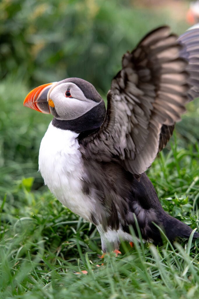
Hafnarhólmi puffin cliffs
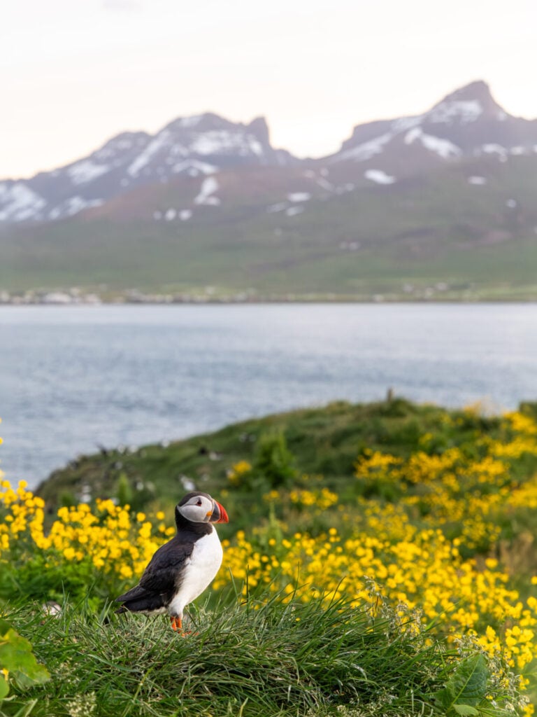
Driving just a few minutes out of town, Hafnarhólmi is the absolute best place in Iceland to see puffins up close. This small rocky islet is home to a small but thriving puffin colony, and a network of viewing platforms allows you to observe the birds from mere metres away!
Against the backdrop of Borgarfjörður Eystri’s jagged mountains, we captured some of our absolute favourite photos around 10pm without even needing to use a telephoto lens.
>>> Read more: Where to see puffins in Iceland: popular spots + hidden gems!
Day 7: Borgarfjörður Eystri to Stokksnes (East Fjords)
- Drive time: 4-5.5hrs
- Roads: 94 > 95 > 939 > 1
- Highlights: hidden gems (or popular highlights) of the East Fjords; Öxi Pass, one of Iceland’s best scenic routes passing dozens of waterfalls; Vestrahorn Mountain & Stokksnes Beach
- Campsite: Vestrahorn (located at Viking Cafe)
The wonders of East Iceland are FAR from over! Today’s itinerary leaves the morning flexible, giving you time to explore more of the East Fjords before embarking on one of the most spectacular scenic drives in the entire country. Wind through misty mountain passes, past countless waterfalls tumbling down black volcanic cliffs, and eventually out towards the dramatic fjords of the southeast.
By late afternoon, walk straight into one of Iceland’s most iconic landscapes: the black sand beach of Stokksnes beneath the jagged peaks of Vestrahorn mountain. With camping right near the beach, you can choose to visit tonight and/or tomorrow morning for the best weather!

Best things to do in the East Fjords
I’ve intentionally left this morning’s itinerary flexible, giving you time to choose one or two additional highlights in East Iceland before beginning the scenic drive south. There’s an enormous amount to see in this region, from short waterfall hikes to colourful fjord towns, so you might even consider adding an entire extra day to explore more of the East Fjords!
A few of my top recommendations that work particularly well with this itinerary:
- Litlanesfoss & Hengifoss: two beautiful waterfalls just south of Egilsstaðir, including the distinctive Hengifoss, which plunges from a towering cliff streaked with vivid red bands of volcanic clay (easy 1–2hr hike)
- Strútsfoss: a quieter and more off-the-beaten-path alternative to Hengifoss, with similarly striking red-striped cliffs surrounding the falls (easy 2hr hike)
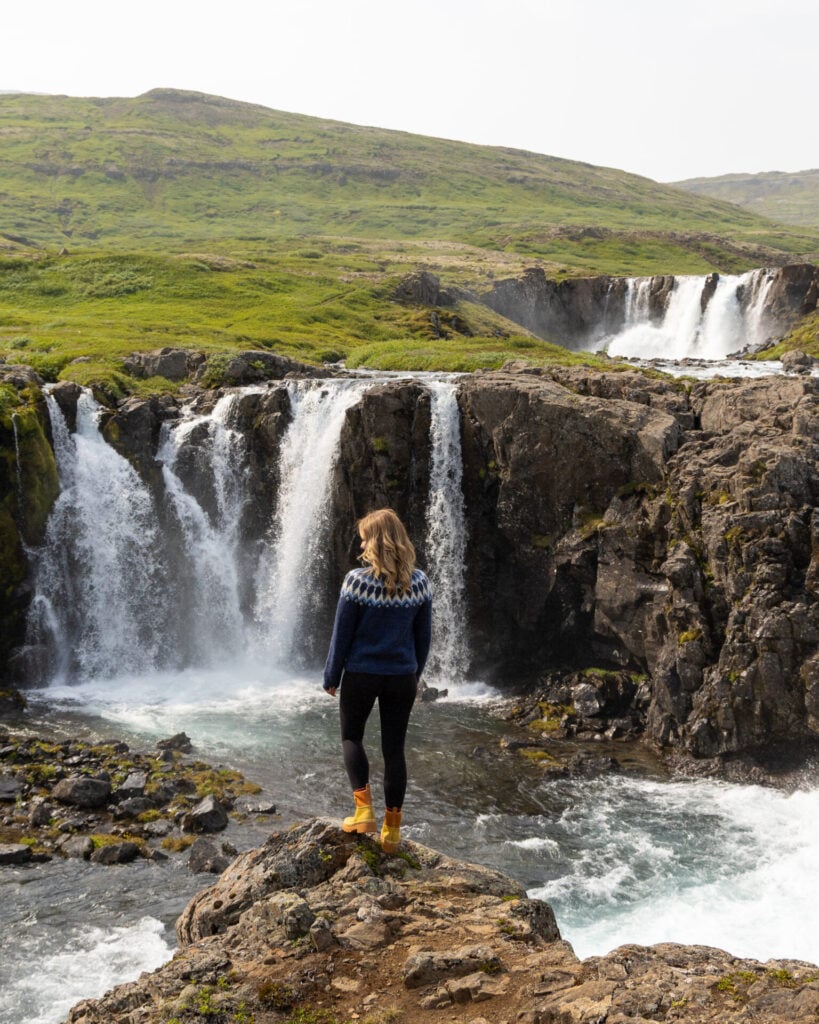
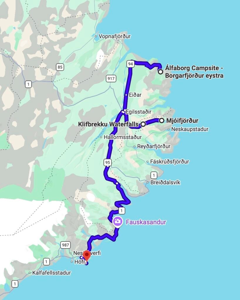
- Mjóifjörður + Klifbrekkufossar: follow a spectacular mountain road into one of Iceland’s most remote fjords for an almost UNREAL scenic drive to the multi-tiered Klifbrekkufossar waterfalls
- Seyðisfjörður: this colourful little town is the creative heart of East Iceland; visit the newly constructed Baugur Bjólfs viewpoint for an incredible panorama over the fjord, stop off at roadside Gufufoss, and walk the iconic Rainbow Road
- Laugarfell: driving up to the remote Eastern Highlands, enjoy the amazing Waterfall Circle hike and a scenic soak in the Laugarfell hot pools
- Stuðlagil Canyon & Rjúkandifoss: enormous basalt columns surround the seasonally turquoise river at the increasingly famous (and crowded) Stuðlagil Canyon, which can easily be combined with nearby Rjúkandifoss; note that this is the longest detour!
>>> Read my complete East Iceland travel guide for heaps more ideas, hiking details & hidden gems!
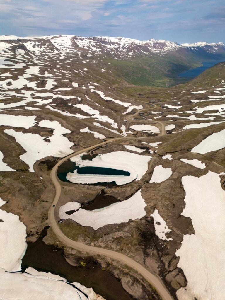
Scenic drive over Öxi Pass (Road 939)
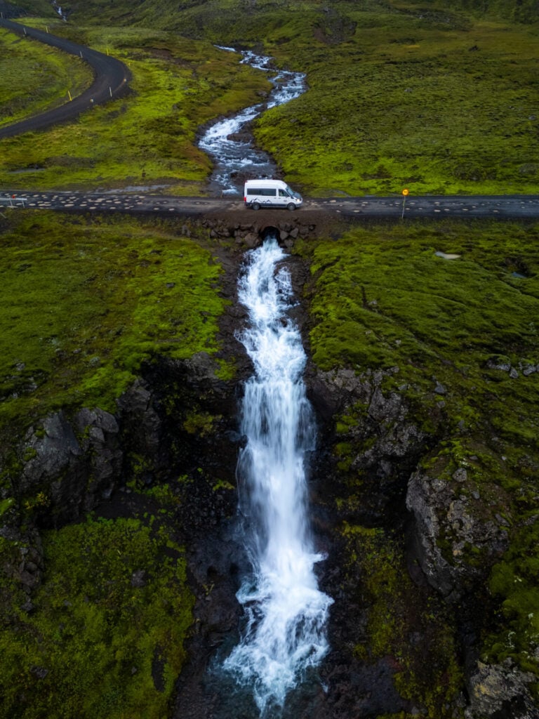
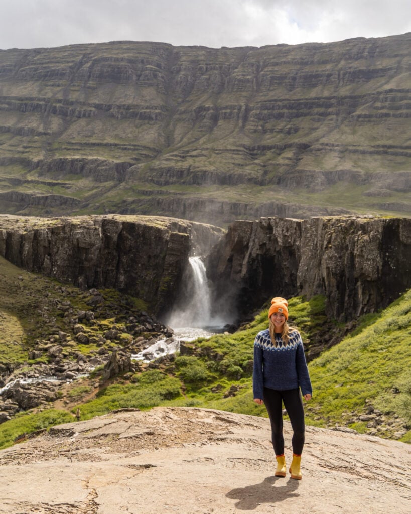
From Egilsstaðir, the largest town in eastern Iceland and the region’s central hub, detour onto Roads 95 and 939 towards Berufjörður. We stumbled upon this route over Öxi Pass almost by accident, and now having driven it multiple times, we can honestly say it’s one of the BEST scenic drives in the entire country.


The road is rough, heavily potholed in sections, and definitely best tackled with a 4WD, but the scenery is simply extraordinary: narrow gravel roads twisting through vivid green mountains, waterfalls pouring down nearly every cliff face, and glacial rivers carving deep canyons through black volcanic rock. It honestly feels like a journey through some ancient, mystical land.
Although the drive itself only takes about an hour without stops, allow about 2hrs to properly enjoy the route. There are seemingly hundreds of waterfalls, many unnamed and completely hidden from the usual tourist trail, so it’s worth going slow and stopping often!
Stokksnes Beach & Vestrahorn
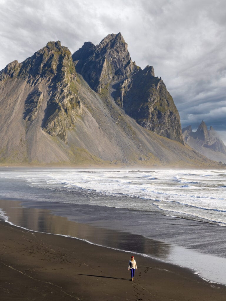
But the views are not over! Following the southeastern coastline down to Stokksnes, this section of the Ring Road offers some truly staggering scenery, with enormous mountains rising right alongside the sea.
There are so many WOW moments that the 2hr drive absolutely flies by! Depending on time, you can stop at a few points of interest along the way before getting to Stokksnes, including the Hvalnes Lighthouse and glacier viewpoints near Höfn.
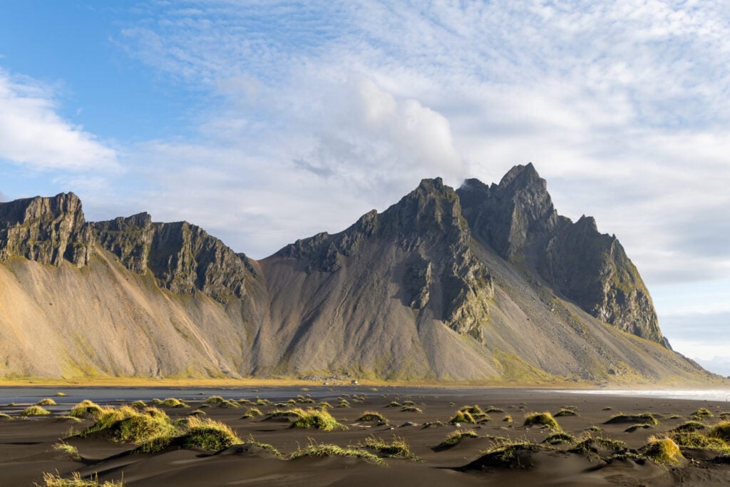
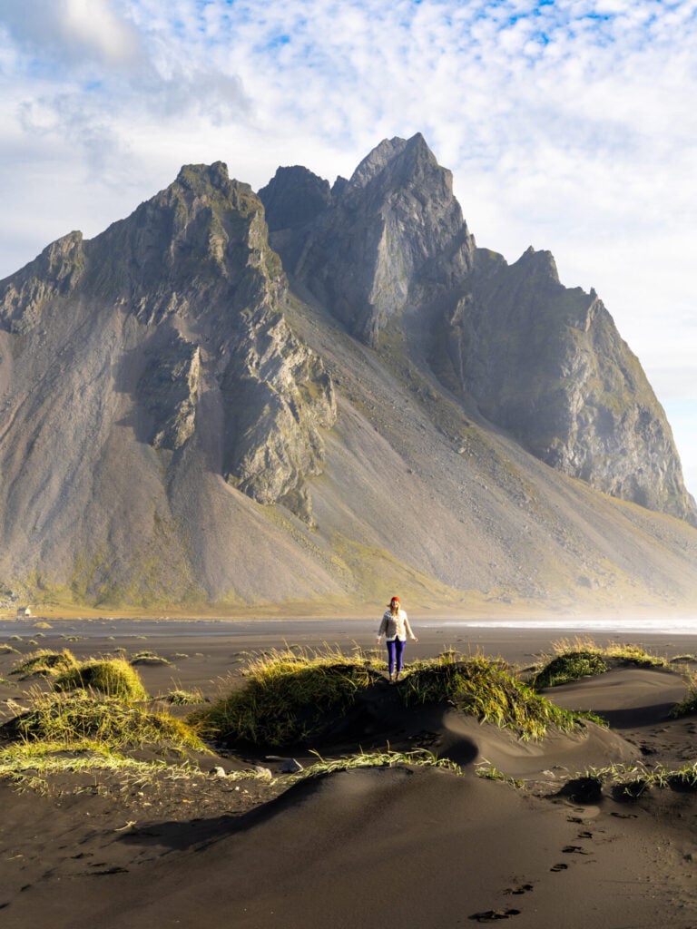
Eventually, arrive at Stokksnes beneath the dramatic peaks of Vestrahorn Mountain, one of the most iconic landscapes in Iceland. With a 4WD, you can continue past the busy main parking area onto a sandy track leading closer to the beach, where it’s usually possible to find much quieter vantage points for photography.
Vestrahorn Camping costs 2500ISK per person, but this includes the beach entrance fee (1100ISK per person), so it’s a real bargain! More importantly, camping gives you two opportunities to visit Stokksnes: first in the evening and again the following morning for the best lighting!
Day 8: Stokksnes to Laki (South Coast to Southern Highlands)
- Drive time: 5hrs
- Roads: 1 > 206 > F206 > F207
- Highlights: Fjallsárlón Glacier Lagoon; hike through Múlagljúfur Canyon; Fjaðrárgljúfur Canyon and Fagrifoss on the scenic drive to Laki Craters; hike up Mt Laki and around Tjarnargígur Crater
- Campsite: Blágil hut & camping (off the F207 in Laki)
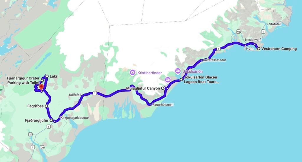
Driving along the South Coast this morning, enormous glacier tongues spill down from Vatnajökull almost to the roadside and waterfalls appear one after another along the Ring Road. There are SO many things to see in this part of the country, but unfortunately the crowds (and recently implemented paid parking schemes) have definitely taken some of the magic out of this otherwise beautiful region— so we’d recommend focusing on just a couple high-value stops before escaping back into the wilderness.
Once off the Ring Road, spend the remainder of Day 8 journeying deep into the southern Highlands, passing remote waterfalls, crossing glacial rivers, and driving through surreal moss-covered lava fields before finally reaching the otherworldly Laki craters. Compared to Landmannalaugar and other popular Highland destinations, Laki feels wonderfully off the tourist track, and it’s easy to find yourself completely alone among the craters!
Fjallsárlón Glacier Lagoon
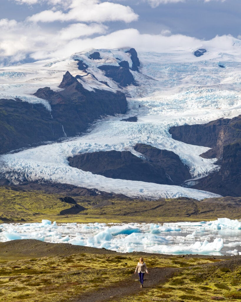
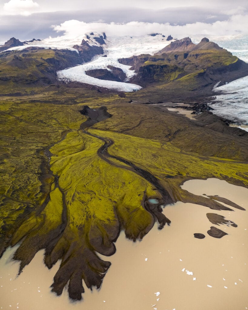
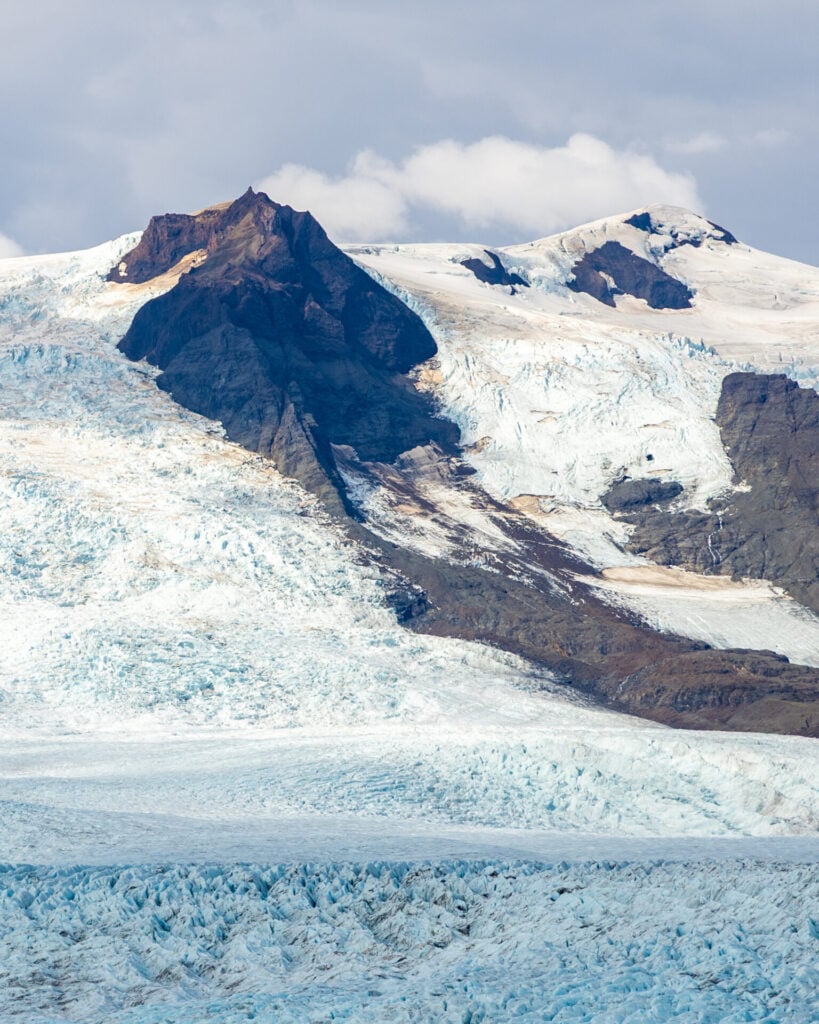
About 1.5hrs west of Stokksnes, make your first stop on the morning at Fjallsárlón, a glacier lagoon that is far less crowded and even more beautiful (in my opinion) than the wildly popular Jökulsárlón and Diamond Beach you would have passed about 10min earlier.


Massive icebergs drift silently across the lagoon while steep glacier-covered mountains rise directly behind the ice. There are two viewpoints: a free parking area near the café and a second paid viewpoint farther along the lagoon that we think is FAR better and absolutely worth the fee for photography!
Múlagljúfur Canyon hike
Trailhead: Múlagljúfur Canyon car park | Time: 2-3hrs | Stats: 6km (400m gain) | Difficulty: easy
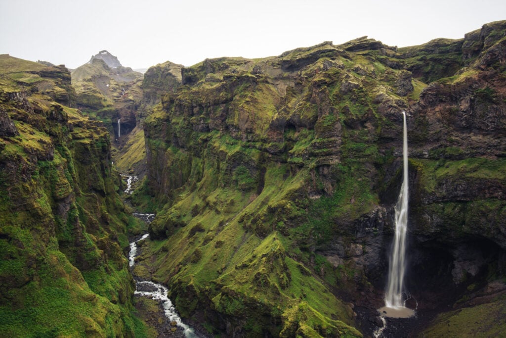
Just a few minutes beyond Fjallsárlón lies another of Southeast Iceland’s most rewarding stops: Múlagljúfur Canyon. It may not be a well-kept secret anymore, but it’s still a phenomenal detour off the Ring Road!
An easy but spectacular hike climbs gradually above this moss-covered canyon filled with waterfalls, glacial rivers, and dramatic cliffs to enjoy a landscape that feels impossibly lush.
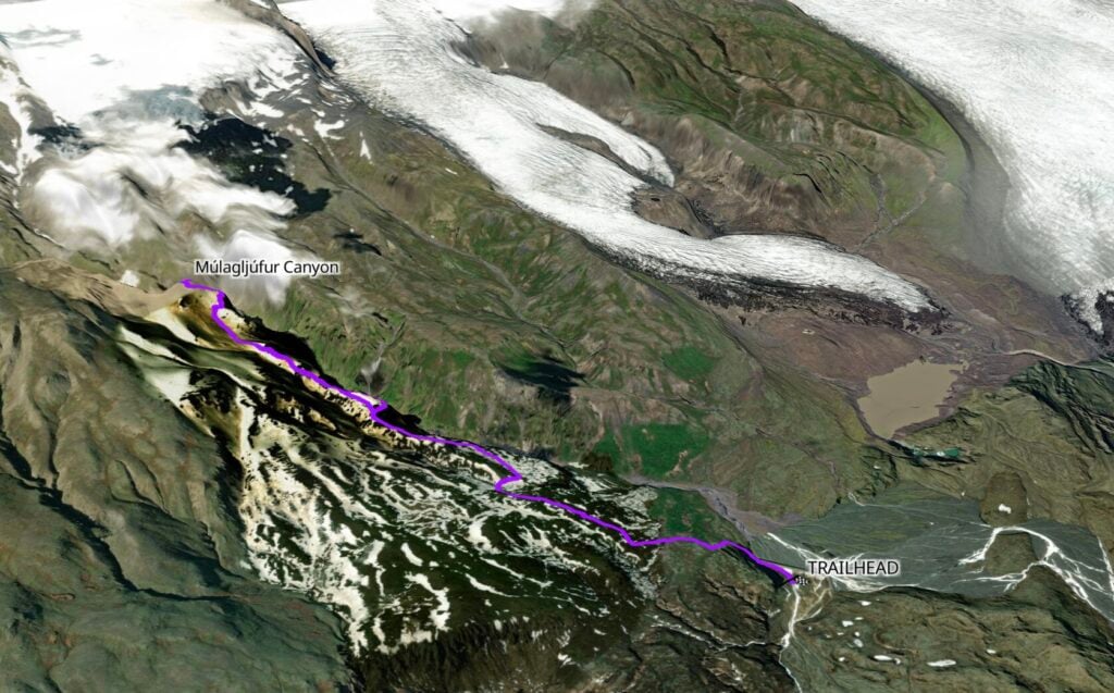
The main canyon viewpoint is just 2km from the trailhead, and this is where a majority of hikers choose to turn around— but if you have the time, continue past Hangandifoss and follow the canyon rim for another kilometre to enjoy increasingly appealing views into the upper canyon!
Fjaðrárgljúfur Canyon
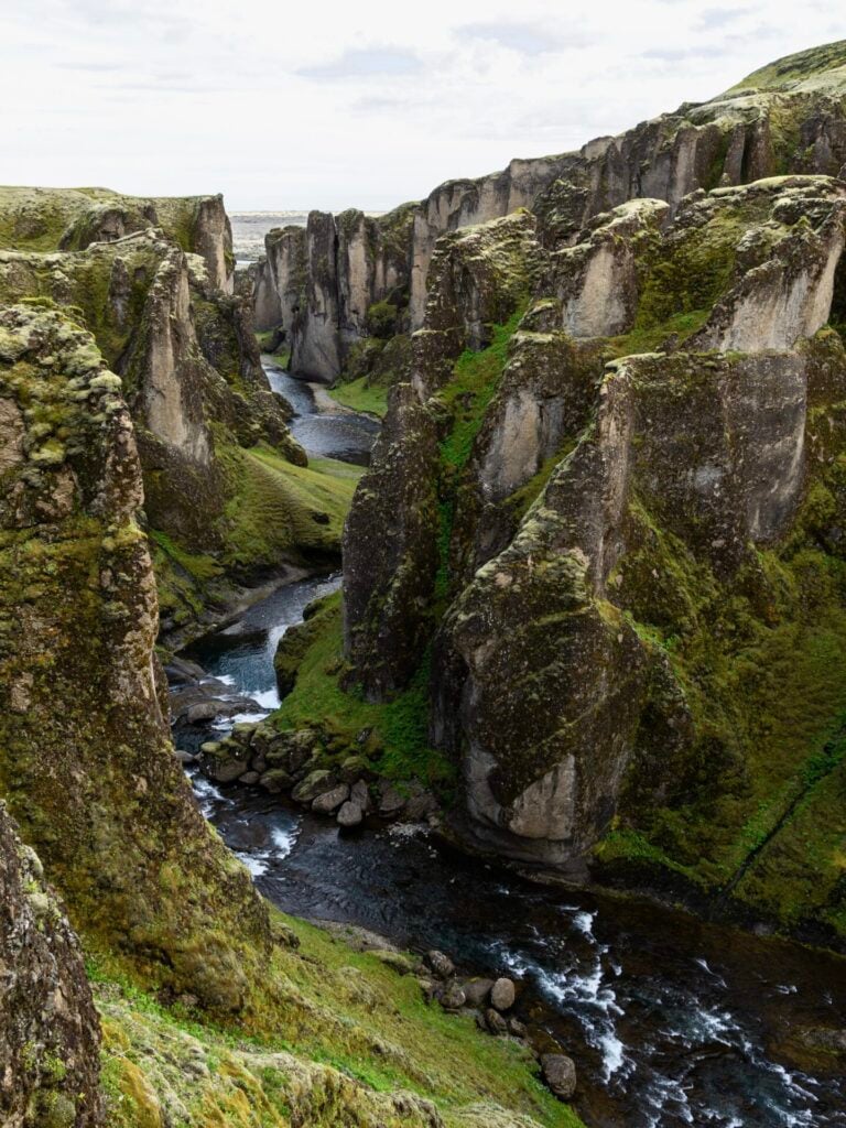
Continuing along the Ring Road for another 1.5hrs, pass through the small town of Kirkjubæjarklaustur (a great place to fill up on fuel!) before turning right onto Road 206 towards Laki. Within a matter of minutes, this road turns into F206 and you’ll reach a small parking lot for Fjaðrárgljúfur Canyon.
Not too many years ago, Fjaðrárgljúfur was a total hidden gem. The first time I visited, I didn’t see another person and it was possible to follow little dirt trails right to the edge of the canyon— but thanks to an unfortunate explosion in visitor numbers, viewing platforms and limited walkways have since been installed to protect the fragile vegetation from erosion.
It’s definitely not the same experience it once was, but the canyon itself remains spectacular and it’s well worth spending 20min walking the designated paths and admiring its twisting walls before continuing deeper into the Highlands.
Fagrifoss
Beyond Fjaðrárgljúfur, F206 becomes increasingly rocky and steep as you continue towards Laki. There are 2 small-ish river crossings on this section of the drive, but neither should pose any issue for 4WD vehicles in normal conditions.
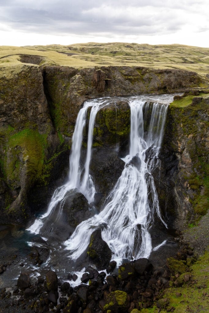
Around 30min beyond Fjaðrárgljúfur, stop at Fagrifoss, a beautiful waterfall tucked into a remote landscape of dark volcanic rock and brilliant green moss. From the carpark, it’s only a short walk to the viewpoint overlooking the falls as they plunge into the rugged gorge below, so this is an easy stop before the road gets considerably wilder!
Scenic drive to Laki on F206/F207
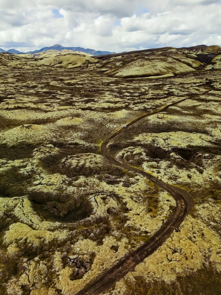
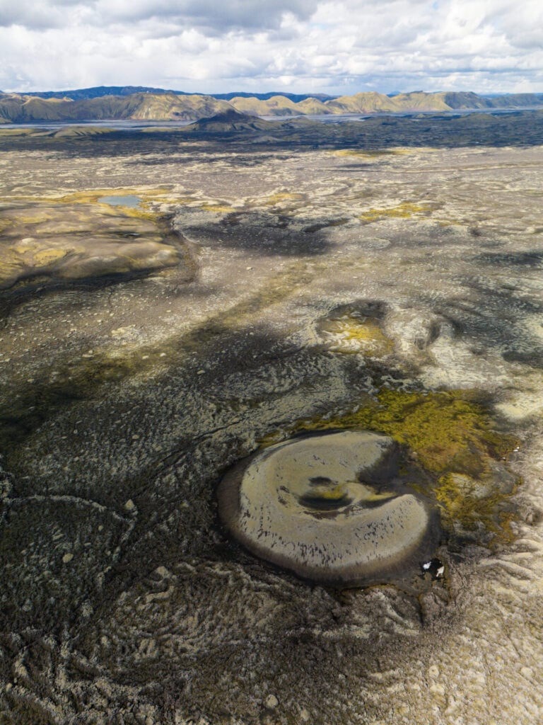
Continuing on F206 beyond Fagrifoss, the scenery becomes progressively more striking as the road winds through vast expanses of moss-covered lava and black volcanic terrain towards Lakagígar (the official name for the Laki crater area).
You’ll also encounter several more rivers, including a medium-sized crossing that might require a bit of finesse depending on recent rain and water levels. Located HERE just before reaching the one-way loop through Laki, this is the second-most challenging river crossing on F206/F207, and rangers will often mark the recommended route through the water with flags. In good conditions, it’s manageable for most 4WD vehicles.
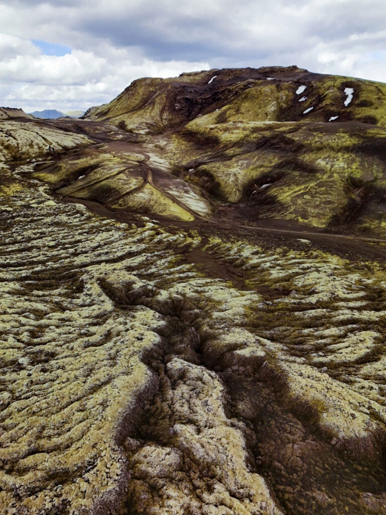
Not far beyond the river, reach a signed junction and turn right towards Laki to begin the anticlockwise one-way loop through this wild landscape, winding between endless mossy craters that seem to glow against the stark black lava fields.
Mt Laki hike
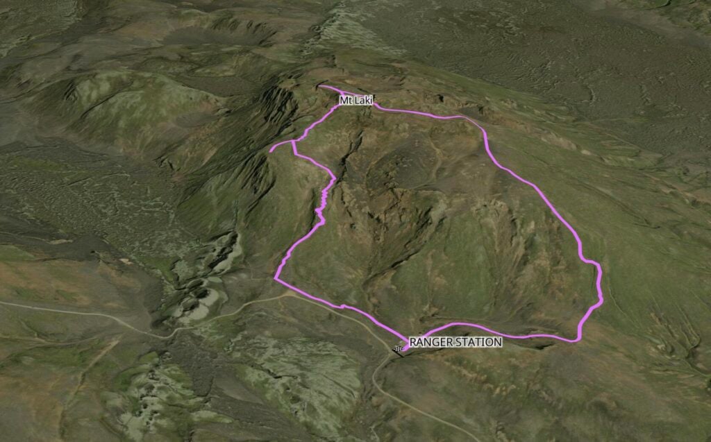
Trailhead: Laki ranger station | Time: 1.5hrs | Stats: 4km (250m gain) | Difficulty: moderate
Roughly halfway around the one-way driving route through Laki, stop at the ranger station for one of the best short hikes in the area. A well-defined trail climbs steeply up Mt Laki, a volcanic mountain in the middle of the enormous crater fissure where more than 130 craters stretch for nearly 30km across the surrounding terrain!
From the summit, you can look directly along the fissure in both directions, with seemingly endless moss-covered craters rising from an enormous landscape of lava fields, glacial lakes, and distant mountains. It’s easily the best vantage point for appreciating the sheer scale of Laki!
*Note that drones are officially banned in Laki, but the ranger told us we were totally fine to fly as long as we stuck to quiet areas free of other tourists.
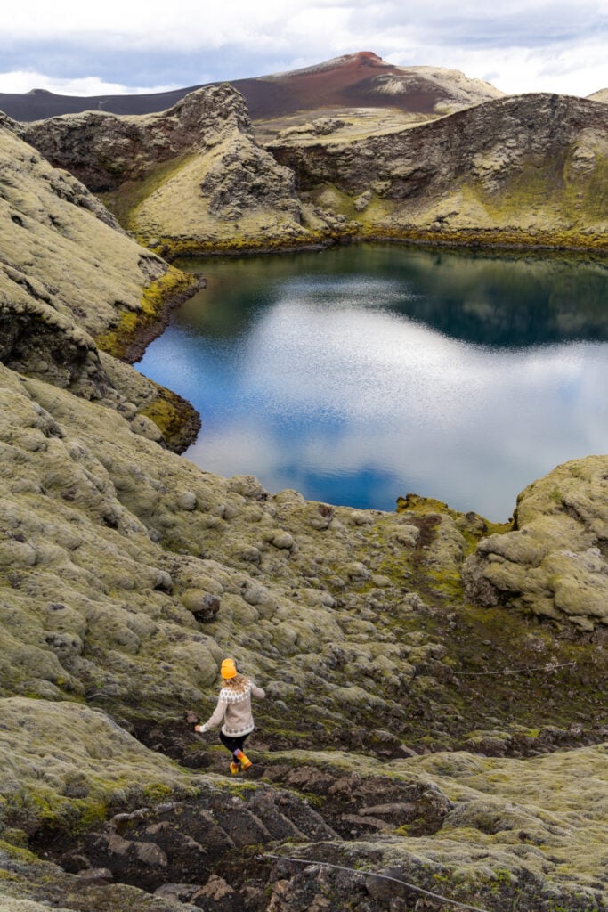
Tjarnargígur Crater & Eldborgarfarvegur hike
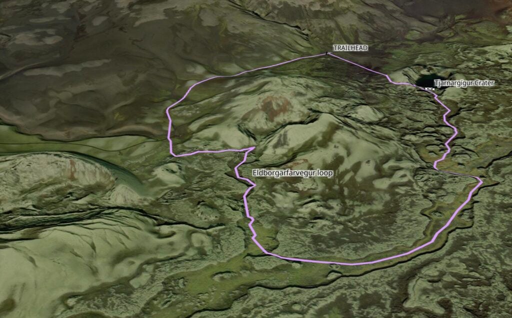
Trailhead: Tjarnargígur Crater parking | Time: 1.5hrs | Stats: 4.5km (100m gain) | Difficulty: easy
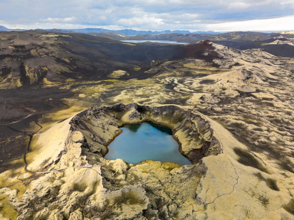
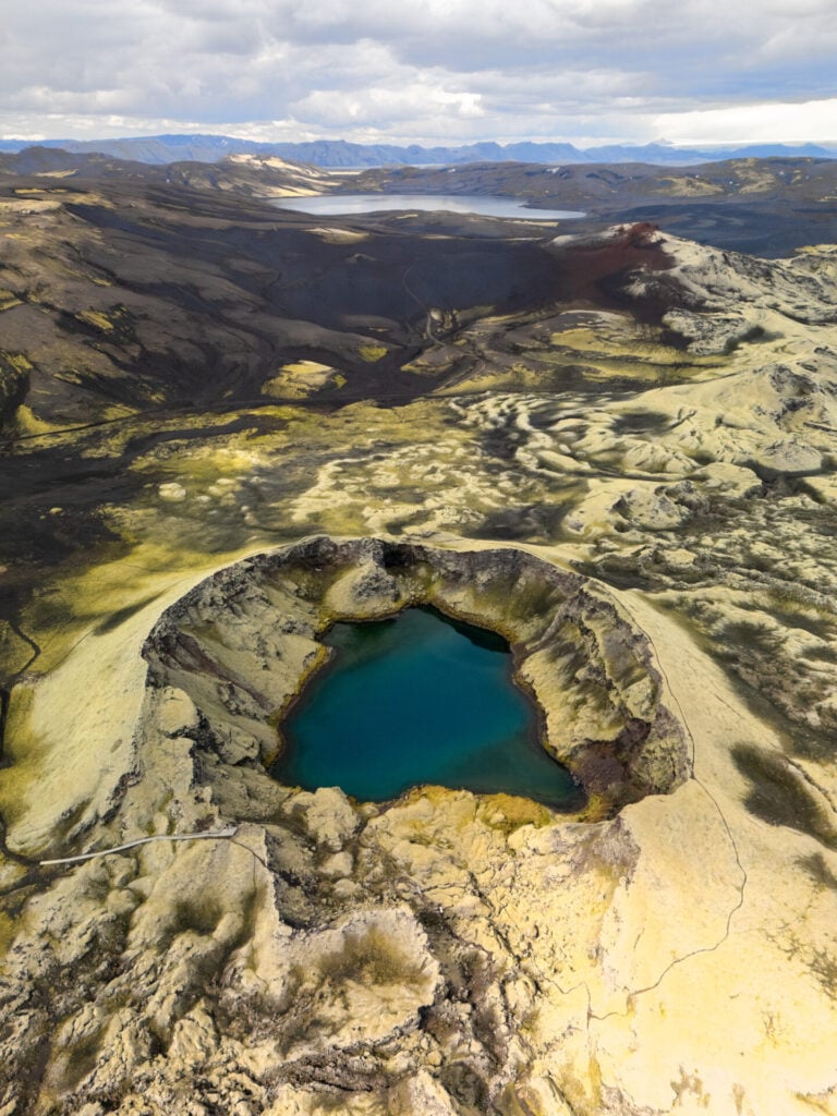
Past the ranger station, F206 becomes F207 and continues anticlockwise for a few minutes before reaching a small parking area for Tjarnargígur Crater. This is one of the most striking spots in Laki (probably my favourite place to photograph!), with an easy path leading down to the beautiful crater lake in about 15min.
You can also extend this short walk onto the Eldborgarfarvegur loop, which follows an ancient lava channel for a little over an hour through the surrounding volcanic terrain. Some of the best scenery is only a short distance beyond Tjarnargígur, so even if you don’t have time for the entire loop, it’s definitely worth continuing beyond the crater lake!
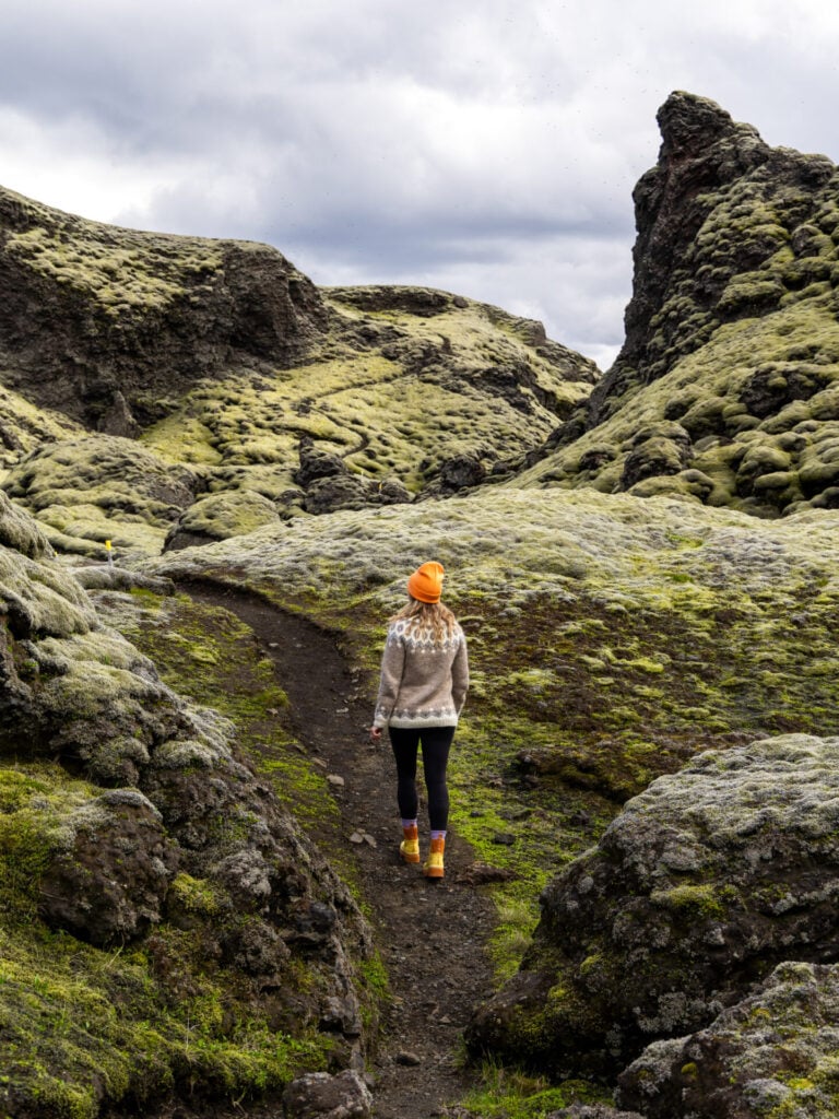


You can still see where old tracks once climbed to the crater rim for what I can only imagine were amazing views, but these trails have since been closed for restoration. It’s worth emphasising that you MUST stick 100% to the marked paths here! The moss that makes Laki so beautiful is also unbelievably sensitive, and even a single step can cause lasting damage to the fragile root system.
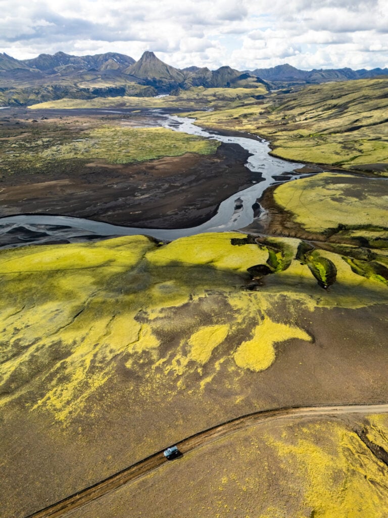
Medium river crossing on F207
From Tjarnargígur Crater, continue anticlockwise along F207 and, just before the turn-off towards Blágil hut & camping, reach the most intimidating river crossing in Laki. The relative difficulty depends a lot on water levels, and much like the medium crossing on F206, rangers typically mark the safest route across the river with flags.


We’ve successfully made this crossing in a Dacia Duster, but I have to admit that it gave us significant pause! We arrived at the same time as a small group of Icelanders and spent upwards of 30min scouting the river together before anyone attempted to drive across. One of the Icelanders even stripped off his pants and waded through to check the depth (a hilarious scene), but everyone made it safely across and onwards to camp!

Day 9: Laki to Langisjór (Southern Highlands)
- Drive time: 3.5hrs
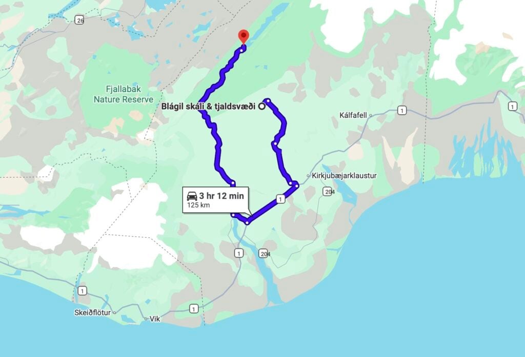
- Roads: F207 > F206 > 1 > 208 > F208 > F235
- Highlights: hike to Ófærufoss, a remote Highland waterfall; drive on scenic F-roads to Langisjór; hike to the summit of Sveinstindur
- Campsite: Langisjór
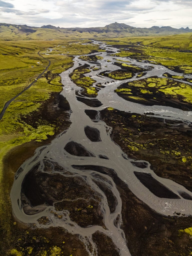
Spend another day exploring deep, untouched corners of the Southern Highlands, this time in wildly underrated Langisjór! Although Laki and Langisjór are incredibly close as the crow flies, you’ll have to drive all the way back out to the Ring Road before venturing back into the Highlands on F208 and F235.
The scenery also couldn’t be more different: where Laki is characterised by soft moss-covered hills and dramatic volcanic craters, Langisjór is a sprawling wilderness of brilliant blue-green lakes, twisting waterways that cut through black sand, and rugged mountains as far as the eye can see. This is easily one of the most INSANE landscapes in Iceland, and the journey to get here is every bit as spectacular as the destination itself!
Scenic drive on 208/F208 to Ófærufoss
Back-tracking along F207 for about an hour to connect the Ring Road, drive just 20km west before turning right onto Road 208 to begin the absolutely epic drive out to Langisjór! The first section of 208 is paved before gradually deteriorating into rough gravel and eventually connecting with F208 South, where the landscapes become dramatically more remote, volcanic, and rugged. Once on F208, it’s a further 26km to Ófærufoss, which takes about 40min in good conditions.
Nearing the falls, be mindful that the GPS might try to route you down the challenging Skaelingar Blautulón track (marked by a blue sign labelled Gjátindur), so make sure to continue left to stay on F208. Almost immediately after that junction, you’ll encounter the most significant river crossing required to reach Langisjór(coordinates here). Under normal summer conditions, this crossing is considered “medium” and manageable in most 4WDs, but it’s still worth stopping to assess carefully before driving through.
Cross two additional tiny streams about 2km before Ófærufoss and then turn right at a signed junction towards the parking area, roughly 1hr after leaving the Ring Road. You’ll likely have it entirely to yourself— and it’s one of our all-time favourite waterfalls in Iceland!
Ófærufoss hike
Trailhead: small car park off the F208 here | Time: 1-1.5hrs | Stats: 5km (100m gain) | Difficulty: easy
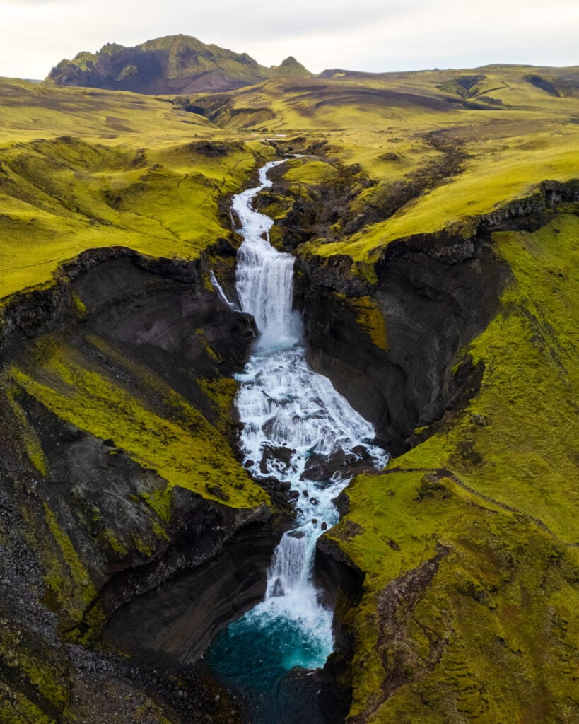
From the small car park, hike about 20min along a well-marked riverside path to reach a wide viewpoint onto Ófærufoss, a spectacular multi-tiered waterfall plunging through a narrow volcanic canyon streaked with black ash and vivid green moss.
Surprisingly for such a remote waterfall, a staircase and official viewing platform have been constructed alongside the falls, so continue another 10min up the right-hand side of Ófærufoss to reach a fantastic viewpoint that you’re all but guaranteed to have to yourself!


Scenic drive on F235 to Langisjór
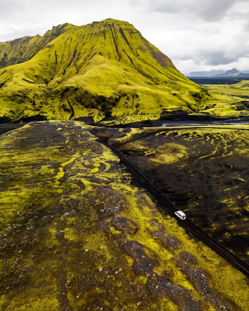
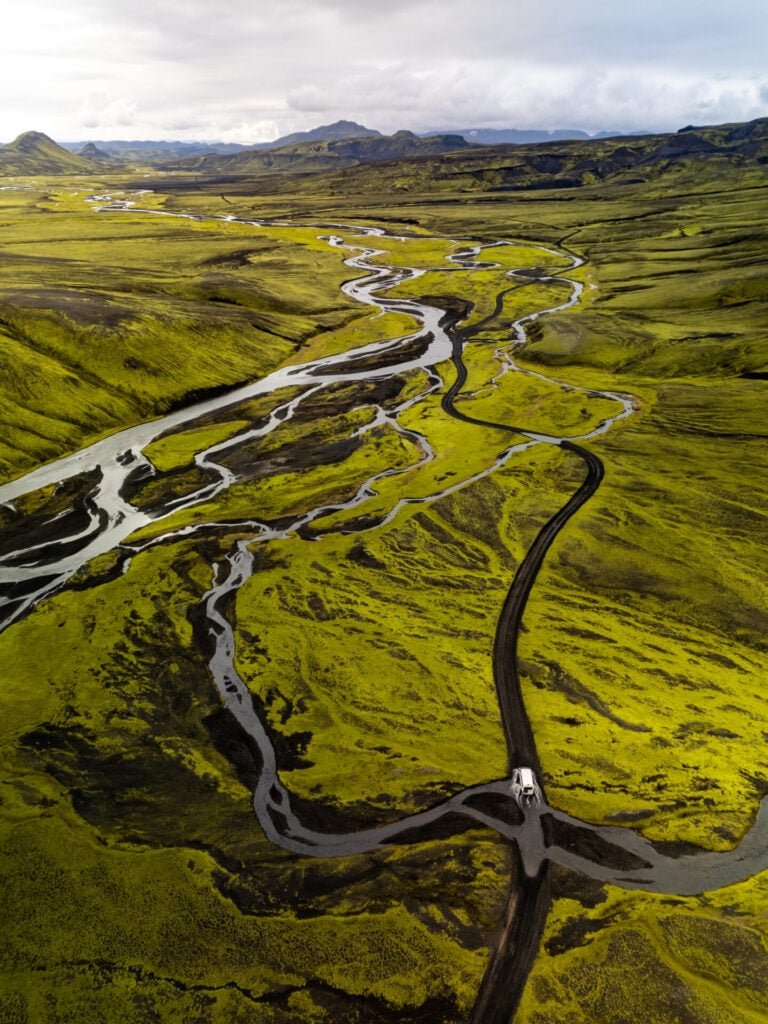
Back on F208 after Ófærufoss, the road becomes noticeably steeper and rougher before turning onto F235 about 10min later, which will carry you all the way to Langisjór through a vast volcanic wilderness of black sand plains, braided glacial rivers, and neon-green moss.


Over the next several kilometres, you’ll encounter several dozen small river crossings, ALL easier than the first crossing you made on F208. This was genuinely one of the most spectacular and just enjoyable drives we’ve done anywhere in the world, and every few minutes we were pulling over to stare at the scenery, launch the drone, or simply laugh at the absurdity of the landscape.
The final 12km to camp follows a winding road through a striking volcanic moonscape with a few bonus creek crossings, delivering you slack-jawed into this remote, wild, well-hidden gem of Vatnajökull National Park.

Langisjór: hidden gem of the Highlands
Hidden deep within the southwestern Highlands, Langisjór is an enormous lake stretching through a volcanic basin of black sand, ash-covered mountains, and impossibly vivid green moss that seems to glow against the dark landscape. Despite being genuinely one of the coolest places we’ve ever seen with our own eyes, it flies pretty far under the radar!
As you arrive at Langisjór, the tiny campground sits along the southern shore of the lake, surrounded by dark volcanic sand and shallow turquoise inlets. Pulling in here after the long drive through the Highlands honestly feels like discovering a secret world at the edge of Iceland!

Sveinstindur hike
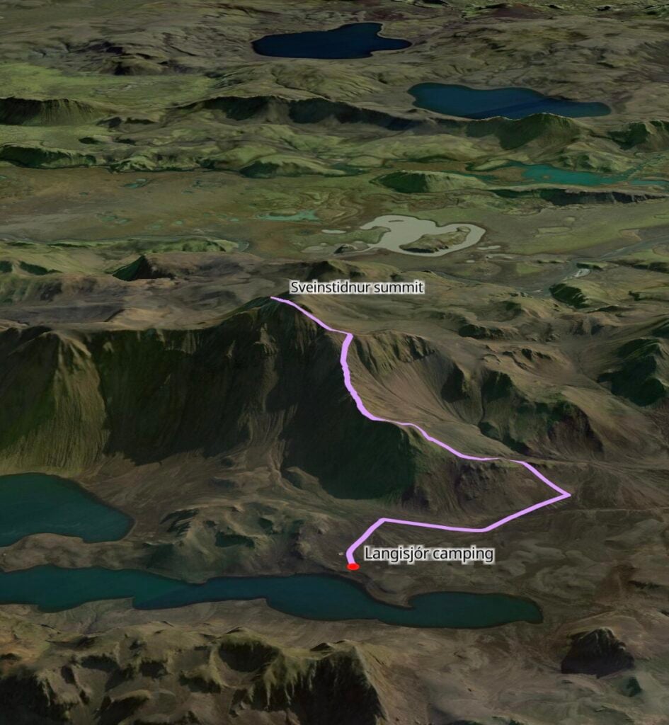
Trailhead: Langisjór campground | Time: 2-3hrs | Stats: 6km (500m gain) | Difficulty: moderate
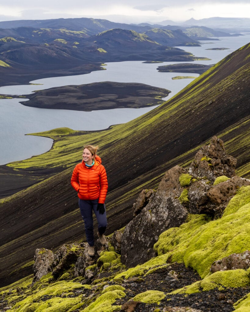
The best day-hike in Langisjór departs just behind the campsite, climbing steeply up the dark volcanic slopes of Sveinstindur. The trail is very straightforward and gains elevation quickly as the lake shrinks below you and the surrounding Highlands begin to unfold in every direction.


From the summit of Sveinstindur, you can really appreciate the vast expanse of lakes and rippled mountains extending in every direction. No photo can properly capture the scale, and I literally cried as we crested the summit ridge— completely overwhelmed that landscapes like this exist on our planet.
Allow about 3hrs return, including plenty of time for photos and soaking in the views, before returning to your scenic campsite for the night!
Day 10: Langisjór to Hvolsvöllur (Southern Highlands)
- Drive time: 5.5hrs
- Roads: F235 > F208 > 208 > 209 > (F232) > 1
- Highlights: retrace the spectacular F-roads out of Langisjór; scenic drive to Bláfjallafoss waterfall crossing; hike to the top of Stóra-Dímon near Hvolsvöllur
- Campsite: Hvolsvöllur
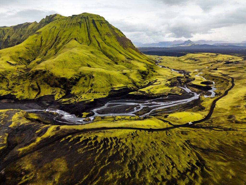
Waking up in the surreal landscape of Langisjór, the majority of the day is dedicated to a scenic drive through the Highlands on the MOST remote and visually outrageous F-roads of the entire trip, culminating in an unforgettable waterfall crossing on F232. I know I’ve been rather liberal with my use of superlatives throughout the itinerary, but THIS is truly the queen of all scenic drives.
Once back on the Ring Road, you may have time for a few stops before settling in at Hvolsvöllur for the night. We’d highly recommend the short hike up Stóra-Dímon for braided river views and glacier scenery, but this section of the South Coast is truly packed with highlights!
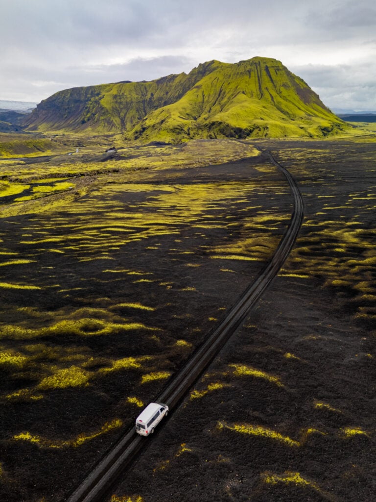
Scenic drive on F232 to Bláfjallafoss
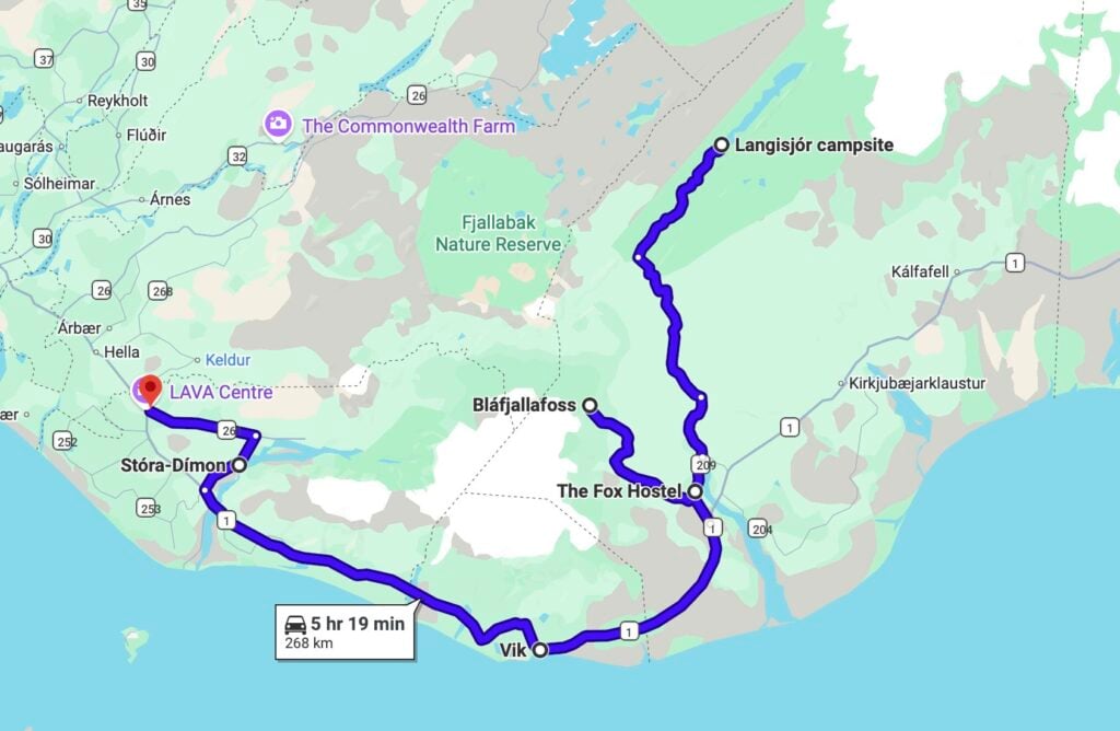
Departing Langisjór, retrace the entire drive back along F235 and F208— stop to photograph anything you missed on the way in and just generally soak it in! You’ll backtrack almost to the Ring Road before turning from 208 onto 209 (you can put the Fox Hostel into your GPS), and then shortly after this, turning onto F232 towards Bláfjallafoss.
You may notice that F210 looks a lot more direct, so why the circuitous route? Sections of F210 are incredibly challenging, including a large river crossing much tougher than anything else on this itinerary, and we’ll pass on the same advice we received: don’t attempt F210 without a LOT of 4WD experience. It’s still worth the long detour to get around to F232, I promise!
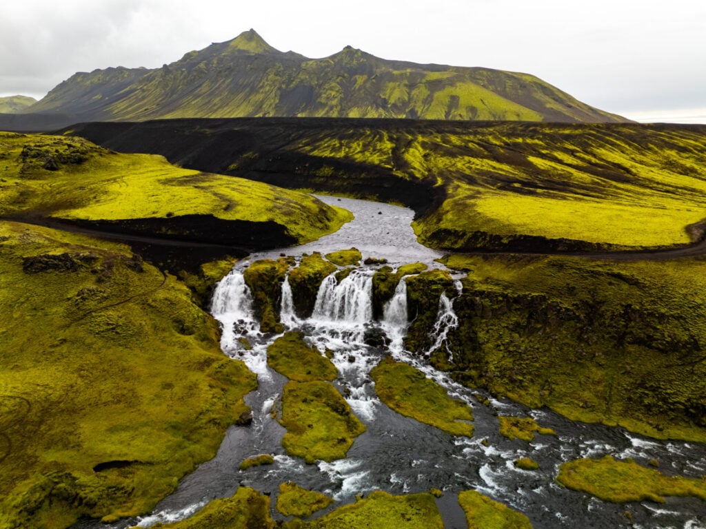
Bláfjallafoss waterfall crossing
All told, it takes about 1.5hrs of slow driving on F232 to get to Bláfjallafoss, which is what we’d recommend as a turn-around point if you aren’t an experienced 4WD driver. Consider it no loss, because this stretch of road is gorgeous, winding through rural farm country, past the Mýrdalsjökull glacier, and eventually into some of the most mind-blowing landscapes we’ve ever seen.
Even after ALL the spectacular landscapes of Landmannalaugar, Kerlingarfjoll, the East Fjords, and Langisjór… F232 still manages to steal the show in terms of scenic drives.
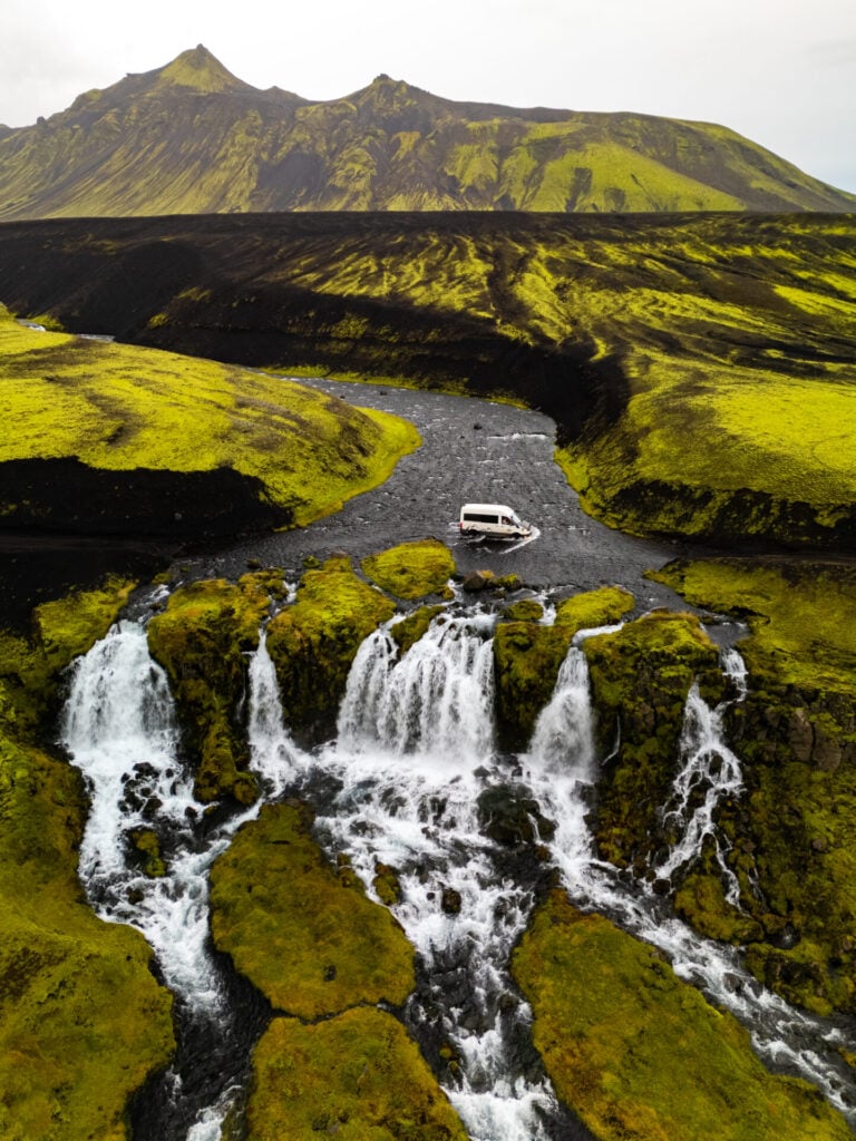
Eventually find yourself at Bláfjallafoss, a braided waterfall cascading from a broad river, against the backdrop of black volcanic mountains draped in neon green moss. Depending on water levels (and your vehicle clearance), it’s actually possible drive directly across this waterfall— which ended up being the most exhilarating crossing of the trip!
The entry and exit points are rather eroded, so ease carefully into the crossing and give the vehicle a little extra momentum on the climb out to avoid slipping. If you’re turning around here, you get to do it twice!
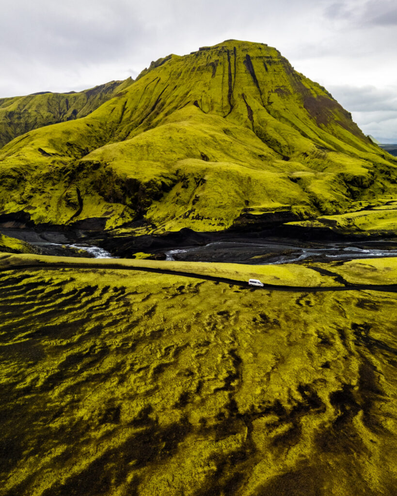
F210 to Maelifell or back to the Ring Road
Experienced drivers can continue across Bláfjallafoss on F232 for a short distance to connect with F210, which heads south past the iconic cone-shaped volcano Maelifell and many other highlights of Fjallabak Nature Reserve.
We have NOT driven F210 ourselves, balking at the large river crossings even in our high clearance van, but for more confident drivers, this road will take you all the way back to the Ring Road in Hvolsvöllur (with just 5min on the connecting Road 264).
I highly recommend reading this great guide to F210, and if you’re anything less than VERY confident with deep river crossings, simply return to the Ring Road on F232 (plus a few minutes on the connecting Road 209). The southern “play it safe” route is 150km compared to 100km on F210, but it’s about 1hr quicker thanks to the easier driving. And there’s absolutely no shame in taking the conservative option here, it’s what we did!

Stóra-Dímon
Rising abruptly from the vast braided river plains near Hvolsvöllur, make one final stop along the South Coast to enjoy amazing views from the top of little Stóra-Dímon.
A steep trail leads to the top in 10-15min, revealing a spectacular panorama over the braided channels of the Markarfljót, with glacier-capped mountains rising in the distance. It’s one of the best low-effort trails that hardly anyone seems to know about, and a great way to cap off another amazing day in Iceland!

Day 11: Hvolsvöllur to Grindavík (Reykjanes Peninsula)
- Drive time: 3.5hrs
- Roads: 1 > 34 > 427 > 42 > 43
- Highlights: geothermal landscapes of the Reykjanes Peninsula; drive onto a black sand beach at Kleifarvatn; hike to the summit of Grænadyngja
- Campsite: Grindavík
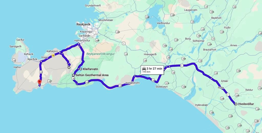
The final full day of this 4WD road trip explores a region that almost every visitor passes through, but very few actually take the time to experience properly: the Reykjanes Peninsula.
Although Keflavík Airport is Iceland’s main international gateway, most travellers land here and immediately drive away from the peninsula without realising how much incredible scenery is packed into this compact volcanic region.Today’s itinerary features colourful geothermal landscapes, moss-covered lava fields, black sand beaches, and a remote summit hike that showcase the beauty of underrated Reykjanes!
Seltún Geothermal Area
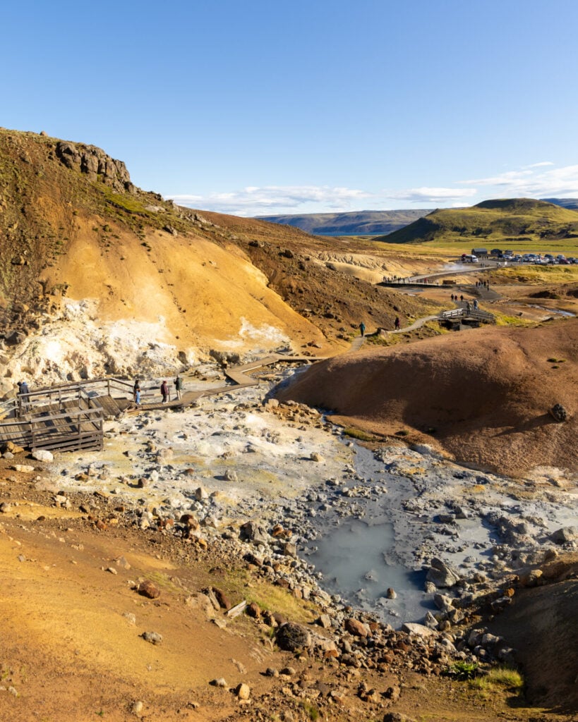
Drive about 1.5hrs from Hvolsvöllur to the Seltún Geothermal Area, first west along the Ring Road and then on a series of smaller roads onto the Reykjanes Peninsula. Unlike the enormous geothermal valleys of the Highlands, Seltún is much more compact and (honestly) a little less spectacular, but still worth a quick wander through its steaming fumaroles, bubbling mud pots, and sulphur-stained hillsides.
A network of boardwalks loops through the geothermal field, but I’d recommend continuing farther uphill on the rough trail beyond the end of the platforms for sweeping views over the peninsula!
Kleifarvatn Black Sand Beach
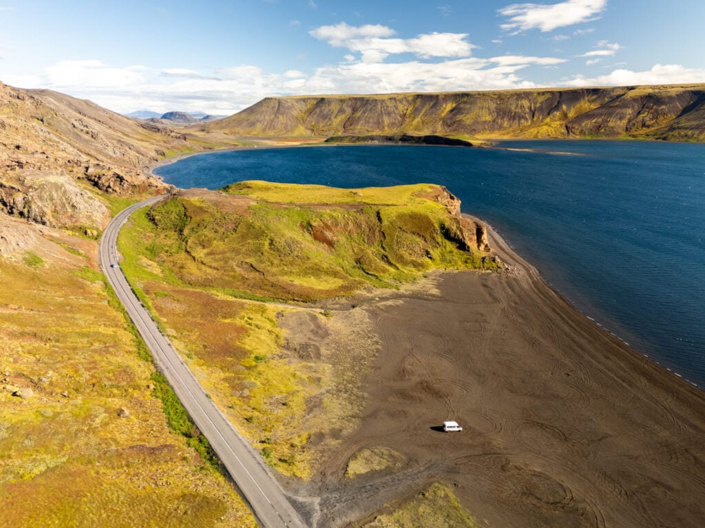
Just a few minutes beyond Seltún on Road 42, stop at Kleifarvatn, the largest lake on the Reykjanes Peninsula. With a 4WD, you can drive directly onto sections of the black sand beach, making this an excellent lunch stop with beautiful views across the water!

Grænadyngja & Grænavatnseggjar hike
Trailhead: small parking area near Trölladyngja (4WD only) | Time: 2-3hrs | Stats: 4.5km (220m gain) | Difficulty: moderate
Due to the dramatic topography of the peninsula, you’ll have to drive a rather circuitous route to the trailhead for this afternoon’s hike, heading north on Road 42, west on Road 41, and finally south on an unnumbered road (called Keilir) through a beautiful, moss-covered lava field. It’s slightly slow-going and gets a bit gnarly towards the end as you approach the trailhead, but it’s manageable for any 4WD vehicle.
The trails in this area are also somewhat ill-defined, so I’ll share our GPX track and a map below. Generally, cross the stream in front of the carpark and head towards the brown ridge on your left, winding your way up the slopes towards the summit of Grænadyngja.
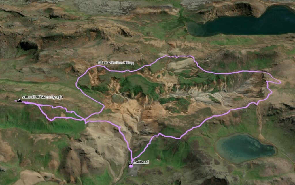


From the top, there are sweeping views across the Reykjanes Peninsula’s volcanic ridges, lava fields, and compact geothermal valleys. And you’ll most certainly have this entire area entirely to yourself!
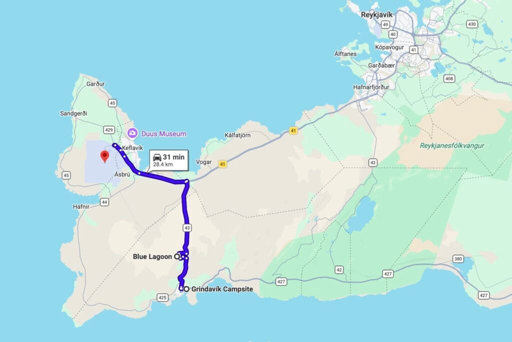
After enjoying the summit, continue clockwise around the loop to return to the trailhead, about 1.5-2hrs total. It takes at least another hour to drive out of the rough 4WD road and then onwards to our recommended campsite at Grindavík, which is conveniently located about 10min from Blue Lagoon for one final morning soak tomorrow before your departure flight!
Day 12: Blue Lagoon to Keflavík Airport
- Drive time: 30min
- Roads: 43 > 41
- Highlights: Blue Lagoon
Finish this epic 12-day road trip with one final Icelandic experience: an early-morning soak in the Blue Lagoon before heading straight to Keflavík Airport!
Blue Lagoon
From Grindavík, it’s an easy 10min drive north to reach the iconic Blue Lagoon, conveniently located right on the way to Keflavík Airport. It may be Iceland’s most famous hot spring (and certainly one of its most expensive), but I honestly LOVE the Blue Lagoon and, at the right time of day, you can still get enjoy a relaxing and fairly quiet experience!


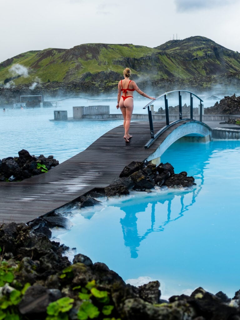
Set within a sprawling black lava field on the Reykjanes Peninsula, the milky-blue geothermal water of Blue Lagoon is wonderfully warm and relaxing. Grab a drink from the swim-up bar, slather on one of the signature silica mud masks (included in the entry price), and enjoy a final soak after nearly two weeks of hiking, F-roads, and river crossings.
The best way to avoid the crowds at Blue Lagoon is to visit first thing in the morning, so we highly recommend booking the earliest available entry (typically 7 or 8am, depending on seasonal opening hours) and arriving a few minutes before your slot. We’ve done exactly this and had the lagoon almost entirely to ourselves before our outbound flight. Bon voyage!
Itinerary extensions & modifications
There are an infinite number of ways to extend and modify this itinerary depending on your trip length, weather, and preferences, but here’s what I’d specifically recommend if you want to prioritise destinations that require a 4WD:
- add 1-2+ days in the East Fjords: this is one of the most underrated corners of Iceland, with an insane number of incredible hiking trails, remote fjords, and hidden waterfalls that are best accessed by 4WD. Check out my complete East Iceland guide for heaps of ideas on how to spend a few extra days in the East!
- Add 1-2 days to explore Þórsmörk: this spectacular corner of the Southern Highlands is dominated by lush canyons, rugged volcanic peaks, hanging glaciers, and some of the best hiking in Iceland. With a 4WD, you can drive F249 as far as Básar without crossing the infamous Krossá (although there are still several other medium rivers crossings).
- Add 3-5+ days for Snæfellsnes or the Westfjords: neither region combines particularly well with this itinerary, since our route travels north through the Central Highlands rather than following the western section of the Ring Road, but it’s pretty awesome to have a 4WD in these locations. If you want to incorporate either, you’ll need to modify the route considerably and allow at least 3 additional days for Snæfellsnes or 5+ days for the Westfjords.


Read all of my Iceland itineraries & travel guides
- 20 best hikes in Iceland (after MANY months of exploration!)
- Where to see puffins in Iceland: popular spots + hidden gems
- 10-day Iceland 4WD campervan itinerary: best of the Highlands & F-roads
- Best places to explore in the Icelandic Highland
- Ultimate Iceland Ring Road itinerary
- The ultimate East Fjords travel guide: best things to do in East Iceland
- 5-day Westfjords + Snæfellsnes road trip itinerary
- Laugavegur + Fimmvörðuháls hiking guide: Iceland’s best 5-day hike
- Laugavegur hike packing list
