
Last Updated on 5 October 2026
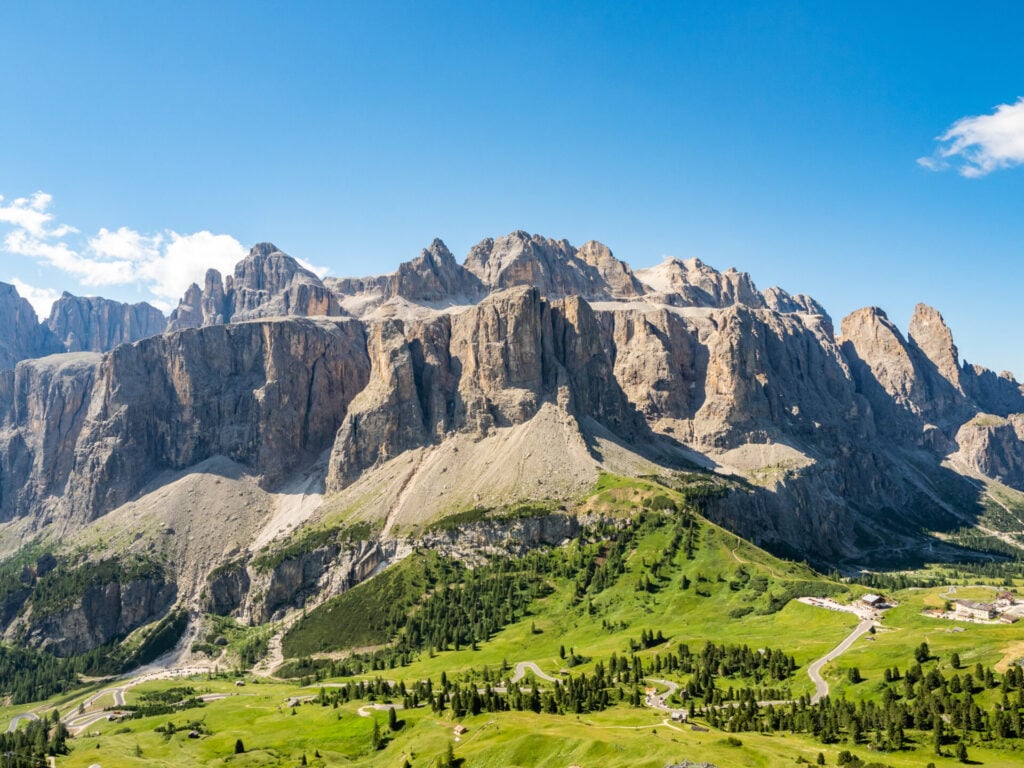
For all the thousands of kilometres of incredible mountains that comprise the European Alps, there’s hardly an equal to the Italian Dolomites. Characterised by jagged limestone (dolomite) peaks, dramatic glacier-carved valleys, and enchanting alpine lakes, this jaw-dropping mountain range in Northeastern Italy is quite unlike anywhere else on the planet. And surging popularity has cemented its place among the world’s premier hiking destinations!
The best way to experience the diversity of this region is along Alta Via 2, the longest of the “high routes” that cut across the Dolomites. Often overshadowed by the popularity of Alta Via 1 and (more recently) Alta Via 4, AV2 presents an altogether different experience: crowds are low, the variety of alpine scenery is unparalleled, and frequent via ferrata ensure that this is so much more than just a garden variety hike.
This guide will tell you absolutely everything you need to know about planning and embarking on a truly epic adventure along AV2, from booking mountain huts and seeking out the best via ferrata to daily route descriptions and navigation essentials— including my custom GPS map that’s helped hundreds of hikers experience the best of AV2!
This post contains affiliate links, which means I may earn a small commission if you book something I recommend, at no extra cost to you. I ONLY recommend tours, rentals and places I’ve personally used (or would happily book again) — your support helps keep this site going and the adventures rolling!
About Alta Via 2
- Trailhead: Bressanone/Brixen (ending in Croce d’Aune, near Feltre)
- Time to complete: 10-14 days
- Distance: 160km (100mi)
- Elevation gain: 13,530m (44,400ft)
Stretching from Bressanone/Brixen in the north to Croce d’Aune (near Feltre) in the south, Alta Via 2 is a spectacular long-distance route that incorporates nearly 200km of scenic trails and exhilarating via ferrata as it meanders through alpine meadows, wraps around dramatic cliffs, and conquers high mountain passes.
In many ways, AV2 is one of the more difficult Alta Via routes that zig-zag across the Dolomites— it covers an incredible distance, gains a significant amount of elevation, navigates often rough terrain, and includes several sections of via ferrata that necessitate careful footwork and a good head for heights. All of these factors combine to make it one of the most exciting multi-day hiking routes in Europe!


The first half of AV2 journeys through the northern province of South Tyrol— annexed by Italy following WWI, this historically Austrian region has retained much of its heritage and the influence is still profound, with locals speaking German as a first language (indignant correction: they speak Austrian!) and food that is a blend of mountain Italian/Austrian (less pasta and pizza, more sauerkraut and polenta).
Around Marmolada at the midpoint of the hike (day 5/6/7, depending on your exact itinerary), AV2 crosses into Belluno, a distinctly more Italian province that represents a change in language, cuisine, and culture. Remain curious and you’ll get a lot more out of AV2 than just incredible scenery!
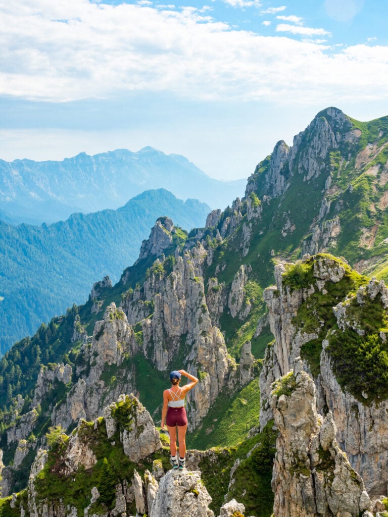
Alta Via 2: is it for you?
- You can hike up to 8hrs for 10-14 days in a row, often on very steep or uneven terrain
- You have some limited experience climbing via ferrata, scrambling, or basic mountaineering— at a minimum, you have steady footing and a solid head for heights, plus all the necessary via ferrata gear
- You are able to carry 10-15kg in your backpack for the entire duration of the trek
- You have basic navigational skills and know how to read a map and/or GPS
- You know what to do in the case of a medical emergency and you have a way to call for help (e.g. Garmin InReach Mini 3)
🧗🏻♂️ VIA FERRATA ON AV2
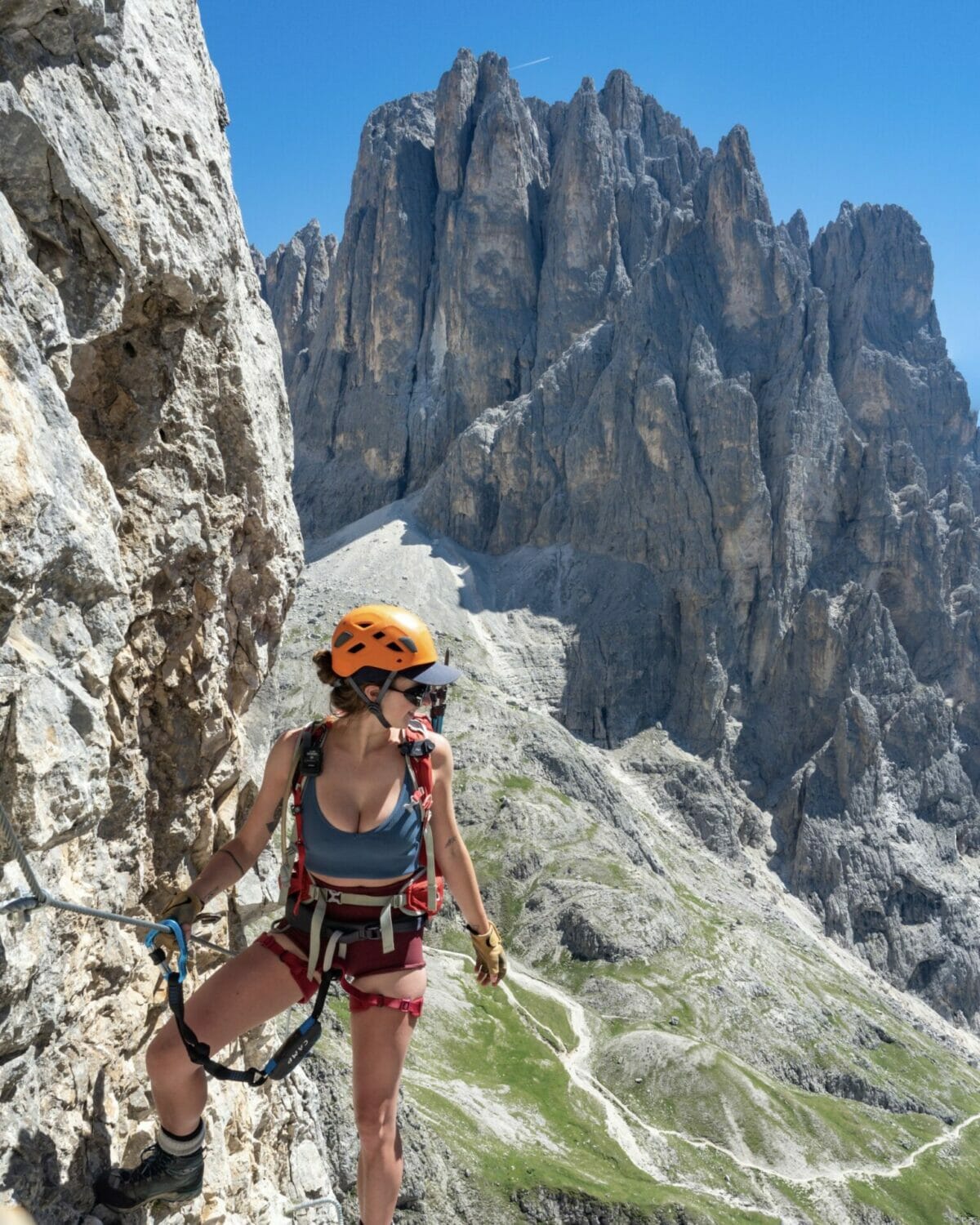
To characterise this as a “just a hike” would do AV2 a disservice, but it’s an experience that defies simple classification: a combination of protected scrambling, long-distance trekking, and the feeling of a rugged backcountry journey with all the convenience of mountain huts and hot food. Unlike AV4, however, AV2 has only a few sections of unavoidable via ferrata, making it more suitable for beginners looking to test their skills on the cable.
It’s no small task and shouldn’t be undertaken lightly, but with careful preparation, this is sure to be a favourite even among first-time scramblers!
>>> Read more about the relative difficulty of each via ferrata along AV2 below
Planning your Alta Via 2 hike
Best time to hike AV2
Most huts in the Italian Dolomites open for the season in mid-June and close again by mid-September, coinciding with the best weather window for AV2. Here’s a little bit of what you can expect during each month of summer in the Dolomites:
- JUNE: lingering spring snow keeps crowds very low & you’ll likely get away without hut reservations; temps are lower & afternoon showers are common
- JULY: with the snow gone, trails & huts become busier; possibility of thunderstorms, but also the possibility of 30C bluebird days!
- AUGUST: the absolute busiest time to be in the Dolomites, as Italians flood the trails during their holiday period; hut bookings are essential, but weather also tends to be very stable
- SEPTEMBER: crowds wane, particularly later in the month, and hut booking may not be necessary; pack & prepare for possible snowfall, which adds difficulty but also a lot of beauty to the landscape!
The Dolomites are known to be somewhat wild when it comes to weather and it’s not uncommon to experience several seasons in a single day, even during July & August. Whatever your dates, prepare for sporadic and often unpredictable thunderstorms (by bringing rain gear and adequate layers). If it rains in the morning, the afternoon tends to be clear and I never experienced more than a few hours of uninterrupted precipitation, but expect to get wet at some point. For reference, I hiked AV2 from 4-17 July 2022 and we had just 1 major day of rain.


Maps & planning resources for AV2
My custom GPS route
Especially for those following my custom AV2 adventure route, the absolute BEST navigational resource is my custom AV2 GPS map— built from personal experience, packed with nearly 200 waypoints & crazy-detailed trail notes to help you navigate safely, on and off trail. UPDATED SEPT 2026 BASED ON USER FEEDBACK!
The map is available as a JSON & GPX download, and is compatible with all major GPS mapping devices/watches AND inexpensive GPS apps available on your smartphone, like CalTopo, Gaia GPS, and AllTrails. Let me help you plan & confidently navigate Alta Via 2!
My custom AV2 map includes:
- Complete daily tracks for the full AV2 route, with trail stats, elevation profiles & terrain insights
- 12 scenic side trips, from quick summits to epic via ferrata— each with a dedicated GPS track & trail notes
- Clear detours to avoid via ferrata or exposed sections, if needed
- 168 key waypoints, including daily tracks, mountain huts, side trips, via ferrata, cable/ladder sections & other key junctions to help you navigate
Tabacco maps
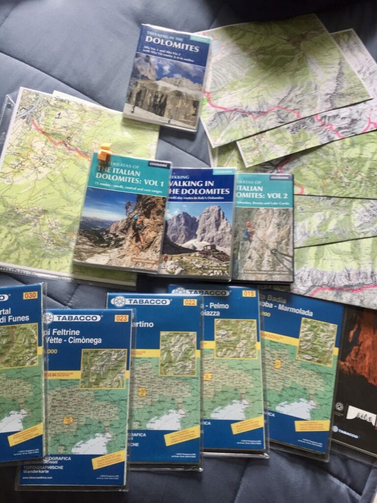
If you want to supplement your planning with physical maps, you’ll need quite a stack for AV2 (but if you’re on a budget, you can visualise 85% of the route by purchasing only Map 07 and 022).
- Tabacco Map 030 (Bressanone)
- Tabacco Map 07 (Alta Badia)
- Tabacco Map 015 (Marmolada)
- Tabacco Map 022 (Pale Di San Martino)
- Tabacco Map 023 (Alpi Feltrine)
I used Tabacco maps rather extensively when building my itinerary, but unsurprisingly, they aren’t super useful for frequent on-trail navigation. I’d recommend combining with GPS for the best of both worlds!
Cicerone guide books
The only official publication for Alta Via 2 is the Cicerone guidebook, which underwent a much-needed update in late 2022 and now provides current and very thorough information on the entire route. If you buy any book, this will surely be the most useful.
- Alta Via 2 – Trekking in the Dolomites by Gillian Price
Split across 2 volumes, these guidebooks also contain detailed route descriptions for all of the via ferrata along AV2, among many others:
- Via Ferratas of the Italian Dolomites: Vol 1: 75 routes-North, Central and East Ranges by Graham Fletcher & John Smith
- Via Ferratas of the Italian Dolomites: Vol 2: Southern Dolomites, Brenta and Lake Garda by Graham Fletcher & John Smith

Via ferrata on Alta Via 2
For those unfamiliar with via ferrata, this seems to be the element of AV2 that contributes to the most apprehension, but it’s also what makes the route so spectacular. Translating to “iron route” in Italian, via ferrata is a form of protected climbing that was invented during WWI as a means of getting soldiers up and over challenging peaks with minimal technical experience or equipment. Today, it’s an amazing form of recreation, with hundreds of via ferrata spread across the Italian Dolomites!
Clipped into a fixed cable for continuous protection, via ferrata routes (sometimes denoted as Klettersteig or EEA) ascend steep rock faces and traverse exposed ledges through the use of ladders, pegs, stemples, and even the occasional bridge, bringing those with limited climbing experience to incredible heights.


My adventure route of AV2 describes numerous side-trips that incorporate occasionally challenging and always exciting via ferrata, but unlike AV4, Alta Via 2 has very few unavoidable sections of cable. These en route ferrata are typically quite easy and should be manageable for those without prior experience, but I’ll reiterate that you DO need a strong head for heights, proper gear, and knowledge of how to use it.
In contrast, some of the off-route via ferrata in my itinerary are very challenging and only suitable for those with previous experience! See more details on each of AV2’s via ferrata immediately below.
To learn more about via ferrata in the Dolomites, check out this post: Via ferrata in the Italian Dolomites: the ultimate beginner’s guide


Aside from a few sections of cabling that provide some additional protection along the main hiking route (but really don’t amount to a formal via ferrata), all of the major via ferrata along AV2 are avoidable, either by skipping the out-and-back side-trips (off route) or by choosing an alternate hiking trail (alt route).
Here’s a quick look at the relative difficulty of all the via ferrata routes recommended in my itinerary:
- Sass di Putia (off route, Day 1)— easy via ferrata, a perfect warm-up to get comfortable with your gear
- Piz Duleda (alt route, Day 2)— fairly easy and short section of cabling to a wide summit, avoidable by following an alt route shown on my GPS map
- Gran Cir (off route, Day 3)— easy via ferrata without any major vertical sections, suitable for beginners
- Piz da Cir V (off route, Day 3)— fairly easy with a few short sections of exposure, a good opportunity to test out your comfort level
- Brigata Tridentina (alt route, Day 3)— exhilarating and very exposed via ferrata up to Rif. Pisciadú, among the best on the entire route but easily avoided by opting for a steep trail instead
- delle Trincee (off route, Day 6)— challenging via ferrata above Lago di Fedaia with lots of exposure and some challenging moves
- Porton & Nico Gusella (off route, Day 9)— challenging via ferrata with heaps of exposure and off-trail nav through steep scree, long and demanding but quiet and spectacular for experienced scramblers
- Canalone (off route, Day 9 or 10)— extremely vertical but short via ferrata right next to Rif. Treviso
*If you’re new to via ferrata or looking to improve your confidence on technical routes, Explore-Share connects you with experienced local guides in the Dolomites who can provide instruction and help you safely navigate the exposed sections of AV4.

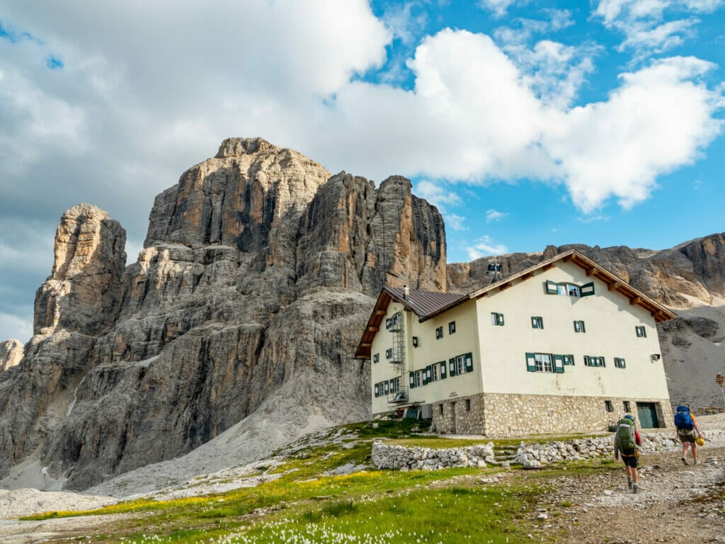
Mountain huts on Alta Via 2
As wild camping is not permitted along Alta Via 2 (or anywhere in the Dolomites), you’ll have the distinct treat of sleeping in a warm bed every night as you hike from Bressanone to Croce d’Aune.
Mountain huts, or rifugi, are such a wonderful part of the Alta Via experience, typically offering a mix of dorms and private rooms for ~25-35€ and half-board (accommodation that includes a 3-course dinner and brekky) for ~50-75€. Be sure to check out my section on Alpine Club membership below for info about how you can save as much as 18€ per night on hut accommodation!
If you want to learn more about mountain huts in the Dolomites and what to expect during your stay, including details about food and facilities, be sure to check out this specific post: Everything you need to know about mountain huts (rifugi) in the Italian Dolomites


I collected heaps of specific details on all the mountain huts along AV2 and collated it in a table for easy reference; those included in my recommended itinerary are marked with a star 🌟. Follow links for each hut to find out more about their booking process.
| Hut | Room | Food | Showers | Connectivity | Alpine Club |
| Schlüterhütte Rifugio Genova 🌟 | 26/34€ (dorm/small room) 54/62€ half board (dorm/small room) | A la carte (approx 10-15€ for dinner, 9€ brekky), great selection of food, wine, beer | 3€ for 5min | Wifi & strong mobile signal | N/A |
| Rifugio Puez 🌟 | 31€ (12pax dorm only, 3-level bunks are not a fave) 74€ half board | A la carte or half board | 4€ for 4min | None | -11€ discount |
| Rifugio Piscadiu 🌟 | 33/39€ (dorms/small rooms) 70/75€ (dorms/small rooms) | A la carte (approx 10-15€ for dinner, 14€ for 1L of wine, 4.5€ Aperol spritz, 12€ breakfast) or half board | 3€ for 4min (4-6pm only) | Wifi & weak mobile signal | -10€ discount (-14.5€ room only) |
| Rifugio Boè | 38€ (dorms only, smallest 4 person) 69€ half board | A la carte or half board, extensive menu with great lunch! | 1€ for 1min | None | -10€ discount |
| Rifugio Capanna Piz Fassa (Piz Boè) 🌟 | 70€ half board (rustic shared rooms, smallest 3ppl) | A la carte or half board (super large 3-course, could share between 2 people) | No | Weak mobile signal | N/A |
| Rifugio Castiglioni Marmolada 🌟 | 31/42€ (dorm/ private) 58/69€ half board (dorm/ private) | A la carte (approx 10-15€ for dinner, add 6€ for breakfast); half board includes 3-course dinner and breakfast | Unlimited & free! *Washing machine and dryer (4€ for each, must have 2€ coins) | Wifi & very weak mobile signal (go 100m outside for better signal) | N/A |
| Rifugio Volpi al Mulaz 🌟 | 34€ (dorm room; privates only for half board) 74/69€ half board (private room/dorm) | Half board with 3-course dinner; get the vin brûlée (hot wine)! | Not open due to water limits | Weak mobile signal outside | -17€ discount |
| Rifugio Rosetta | 42€ (dorm) 75€ half board (only shared rooms, but some as small as 3ppl) | Half board for dinner, a la carte option for lunch only | 7€ (frequently out of water) | No wifi, mobile signal outside the hut | -17€ discount (-20€ room only) |
| Rifugio Pradidali 🌟 | 75€ half board | Half board | No | No mobile signal | -17€ discount |
| Rifugio Treviso 🌟 | 36€ (only shared rooms, but as small as 4ppl) 65€ half board | Half board, great lunch options (10-15€; try the spicy veg sandwich!) | 6€ for 30L of water (no time limit—best shower in the Dolomites) | Wifi, weak mobile signal outside the hut | -15€ discount (-18€ room only) |
| Rifugio Cereda 🌟 | 45€ (dorm; 160€ for 4pax room) 65€ half board (dorm) | A la carte or half board, outstanding brekky + 2.5€ Aperol Spritz! | Unlimited | Wifi & strong mobile signal | N/A |
| Rifugio Boz 🌟 | 28€ (dorm) 58€ half board | Half board only, limited food & drink menu | 5€ for 25L of water | Wifi, no reception | -10€ discount (-13.5€ room only) |
| Rifugio Dal Piaz | 28€ (dorm) 55€ half board | Half board | 5€ | Limited reception | -11€ discount (-14€ room only) |
Booking mountain huts
The process of booking these mountain huts is fairly simple once you decide where you want to stay— depending on the hut, you’ll either need to send an email request or fill out a contact form on their website with your dates and party size. Follow links for each hut in the table above to find out more about their booking process.
Things can become more complicated when the huts require a deposit, as several do, but my best advice is to use the app/website Wise for all of your international transfers! I’ve been using this for over 10 years (since I first moved to Australia) to send money overseas; it’s fast, reliable, and WAY cheaper than traditional wire transfers.


Do you need to reserve mountain huts in advance? With Alta Via 2 gaining in popularity, you should absolutely reserve spots in mountain huts several months in advance to guarantee the itinerary you want, with a couple exceptions:
* solo hikers: if you’re hiking alone, even during the busy season, it is almost always possible to arrive without a reservation and find a bed. The risk isn’t zero, but you can aim to arrive early at popular huts for a better chance of snagging a cancellation.
*early season: if you’re hiking outside of peak season (late June seems to be the quietest time), you’ll also have good luck finding space in most huts without a reservation. I absolutely wouldn’t risk this with a large party, but a group of 2-3 might fare reasonably well without advance bookings.

Alpine Club membership
The CAI (Club Alpino Italiano, or Italian Alpine Club) operates a staggering 433 mountain huts and 224 bivouacs throughout the Italian Alps, offering discounts to its members that range from approximately 10-18€ per night. My top hack for saving money along Alta Via 2 is to join an Alpine Club— it doesn’t even need to be the Italian Alpine Club, as most European Clubs offer reciprocal discounts!
Staying at the huts I recommend in my AV2 itinerary, alpine club membership saves you a whopping 80€! These discounts and benefits extend all over the Alps— I recently used my membership for massive discounts in Slovenia’s Julian Alps, though thankfully haven’t had to access any emergency insurance yet. I’d highly, highly recommend this before any embarking on any adventures in the Dolomites and beyond.


The best reason to become an Alpine Club member, though, is for the emergency medical insurance, valid anywhere in the WORLD (yes, you read that right). In the case of the Austrian Alpine Club, this includes 25,000€ in emergency rescue costs, 10,000€ in medical coverage, and unlimited repatriation, among other benefits.
I personally joined the Academic Section of the Austrian Alpine Club (Alpenverein Österreich, Akademische Sektion Innsbruck) because they were offering subsidised membership in 2022 for just 18€— annual dues have since increased to 69€ (+ add a partner for 53€), which is comparable to other clubs, but I find the Austrian website particularly easy to use and you can sign up entirely online, no need to visit an office!
Getting to & from the trailhead
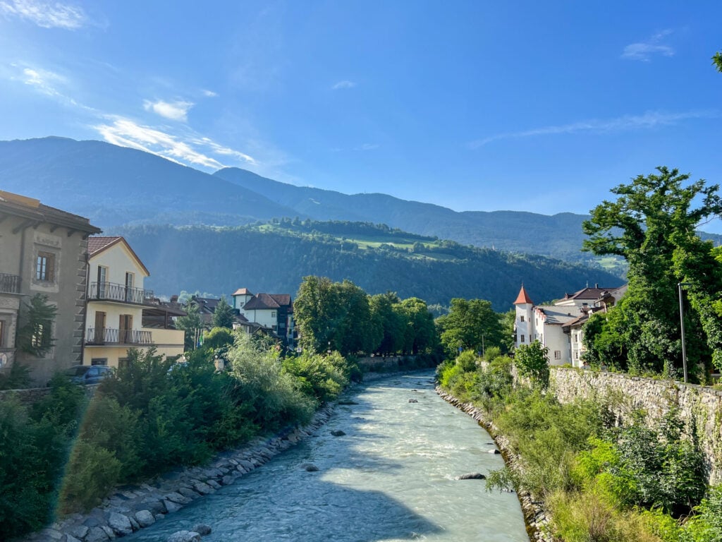
Alta Via 2 begins just outside of Bressanone, Italy (which you’ll also see written as Brixen, since this part of South Tyrol is historically Austrian). It’s a descent sized town with good connection to larger cities nearby, so the easiest way to get to Bressanone/Brixen is to fly into either Munich, Germany; Innsbruck, Austria; Venice or Milan, Italy and then catch a train or bus.
Getting to Bressanone/Brixen
From Munich
- Train company: Deutsche Bahn
- Route: München Hbf to Bressanone/Brixen
- Time: 3.5hrs direct
- Cost: 39.90€
From Innsbruck
- Train company: Deutsche Bahn
- Route: Innsbruck Hbf to Bressanone/Brixen
- Time: 1.5hrs direct
- Cost: 23.15€
From Venice
- Train company: Trenitalia
- Route: Venezia Mestre to Bressanone/Brixen
- Time: 2hrs direct
- Cost: 44€ (specials from 19.9€)
From Milan
- Train company: Trenitalia
- Route: Milano Centrale to Verona OR Bolzano/Bozen to Bressanone/Brixen
- Time: 4hrs with 1 stop
- Cost: 32.90€
For mobile service in the Dolomites, I use Airalo, an amazing app that offers data eSIM packages for nearly every country in the world— you can activate the eSIM entirely from your phone, so you’ll have service as soon as you land in Italy without needing to track down a local mobile shop! Whether you’re a full-time traveller or casual explorer, this app is a game-changer.
Use code BROOKE2994 for $3 off your first eSIM with Airalo!
Where to stay in Bressanone
I’d recommend spending at least one night in Bressanone before setting out on the trail for a full Day 1 of hiking. For more affordable accommodation, you might also consider a Day 0 where you catch the gondola up to the trailhead at Kreutzal-Valcroce and then hike under an hour (2.5km, 400m of elevation gain) to Rifugio Plose.
Search for the best deals in Bressanone/Brixen through Booking.com below:
Getting from Croce d’Aune to other destinations
AV2 officially ends in the small mountain town of Croce d’Aune and, in all likelihood, your first step for onwards transit will be to get to the larger town of Feltre, either by walking 1.5-2hrs (8km), catching a local bus (with 1-2 transfers), or sharing a taxi (6 of us split the 40€ fare).
Once in Feltre, it’s easy to connect to other locations across Italy: direct buses (Brusutti SRL) run to Venice airport or train station and a (confusing) network of local buses also link to towns across the Dolomites, such as the major hub of Cortina d’Ampezzo.
Getting to the Alta Via 2 trailhead
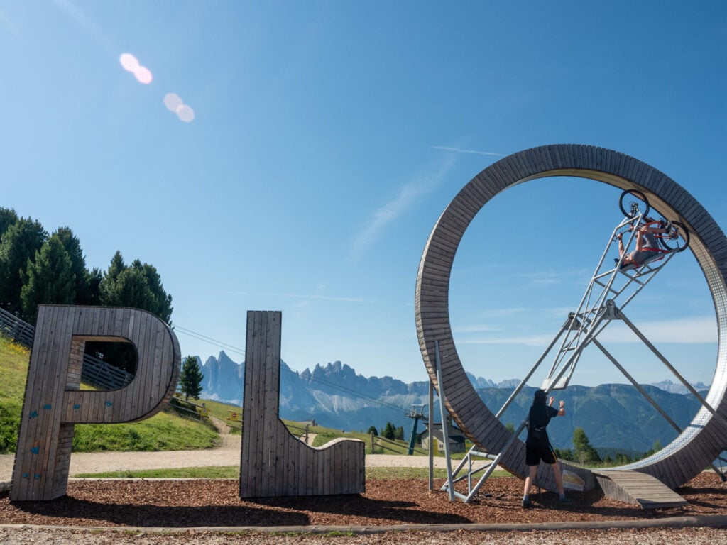
Alta Via 2 officially begins at the top of the Plose Gondola above Bressanone/Brixen. You can access the lower gondola station by taxi or local bus (number 321 from the bus station) in about 30min and then ride the gondola to the upper station, where a network of trails lead off into the surrounding mountains.
A one-way ticket on the Plose Gondola costs 19€, but it’s totally free if you have a BrixenCard— this is a local discount card that provides free access to transport, issued as a complimentary perk from a number of hotels in Bressanone/Brixen. Be sure to check the list of participating hotels before you reserve accommodation to see if you can score a free bus and gondola ride!
*Detailed Alta Via 2 itinerary
12-day Alta Via 2 itinerary (recommended)
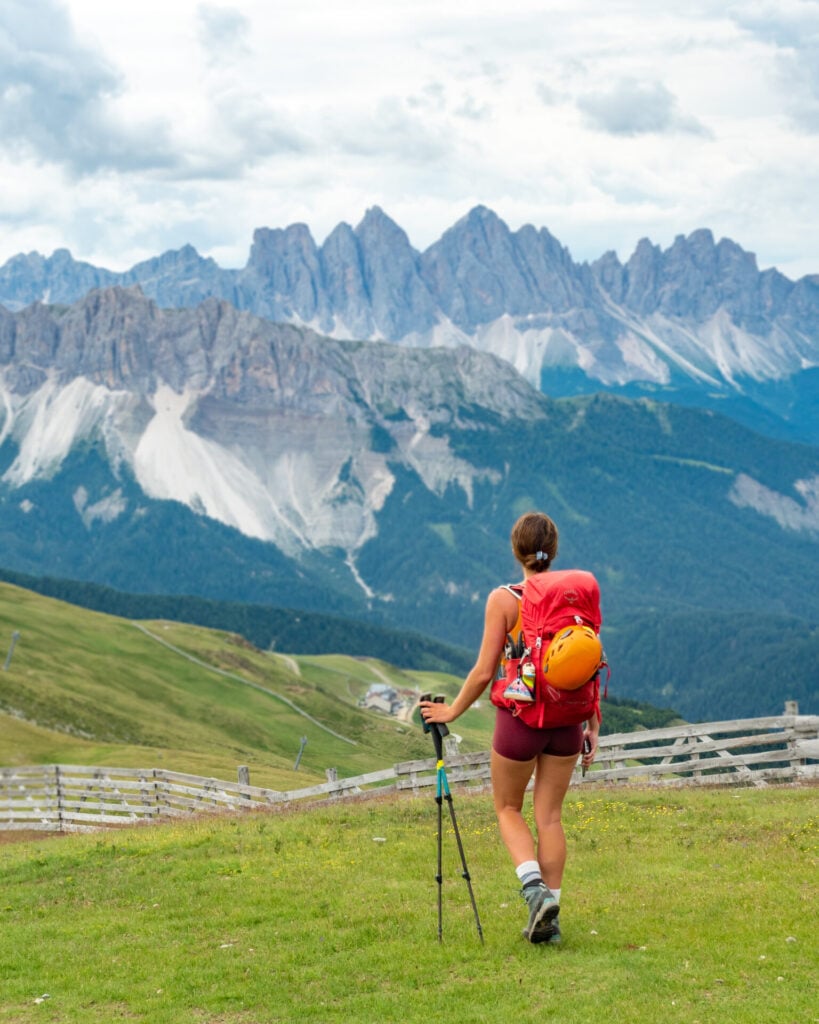
Described below (and in great detail within daily posts) is my ultimate Alta Via 2 itinerary, incorporating as many side-trips and via ferrata into the route as possible over the course of 12 fantastic days. The absolute BEST way to experience AV2 is to get off the main trail as often as possible— there are so many opportunities to mix up the standard route and inject a little magic into your hike, so that’s what I recommend here:
- Day 1: Bressanone to Rifugio Genova + Via Ferrata Sass di Putia (8hrs; 19.5km; +1540m gain)
- Day 2: Rifugio Genova to Rifugio Puez + Via Ferrata Piz Duleda (6.5hrs; 13.5km; +940m gain)
- Day 3: Rifugio Puez to Rifugio Pisciadú + Via Ferrata Gran Cir, Piz da Cir V, Brigata Tridentina en route (8hrs; 14km; +1500m gain)
- Day 4: Rifugio Pisciadú to Rifugio Piz Boè + Cima Pisciadú (3.25hrs; 6km; +930m gain)
- Day 5: Rifugio Piz Boè to Rifugio Castiglioni Marmolada (4.5hrs; 11.5km; +500m gain)
- Day 6: Castiglioni Marmolada to Passo San Pellegrino + Via Ferrata delle Trincee (6hrs; 14.5km; +1380m gain)
- Day 7: Passo San Pellegrino to Rifugio Volpi al Mulaz (5hrs; 13km; +1130m gain)
- Day 8: Rifugio Volpi al Mulaz to Rifugio Pradidali (7hrs; 14km; +1100m gain)
- Day 9: Rifugio Pradidali to Rifugio Treviso + Via Ferrata Porton & Nico Gusella (9hrs; 11km; +1250m gain)
- Day 10: Rifugio Treviso to Passo Cereda + Via Ferrata Canalone (5hrs; 9km; +970m gain)
- Day 11: Passo Cereda to Rifugio Boz (6.5hrs; 13km; +1320m gain)
- Day 12: Rifugio Boz to Croce d’Aune (7hrs; 21km; +970m gain)
*Trail times reflect the time we spent hiking, excluding extended breaks where we removed our backpacks to eat lunch, relax on the summit, or otherwise luxuriate along the trail. These figures are best used to understand realistic minimum hiking times between major waypoints, but we definitely recommend factoring in 1-2hrs of additional time every day to properly enjoy the route! This should give you a more realistic hut-to-hut hiking time for the day.
9-day Alta Via 2 itinerary
Fast hikers who are short on time and willing to sacrifice some of the spectacular via ferrata and other side trips along AV2 can certainly shorten their trip by several days. This speed-itinerary of AV2 condenses the route into a 9-day hike:
- Day 1: Bressanone to Rifugio Puez (10.5hrs; 25.5km; +1800m gain)
- Day 2: Rifugio Puez to Rifugio Pisciadú + Via Ferrata Gran Cir, Piz da Cir V, Brigata Tridentina en route (8hrs; 14km; +1500m gain)
- Day 3: Rifugio Pisciadú to Rifugio Castiglioni Marmolada via Piz Boè summit (7hrs; 16.5km; +1270m gain)
- Day 4: Castiglioni Marmolada to Passo San Pellegrino (6hrs; 21km; +1280m gain)
- Day 5: Passo San Pellegrino to Rifugio Rosetta (9hrs; 20km; +1880m gain)
- Day 6: Rifugio Rosetta to Rifugio Treviso (6.5hrs; 13km; +800m gain)
- Day 7: Rifugio Treviso to Passo Cereda + Via Ferrata Canalone (5hrs; 9km; +970m gain)
- Day 8: Passo Cereda to Rifugio Boz (6.5hrs; 13km; +1320m gain)
- Day 9: Rifugio Boz to Croce d’Aune (7hrs; 21km; +970m gain)

Day 1: Bressanone to Rifugio Genova + Via Ferrata Sass di Putia
AV2 kicks off with a spectacular introduction to the Dolomites, crossing flower-filled alpine meadows beneath the dramatic peaks of Puez-Odle Nature Park before tackling the easy but rewarding Via Ferrata Sass di Putia. Despite racking up nearly 20km, it’s an undemanding day that perfectly sets the tone for the incredible adventure ahead!
The traditional AV2 route begins with a 1,500m climb from Bressanone, but my recommended itinerary uses the Plose gondola instead to save both time and energy. I’d consider this fairly essential if you want to enjoy your first via ferrata without turning the opening day into an unnecessary sufferfest of 3,000m vertical.
- Trail hours: 8hrs (5hrs without via ferrata)
- Distance: 19.5km (15.5km without via ferrata)
- Elevation gain & loss: 1540m gain & 1280m loss (1040m gain & 780m loss without via ferrata)
- Side trips: Via Ferrata Sass di Putia (up & back; easy)— refer to Tabacco Map 07 & Cicerone Vol.1 (route 22)
- Huts: (Rifugio Plose), Schlüterhütte-Rifugio Geneva
Day 2: Rifugio Genova to Rifugio Puez + Via Ferrata Piz Duleda
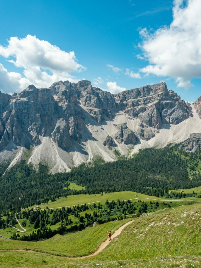
The second day of AV2 ventures deeper into Puez-Odle Nature Park, where serrated limestone peaks and remote alpine plateaus create some of the most varied scenery on the entire hike. Although fairly short in distance, the route is punctuated by frequent opportunities to leave the main trail for panoramic viewpoints and short summit detours, while the excellent Via Ferrata Piz Duleda offers a worthwhile route variation for those keen to keep things adventurous!
- Trail hours: 6.5hrs (4.5hrs without 3x viewpoints)
- Distance: 13.5km (10km without 3x viewpoints)
- Elevation gain & loss: 940m gain & 770m loss (760m gain & 590m loss without 3x viewpoints)
- Via ferrata en route: Via Ferrata Piz Duleda (one-way; easy)— refer to Tabacco Map 07 & Cicerone Vol.1
- Side trips: 3 quick viewpoints described below (all easy)
- Huts: Rifugio Puez

Day 3: Rifugio Puez to Rifugio Pisciadú + Via Ferrata Gran Cir, Piz da Cir V, Brigata Tridentina
Deviating from the classic AV2 trail almost immediately, today’s adventure route ascends to the broad summit of Sass da Ciampac for staggering views back across the vast limestone plateau. From there, descend into Passo Gardena, one of the most iconic valleys in the Dolomites, where towering limestone walls and uninterrupted views of the Sella Group create an unforgettable alpine backdrop for two scenic beginner-friendly via ferrata: Gran Cir and Piz da Cir V.
Amidst non-stop mountain scenery, the highlight of the day is undoubtedly Via Ferrata Brigata Tridentina, an adventurous and moderately difficult route leading directly to Rifugio Pisciadù. Featuring sustained vertical climbing, dizzying exposure, and an iconic suspension bridge high above the valley floor, this is easily one of the best via ferrata in the Dolomites and not to be missed!
- Trail hours: 8hrs (4.5hrs without 2x via ferrata)
- Distance: 14km (12.5km without 2x via ferrata)
- Elevation gain & loss: 1500m gain & 1380 loss (1140m gain & 1020m loss without 2x via ferrata)
- Via ferrata en route: Brigata Tridentina (one-way; challenging)— refer to Tabacco Map 07 & Cicerone Vol.1 (routes 27, 26 & 28, respectively)
- Side trips: Via Ferrata Gran Cir (up & back; easy), Via Ferrata Piz da Cir V (small loop; moderate)
- Huts: Rifugio Pisciadú
Day 4: Rifugio Pisciadú to Piz Boè + Cima Pisciadú
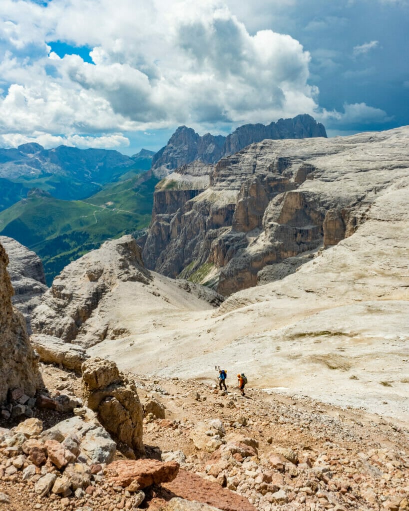
Following the traditional AV2 route, Day 4 is very short and not terribly remarkable, but there’s a wonderful addition that might just change that: Piz Boè. Rather than stopping in the barren, lunar landscape of Rifugio Boè, ascend further to the summit of Piz Boè and sleep among the stars at 3,152m. This is the highest point of the entire route, boasting uninterrupted 360° views across the Dolomites and a rustic, sure-favourite hut!
- Trail hours: 3.25hrs (2.5hrs without summit)
- Distance: 6km (5km without summit)
- Elevation gain & loss: 930m gain & 370m loss (770m gain & 210m loss without summit)
- Side trips: Cima Pisciadú (moderate summit)
- Huts: (Rifugio Boè), Campanna Piz Fassa

Day 5: Piz Boè to Rifugio Castiglioni Marmolada
Trade lofty summits for an unforgettable traverse beneath Marmolada, the tallest mountain and undisputed Queen of the Dolomites. Despite being another relatively short stage of AV2, today’s route delivers spectacular glacier views, flower-filled meadows, and a succession of panoramic mountain huts that make for an unforgettable (and delicious) lunch stop.
To escape the crowds on the main trail, I’d highly recommend my alternate route via Sasso Capello. Climbing onto a quiet ridgeline with uninterrupted views of Marmolada and the turquoise waters of Lago di Fedaia, it’s a far more adventurous and rewarding way to finish the day!
- Trail hours: 4.5hrs
- Distance: 11.5km
- Elevation gain: 500m gain & 1600m loss
- Huts: (Rifugio-Hütte Forcella Pordoi, Rifugio Maria, Rifugio Sass Bece, Rifugio Fredarola, Rifugio Viel dei Pan, Rifugio Luigi Gorza), Rifugio Castiglioni Marmolada

Day 6: Lago di Fedaia to San Pellegrino + Via Ferrata delle Trincee
Day 6 marks the halfway point of AV2 and features a completely different side of the Dolomites, where dark volcanic ridges replace the familiar limestone peaks and a fascinating network of WWI fortifications tells the story of this once fiercely contested frontier. Beginning on the hillside above Lago di Fedaia, Via Ferrata delle Trincee is an extended and challenging traverse around the spectacular Padon Ridge, combining sustained scrambling, wartime tunnels, and uninterrupted views of Marmolada, the highest mountain in the Dolomites.
With via ferrata occupying much of the day, I’d recommend hiking the short distance to Penia and then catching a bus onwards to Passo San Pellegrino. In doing so, you’ll cross from South Tyrol into Belluno, where the shift from Austrian language and cuisine to a distinctly more Italian culture is immediately apparent (basically: less Guten Tag, more pasta).
*If you want to skip the via ferrata entirely, an alternate hiking route brings you from Lago di Fedaia to Passo San Pellegrino via Penia and Rifugio Contrin (6hrs; 21km; +1280m / -1410m). This variation is shown on my GPS map and is recommended over the traditional AV2 route, which follows a lot of paved road.
- Trail hours: 6.25hrs
- Distance: 14.5km
- Elevation gain: 950m gain & 1465m loss
- Side trips: Via Ferrata della Trincee (loop; challenging)— refer to Tabacco Map 07 & Cicerone Vol.1 (route 33), Cima Mesolina
- Huts: (Rifugio Castiglioni Marmolada, Rifugio Padon), Hotel Costabella (& others in San Pellegrino)

Day 7: Passo San Pellegrino to Rifugio Volpi al Mulaz
The quieter second half of AV2 begins with a spectacular journey into the Pale di San Martino, where broad alpine pastures gradually give way to soaring limestone towers and increasingly rugged mountain scenery.
Even without much in the way of extensions or side-trips (and only a short, easy section of cable), this is a wonderfully rewarding day with panoramic ridgelines, friendly local cows, and a spectacular finish at Rifugio Volpi al Mulaz, one of the most dramatically situated huts on the entire hike.
- Trail hours: 5hrs
- Distance: 13km
- Elevation gain & loss: 1130m gain & 480m loss
- Huts: (Rifugio Valles), Rifugio Volpi al Mulaz
Day 8: Rifugio Mulaz to Rifugio Pradidali
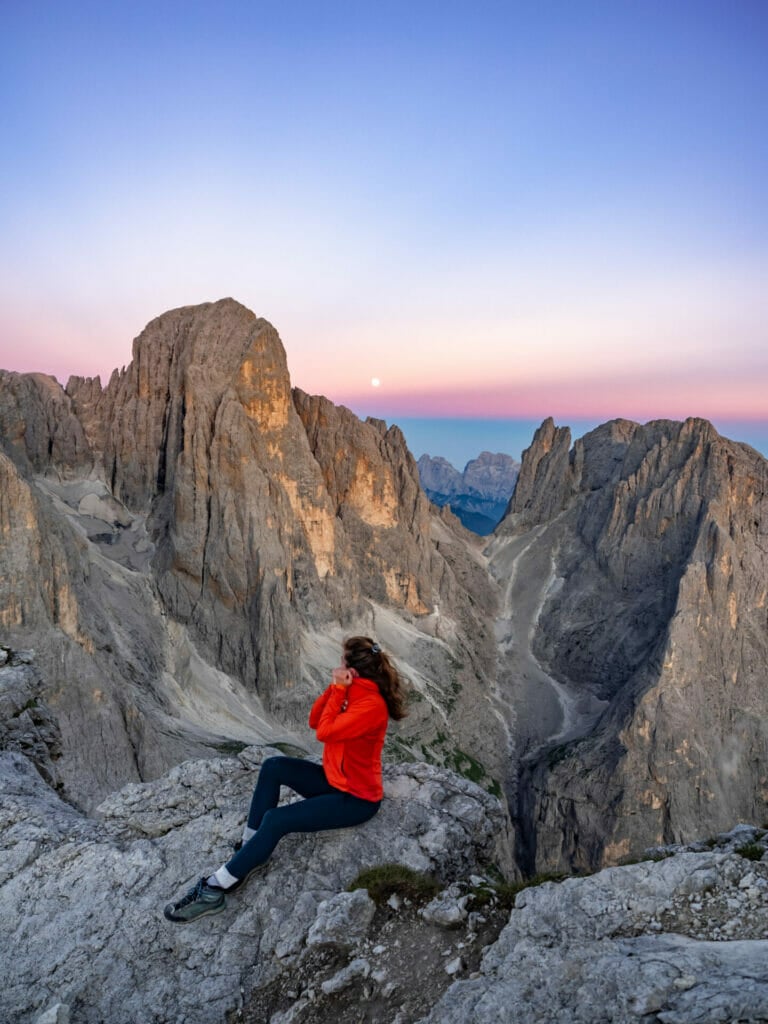
From the lunar landscapes of Rosetta to the flower-filled meadows of Pian de Cantoni and finally the striking tower of Cima Canali, the Pale di San Martino are on full display today.
Although the standard route includes several cable-protected sections, none really qualify as a true via ferrata; instead, the highlight is a quick detour to Cima Rosetta, whose sweeping summit views further showcase one of the Dolomites’ most dramatic mountain groups.
- Trail hours: 7hrs (6.5hrs without summit)
- Distance: 14km (12km without summit)
- Elevation gain & loss: 1225m gain & 1525m loss (990m gain & 1280m loss without summit)
- Side trips: Cima Rosetta (easy summit)
- Huts: (Rifugio Rosetta), Rifugio Pradidali

Day 9: Rifugio Pradidali to Rifugio Treviso + Via Ferrata Porton & Nico Gusella
Today’s adventure is dominated by the spectacular Via Ferrata Porton & Nico Gusella circuit— alongside Brigata Tridentina on Day 3, these are my absolute favourite routes on AV2! Combining long stretches of exposed climbing on vertical rungs, rugged alpine gullies, and a remote traverse between high mountain passes, Porton & Nico Gusella deliver a genuine sense of off-trail adventure that’s unlike anything else on the route.
These via ferrata demand confident scrambling, careful navigation, and a solid head for heights, but the rewards are immense: huge exposure, remarkably few other climbers, and uninterrupted views across the dramatic Pale di San Martino. Once back at Pradidali and across Passo delle Lede, the adventure concludes with a brutally steep 1,300m descent to Rifugio Treviso in the forest, making for a tough finish to an otherwise spectacular day.
- Trail hours: 8.75hrs (4.25hrs without via ferrata)
- Distance: 11km (7km without via ferrata)
- Elevation gain & loss: 1250m gain & 1910m loss (590m gain & 1250m loss without via ferrata)
- Side trips: Via Ferrata Porton (upper loop; challenging), Via Ferrata Nico Gusella (lower loop; moderate)— refer to Tabacco Map 022 & Cicerone Vol.2 (routes S.Mar 3 & 4)
- Huts: Rifugio Treviso

Day 10: Rifugio Treviso to Passo Cereda + Via Ferrata Canalone
Climbing gently out of the forest into a spectacular landscape of verdant foliage and misty Dolomite pillars, today marks yet another distinct change of scenery. Gone are the arid lunar-scapes and high-altitude peaks, but so are the crowds, leaving you to enjoy this beautiful corner of the mountains in complete solitude.
Before setting off on the gentle hike towards Passo Cereda, don’t miss the final via ferrata of Alta Via 2! Rising directly behind Rifugio Treviso, Via Ferrata Canalone packs an incredible adventure into less than an hour, offering some of the most challenging climbing of the entire trek despite its surprisingly short length. Do a second lap if time allows!
- Trail hours: 5hrs (4hrs without via ferrata)
- Distance: 9km (8km without via ferrata)
- Elevation gain & loss: 970m gain & 1210m loss (740m gain & 980m loss without via ferrata)
- Side trips: Via Ferrata Canalone (loop; challenging)— refer to Tabacco Map 022 & Cicerone Vol.2 (route S.Mar 12)
- Huts: Rifugio Cereda

Day 11: Passo Cereda to Rifugio Boz
Following the standard AV2 route, today is slightly longer than the previous day’s leisurely stroll, with the sweaty and occasionally cable-protected climb up to Passo Comedon presenting the greatest obstacle. Once over the pass, descend through wildflower-dusted meadows and lush green mountains, savouring the peaceful setting and the feel of an almost entirely different mountain range from the arid, rocky trailscapes that characterised AV2 initially.
The day concludes at idyllic Rifugio Boz— tucked amongst rolling green hills, it feels more like a traditional Italian farmhouse than an alpine hut. With precious little foot traffic beyond fellow AV2 hikers and a few local cows, it’s the perfect place to enjoy one last peaceful evening in the mountains.
- Trail hours: 6.5hrs
- Distance: 13km
- Elevation gain & loss: 1320m gain & 980m loss
- Huts: Rifugio Boz
Day 12: Rifugio Boz to Croce d’Aune
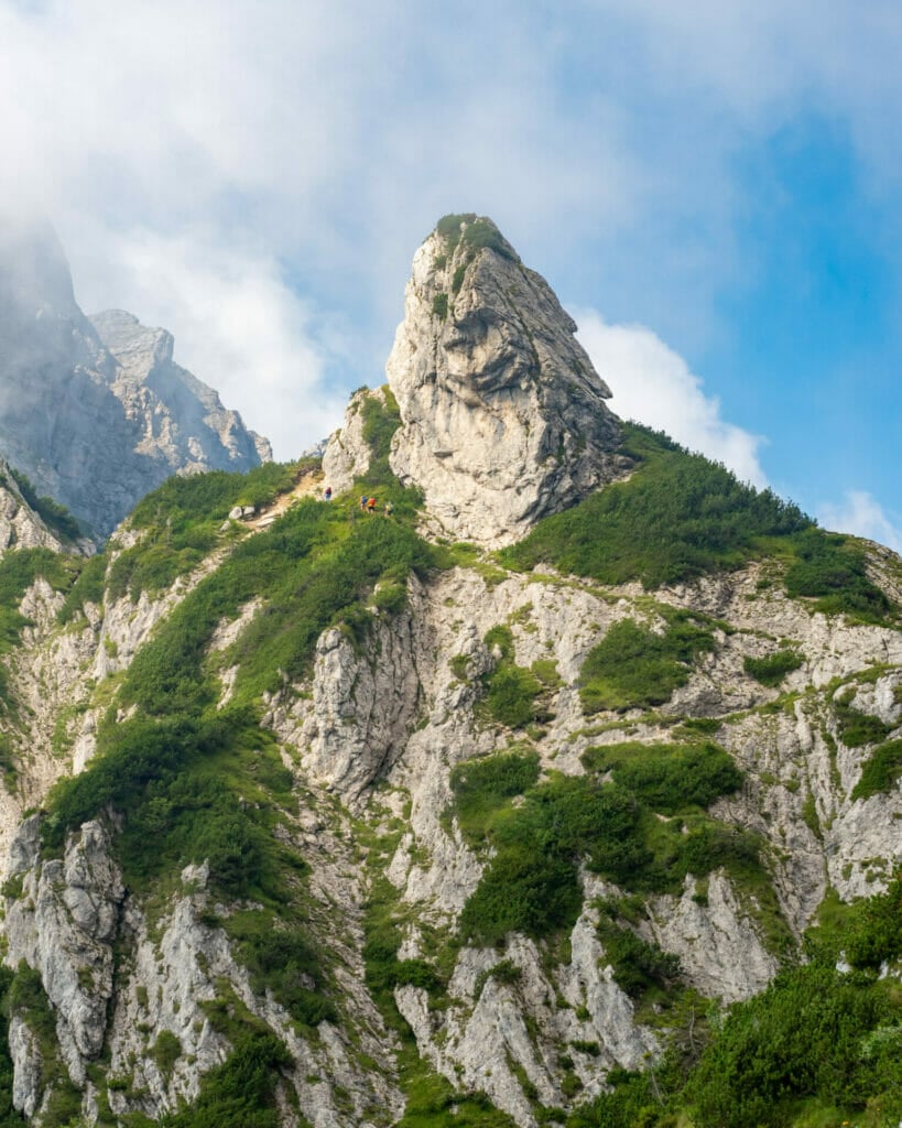
The final day of AV2 showcases dramatic and often unexpected views of yet another spectacular corner of the Dolomites, crossing the rolling ridges and broad alpine basins of Parco Nazionale delle Dolomiti Bellunesi. Although 21km is no small finale, the trail is wonderfully varied, offering one last chance to soak up the scenery before returning to civilisation.
- Trail hours: 7hrs
- Distance: 21km
- Elevation gain & loss: 970m gain & 1640m loss
- Huts: (Rifugio Dal Piaz), Albergo Croce d’Aune & many hotels in Feltre (recommended: Corte Garibaldi or L’Antico Piol de Feltre)

What to expect on the trail
Navigation
Like most popular hiking areas in the Dolomites, Alta Via 2 is very well marked, with frequent signposts providing directions and sometimes even time estimates to relevant waypoints, such as mountain huts, high passes, and nearby townships (typically located at low passes).
Between these signposts and particularly through rough terrain where it can be more challenging to follow a trail, red and white flags have been painted onto the rock to aid in navigation.


Using this combination of signs, flags, and occasional cairns (small rock piles), AV2 isn’t overly confusing to follow and should be very manageable even for those without extensive backcountry navigation experience.
That being said, it’s still important to carry a GPS and/or paper maps along the route. Even with frequent trail markers and signposts, it’s possible to stray off-course. Particularly for those leaving the standard AV2 trail to tackle interesting side-trips and via ferrata, having your own navigational reference will be essential!

If you’re following my custom AV2 adventure route, the best way to stay on track is with my custom-built AV2 GPS map— packed with detailed daily tracks, 168+ waypoints, all the side trips & via ferrata described in this guide, detours to avoid challenging sections, plus extensive trail notes to help you navigate AV2 like an expert. UPDATED SEPT 2026 BASED ON USER FEEDBACK!
Available in both JSON and GPX formats, the map works seamlessly with GPS apps like CalTopo, Gaia, and AllTrails, or with Garmin devices and watches. Head to my storefront to purchase the map!

Terrain
Alta Via 2 is anything but a typical “hike”— for all the time you spend on a distinct, well-graded trail, you’ll spend just as many hours hiking through rough and rocky terrain, traversing across scree fields, and scrambling with the protection of a fixed cable (whether you clip in or use the cable as a handline will be a matter of personal comfort).


Particularly in the latter half of AV2, which is notably more rugged and far less busy than the section from Bressanone/Brixen to Marmolada, you’ll hike almost exclusively on steep, rocky trails and encounter plenty of exposed sections that exceed the usual demand of a “hike”. Sturdy boots and hiking poles are essential for coping with the characteristically challenging terrain of Alta Via 2.

Food & other supplies
With an extensive network of mountain huts along Alta Via 2, hot food is always close at hand.
- All overnight huts offer a very basic breakfast (that I often found to be poor value for money and therefore skipped). This is usually bread, spreads, tea or coffee, occasionally yogurt, and if you’re lucky some meat and cheese for about 10-15€.
- Some huts offer hot lunch options for those passing through (for about 10-15€, you can enjoy a hot pasta dish or a pizza, which is particularly enticing if you’ve skipped brekky), while others will sell you a packed lunch to-go (typically consisting of a sandwich, apple, granola bar, and chocolate for about the same price).
- Simple snacks like chips and chocolate bars are available for purchase at some of the busier huts, but this will become less likely as you cross into the second-half of AV2.
- All overnight huts also whip up excellent evening meals, either included as part of half-board lodging (50-75€ including a bed, 3-course dinner, and breakfast) or a la carte (10-15€ for most dishes). This is where mountain huts in the Dolomites really shine— an example of a standard evening meal would be soup and bread as a starter, hearty goulash and polenta as a main, and some sort of pastry as dessert. Rest assured, you will not go hungry (even as a vegetarian!).
- Read more about hut food in this post: Everything you need to know about mountain huts (rifugi) in the Italian Dolomites
Alta Via 2 also crosses through several mountain passes, where you can occasionally find dry goods for purchase, though this is admittedly limited. The absolute best opportunity to restock on snack food (as well as personal items and pharmaceuticals) will be at the half-way point of Passo Fedaia, where you can find small supermarkets and pharmacies in the nearby town of Canazei (accessible via bus or short walk).


Water access
Thanks to the dry, rocky landscape of AV2, water along the trail is somewhat limited and at best unpredictable, so I’d definitely recommend filling up each morning with enough water to get you through the day. Water is available in all of the mountain huts along Alta Via 2, but there’s ongoing debate as to whether the tap water is safe to drink.
Water is available in all of the mountain huts along Alta Via 2, but there is ongoing debate as to whether the tap water is safe to drink in all of these rifugi. Out of an abundance of caution, some of the hut staff will advise against drinking water directly out of the sink, but given that much of the water is either rain-collected or glacier-fed, I personally filled up my water bottle in the bathroom without issue.
Out of an abundance of caution, some of the hut staff will advise against drinking water directly out of the sink (although I did in most places), so I’d recommend bringing a lightweight filter, which will also serve you well along the trail, filling up in occasional streams. I implore you not to buy the plastic water bottles for sale in the huts, as it’s an incredible source of waste and altogether unnecessary with proper planning!

Essential via ferrata gear for Alta Via 2
Below is a very short list of essential gear for AV2, including your via ferrata kit and your most crucial safety equipment! For a full Alta Via 2 packing list, check out this post: Complete Alta Via packing list: what to pack for hut-to-hut hikes in the Dolomites

daypack (25–35L): Osprey Tempest 30 (women’s) / Osprey Talon 33 (men’s)
I’d recommend something in the 25-35L range with sturdy hip belts, a good suspension system, and some back venting. I used the Osprey Talon 33L unisex pack and comfortably carried 16kg on Alta Via 2 (much of which was camera gear, so you can expect your pack to be ~10-12kg!).

helmet: Black Diamond Half Dome Helmet (women’s) / (men’s)
For via ferrata routes, a light climbing helmet is essential to protect against rockfall, which might come from other climbers above or even unstable areas of the mountain.
And for routes that wind through dark tunnels (like Via Ferrata De Luca/Innerkofler), it can also be handy for protecting your head against bumps. Bring a headlamp for these via ferrata.

climbing harness: Black Diamond Momentum (women’s) / (men’s)
A climbing harness is how you’ll connect your via ferrata lanyard to yourself for protection on exposed routes. This is essential safety equipment and you should not do AV2 without it! I love the fit and comfort of this crag climbing harness and have used it on countless adventures.

via ferrata lanyard: Petzel Scorpio Vertigo Lanyard
A via ferrata lanyard connects to your climbing harness and is then used to clip into the cable for continuous protection along exposed or challenging routes; the shock absorber helps distribute force in the event of a fall.
After trying several different styles, I personally prefer these flick-lock carabiners for ease of use and this bungee-style lanyard for improved mobility on the rock.

climbing gloves: Metolius Half Finger Climbing Gloves
Although not technically required, you’ll enjoy via ferrata a lot more with climbing gloves to protect your hands from cable-burn, particularly when down-climbing. I like these half-finger gloves, which maximise dexterity for climbing— plus, I can still operate my camera/phone with them on!

trekking poles: Black Diamond Trail Trekking Poles
For all the rough terrain you’ll encounter on AV2, trekking poles are incredibly helpful and a lightweight addition to your kit.

Never, EVER hit the trail without a satellite communicator— whether you’re sending messages back home, checking the weather, or communicating with emergency services, this small device can literally save your life.


Read more about the Dolomites
- Complete Alta Via packing list: what to pack for hut-to-hut hikes in the Dolomites
- Everything you need to know about mountain huts (rifugi) in the Italian Dolomites
- Via ferrata in the Italian Dolomites: the ultimate beginner’s guide
- 10 best via ferrata routes in the Italian Dolomites
- Alta Via 2: complete hiking + via ferrata route guide
- navigate confidently on & off the trail ->AV2 adventure route GPS map! (updated Sept 2026)
- Alta Via 4: complete hiking + via ferrata route guide
- navigate confidently on & off the trail ->AV4 adventure route GPS map! (updated Sept 2026)

The Comments
Chris
Hi Brooke,
Fantastic writeup.
I am wondering about your 9 day itinerary.
We are fit and hike quite a bit. Good for 10-15 miles per day in the Sierra w similar vertical gain/loss.
I know the Dolomites with Via Ferrata are going to be slower and more challenging.
I am wondering what advice you could offer in completing the 9 day. How does it compare to other things you have done? How much of a stretch is it?
Does your AV2 custom map work for the 9 as well as the 12 day?
Any other thoughts?
Thank you,
Chris
brooke beyond
ChrisHi Chris,
I’m wondering if you’re considering the 9-day version because you don’t have enough time in your itinerary for the 12-day or because you’re worried 12 will feel too slow? If it’s the former, then the 9-day itinerary is definitely doable for fast hikers, and it’s more a matter of how many side via ferrata you’ll have time to fit in. You can play that by ear and definitely still manage to do a few!
If it’s the latter (worrying that 12 will feel too slow), I promise it absolutely won’t. There are SO many cool side trips and via ferrata to explore along the route that more time will ALWAYS yield a superior trip. If time allows, I highly recommend 12, but if 9 is the only way to make it work, it’s still worthwhile!
My maps is definitely optimised for the 12-day (all the notes and daily tracks correspond to this), but it can still be used for the 9-day since the overall route is still the same. You’ll just have to know that sometimes you’re finishing at an earlier or later hut than what’s quoted as “Night 3 hut” on the map, for example.
Hope that helps 🙂
xx bb
Marjolein Pordon
Hi Brooke,
great to read so much about the Alta Via 2. I am orienting on which hike we want to do this summer. Two years ago we did the Stubaier Hohenweg. This had also lots of cables. We did it without any Via Ferrata gear, I did use Nordic walking sticks. Is the Alta Via 2 similar that you know of? If we did that without gear, would we be able to do Alta Via 2 also without gear?
brooke beyond
Marjolein PordonHi Marjolein, I don’t know specifically how AV2 compares to Stubaier Hohenweg, but doing AV2 without via ferrata gear is theoretically possible… but you’d need to be a VERY confident scrambler on some of the exposed sections and you’d also have to be ok avoiding all of the exciting side-trips or alternate routes with via ferrata sections. If you absolutely don’t want to bring any VF gear, you could consider just the second half of AV2, which has much less cabling and exposure.
Hope that helps!
xx bb
Chris
Hey! Great write-up on the Av2. I’m curious, with the 9-day itinerary, is it still possible to hit more via ferratas if you’re a fast hiker? Didn’t want to miss any of the epic via ferratas, but also on a time crunch of about 9 days max hiking and some travel days to get back to the USA. I saw the 9-day plan you have, but was wondering if one could still do the via ferratas or some more of them, stay at huts, and still manage the 9 days. I had done the Tmb last year (117 miles and around the same elevation gain, 35k or so), but i know the via ferratas do add some time.
Would love to hear your thoughts on this.
Looking forward to getting your GPX map as well!
brooke beyond
ChrisHi Chris,
Yes, fast hikers can absolutely shorten this route to 9 days and still manage to hit SOME of the optional via ferrata, you’ll just have to see how you’re going on time! TMB is a good comparison for the hiking sections, but you’re right that the via ferrata introduce a totally different element and it’s hard to know exactly how fast you’re able to manage until you get boots on the ground (or on the cable, as it were).
Hope that helps! The GPX should also help you visualise your options and adjust as you go, based on which via ferrata you expect to have time for and how long previous days have taken you.
John
Hey Brooke, I’m doing the AV2 in early September and wandered if there would be any “meet-up” locations for a group of non-hikers to occasionally join the hikers on the route. We have two (2) groups, hikers and non-hikers. The obvious is taking the Gondola up at the start in Bixen, but didn’t know if there would be other suitable locations that they could access parts of the trail or a Refugio for lunch or dinner along the way (particularly between the start and San Pellegrino) by car and a shorter less strenuous hike. Thanks in advance for any insight and I purchased your map. Very helpful. Thank you.
Himalaya heart trek and expedition
This guide really hits the mark—reminds me so much of climbing Lobuche East in Nepal’s Everest region. The mix of rugged mountains and cultural shifts feels just the same. It’s inspiring and makes me eager to take on Lobuche East again soon. Great job capturing the true spirit of mountain adventure!
Carmen
Hi Brooke! Awesome blog, I also like getting off the beaten path, and I am planning the AV2 for me and a couple of friends next September!
As we have to take the extra weight of the ferrata gear, I have concerns regarding weight. It’s OK as long as we do not need to bring with us all snacks for the pauses of 10 days and if we can get lunch as take-aways in the refuges. I mean, we will not have time to stop and wait to be served for lunch at the tables of the refuges, we will need to purchase a picnic or something like that in the refuge where we sleep each night. We have done this many times in the Pyrenees, do you know if it is possible to do this in the AV2 refuges?
Otherwise, do they sell at least some energy bars or mixed nuts that we can buy on our way and eat to survive until dinner?
Thanks.
brooke beyond
CarmenHi Carmen, AV2 sounds like it will be perfect for you!
I personally carried 16kg on this route and it was fine for all the via ferrata, but if you’re trying to go ultra-lightweight, then yes, cutting down food is the best way. Many huts serve lunch, but takeaway options are scant and overpriced (expect to pay 15€ or more for a picnic lunch with sandwich, fruit, and maybe a candy bar). I do think in some instances you’ll also have plenty of time to sit down and eat a slow lunch to break up the day’s hike– I did this on several occasions and it was lovely!
Around the halfway point of the hike, you’ll pass within close range of a few small towns and have a good opportunity to restock energy bars and nuts, so my advice is to bring enough for a few days and plan to do some shopping near Marmolada (Canazei). The good thing about the Dolomites, much like the Pyrenees, is that you’re unlikely to go hungry if you don’t pack enough food– worst case you end up paying for expensive hut lunches!
Conrad
Hi Brooke !
Came across your site when researching Alta Via 2, fantastic material ! Super useful. Tks a lot !
I intend to start by the last week of August, no reservations ! I am solo, will carry a super light Z packs tent and hope for the best ! the ideia of having a super fixed itinerary sucks the joy out of the trail in my opinion. I did the slovenian mt trail last year the same way with no issues, not even in Triglav. Should I be more concern on the crowded dolomites ?
My question to you, if you would be so kind, is regarding the ferratas. How would they compare to triglav ? How about the ones you mentioned on Alta Via 4 ? those seem more complicated ! but I like the fact that 4 is shorter than 2.
Tks a lot
brooke beyond
ConradHi Conrad, I should call attention to the fact that it is illegal to wild camp in the Italian Dolomites. If you’re set on camping, I’d recommend looking at a different route.
I would say that most of the via ferrata on AV2 are similar to Triglav, with some of the optional extensions a bit harder. AV4 has harder VF in general, I’d say more challenging than Triglav.
Hope that helps!
xx bb
Euan
Hi, how did you transport your helmet? I see you have the same rucksack as me, but I don’t see a way to fix it to the outside securely (based on the Mammut version of the holder). What would you recommend?
brooke beyond
EuanHi Euan, I recommend using the buckle on the front of your pack (for that mesh compartment) and running it through one of the holes in the helmet or through the chin strap. Does that make sense?
Happy trails!
xx bb
KURT
aside from being a VERY photogenic creature, your accomplishments are most admirable.
I’m jealous. I thought at first it was another blogger trying to push gear they know little about and used even less but after seeing some breathtaking images of far away places, with
you on terrain with the balance of a cat, I am duly impressed. The photography is great! If I had to ask a question, it would be: HOW DO YOU STAY SO FREAKING CLEAN??? A backpacker
myself, I look like a dead ringer for homeless person after three or four days. Lordy! Love the Italian recap. I was in Sienna last year but got no hiking in, you may have motivated me for a return trip. Great blog!! Passing it on to friends. Maybe I can get a few outside. lol.
brooke brisbine
KURTAh Kurt, thank you so much, I really appreciate it. I pride myself on ONLY recommending things on this site that I can truly stand behind, and that means testing gear extensively before I ever put a link into a post.
To answer your question about cleanliness, I can only say it’s a trick of the camera if you can’t see my legs covered in dirt and thank goodness for hats/helmets that hide an unwashed head of hair lol!
Happy trails, my friend!
xx bb
Peter
Probably the best guide on Alta Via 2.
Thinking of going for 5 days but bringing my own solo tent.
I know about the restrictions but out of curiosity.. Did you encounter hikers doing solo wild camping?
Many thanks.
brooke brisbine
PeterHi Peter, so glad you found this post helpful!
Not to be a massive downer, but I’d really discourage you from camping in the Dolomites given the restrictions. I spoke to one couple who did it and they effectively had to walk an hour off the trail, wait until nightfall to pitch camp each night, and then leave before sunrise to avoid detection– it sounded sleepless and stressful. The rocky terrain doesn’t lend itself to comfortable campsites and, at the end of the day, it’s illegal because of the damage that camping causes to the pristine natural environment out here. Not trying to rain on anyone’s parade (I’m a camper at heart myself), but the huts are super fun and a great part of the experience 🙂
Happy trails!
xx bb
Claudia
Hey Brooke,
Thanks so much for this wonderful travel blog! It has been our main lead in preparing for AV2, starting this Thursday and taking our sweet time (12 days)! If you’re in the Dolomites this summer, perhaps we will run into each other!
Cheers,
Marga & Claudia (Netherlands)
brooke brisbine
ClaudiaHi Marga + Claudi,
So glad you found this guide helpful, hope you had a fantastic time on AV2!!
xx bb
Eric
In the southern part of the AV2, while avoiding any side trips, what section in your mind requires full via ferrate kit?
We have walked the northern part with no kit with no issue, though we did skip the Marmolada section.
brooke brisbine
EricHi Eric,
Totally depends on your scrambling comfort level! Truthfully, you can walk all of AV2 without kit IF you are VERY confident and willing to skip a few of the high risk VF alternatives (ex. I definitely would never recommend Via Ferrata Brigata Tridentina to Rif Pisciadù without gear, so you probably took the alt trail to the hut there). On the backend, there’s even less cabling, so if you managed the first half, you’d manage the back too.
Happy trails!
xx bb
Jake
Fantastic guide, Brooke! Thank you so much 🙂
Quick question – given the trek starts in Brixen and ends in Croce d’aune (i.e., the trek isn’t a loop), what are your recommendations for luggage storage?
Thanks
Jake + Sophie (your friends from Patagonia!!)
brooke brisbine
JakeHey Jake + Sophie!! SO excited to hear you guys are planning to do AV2, you are going to absolutely love it! When will you be there?? I’m back in the Dolomites this summer and would be amazing if we managed to overlap…
As for the luggage storage, the best option is at a hotel or in a locker in Venice (or whichever major city you’re transiting through). Backtracking through small mountain towns is neither easy nor cheap, so I would not recommend leaving anything in Brixen that you want to see again 😅
Happy trails, you two!! Ps I’ll be in Sydney in May, let’s see if we can’t manage to catch up for a drink xx
Nick
Awesome guide, Brooke! We did Alta Via 1 a few years ago and are hoping to get back to the Dolomites to do AV2 one day! If any of your readers are interested in AV1 they can check out our guide here; https://greeneyedglobetrotters.com/alta-via-1/
brooke brisbine
NickHey Nick, thanks for reading and hope you guys make it back for AV2 someday– it’s a bit of a different experience than AV1 and I’m sure you’d love it!!
Happy trails 🙂
xx bb
Dave
Hi Brooke,
I’m assuming the membership to an alpine club won’t give you a discount at the rifugios if you go through a outfitter, any knowledge of this? Thanks. Love this site, it’s great!
brooke brisbine
DaveHi Dave, that’s probably the case, but you may be able to check with the outfitter to see if they will pass savings onto you. In addition to the discounts, though, the alpine club membership is excellent for rescue/medical insurance!!
Hope you have a fantastic time 🙂
xx bb