• start here
  • about
  • group trips
  • brooke beyond

  • hiking guides
  • outdoor gear
    • hiking boots
    • hiking backpacks
    • cold-weather layers
    • backpacking tent
    • outdoor sleep system
    • backcountry food
    • day-hike packing list
    • hut-to-hut packing list
    • via ferrata packing list
    • backpacking packing list
    • mountaineering packing list

brooke beyond

Africa / South Africa

The ultimate guide to driving South Africa’s Garden Route

28 December 2017

Last Updated on 5 June 2022

Inarguably South Africa’s best known multi-day road trip and a solid contender for one of the world’s most scenic drives, the Garden Route lives up to all of the hype and even exceeds expectations in terms of beautiful coastal views and cosy little seaside towns. This 300km route officially stretches from Port Elizabeth to Mossel Bay, but it’s possible to extend the trip on either end and add in a number of worthwhile detours depending on what you’d really like to see.

We spent over a week driving through national parks looking out for elephants, visiting big cats at a rehabilitation centre, hiking through stunning nature reserves, wine tasting amid rows of vines and roses, hugging ostriches, sailing out into the Indian Ocean in search of seals, shopping in cute little markets, and eating our hearts out at an assortment of lovely restaurants, and still we could have easily spent two or three weeks more. This guide contains everything you need to know about driving the Garden Route, including itinerary recommendations and info about all of the best stops along the way.

What's in this guide

Toggle
  • Our itinerary
    • What I would have done differently
    • Where to stay longer
  • *Recommended itinerary
    • Top tips
  • Best stops along the route
    • Addo Elephant National Park
    • Storms River Bridge
    • Tenikwa Wildlife Rehabilitation Centre
    • Robberg Nature Reserve
    • Karusa Winery
    • Ostrich Farm in Oudtshoorn
    • Seal Island
    • Fernkloof Nature Reserve & Cliff Path
    • Scenic drive from Hermanus to Gordon’s Bay
    • Hermanus town
    • Stellenbosch

Our itinerary

We flew into Port Elizabeth and rented a car, backtracking to Addo Elephant National Park on the first day, and then continued southwest along the N2, staying in Plettenberg Bay, passing through Knysna and Wilderness, and staying in George before veering inland on the R62 to stay in Oudtshoorn. We drove back out to Mossel Bay, the official end of the Garden Route, but continued on, staying in Hermanus and passing through Gordon’s Bay via the coastal route before finishing our drive in Stellenbosch. I wrote a post for each day of our road trip, linked below:

Day 1: Port Elizabeth—Addo Elephant National Park—Plettenberg Bay

Day 2: Plettenberg Bay & Tenikwa Wildlife Rehabilitation Centre

Day 3: Plettenberg Bay—Robberg Nature Reserve—George

Day 4: George—Oudtshoorn

Day 5: Oudtshoorn—Mossel Bay—Fernkloof Nature Reserve—Hermanus

Day 6: Hermanus—Gordon’s Bay—Stellenbosch

Days 7-9: Cape Winelands

What I would have done differently

We absolutely loved our time driving the Garden Route, but, as with any trip planned from across the world, there are a number of things I would have done differently if I had known what I do now. For the most part, I would have just allowed heaps more time, as we had to pass through a number of beautiful towns and skip exciting activities because we had a schedule to keep. A week was no where near enough to see all of the amazing places along this drive, and I can’t imagine how people do it in even less time, but I know they do.

Really, 2 weeks would allow you to visit most of the beautiful towns and enjoy the activities available, but you certainly wouldn’t get bored with even 3 or more weeks. Plettenberg Bay was the only town we stayed in for more than one night, but we could have happily stayed for a few days in each place and even added in some more stops along the way.

Where to stay longer

Port Elizabeth: Quaint seaside city with a great coastline. We really just landed in PE, drove to Addo, and then passed right on through on the way to Plettenberg Bay. With more time, I would have definitely liked to explore what appeared to be a really lovely beach town.

Plettenberg Bay: Beautiful and slightly upscale seaside town with lots of activities, boutique shops, markets, and great seafood restaurants. We spent 2 nights here, but definitely could have spent more. We stayed in the Whale of a View B&B, which was really nice and had amazing ocean views.

Knysna: Another upscale beach resort town with cute shops and nice restaurants. We had planned to kayak here, sadly the weather didn’t agree, but we were pretty disappointed not to be hanging around for a few days to explore.

Wilderness: Outdoorsy town offering lots of hiking, canoeing, kayaking, abseiling, canyoning, etc. Again, we had planned to spend a few hours here, but ran out of time and had to drive basically right through to George, which was no where near as exciting.

Oudtshoorn: Small semi-desert town on the R62 famous for its ostiches, but also boasting a few nice wineries in the nearby Klein Karoo. We stayed in the B&B on church which had a braai area and a private pool, and would have liked to stay a few more days to just relax and enjoy more of the nearby activities.

Mossel Bay: Larger town on the coast marking the official end of the route. We spent a few hours in Mossel Bay, taking a trip out to Seal Island and lunching on the tasty seafood, but could have made this a stop for the night.

Hermanus: Upscale coastal town set against a mountain backdrop with a stunning waterfront Nature Reserve and some wine country of its own. This was our favourite town on the entire route and we ended up skipping an entire day of wine tasting in Stellenbosch just to spend more time here. We stayed in the Hermanus at Home guesthouse, which was adorable and very conveniently located. I probably would have spent 4 days minimum here if I had known how amazing it would be.

Stellenbosch: Sweet little town in the Cape Winelands, surrounded by several hundred vineyards and cellar doors. We spent 3 days here in the Fleur du Mont Airbnb, which had a large braai area and pool in the stunning garden.

*Recommended itinerary

If I were able to go back in time (or, more realistically, if I come back to South Africa and drive the Garden Route again someday), this is the itinerary I would book for myself:

Day 1: Fly into Port Elizabeth, pick up the rental car, explore town and spend some time on the beach

Day 2: Drive to nearby Addo Elephant National Park and self-drive through the park to see wild animals, return to Port Elizabeth for dinner

Day 3: Drive from PE to Plettenberg Bay, stopping to see the beautiful Storms River Bridge, and spend the day wandering around Plett, lounging on the beach, and eating seafood

Day 4: Visit nearby Tenikwa Wildlife Rehabilitation Centre for a full or half day tour of the facilities and the resident big cats

Day 5: Stop in Robberg Nature Reserve for a hike on the way to Knysna, explore town

Day 6: Go kayaking in Knysna

Day 7: Drive on to Wilderness for a dayhike, canoe, or canyoning adventure

Day 8: Enjoy a second activity in Wilderness before continuing to Oudtshoorn for the night

Day 9: Visit the Cango Caves and nearby Karusa Winery for wine tasting and lunch, returning to Oudtshoorn for dinner

Day 10: Visit an ostrich farm before driving on to Mossel Bay and exploring town

Day 11: Take a boat trip to seal island or go cage diving with sharks in Mossel Bay

Day 12: Drive to Hermanus and hike around Fernkloof Nature Reserve

Day 13: Explore the markets in Hermanus and go for a kayak along the coast

Day 14: Stop at a winery or two in Hermanus before driving the scenic route via Gordon’s Bay to Stellenbosch

Day 15-16: Wine tasting in Stellenbosch and Franschhoek

Top tips

  • If your group size (and luggage size) allows, get a compact car. Fuel is quite expensive!
  • Pick-up a Vodacom SIM card in the airport or in town and load it up with data so you can use Google Maps in the car to navigate. We paid about R230 for the SIM card, 20 minutes of talk time (in case we needed to call our B&Bs to confirm bookings, etc), and 1G of data, which we found to be more than enough. We turned airplane mode on when not in the car to conserve our 4G, but probably didn’t even need to.
  • Load up a good road trip playlist on your phone before you leave. Most all rental cars have Bluetooth and the drive time will be a lot more enjoyable with some tunes.
  • Book your accommodation in advance unless you’re planning to sleep in the car. This is a popular route and you wouldn’t want to pass through a wonderful town just because you couldn’t find somewhere to stay last minute.
  • Service station attendants will pump your fuel for you, so be sure to have a few R5 coins around the car for a tip.
  • Go slow and enjoy what is sure to be a highlight of your time in South Africa.

Best stops along the route

Addo Elephant National Park

About a half hour drive east from Port Elizabeth, Addo is an unmissable stop along the route. Even if you’ve been on safari before, it’s great fun to self-drive through this smaller national park and see hundreds of elephants. Entrance was about R280 per person and is just paid at the gate.

Read more about our Addo Elephant National Park safari in this post.

Storms River Bridge

Between Port Elizabeth and Plettenberg Bay, this beautiful gorge seems to fly by your window before you even know where you are, but definitely park up at the service station across the road and walk over to take in the view properly.

Tenikwa Wildlife Rehabilitation Centre

This phenomenal rehabilitation and awareness centre about 15 minutes out of Plettenberg Bay is home to all of Africa’s wild cats, plus a number of birds, turtles, lizards, meerkats, mongoose, and other small animals. You can visit for a cheetah walk, half-day, or full-day tour of the facilities with a booking online and learn all about the important work being done here. I really admire Tenikwa for their commitment to the animals, not allowing any touching of the cheetahs like other similar facilities and not allowing any of the animals undergoing rehabilitation to even be seen by visitors. Of the cats we did see, one was Chester, the centre’s first animal, a diabetic cheetah who receives a daily insulin shot and lives a very happy life in the shelter.

Read more about our day at Tenikwa Wildlife Rehabilitation Centre in this post.

Robberg Nature Reserve

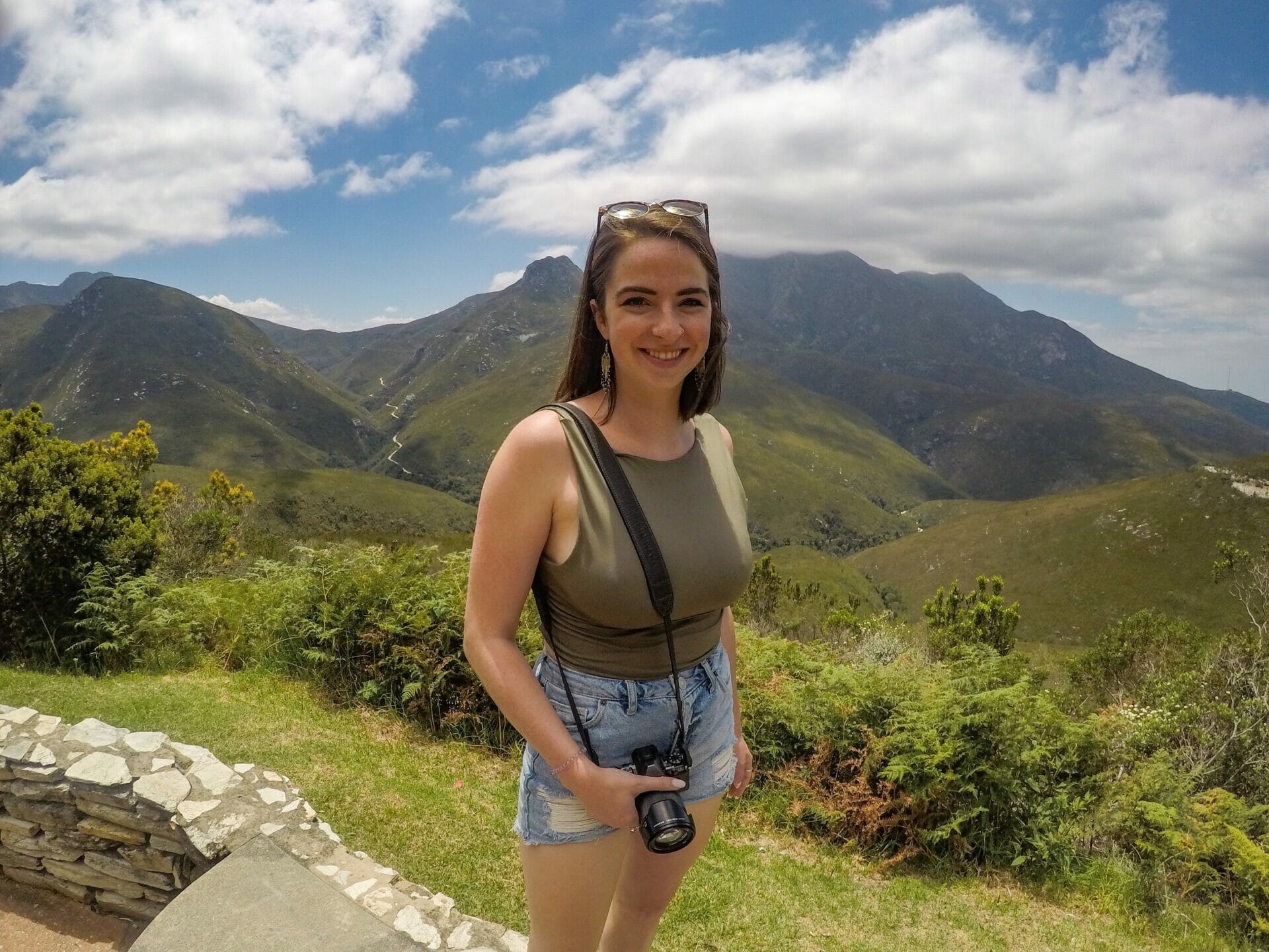
One of the scenic highlights of this route, Robberg is located less than 10 minutes out of Plett on the way to George and is covered with walking trails and stunning beaches just begging to be explored. Even in overcast weather, this is a beautiful spot to enjoy views of South Africa’s rugged coastline and to stretch your legs a bit.

Read more about our walk through Robberg Nature Reserve in this post.

Karusa Winery

Don’t wait until Stellenbosch to start sampling some of South Africa’s amazing wine. About 20 minutes out of Oudtshoorn on the road towards Cango Caves, Karusa is an absolutely gorgeous winery offering an extensive tasting list and great bottle prices, not to mention a very excellent restaurant overlooking the vineyard.

Read more about Karusa Winery in this post.

Ostrich Farm in Oudtshoorn

Despite the amazing wine that we discovered, the real draw to this inland town is its ostriches. No visit would be complete without also taking a tour through one of the many ostrich farms here to learn about these strange, flightless birds and how they have put little Oudtshoorn on the map.

Read more about our tour of an ostrich farm in this post.

Seal Island

Back on the coast, park at Mossel Bay Harbour and buy tickets for a boat trip around Seal Island, a large rock about 25 minutes off the coast that is home to thousands of fur seals. Although you can’t get off the boat or get any closer to the seals because the island is protected, the views from the boat are still pretty cute. Tickets were about R170.

Read more about our trip to Seal Island in this post.

Fernkloof Nature Reserve & Cliff Path

Winding along (in my opinion) South Africa’s most scenic stretch of coastline, the 12km Cliff Path through Fernkloof Nature Reserve is a flat walkway that takes in all the beauty of Hermanus, from some of its incredible beaches to its dramatic mountains. Within moments of laying eyes on this view, I was ready to cancel all plans for onward travel and just stay right here (we did actually rearrange our next day to spend more time walking through Fernkloof).

See more pictures of the stunning Fernkloof Nature Reserve in these posts.

Scenic drive from Hermanus to Gordon’s Bay

Rather than taking the inland route from Hermanus to Stellenbosch, take the slightly longer scenic route via Gordon’s Bay. I promise, it’s well-worth the extra 20 minutes.

Read more about our scenic drive in this post.

Hermanus town

But don’t skip out of town too quickly, Hermanus is actually my favourite town along the whole route. Full of upmarket restaurants, boutique shops, a bustling craft market (and who can forget those coastal views!?), spend some time just exploring Hermanus itself.

Read more about Hermanus in this post.

Stellenbosch

The gem of the Cape Winelands, Stellenbosch is home to hundreds of cellar doors with fantastic wines and some truly unparalleled scenery. Sample a few (dozen) varietals, take some bottles home, and eat at some of the nicest restaurants in the whole of South Africa.

Read more about winetasting in the Cape Winelands in this post.

Read more about our road-trip along the Garden Route

DRIVING THE GARDEN ROUTE DAY 1: ADDO ELEPHANT NATIONAL PARK

DRIVING THE GARDEN ROUTE DAY 2: VISITING BIG CATS AT TENIKWA WILDLIFE REHABILITATION CENTRE

DRIVING THE GARDEN ROUTE DAY 3: HIKING THROUGH ROBBERG NATURE RESERVE

DRIVING THE GARDEN ROUTE DAY 4: WINE TASTING & OSTRICHES IN OUDTSHOORN

DRIVING THE GARDEN ROUTE DAY 5: SEASIDE IN MOSSEL BAY & HERMANUS

DRIVING THE GARDEN ROUTE DAY 6: EXPLORING HERMANUS & FERNKLOOF NATURE RESERVE

TOP 12 THINGS TO DO IN CAPE TOWN, SOUTH AFRICA

TAGS:road tripstravel guides
0 Comments
Share
brooke beyond

Hey, I'm Brooke and I'm obsessed with getting off the beaten path, exploring backcountry gems & travelling beyond the ordinary! I left Australia 5 years ago after finishing a PhD in Biomechanics & have been travelling the world full-time ever since (joined by my life/climbing partner, James). Whether it’s road-tripping through Mexico, climbing alpine peaks in the Andes, scuba diving in the Red Sea, or tackling epic via ferrata in the Dolomites, I hope this blog will inspire your future adventures & help you find wonder in every corner of the globe. xx bb

Leave a Comment Cancel Comment

You May Also Like

30 December 2017

Driving the Cape Peninsula: Boulders Beach & Cape of Good Hope

12 January 2018

Out on the town in Windhoek, Namibia

25 December 2017

Driving the Garden Route Day 6: Exploring Hermanus & Fernkloof Nature Reserve

hi, I’m brooke!

I'm obsessed with getting off the beaten path, exploring backcountry gems & travelling beyond the ordinary! I left Australia 5 years ago after finishing a PhD in Biomechanics & have been travelling the world full-time ever since (now joined by my life/climbing partner, James). I hope this blog will inspire your future adventures & help you find wonder in every corner of the globe. xx bb

read my story
currently exploring

currently exploring

mexico

read our gear guides

🥾 hiking boots

🎒 hiking backpacks

🌨️ cold-weather layers

⛺️ backpacking & alpine tents

🛌 sleeping bag & pads

🍪 backcountry food

📸 travel camera gear

✈️ travel clothing

trail guides

summit guides

itineraries

outdoor gear

GPS maps

recent posts

  • Climbing Iztaccíhuatl volcano

    2-week Mexico volcanoes itinerary: climbing Pico de Orizaba, Izta, Malinche & Toluca

    3 June 2025
  • Mexico City: the perfect 5-day itinerary for CDMX

    31 May 2025
  • Climbing Iztaccíhuatl volcano

    Driving in Mexico: essential road trip guide for foreigners

    28 May 2025
  • 10-day Rwanda road trip itinerary: gorillas, volcanoes & Lake Kivu

    25 May 2025
  • 2-week Patagonia itinerary: best of Torres del Paine & Los Glaciares/El Chaltén

    22 May 2025

@brookebeyond_
brooke ✨travel & mountain gal

@brookebeyond_

  • NEW CUSTOM GPS MAPS!!

✨ shop.brookebeyond.com ✨

Before every single backpacking trip, hut-to-hut & alpine expedition, I spend dozens of hours on @caltopo building a GPS track to help me navigate along the route confidently, especially when venturing off the standard trail (which I nearly always do) 🗺️

And after MANY requests to share my custom routes, I now have 8 super detailed JSON/GPX files that you can use to plan your own epic adventure off the beaten path— navigating right off your smartphone!!!

Available maps:
🇮🇹 Alta Via 2
🇮🇹 Alta Via 4
🇫🇷 Mont Blanc Summit
🇵🇪 Huayhuash Circuit
🇦🇷 Aconcagua Summit
🇺🇸 Teton Crest Trail
🇨🇱 O-Circuit
🇦🇷 Fitz Roy Loop
+ more coming soon!

These maps include detailed route beta with hundreds of waypoints, essential trail stats, alternatives & bailouts, side-trips & summits, all based on my adventurous modifications to these amazing routes! 

They’ve been heavily tested by friends & readers, and I’m confident you won’t find another resource like them 🗺️

✨ shop.brookebeyond.com ✨

ps. If you’ve bought one of my maps this summer (AV2 + AV4 have been SO popular!), I’d love to hear from you!!
  • We took our own engagement photos in the Swiss Alps this summer and here’s how it went 👉🏼

(#8 might just be my personal fave 😂)

ALSO this post is for anyone who’s gotten the (woefully mistaken) impression that I am “naturally photogenic”
  • absolutely one of the most amazing little hikes we did in Switzerlnad this summer (& the competition was stiff) 🤩🏔️🌞🌸

📍Saxer Lücke

GETTING THERE: catch the Frümsen gondola to Staubernkanzel

HIKE: 1hr (2.5km, 250m gain) to this amazing viewpoint

WHEN TO GO: the best lighting is in the afternoon, these photos were taken around 4pm and it just kept getting better!
.
.
.
.
.
#swissalps #switzerland #saxerlücke #swisssummer #alpstein
  • the BEST easy hike in Zermatt 🏔️🥾✨

For spectacular views of the Matterhorn, the enormous Monte Rosa massif, and the Gorner Glacier (as well as 29 peaks over 4,000m!), there’s no better EASY hike than Riffelberg to Gornergrat, accessible via the Gornergrat Railway in Zermatt. 

The hike only takes about 2hrs at a leisurely pace (I did it 7 weeks after knee surgery!), so it’s suitable for families and non-hikers with even a basic level of fitness 🏃🏻‍♀️

🇨🇭 START FROM ZERMATT
- purchase tickets (day-of is fine) from Gornergrat Railway, right across from Zermatt train station

🚞 GORNERGRAT RAILWAY
- tickets from Zermatt to Riffelberg cost 42CHF ($50USD)— there’s no discount for return, so keep it flexible by purchasing one-way
- the train takes the about 25min, sit on the right side for best views!
- when you finish the hike at Gornergrat, buy a one-way ticket back to Zermatt for 66CHF ($80USD)
- save 50% on tickets with the Swiss Half Fare Card— the pass costs 120CHF ($150USD) and lasts for a whole month, it’s almost always worth it!) 

🥾 HIKE DETAILS: RIFFELSEE TO GORNERGRAT
- the route is 5km with 560m elevation gain (entirely uphill)
- the best views of the Matterhorn are around Riffelsee, where several small lakes offer perfect reflections
- near Rotenboden (the train station in between Riffelberg & Gornergrat), there are excellent rocky viewpoints of both Matterhorn and Monta Rosa— it’s easy to find quiet views if you hike around a bit!
- as you get closer to Gornergrat, Monte Rosa and the Gorner Glacier are right in your face
- almost everyone does this hike in reverse (Gornergrat to Riffelberg), I just personally hate hiking downhill— but you can swap if you’d rather descend the entire way!
  • 2 months after knee surgery and barely a week after I stopped walking with a knee brace and cane, I was honestly so proud to be able to do this (objectively very easy) 5km hike with 250m gain— it may not seem like much, but for me, this was a HUGE step forward 🥹

📍 Saxer Lücke, Switzerland 

it’s been an extremely challenging recovery, both physically and mentally… but the milestone moments always fill me with hope that things are indeed getting better ❤️‍🩹

special shoutout to my fiancé/hiking partner/personal cheering squad @slatojc for slowing down with me on the trail and always offering a hand down slippery rocks before I even have to ask
  • it’s another “if it wasn’t so stupid beautiful, I’d never set foot in this country again because it’s bleeding me dry” kinda summer 🇨🇭🌸☀️🏔️🦋✨

(hands up if you feel personally victimised by Swiss prices but you can’t stay away because MOUNTAINS 😭😭)
  • magical summer sunsets in Switzerland ✨
.
.
.
.
#swissalps #stoosridge #swisssummer #sunset
  • BEST EASY HIKES IN SWITZERLAND 🇨🇭❤️‍🩹

just 2 months after knee surgery, I found myself travelling through Switzerland— in search of easy hikes that were actually accessible post-op 🩼 

luckily, there’s hardly a better place in the world for easy hiking than the Swiss Alps!!

so whether you’re recovering from an injury, hiking with older parents/young children, or just a non-hiker who loves an epic view, this short list of HIGH VALUE viewpoints & hikes offer the most spectacular mountain scenery with minimal challenge

💸 BUDGET TIP: buy the Swiss Half Fare Card to save 50% all these gondolas and trains, which can seriously add up!!

- Stoos Ridge: take the Stoosbahn to the little village of Stoos + walk about 15min to the chairlift that can take you all the way up to Fronalpstock— you can walk as little or as much as you want up here, the views are amazing right away
- Riffelsee: take the Gornergrat Railway from Zermatt to Riffelsee + hike 20min to the 2 beautiful alpine lakes (then either hike 1hr up to Gornergrat or catch the train)
- Saxer Lücke: catch a gondola + hike 1hr (2.5km, 250m gain) to this amazing viewpoint— hardest on this list and not suitable for those with extremely limited mobility 
- Kleine Scheidegg: take the train or the gondola from Grindelwald + hike about 20min uphill to the lake
- Jungfraujoch: from Kleine Scheidegg, take the gondola to Jungfraujoch + walk around the viewing platforms
- Trockener Steg: take the gondola from Zermatt + walk 10min from the top of the cable car to the lake for incredible Matterhorn views
- Oeschinensee: 20min walk from the top of the Kandersteg cable car to the lake (bus also available), then you can walk as little or as much as you want around the lake or on the famous Panorama Trail
.
.
.
.
.
#easyhikes #swissalps #matterhorn #jungfraujoch #oeschinensee #stoos #switzerland
  • This is my 2nd summer back in Zermatt to climb the Matterhorn— and my 2nd summer NOT climbing the Matterhorn 😑

In 2023, a wicked snow storm blew through the night before my planned ascent and grounded all climbing parties… and then I had knee surgery less than 2 months before our repeat trip to Zermatt this year. I won’t lie, it’s been extremely disappointing to spend nearly 2 weeks in one of the most expensive places in the world, and STILL not do the thing I came here to do 😅

But alas, here we are in Zermatt again! (and apparently not for the last time)

Even though we are slowly going bankrupt, it’s a gorgeous place to be in the summer with no shortage of amazing trails!

Can’t wait to share some of what we’ve been up to— my first little hikes since surgery 🤩
follow @brookebeyond_

travel beyond the ordinary

Explore my travel guides, custom itineraries & blog posts with an interactive world map ✨

all destinations

  • NEW CUSTOM GPS MAPS!!

✨ shop.brookebeyond.com ✨

Before every single backpacking trip, hut-to-hut & alpine expedition, I spend dozens of hours on @caltopo building a GPS track to help me navigate along the route confidently, especially when venturing off the standard trail (which I nearly always do) 🗺️

And after MANY requests to share my custom routes, I now have 8 super detailed JSON/GPX files that you can use to plan your own epic adventure off the beaten path— navigating right off your smartphone!!!

Available maps:
🇮🇹 Alta Via 2
🇮🇹 Alta Via 4
🇫🇷 Mont Blanc Summit
🇵🇪 Huayhuash Circuit
🇦🇷 Aconcagua Summit
🇺🇸 Teton Crest Trail
🇨🇱 O-Circuit
🇦🇷 Fitz Roy Loop
+ more coming soon!

These maps include detailed route beta with hundreds of waypoints, essential trail stats, alternatives & bailouts, side-trips & summits, all based on my adventurous modifications to these amazing routes! 

They’ve been heavily tested by friends & readers, and I’m confident you won’t find another resource like them 🗺️

✨ shop.brookebeyond.com ✨

ps. If you’ve bought one of my maps this summer (AV2 + AV4 have been SO popular!), I’d love to hear from you!!
  • We took our own engagement photos in the Swiss Alps this summer and here’s how it went 👉🏼

(#8 might just be my personal fave 😂)

ALSO this post is for anyone who’s gotten the (woefully mistaken) impression that I am “naturally photogenic”
  • absolutely one of the most amazing little hikes we did in Switzerlnad this summer (& the competition was stiff) 🤩🏔️🌞🌸

📍Saxer Lücke

GETTING THERE: catch the Frümsen gondola to Staubernkanzel

HIKE: 1hr (2.5km, 250m gain) to this amazing viewpoint

WHEN TO GO: the best lighting is in the afternoon, these photos were taken around 4pm and it just kept getting better!
.
.
.
.
.
#swissalps #switzerland #saxerlücke #swisssummer #alpstein
  • the BEST easy hike in Zermatt 🏔️🥾✨

For spectacular views of the Matterhorn, the enormous Monte Rosa massif, and the Gorner Glacier (as well as 29 peaks over 4,000m!), there’s no better EASY hike than Riffelberg to Gornergrat, accessible via the Gornergrat Railway in Zermatt. 

The hike only takes about 2hrs at a leisurely pace (I did it 7 weeks after knee surgery!), so it’s suitable for families and non-hikers with even a basic level of fitness 🏃🏻‍♀️

🇨🇭 START FROM ZERMATT
- purchase tickets (day-of is fine) from Gornergrat Railway, right across from Zermatt train station

🚞 GORNERGRAT RAILWAY
- tickets from Zermatt to Riffelberg cost 42CHF ($50USD)— there’s no discount for return, so keep it flexible by purchasing one-way
- the train takes the about 25min, sit on the right side for best views!
- when you finish the hike at Gornergrat, buy a one-way ticket back to Zermatt for 66CHF ($80USD)
- save 50% on tickets with the Swiss Half Fare Card— the pass costs 120CHF ($150USD) and lasts for a whole month, it’s almost always worth it!) 

🥾 HIKE DETAILS: RIFFELSEE TO GORNERGRAT
- the route is 5km with 560m elevation gain (entirely uphill)
- the best views of the Matterhorn are around Riffelsee, where several small lakes offer perfect reflections
- near Rotenboden (the train station in between Riffelberg & Gornergrat), there are excellent rocky viewpoints of both Matterhorn and Monta Rosa— it’s easy to find quiet views if you hike around a bit!
- as you get closer to Gornergrat, Monte Rosa and the Gorner Glacier are right in your face
- almost everyone does this hike in reverse (Gornergrat to Riffelberg), I just personally hate hiking downhill— but you can swap if you’d rather descend the entire way!
  • 2 months after knee surgery and barely a week after I stopped walking with a knee brace and cane, I was honestly so proud to be able to do this (objectively very easy) 5km hike with 250m gain— it may not seem like much, but for me, this was a HUGE step forward 🥹

📍 Saxer Lücke, Switzerland 

it’s been an extremely challenging recovery, both physically and mentally… but the milestone moments always fill me with hope that things are indeed getting better ❤️‍🩹

special shoutout to my fiancé/hiking partner/personal cheering squad @slatojc for slowing down with me on the trail and always offering a hand down slippery rocks before I even have to ask
NEW CUSTOM GPS MAPS!!

✨ shop.brookebeyond.com ✨

Before every single backpacking trip, hut-to-hut & alpine expedition, I spend dozens of hours on @caltopo building a GPS track to help me navigate along the route confidently, especially when venturing off the standard trail (which I nearly always do) 🗺️

And after MANY requests to share my custom routes, I now have 8 super detailed JSON/GPX files that you can use to plan your own epic adventure off the beaten path— navigating right off your smartphone!!!

Available maps:
🇮🇹 Alta Via 2
🇮🇹 Alta Via 4
🇫🇷 Mont Blanc Summit
🇵🇪 Huayhuash Circuit
🇦🇷 Aconcagua Summit
🇺🇸 Teton Crest Trail
🇨🇱 O-Circuit
🇦🇷 Fitz Roy Loop
+ more coming soon!

These maps include detailed route beta with hundreds of waypoints, essential trail stats, alternatives & bailouts, side-trips & summits, all based on my adventurous modifications to these amazing routes! 

They’ve been heavily tested by friends & readers, and I’m confident you won’t find another resource like them 🗺️

✨ shop.brookebeyond.com ✨

ps. If you’ve bought one of my maps this summer (AV2 + AV4 have been SO popular!), I’d love to hear from you!!
@brookebeyond_
@brookebeyond_
•
Follow
NEW CUSTOM GPS MAPS!! ✨ shop.brookebeyond.com ✨ Before every single backpacking trip, hut-to-hut & alpine expedition, I spend dozens of hours on @caltopo building a GPS track to help me navigate along the route confidently, especially when venturing off the standard trail (which I nearly always do) 🗺️ And after MANY requests to share my custom routes, I now have 8 super detailed JSON/GPX files that you can use to plan your own epic adventure off the beaten path— navigating right off your smartphone!!! Available maps: 🇮🇹 Alta Via 2 🇮🇹 Alta Via 4 🇫🇷 Mont Blanc Summit 🇵🇪 Huayhuash Circuit 🇦🇷 Aconcagua Summit 🇺🇸 Teton Crest Trail 🇨🇱 O-Circuit 🇦🇷 Fitz Roy Loop + more coming soon! These maps include detailed route beta with hundreds of waypoints, essential trail stats, alternatives & bailouts, side-trips & summits, all based on my adventurous modifications to these amazing routes! They’ve been heavily tested by friends & readers, and I’m confident you won’t find another resource like them 🗺️ ✨ shop.brookebeyond.com ✨ ps. If you’ve bought one of my maps this summer (AV2 + AV4 have been SO popular!), I’d love to hear from you!!
2 days ago
View on Instagram |
1/5
We took our own engagement photos in the Swiss Alps this summer and here’s how it went 👉🏼

(#8 might just be my personal fave 😂)

ALSO this post is for anyone who’s gotten the (woefully mistaken) impression that I am “naturally photogenic”
We took our own engagement photos in the Swiss Alps this summer and here’s how it went 👉🏼

(#8 might just be my personal fave 😂)

ALSO this post is for anyone who’s gotten the (woefully mistaken) impression that I am “naturally photogenic”
We took our own engagement photos in the Swiss Alps this summer and here’s how it went 👉🏼

(#8 might just be my personal fave 😂)

ALSO this post is for anyone who’s gotten the (woefully mistaken) impression that I am “naturally photogenic”
We took our own engagement photos in the Swiss Alps this summer and here’s how it went 👉🏼

(#8 might just be my personal fave 😂)

ALSO this post is for anyone who’s gotten the (woefully mistaken) impression that I am “naturally photogenic”
We took our own engagement photos in the Swiss Alps this summer and here’s how it went 👉🏼

(#8 might just be my personal fave 😂)

ALSO this post is for anyone who’s gotten the (woefully mistaken) impression that I am “naturally photogenic”
We took our own engagement photos in the Swiss Alps this summer and here’s how it went 👉🏼

(#8 might just be my personal fave 😂)

ALSO this post is for anyone who’s gotten the (woefully mistaken) impression that I am “naturally photogenic”
We took our own engagement photos in the Swiss Alps this summer and here’s how it went 👉🏼

(#8 might just be my personal fave 😂)

ALSO this post is for anyone who’s gotten the (woefully mistaken) impression that I am “naturally photogenic”
We took our own engagement photos in the Swiss Alps this summer and here’s how it went 👉🏼

(#8 might just be my personal fave 😂)

ALSO this post is for anyone who’s gotten the (woefully mistaken) impression that I am “naturally photogenic”
We took our own engagement photos in the Swiss Alps this summer and here’s how it went 👉🏼

(#8 might just be my personal fave 😂)

ALSO this post is for anyone who’s gotten the (woefully mistaken) impression that I am “naturally photogenic”
We took our own engagement photos in the Swiss Alps this summer and here’s how it went 👉🏼

(#8 might just be my personal fave 😂)

ALSO this post is for anyone who’s gotten the (woefully mistaken) impression that I am “naturally photogenic”
@brookebeyond_
@brookebeyond_
•
Follow
We took our own engagement photos in the Swiss Alps this summer and here’s how it went 👉🏼 (#8 might just be my personal fave 😂) ALSO this post is for anyone who’s gotten the (woefully mistaken) impression that I am “naturally photogenic”
5 days ago
View on Instagram |
2/5
@brookebeyond_
@brookebeyond_
•
Follow
absolutely one of the most amazing little hikes we did in Switzerlnad this summer (& the competition was stiff) 🤩🏔️🌞🌸 📍Saxer Lücke GETTING THERE: catch the Frümsen gondola to Staubernkanzel HIKE: 1hr (2.5km, 250m gain) to this amazing viewpoint WHEN TO GO: the best lighting is in the afternoon, these photos were taken around 4pm and it just kept getting better! . . . . . #swissalps #switzerland #saxerlücke #swisssummer #alpstein
5 days ago
View on Instagram |
3/5
the BEST easy hike in Zermatt 🏔️🥾✨

For spectacular views of the Matterhorn, the enormous Monte Rosa massif, and the Gorner Glacier (as well as 29 peaks over 4,000m!), there’s no better EASY hike than Riffelberg to Gornergrat, accessible via the Gornergrat Railway in Zermatt. 

The hike only takes about 2hrs at a leisurely pace (I did it 7 weeks after knee surgery!), so it’s suitable for families and non-hikers with even a basic level of fitness 🏃🏻‍♀️

🇨🇭 START FROM ZERMATT
- purchase tickets (day-of is fine) from Gornergrat Railway, right across from Zermatt train station

🚞 GORNERGRAT RAILWAY
- tickets from Zermatt to Riffelberg cost 42CHF ($50USD)— there’s no discount for return, so keep it flexible by purchasing one-way
- the train takes the about 25min, sit on the right side for best views!
- when you finish the hike at Gornergrat, buy a one-way ticket back to Zermatt for 66CHF ($80USD)
- save 50% on tickets with the Swiss Half Fare Card— the pass costs 120CHF ($150USD) and lasts for a whole month, it’s almost always worth it!) 

🥾 HIKE DETAILS: RIFFELSEE TO GORNERGRAT
- the route is 5km with 560m elevation gain (entirely uphill)
- the best views of the Matterhorn are around Riffelsee, where several small lakes offer perfect reflections
- near Rotenboden (the train station in between Riffelberg & Gornergrat), there are excellent rocky viewpoints of both Matterhorn and Monta Rosa— it’s easy to find quiet views if you hike around a bit!
- as you get closer to Gornergrat, Monte Rosa and the Gorner Glacier are right in your face
- almost everyone does this hike in reverse (Gornergrat to Riffelberg), I just personally hate hiking downhill— but you can swap if you’d rather descend the entire way!
@brookebeyond_
@brookebeyond_
•
Follow
the BEST easy hike in Zermatt 🏔️🥾✨ For spectacular views of the Matterhorn, the enormous Monte Rosa massif, and the Gorner Glacier (as well as 29 peaks over 4,000m!), there’s no better EASY hike than Riffelberg to Gornergrat, accessible via the Gornergrat Railway in Zermatt. The hike only takes about 2hrs at a leisurely pace (I did it 7 weeks after knee surgery!), so it’s suitable for families and non-hikers with even a basic level of fitness 🏃🏻‍♀️ 🇨🇭 START FROM ZERMATT - purchase tickets (day-of is fine) from Gornergrat Railway, right across from Zermatt train station 🚞 GORNERGRAT RAILWAY - tickets from Zermatt to Riffelberg cost 42CHF ($50USD)— there’s no discount for return, so keep it flexible by purchasing one-way - the train takes the about 25min, sit on the right side for best views! - when you finish the hike at Gornergrat, buy a one-way ticket back to Zermatt for 66CHF ($80USD) - save 50% on tickets with the Swiss Half Fare Card— the pass costs 120CHF ($150USD) and lasts for a whole month, it’s almost always worth it!) 🥾 HIKE DETAILS: RIFFELSEE TO GORNERGRAT - the route is 5km with 560m elevation gain (entirely uphill) - the best views of the Matterhorn are around Riffelsee, where several small lakes offer perfect reflections - near Rotenboden (the train station in between Riffelberg & Gornergrat), there are excellent rocky viewpoints of both Matterhorn and Monta Rosa— it’s easy to find quiet views if you hike around a bit! - as you get closer to Gornergrat, Monte Rosa and the Gorner Glacier are right in your face - almost everyone does this hike in reverse (Gornergrat to Riffelberg), I just personally hate hiking downhill— but you can swap if you’d rather descend the entire way!
2 weeks ago
View on Instagram |
4/5
2 months after knee surgery and barely a week after I stopped walking with a knee brace and cane, I was honestly so proud to be able to do this (objectively very easy) 5km hike with 250m gain— it may not seem like much, but for me, this was a HUGE step forward 🥹

📍 Saxer Lücke, Switzerland 

it’s been an extremely challenging recovery, both physically and mentally… but the milestone moments always fill me with hope that things are indeed getting better ❤️‍🩹

special shoutout to my fiancé/hiking partner/personal cheering squad @slatojc for slowing down with me on the trail and always offering a hand down slippery rocks before I even have to ask
@brookebeyond_
@brookebeyond_
•
Follow
2 months after knee surgery and barely a week after I stopped walking with a knee brace and cane, I was honestly so proud to be able to do this (objectively very easy) 5km hike with 250m gain— it may not seem like much, but for me, this was a HUGE step forward 🥹 📍 Saxer Lücke, Switzerland it’s been an extremely challenging recovery, both physically and mentally… but the milestone moments always fill me with hope that things are indeed getting better ❤️‍🩹 special shoutout to my fiancé/hiking partner/personal cheering squad @slatojc for slowing down with me on the trail and always offering a hand down slippery rocks before I even have to ask
3 weeks ago
View on Instagram |
5/5

  • start here
  • about
  • group trips
  • destinations
  • hiking guides
  • outdoor gear
  • custom GPS maps
  • privacy
  • contact

COPYRIGHT © 2025 BROOKE BEYOND. TRAVEL BEYOND THE ORDINARY. Site Powered by Pix & Hue.


Loading Comments...