
Last Updated on 20 August 2025
Pioneered in 1938 by the Ptarmigan Climbing Club, a group of 4 climbers out of Seattle who summited 12 peaks and put up half as many first assents over just 13 days, the iconic Ptarmigan Traverse represents Washington mountaineering at its very finest. Each day brings high passes, steep glaciers, windy summits, and sparkling lakes, all set against the impossibly picturesque backdrop of the snow-capped North Cascades.
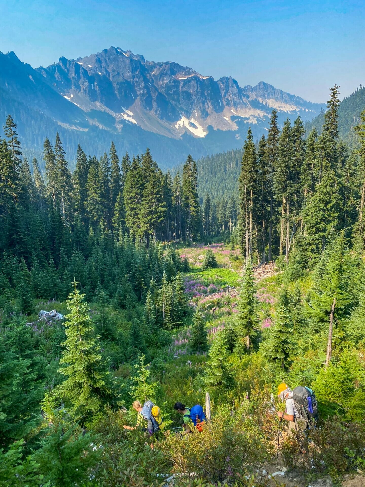
No creativity was wasted in crafting a Ptarmigan Traverse of our very own, informed by previous trips both dad and Eileen had undertaken and incorporating every worthwhile side-trip we could possibly manage within a 9-day schedule. We were prepped and ready for one of the most spectacular PTs ever executed, but of course the mountains had other plans.
Despite good planning, we were faced with days of rain and thick fog followed by an excessive heat warning, smoky skies, multiple group injuries, horrible glacier conditions, blue ice, and just about every obstacle one could possibly imagine— we continually missed summits and were even forced to bail out via an alternate route. For all the times I wondered aloud what fresh hell awaited us around the corner (and it was always something), there’s still no denying this was a Ptarmigan Traverse for the books.

Day 1: Cascade River Road to Cascade Pass TH
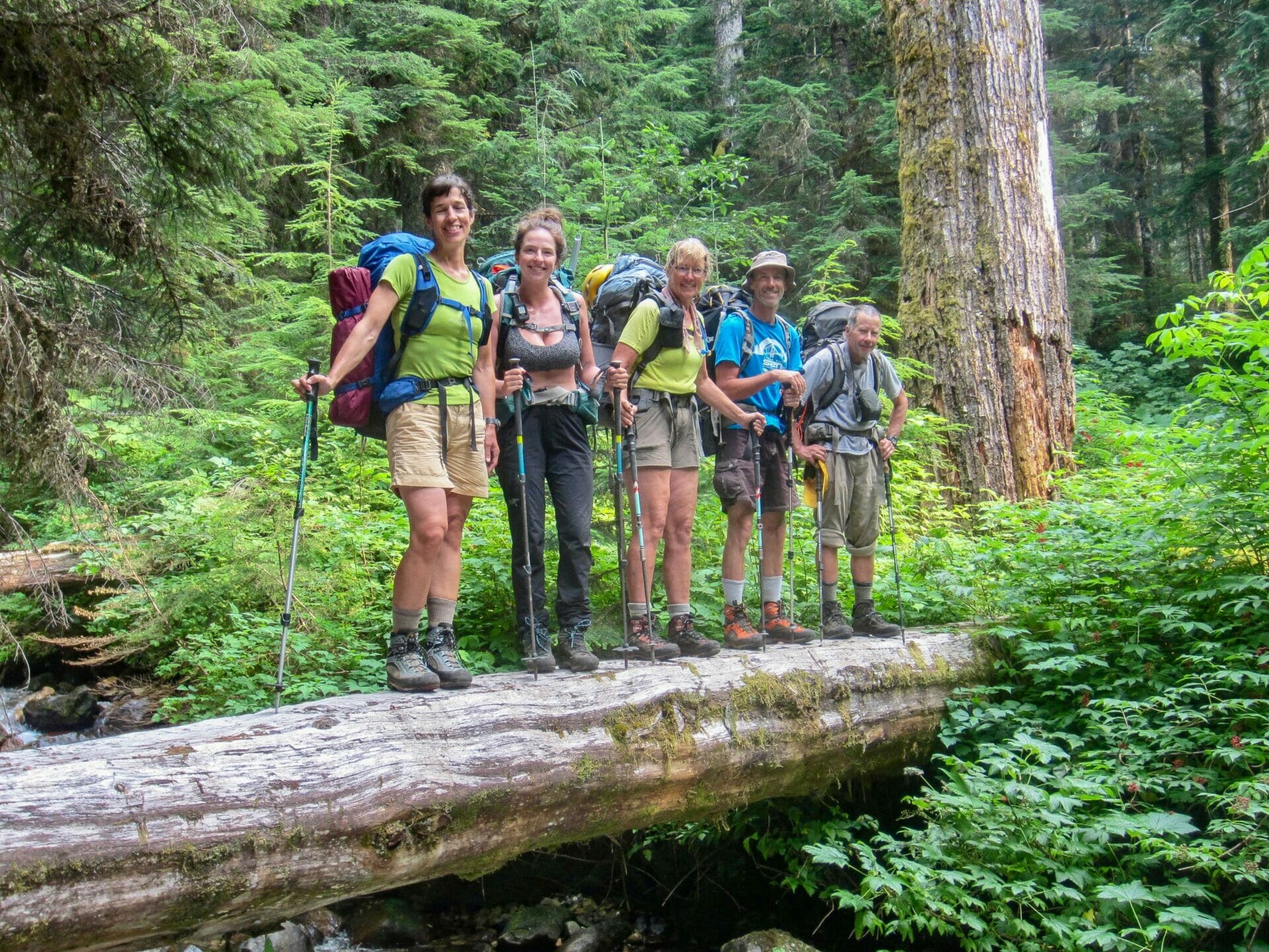
After a lengthy drive from Bellevue to Kirkland to Seattle to Marblemount, followed by an enormous dinner at Mondo’s, Derek dropped me, dad, Eileen, Kellie, Doug, and Todd at the El Dorado Trailhead (mile 20) around 8.30pm. We quickly readied packs, distributed group gear, and hit the pavement.
With Cascade River Road partially closed yet again (although it was all the way to mile 18 when we did Buckner last week), our journey began with an exhilarating 3.5mi road hike.
We managed to make it to the trailhead without headlamps, but only by sheer stubbornness— it was long past sunset and I could hardly see as I pitched camp next to the parking lot bathrooms (what Kellie and I fondly referred to as “our spot”). Already full from burgers on the road, we all tucked in and braced for the night’s forecast of constant rain.

Day 2: Cascade Pass TH to Kool-Aid Lake via Cache Col
Sure enough, we awoke to soaking tents and zero visibility, eventually making very slow work of packing up camp since no one was particularly eager to leave in this weather.
By 8.30am, we hit the trail up to Cascade Pass, pack covers billowing, rain gear fully engaged, and with a perhaps misplaced hope that conditions would soon improve.
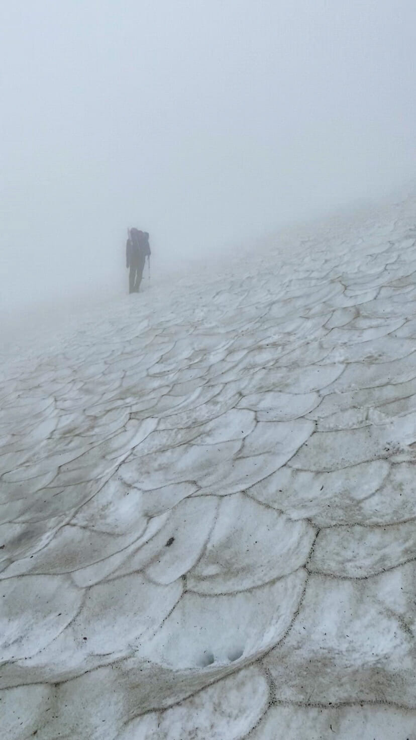
Having just been up here to climb Sahale and Buckner a few weeks ago, I was somewhat familiar with the trail and Cascade Pass, so by the time we did arrive at the top a very slow 2.5hrs later, I wasn’t overly disappointed (and certainly not surprised) to see the entirety of the usually beautiful view obstructed by thick clouds. I didn’t bother photographing the fog, but here’s what we were missing:

We were quickly driven onwards by the huge swells of wind washing over the pass, turning right to follow a narrow but well-worn boot path past the toilets and up the opposite mountainside as Sahale Arm. Soaked bushes beat us with water until we were all dripping wet and painfully shivering, while the rain overhead never let up.
Soon we reached a muddy gulch and had to descend over precarious scree and polished rocks already soaked by rain, only to climb up the other side of the dirt bank on impossibly steep sludge.

I could hardly see the climbers ahead or behind me, and certainly not as we kicked steps across an icy snow slope, their shadows gradually falling away into the mist.
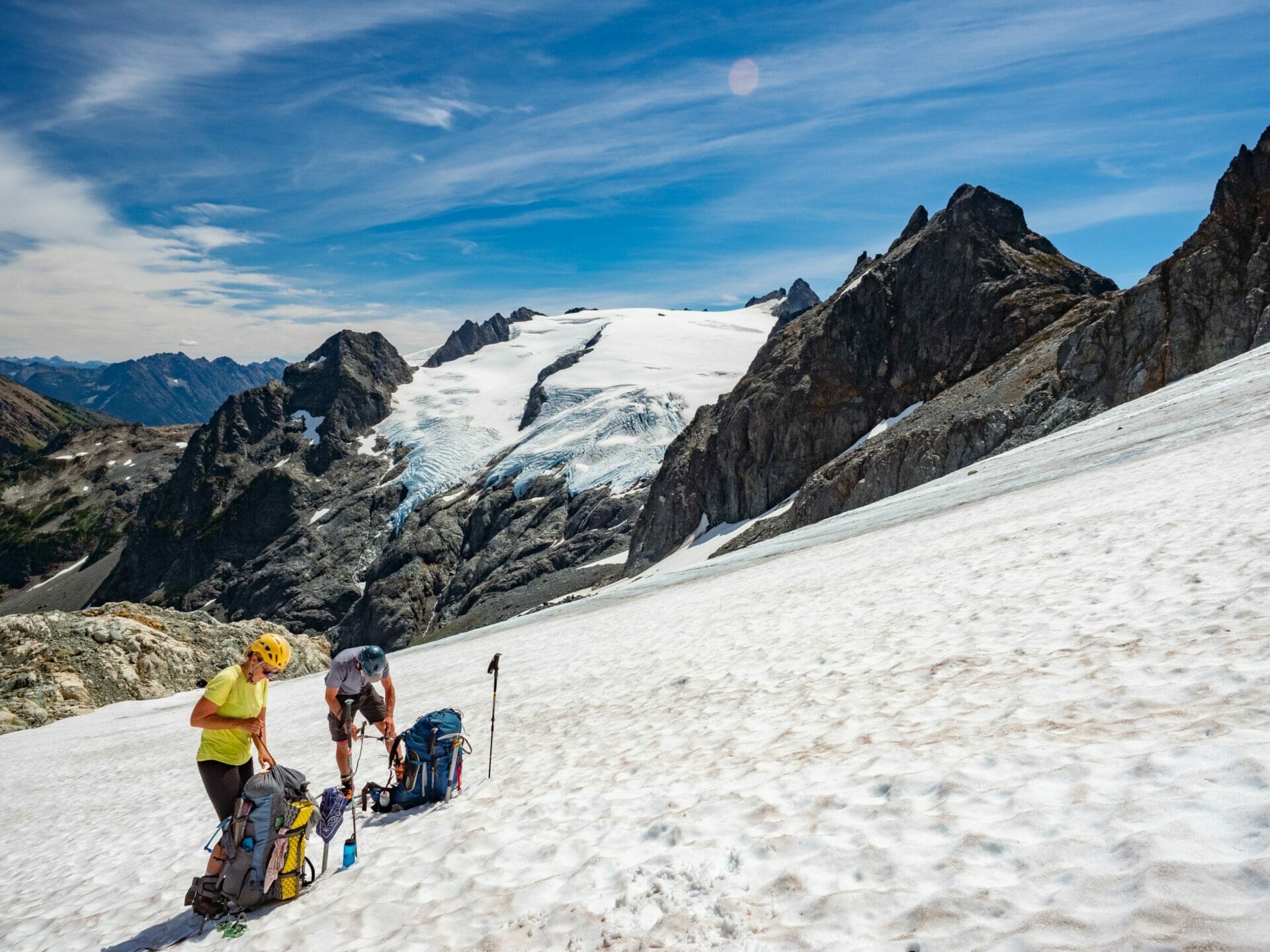
There was much shouting and “woo woo”-ing as we struggled to communicate, but finally everyone reached the edge of the Cache Glacier and stepped into crampons for the final push to Cache Col.

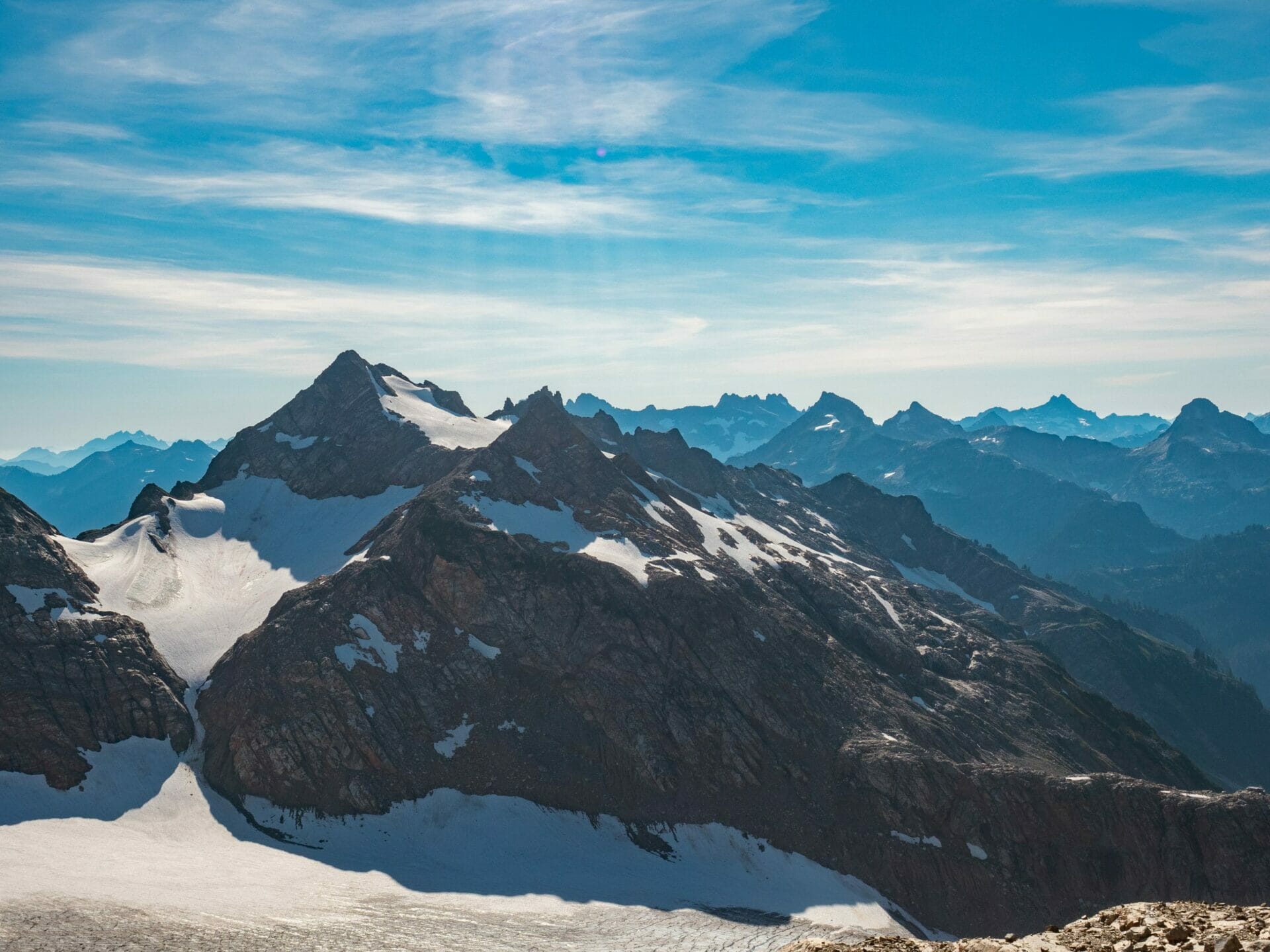
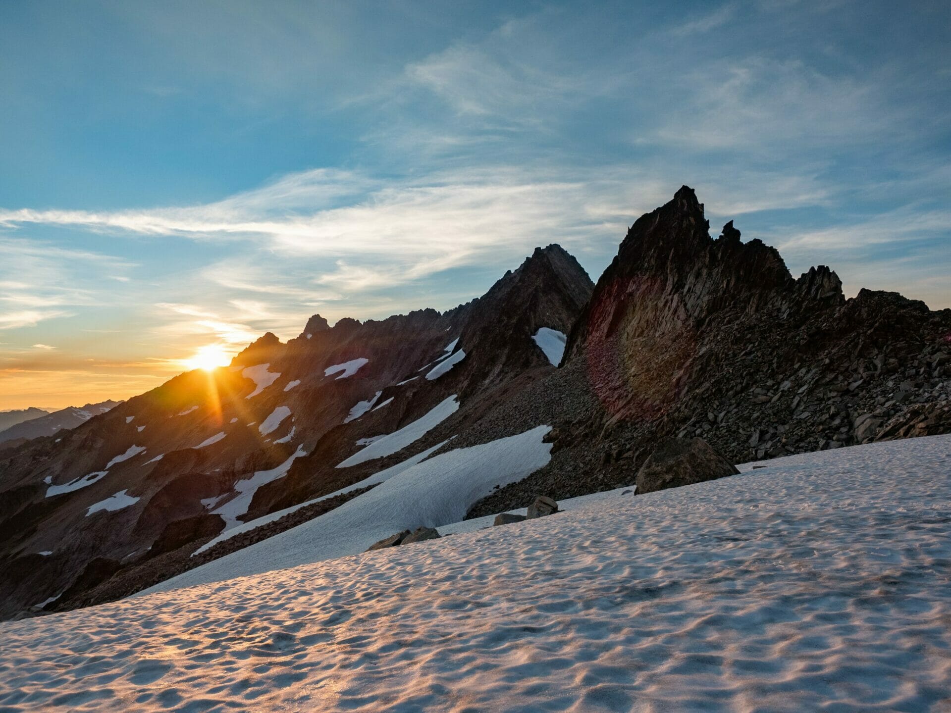
By 3pm, we were standing in the lush meadows of Cache Col, just in time to catch a fleeting glimpse of the dark mountains and blue-ice glaciers in the distance before clouds rolled back over and encased everything in white once again.
Off the other side, there was a boot path worn alongside the heather that led all the way to Kool-Aid Lake, via a slippery but otherwise harmless boulder field and what would have been staggering views of Formidable.


We arrived at Kool-Aid Lake shortly thereafter and, although it wasn’t our original destination for the night, the group unanimously decided to pitch camp here after our gruelling day, taking advantage of an extremely brief break in the rain to pitch tents. As if on queue, the rain returned as soon as we’d finished setting up, so all retreated indoors for a hot meal cooked in the tent vestibule.
Much of my pack contents were wet, all my clothes were soaked, and the tent itself hadn’t even dried fully after the previous night, but somehow Kellie and I got comfortable in our tent, managed to dry some of our wet clothes with body heat, and passed out early to the sound of rain pattering the tent fly.

Day 3: Stuck at Kool-Aid Lake
We awoke some 12hrs later to terrible conditions, with rain still pelting down and even worse visibility than the previous night. Our route up Red Ledge was entirely obscured and there was no way we’d be able to make any reasonable or safe progress this morning, so instead we rolled over and went back to sleep, waiting for news on the InReach of when the weather might break.
By 3pm, we’d failed to receive any promising updates. I was feeling genuinely sick of hiding in my wet tent, but equally unenthusiastic about going anywhere outdoors— and so we continued to sit, or rather lay, and wait out the weather until the following morning. This involved a lot of napping, general fiddling, and some intermittent Steely Dan.

Day 4: Kool-Aid Lake to Yang Yang Lakes
After being woken up around 6am to dad muttering from the neighbouring tent “oh fuck”, I was surprised and delighted to open my tent an hour later to a few sun rays burning through the fog and gradually revealing the hulking peaks that surrounded us on all sides.
40hrs after crawling into our tents on the afternoon of Day 2, and it finally looked like we were going to be continuing along the Ptarmigan.


Excitement was palpable as we departed camp and watched the fog burn out of the basin, navigating through a rock field towards the infamous Red Ledge, which we could actually see for the first time in 2 days.
Even this notoriously tricky section of the route, now accessed by a straightforward Class 3 scramble due to receding snow, felt exhilarating, proof of just how tired we’d all grown of the inside of our tents.


After donning crampons and crossing a small snowfield, we dropped over the side of a moat and climbed on prusiks up to the rocky maroon ledge, from which we could walk around the backside of the mountain and into full view of Formidable and her very formidable glacier.
The next hour passed quickly as we ran along a well-worn path through the heather, eventually crossing through another rock field en route to the Middle Cascade Glacier that would bring us up the Spider-Formidable Col.


All the while, views of snowy peaks and rough glaciers commanded our attention, slowing progress to a near halt for frequent photo opportunities. The sun was out, the fog was almost entirely lifted, and I could hardly imagine a more spectacular place to be in that exact moment.

It was 1pm before we reached the edge of the glacier and broke for lunch— a social affair that lasted almost an entire hour before we finally geared up for the climb to Spider-Formidable Col.
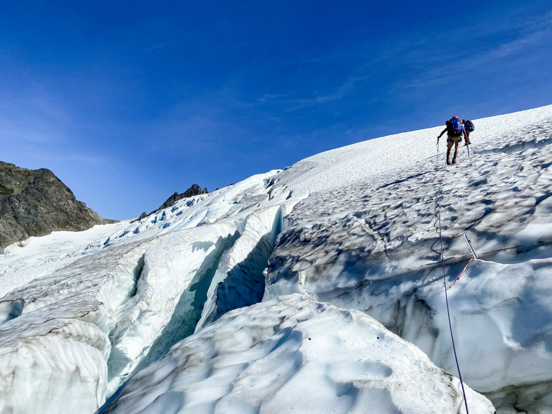
Despite the many crevasses baring a direct path to the col, conditions were prime and we breezed up the glacier without a single stumble.
At the front of the rope for once (still following behind the first rope team, though), I took every opportunity to peer into the intricate latticework of blue ice concealed within each crevasse and admire what was truly a staggeringly beautiful glacier surrounded by equally impressive peaks. I could hardly smack the smile off my face.


Once over the col, we made quick work of descending a short dirt chute on the opposite side and connecting back with the snow for our descent. If possible, this side of the pass boasted even more superb scenery, with the LaConte Glacier and her glassy turquoise lakes stealing the show.
I fell into near-hysterics as dad recounted having overheard a woman on the Lady of the Lake tell her out-of-town visitors that “it’s crazy that people think these are mountains. I’ve been to Switzerland and I know mountains. Washington has no mountains.”
Having also been to Switzerland myself, and on a long-distance backpacking trip no less, I don’t think I’d rate the North Cascades a single step below the Alps— these are every bit as grand, and about one million times more pristine.

Continuing our descent, I locked into a stable position against the rocks to belay Kellie and Eileen down the snow slope before following, eventually turning in to front-point the final stretch with my axe punched firmly into the ice.
The ordeal was momentarily reminiscent of our brutal descent on Buckner, but thankfully no where near as steep, soft, or long— and therefore nothing like Buckner, as it turned out.

Just as our first rope team was reaching level snow, a massive rock fall crashed down and connected with dad’s knee, sending the upper rope team sliding down the ice as he swore through a swell of pain. The blood was minimal, but I’d watched the rock contact his leg and knew the bruising would be no joke.
We doctored his knee up as best we could, sliding easily into my role as the unlicensed medical professional of the group, and then we divided some of his pack weight amongst us for the onward journey, all anxiously looking to dad for some sign that we was going to be alright.


After dad had iced his knee and felt ready to move, we set out to reach Yang Yang Lakes along a faint trail through rocky terrain and heather hills. Despite crossing a snowfield and several talus slopes in the process, he never gave any verbal indication of discomfort, but I could see him grimace with every step when I turned around.
It wasn’t a moment too soon when we finally arrived to our camp at 7pm— not for dad’s swelling knee, nor for our still-wet tents, and not for the rest of our tired group. It had been an 11hr day full of enough excitement for several.

Day 5: Yang Yang Lakes to White Rock Lakes
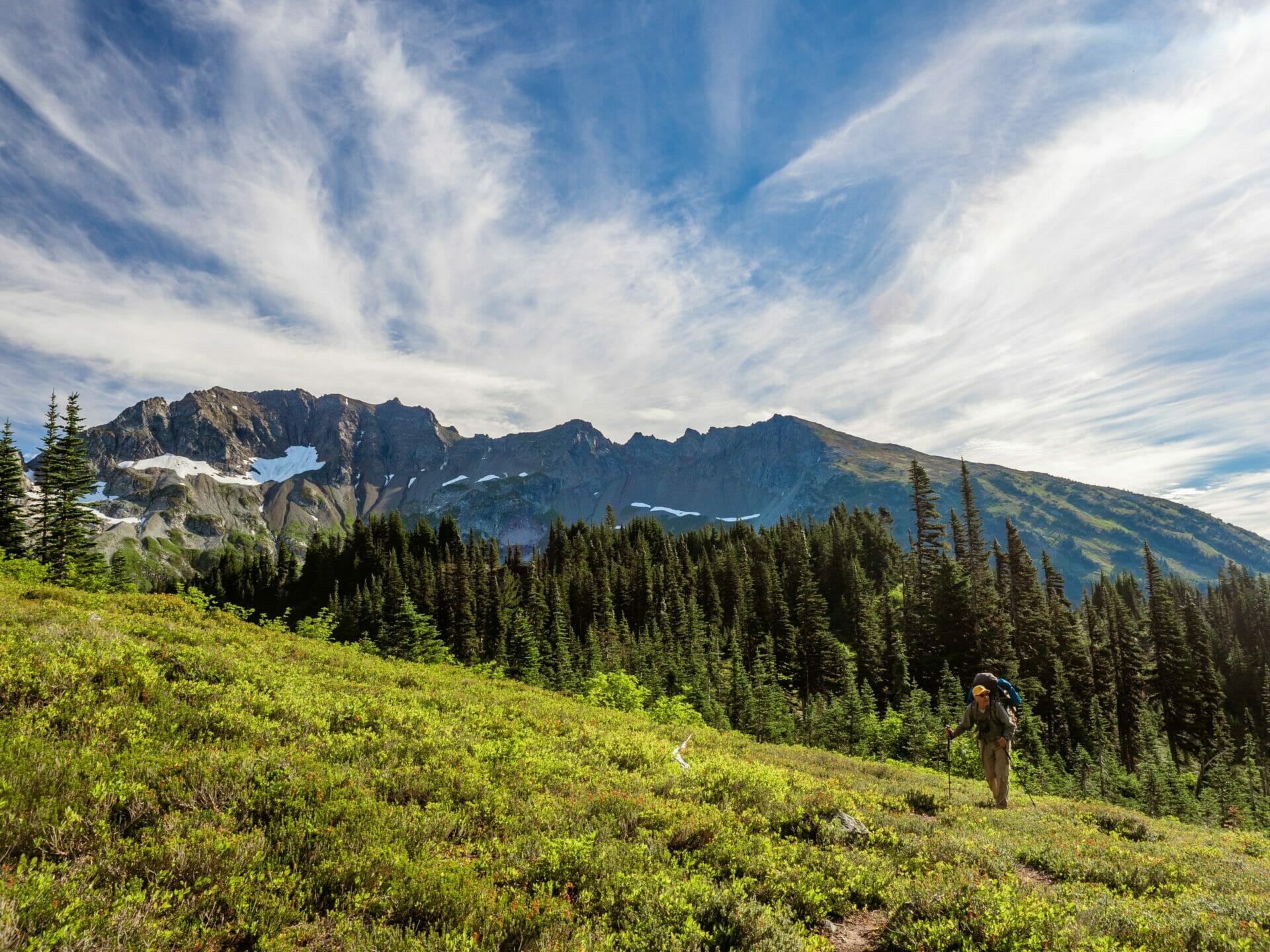
The day began pleasantly enough, rolling out of our beautiful site at Yang Yang Lakes and ascending a steep trail through the heather to gain the rocky ridgeline overhead.
The view of the lakes below, as well as the snow-capped peaks dominating the horizon, was just incredible. Looking out at the narrow snow chute we’d descended the previous afternoon from Spider-Formidable Col, I could hardly even believe how far we’d come— only a fraction of how far we’d have to go.


Once the entire group had arrived to the top of the ridge (which we later learned was the summit of Hahlakl Peak, and then took to remarking at every future failed summit attempt ‘at least we’ll always have Hahlakl’), Todd, Kellie, and I moved ahead to scout a route through the mass of talus that stood between us and the LeConte Glacier.
It proved a difficult task, but we did finally make our way over the rocks and onto the snow, traversing across an irritating series of rock ribs (continually putting crampons on only to remove them minutes later)— demonstrating yet again that there is a market for retractable crampons, despite the disturbingly lacklustre response from Dan when I originally revealed the business idea.


Again, the view was absolutely ridiculous, and actually bore a striking resemblance to one of my favourite Andean massifs in Peru, Ausangate.
Both are a crowd of peaks above a wild icy glacier that drops eventually to turquoise lakes below, and both are enough to completely overwhelm you.


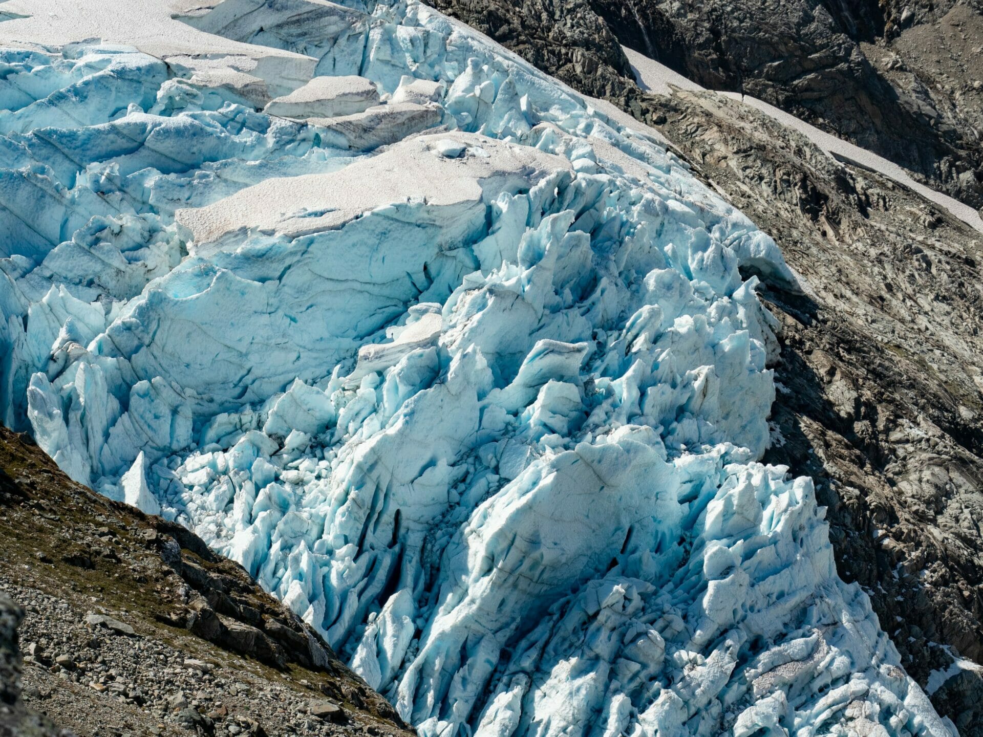
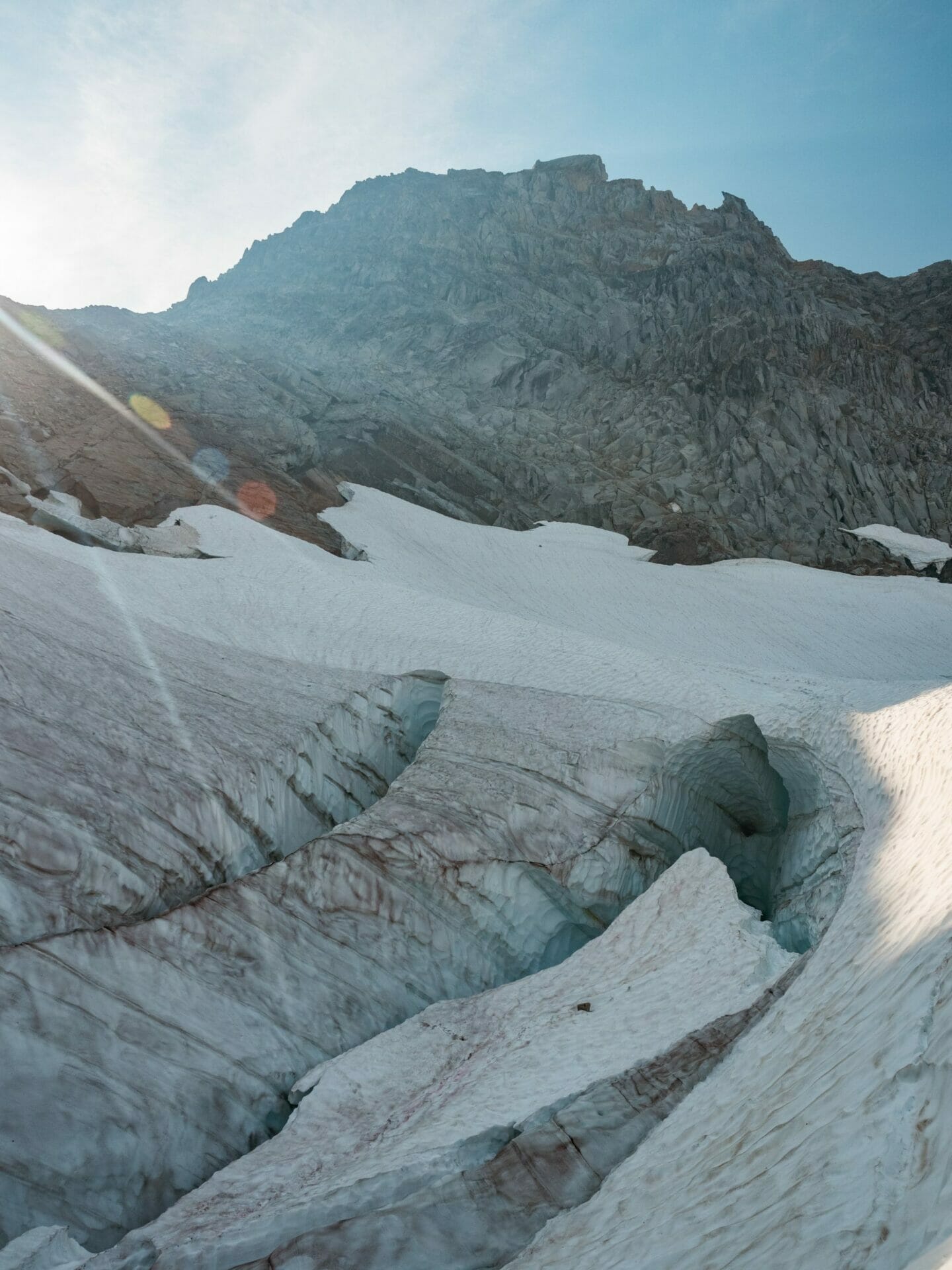
After an eternity of route-finding along inconvenient and somewhat messy rock ribs, we finally reached the base of the LeConte Glacier— and collectively winced at the sight of the hulking crevasses and solid blue ice that covered the entire route.
Much deliberation ensued, including a scouting mission by Kellie and dad, but it was eventually decided that we could hug the rock to the right of the glacier and travel several hundred feet on reasonable snow before cutting across the ice to reach the snowy cap of Sentinel Pass.

The route unfolded beautifully before us, but was still wildly difficult— I could hardly dig my crampons more than a few centimetres into the thick ice, so each step felt precarious yet painfully important.
When the fifth member of our 6 person rope team took a heart-stopping tumble down rough rock and ice, Eileen and I both dropped to arrest the fall and felt the full weight of a climber (and pack) strain against the rope and our own tenuous grip on the ice.
It was an incident that shook everyone in the group— thankfully Doug wasn’t injured beyond a few cuts, but we all redoubled efforts to keep both feet dug into the ice.

By 4.30, after crossing several large crevasses and a massive sea of ice, we topped out on the LeConte Glacier and enjoyed a quick break before continuing unroped down the opposite snow slope. The route soon transitioned to unpleasant loose rock, but an exhilarating glissade onto the South Cascade Glacier managed to offer a much-needed boost.
Although we’d set our sights on Sentinel for today, there simply weren’t enough hours in the day— as it was, we hardly made it to camp before dark. But how could we complain with views like these from the glacier?!


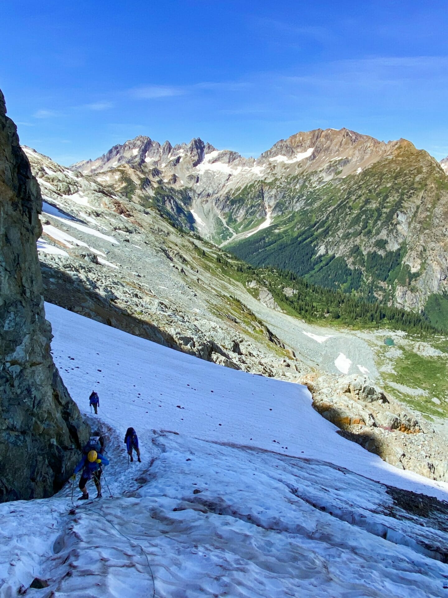
The final stretch of the day was far and away the worst terrain, a cliff of endless scree and talus descending Lizard Pass that was only tolerable because of the insane panorama that had just emerged over the ridge.
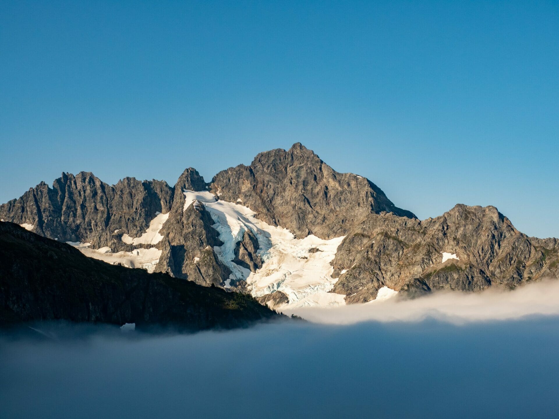
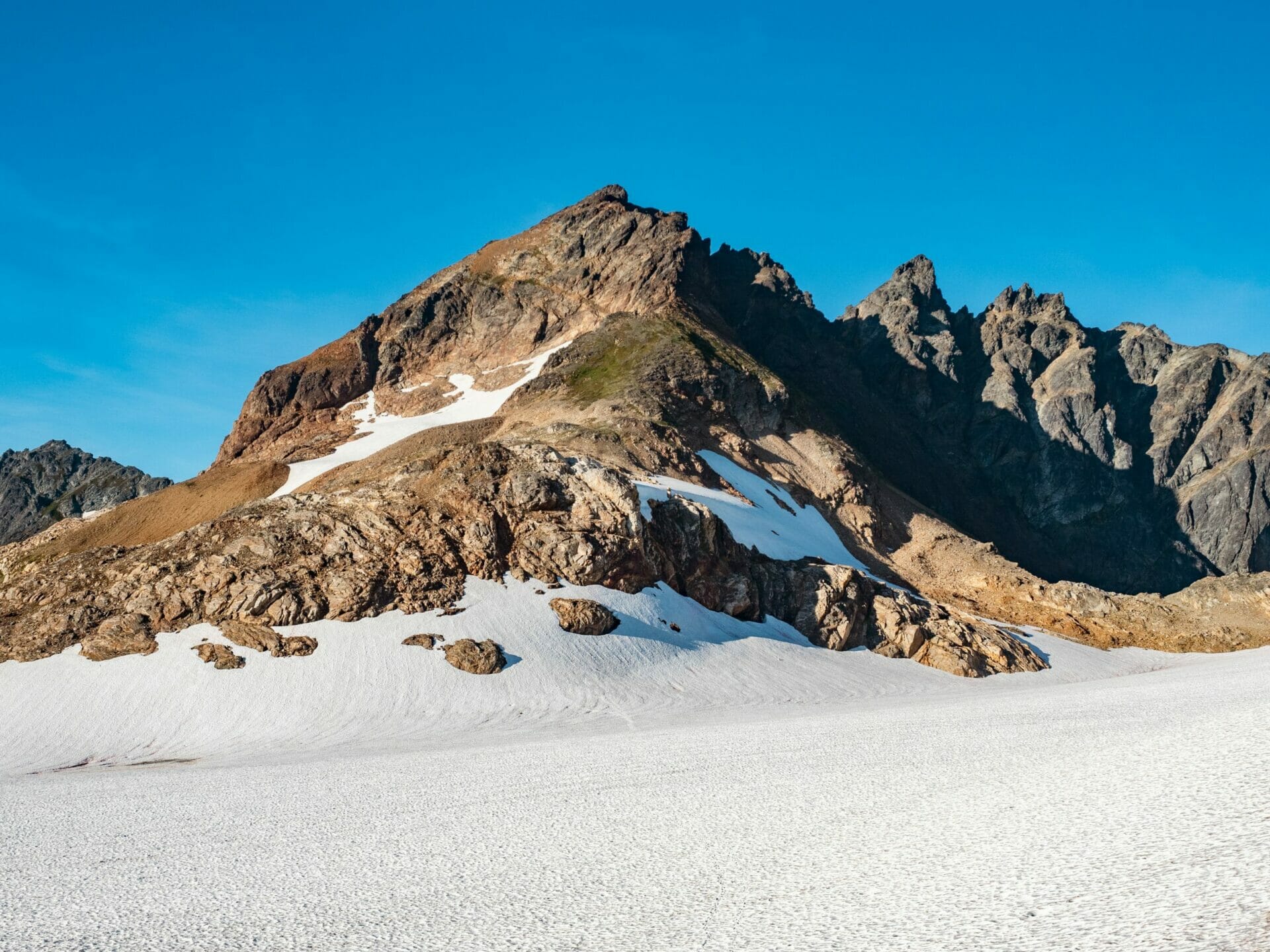
Stretched before us was White Rock Lakes and a dozen prominent peaks, all framing the imposing snowy face of Dome Peak, another of our climbing objectives for the trip (and really the only one we managed to accomplish).


By some miracle, I arrived to the base of the rock slope in a single piece and made it across the final snow slope without incident, although I’ll admit morale was suffering. All it took to improve matters, though, was one look at our campsite for the night.
Views like these practically repel negativity, and soon I had forgotten the agony of the evening and was running around taking photos like my usual non-traumatised self.

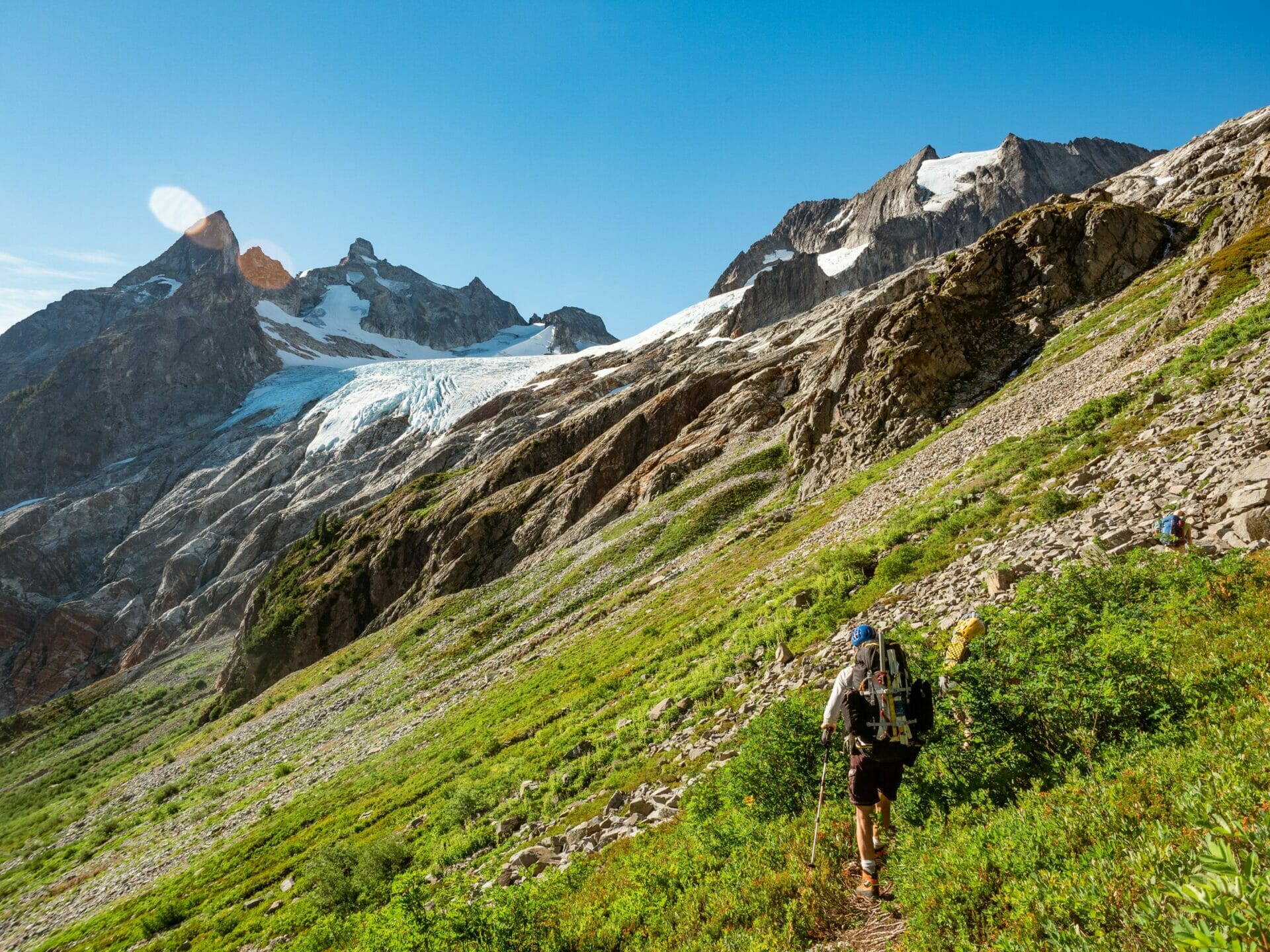
Day 6: White Rock Lakes to Dana-Dome Saddle
Departing our gorgeous campsite at the “early” hour of 7.30am, we spent the first part of the morning traversing through thick heather and bushwhacking our way towards a gully gushing with glacier water, which we hoped would bring us to the base of the Dana Glacier and eventually up to Spire Point.


The constant scratching and scraping of shrubs and overgrown trees on my sunburnt legs was bad enough, but worse still was the trail being entirely obscured by low brush— it was impossible to see your footing, which is how I ended up sticking my leg through a gap in the rocks and, still trapped up to my shin in granite, falling backwards onto my pack like an overturned beetle.
Had dad not been just in front of me, it easily would have taken me 20min to free my leg from between the rocks, but thankfully I had assistance— and more thankfully still, I hadn’t broken my leg.


After scaling a slick waterfall and crossing an endless sea of scrambly rock benches (a welcome change from the usual scree mess), we finally topped out and geared up to transition onto the glacier.
We’d spared ourselves a good deal of snow climbing by ascending the rocks, so it took precious little time to blaze a path all the way up to the snow arete that appeared to connect with the east face of Spire Point.

In reality, a hulking snow moat separated us from any reasonable rock route to the summit and, after some poking around, we came to the unpleasant conclusion that there wasn’t time to drop all the way back to the blue ice and wrap around via an alternate route— once again, we were foiled by the conditions and forced to retreat.
There was, however, a major consolation to our failed summit attempt— we did manage to climb onto the rocky ridge below Spire Point and enjoy sweeping views of everything from Glacier and Rainier to nearby Dome Peak and Cub Lake.
It may not have been the summit, but it was a pretty stellar lunch spot!


After retracing our steps down the glacier and reconnecting with Doug, who’d (perhaps wisely) opted to sit Spire Point out, we roped together again for the long journey to the Dana-Dome Saddle.
The first section of the traverse wove tightly through a series of crevasses and then spat us onto a lengthy rock rib that ran all the way up to the glacier above on a relatively steady scramble.
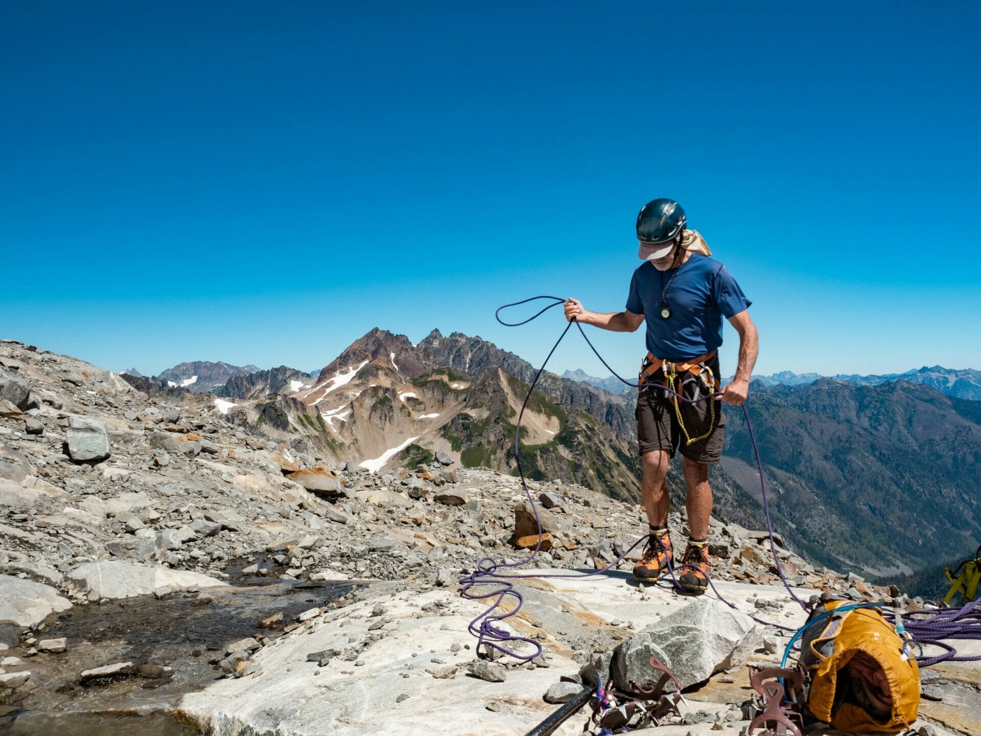
No sooner had we reached the snow and began to reassemble into our lengthy rope team than Eileen realised she’d left her harness some several hundred feet behind at the start of the scramble.
Amidst considerable collective groaning, Kellie volunteered to retrieve it at hyper-speed, a favour for which she requested a free ticket to South America to visit me in the coming year— but for which she was instead awarded a chicken salad and two gluten free cookies from Eileen’s pack. Although a talented climber, her negotiation skills require serious work.


Finally setting off, I was offered the opportunity to lead up the Dana Glacier for the sake of additional experience. Very wisely, as it turns out, I instead volunteered myself to bring up the rear and clean— removing all the pickets and ice screws that dad ended up placing as protective and then carrying them uncomfortably up the snow for the next 2.5hrs.
As much of a slog as it might have been, I was appreciative for the skill development and largely compensated by the stupendous views back onto Lizard Pass, which we’d descended the previous day, and Sentinel/Old Guard, which we’d failed to ascend the day before that.
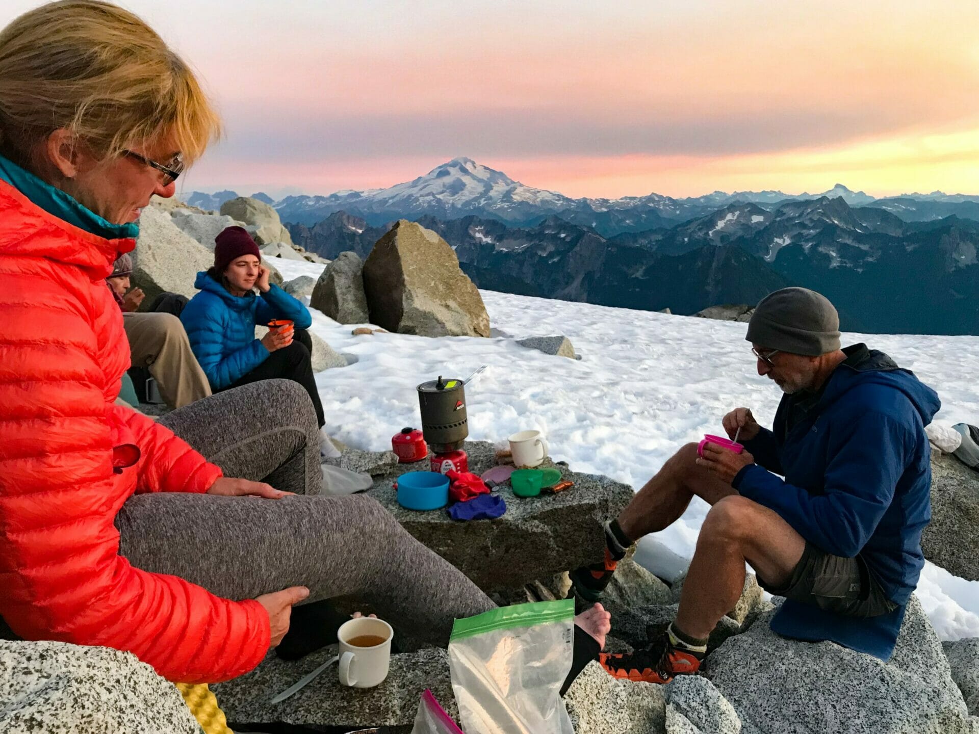
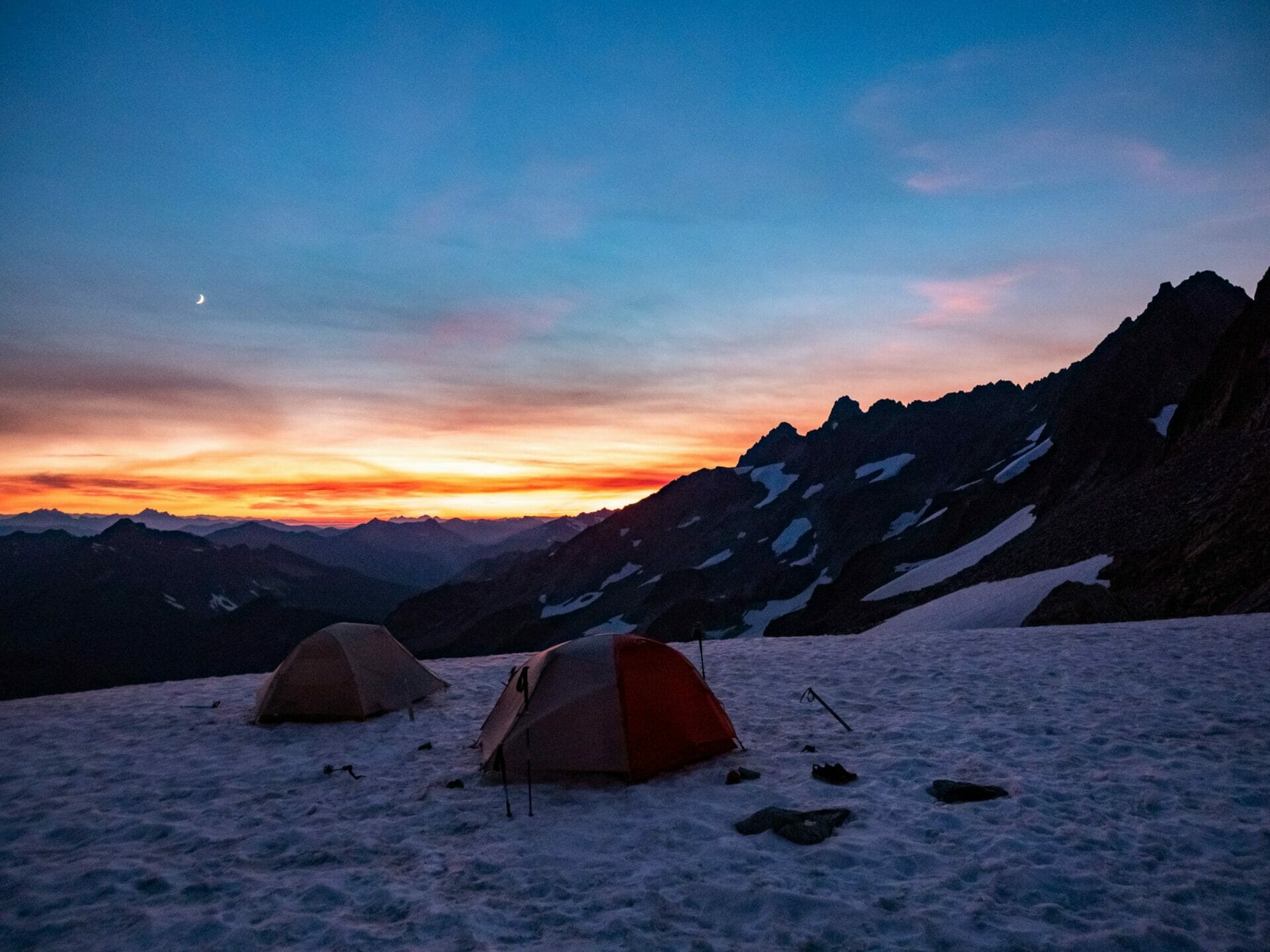
Indeed, the ultimate prize was our camp at the Dana-Dome Saddle. The prospect of camping on ice was originally unappealing (although I was somewhat reassured by having woken up the previous night in a fever sweat and sleeping the remaining hours with 70% of my body removed from my oven of a sleeping bag), the view was an easy sell.
Glacier Peak dominated the horizon, but dozens of other peaks provided ample intrigue, and I honestly couldn’t say whether White Rocks or our isolated perch on the snow was more spectacular.


Day 7: Dana-Dome Saddle to Cub Lake via Dome Peak
By morning, all the beautiful views were gone, entirely clouded by a heavy layer of smoke that had woken me up coughing countless times in the night and that hung thick in the air all day.
Unfortunately, this also coincided with our last summit attempt— Dome Peak.


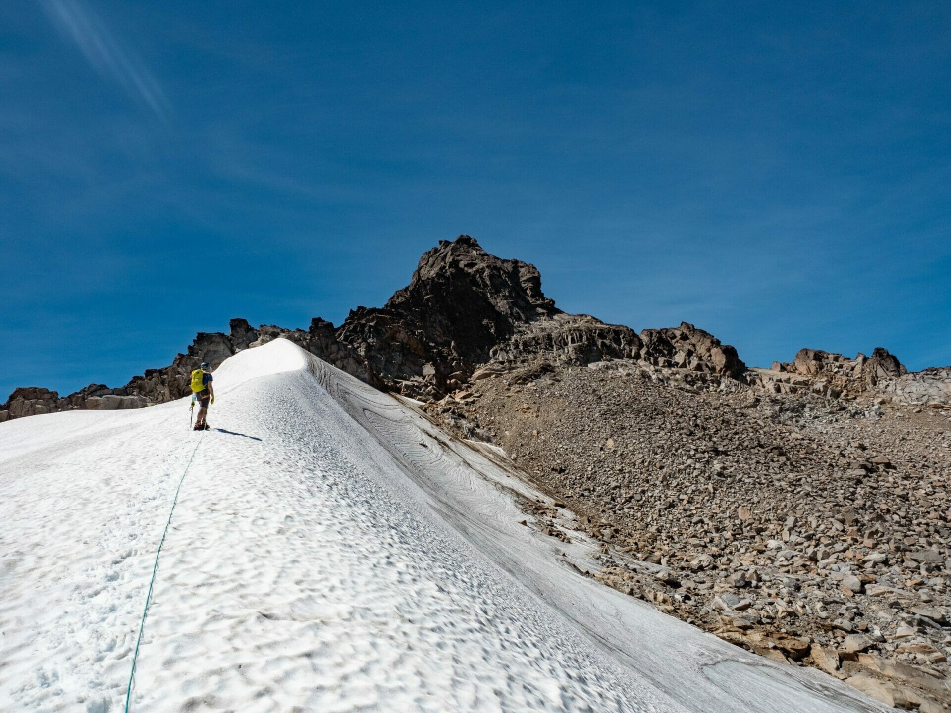
Eager to climb at least one of the peaks we’d originally set out to, we all blazed out of camp around 7.30am and, after a brief rock scramble, spent the remainder of the morning ascending the Dome Glacier as a rope team.
The route wasn’t particularly harrowing, nor was our smokey view all that remarkable, so we made quick work of the ascent and soon found ourselves clawing up a dirty slope riddled with loose rocks to gain the ridge.


Here, we dropped packs for the remaining scramble to the summit, which still featured plenty of loose rock but markedly less dirt.
Kellie and I flew up the granite boulders and all the way across to the actual summit block before realising that Todd, who’d turned back halfway up the rock, had all the gear. She raced to collect it and watched dad, Eileen, and Doug ascend to our breezy spot on the ridge.
Using a hand line, we all piled onto the summit for a rather underwhelming view from what should have been an unbeatable vantage point over the Cascades.


In the meantime, dad had also zipped out from the ridgeline along the snow to assess a possible route onto the Chickamin Glacier. He returned not long after with the unfortunate news that there was a massive bergschrund barring our path and absolutely no safe way to get around it that he could see. This meant ‘bailing out’ along the traditional Ptarmigan exit route onto Bacheler and Downey Creeks.
After retracing our steps back to the previous night’s camp at the Dana-Dome Saddle, we set out on what would be the longest and most painful downward traverse of the trip. Constantly transitioning from steep, thin snow to steep, loose rocks, there wasn’t a single moment where I felt stable.
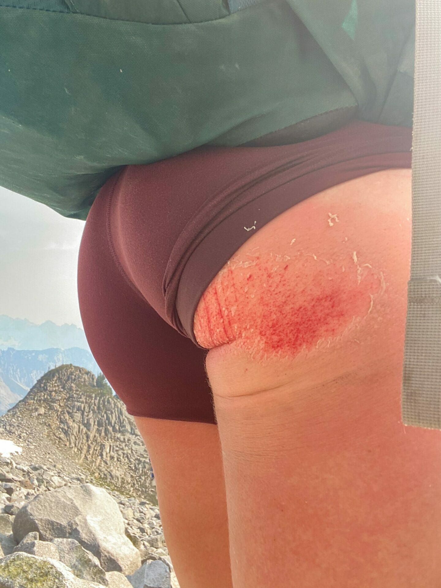
In an effort to avoid a painful fall on a particularly steep snow patch, I opted to glissade, only to emerge with a raw ice burn that covered the entire right side of my bum and which burned with an almost unbearable intensity, unaided by several tumbles onto loose rocks, until Eileen and Kellie gave me painkillers and bandaged the hell out of my backside.


Not a moment too soon, the terrain began to improve. First we were on rock slabs through a series of waterfalls, then there was an actual route through the rocks marked by cairns, and finally a distinct trail cut into the heather ascending to Iswoot Pass.
From here, we could see the heather trail continue for hundreds of feet, all the way down to Cub Lake. We spent the next couple hours descending the steep and often flooded heather trail, finally arriving at the lake just after 7pm. It had been a massive day on the Ptarmigan, but what’s new.

Day 8: Cub Lake to Downey Creek Forest Camp via Bachelor Creek
The goal for our penultimate day of the trip was to get as far along the Downey Creek Trail as possible.
This involved two major challenges: navigating through Bachelor Creek, a purportedly awful stretch of unmaintained trail that had been abandoned for the better part of 40 years (and that Eileen remembered as being nearly impassible), and then making our way along the Downey Creek trail that was officially closed due to a recent forest fire, the extent of which was unknown.
Anticipating a long day of agony, we left Cub Lake promptly in the morning and began our steep ascent out of the basin. Both the climb up to the ridge and down the opposite side went far better than anticipated, and by the time we arrived at Bachelor Flats, the start of the allegedly disastrous trail, we were in fairly high spirits.


Throughout the course of the day, the Bachelor Creek Trail devolved into worse and worse conditions, but I still never felt like it was as brutal as the previous day’s drop from the Dana-Dome Saddle— at least there was zero scree to contend with!
What we had instead was a wildly overgrown forest trail littered with downed trees, plagued by mosquitos, and peppered with slide alder. Since the last time dad and Eileen had been through the area, though, someone had cut a rough path and flagged with pink ribbon every several dozen feet, so it was exponentially better than expected.

By early afternoon, we finally burst out to the Bachelor/Downey Creek junction and enjoyed a break in the shade. We’d survived the worst part of our exit and without any major issues, cause for major celebration.
The final stretch of our hike for the day was along a well-maintained stretch of the Downey Creek trail, possibly the best section of trail walking we’d done in the last week and a half. When we did arrive to an informal camp alongside the creek and collapse into the pine needles, it was with great satisfaction, knowing that the trailhead was only 4mi away.

Day 9: Forest Camp to Downey Creek TH
Finally, we were about to escape the adventure/nightmare of the Ptarmigan Traverse, only a few miles from the trailhead where our rides (my stepbrother Derek and Kellie’s husband Rolf) were meeting us at 2pm.
Thankfully, the remainder of the Downey Creek Trail, although markedly worse than the first section, still wasn’t awful. The fire had brought trees and brush across the trail, but only in the final mile. Prior to that, our only agony was a mess of stinging nettles and countless spiderwebs (filled with spiders) hanging across our path.
We arrived to the trailhead by 12.30pm and ran directly into the creek, and not long after were met by our drivers. With river-soaked legs and cold beers in hand, the events of the trip slowly began to seem amusing rather than traumatic, and soon we were all smiling at what had truly been an epic trip.

READ MORE WASHINGTON TRIP REPORTS
CLIMBING MT RAINIER VIA CAMP SCHURMAN & THE EMMONS GLACIER
SAHALE ARM TO BOSTON BASIN VIA MT BUCKNER & SAHALE PEAK
FROZEN LARCH HIKE: INGALLS LAKE & SOUTH INGALLS PEAK
CHELAN SUMMIT TRAIL (DAYS 1 & 2): PRINCE CREEK TO STAR LAKE VIA STAR & COURTNEY PEAK
MAPLE PASS LOOP & BLACK PEAK (DAYS 2 & 3): LEWIS LAKE TO WING LAKE & BLACK PEAK SUMMIT
The Comments
Keith Langenwalter
What a difference from when I did the Ptarmigan over July 4th of 2020. We had similar weather to start (along with the 3.5 mile road-hike), and we didn’t really get a good clear day until waking up at White Rock Lakes. But we put our crampons on at Cascade Pass, and didn’t take them off again until past Cub Lakes. I think there was a short section of dirt on the traverse from White Rocks to the Dana Glacier. Some of the descents seemed easier with snow (specifically from Spider-Formidable and from Lizard Pass down to White Rock Lakes), but I was looking forward to some of the paths through heather slopes. I’d like to go back and do it again with less snow, although time it right to hit the alternate exit via the Hanging Gardens.
brooke brisbine
Keith LangenwalterHi Keith, thanks so much for reading! Your conditions sound a bit more favourable than ours– we would have LOVED more snow– but I suppose it too comes with its own challenges. That fickle mountain weather, you never really know what the season is going to be like!
Happy trails 🙂
xx bb
Peter Kelemen
Hi, nice trip report though sounds like a bit of an epic based on your post, and Eileen’s Adventures. It’s good to know that the Bachelor/Downey route out is passable, despite the trail and road closures. If possible, I would like to know more about the (non) route from Dome Col down onto the Chickamin Glacier. It sounds like part of the issue was the lack of snow in August. Do you or your companions think this would be passable in the early season (May, June)? We would have crampons, ice axes, rope, a tiny amount of rock gear … and skis but that is irrelevant, except that, yes, we will have heavy packs.
brooke
Peter KelemenHi Peter, thanks for reading!
It certainly ended up being more epic than anyone could have anticipated (isn’t that always the way). We fully intended to descend on the Chickamin and my dad (our trip leader, Jim Brisbine) recalls that he’s never seen the glacier and snowpack so stripped back– that early-season heatwave last year completely ravaged the Cascades and we were constantly surprised by the conditions. In previous years, that route should have been entirely passable, but it’s worth noting that the glaciers may not have fully recovered in a single season, so who knows what things look like at the moment (early season being a safer bet).
My best advice would be to send my dad an email directly, he’s a geologist and far more familiar with the route (having completed it multiple times), so I’d trust his advice over my own: https://trailcatjim.com/contact-trailcatjim/
Hope that helps!
xx bb
Lefkos Christodoulides
Your Ptarmigan traverse account took me back to the same route and struggles 40 years ago with Pete Schoening and Otto Trott. Pete Athas turned back with an injured Fred Beckey (icefall off Formidable)
brooke brisbine
Lefkos ChristodoulidesIt sounds like this route has been dishing out surprising conditions and route challenges since the beginning of time! My dad has his own story of setting out on a disastrous Ptarmigan Traverse (probably around the same time, 40yrs ago) with an experienced climber and his wife (very much not a climber) because they’d read somewhere that this was little more than a backpacking trip.
I was expecting a mountaineering trip, and still I was constantly amazed at how difficult even “straightforward” glaciers were to navigate– I can’t imagine signing up for a backpacking trip and instead finding THIS.
Thanks for sharing your experience!
Bob Harn
Hi Brooke
We did the Ptarmigan Traverse in 1984. my wife and I were 30 then. I was fortunate to work with the son of Ralph (Ray) Clough, one of the original Ptarmigan party. I talked to Ray Clough the day before we did our trip.
From what I remember of my conversation, they were teenagers and were dropped off at Downey at Sulphuric creek by their mother. I think they approached Dome via Sulphur creek. From Dome they did the route roughly in reverse from the way it is done now. They did first ascents of Leconte, Spider, Formidable, Magic, Johannesburg, Boston and the north face of Buckner. They did second ascents of Dome, Spire pt, and Sentinal. When they finished Buckner they descended to Agnes creek and from there not sure.
The route now is much more difficult than 1984 due to lack of snow cover. The red ledge then was a perhaps class 2 but mostly a walk. We did Spider by a steep snow finger on the south which does not exist any more. We put a cairn on what I think is now called Hacklah peak. The traverse from The S-F col was mostly on glacier require ropes but not difficult. The rest of the trip was not difficult. We camped 6 nights, at Kool- aid lakes, on a ridge overlooking formidable, the Sentinal col, White rock lakes and 2 nights at Cub lake hoping to do Dome but the weather didn’t permit. We climbed Spider, Leconte , old Guard, and Spire pt.
I really enjoyed your photos
Bob
brooke brisbine
Bob HarnHi Bob, thanks so much for sharing your experience!
This route is a piece of local history, and the fact that you were able to do it with some planning input from the original team is beyond impressive– we spent our whole trip reading snippets of the original traverse (constantly amazed at how many summits they reached in the time it took us to barely survive the route!) and trying to imagine how much harder it would have been without our modern comforts (we read one account that they were all sharing one ice axe between them?!).
We’d also done Buckner a few weeks prior, and it took us a solid 12hrs from Sahale Glacier Camp, so again, AMAZED at their summit record. The fact that the conditions have deteriorated in recent years is my only consolation.
Happy trails!