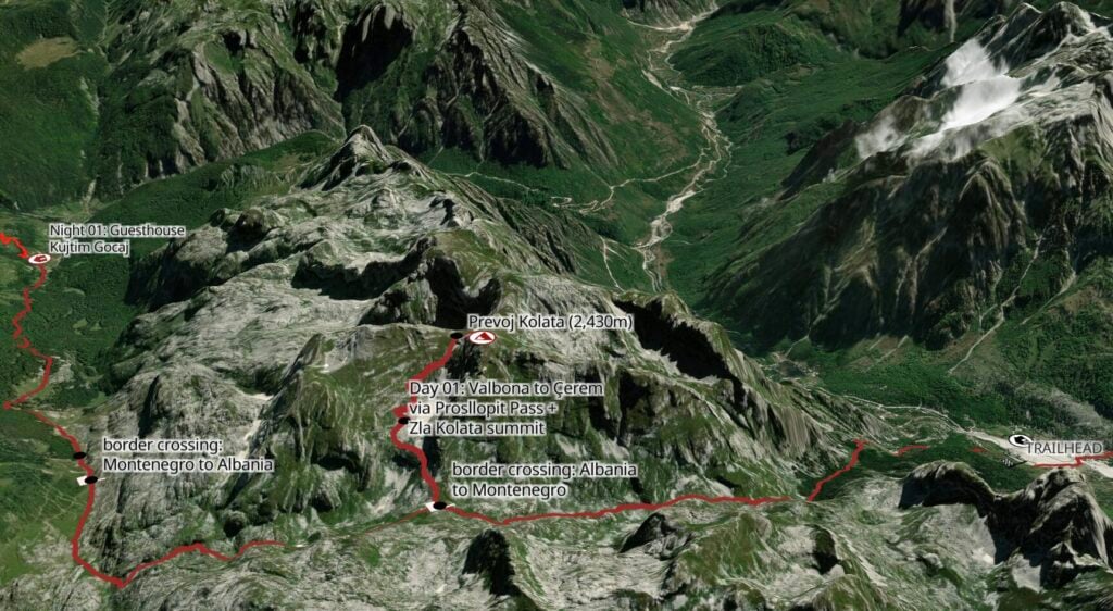
Peaks of the Balkans (Day 1): Valbona to Çerem via Prosllopit Pass + Zla Kolata summit
Dive headfirst into Peaks of the Balkans on a challenging but truly spectacular first day in the Accursed Mountains! Climbing high above Valbona Valley to Prosllopit Pass, the route crosses the border to summit Zla Kolata (2,534m), the highest mountain in Montenegro, before traversing a wild limestone karst plateau and re-entering Albania at Borit Pass for the long descent into the tiny settlement of Çerem.
Although a lower valley trail connects Valbona and Çerem in about 4hrs (and with a fraction of the elevation gain), this high variant delivers some of the best scenery on Peaks of the Balkans and was easily one of our favourite days of the entire circuit! Get an early start and allow plenty of time to enjoy the jaw-dropping landscapes you’ll encounter from start to finish.
This comprehensive guide to Day 1 of Peaks of the Balkans contains detailed section times, route recommendations, adventurous side trips, and heaps of insider tips— use it to plan your hike & then refer back on the trail so you always know what to expect!
>>> Read my Peaks of the Balkans hiking guide for the full 12-day adventure itinerary
Peaks of the Balkans: Day 1 overview
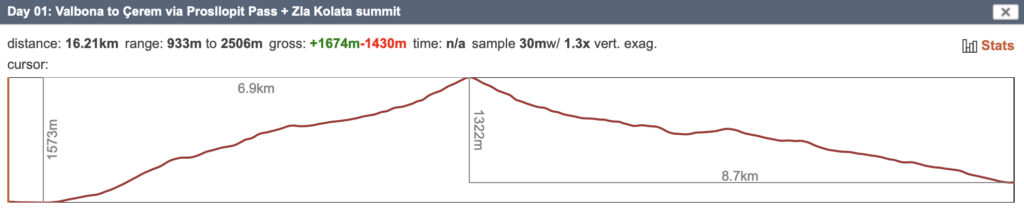
Stats are based on my Peaks of the Balkans adventure route, incorporating scenic detours, side-summits, and high variations to the standard trail wherever possible:
- trail time: 9.5hrs
- distance: 16km
- elevation: 1675m gain / 1430m loss
- side summits & variations: high route over Prosllopit Pass + Zla Kolata summit (2,534m), highest mountain in Montenegro
*Trail times are reflective of our personal moving time (excluding any breaks where we removed backpacks), but may be slower than average due to considerable snow cover along this section of the route in early June— these times are most useful as an estimate!
**Make sure to carry plenty of water today— there are no water sources until after Borit Pass, more than 7 hours into the hike!
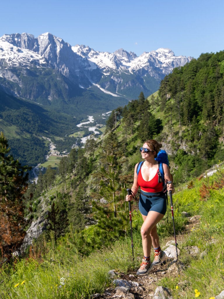
Valbona to Prosllopit Pass (3hrs)
The trail to Prosllopit Pass begins on the north side of the Valbona River— cross the Musli Syla Bridge in front of Valbona Resort and continue a short distance up a rocky road to connect with a well-defined trail (coordinates here) angling left up into the forest.
The 1,110m ascent to the pass is continuous but surprisingly gentle, and much of the climb is pleasantly shaded within an ancient beech forest, popping out occasionally to enjoy ever-improving views of the Valbona Valley flanked by snow-covered peaks in your rearview.


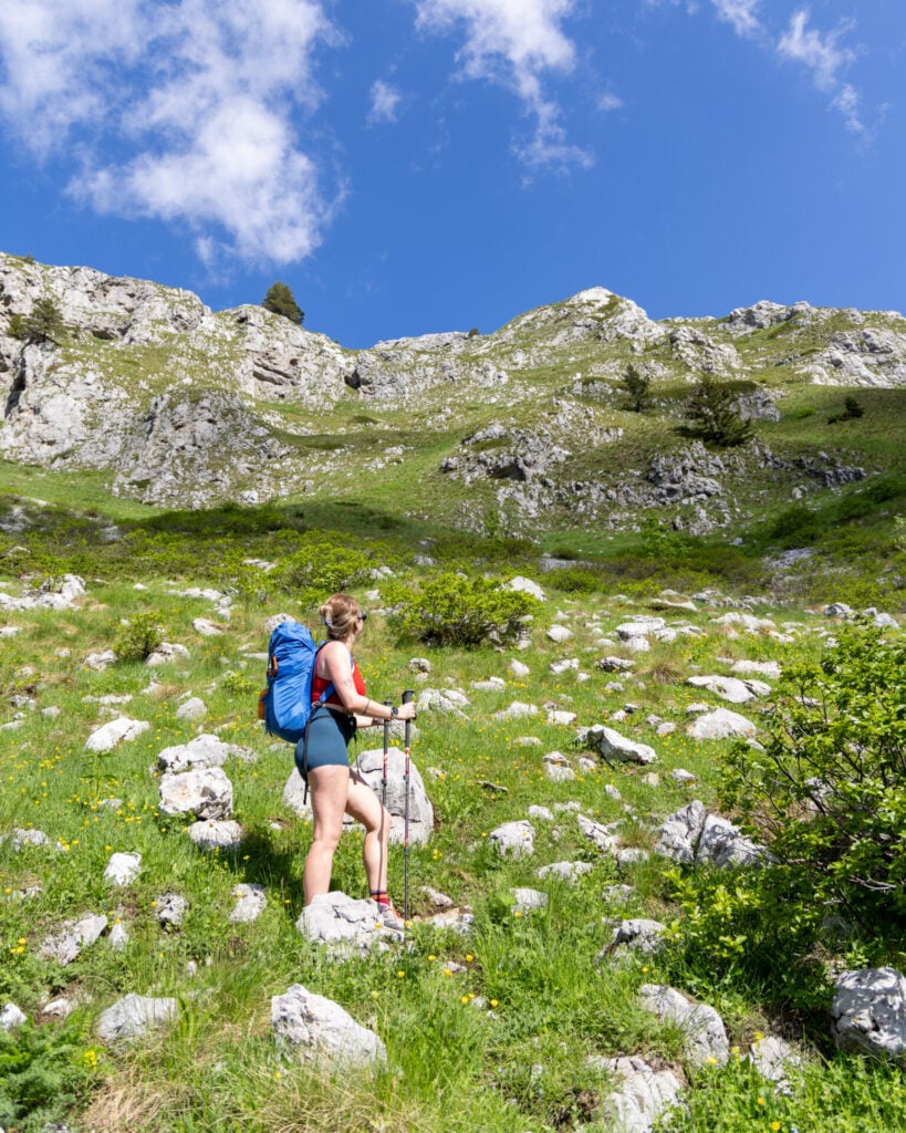
After about 1.5hrs, the trail emerges into a flower-filled meadow roughly halfway to the pass (3.5km, 580m gained from Valbona). The brief stretch of open terrain offers a welcome excuse to pause and admire the scenery before the route climbs through one final section of cool beech forest.
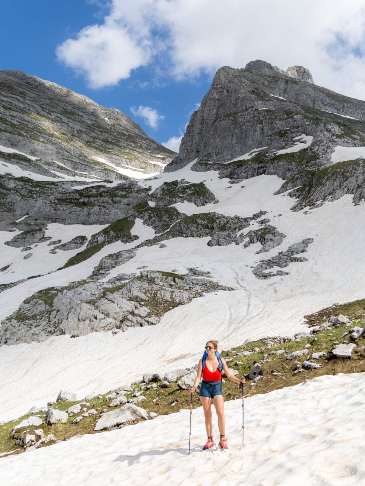
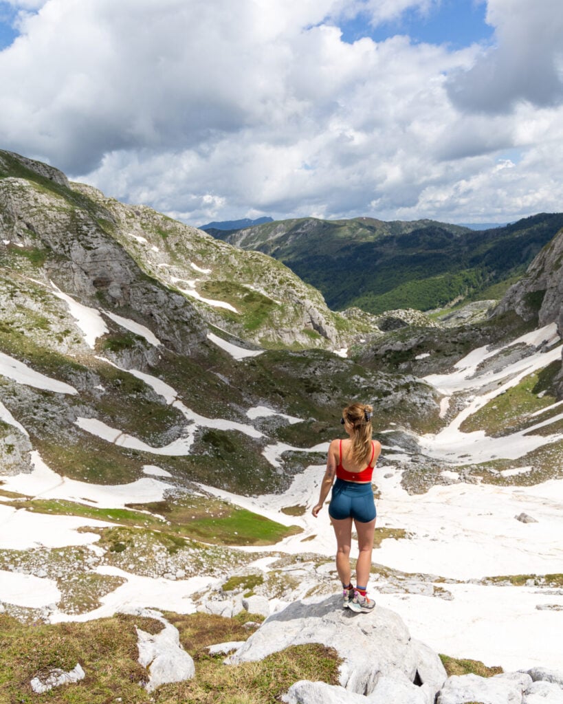
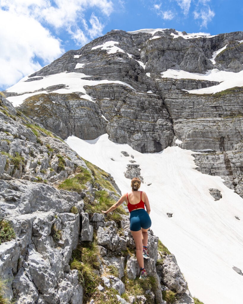
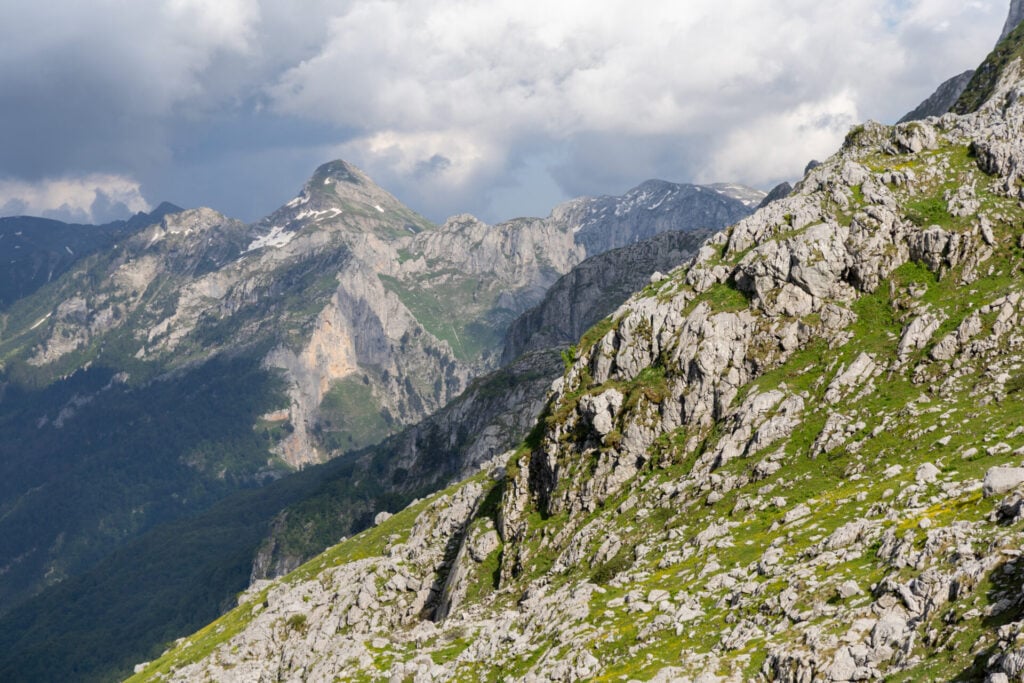
When the trail finally emerges above the treeline shortly thereafter, it is to absolutely spectacular views of the pale towers of Maja e Thatë on your left and Zla Kolata on your right. Even in summer, snowfields often linger beneath the steep north-facing slopes, lending the entire landscape a dramatic, high-alpine feel despite its fairly modest elevation.
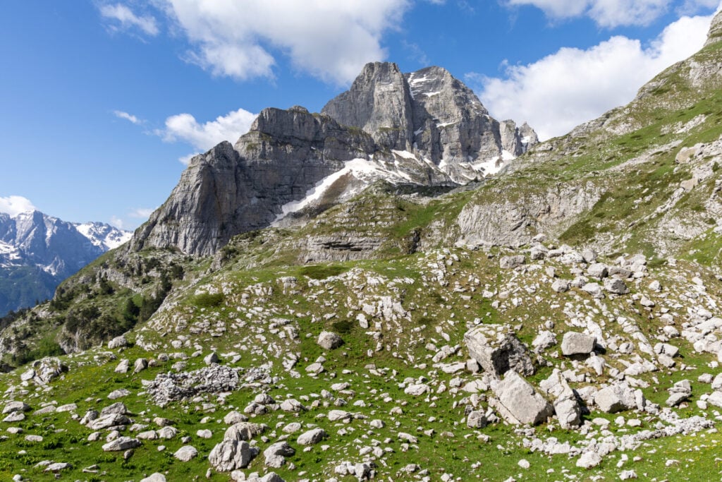
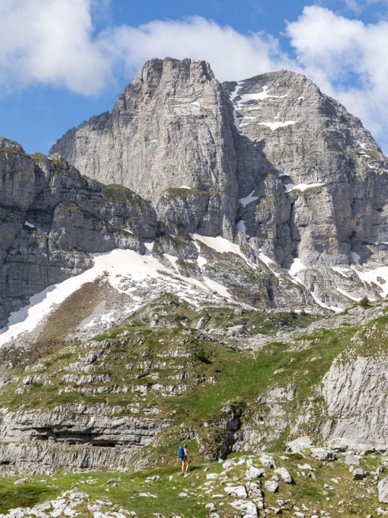
This dramatic glacial basin, with its striking white boulders and steep limestones peaks, reminded us instantly of the Dolomites— but unlike Italy, we didn’t see a single person until 2pm when we were back down at Prosllopit Pass after summiting Kolata!
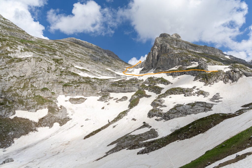
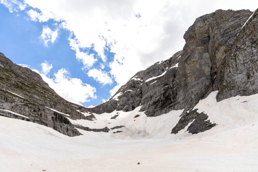
Just under 3hrs from Valbona, the trail reaches Prosllopit Pass (2,039m), a low col ringed by impressive limestone mountains and perched on the border between Albania and Montenegro. Early in the season, you can expect some snow here, but it’s quite flat and manageable (unlike the somewhat perilous snow slopes just beyond the pass).
Prosllopit Pass to Zla Kolata & back (3hrs)
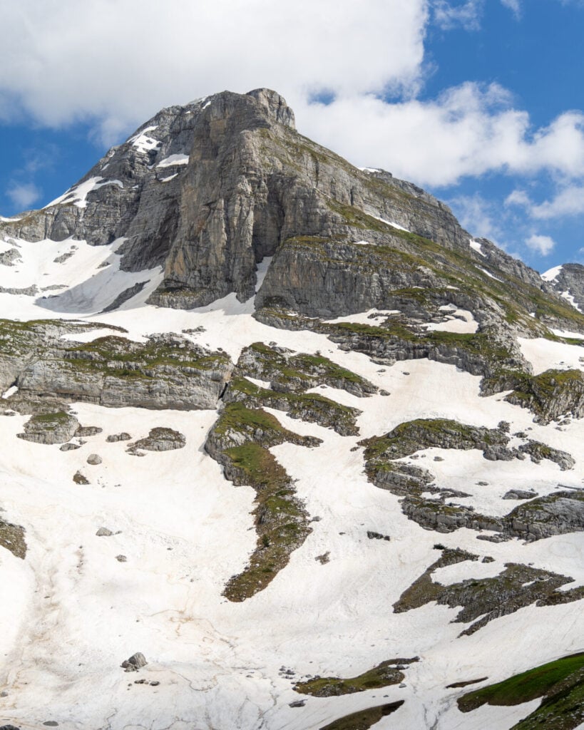
After enjoying the expansive views from Prosllopit Pass, begin the approach to Zla Kolata, the highest mountain in Montenegro at 2,534m and one of the most dramatic summits in the Accursed Mountains!
The ascent is fairly straightforward, following a winding trail up rocky ledges of Class 2 terrain (with only occasional Class 3 scrambling), but summit time can vary from 1-2hrs depending on conditions.
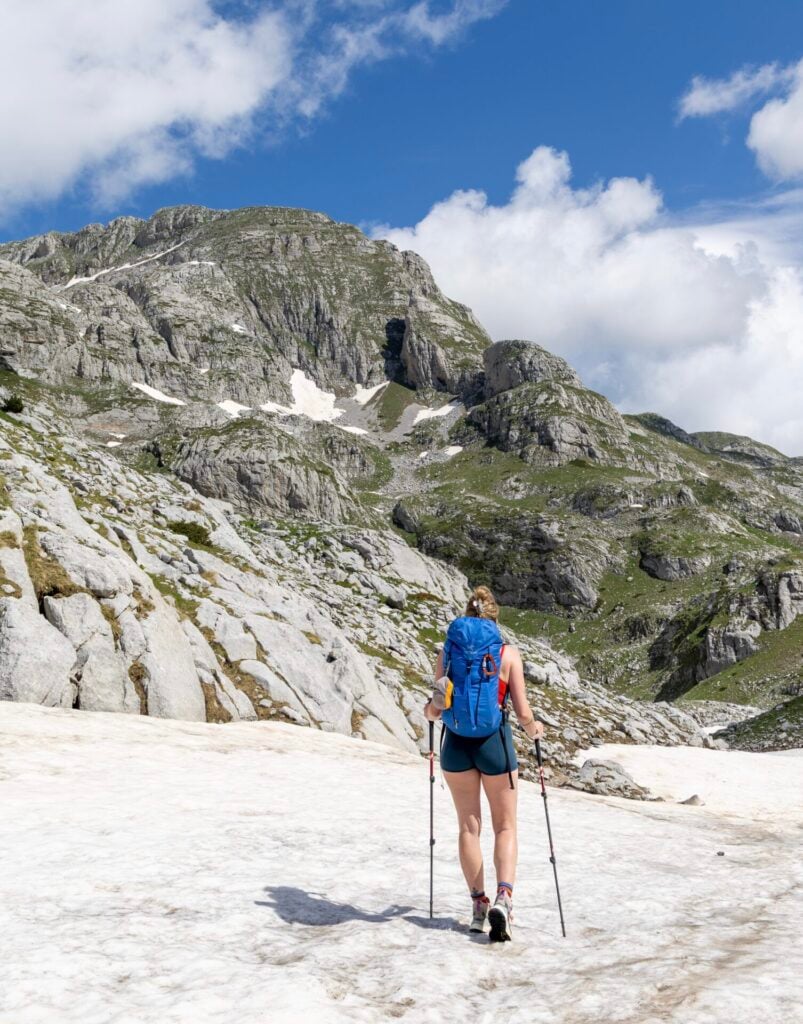
In early June, steep snow obscured much of the trail and required substantial route-finding, step-kicking, and a few short scrambles, which added considerable time to the 500m ascent. Microspikes and poles were absolutely essential, as was previous experience on snow.
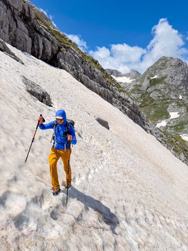
Dropping some of our pack-weight under a rock at the pass, we climbed a rocky rib immediately to the right of Prosllopit and traversed several steep snowfields just to reach the basin beneath Zla Kolata. Later in the season, you should be able to follow a more obvious trail for most of the route— the GPS is quite precise, so it’s a good tool with or without snow.
Once in the glacial basin, chart a broad, sweeping traverse across a boulder-field (which may be entirely buried in snow) to reach the limestone ledges on the far left side. The route then ascends these well-marked rocky ledges for about 400m to Prevoj Kolata (2,430), the saddle dividing the twin peaks of Zla Kolata (2,534m) and Dobra Kolata (2,528m).


From the saddle, wrap around to the eastern side of the mountain before making a final 100m ascent to the summit on a steep trail (which may be partially buried in steep snow).
As the highest point in Montenegro, Zla Kolata offers enormous views across the Accursed Mountains and into Albania, Montenegro, and Kosovo, with much of the afternoon’s route between Prosllopit and Borit Passes also visible below. We had low-hanging clouds moving across the larger peaks in the landscape, but it was still absolutely beautiful to be up here!


Once you’ve soaked in your fill of the scenery, descend back to Prosllopit Pass via the same route. This took us an entire hour with the snow, but would almost certainly be quicker in dry conditions later in the season!
Prosllopit Pass to Borit Pass (1.5hrs)
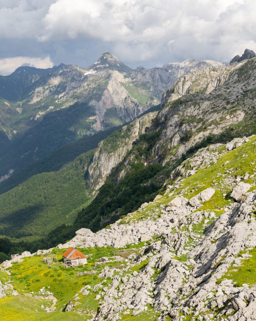
Once back at Prosllopit Pass (2,039m), the route drops for the next 2.5km to Borit Pass (1,850m), descending steep trails (sketchy snow slopes in the early season) to eventually enter a wild karst landscape of warped and weathered limestone.
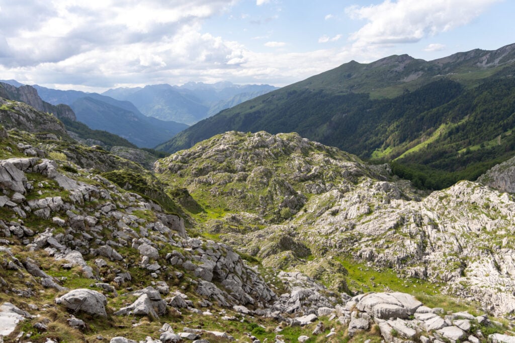
Millions of years of erosion have sculpted this area into a sea of rippled rock, cut by dramatic fissures and jagged outcrops that create an almost otherworldly landscape between the two passes.
Although never technically difficult, the uneven terrain demands constant attention and can feel surprisingly tiring after the additional effort of summiting Zla Kolata. Watch your footing while taking in some of the most staggering scenery of the entire day.
Borit Pass to Çerem (2hrs)
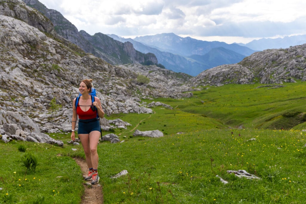
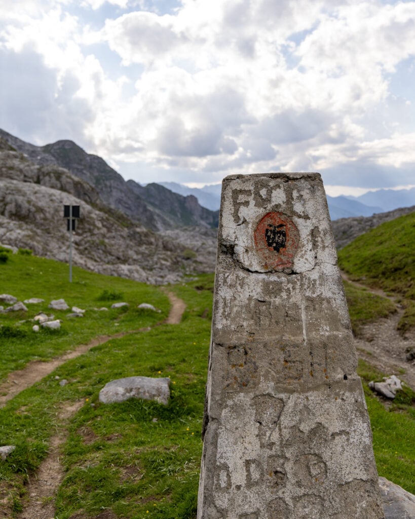
Crossing back into Albania at Borit Pass (1,850m), marked by a communist-era concrete border marker, the route begins a fairly gentle 5km, 700m descent toward Çerem. The stark limestone landscapes gradually give way to flower-filled alpine meadows, shepherd huts, and seasonal grazing land.
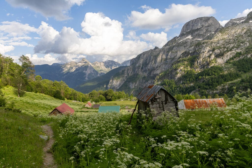
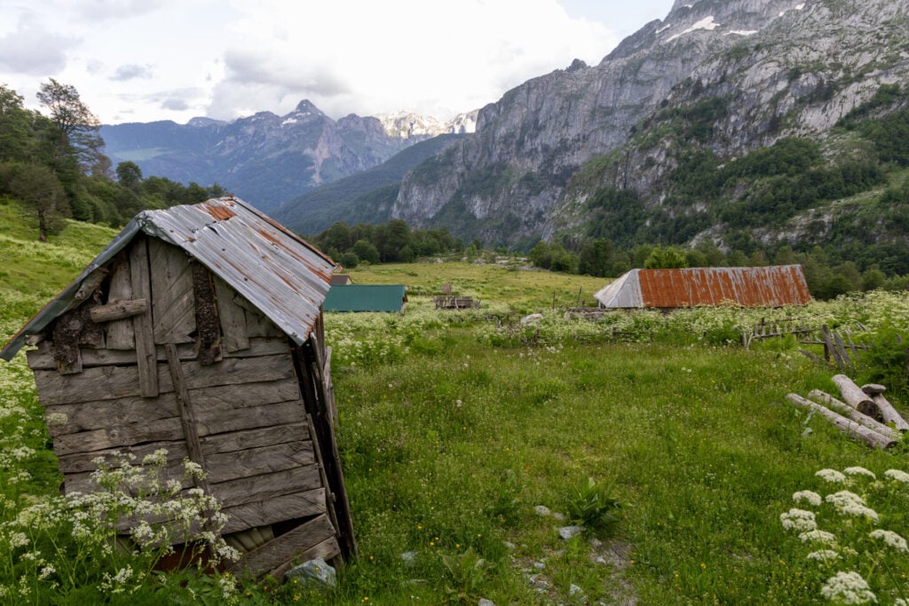
About a kilometre below the pass, the trail briefly winds through the trees before emerging into a clearing dense with katuns (summer settlements) and overgrown vegetation. We tried to stay high on the left to avoid passing through any of the properties, but the trail eventually disappeared into a sea of itchy plants and we had to return all the way to the first katun to try again.
The trick in this area is to thread the needle between the fence lines, ignoring the more obvious trail leading left and instead following a very faint path through the middle of the katuns (just to the right of the dilapidated hut pictured below) that eventually emerges into the open meadow beyond.
Nearly 12hrs after setting out from Valbona (the 9.5hrs quoted above includes only actual hiking time and excludes the snack breaks and summit time you’ll inevitably want to enjoy), drop into the riverside settlement of Çerem.
Night 1: Guesthouse Kujtim Gocaj
Located directly on the trail above Çerem, Kujtim Gocaj is the first guesthouse reached on the long descent from Borit Pass and an ideal stop after a demanding first day on Peaks of the Balkans. Accommodation is split between an older and newer house (40€ and 50€ per person for full board, respectively), sharing a grassy yard with ample outdoor seating.
We stayed in the newer building and appreciated the simple but spacious private room, hot shower, and ensuite bathroom— a real luxury along the trail! Full board also includes a traditional dinner, breakfast, and a packed lunch for the following day (essentially just DIY sandwiches, as is typical on Peaks of the Balkans). Overall, a simple but immensely convenient place to stay.
>>> Contact Guesthouse Kujtim Gocaj on Facebook to reserve a room
For more information on what to expect in the guesthouses on Peaks of the Balkans, check out this post: Peaks of the Balkans guesthouses: where to stay & what to expect


Read more about Peaks of the Balkans
- start here >>> Peaks of the Balkans hiking guide & 12-day itinerary
- Day 1: Valbona to Çerem via Prosllopit Pass + Zla Kolata summit
- Day 2: Çerem to Dobërdol
- Day 3: Dobërdol to Gacaferi via Gjeravica summit
- Day 4: Gacaferi to Milishevc
- Day 5: Milishevc to Rekë e Allagës + Via Ferrata Shpellat
- Day 6: Rekë e Allagës to Drelaj via Hajla summit
- Day 7: Drelaj to Babino Polje
- Day 8: Babino Polje to Plav
- Day 9: Plav to Vusanje
- Day 10: Three Peaks Loop
- Day 11: Vusanje to Theth via Great Valley of Lakes + Maja Bojës summit
- Day 12: Theth to Valbona
- navigate confidently on & off the trail >>> Peaks of the Balkans GPS map
- essential gear >>> Peaks of the Balkans packing list