Peaks of the Balkans (Day 6): Rekë e Allagës to Drelaj via Hajla summit
Following the standard Peaks of the Balkans route between Rekë e Allagës and Drelaj, this is a short and rather uninspiring day on the trail— but with ample time to detour up Hajla Peak and enjoy one of the finest ridgeline hikes in the Accursed Mountains!
From Rekë e Allagës, ascend to Gjonit Pass (1,820m) before continuing upwards on a straightforward and wonderfully scenic loop along the Montenegro–Kosovo border ridge to Hajla Peak (2,370m). Although lacking in the “highest peak” superlatives of Zla Kolata or Gjeravica, the trail is impeccably marked, the views are enormous, and overall, this makes a hugely worthwhile addition to an otherwise unremarkable day.
This comprehensive guide to Day 6 of Peaks of the Balkans contains detailed section times, route recommendations, adventurous side trips, and heaps of insider tips— use it to plan your hike & then refer back on the trail so you always know what to expect!
>>> Read my Peaks of the Balkans hiking guide for the full 12-day adventure itinerary
Peaks of the Balkans: Day 6 overview
Stats are based on my Peaks of the Balkans adventure route, incorporating scenic detours, side-summits, and high variations to the standard trail wherever possible:
- trail time: 5.5hrs
- distance: 15km
- elevation: 1130m gain / 1320m loss
- side summits & variations: Hajla summit (2,370m)
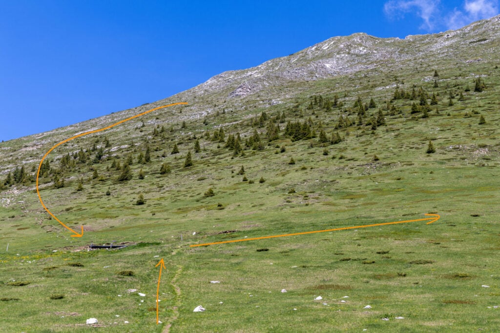
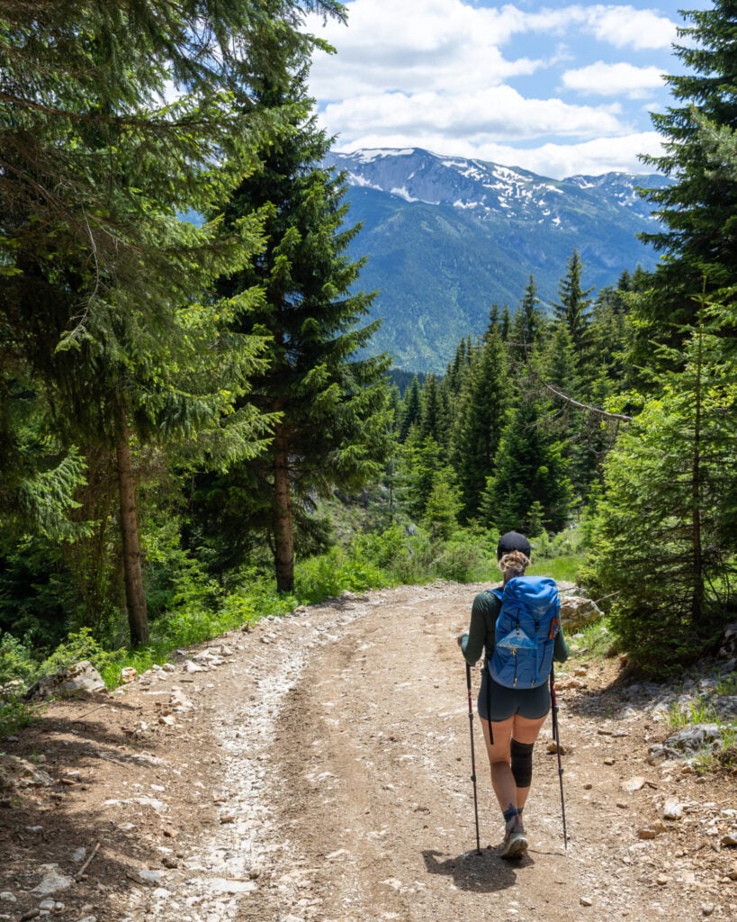
Rekë e Allagës to Gjonit Pass (1hr)
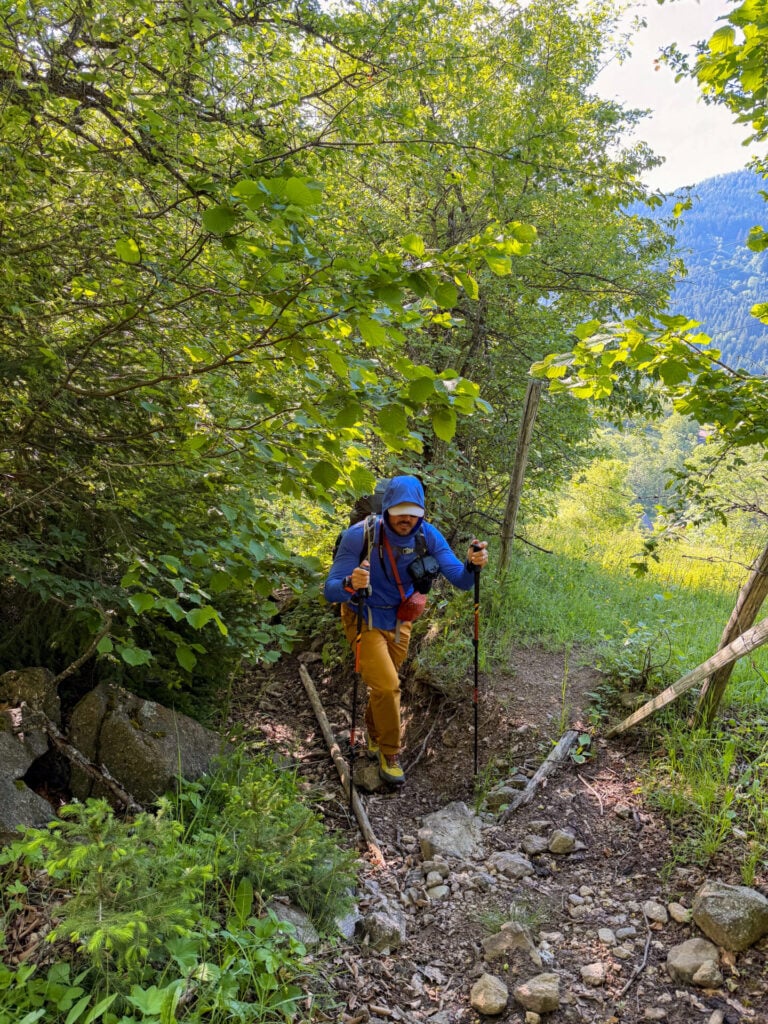
Just behind Ariu Guesthouse, a narrow tunnel through the trees leads somewhat confusingly up the hillside. After gaining about 150m, emerge from the forest into open meadows and angle left to continue climbing.
Keep close watch of the GPS, as there are marked trails and roads leading off in just about every direction— some converge along the correct path, while others shoot you off into the distance.
Just short of the pass, the GPS trail attempts to bring you straight across a grassy field now clearly signed as private property. Head right to drop below and around this section of trail, and then reconnect easily to the route for the final ascent to Gromit.
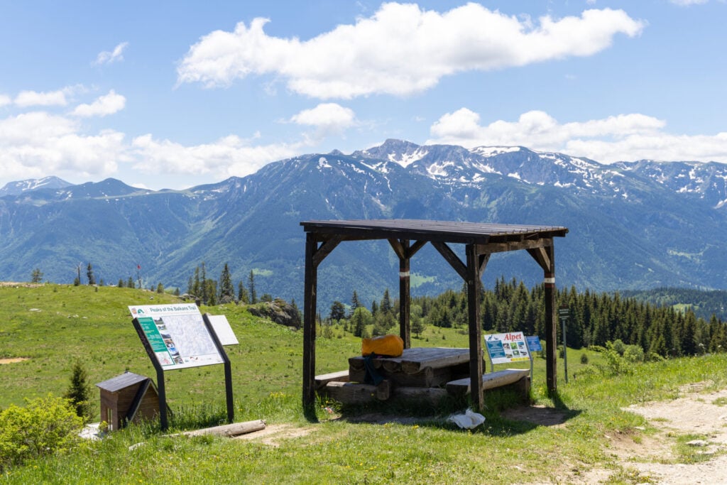
Despite the navigational challenges, it takes just over an hour to reach Gjonit Pass (1,820m), marked by a small wooden shelter and a large Peaks of the Balkans map.
Although clearly labelled as Gjonit Pass on the map, our guidebook curiously describes this location as Hajla Pass. For the purposes of this route description, I’m going to remain consistent with the map and refer to this lower pass with the wooden shelter as Gjonit Pass, while referring to a signed junction roughly 20min farther up the trail (which isn’t labelled at all on the topo) as Hajla Pass.
Under the covered wooden shelter of Gjonit Pass, offload a bit of pack weight before ascending Hajla Peak. We left behind our hut shoes, spare clothing, and extra snacks wrapped inside a pack cover and collected everything on the way back down.
Gjonit Pass to Hajla Peak & back (2.5hrs)
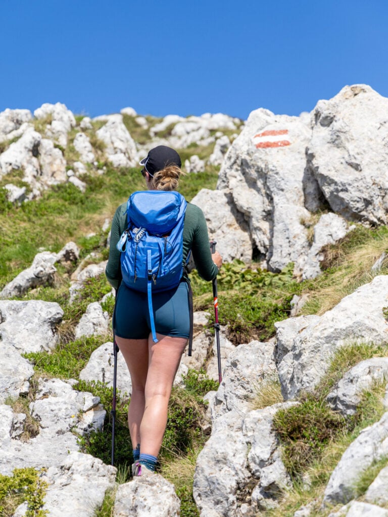
Ascending on a clearly marked and well-defined trail from Gjonit Pass, gain just under 200m to another signed junction in 20min. Although marked as “Era Mountain Lodge 2,005m” on the signpost, both our GPS and topo map placed this point closer to 1,970m, and this is the location I’ll refer to as Hajla Pass for the sake of simplicity. (Coordinates for your reference: 42.74875, 20.13975).
Despite the strange discrepancies between maps, guidebooks, and trail signs in this area, we were delighted to discover that the route up Hajla is one of the easiest to follow anywhere in Kosovo, a refreshing change after several days of inconsistent signage and confusing navigation (which unfortunately characterises the entire Kosovo section of Peaks of the Balkans).
Continue another couple minutes beyond Hajla Pass to a black water trough, where the route splits to travel anticlockwise or clockwise up to the summit.
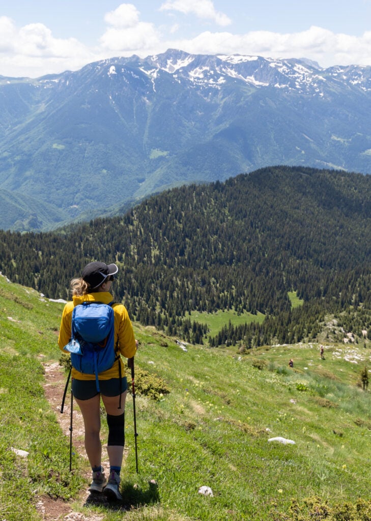
We saw people heading up in both directions, and the route is equally obvious either way, but we particularly enjoyed the long parade across the ridgeline afforded by the anticlockwise route, offering spectacular views in all directions.
From the trough, head right across the grassy slopes on a well-worn trail that gradually ascends along the mountainside. Around 2,100m elevation, the route rounds a steep corner to reveal spectacular views down into Rugova Valley before turning sharply left and climbing more directly to the ridge.

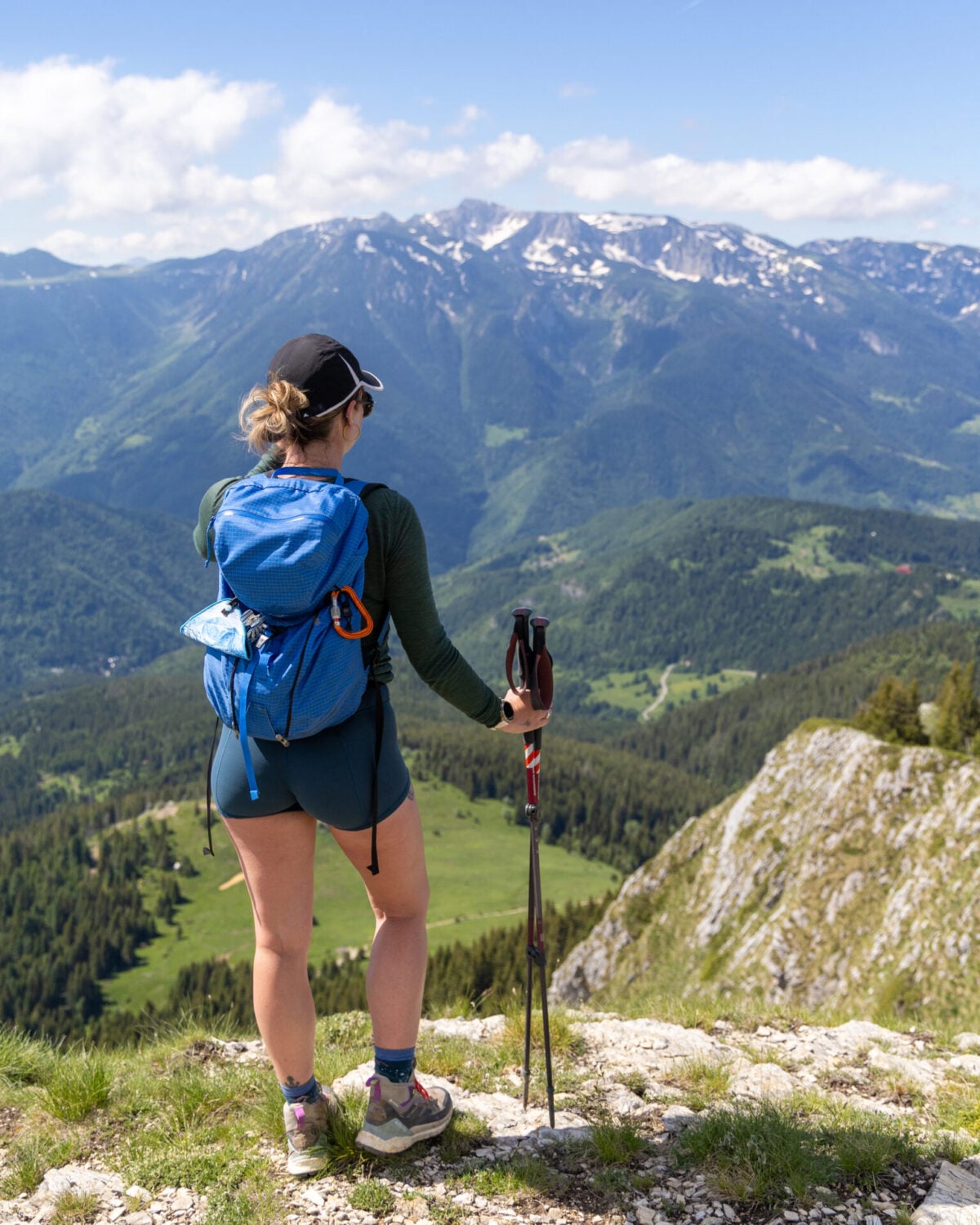
The final kilometre follows the Montenegro–Kosovo border ridge, navigating pleasantly along a clear path through the rocks and gaining about 100m before finally arriving to the summit of Hajla Peak at 2,370m, approximately 1hr from Hajla Pass and 1.5hrs from Gjonit Pass.
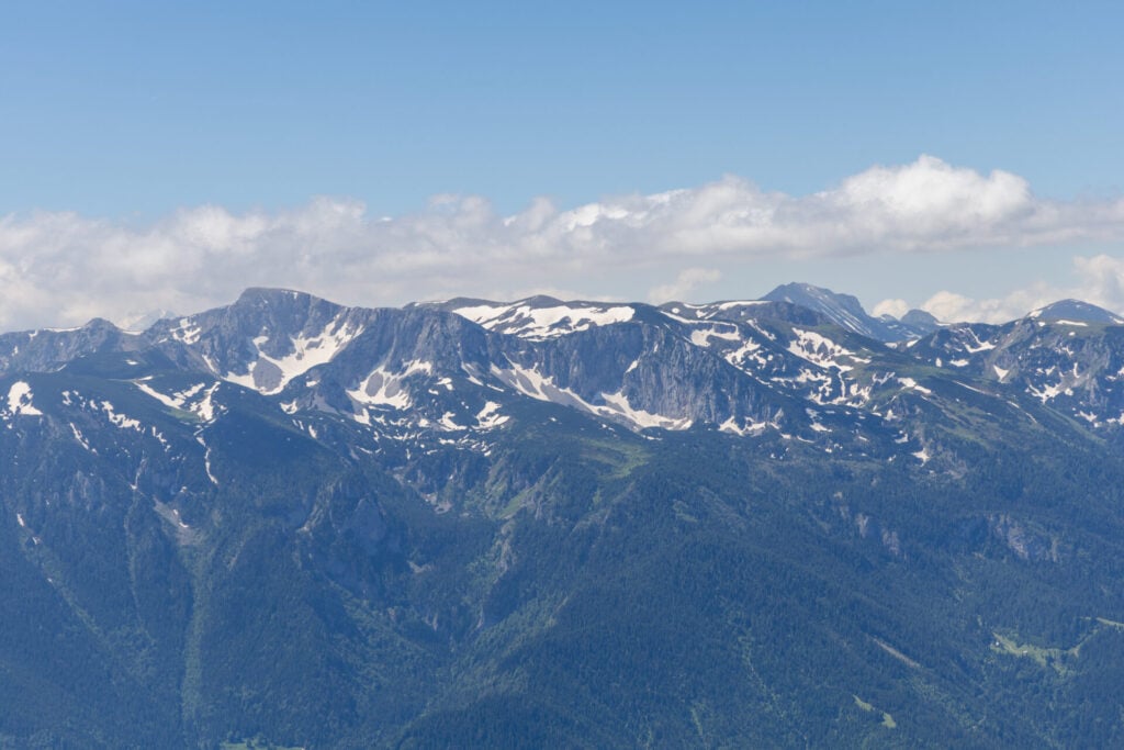
Although modest in height compared to some of the surrounding peaks, Hajla commands exceptional views across the Accursed Mountains, Rugova Canyon, and the rolling mountains of western Kosovo. With clear weather and an easy trail, this ended up being a true highlight of the route!
From the summit of Hajla Peak, 1,110m of the day’s 1,130m elevation gain has already been gained, so it’s truly all downhill to Drelaj.
Continue along the ridgeline, dropping more directly back to the water trough and signed junction of Hajla Pass (within about 40min) and back to Gjonit Pass about 20min further.
Gjonit Pass to Drelaj (2hrs)
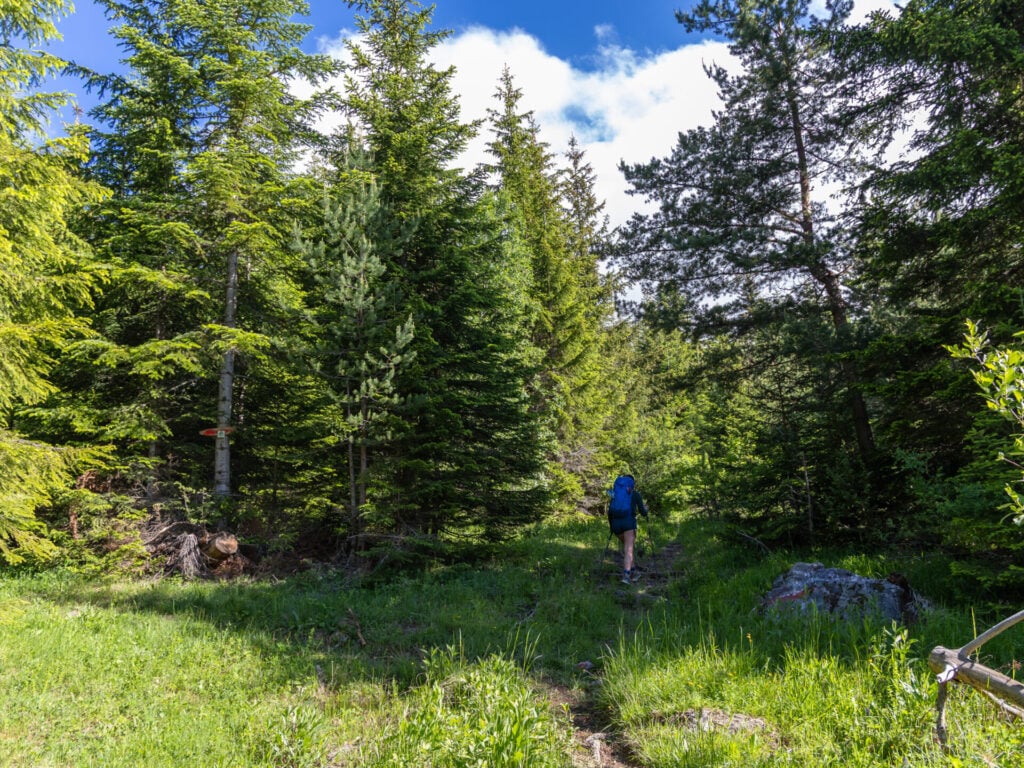
Back at Gjonit Pass, the route to Drelaj largely follows a series of roads, descending for about 40min on dirt road to connect with paved road. Just moments after the transition to pavement, a quick right turn brings you onto an impossibly steep dirt road with a sign marked for Shqiponja.


After around 10min of descending, this reconnects with yet another paved road that continues toward Drelaj. Aside from a short section of rocky forest trail, most of the 2hr descent consists of road walking, so it is with great pleasure that you’ll arrive into town and the quaint garden of Guesthouse Shqiponja.


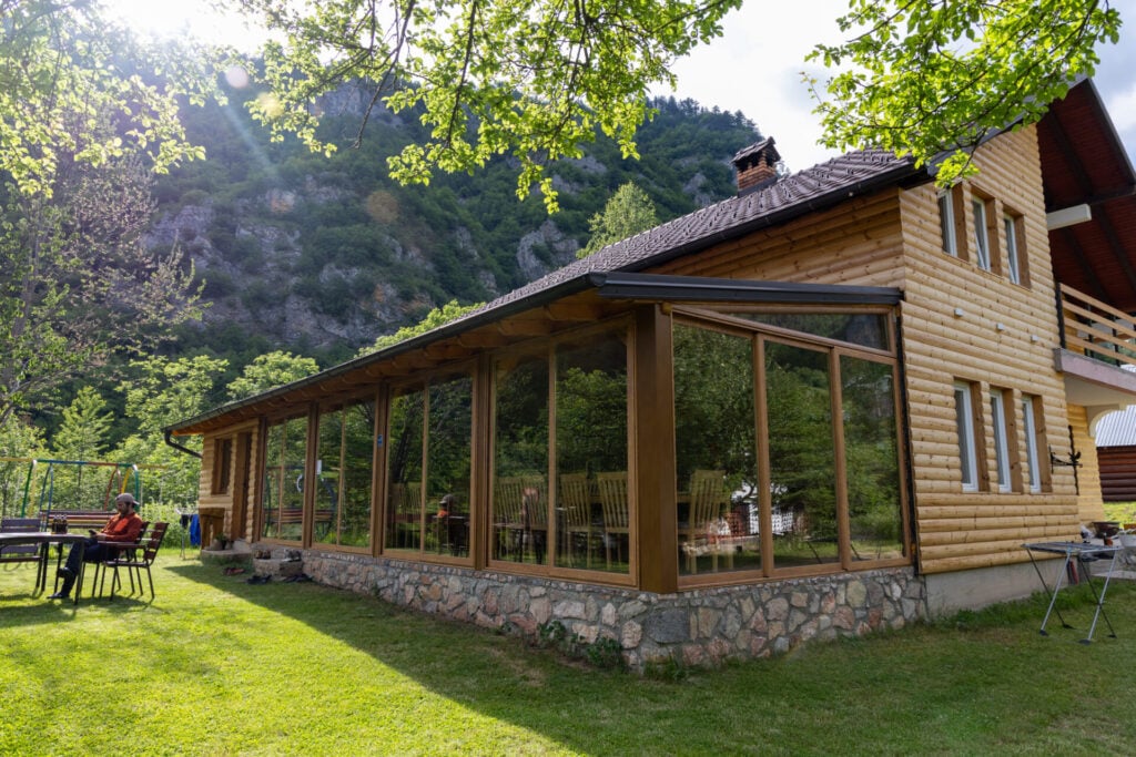
Night 6: Guesthouse Shqiponja
Located towards the bottom of town in Drelaj, we trudged past a number of lively guesthouses (Guesthouse Bujtina Kaçaku was particularly memorable) before arriving to Guesthouse Shqiponja, which means “eagle” in Albanian. The family who owns the guesthouse, including the adorable grandfather with whom James was able to communicate in French, was very hospitable, and the overall the vibe was much more mellow and quiet than other stays along the route.
Full board cost a reasonable 35€ per person and includes an excellent dinner, one of the best breakfasts on the trail (as a non-egg-eater, the crepes and beignets were a particular highlight for me), and even burek for lunch the following day. The owners can also arrange a transfer to Liqenat (20€ for the two of us), saving approximately 13km of largely unremarkable road walking the following morning.
>>> Contact Guesthouse Shqiponja on WhatsApp to reserve a room (+386 49 586 740)
For more information on what to expect in the guesthouses on Peaks of the Balkans, check out this post: Peaks of the Balkans guesthouses: where to stay & what to expect


Read more about Peaks of the Balkans
- start here >>> Peaks of the Balkans hiking guide & 12-day itinerary
- Day 1: Valbona to Çerem via Prosllopit Pass + Zla Kolata summit
- Day 2: Çerem to Dobërdol
- Day 3: Dobërdol to Gacaferi via Gjeravica summit
- Day 4: Gacaferi to Milishevc
- Day 5: Milishevc to Rekë e Allagës + Via Ferrata Shpellat
- Day 6: Rekë e Allagës to Drelaj via Hajla summit
- Day 7: Drelaj to Babino Polje
- Day 8: Babino Polje to Plav
- Day 9: Plav to Vusanje
- Day 10: Three Peaks Loop
- Day 11: Vusanje to Theth via Great Valley of Lakes + Maja Bojës summit
- Day 12: Theth to Valbona
- navigate confidently on & off the trail >>> Peaks of the Balkans GPS map
- essential gear >>> Peaks of the Balkans packing list