Last Updated on 22 April 2025
The final day of AV2 features dramatic and often unexpected views of yet another spectacular National Park, Dolomiti Brunello. At 21km, it’s no slouch for a final day, so soak in the final stage of this epic route before finishing in Croce d’Aune, a tiny town just outside of Feltre, where pizza and chilled Aperol Spritz await. You’ve made it!
This comprehensive guide to Day 12 of Alta Via 2 contains detailed section times, route recommendations, adventurous side trips, via ferrata, and heaps of insider tips— use it to plan your hike & then refer back on the trail so you always know what to expect!
All my AV2 knowledge in one place: Alta Via 2: complete hiking + via ferrata route guide
Alta Via 2: Day 12 overview
Stats quoted here are for my recommended “adventure route” AND the standard route (no changes today!)
- Trail hours: 7hrs
- Distance: 21km
- Elevation gain & loss: 915m up & 1585m down
- Huts: (Rifugio Dal Piaz), Croce d’Aune & hotels in Feltre
Rifugio Boz to Rifugio Dal Piaz (5hrs)
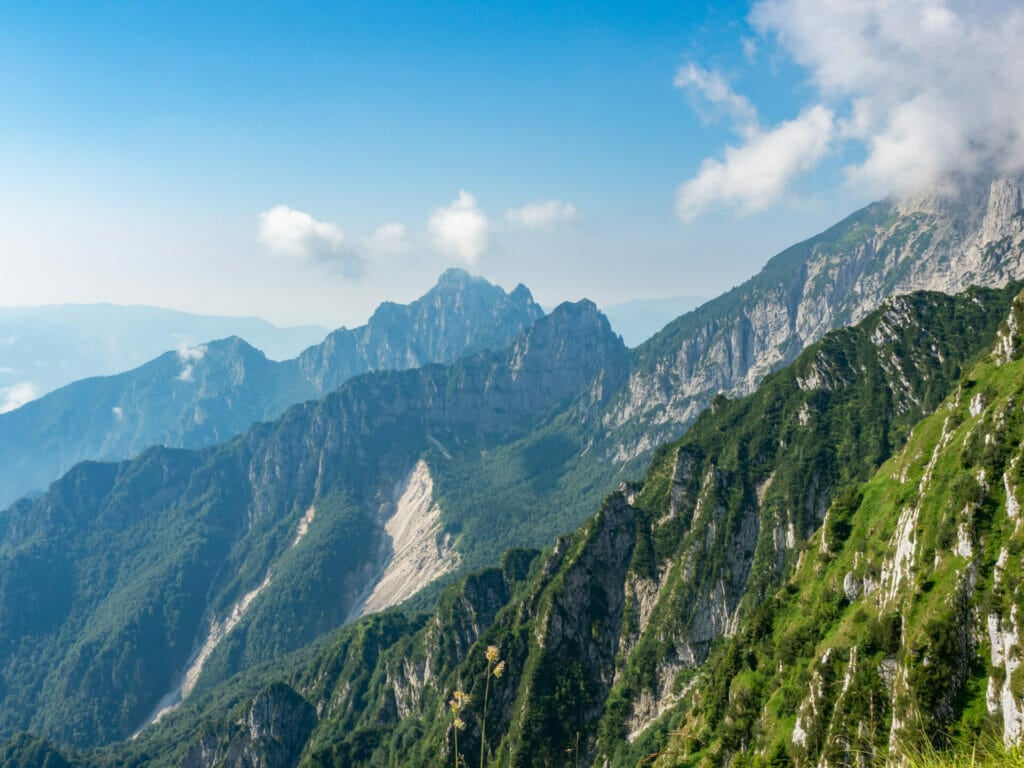
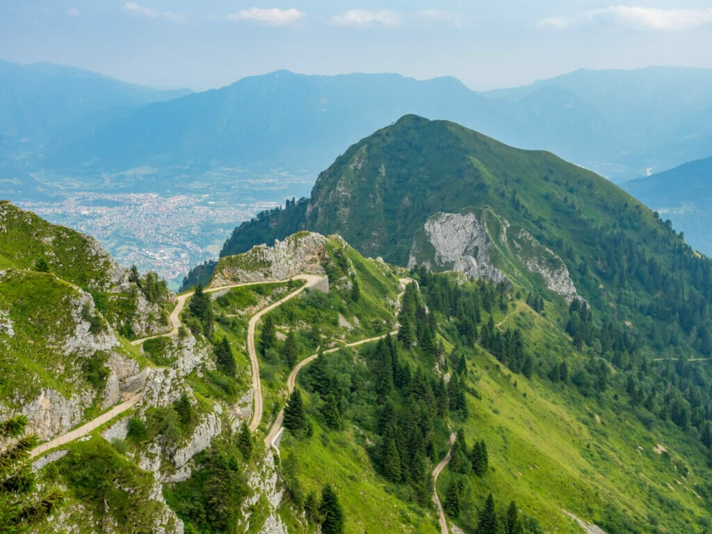
From Rifugio Boz, begin a pleasant 30min climb over and around to Passo Finestra at 1,776m, then descending slightly to reveal sweeping views of Parco Nazionale delle Dolomiti Bullenesi.
If you’re following my custom AV2 adventure route, the best way to stay on track is with my custom-built AV2 GPS map— packed with detailed daily tracks, 168+ waypoints, all the side trips & via ferrata described in this guide, detours to avoid challenging sections, plus extensive trail notes to help you navigate AV2 like an expert.
Available in both JSON and GPX formats, the map works seamlessly with GPS apps like CalTopo, Gaia, and AllTrails, or with Garmin devices and watches. Head to my storefront to purchase the map!
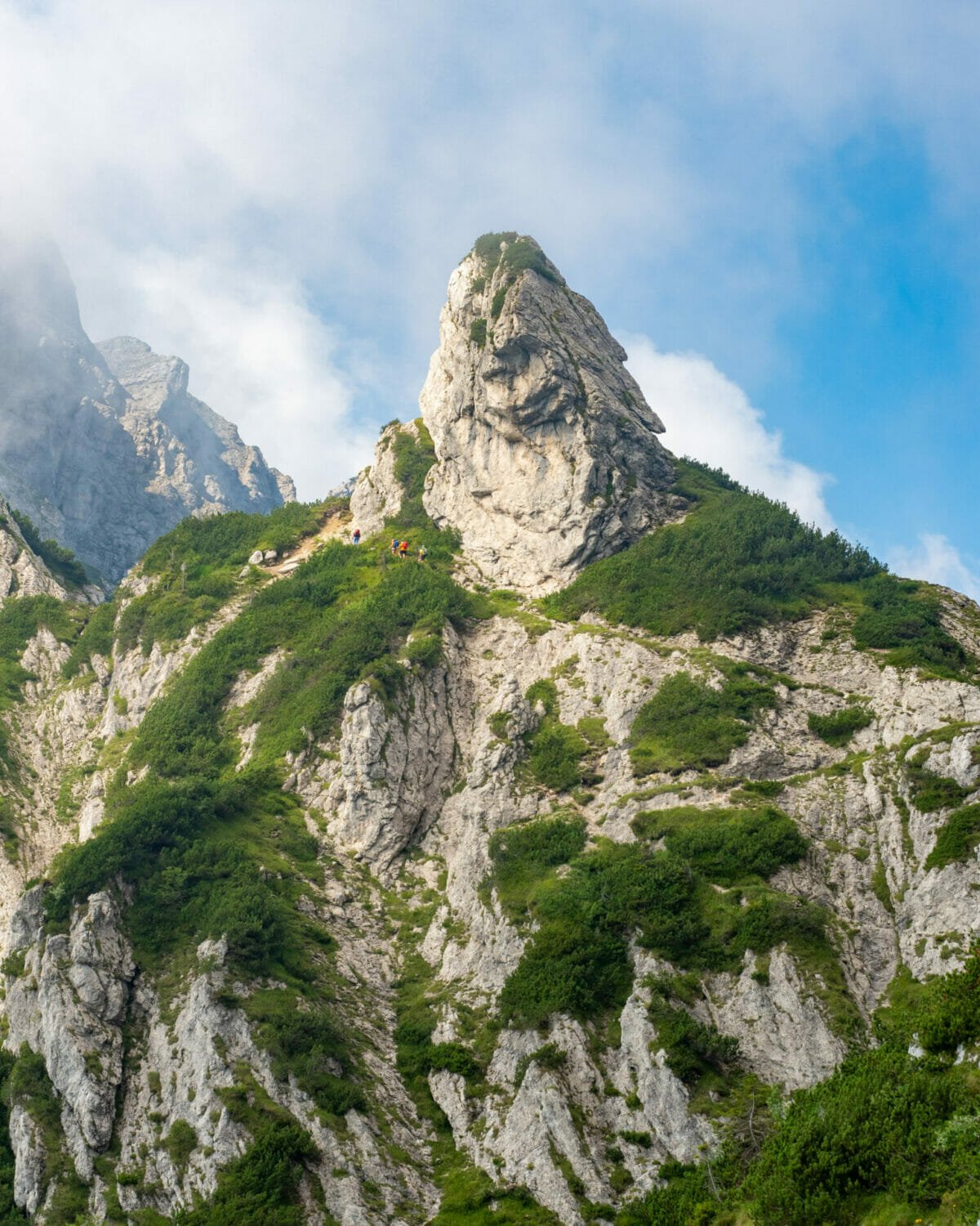
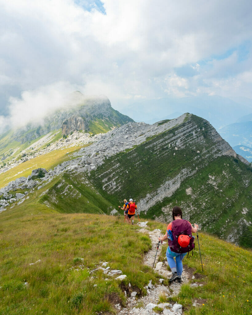
Shortly after dropping downhill, make a tight (and very easily missed) right turn to climb uphill once again. Ascend gradually at first, eventually ramping up to a steep, rocky trail that brings you to a high point under Monte Zoccare Alto after about an hour. Even on nice days, this valley has a tendency to fill with fog, so don’t be surprised if you find yourself hiking through bright white clouds!


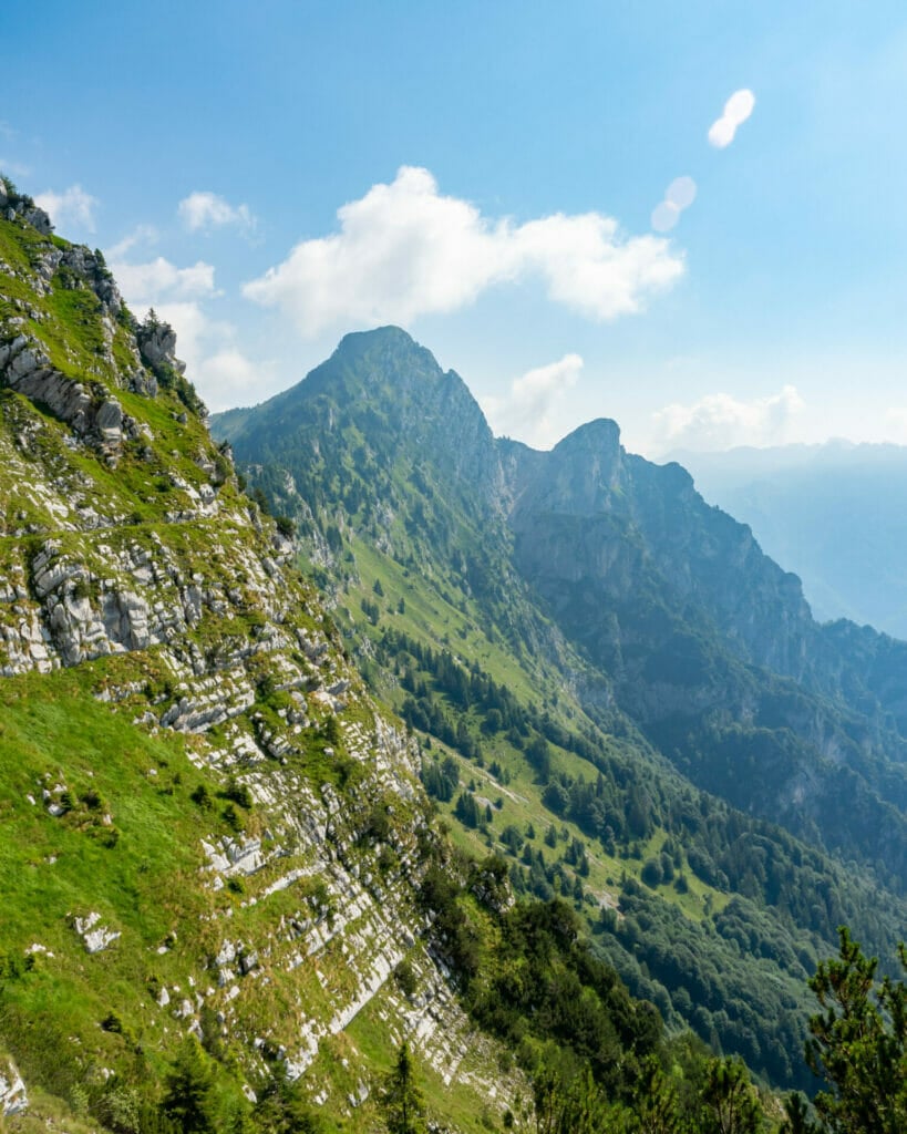
The descent then begins on a gentle trail that contours around the hillsides to the signed Sasso di Scarnia at 1,805m.
From this point, the route ascends once again, but soon settles into the final descent through flowered meadows and onto an old military road. Rifugio Dal Piaz is just out of view up and over a pass on the distant right side of the basin.


Rifugio Dal Piaz to Croce d’Aune (2hrs)
Leaving behind the final hut of AV2 (but not before a beer and Apple strudel to fuel your descent!), drop steeply on a mix of rocky trail and heavily switchbacking road all the way to Croce d’Aune.
It’s impossible to avoid the pavement entirely, but you can take a steep shortcut past much of it— keep a close eye on the GPS for the trail, as you’ll end up waking several additional kilometres (albeit more gradual ones) if you do miss it.
The trail terminates on a high paved road at the top of Croce d’Aune. You’ve officially made it!!
Croce d’Aune to Feltre (bus or taxi)
Walk into town to connect via bus to the larger town of Feltre or call a taxi— expect about 40€ for up to 6 people, so making a few friends on the trail is recommended!
If you do find yourself in Feltre, we highly recommmend Pizza Il Napoli as the perfect post-AV2 feasting grounds! Saluti!


Read more about Alta Via 2
- start here ->Detailed AV2 Route Guide
- ALTA VIA 2 (DAY 1): BRESSANONE TO RIFUGIO GENOVA + VIA FERRATA SASS D’PUTIA
- ALTA VIA 2 (DAY 2): RIFUGIO GENOVA TO RIFUGIO PUEZ + VIA FERRATA PIZ DULEDA
- ALTA VIA 2 (DAY 3): RIFUGIO PUEZ TO RIFUGIO PISCIADÚ + VIA FERRATA GRAN CIR, PIZ DA CIR, BRIGATA TRIDENTINA
- ALTA VIA 2 (DAY 4): RIFUGIO PISCIADÚ TO PIZ BOÈ + CIMA PISCIADÚ
- ALTA VIA 2 (DAY 5): PIZ BOÈ TO RIFUGIO CASTIGLIONI MARMOLADA
- ALTA VIA 2 (DAY 7): LAGO DI FEDAIA TO SAN PELLEGRINO + VIA FERRATA DELLE TRINCEE
- ALTA VIA 2 (DAY 8): PASSO SAN PELLEGRINO TO RIFUGIO VOLPI AL MULAZ
- ALTA VIA 2 (DAY 9): RIFUGIO MULAZ TO RIFUGIO PRADIDALI
- ALTA VIA 2 (DAY 10): RIFUGIO PRADIDALI TO RIFUGIO TREVISO + VIA FERRATA PORTON & NICO GUSELLA
- ALTA VIA 2 (DAY 11): RIFUGIO TREVISO TO PASSO CEREDA + VIA FERRATA CANALONE
- ALTA VIA 2 (DAY 12): PASSO CEREDA TO RIFUGIO BOZ
- ALTA VIA 2 (DAY 13): RIFUGIO BOZ TO CROCE D’AUNE
- navigate confidently on & off the trail ->AV2 adventure route GPS map!
The Comments
Tony
Thanks for the wonderful report! Cannot wait the “Complete Alta Via 2 planning guide”!!
brooke brisbine
TonyThanks so much for reading, Tony! Here’s the full planning guide: https://brookebeyond.com/alta-via-2-in-the-italian-dolomites-complete-hiking-via-ferrata-guide
Happy trails!
xx bb
Jess
Hey! Thank you SOOO much for your comprehensive guide + all of the exciting side routes for the AV2!! Any chance you have a link for a GPX file which shows your route? Cheers!
brooke brisbine
JessHey Jess, thanks so much for reading, I’m really glad you found all this info helpful!
In the next month, I should have my GPX files available for download, stay tuned 🙂
Happy trails,
xx bb
Ganriele Scandola
Dear Brooke, your work is high Quality and informative, tjis is way I suggest to verify this option in the wildest side of the Italian alps Friuli Venezia Giulia region. My suggestion does not iclude only the mountain side anyway… https://www.turismofvg.it/en/fvglivexperience?LangSetCMS=en
I see you can became one of the ambasadors, but of course it is just a suggestion. Cheers
brooke brisbine
Ganriele ScandolaThanks so much for the suggestion, Ganriele!
I am heading back to the Dolomites in June of 2024, hopefully discovering some epic new routes 🙂
Happy trails!
xx bb