

Last Updated on 3 September 2026
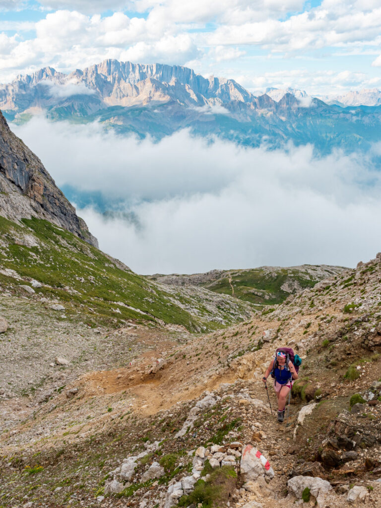
The quieter second half of AV2 begins with a spectacular journey into the Pale di San Martino, where broad alpine pastures gradually give way to soaring limestone towers and increasingly rugged mountain scenery.
Even without much in the way of extensions or side-trips (and only a short, easy section of cable), this is a wonderfully rewarding day with panoramic ridgelines, friendly local cows, and a spectacular finish at Rifugio Volpi al Mulaz, one of the most dramatically situated huts on the entire hike.
This comprehensive guide to Day 7 of Alta Via 2 contains detailed section times, route recommendations, adventurous side trips, via ferrata, and heaps of insider tips— use it to plan your hike & then refer back on the trail so you always know what to expect!
All my AV2 knowledge in one place: Alta Via 2: complete hiking + via ferrata route guide
Alta Via 2: Day 7 overview
- Trail hours: 5hrs
- Distance: 13km
- Elevation gain & loss: 1130m gain & 480m loss
- Huts: (Rifugio Valles), Rifugio Volpi al Mulaz
*Trail times reflect the time we spent hiking, excluding extended breaks where we removed our backpacks to eat lunch, relax on the summit, or otherwise luxuriate along the trail. These figures are best used to understand realistic minimum hiking times between major waypoints, but we recommend factoring in 1-2hrs of additional time every day to properly enjoy the route!

San Pellegrino to Passo Valles (1h45m)
Leaving San Pellegrino, it’s a touch tricky to connect with the trail— walk towards the Margherita cable car and pass through a plastic gate followed by a wooden turnstile to find a forested trail winding gradually up the hillside.
From this point, it’s much easier to stay on the intended route. Follow cairns across the rocks above Lago di Cavia and through cow-filled pastures. Although the early sections of the route can be quite steep, it should only take about 45min to reach Pale di Gargol at 2,218m.
If you’re following my custom AV2 adventure route, the best way to stay on track is with my custom-built AV2 GPS map— packed with detailed daily tracks, 168+ waypoints, all the side trips & via ferrata described in this guide, detours to avoid challenging sections, plus extensive trail notes to help you navigate AV2 like an expert. UPDATED SEPT 2026 BASED ON USER FEEDBACK!
Available in both JSON and GPX formats, the map works seamlessly with GPS apps like CalTopo, Gaia, and AllTrails, or with Garmin devices and watches. Head to my storefront to purchase the map!


At the junction, follow signs towards Passo Valles and continue 30min further to Forcella di Pradazzo. The route descends on a wide road, but the most expedient way to reach the pass is to follow the GPS straight through the hills for about 30min, connecting with various trails and goat tracks to eventually reach Rifugio Valles.
Though early in the day, Rifugio Valles is an excellent spot to break for lunch, with fresh pasta and cold Aperol Spritz!


Passo Valles to Rifugio Volpi al Mulaz (3h15m)
From Rifugio Valles, hike uphill for about 25min to reach Forcella Venegia at 2,212m, where the first expansive views of the Pale di San Martino open ahead.
Following signs pointing towards Rifugio Mulaz, a pleasant dirt trail meanders through the idyllic pastures of Val Venegia, weaving between grazing cows and wildflower-filled meadows beneath an ever-present wall of jagged limestone peaks. This valley is one of the most peaceful sections of AV2, yet the mountains feel almost impossibly large. It’s an incredible contrast that perfectly characterises the quieter back-half of the route!


As the valley narrows, the landscape gradually transforms to rugged alpine terrain. The final approach to Rifugio Volpi al Mulaz is noticeably steeper and more rugged, with some cable-protected sections adding a touch of adventure (without requiring full via ferrata gear).
After a short but visually spectacular day on AV2, the hut finally appears after one final uphill push beneath the dramatic cliffs of the Focobon massif.

Night 7: Rifugio Volpi al Mulaz
Surrounded by the dramatic limestone towers of the Pale di San Martino and staffed by some of the loveliest people we met on the trek, Rifugio Volpi al Mulaz was among my favourite huts.
Grab a hot wine (vin brûlée) on arrival and dig into a delicious 3-course dinner, warmed by a hot stove in the dining area while admiring the many old-school mountaineering photos (and stuffed kitties) that adorn the interior of this cozy hut. Reserve Rifugio Mulaz by email.
- Rooms: 34€ (dorm room; privates only for half board) OR 74/69€ half board (private room/dorm)
- Food: half board with 3-course dinner; get the vin brûlée (hot wine)!
- Showers: closed indefinitely due to water shortage
- Connectivity: weak mobile signal outside the hut
- Alpine Club Discount: -17€ half board
For more information on what to expect in a mountain hut & how to prepare for your stay: Everything you need to know about mountain huts (rifugi) in the Italian Dolomites


Read more about Alta Via 2
- start here ->Detailed AV2 Route Guide
- Alta Via 2 (day 1): Bressanone to Rifugio Genova + Via Ferrata Sass di Putia
- Alta Via 2 (day 2): Rifugio Genova to Rifugio Puez + Via Ferrata Piz Duleda
- Alta Via 2 (day 3): Rifugio Puez to Rifugio Pisciadú + Via Ferrata Gran Cir, Piz da Cir V, Brigata Tridentina
- Alta Via 2 (day 4): Rifugio Pisciadú to Piz Boè + Cima Pisciadú
- Alta Via 2 (day 5): Piz Boè to Rifugio Castiglioni Marmolada
- Alta Via 2 (day 6): Lago di Fedaia to San Pellegrino + Via Ferrata delle Trincee
- Alta Via 2 (day 7): Passo San Pellegrino to Rifugio Volpi al Mulaz
- Alta Via 2 (day 8): Rifugio Mulaz to Rifugio Pradidali
- Alta Via 2 (day 9): Rifugio Pradidali to Rifugio Treviso + Via Ferrata Porton & Nico Gusella
- Alta Via 2 (day 10): Rifugio Treviso to Passo Cereda + Via Ferrata Canalone
- Alta Via 2 (day 11): Passo Cereda to Rifugio Boz
- Alta Via 2 (day 12): Rifugio Boz to Croce d’Aune
- navigate confidently on & off the trail ->AV2 adventure route GPS map! (updated Sept 2026)
